Wilsons Promontory National Park
Wilsons Promontory National Park, Australia
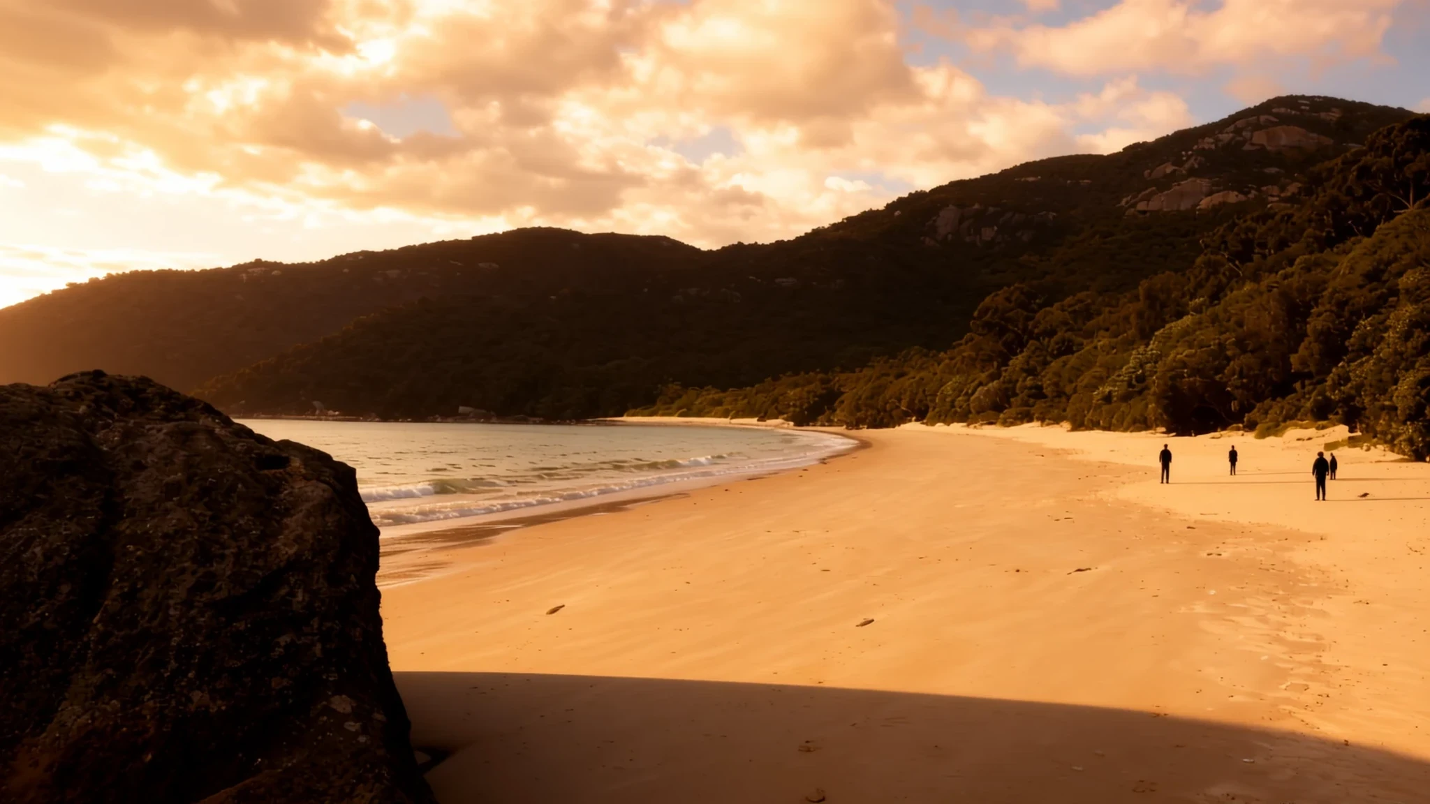
Go for dramatic southern-coast walks, wildlife on the move, and beaches and bays that feel remote even in school-holiday season.
The place
Wilsons Promontory National Park—people shorten it to “Wilsons Prom” or “The Prom”—sits on a peninsula in Victoria, making it the southernmost slice of the Australian mainland. A lot of the land is protected, and the park is paired with a marine national park offshore, so the scenery shifts from granite headlands and cliffy south-coast views to sheltered coves and long stretches of sand.
The coast is where the place really lands. At low tide you can see expansive intertidal mudflats; at high tide the same edges turn to beach and waterline. In the south, granite cliffs meet the sea, backed by dunes, swamps and scrub. Around the peninsula there are smaller granite islands, and together they’re important for seabirds.
Tidal River is the main river on the promontory and it swells with the tide as it heads into Norman Bay, colouring the water with a tea-like tint from tannins. Darby River comes with its own maze of meanders and alluvial flats, and the older entrance and accommodation area was once here.
Wildlife is a genuine part of the experience: wombats are common (especially near campsites), with kangaroos, wallabies, emus and several kinds of native birds also in the mix. The park can feel big, but most visits revolve around easy coastal walks and one or two longer hikes depending on weather and energy—plus the timing, because southern Victoria can change quickly.
Its story
Wilsons Promontory National Park feels like a film set for “far south”: headlands, salt wind, big sky, and the sense that the ocean is doing the shaping here. There’s a reason the peninsula is often approached as a day-trip or a short break—most visitors anchor around the Tidal River area, where the landscape is easy to read and camping gives it a proper outdoors rhythm.
The park’s tides help tell the story. Tidal River moves with the sea, and Norman Bay becomes a changing backdrop—mudflats and shallows in one light, wet sand and coves in the next. The water’s unusual purple-yellow look comes from tea trees staining it with tannin, and once you’ve seen it, you notice how much of the park’s “colour” is tied to vegetation and wet ground.
On the trail, the wildlife turns the hike into something more than scenery. Common wombats often wander near campsites where people are cooking and moving, and kangaroos and wallabies show up when tracks quiet down. Even the bigger island features and marine areas feed into that sense of layers: granite cliffs and beaches on land, and a different ecosystem offshore in the marine national park.
Weather is part of the plot too. Southern Victoria can bring low-pressure systems and rain, and the summer heat doesn’t always feel oppressive here the way it can elsewhere in Australia. That means the best days are often the ones where you can get out early, time your walks around the light, and stay flexible when the clouds roll in.
What to see
- Prom Wildlife Walk — Tidal River / Prom tracks
Prom Wildlife Walk is a wildlife-focused circuit where you’re likely to see animals at close range, including kangaroos, wombats and other native creatures. It’s a good low-stress option when the weather is changeable and the day is short.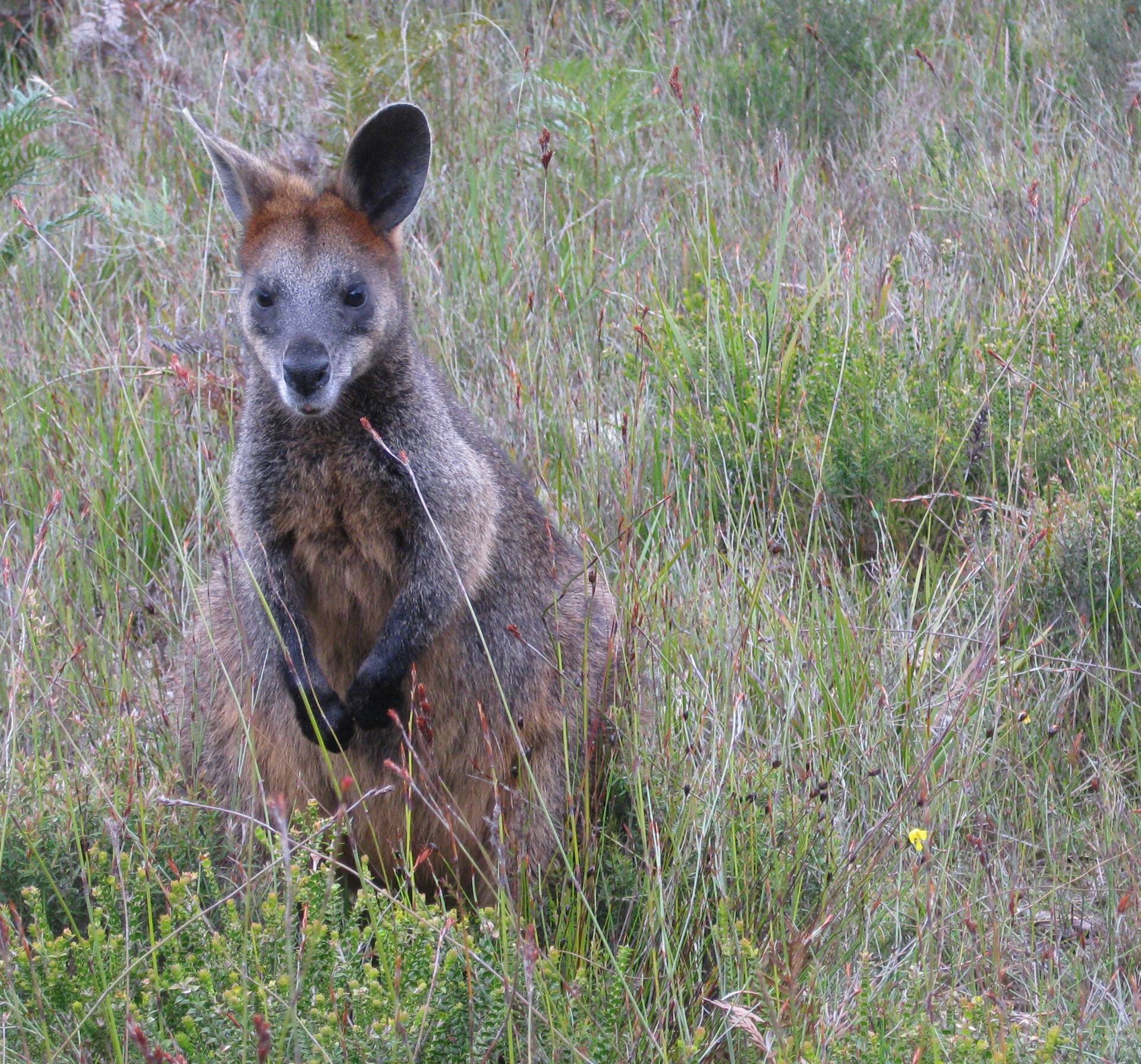
- Cleft Island cave — Southern islands / island views
Cleft Island is a small granite island shaped by ancient wave action, with a hollowed-out section that forms a wide cave. When conditions line up, it’s the kind of coastal feature that makes you look twice at what waves can carve over time.
- Tidal River to Norman Bay — Tidal River / Norman Bay
Tidal River is the main river on the promontory and it runs into Norman Bay, swelling with the tide. The tannin-stained tea-tree effect can tint the water, making the shoreline feel scenic even between walks and at dusk.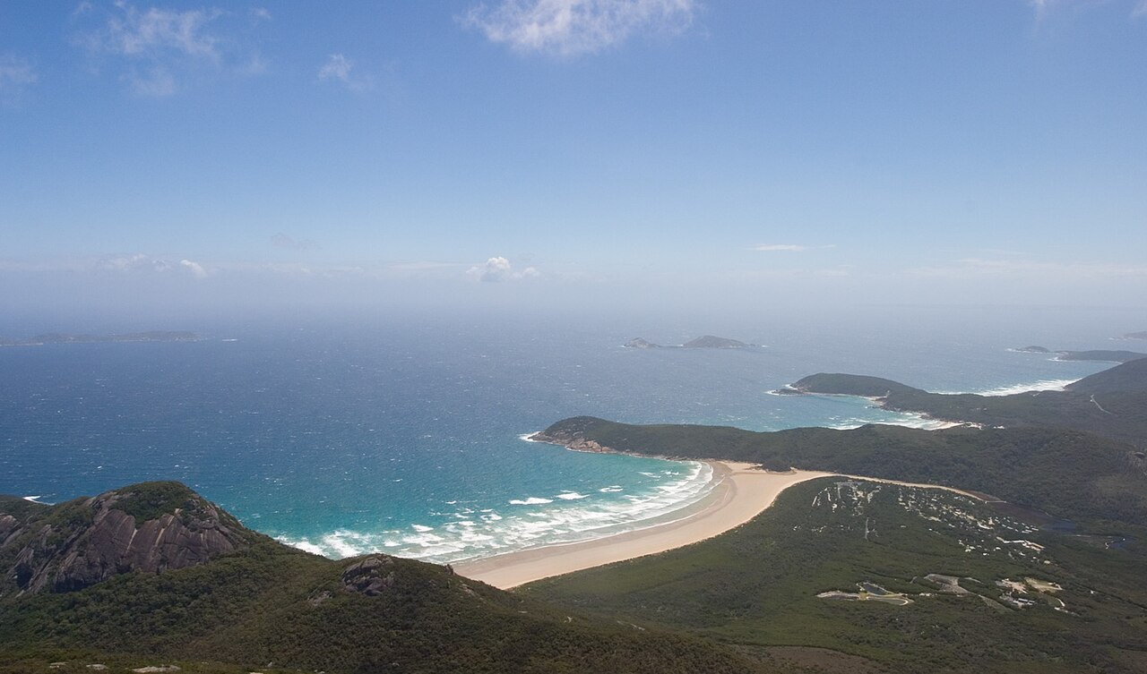
- 5 Mile Beach — Northern beaches
5 Mile Beach runs along the northern part of Wilsons Prom and works well for unhurried beach time, particularly when you want a change from track surfaces. The dunes and wide sand make it feel open and airy, even when the park is busy.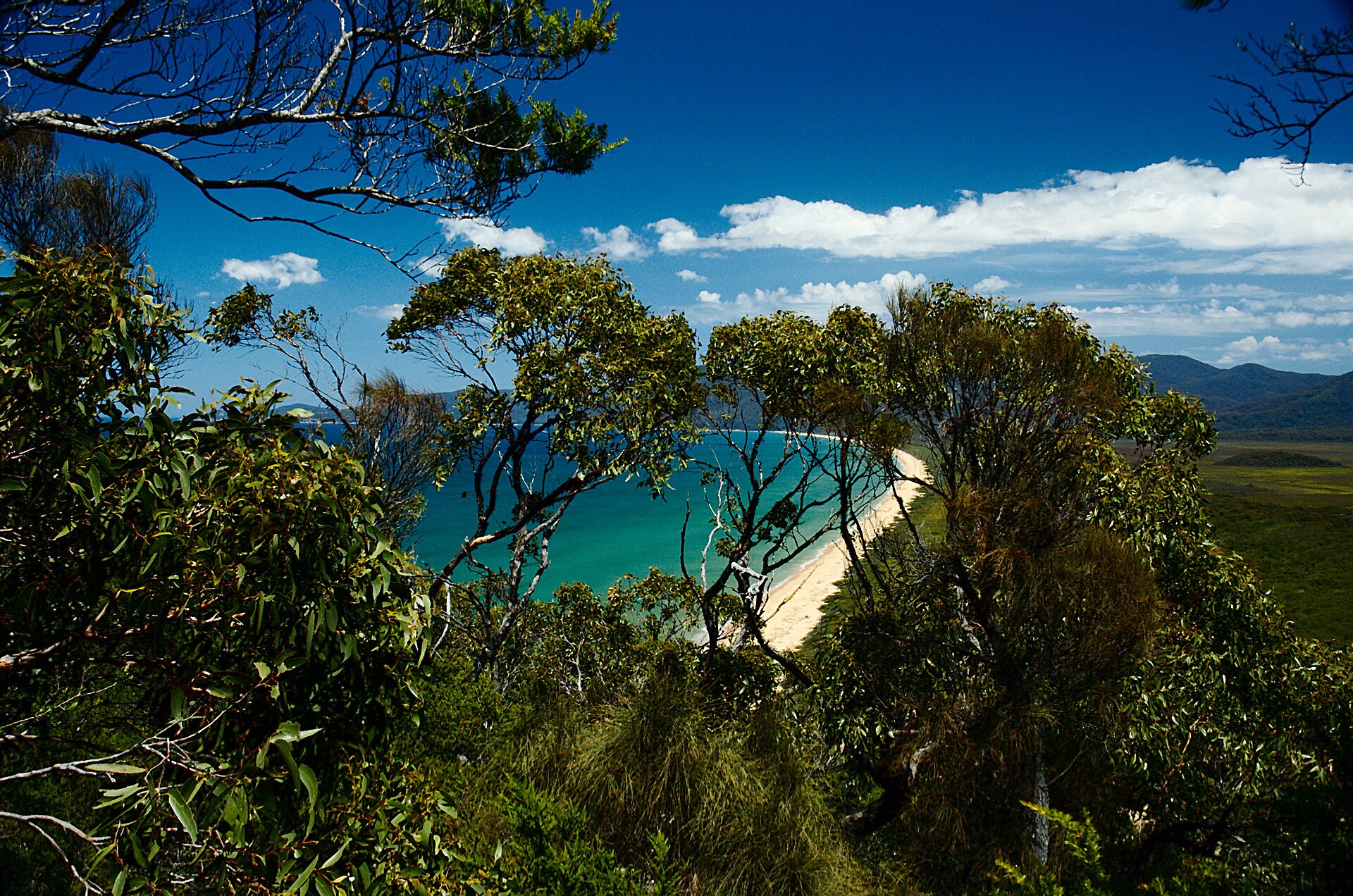
- Waterloo Beach — Coastal south
Waterloo Beach is a straightforward place to spend a couple of hours—walk the edge, check the tide, and settle into the coastal rhythm. It’s also a handy option when the wind is up and you want something more relaxed than a longer hike.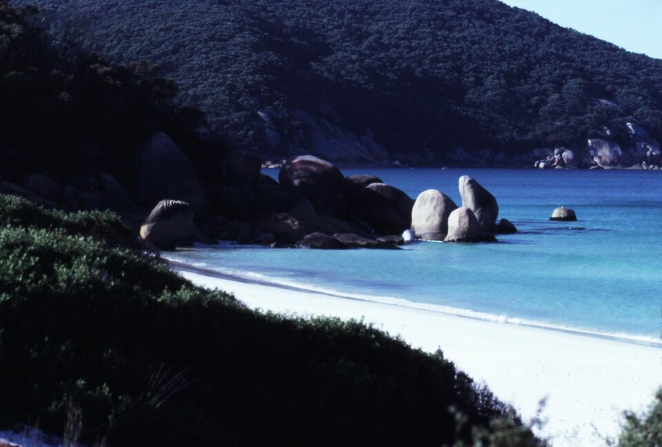
Culture
Wilsons Promontory National Park is a wildlife place, so the biggest “culture” is how people share space with animals. Wombats are common, especially around campsites, and that means the usual camping rules become extra important: store food securely and keep rubbish managed so animals aren’t tempted into human areas.
Hiking and overnight camping also come with a permit side. The northern area is a declared “Wilderness Area”, and overnight hikes require permits, whether they’re booked in advance or arranged at the park entrance or visitor centre at Tidal Creek. Camping options are concentrated in the southern part with facilities, while the north has fewer amenities.
In practice, the park runs on sensible timing: animals are more active around dawn and dusk, and road safety matters if you’re driving back late. The trails are often straightforward, but surfaces can be slippery after rain and conditions can turn fast in southern Victoria.
Visitor-etiquette: Keep distance from wildlife and don’t feed animals—especially near campsites and along tracks where wombats and kangaroos can get bold.
What to wear
For Wilsons Promontory, dress for wind, shifting cloud and wet ground more than for “hot sun”. Traditional clothing isn’t a focus here; the day-to-day look is practical outdoorswear.
Most people wear breathable layers: a short-sleeved top with a warmer mid-layer, plus a waterproof jacket that can handle ocean gusts and rain. Trousers or quick-dry hiking leggings help when you’re on uneven track edges, and good socks matter because damp footwear can spoil a day. At camp, many visitors bring a spare warm layer for evenings when it can feel cooler than expected.
Footwear is the big non-negotiable. Choose sturdy walking shoes or trail trainers with grip for muddy patches and beach sand. If planning to swim or snorkel in the marine areas, include a towel and a rash vest or swimwear you can put on without overheating in the wind.
For any wildlife-adjacent areas, avoid bright clothing that draws attention and wear a hat or sunglasses in clearer weather—then strip layers back if the sun breaks through. If you’re camping, pack a dry bag for electronics and a layer that blocks wind when you’re cooking or walking back after dark.
What to eat
- Tidal River café takeaways and supplies — Tidal River General Store
Stock up and refuel at the Tidal River General Store area, which includes a café with takeaway options alongside the basics you might have forgotten. It’s the most dependable stop when you’re staying around Tidal River. - Free gas barbecues at Tidal River — Car parks around Tidal River
If you’re camp-based, use the free gas barbecues in the Tidal River car parks for a relaxed dinner before an evening walk. It’s a simple way to eat well without hauling elaborate cooking gear. - Picnic-style beach snacks — Any coastal track or beach walk
Carry easy, no-fuss snacks for coastal walks: things like sandwiches, fruit and muesli-style bars work well when you don’t want to time your hikes around purchases. It’s especially handy once you’re away from Tidal River. - Camp pantry basics — Tidal River supply run
Camping days often turn into “cook and eat when you’re hungry”, so it helps to buy basics early from the Tidal River store area. Think simple ingredients that don’t require oven heat and extra cleaning.
Plan it
Best time. March–April and October–November suit Wilsons Promontory because southern Victoria is less wild than mid-winter, and it’s typically more comfortable for coastal walking; June often brings more rain, while August can still be hot and humid.
How long. 2–3
Getting there. Drive in via the South Gippsland Highway, turning off at Meeniyan or Foster, then continue toward the park entrance near Foster; allow the final stretch to Tidal River when you base yourself there. If using public transport, take a bus from Foster run by Foster Backpackers Hostel, with a connecting option via Fish Creek to Tidal River that links with V/Line coach services at Foster.
Budget. mid
Tips
- Plan around sunset or night driving: animals are often on the road at these times.
- If you’re staying near Tidal River, start day walks early to make the most of calmer light and easier wildlife viewing.
- For overnight trips, sort permits for wilderness area hiking and multi-day routes through the park entrance or visitor centre at Tidal Creek.
- Book campgrounds well ahead for Christmas and January, as well as other busy long weekends.
- Carry water and weatherproof layers—low-pressure systems and rainfall can roll through quickly.
Etiquette
- In and around campsites, secure food and keep rubbish under control to avoid wildlife rummaging.
- Keep to marked tracks in wilderness areas, particularly when conditions are wet.
- Be careful when driving back around dusk; watch for animals crossing.
Nearby
Sources
- Wikidata Q384739 (CC0)
- Wikipedia (rev 1380971520) (CC BY-SA 4.0)
- Wikivoyage (rev 5109621) (CC BY-SA 4.0)
- Photo photos/01-erosion-damage-wilsons-promontory-australia-mar-2012.jpg (CC BY 3.0)
- Photo photos/02-wilson-s-promontory-tidal-river-from-mt-oberon-dec-2004.jpg (CC BY 3.0)
- Photo photos/03-wilsons-prom-swamp-wallaby.jpg (CC BY 2.5)
- Photo photos/04-wombat-wilsons-promontory.jpg (CC BY 2.5)
- Photo photos/05-wilsons-promontory-national-park-au-big-drift-2019-1683.jpg (CC BY-SA 4.0)
- Photo photos/06-waterloo-beach.jpg (Public domain)
- Photo photos/07-emus-wilsons-promontory-national-park.jpg (CC BY 2.5)
- Photo photos/08-fivemilebeach-4a.jpg (CC BY 3.0)


