Uaxactún
Uaxactún, Guatemala
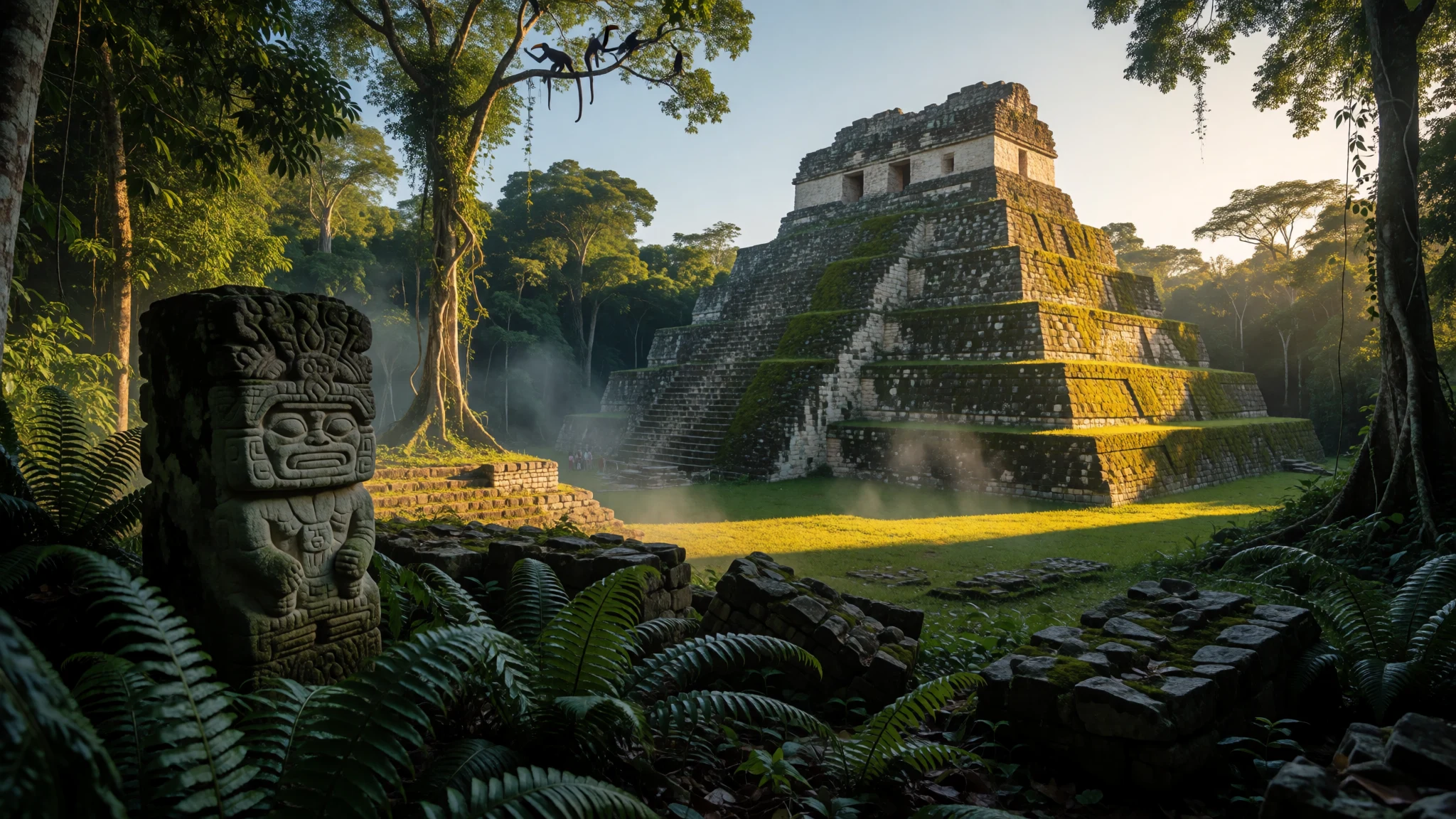
Uaxactún offers a rare chance to explore ancient Maya ruins inside a living jungle village without the heavy crowds of nearby sites.
The place
Tucked deep in the northern Guatemalan lowlands of the sprawling Petén Basin, Uaxactún is an old, holy site tied to the Maya civilization. Positioned just north of the famous archaeological centre of Tikal, this remote settlement provides an entirely different atmosphere from its larger neighbour. Unlike most archaeological reserves, Uaxactún is home to a permanent community of residents who live directly among the weathered limestone plazas and moss-covered stone structures. The modern village was established as a base camp for harvesting chicle, the natural tree sap once used to manufacture chewing gum before synthetic alternatives took over global markets. Because of this industrial origin, the current inhabitants are largely migrants from other parts of Guatemala rather than direct biological descendants of the original ancient architects, though many belong to modern indigenous Maya groups. The community's layout still bears the physical imprint of its twentieth-century history, centred around a broad grassy clearing that once served as an active airstrip long before any drivable dirt track connected the settlement to the outside world. Today, travellers arriving here find a quiet, isolated frontier where children play football against a backdrop of crumbling pyramids and howler monkeys roar from the high rainforest canopy at dawn and dusk. The surrounding forest is protected as part of a vast biosphere reserve, meaning the human footprint remains strictly managed to preserve both the dense jungle and the archaeological heritage scattered beneath its thick green canopy.
Its story
Uaxactún guards a complex history that spans centuries of imperial rivalry, dynastic intrigue, and archaeological discovery. Although modern epigraphers have unlocked many secrets of the ancient Maya hieroglyphic writing system, the original indigenous name of the ancient city remains a subject of scholarly debate and uncertainty. Some researchers suggest it may have shared titles with other lowland centres, while certain royal inscriptions point towards a polity associated with a regional title known as K'anwitz. The site received its modern designation from the pioneering archaeologist Sylvanus Morley during his expedition in May 1916. Morley constructed the name using two indigenous terms to signify eight stones, choosing the moniker to commemorate the discovery of a stela bearing an inscription from the ancient eighth bakhun of the Maya calendar, which at the time marked the earliest recorded chronological date found anywhere in the lowlands. Etymologists have also noted a curious linguistic coincidence, as the phonetic pronunciation sounds remarkably similar to Washington, the capital city of the institutional patron that funded Morley's early explorations in the Petén jungle. Subsequent excavations directed by institutions such as the Carnegie Institution of Washington revealed extensive stratigraphy, proving that the settlement was occupied across multiple epochs. During the Classic period, the city fell under the political shadow and eventual military domination of its powerful southern neighbour, Tikal, whose lords integrated Uaxactún into their expanding regional network through a combination of marital alliances and coercive diplomacy.
What to see
- Groups A and B — Central archaeological zone
Groups A and B form the sprawling late political core of the ancient settlement, featuring complex residential plazas, decaying palace structures, and weathered limestone stelae that hint at centuries of elite dynastic governance, royal ceremonies, and administrative control over the surrounding lowland hinterlands.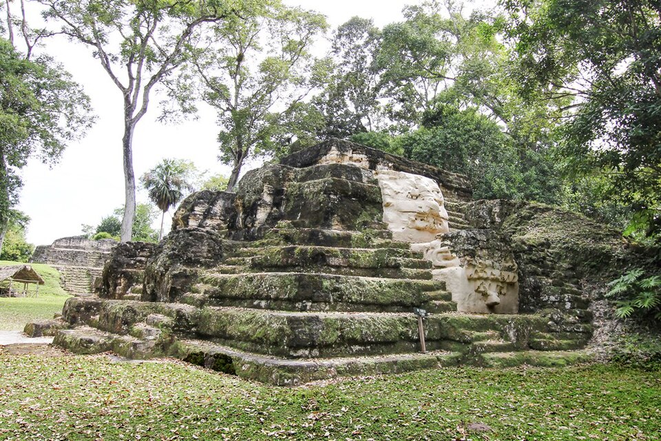
- Group E — Eastern sector of the ruins
Group E represents the much older architectural heart of the site, containing a celebrated ancient astronomical complex where aligned structures allowed ancient priests to track solstices and equinoxes precisely across the horizon against the rising jungle sun over a millennium ago.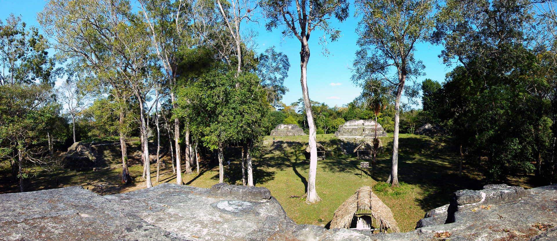
- El Respiradero — Jungle fringe near the settlement
El Respiradero is a remarkable natural limestone cave opening hidden within the thick surrounding jungle that continuously vents a steady stream of refreshingly cool air during the intense heat of the day, housing native cave-dwelling bats and insects. - Local Archaeological Museum — Village centre near the airstrip
The community-run local archaeological museum houses a fascinating collection of recovered ceramic vessels, carved stone fragments, and painted pottery plates that illustrate the artistic achievements, daily domestic habits, and rich funerary rituals of the ancient inhabitants.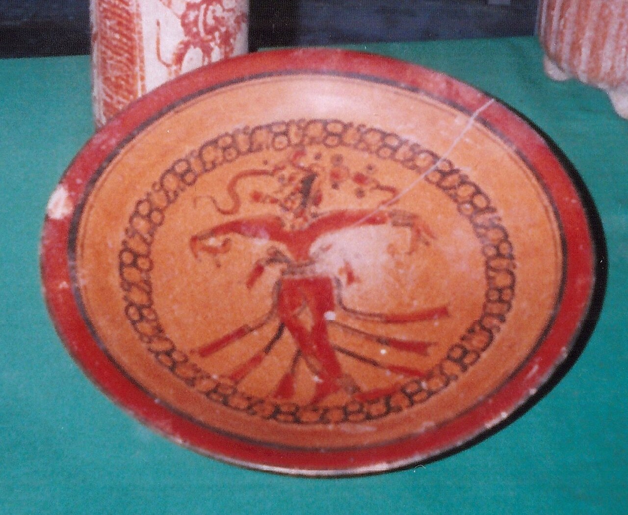
- Temple of the Masks — Southern plaza group
The Temple of the Masks showcases remarkably preserved monumental stucco masks adorning its ancient architectural facade, offering visitors a vivid look at the fearsome zoomorphic deities and cosmological symbolism that once dominated sacred public spaces across the early Maya world.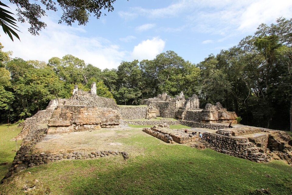
Culture
Uaxactún sustains a distinct cultural identity forged by its unique origins as an isolated forest working camp rather than an ancient indigenous lineage settlement. The modern residents are largely descendants of labourers who migrated into the Petén forest to harvest chicle latex and timber, though many families now identify with various indigenous Maya communities from across Guatemala. Life in the village is governed by strict environmental agreements with national conservation authorities, which permit local residents to forage sustainably for forest resources while forbidding commercial cattle ranching, unauthorized land sales, and intensive hunting. This shared ecological stewardship fosters a tight-knit, welcoming community atmosphere where traditional Spanish is spoken alongside regional indigenous dialects. Visitors are encouraged to engage respectfully with local residents, support community-run tourism initiatives such as hiring local guides through the village administration office, and purchase handicrafts directly from local artisans rather than bargaining aggressively. Always ask permission before photographing local residents and community elders in the village streets.
What to wear
Uaxactún residents generally wear practical, casual modern clothing suited for life in a remote tropical forest village, including durable trousers, sturdy boots, and lightweight shirts that withstand high humidity and muddy tracks. Traditional indigenous garments such as intricately woven huipils and cortes are worn by some residents, particularly older community members and during local festivals or civic celebrations, reflecting diverse heritage roots from across Guatemala. For visitors exploring Uaxactún, dressing for the climate and terrain is essential for comfort and safety. You should pack lightweight, breathable cotton or synthetic clothing, long trousers to protect against sharp brush and biting insects while hiking through the jungle, and sturdy walking shoes or hiking boots with good grip for navigating uneven limestone ruins and slippery forest trails. A wide-brimmed hat, sunglasses, and a lightweight waterproof jacket are also indispensable items for coping with sudden tropical downpours and strong equatorial sun.
What to eat
- Restaurante Uaxactun Set Dinners — The main village corner near the central airstrip
Restaurante Uaxactun serves hearty home-cooked set dinners featuring traditional Guatemalan staples like rice, beans, tortillas, and chicken, providing a welcoming social hub for travellers after a long day exploring the jungle ruins. - Village Shop Snacks — Various small family shops along the airstrip
Small local shops scattered along the airstrip and residential paths sell basic packaged snacks, biscuits, and chips for travellers needing a quick energy boost while wandering between distant temple groups. - Bottled Mineral Water — Selected village grocery stores near the central green
Local grocery shops stock bottled drinking water and cold soft drinks, with larger two-litre bottles available at select stores to keep hikers hydrated in the humid jungle heat. - Gallo Beer — Local village restaurant and grocery kiosks
Guatemala's ubiquitous national lager, Gallo beer, is widely available cold at the local eatery and small shops, offering a refreshing way to unwind after exploring the archaeological zone.
Plan it
Best time. November to April offers drier weather and more manageable trail conditions through the Petén forest, whereas the wet season brings heavy downpours and muddy, challenging roads.
How long. 2
Getting there. Travel from Flores to Tikal by road, then continue along the unpaved, bumpy dirt track north for about 23 kilometres using a high-clearance vehicle or local transport.
Budget. low
Tips
- Arrange high-clearance transport in advance, as the dirt road from Tikal becomes extremely rugged.
- Carry sufficient cash, as there are no automated teller machines or card payment facilities in the village.
- Bring a high-powered torch or headlamp, as village electricity is often limited or subject to scheduled cut-offs.
- Pack plenty of insect repellent and high-factor sunscreen for jungle hikes.
- Inquire about daily bus departures in Santa Elena before setting out.
Etiquette
- Always ask permission before taking photographs of local residents and village children.
- Support sustainable tourism by hiring local community guides through the official village office.
Nearby
Sources
- Wikidata Q977738 (CC0)
- Wikipedia (rev 1375581785) (CC BY-SA 4.0)
- Wikivoyage (rev 5362825) (CC BY-SA 4.0)
- Photo photos/01-uaxactun2.jpg (CC BY-SA 4.0)
- Photo photos/02-uaxactun1.jpg (CC BY-SA 4.0)
- Photo photos/03-uaxactun-groupe-fromtempleofmasks.png (CC BY 3.0)
- Photo photos/04-encenser-uaxact-n-museu-nacional-d-arqueologia-i-etnologia-d.jpg (CC BY-SA 4.0)
- Photo photos/05-encenser-uaxact-n-museu-nacional-d-arqueologia-i-etnologia-g.jpg (CC BY-SA 4.0)
- Photo photos/06-maya-plate-at-uaxactun.jpg (CC BY 3.0)
- Photo photos/07-maya-tripod-bowl-uaxactun.jpg (CC BY 3.0)
- Photo photos/08-uaxactun-1.jpg (CC BY 3.0)


