Tinakula
Tinakula, Solomon Islands
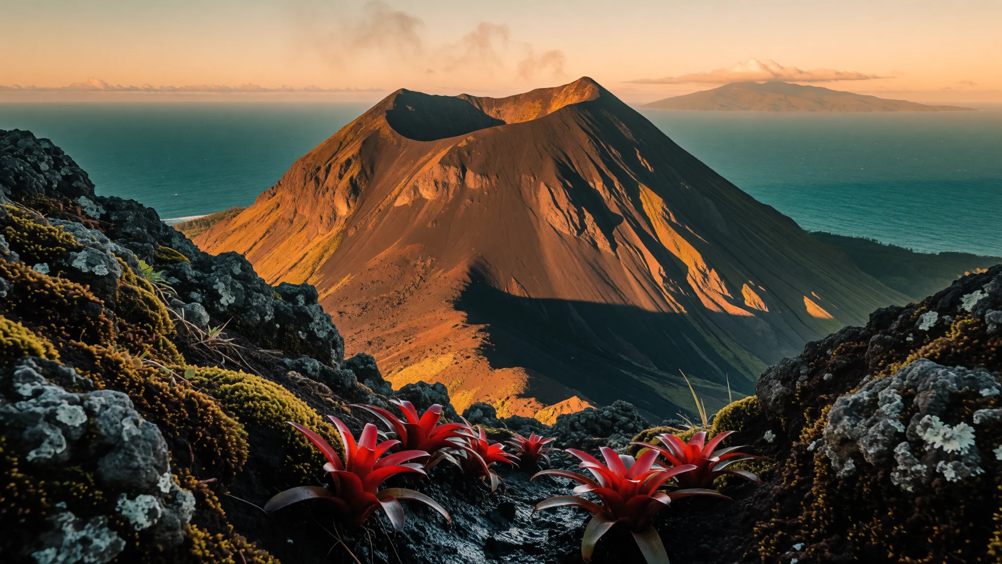
Tinakula is an uninhabited volcanic cone in the Santa Cruz Islands, seen across the reef when the summit is quiet enough to approach.
The place
Tinakula is a volcano that is also an island, set in Temotu Province of the Solomon Islands, on the seaward side of Nendo. Old charts list it as Tamami, and as Volcano Island. What looks like a small landmass from a distance is one cone of andesite mixed with basaltic andesite, roughly 3.5 kilometres from shore to shore, with the summit 851 metres above the sea. Measured from the seabed, the same cone continues down for another three to four kilometres before it meets the ocean floor. The summit holds a crater. Tinakula stands on the New Hebrides arc, a belt of volcanic islands running from these waters towards Vanuatu. The arc exists because one plate is driven down beneath its neighbour, with the Pacific side riding over the Indo-Australian side and magma rising to the vent. That is why steam and ash still leave the crater, and why pale streaks of debris mark the flanks. No one lives on Tinakula today. It closes the Santa Cruz Islands on their northern side: open ocean beyond, and the Reef Islands, including Fenualoa, lying to the south across the Great Reef. From those lagoons the cone is a dark triangle, often with a light plume. There is no town, no pier and no path network. The only way onto the rock is by small boat, and only in a spell when the summit is quiet and the landing is safe. Vegetation returns slowly on slopes that hot flows have scoured, and the coast is a thin rim of cliff and boulder between the cone and deep water.
Its story
European records of Tinakula open in 1595. Álvaro de Mendaña's Spanish expedition sighted the cone on 7 September that year, while the ships were bound for Nendo and later remained there. The crews described a high, symmetrical peak. Later eruptions decided who could remain. Around 1840, clouds of hot ash and rock poured down every slope and destroyed the community then living on the island. Reports say people were back by 1887. A clearer settlement began in 1951, when Polynesian families sailed from Nukapu and Nupani and took up ground on Tinakula. Temateneni, their village, sat on the southeastern shore. The group grew until 160 people lived there. The 1971 eruption ended that stay: everyone left. Near the end of the 1980s two Nupani households, under 10 people in all, tried once more. They did not remain, and Tinakula has had no resident population since. Passing ships often found the mountain on fire. In October 1827 Captain Dillon of the HCS Research lay overnight in the channel between Santa Cruz and the cone, which he called Thinnacoraw and also Carteret's Volcano Island, and saw molten rock streaming down the flanks again and again. The channel that night was a place to watch from, not a harbour to enter. Taken together, Tinakula's record is a cycle of arrival, eruption and leaving, and long empty years in between.
What to see
- Summit crater — Tinakula summit
The summit of Tinakula holds a crater on a cone that reaches 851 metres above the sea. That hollow is where the pale column of steam and ash begins. The stone is andesite and basaltic andesite, the mix that makes up the island. No path or shelter exists. Slopes are steep and the vent is still active, so the crater is watched from the air or from well offshore.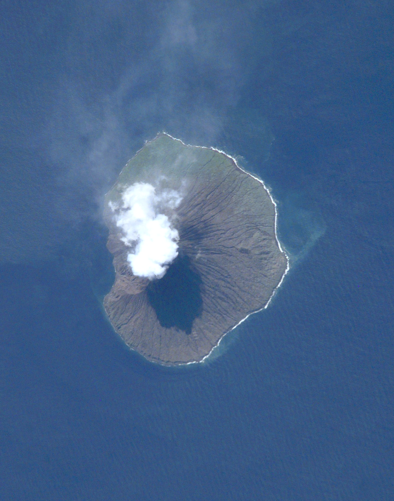
- Ash and steam plumes — Above the cone
Tinakula lifts columns of ash and steam that drift across the Santa Cruz sea. A NASA frame from February 2012 shows one plume streaming off the cone, and an October 2017 satellite pass shows the island throwing ash again. That column is the signal. While it rises, boats keep out of the lee, where grit settles on the water.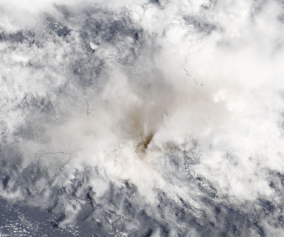
- Temateneni — Southeast coast
The empty southeast shore of Tinakula is where Temateneni stood. Settlers from Nukapu and Nupani built that village after 1951, and it remained home until the 1971 eruption forced everyone off. A brief return in the late 1980s did not restore it. No houses, water supply or path remain. The shore was left because the volcano made it unsafe, after people had already chosen it. - View from Fenualoa — Fenualoa, Reef Islands
From the lagoon at Fenualoa, in the Reef Islands, Tinakula sits beyond the Great Reef as a dark cone, sometimes capped by a plume. The reef draws a pale line between that shore and the volcano. People here usually see the island from a distance, not from a beach on the cone. Haze softens the peak; a busy vent marks it with smoke.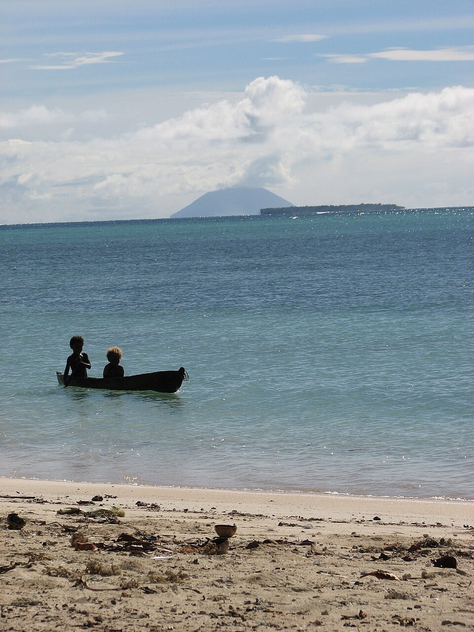
- Sea approach from Nendo — Waters north of Nendo
Tinakula rises north of Nendo, at the Santa Cruz Islands' seaward end, so the approach is by open water, not by road or airstrip. Only about 3.5 kilometres across, the cone still climbs out of deep water and looks taller than that width suggests. There is no anchorage town. Boats pass between the Reef Islands and Nendo, or stay offshore while the summit is quiet.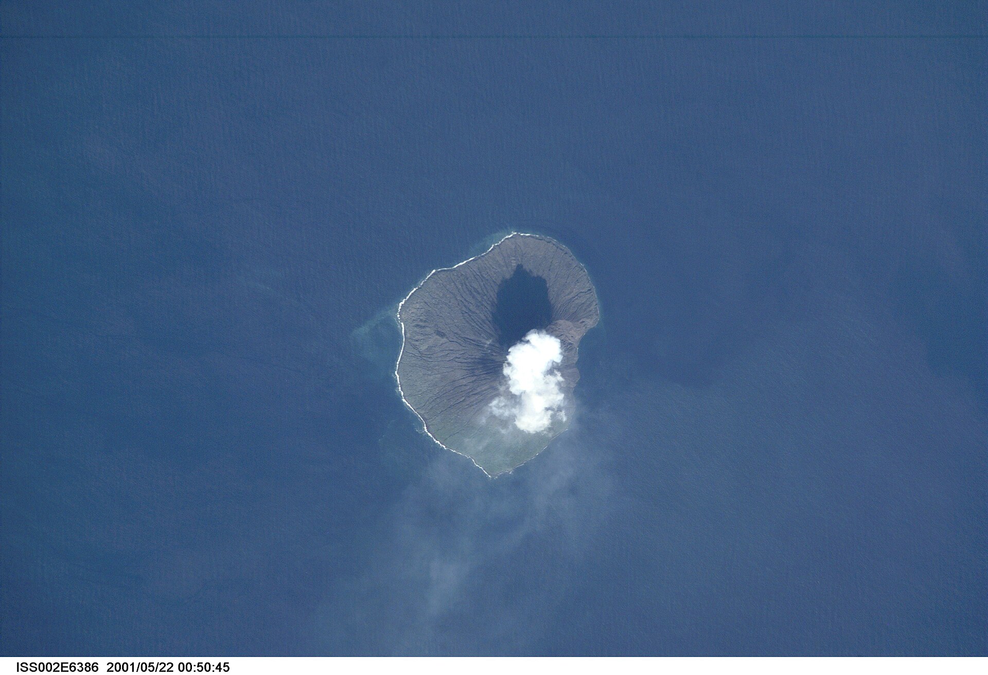
Culture
Tinakula has no village of its own, so the customs that govern a visit are those of Temotu and the neighbouring Reef Islands, not a code written for the cone. Solomon Islands life is not one culture. Clans, language and island each keep their own ways, and what is ordinary on Nendo may differ on Nukapu or Nupani, the Polynesian communities whose families once tried to live on Tinakula. Two ideas travel almost everywhere. Kastom is the Pijin name for inherited practice: the accepted way to approach land, kinship and ceremony. Wantok names the duty owed to relatives and to people who share a language or a home place, a duty that still organises work, welcome and help. Land is held, even when a beach looks unused. An empty shore, a reef or a bush track can belong to a clan. Visitors are expected to find the right chief, elder or landowner, often through a guide or a host, and to ask before going ashore, following a path or stepping onto a site that matters locally. A kastom offering is sometimes part of that asking. Graves, shrines and ceremony are not scenery. Photographing people, houses, objects or sacred ground waits on a clear yes. On Tinakula itself there is nobody to ask, which makes the rule stricter rather than looser: do not treat the island as unowned ground, and go ashore on a lived-in island only after the landholder has agreed.
What to wear
Tinakula has no residents and no festival calendar, so dress is a question for the islands around it, especially Nendo and the Reef Islands, whose people once crossed to the cone. In Temotu, older ceremonial dress uses what the gardens and shore provide: skirts and wraps of coconut and pandanus fibre, bark cloth beaten from tree bark, and ornaments of shell. Those clothes appear for dance and custom events, not for an ordinary morning in a garden. Day to day, people wear the same light cotton the shops sell: T-shirts, shorts, loose dresses and printed wrap skirts, with sandals or bare feet in the village. Church and custom occasions bring a neater cotton dress or a collared shirt, and sometimes the fibre skirt over or instead of that. A visitor does better copying the practical layer than the ceremony. The climate is hot, wet and salty. Sensible clothes are thin cotton that covers shoulders and knees for a village visit, a hat and sleeves against the sun on the water, and a light rain layer. Footwear should cope with a wet dinghy and still grip wet rock if a landing on Tinakula is ever offered. Ceremony dress belongs to the people who own it. Swimwear belongs on the boat or the beach, not in a village.
What to eat
- Poi — Village kitchens on Nendo and in the Reef Islands
Poi is fermented taro from village kitchens on Nendo and in the Reef Islands, near Tinakula. The corm is pounded, left until sour, and eaten with fish or greens. The cone has no gardens and no market, so a boat carries poi only if it was packed ashore. - Cassava — Village kitchens on Nendo and in the Reef Islands
Cassava is the everyday starch around Tinakula, boiled or fried in kitchens on Nendo and the Reef Islands. It fills a plate beside fish when taro is short. The volcano is not farmland. People eat it on those inhabited islands, or from a pot stocked before a boat crosses. - Chilli tuna — Fishing boats, and eateries in Honiara and provincial towns
Tuna from these waters is a common plate on routes near Tinakula, often cooked with chilli and served with rice or pasta. Fishing boats land it, and eateries in Honiara and provincial towns cook it that way. The island itself has no kitchen for a visitor to walk into. - Garden fruit — Village gardens and markets on Nendo and in the Reef Islands
Fruit around Tinakula means garden fruit from Nendo and the Reef Islands. A host may offer it when a boat calls at a village. There is no stall on the cone. Fruit has to be bought or accepted on the inhabited shore, because the volcano will not provide it. - Canned tuna and spam — Small shops on Nendo and in the Reef Islands
Small shops near Tinakula, on Nendo and in the Reef Islands, often stock canned tuna or spam when the catch is thin. Those tins are ordinary outer-island pantry food, not a dish of the volcano. Fresh plates belong to towns and good fishing days; the shelf is often a can.
Plan it
Best time. Tinakula is hot and wet throughout the year, and the sources give no pleasant month to single out. A passage makes sense only when the summit is quiet and the sea is calm enough for a small boat from Nendo or the Reef Islands. Volcanic unrest does not follow a visitor season. Check a marine forecast and current eruption advice before leaving inhabited land.
How long. 1–2
Getting there. Most journeys start at Honiara, the capital named in the sources, and continue by air and then boat into Temotu; the last leg is a boat from Nendo or the Reef Islands. Tinakula has no airstrip or harbour town. Check current services, since the sources give no timetable.
Budget. high
Tips
- Do not plan to sleep on Tinakula; the island has no village, water or shelter.
- Ask about current volcanic activity and stay offshore if ash is rising.
- The Solomons lie on the Pacific Rim of Fire, so know the tsunami advice where you are staying before you travel.
- Bring drinking water and sun protection; the cone supplies neither.
- Carry a passport and proof of onward travel, which the entry rules require, and confirm visa needs on an official site before you fly.
Etiquette
- Ask the chief, elder or landowner before going ashore on an inhabited island, walking a track or using a beach.
- Ask before photographing people, homes, graves, ceremonies or sacred objects.
- Do not treat an empty shore as public land; it may be customary land.
- Leaving a tip is not the local custom, so do not add one unless someone has asked.
Nearby
Sources
- Wikidata Q986896 (CC0)
- Wikipedia (rev 1369728235) (CC BY-SA 4.0)
- Wikivoyage (rev 5392304) (CC BY-SA 4.0)
- Photo photos/01-iss002-e-6386-view-of-the-solomon-islands.jpg (Public domain)
- Photo photos/02-ash-plume-from-tinakula-santa-cruz-islands-solomon-islands-m.jpg (Public domain)
- Photo photos/03-fenualoa-lagoon-2-4.jpg (CC BY 3.0)
- Photo photos/04-fenualoa-lagoon-2.jpg (CC BY 3.0)
- Photo photos/05-fenualoa-lagoon.jpg (CC BY 3.0)
- Photo photos/06-iss002-e-6386tinakula.png (Public domain)
- Photo photos/07-steam-and-ash-plume-over-tinakula-island-6920551845.jpg (CC BY 2.5)


