Sirmilik National Park
Sirmilik National Park, Canada
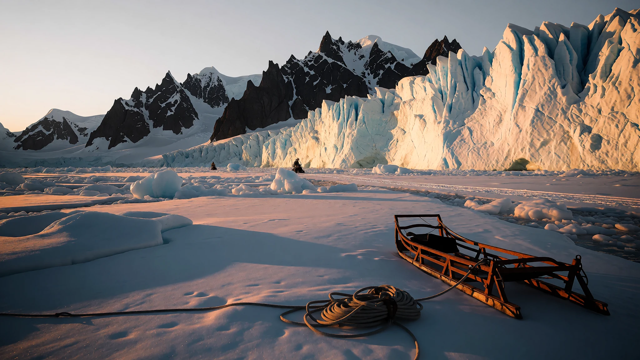
Sirmilik National Park offers towering glacier-carved fjords, dramatic Arctic coastlines, and a remote wildlife haven where ancient ice meets the sea.
The place
Sirmilik National Park, whose Inuktitut name translates directly as the place of glaciers, occupies a dramatic corner of the Qikiqtaaluk Region in Nunavut. Positioned firmly within the rugged Arctic Cordillera, this remote northern landscape divides its territory across distinct protected parcels. It encompasses the vast majority of Bylot Island, the steep coastal relief of Oliver Sound known locally as Kangiqłuruluk, and the expansive plateau with wide river valleys of the Borden Peninsula. Vast marine areas and shifting sea ice stitch these terrestrial fragments together into a cohesive polar wilderness. The terrain bears permanent witness to ancient geological forces. Massive ice sheets once scoured the land completely, leaving behind carved valleys, sheer coastal cliffs, and peculiar weathered columns known as hoodoos that stand like silent sentinels on Bylot Island and the Borden Peninsula. The surrounding waters provide a rich transition zone where northern marine life thrives against a backdrop of hanging glaciers, ice fields, and towering headlands. Because roads do not reach this far north, travellers arrive entirely by air through gateway communities before making the final journey across open water by boat or over frozen sea ice by snowmobile, depending strictly on the seasonal cycle of the polar year.
Its story
Sirmilik National Park holds a deep human history that stretches across millennia of continuous survival in an unforgiving climate. Long before European vessels probed northern waters, ancestral communities including early Paleo-Eskimo groups inhabited these coastal margins, establishing a profound cultural continuity that modern-day Inuit carry forward through traditional hunting and fishing practices. European contact arrived as explorers and commercial whalers pushed ever northward in search of the elusive Northwest Passage. British navigators William Baffin and Robert Bylot surveyed the icy channels in the seventeenth century, charting prominent landmarks such as Lancaster Sound and giving their names to the great island that anchors the park. Centuries later, official expeditions attempted to unlock the same frozen passage, confirming the accuracy of early charts amid towering sea cliffs and massive ice barriers. Federal agencies later mapped the region extensively from the air during decades of northern surveys. Recognizing the extraordinary concentration of marine life and nesting seabirds, authorities first designated parts of the territory as a protected bird sanctuary before officially establishing the national park to safeguard both its rich avian colonies and its striking geological heritage for future generations.
What to see
- Bylot Island Glaciers — Bylot Island
Vast fields of ancient ice spill down towards the ocean across Bylot Island, creating dramatic coastal margins where towering blue tongues of glacial ice calve directly into frigid polar waters. Exploring these margins reveals striking landforms shaped by millennia of relentless freeze-thaw cycles and immense geological pressure.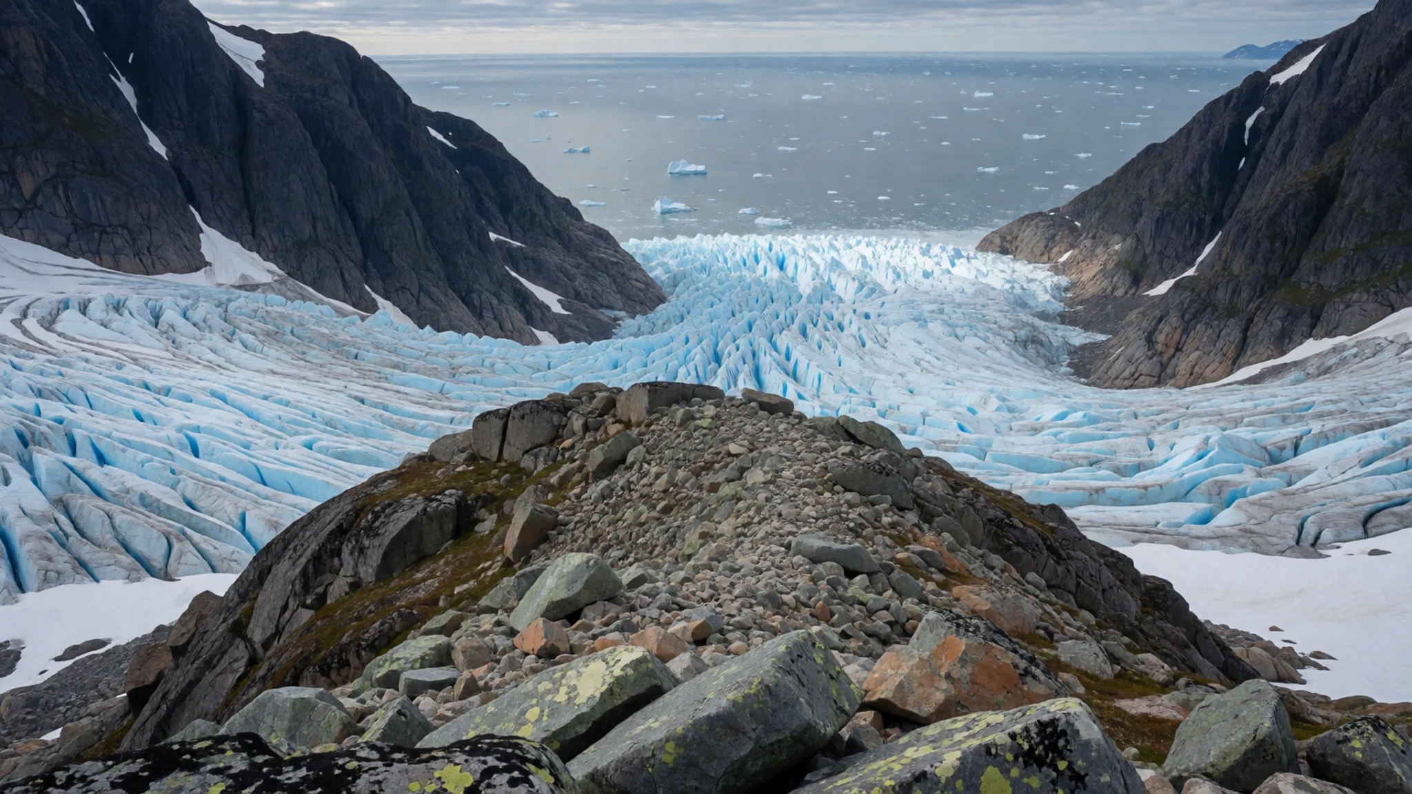
- Oliver Sound — Kangiqłuruluk
This exceptionally long and narrow fjord cuts deep into the mainland south of Pond Inlet, flanked by sheer vertical cliffs that rise straight out of deep marine waters. Exploring this protected marine corridor offers tranquil paddling beneath hanging glaciers and dramatic rock faces.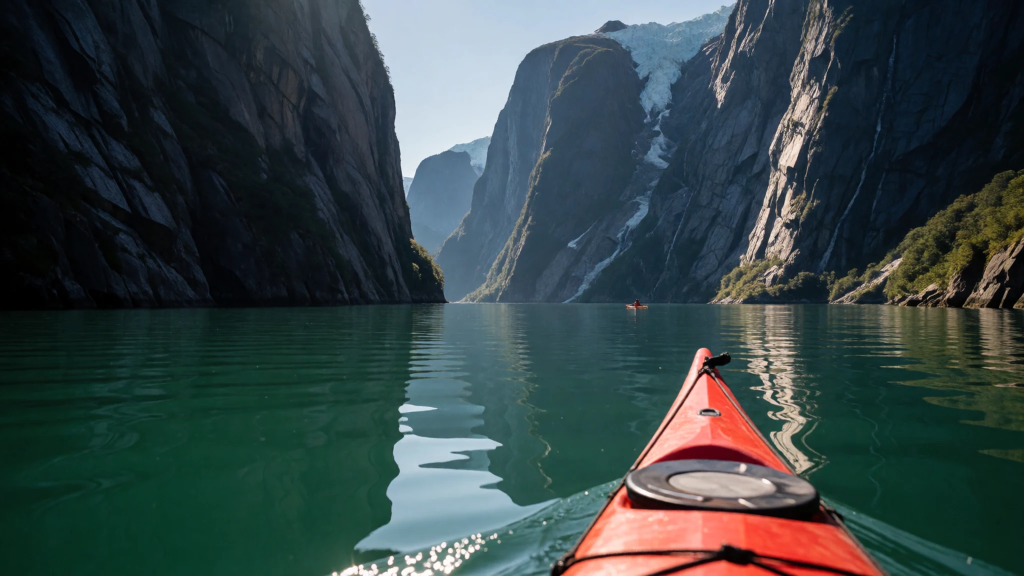
- Floe Edge Wildlife Viewing — Pond Inlet gateway
Springtime journeys to the shifting boundary where fast land ice meets open ocean water provide extraordinary opportunities to observe marine mammals and migratory birds. Guided excursions along this dynamic fracture line frequently reveal narwhal, beluga whales, and polar bears navigating the icy leads.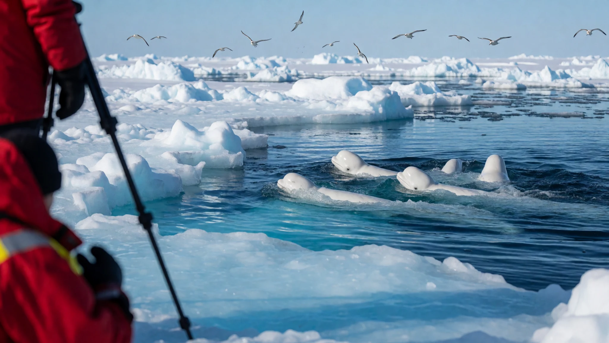
- Baillarge Bay Seabird Cliffs — Borden Peninsula coast
Towering coastal precipices near the western gateway provide nesting habitat for countless seabirds, including massive colonies of thick-billed murres and black-legged kittiwakes wheeling overhead. These remote avian cliffs are best appreciated from the deck of an expedition vessel during the short summer open-water window.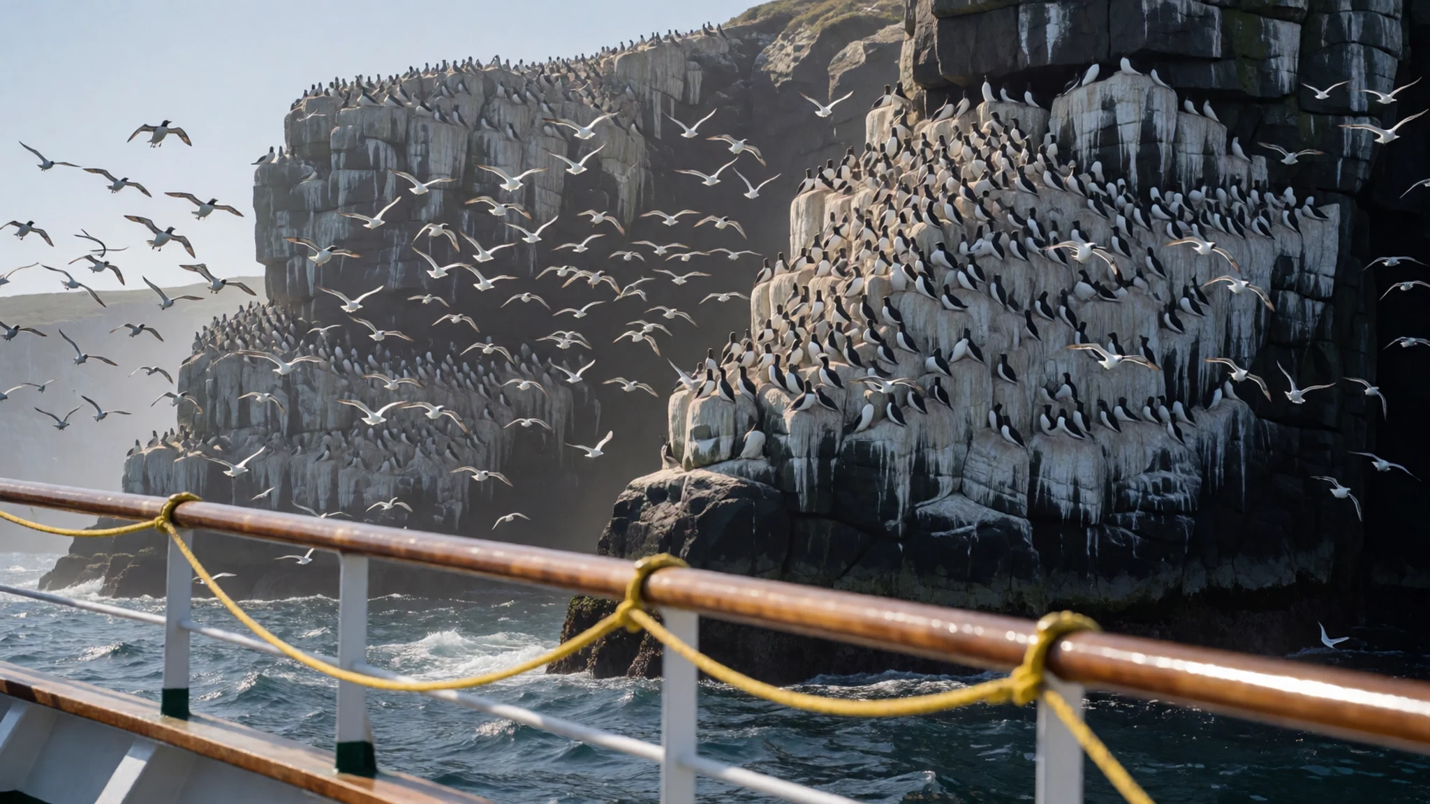
- Borden Peninsula Plateaus — Borden Peninsula interior
Expansive upland plateaus and broad river valleys stretch across the northern reaches of the peninsula, cut through by deep canyons and capped by flat-lying rock layers. These remote inland expanses offer challenging terrain for experienced hikers seeking absolute solitude under the endless midnight sun.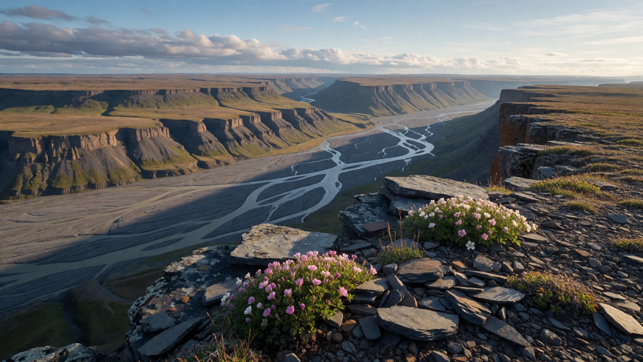
Culture
The cultural fabric of Sirmilik National Park is inextricably tied to Inuit heritage, whose community members maintain a profound living relationship with the land and ice. Traditional knowledge, or Inuit Qaujimajatuqangit, guides everyday survival, seasonal movement, and respectful stewardship of wildlife populations that have sustained generations. Elders pass down oral histories, traditional crafting techniques, and deep navigational wisdom required to read shifting weather patterns and dangerous sea ice conditions. Visitors encounter a culture rooted in sharing, resilience, and a deep spiritual connection to the natural world. Contemporary community life in the nearby gateway settlements blends modern amenities with traditional subsistence harvests, where snowmobiles and modern navigation tools sit alongside generations of outdoor expertise. When visiting northern communities near the park boundary, always seek local guidance, respect community protocols regarding private lands, and ask permission before photographing residents or traditional hunting gear.
What to wear
Traditional clothing in the Sirmilik National Park region was historically engineered for extreme polar survival, utilizing caribou skin, marine mammal leather, and dense furs carefully stitched with sinew to block biting winds and sub-zero temperatures. Heavy parkas with protective ruffs of wolf or wolverine fur traditionally shielded the face from severe frostbite during long winter journeys across frozen sea ice. Today, residents in nearby gateway communities wear modern, high-performance technical outerwear alongside traditional handmade garments like fur boots and insulated parkas for everyday wear in severe weather. Visitors heading into the park must adopt a strict layering system, bringing windproof and waterproof outer shells, heavy down insulation, moisture-wicking thermal base layers, sturdy mountaineering boots, and specialized face protection to guard against intense glare and biting polar winds.
What to eat
- Country Food (Pijittarniq) — Local community gatherings and family homes in Pond Inlet
Traditional harvested foods form the cornerstone of local nutrition, featuring Arctic char, caribou, seal, and occasionally marine mammal products shared within community networks.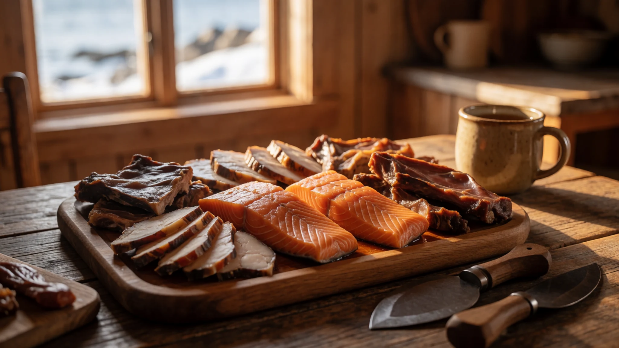
- Arctic Char — Community feasts and local family kitchens
A prized northern fish found in cold pristine waters, typically prepared fresh by local hosts as pan-fried fillets, baked dishes, or enjoyed dried.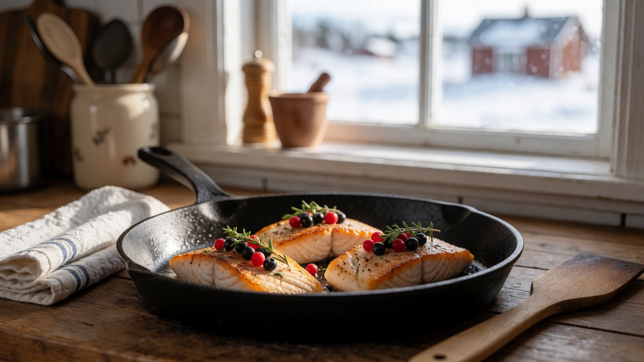
- Bannock — Local bakeries and community gatherings in Pond Inlet and Arctic Bay
A dense, comforting traditional flatbread baked or pan-fried daily, often served warm with butter or jam to accompany hearty meat stews. - Caribou Stew — Local community halls and seasonal hunting camps
A warming, slow-cooked meat dish prepared with root vegetables and thick broth, designed to sustain travellers against bitter cold weather.
Plan it
Best time. Late March to early June for snowmobile travel across frozen oceans and spring ski touring; August to mid-September for open-water boat travel and hiking.
How long. 5–7
Getting there. Fly via commercial airline from Ottawa to Iqaluit, then take a scheduled connecting flight to the gateway communities of Pond Inlet or Arctic Bay.
Budget. high
Tips
- Book flights and local outfitter arrangements many months in advance
- Factor in several days of schedule flexibility for frequent weather delays
- Complete mandatory park registration and safety orientations before departure
- Practise strict leave-no-trace camping as no facilities exist within the park
Etiquette
- Respect Inuit hunting areas and private lands throughout the region
- Always ask permission before photographing local residents or traditional equipment
- Follow local outfitter instructions closely regarding polar bear safety
Nearby
Sources
- Wikidata Q795332 (CC0)
- Wikipedia (CC-BY-SA 4.0)
- Wikivoyage (CC-BY-SA 4.0)