Auyuittuq National Park
Auyuittuq National Park, Canada
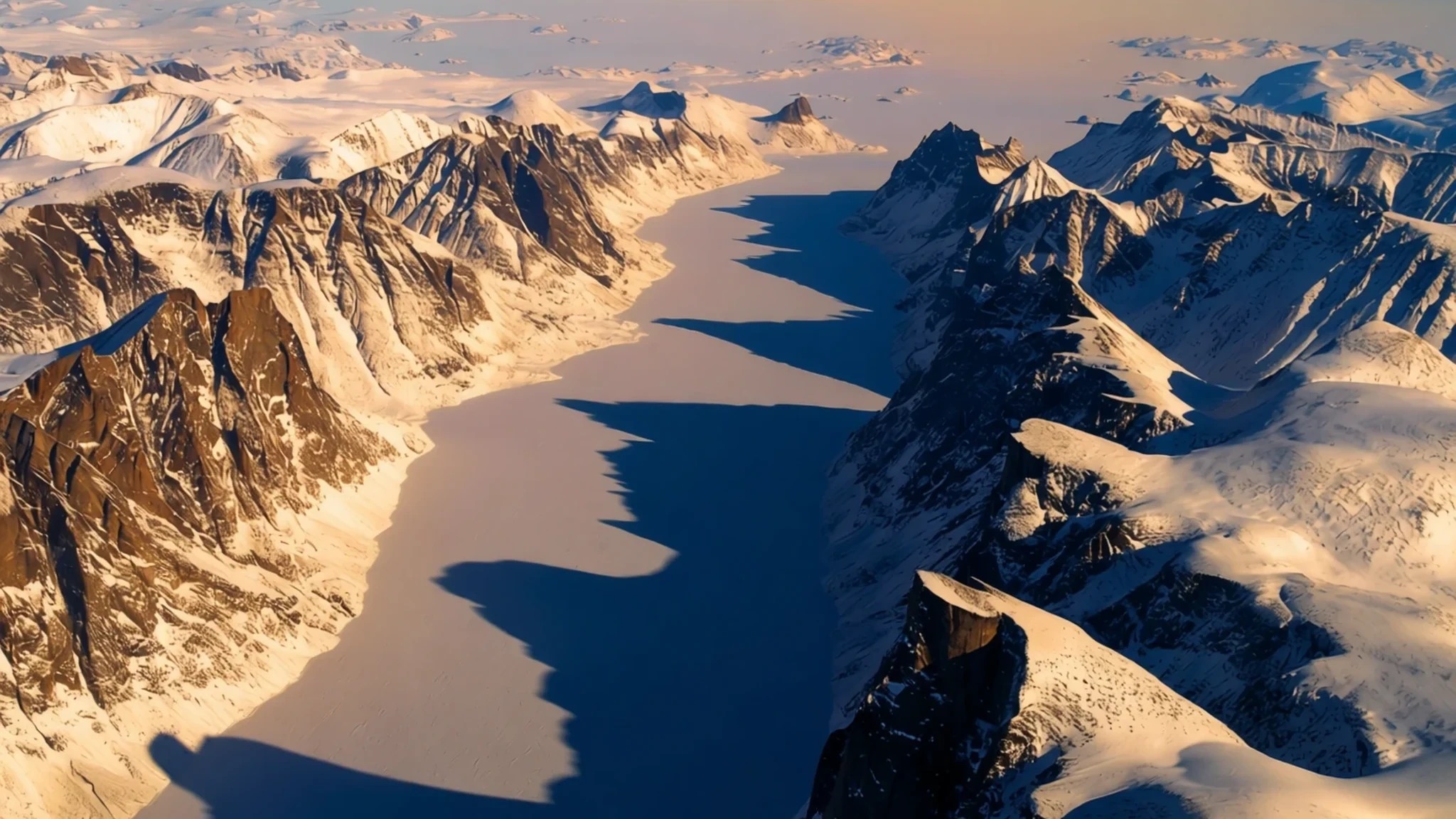
Auyuittuq is a remote Arctic park of ice caps, granite walls and fjords, reached only with planning for weather and rivers.
The place
Auyuittuq National Park occupies much of the Cumberland Peninsula on Baffin Island, in the Qikiqtaaluk Region of Nunavut, and it lies mostly within the Arctic Circle. Its 21,470 square kilometres take in fjords, glaciers and ice fields rather than the forests or lakes most park visitors expect. At the centre sits the Penny Ice Cap, a vast sheet of ice that rests on very old granite and feeds a set of glaciers running down toward the valleys. Between the ice and the sea the land breaks into steep peaks and deep valleys, while narrow fjords cut into the coast. Weather is the main force here. In Akshayuk Pass gusts can reach 175 km/h, and summer rivers rise through the afternoon as meltwater pours off the ice. Access is limited because Nunavut has no road network between its communities. Walkers reach the park by boat from Pangnirtung in the south or Qikiqtarjuaq in the north, and the gateway towns are where transport is arranged, park staff are consulted and the required briefing takes place. The Inuktitut name speaks to ice that persists in this landscape, a fitting description for a park where glaciers define the terrain. Crowds are rarely an issue; the rewards come from solitude, scale and the sense of being a long way from help.
Its story
Auyuittuq National Park was first set aside under a different name, Baffin Island National Park, which described the island rather than the terrain inside it. The current name dates from 1976, and the change was a choice meant to reflect the land and its Inuit past. The Inuktitut word at its heart is usually translated as a reference to ice that does not disappear, and the name signals how central the land and its people are to the park's identity. Long before the park existed, Inuit families travelled the fjords and valleys of the Cumberland Peninsula for hunting and seasonal movement, and their knowledge of routes, ice and weather still shapes how people cross the land. The place was later protected as a reserve, and in time it gained the fuller status of a national park, which brought firmer rules for the glaciers and the coast. Its geology explains much of the drama. The Penny Ice Cap rests on Precambrian granite, and the ice has carved deep valleys between the peaks, leaving rock walls that now draw climbers from around the world. The Weasel River and Summit Lake have also shaped the modern story. A flood in 2008, after heavy rain and warm weather, changed which routes walkers could follow through the pass, and the park's managers still set limits on that basis. Today the park remains a place of ice and wind, with its history written as much in the landscape as in its records.
What to see
- Mount Thor — Thor side of Akshayuk Pass, north of the Weasel River
Mount Thor's wall drops 1,250 m (4,100 ft), a height that makes it a major draw for rock climbers. Rockfall is a real hazard on this side of the pass, so walkers should keep well back from the base. The face is often visible from the trail for long stretches, with cloud drifting across its top. Climbers accept the risk of falling stone, so casual walkers are better served by viewing the wall from a safe distance.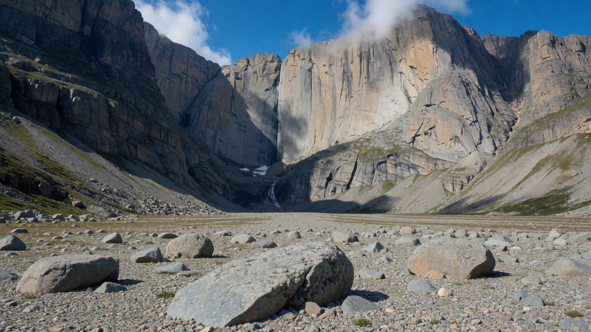
- Mount Asgard — Valley walls of the Akshayuk Pass, Cumberland Peninsula
Mount Asgard has a face 800 m (2,600 ft) high, its granite standing above the valley floor in a single steep sweep. The mountain gained wider attention when it appeared in a James Bond film, a fact that draws some visitors who otherwise know little of the park. Photographs taken from the valley show the scale most clearly, especially with a small tent set against the base. The cliff is best appreciated from the ground, where the height and the silence of the valley combine.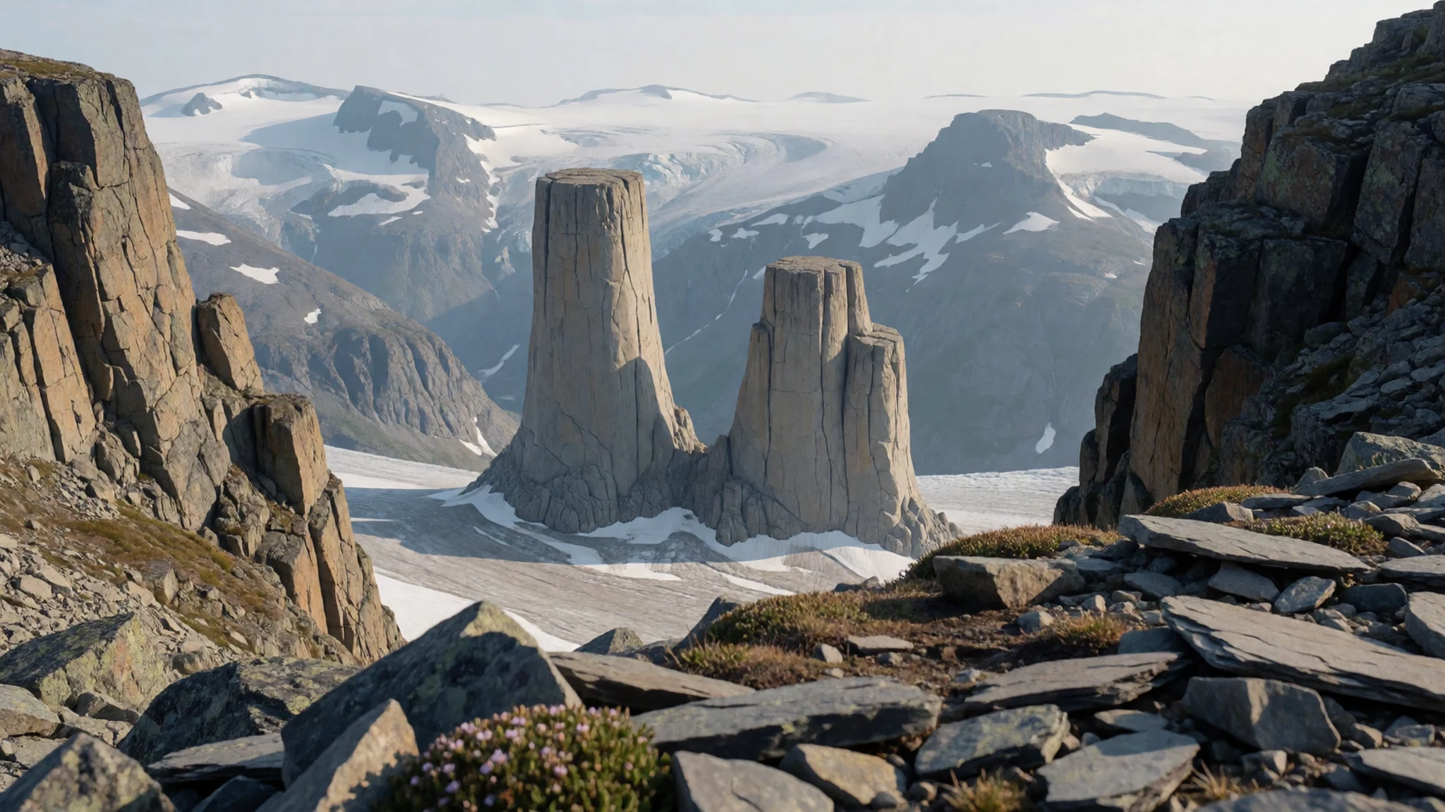
- Penny Ice Cap — Interior of the park, feeding glaciers toward the valleys
The Penny Ice Cap covers much of the park's interior, a body of ice spread over ancient granite. Its edges feed glaciers, among them the Coronation Glacier, which descends toward the valleys. Ice of this kind makes walking hard going on the surface, so it is usually seen from a ridge or from the air. Meltwater from the ice runs into the rivers that cross the pass, which is why river levels change so quickly through the day.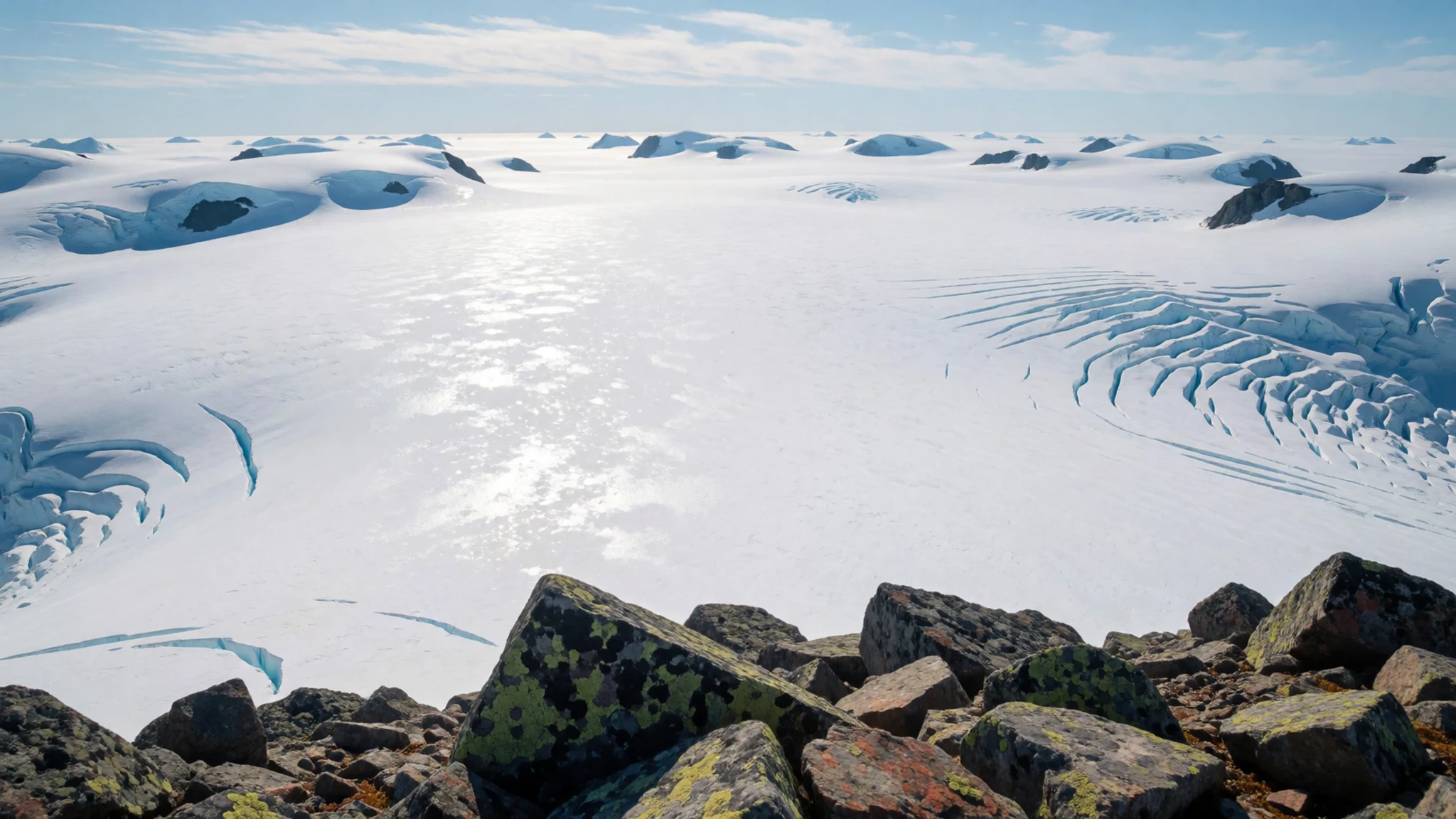
- Akshayuk Pass and Summit Lake — Main backpacking route along the Weasel and Owl rivers
Akshayuk Pass is the park's main route, following the Weasel and Owl rivers past Summit Lake. Walkers travel a long valley between high walls, camping on gravel and tundra. In 2008 heavy rain and warm weather pushed Summit Lake over its banks, flooding the Weasel River and carrying away a bridge at Windy Lake. Since then the walking routes through the pass have been limited to either side of the Weasel River, so plans should be checked with park staff before departure.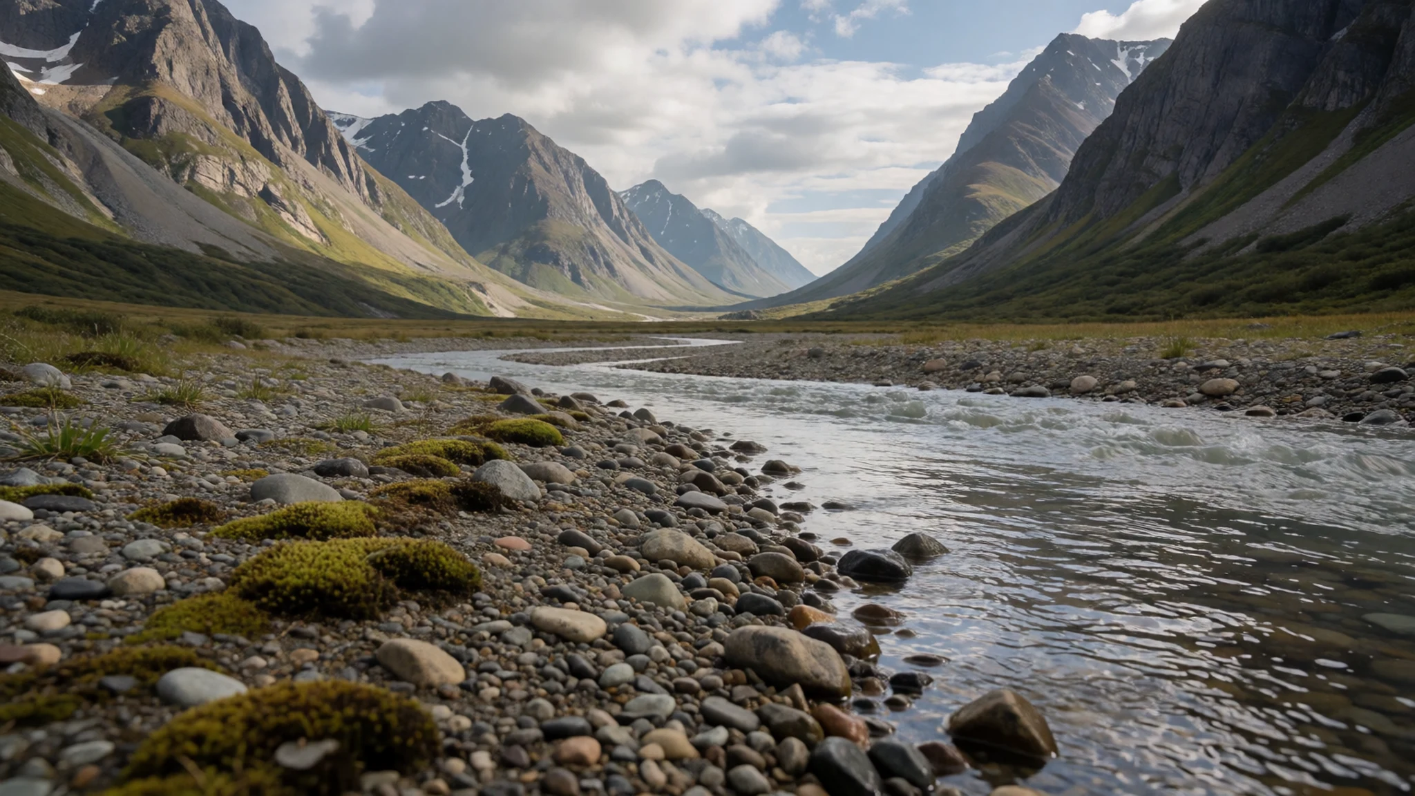
- Arctic Circle marker — Crossing the park, marked by a stone inukshuk
The Arctic Circle crosses the park, and a stone inukshuk stands near the line for walkers who pass that way. Stone figures like this were built across the Arctic as markers and navigation aids, and this one has become a favourite for photographs. Expect a brief stop here rather than a long rest, since the wind can be cold even in summer. Visitors should leave the stones undisturbed so the marker stays in place for the next group.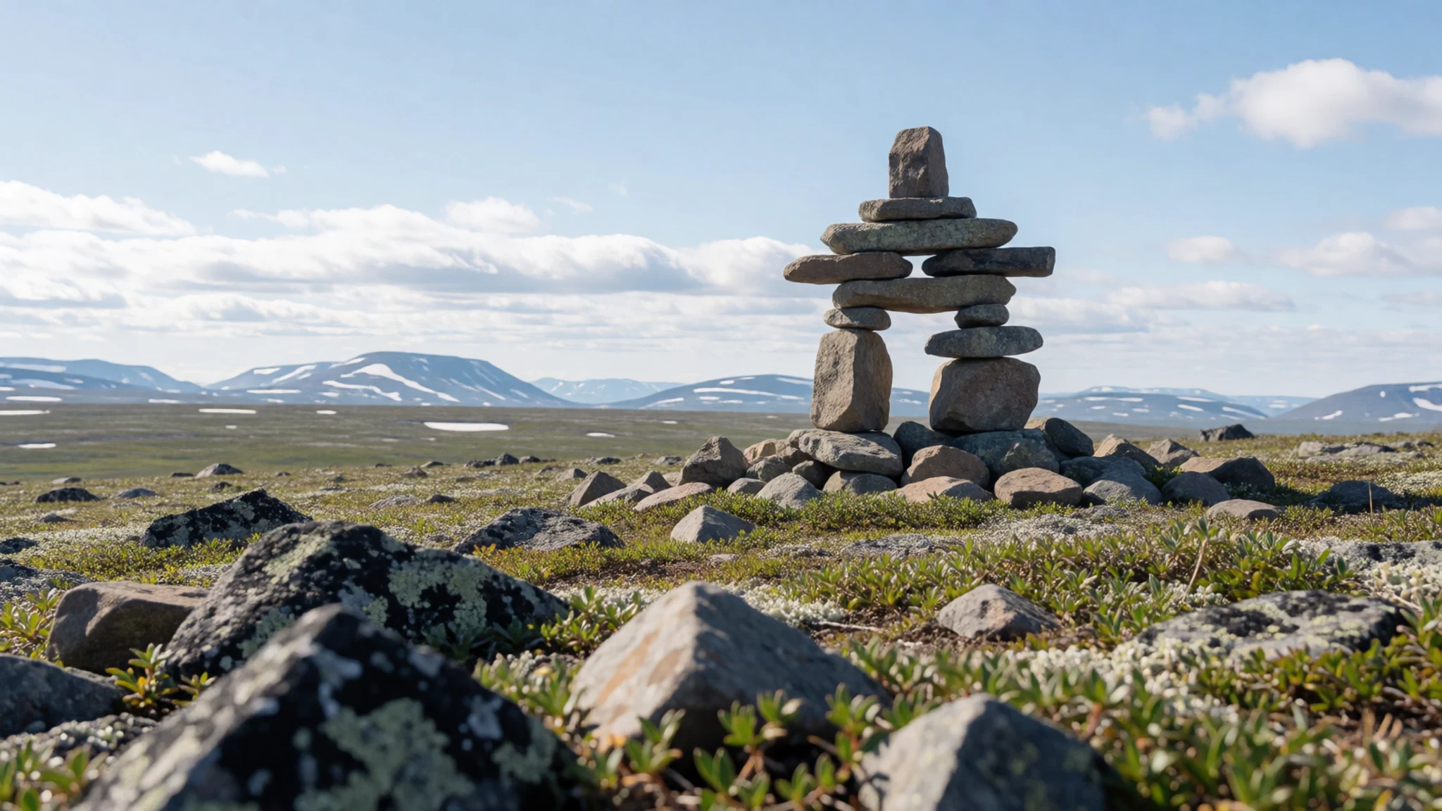
Culture
Auyuittuq National Park sits within the traditional homeland of Inuit in Canada, and the communities of Pangnirtung and Qikiqtarjuaq are where most visitors begin. Inuit hunters and families have used this coast for generations, and their knowledge of ice, weather and animal movement still guides travel here. Hunting remains part of community life, and conversations about the land often carry more weight than any tourist guidance. Inuktitut is the first language of many people in the gateway towns, and English and French are also in use. Greetings are usually simple and friendly, and a short conversation in a store or at the harbour goes a long way. The park itself is managed by Parks Canada, which sets rules on camping, food storage and river crossings. Ask before photographing anyone in the communities, and keep food and waste secured at every campsite.
What to wear
Auyuittuq National Park lies in a region where traditional clothing was shaped around survival in the cold, and Inuit design remains the best guide to what works. The amauti, a hooded parka with a deep back pouch for carrying a baby, is the classic women's design, while the atigi was the matching parka for men. Both were cut from caribou skin or sealskin, chosen for warmth, lightness and wind resistance, and sewn with sinew thread. Kamiik, skin boots with fur or wool liners, kept feet dry on ice and wet ground. Today most people in the communities wear modern insulated parkas, snow pants, boots and warm layers, often with a traditional touch such as a sealskin mitt or beaded trim worn at celebrations. Visitors need layers that cope with wind and sudden drops in temperature. Choose a waterproof, windproof outer shell, a fleece or wool mid-layer, thermal base layers, and warm gloves and a hat that stay on in gusts. Footwear should be sturdy, waterproof and well broken in, with gaiters to keep gravel and snow out. Modesty is not a formal issue here, but religious sites are rare, so dress for the cold rather than for display.
What to eat
- Glacier meltwater — Streams and rivers along the Akshayuk Pass route
Meltwater from glaciers and streams is the only drink on the trail, and it looks clean enough to drink straight from the channel. Treat it anyway. Birds nest on the northern side of the pass, so runoff there may be contaminated regardless of how clear it seems. Use a filter or boil the water before drinking, and carry enough fuel to do so each day.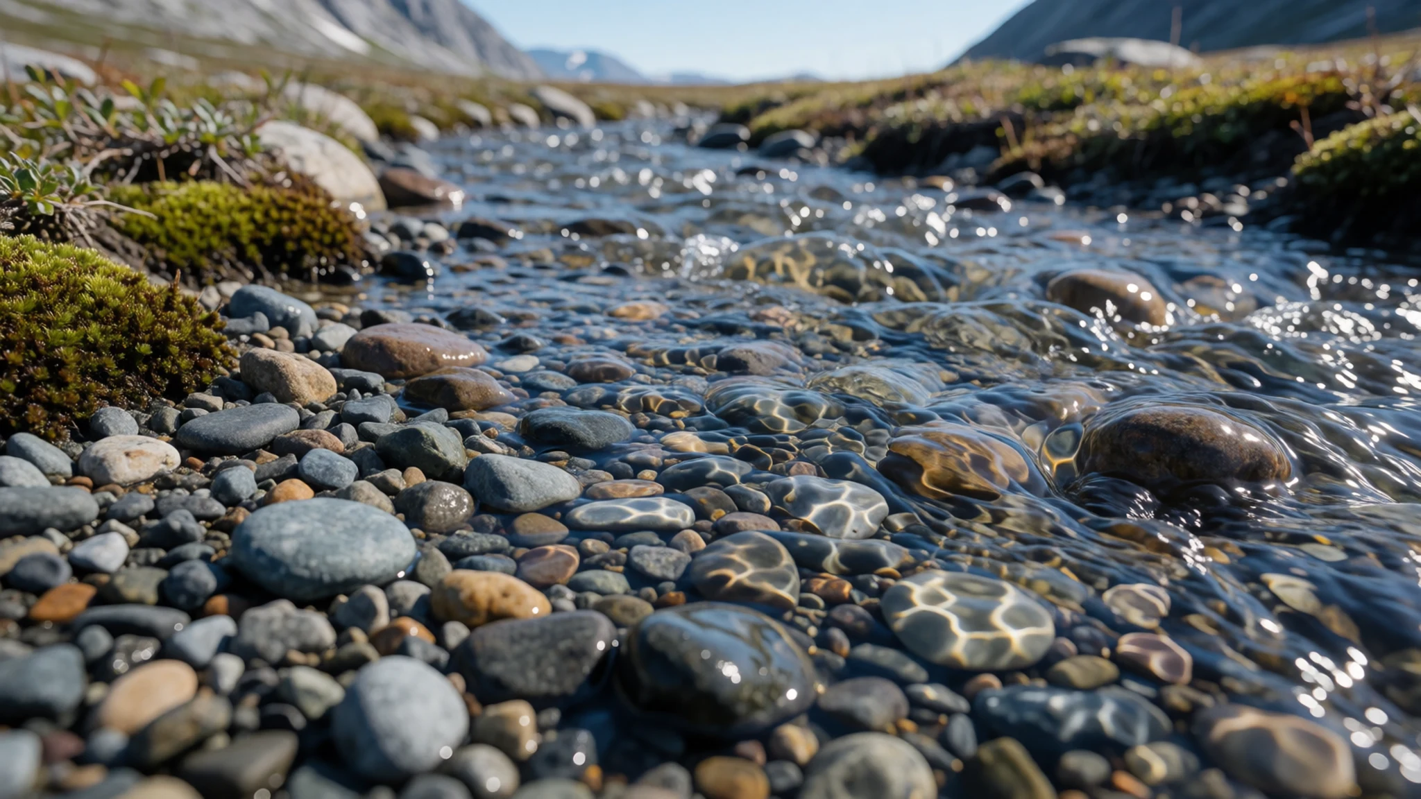
- Arctic char — Community kitchens and home meals in the gateway towns
Arctic char is one of the fish most often eaten across Nunavut, taken from cold rivers and coastal waters. It appears in the gateway communities as a home-cooked meal or at community gatherings rather than in restaurants. Ask a local host how it is prepared, since smoking, drying and frying are all common. Bring nothing that could attract wildlife to the trail, but do eat it while in town.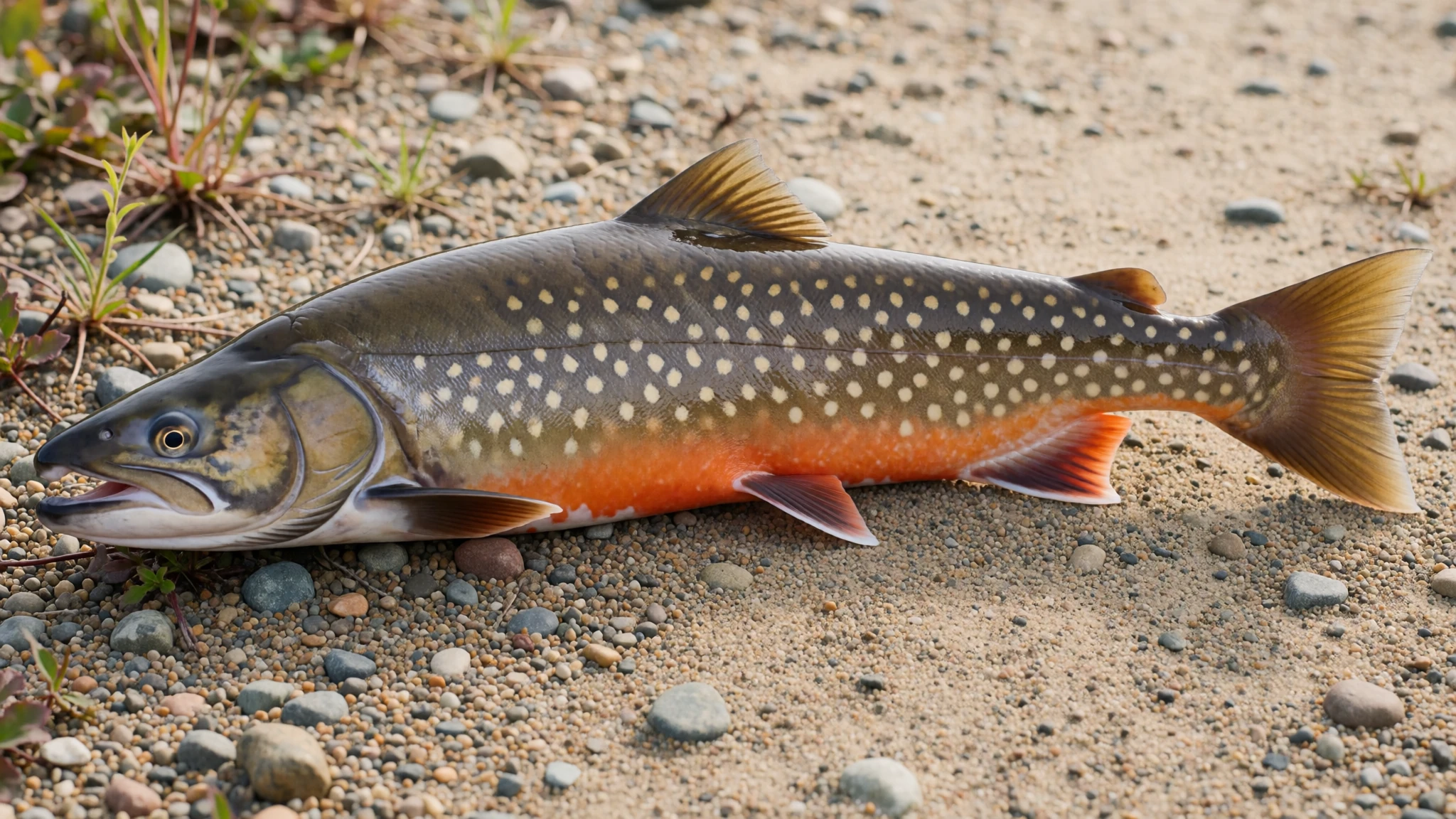
- Bannock — Campfire and camp stove cooking on the trail, and community kitchens in town
Bannock is a simple flatbread cooked in a pan over a stove or fire, a staple that works well for walkers. It needs only flour, baking powder, water and a little fat, which keeps packing simple. Cook it at a distance from the tent, since food smells attract animals. It also makes a good accompaniment to fish when shared in a community kitchen. - Packed trail food — Grocery stores in Pangnirtung and Qikiqtarjuaq before the boat leaves
Trail food has to be dense, light and resistant to cold, so dried meat, nuts, oats, cheese and energy bars are the usual choices. Buy supplies in the gateway communities, where stock is limited and prices are higher than in southern towns. Pack food in sealed bags and store every item securely overnight, away from the sleeping area.
Plan it
Best time. Late July to September, once ice break-up has ended and boats run; July is the warmest month, August the wettest, and early summer and spring or autumn bring harder travel and colder conditions.
How long. 2–3 weeks
Getting there. Fly to Iqaluit on Baffin Island, take a Canadian North connection to Pangnirtung or Qikiqtarjuaq, and arrange the final boat ride into the park with a local outfitter.
Budget. high
Tips
- Book flights to Iqaluit and the boat transfer early, since summer seats and outfitter slots are limited
- Cross rivers in the early morning, when water is lowest, and avoid the late afternoon
- Carry bear deterrent, because rifles are not permitted in the park and polar bears are a risk on the north side
- Store all food away from the tent every night and never leave it near the campsite
- Carry a water filter and treat all water, including clear meltwater
- Pack for strong wind and use sturdy tent pegs in the pass
Etiquette
- Leave cairns, stones and any cultural features as you find them
- Keep noise low and campsites clean, and carry out all waste
- Ask before photographing people in the gateway communities
Nearby
Sources
- Wikidata Q789743 (CC0)
- Wikipedia: Auyuittuq National Park (CC BY-SA 4.0)
- Wikivoyage: Auyuittuq National Park (CC BY-SA 4.0)
- Photo: Pangnirtung Fiord S 2 (Ansgar Walk) (CC BY-SA 2.5)
- Photo: Baffin Island Snowcap (Doc Searls) (CC BY 3.0)
- Photo: lhr-lax 147 (Doc Searls) (CC BY 2.5)
- Photo: lhr-lax 149 (Doc Searls) (CC BY 2.5)
- Photo: lhr-lax 150 (Doc Searls) (CC BY 2.5)
- Photo: lhr-lax 151 (Doc Searls) (CC BY 2.5)
- Photo: lhr-lax 154 (Doc Searls) (CC BY 2.5)
- Photo: lhr-lax 155 (Doc Searls) (CC BY 2.5)


