Santiago
Santiago, Chile
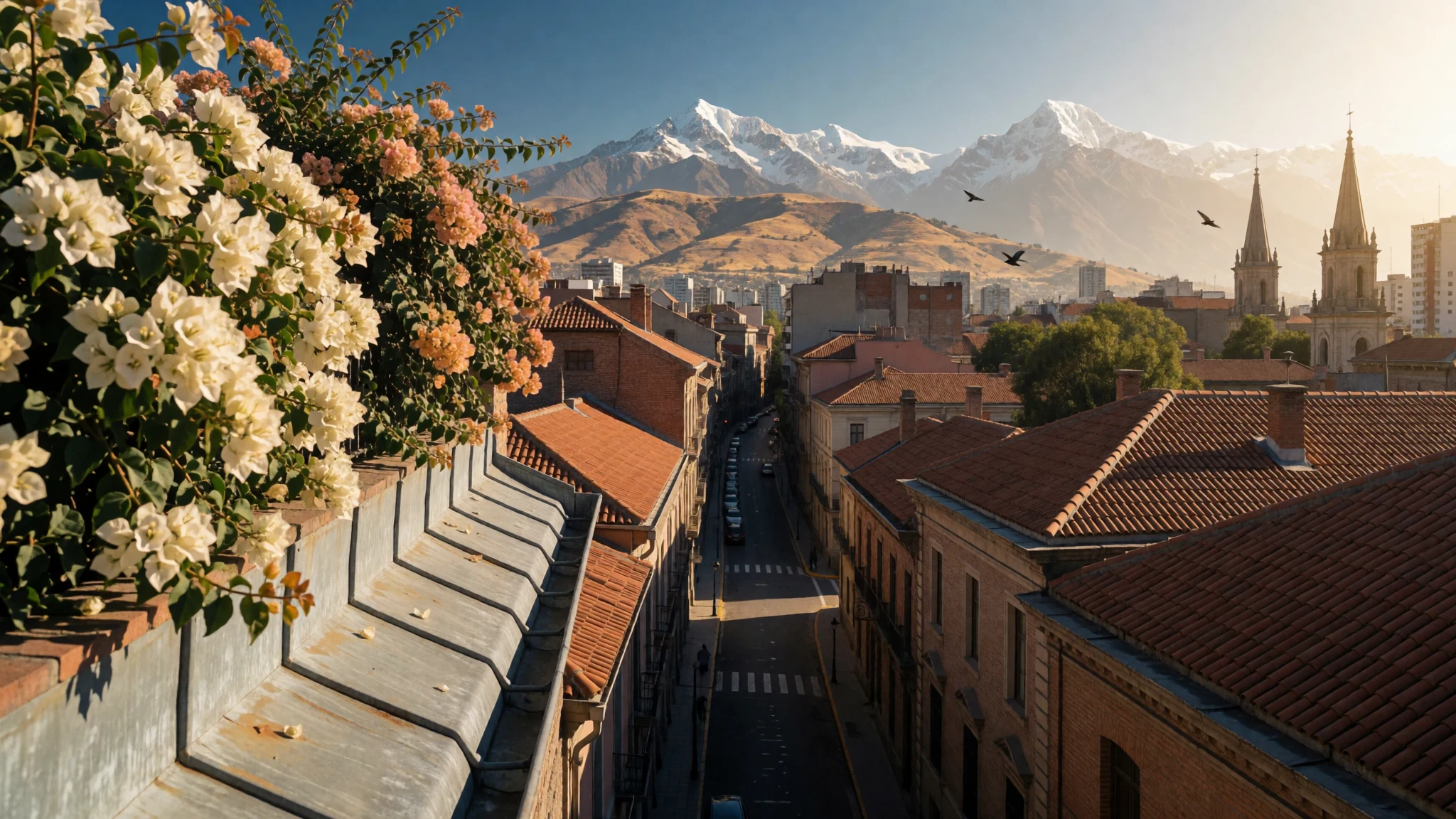
Santiago puts a working capital in a river basin between the Andes and the coastal mountains, with hills inside the grid.
The place
Santiago serves as Chile's capital, and no other city in the country is larger. It spreads through an inland basin: the Andes rise immediately to the east, and a coastal mountain chain closes the west. The Mapocho River crosses the bowl. The built-up core sits in a wider metropolitan region, and the urban area known as Greater Santiago bundles forty-plus communes. Taken together those communes house more than one Chilean in three and turn out close to 45 percent of the country's economic output. Heights sit in the mid-hundreds of metres. The figure recorded for Santiago is 575 metres, inside a band of about 500 to 650 metres for most of the streets, and newer districts have climbed onto the first slopes beneath the Andes. A pair of hills break the grid inside the city. From them the layout is easy to read: a compact historical centre on the old Spanish blocks, then communes running toward both ranges. Plaza de Armas, formerly the Plaza Mayor, is still the square at the middle of that original plan. About 7 million people live in Santiago. Repeated earthquakes have stripped away much of the earliest building stock, so colonial houses are scattered among later public offices and a skyline of newer towers. On a clear day the mountains shut the view; in cooler months air can settle in the basin and erase them. Ordinary days are ministerial, commercial and crowded — markets and long cross-town trips as much as any ceremonial front.
Its story
Santiago's valley was in use long before any Spanish street plan. By the 10th millennium BC, bands were moving between the coast and the interior, hunting guanaco when meltwater opened the mountain side. They were mobile, not yet village farmers. Settled agriculture along the Mapocho comes much later, around 800 AD: beans, maize and potatoes in the fields, camelids in the herds. The farming communities later appear under separate names. In Chile they are called Picunche; Inca usage says Promaucae. Inca control arrived in the late fifteenth century and ran on into the early sixteenth. A colony of mitimas was set down in the middle of what is now the city, with a fort at Huaca de Chena and a sanctuary on the summit of El Plomo. Armando de Ramón, the Chilean historian, treated the valley as a launch point for southern campaigns that failed, and as a junction of Inca roads. The Spanish foundation is a clean break from that map. The founder was Pedro de Valdivia, an Extremaduran in Francisco Pizarro's service, dispatched from Peru. He came to the Mapocho only after riding south from Cusco. In 1541 he founded Santiago del Nuevo Extremo and drew a grid around the Plaza Mayor, today's Plaza de Armas. Hunger, Indigenous attack, flood and earthquake — a particularly destructive shock in 1647 — struck the young town. It held. The Captaincy General of Chile took the town as its capital. Patria Vieja, the early independence era, follows that same capital.
What to see
- Cerro San Cristóbal — Bellavista, north of the centre
Santiago's Cerro San Cristóbal rises just north of the centre, crowned by a pale statue of the Virgin. Terraces look across the grid and the towers to the Andes when the air is clear. The hill is a public park as much as a viewpoint, with gardens and paths busy at weekends. Cooler months can bring haze, and a clear morning shows the basin best.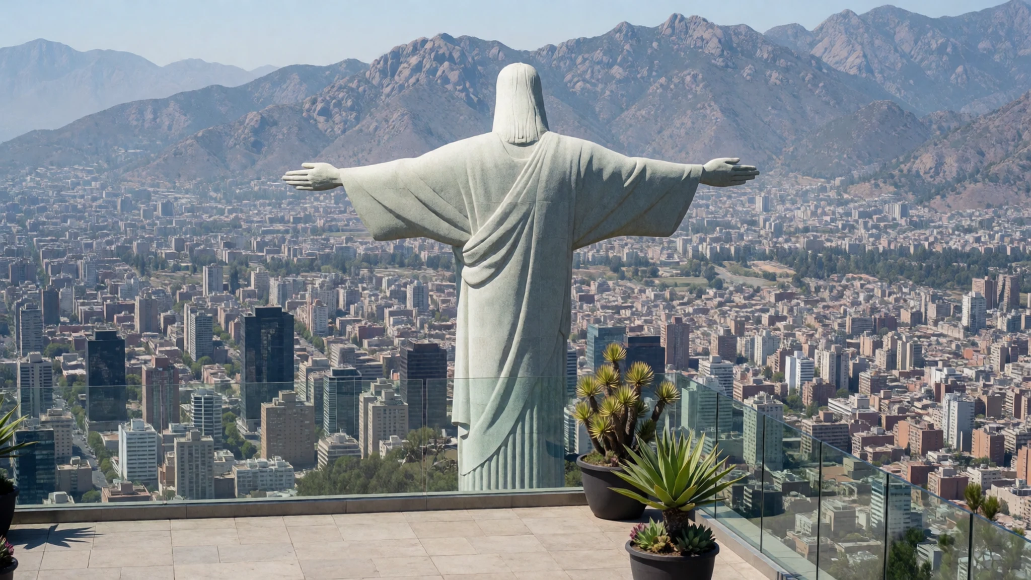
- Palacio de La Moneda — Historical centre
Santiago's Palacio de La Moneda stands in the historical centre, a long formal palace built for minting coin and later used as the presidential seat. During the coup of 1973 the building was bombed, so the restored front carries political memory as well as ceremony. Outer courtyards are often open when security allows people to pass through. Any interior visit should be confirmed on the official site.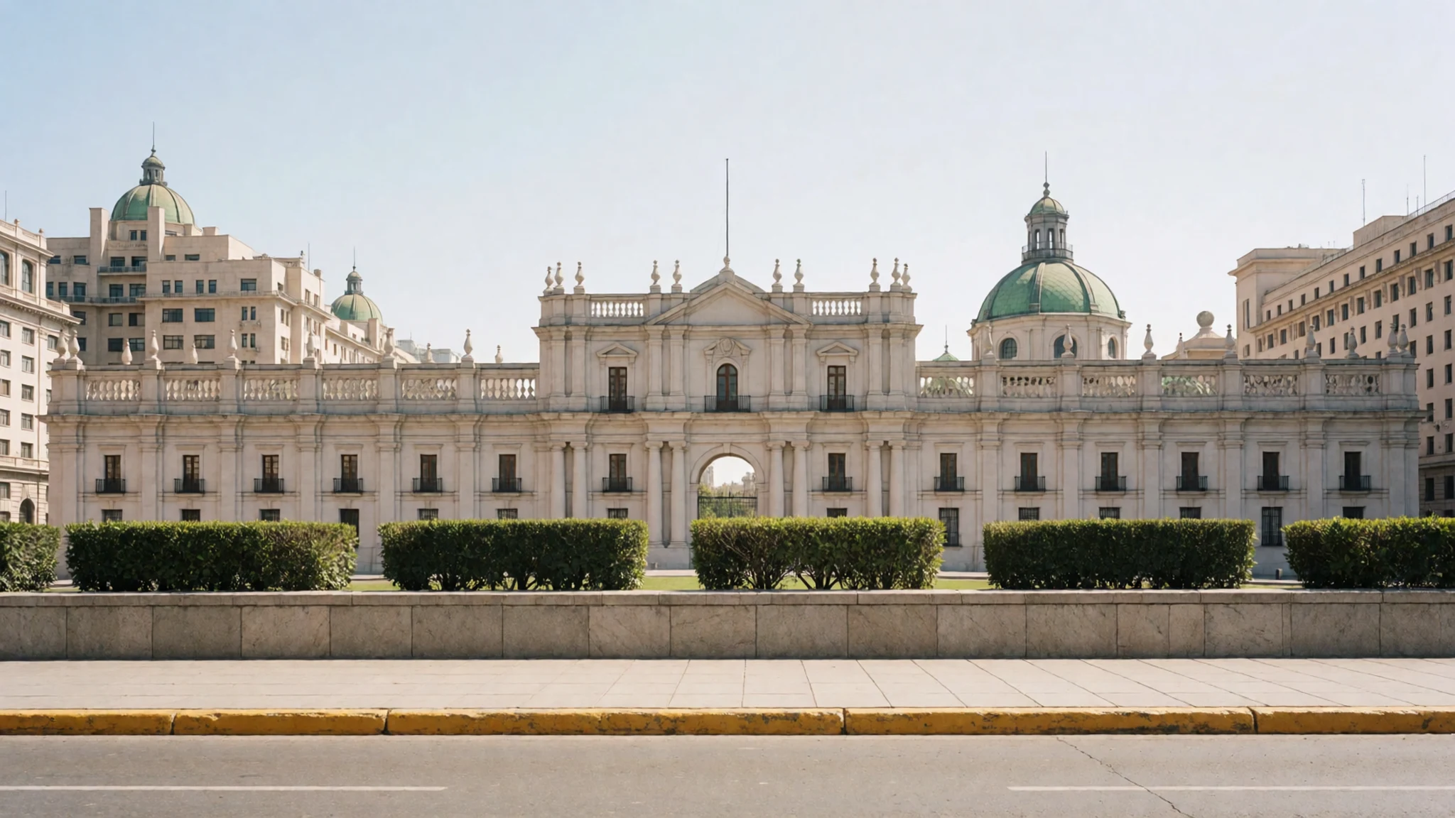
- Metropolitan Cathedral — Plaza de Armas
Santiago's Metropolitan Cathedral fills the west side of Plaza de Armas, the square that began as Plaza Mayor. Joaquín Toesca was hired in 1780 and designed the façade, among works opened in 1798. The church shares the plaza with civic neighbours and with everyday noise: pigeons, conversations and gatherings. It is a working cathedral, so a visit sits easily beside ordinary city life rather than apart from it.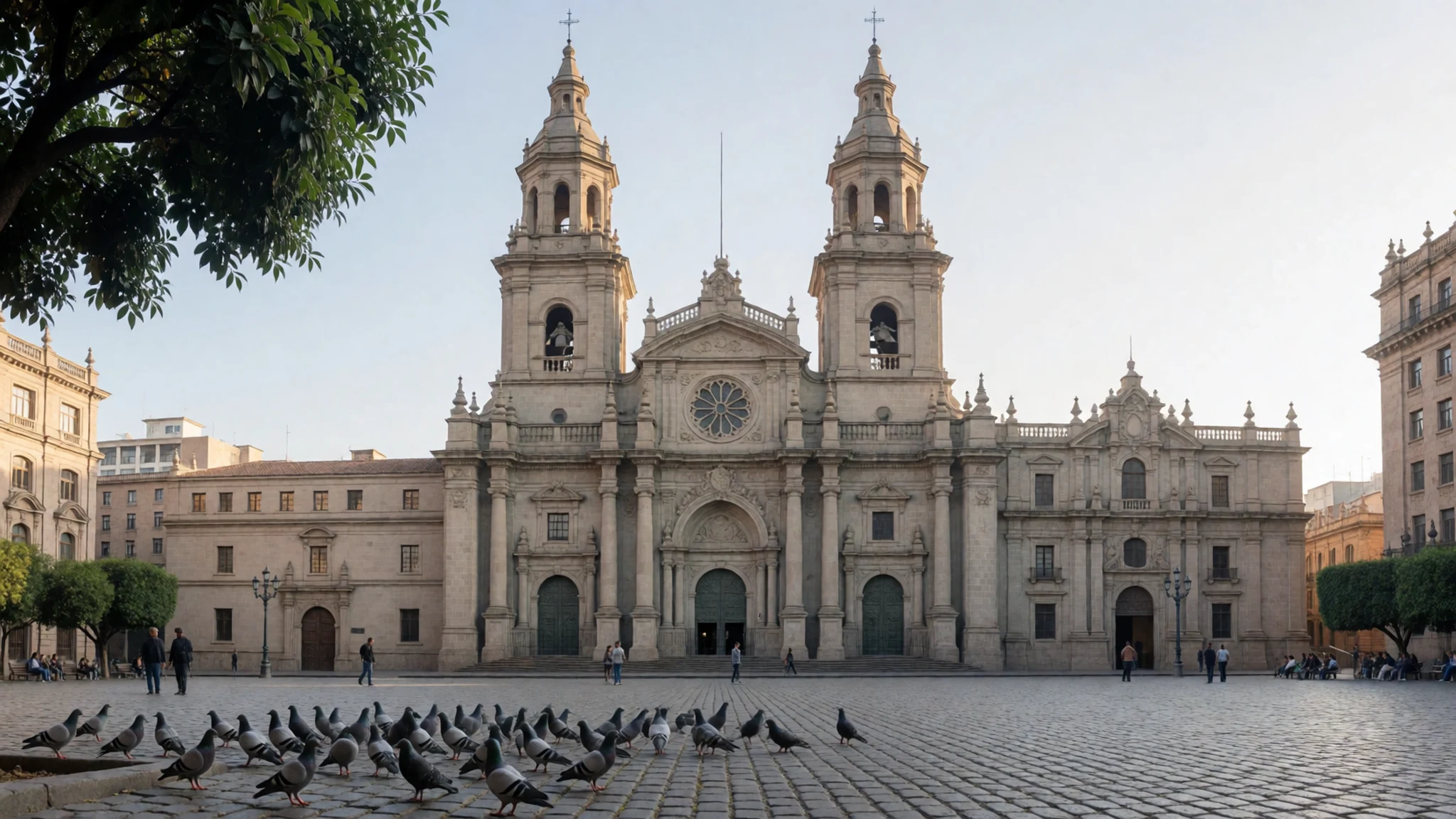
- Cerro Santa Lucía — Historical centre
Santiago's Cerro Santa Lucía is a rocky hill on the edge of the historical centre, laid out as a park with stairs, terraces and a monumental fountain of Neptune. From the grid the climb is short, but it clears the roofs toward the Andes. Paths turn steep and fill toward sunset. Earthquakes have reshaped it more than once, so the garden feels civic rather than purely colonial.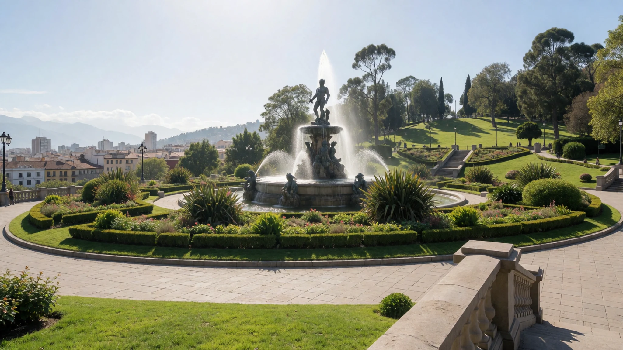
- Chilean National History Museum — Plaza de Armas
Santiago's Palacio de la Real Audiencia, on Plaza de Armas, dates from 1804 to 1807 and houses the Chilean National History Museum. The collection holds twelve thousand objects, with only part on show. Earthquakes left scattered colonial survivors nearby: Casa Colorada (1769), San Francisco Church (1572) and Posada del Corregidor (1750). What remains is a handful of buildings, not a whole colonial quarter.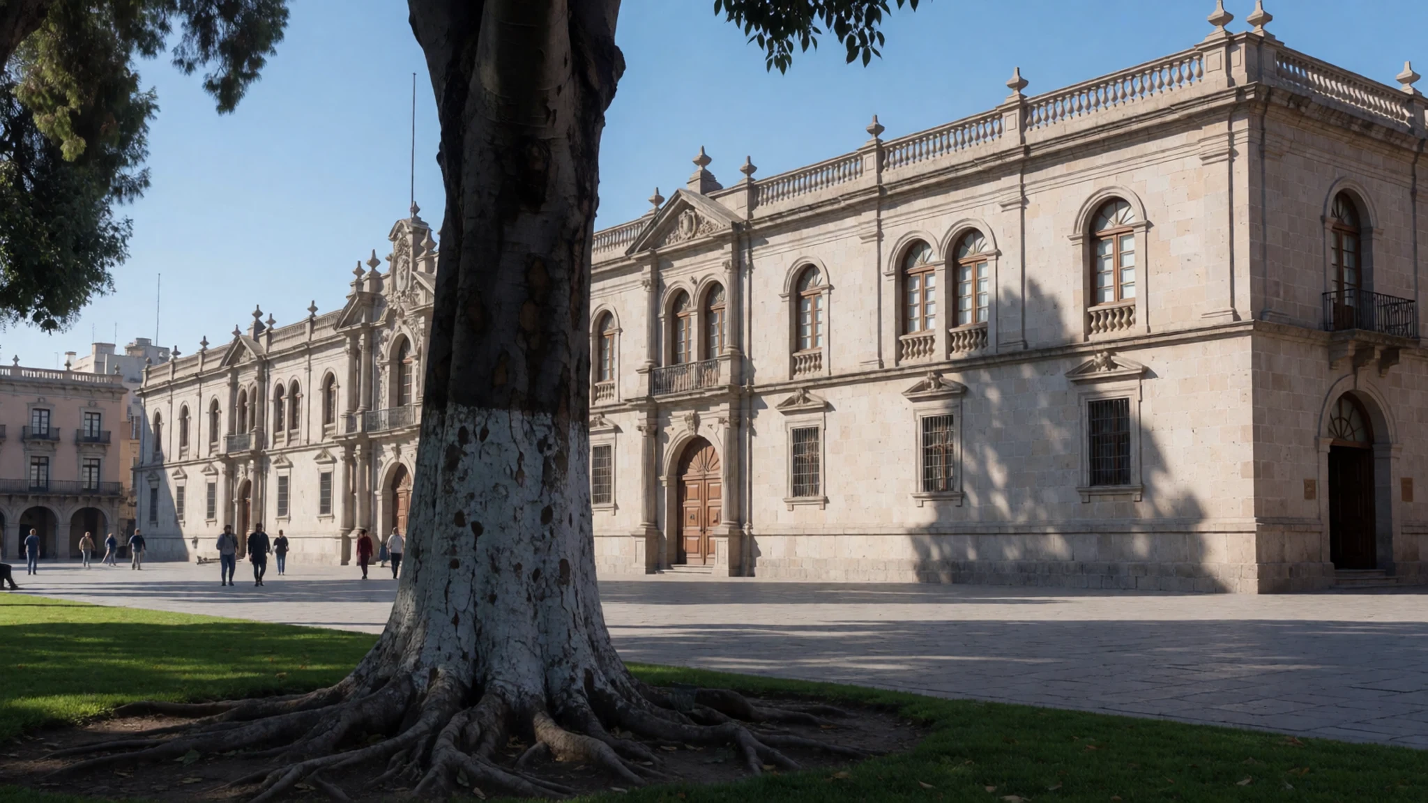
Culture
Santiago's culture is that of a capital which lost most of its colonial buildings to earthquakes and kept its memory in institutions, plazas and festivals instead. Spanish is the language of daily life, while older names such as Mapocho stay on the river and the map. Catholic practice still organises parts of the civic year: the cathedral on Plaza de Armas draws people for worship and for large gatherings, and parish churches across the communes do the same on feast days. September's national holidays bring cueca, flags and long family barbecues, and the rural huaso figure shows up in the city even though daily life here is urban. Public argument is normal around Plaza de Armas and La Moneda, where marches form part of the capital's political life. Families still head for the hills at weekends when the air is clear. In Santiago's churches, keep your voice low, skip flash during a service, and step aside rather than blocking people who are there to pray.
What to wear
Santiago's ceremonial dress is the huaso costume of central Chile, worn for rodeos and for the September national holidays rather than for the office. The main textile is the chamanto, a heavy woollen poncho, often reversible, patterned with strong geometry. With it go a chupalla of straw, a short jacket, riding boots and spurs. Women dancing the cueca wear full dresses, usually floral, with a sash at the waist. None of this is ordinary street clothing. Around the ministries people wear jackets, collared shirts and dark trousers; in Bellavista and the parks the uniform is jeans, trainers and a light layer. The dry warm months favour short sleeves, and the cooler wet months bring coats. A visitor should dress for walking and for a change of temperature after dark: closed comfortable shoes for cobbles and hill paths, a layer to add when the basin cools, and sun cover even on mild days, because the city stands at 575 metres in strong highland light. At the cathedral and other churches, shoulders and knees covered is the respectful habit. Huaso dress is for festival and saddle, not for touring the grid.
What to eat
- Completo — Picadas and counters in the centre and the eastern communes
Santiago's completo is a hot dog piled with tomato, mayonnaise and sauerkraut. Picadas, the small sandwich bars of the centre and the eastern communes, sell it all day, and so do simple counters. It is eaten in the hand, as a quick meal between errands rather than a seated dinner.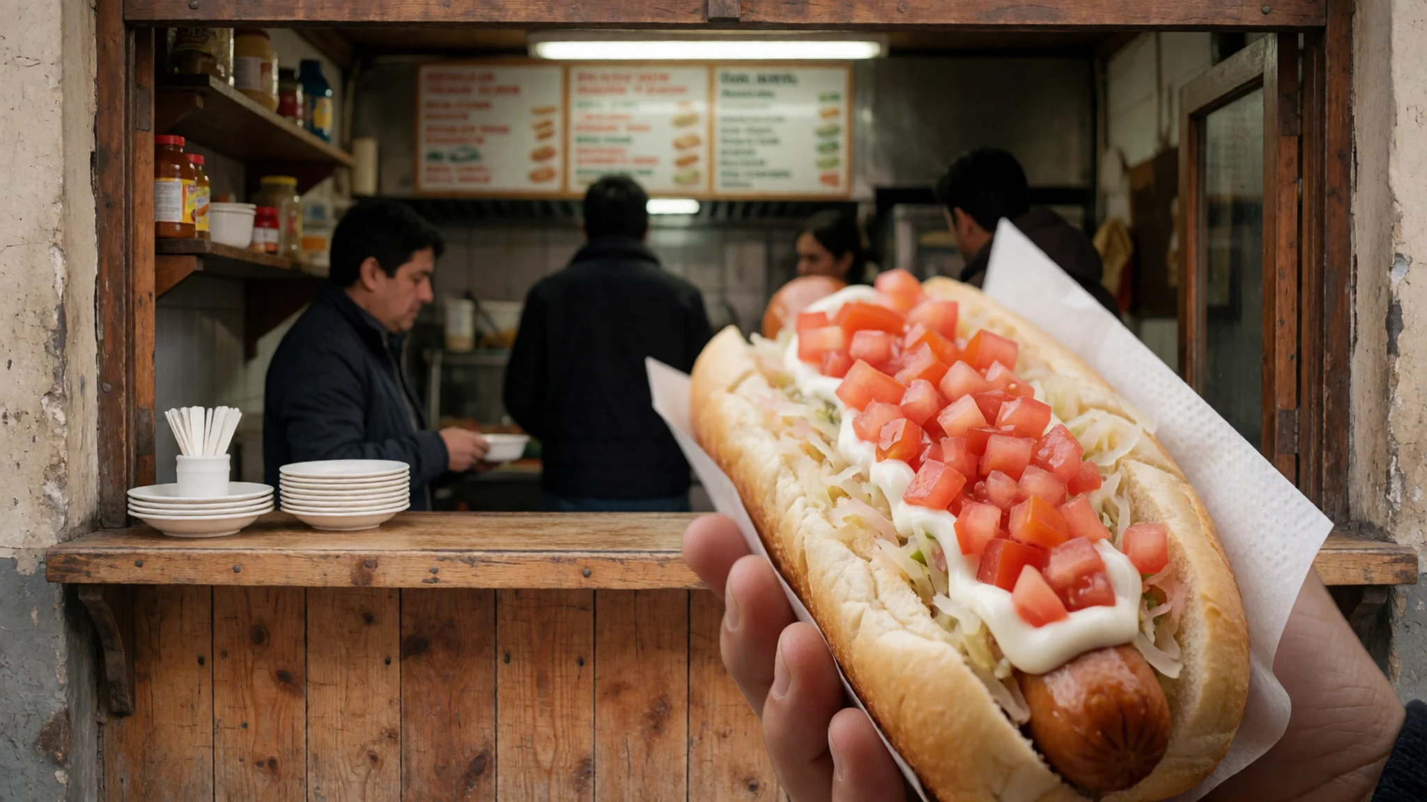
- Italiano — Picadas and downtown counters
Santiago's italiano is a hot dog topped with tomato, mayonnaise and avocado, the red, white and green that gave it the name. Picadas and downtown counters that make a completo usually offer this version too. It is messy street food, best eaten straight away while the avocado is still fresh.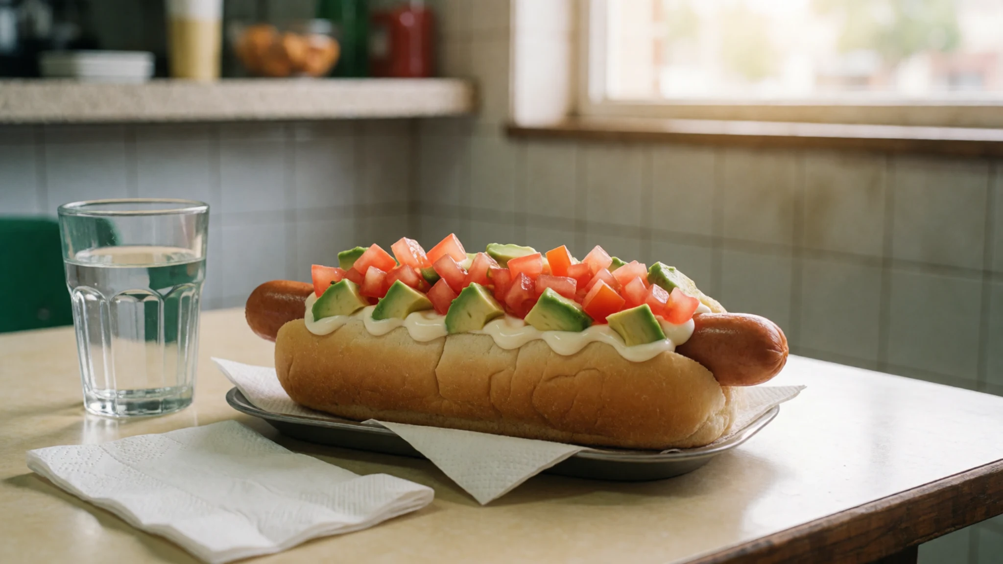
- Sopaipilla — Downtown street carts and the edges of markets
Santiago's sopaipilla is a fried dough round, and the street version is often stuffed with fried pumpkin. Carts selling them work downtown streets and the edges of markets. Eat it at once, in the hand, the way the cart expects. - Mote con huesillo — Street carts and juice stands in the centre
Santiago's mote con huesillo puts cooked wheat in a cold glass with a dried peach softened in syrup, to be eaten with a spoon as well as drunk. Centre street carts and juice stands sell it in warm weather. It is a walk's refreshment, not a restaurant dessert. - Asado — Family asados in residential communes and simple eateries in the centre
Santiago's central Chilean table turns on barbecued beef or pork with tomato, potato or corn. The fullest versions happen at family asados in the residential communes, while simple eateries in the centre grill the same meats for a weekday meal. It is hearty food, meant to be shared and unhurried. - Picada steak sandwich — Picadas downtown and in the east of the city
Santiago's picadas are small sandwich bars, downtown and in the east, serving steak sandwiches big enough to need two hands and a range of savoury pies. They sit beside international fast-food chains but cook local fillings. Eat at the counter; the point is the sandwich, not a long sitting.
Plan it
Best time. Santiago is pleasant to walk in March and April, milder autumn after the dry heat, and again in October and November, spring before the hot summer. Mid-year is cooler and wetter, and haze can sit in the basin.
How long. 3–4
Getting there. Santiago's long-haul airport is Aeropuerto Internacional Comodoro Arturo Merino Benítez, a Latin American hub with routes that include Oceania. The last leg is by road: airport bus or taxi into the centre. Check transfers before travelling at the municipal site, https://www.gobiernosantiago.cl/.
Budget. mid
Tips
- Keep the stamped tourist card from arrival; it covers 90 days, and only the PDI can reissue a lost one before exit.
- Begin at Plaza de Armas and La Moneda early in the day, ahead of tour groups and of the hotter summer afternoons.
- Carry some cash for street carts and small picadas; do not assume every counter takes a card.
- Treat mountain views as weather-dependent: cooler months can leave haze in the basin, and evenings cool off even after a warm day.
- For access to public buildings, check the municipal site rather than relying on remembered opening hours.
Etiquette
- Ask before you photograph people at close range, including vendors and families.
- In churches, keep quiet during worship and do not use flash.
- Queue at bus stops and counters instead of pushing forward.
Nearby
Sources
- Wikidata Q2887 (CC0)
- Wikipedia (CC BY-SA 4.0)
- Wikivoyage (CC BY-SA 4.0)
- Photo photos/01-santiago-de-chile-desde-cerro-san-crist-bal-cropped.jpg (CC BY-SA 4.0)
- Photo photos/02-santiago-de-chile-desde-cerro-san-crist-bal-cropped-panorama.jpg (CC BY-SA 4.0)
- Photo photos/03-palacio-de-la-moneda-miguelreflex.jpg (CC BY-SA 2.0)
- Photo photos/04-biblioteca-nacional-de-chile-2012-09-08.jpg (CC BY 3.0)
- Photo photos/05-chile-santiago-24-virgin-mary-statue-on-cerro-san-crist-bal-.jpg (CC BY 2.5)
- Photo photos/06-torre-entel-santiago-20230312.jpg (CC BY-SA 4.0)
- Photo photos/07-fuente-neptuno-en-la-terraza-del-cerro-santa-luc-a-ii.jpg (CC BY-SA 4.0)
- Photo photos/08-metropolitan-cathedral-of-santiago.jpg (CC BY-SA 4.0)


