Salar de Uyuni
Salar de Uyuni, Bolivia
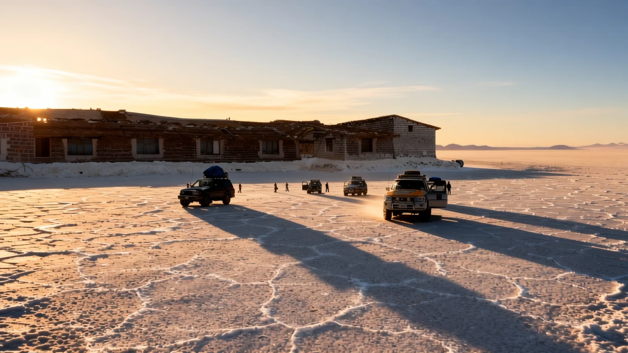
Cross the largest salt flat on earth, where infinite horizons and thin rainy-season waters turn the high plateau into a giant natural mirror.
The place
Salar de Uyuni sits high in the southwestern reaches of Bolivia, tucked inside the Daniel Campos Province of the Potosí Department near the crest of the Andes Mountains. Reaching this remote expanse puts visitors on a thick, remarkably flat crust of salt resting at an elevation well above sea level. Across this immense basin, the surface remains so consistently level that variations across the entire area are virtually imperceptible. Beneath the hard white crust lies an extensive pool of brine holding massive reserves of valuable lithium, while the wide-open skies and mirror-like conditions after seasonal rains offer an arresting optical expanse that stretches toward distant mountain silhouettes. The salt flat acts as a crucial transport corridor across the high Altiplano, besides serving as a nesting environment for several species of flamingos that feed in the shallow waters. Climatologically, the area forms a distinct transitional boundary; towering convective clouds build up over the eastern side of the basin during warmer months but struggle to push past the drier western fringes that bleed toward the Atacama Desert. Because of its blindingly bright white surface, extreme flatness, and clear atmospheric conditions, the basin also functions as a prime calibration site for the altimeters of orbiting Earth observation satellites. Travellers journeying across the landscape encounter a terrain defined by stark contrasts—blinding daylight glare, sudden sharp winds, and deep quietude broken only by the crunch of salt crystals underfoot or the distant call of wading birds along the saline lagoons.
Its story
The creation of Salar de Uyuni is tied to the dramatic geological shifts that formed the high Andean plateau. Long before human presence, the region was shaped by a succession of ancient lakes from the Late Pleistocene epoch, whose slow, progressive drying left behind massive layers of evaporitic mineral deposits. Tens of thousands of years ago, the entire basin was submerged beneath a vast, deep expanse known as Lake Minchin. As the climate warmed and shifted over millennia, the colossal lake gradually shrank through evaporation, leaving behind smaller residual lakes and the thick, mineralized crust that defines the modern landscape today. Human history here is equally tied to the harsh demands of geography, from early indigenous trade routes traversing the high plains to the later arrival of industrial mining during the silver and railway booms of the nineteenth and twentieth centuries. Iron relics left behind from past industrial ventures now rest rusting in the dry air near the edge of town, recalling an era when steam engines chugged across the high plateau to link remote mountain mines with Pacific ports. In more recent decades, the stark beauty of the salt flat has drawn filmmakers from around the globe, serving as an otherworldly backdrop for science fiction epics and cinematic journeys. Yet beneath its modern fame as a tourist destination and a coveted source for green-energy minerals, the Salar remains an ancient, elemental place shaped entirely by the slow evaporating power of Andean sun and wind.
What to see
- Train Graveyard — Uyuni outskirts
A sprawling collection of abandoned historic steam locomotives resting on the tracks just outside the main town, bearing silent witness to past mining transport failures.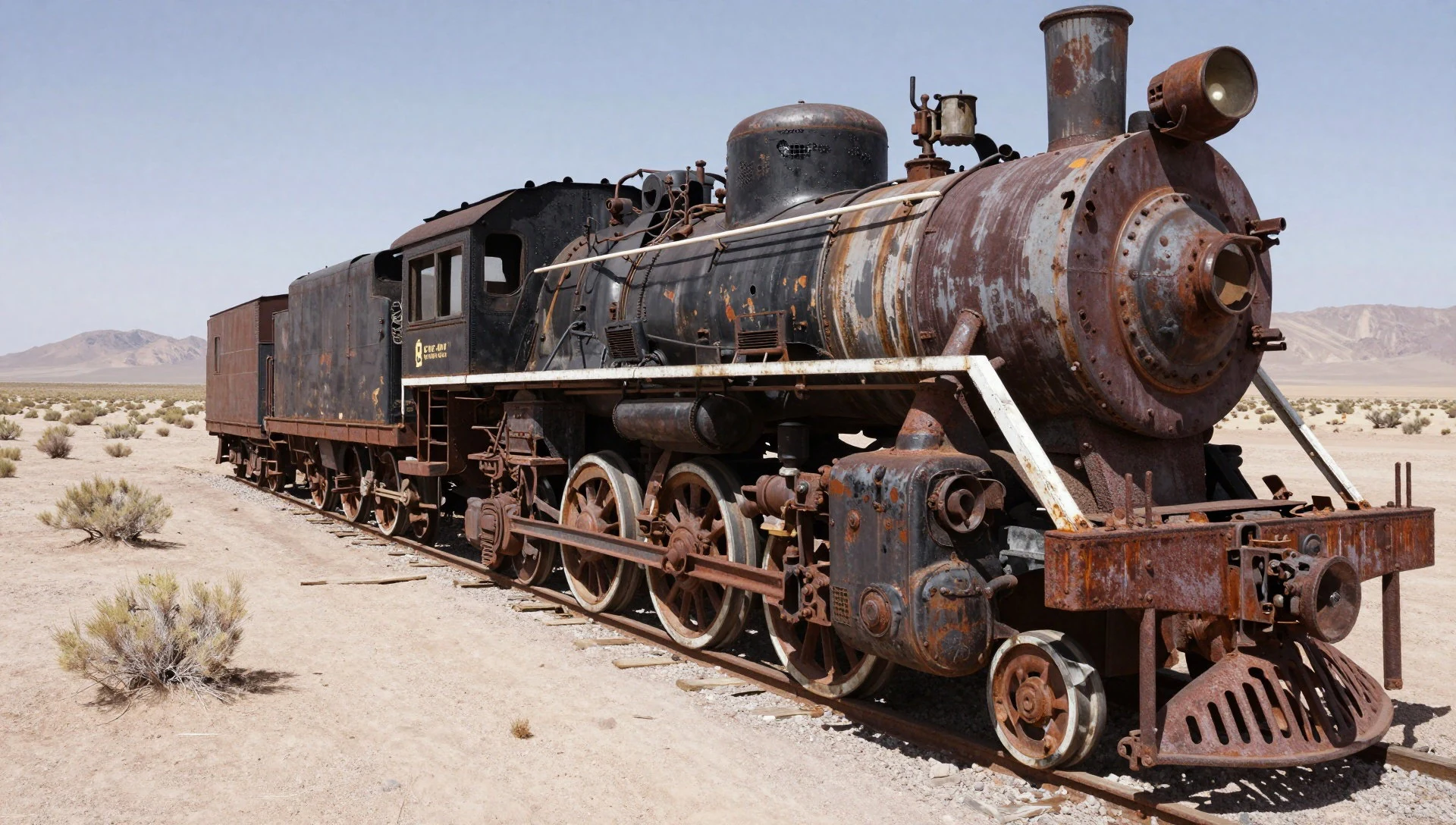
- Colchani Salt Processing Village — Central Salar
A small settlement where local families harvest, iodize, and package salt blocks for domestic use, alongside stalls selling handcrafted salt souvenirs.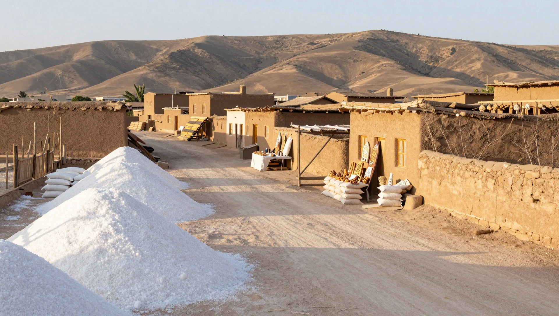
- Isla del Pescado — Central Salar
A dramatic rocky outcrop resembling an island amid the white salt, covered in fossilized coral remnants and towering ancient cacti that grow at a remarkably slow pace.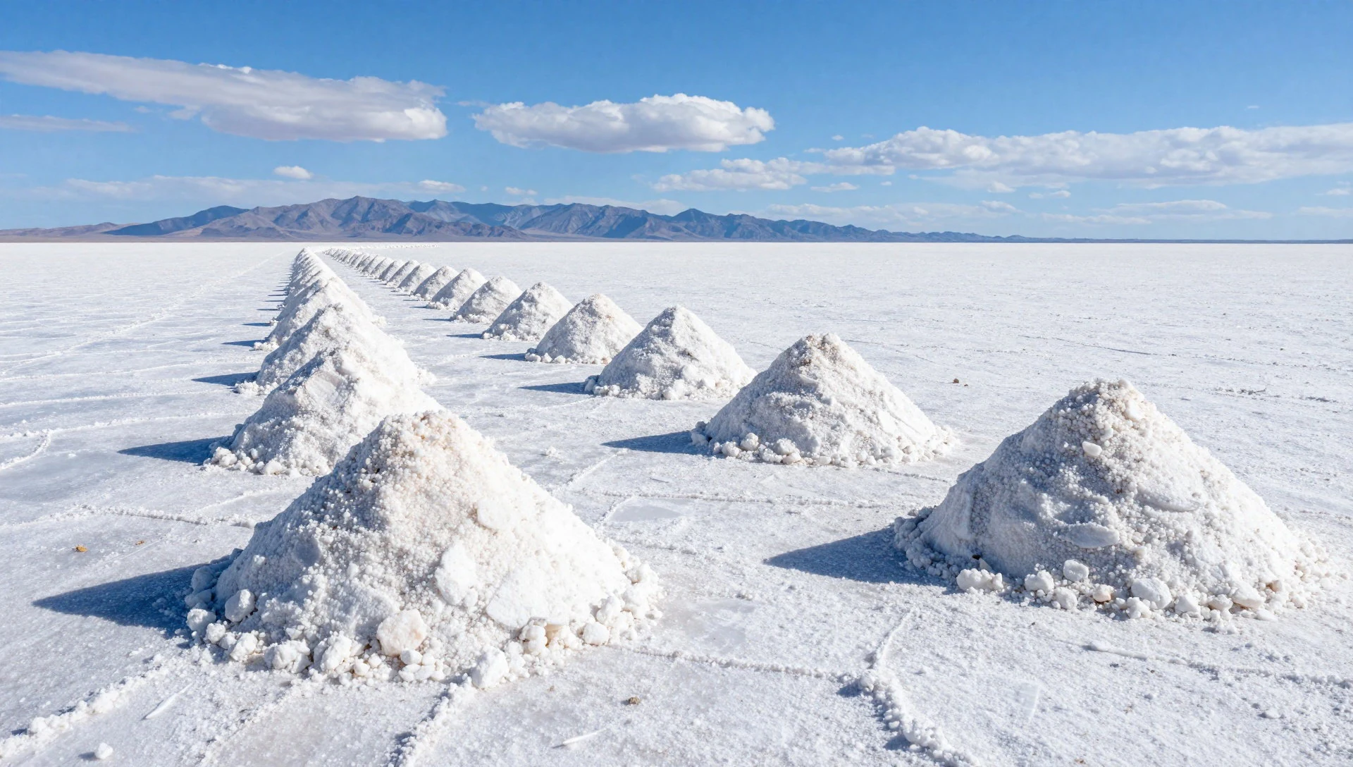
- Laguna Colorada — Southern reserve area
A striking high-altitude red lake coloured by specialized microalgae and minerals, frequently populated by flocks of feeding flamingos against the rugged volcanic backdrop.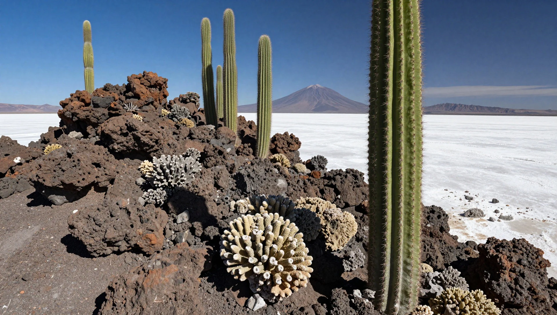
- Sol de Mañana Geyser Basin — High Altiplano reserve
A high-elevation geothermal field featuring bubbling mud pools and steaming sulphur vents, usually visited during the biting cold of early morning tours.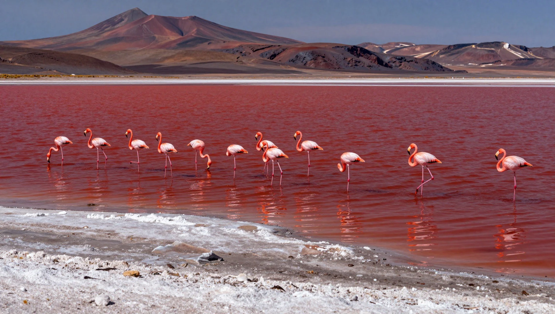
Culture
Life around the fringes of Salar de Uyuni is rooted in high-altitude Andean traditions, where indigenous communities have farmed, herded llamas, and harvested salt for generations. Traditional dress remains common among older residents in nearby towns and villages, featuring heavy woven wool shawls, layered skirts, and bowler hats that reflect centuries of cultural blending. Social life in the Altiplano moves at the deliberate pace dictated by thin air and cold mountain weather, with markets serving as the central hub for community gathering and trade. Visitors navigating the region will find a quiet, resilient hospitality among local drivers, guides, and hostelry owners who share their knowledge of the unforgiving terrain. Always ask permission before photographing local residents in remote villages, as many prefer not to have their portraits taken without consent.
What to wear
Traditional attire across the Potosí region showcases practical adaptation to the severe mountain climate. Indigenous women traditionally wear brightly coloured pollera skirts layered over warm wool petticoats, paired with hand-woven aguayo cloths used securely on the back to carry infants or goods, topped distinctively with small bowler hats. Handspun alpaca and llama wool jumpers, ponchos, and scarves provide vital insulation against freezing plateau winds. Modern locals in towns like Uyuni dress in practical contemporary clothing, combining fleece jackets and sturdy trousers with traditional knitted caps. For visitors, dressing for the Salar requires absolute priority on layering and sun protection. The intense high-altitude sunlight reflects fiercely off the white salt crust, making polarized sunglasses and high-factor sunscreen essential. Daytime temperatures can drop rapidly when the wind blows or the sun dips, so thermal base layers, a windproof and waterproof outer shell, thick wool socks, and sturdy walking boots or well-sealed footwear are mandatory to keep salt corrosion and cold at bay.
What to eat
- Llama Steak — Local eateries and tour lodges in Uyuni
A lean, rich red meat served grilled or in stews, offering a traditional source of protein across the high plateau.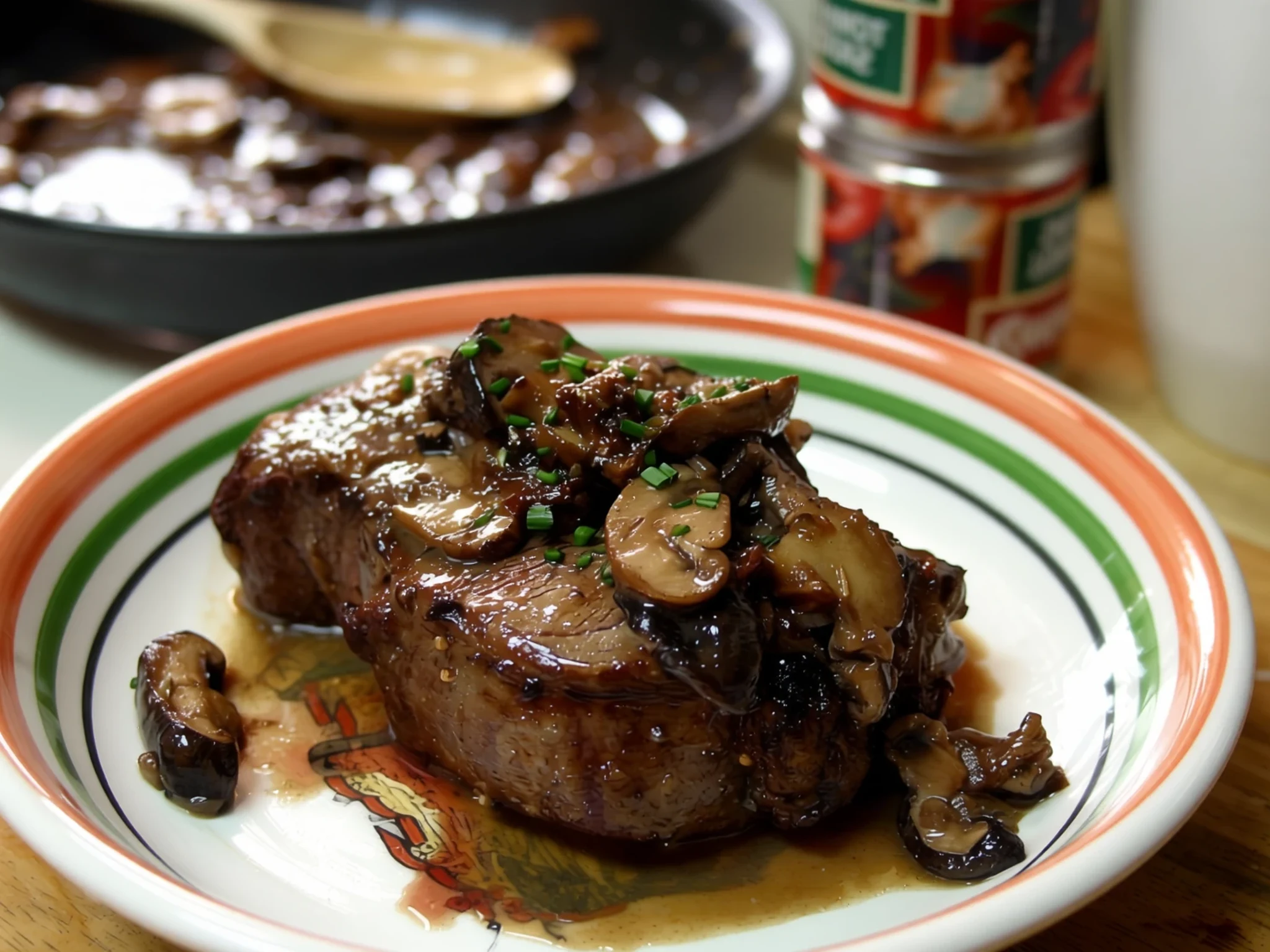
- Quinoa Soup — Markets and simple restaurants in town
A comforting, hearty broth thickened with native Andean grains, garlic, and local vegetables to warm up against the chill. - Salt-Baked Chicken — Specialized salt hotels and tourist lodges
Chicken roasted inside an oven using blocks or crusts harvested directly from the surrounding salt flats. - Altiplano Trout — Village family-run diners
Freshwater fish sourced from nearby mountain lakes, usually pan-fried and served with potatoes and rice.
Plan it
Best time. December to March for the rainy season when the salt flats transform into a massive mirror; May to September for dry weather and easy driving across the entire crust.
How long. 3–4
Getting there. Fly or take a long-distance bus to Uyuni or Tupiza from La Paz, or arrive overland from San Pedro de Atacama in Chile.
Budget. mid
Tips
- Acclimatise to the high altitude for a few days in lower cities before heading up to the salt flats.
- Drink plenty of water and carry at least two litres per person daily during tours.
- Book multi-day excursions with reputable tour operators and check vehicle safety.
- Protect cameras and gear from fine salt dust and bright glare.
- Carry cash for small purchases, park fees, and local markets.
Etiquette
- Always ask permission before taking photographs of local indigenous residents.
- Pack out all personal rubbish and respect the fragile desert and salt ecosystem.
Nearby
Sources
- Wikidata Q76122 (CC0)
- Wikipedia (Salar de Uyuni) (CC-BY-SA 4.0)
- Wikivoyage (Salar de Uyuni) (CC-BY-SA 4.0)