Pont du Gard
Pont du Gard, France
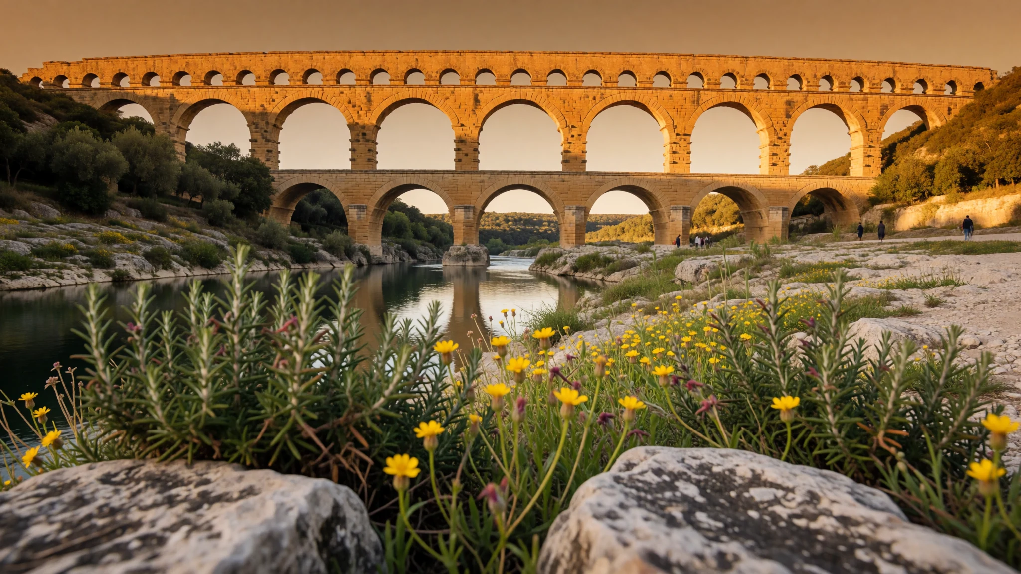
Pont du Gard is a Roman aqueduct bridge of real scale, still standing, letting you read engineering like a landscape.
The place
Pont du Gard sits just outside Vers-Pont-du-Gard in southern France, crossing the Gardon River. It’s an ancient Roman aqueduct bridge, built to move water to the Roman colony of Nemausus (Nîmes) in the first century AD. When you arrive, the first impression is less “ruins” and more “infrastructure”: stacked tiers of stone arches holding a long, deliberate line across the valley.
The structure is tall, built from Shelly limestone, and arranged in three tiers of arches. The engineering story is the part you feel rather than just read about: the aqueduct formerly carried water over 50 km, following a gentle overall gradient so the flow could keep moving. Even today, looking at the repeating arches, it’s hard not to think in measurements and patience.
The bridge also has a life beyond the Romans. After the aqueduct’s original purpose ended, the Pont du Gard stayed largely intact and later served as a toll bridge. Over centuries, maintenance patterns changed, some stone blocks were taken, and the structure suffered damage in the 17th century. That layered history is visible if you pause long enough—patches, missing work, and the way different parts weather differently.
For visits, expect a Mediterranean setting: bright light, heat in the warmer months, and a mix of slow strollers, hikers, cyclists, and families. Plan for the crowds to concentrate at popular viewpoint areas, and for the ground near the river to feel rocky underfoot.
Its story
Pont du Gard has that rare quality where the “who built it” question is almost as interesting as the stones themselves. The construction of the aqueduct has long been associated with Marcus Vipsanius Agrippa, tied to Augustus’s circle around the turn of the Roman era, though later research has suggested different timing. Excavations and findings (including coins connected with the outflow at Nîmes) point to a completion in the middle of the first century AD. Whatever the exact year, the work looks organised for a long run: builders had to bypass older tunnel routes, and the project likely involved large teams over an extended period.
From the 4th century onwards, maintenance fell away as the region was affected by repeated upheavals. As the aqueduct stopped being cared for, debris and plant growth contributed to clogging. Over time, deposits built up inside the conduit, reducing flow until the system could no longer do its job.
After the Roman Empire’s collapse, the aqueduct’s function faded, but the Pont du Gard remained standing enough to become useful again. It took on a secondary role as a toll bridge, with local powers responsible for upkeep and for collecting tolls from travellers crossing the river.
The bridge then moved into “cultural landmark” territory: it’s been visited for centuries, later remembered as a stop for travellers on routes connected with the Grand Tour, and later still tied into French pride and public imagination. So the Pont du Gard story isn’t just about Rome—it’s also about how later generations kept reinterpreting the same long line of stone across a river.
What to see
- Pont du Gard (aqueduct bridge) — Pont du Gard / bridge viewpoints near Vers-Pont-du-Gard
Walk the immediate viewpoint areas around the bridge to take in the three tiers of arches spanning the Gardon River. This is the Roman aqueduct element you came for, and it’s easy to spot how the design supports a long, steady water channel.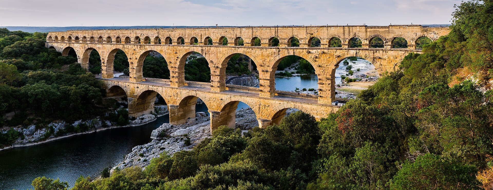
- Stonework close-ups — Along the accessible paths near the bridge
Look for the texture of Shelly limestone and the way individual blocks sit together. Up close, the structure reads like masonry at work, not just a monument—details help you understand why it was valued enough for later generations to keep it standing.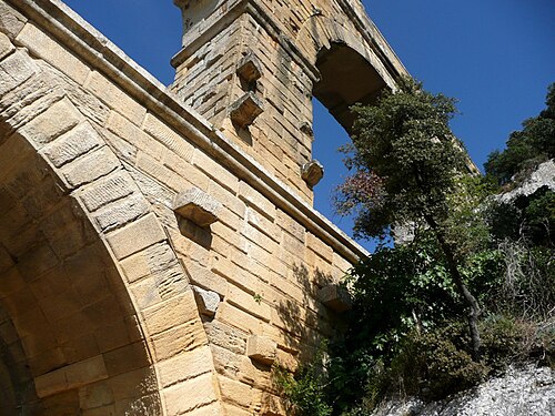
- Under-arch views — Lower-level walking areas beneath/around the arches
Finding an angle under an arch gives a different sense of scale. It also helps explain how the tiers relate—one of the easiest ways to “see” the structure rather than only look at it from afar, especially when the light is softer.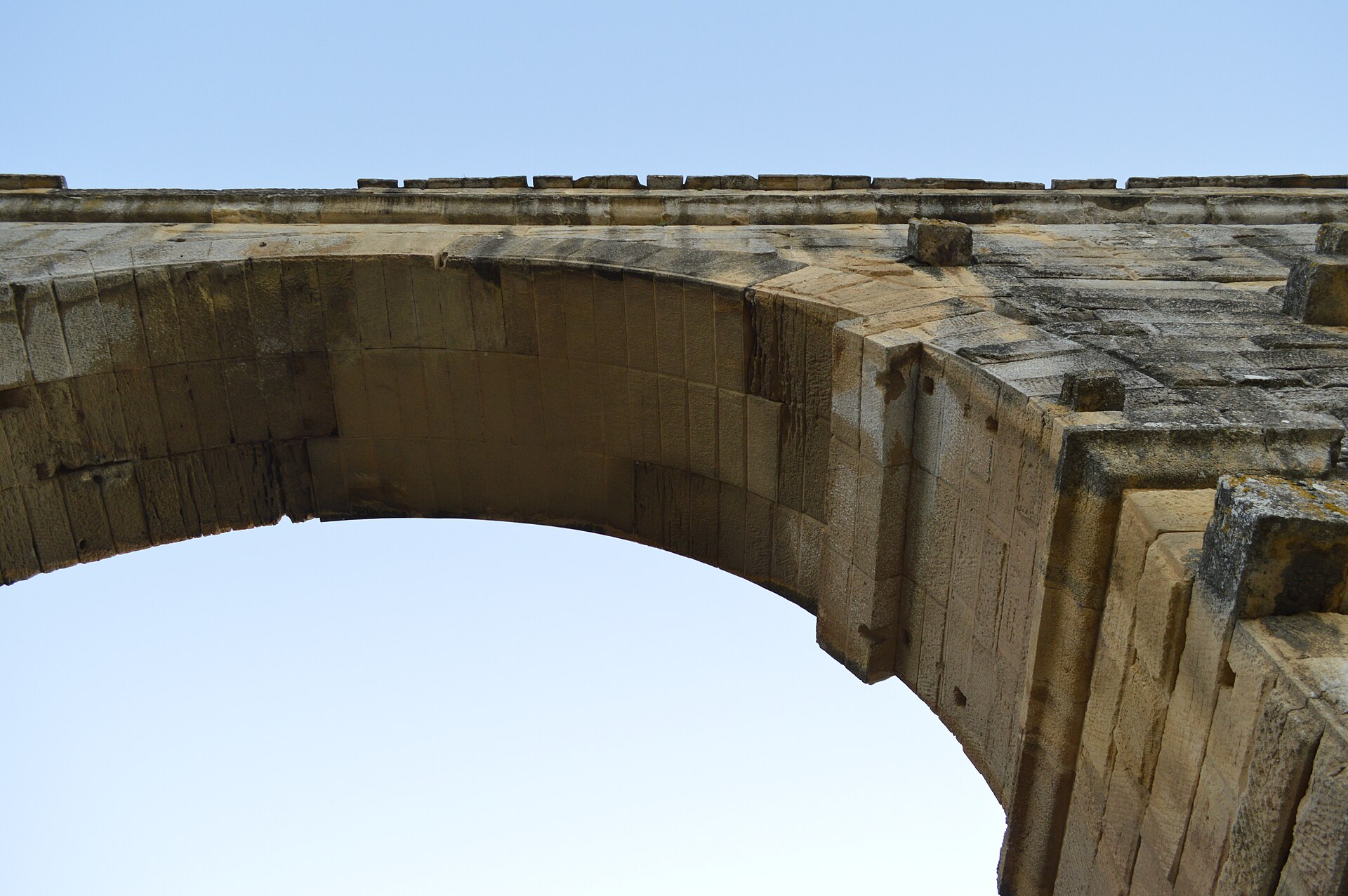
- Road bridge by the aqueduct (pedestrian area) — Riverside crossing area near the modern road bridge
The adjacent 18th-century road bridge sits alongside the Roman structure. It’s a useful contrast: older and newer engineering in the same frame, and a good place to gauge proportions when pedestrians are visible for scale.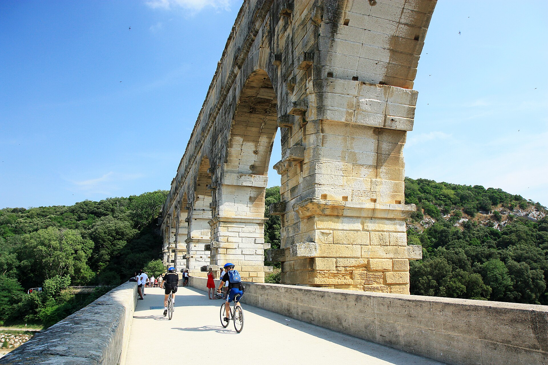
- Hiking/cycling routes around the bridge — Trail network around Pont du Gard
Pont du Gard is set up for hikers and cyclists on marked trails. A short out-and-back is enough for most people, but longer loops work well when the weather is cooler and you want to move between river views and viewpoints along the paths.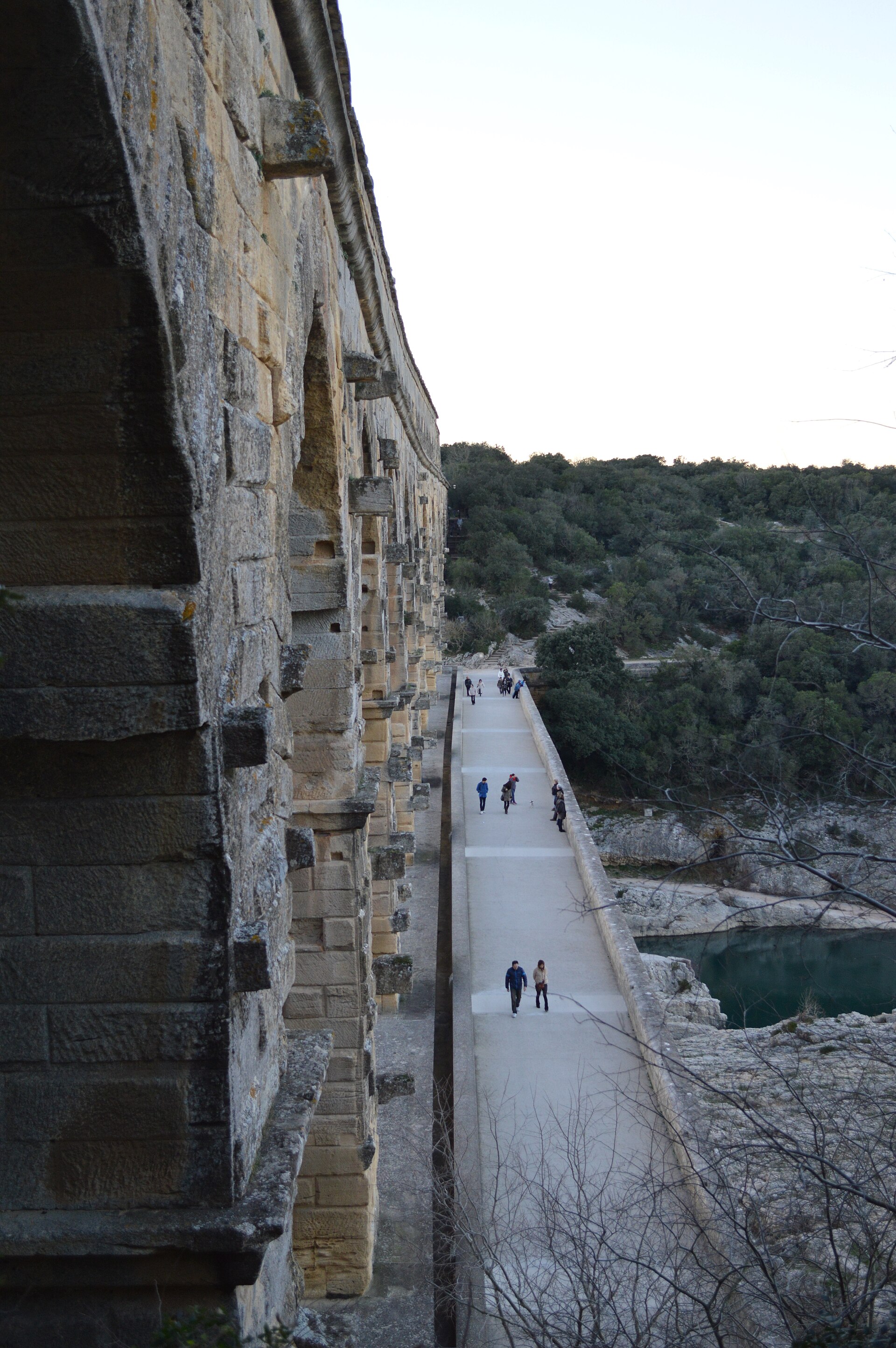
- Canoeing stretch on the Gardon — Gardon River near Pont du Gard
Canoe along the Gardon and, on some trips, under the bridge. It’s a different perspective on the river valley and the aqueduct’s mass—ideal when you want to trade land views for something more immersive.
Culture
Pont du Gard is one of France’s most visited antique sites, and that shows—expect a steady flow of visitors, particularly in peak daylight hours. The site sits in a fragile Mediterranean environment, so the basic rules matter: litter doesn’t belong anywhere on the ground, and the most sustainable way to explore is to use the marked paths.
Dogs are another common point of friction at heritage sites; keeping them on a lead protects the plants and reduces stress for other visitors. Fire is also a strict no: no lighting fires on the grounds. The bridge itself is not a playground—don’t jump or dive from it, and treat the stonework with the respect it deserves.
If you’re tempted to grab a “quick souvenir” by pulling something from the landscape, don’t; leaving plants where they grow helps keep the setting intact. And if you’re swimming near the bridge area, remember it’s described as cold and very rocky, so safe access and old shoes matter—more reason to keep to the safest zones rather than experimenting.
Visitor etiquette: take your waste with you and stay on the marked paths—Pont du Gard’s rules protect the stone and the fragile Mediterranean setting.
What to wear
At Pont du Gard, the “traditional” clothing angle is more about understanding the region than copying outfits. In southern France, you’ll see modern casual wear outdoors, with sun-protective layers doing the heavy lifting. The terrain is outdoors and sometimes rocky near the river, so footwear matters more than fashion.
In terms of what people wear now: most visitors opt for breathable tops, shorts or light trousers, and practical shoes or trainers. On hot days, caps and sunglasses are common; in cooler months, light layers help because mornings and late afternoons can feel fresher even when the sun is bright.
For visitors, dress for a Mediterranean day: bring a hat, sunscreen, and a layer for breeze near the water. Wear closed-toe shoes with a decent grip if planning any river-edge walking; “nice sandals” become uncomfortable fast on uneven ground. If doing anything near water (including optional swim or canoe activities), pack old shoes or footwear you don’t mind getting wet and scuffed.
If you’re visiting in midday heat, plan clothing to stay comfortable while moving—thin, light fabrics and a water bottle tend to beat heavy layers.
What to eat
- Visitor-centre snacks — Pont du Gard visitor centre
The Pont du Gard visitor centre is the place to grab food. It’s the simplest option if you’re doing a day visit and want refreshments without hunting around for opening hours in a small area. - Visitor-centre drinks — Pont du Gard visitor centre
The only drinks available for visitors are sold at the visitor centre. On hot days, this is handy—carry what you can and plan refills around your walking schedule.
Plan it
Best time. March–April for milder daylight and comfortable walking; October–November when the heat eases. In summer, expect warmer conditions typical of the Mediterranean setting.
How long. 2–3
Getting there. Fly or train into Avignon or Nîmes, then take the Edgard bus from Avignon (route A15) or from Nîmes (route C21) to the area for Pont du Gard; finish the last leg as needed on foot or via local connections.
Budget. mid
Tips
- Start earlier in the day if possible to reduce the densest crowds around the viewpoints.
- Pack water and sun protection; the setting is Mediterranean and can feel hot in the daytime.
- Bring closed shoes with grip if walking near the river—descriptions highlight rocky conditions.
- If doing trails, pick a length you can handle before the late-day light; longer loops are best when temperatures cool.
- For tickets and services, check the Pont du Gard website so you’re not relying on outdated details from elsewhere.
Etiquette
- Take your waste away and stick to the marked paths.
- Keep dogs on a lead.
- Don’t jump or dive from the bridge area.
Nearby
Sources
- Wikidata Q189764 (CC0)
- Wikipedia (rev 1379503814) (CC BY-SA 4.0)
- Wikivoyage (rev 5360536) (CC BY-SA 4.0)
- Photo photos/01-pont-du-gard-bls.jpg (CC BY 3.0)
- Photo photos/02-pont-du-gard-hdr.jpg (CC BY 2.5)
- Photo photos/03-pont-du-gard-hdr-2.jpg (CC BY-SA 4.0)
- Photo photos/04-pont-du-gard-pont-moderne.jpg (CC BY 2.5)
- Photo photos/05-pont-du-gard-stonework.jpg (CC BY 2.5)
- Photo photos/06-pont-du-gard-arch-underside.jpg (CC BY-SA 4.0)
- Photo photos/07-pont-du-gard-scale.jpg (CC BY-SA 4.0)
- Photo photos/08-aqueduc-pont-du-gard.jpg (CC BY 3.0)


