Phan Xi Păng
Phan Xi Păng, Vietnam
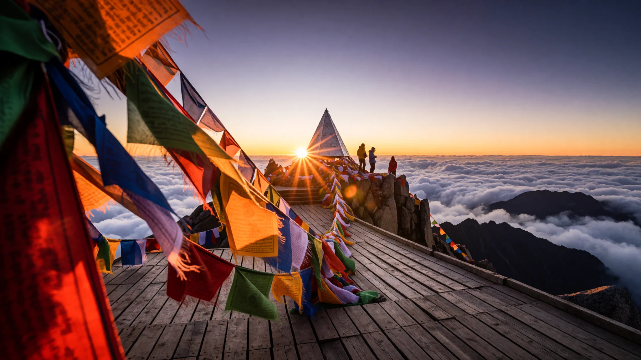
Climb or ride above misty highland valleys to reach Indochina's tallest peak and its serene mountain sanctuaries.
The place
Phan Xi Păng towers above the misty ridges of the Hoang Lien Son range in northwestern Vietnam. Rising to an elevation of 3,143 metres, this formidable peak forms part of Hoàng Liên National Park and sits near the highland town of Sa Pa. The surrounding geography is defined by steep forested ridges, deep river valleys, and terraced rice paddies that carve green steps into the lower slopes. High alpine humidity creates a dynamic mountain climate where dense clouds roll across the granite outcrops within minutes, suddenly blanketing the slopes in grey fog before opening to reveal broad valleys below.
The environment around Phan Xi Păng changes dramatically with elevation. Tropical vegetation on the lower valley floors gives way to bamboo thickets, evergreen forests, and cold alpine scrub on the upper crags. For decades, reaching the summit required an arduous multi-day trek through dense mud and slippery forest paths. Today, modern infrastructure has made the high altitude accessible via a record-breaking cable car system that glides above the forest canopy, connecting valley terminals directly to the upper mountain complex. Despite this development, the peak retains its wild alpine winds and dramatic weather shifts. Cold winter snaps bring sub-zero temperatures and occasional frost to the summit, making warm clothing essential even in Southeast Asia.
Its story
Phan Xi Păng has long held a prominent place in the geography and cultural identity of Indochina. Known historically as the highest summit in the region, the mountain was explored during the French colonial era when survey parties mapped the Hoang Lien Son range. Colonial administrators established nearby Sa Pa as a high-altitude hill station to escape the sweltering heat of the northern plains, turning the surrounding highlands into a retreat for health and recreation. For generations of local mountain communities, including the Hmong, Dao, and Tay ethnic groups, the peak stood as an imposing natural border and a sacred landscape towering over their ancestral villages.
In recent decades, Phan Xi Păng underwent a dramatic transformation from an isolated wilderness destination to a major national landmark. Early visitors were limited to experienced trekkers and local guides who navigated unmarked forest tracks over several days. The construction of the cable car network and high-altitude spiritual complex altered the mountain landscape, bringing hundreds of thousands of visitors to the peak. A grand Buddhist sanctuary, including towering stairways and a prominent Amitābha statue, was established near the crest, combining religious pilgrimage with mountain tourism. Today, the summit represents a meeting point between ancient highland traditions, colonial resort history, and modern engineering, standing as a proud symbol of Vietnamese national geography.
What to see
- Fansipan Summit Marker — Summit Peak
Standing at an elevation of 3,143 metres, the metal summit pyramid marks the highest point in the region. Visitors gather on the wooden observation platforms around the peak to photograph the triangular marker, surrounded by fluttering flags and sweeping views of cloud seas floating over distant green valleys.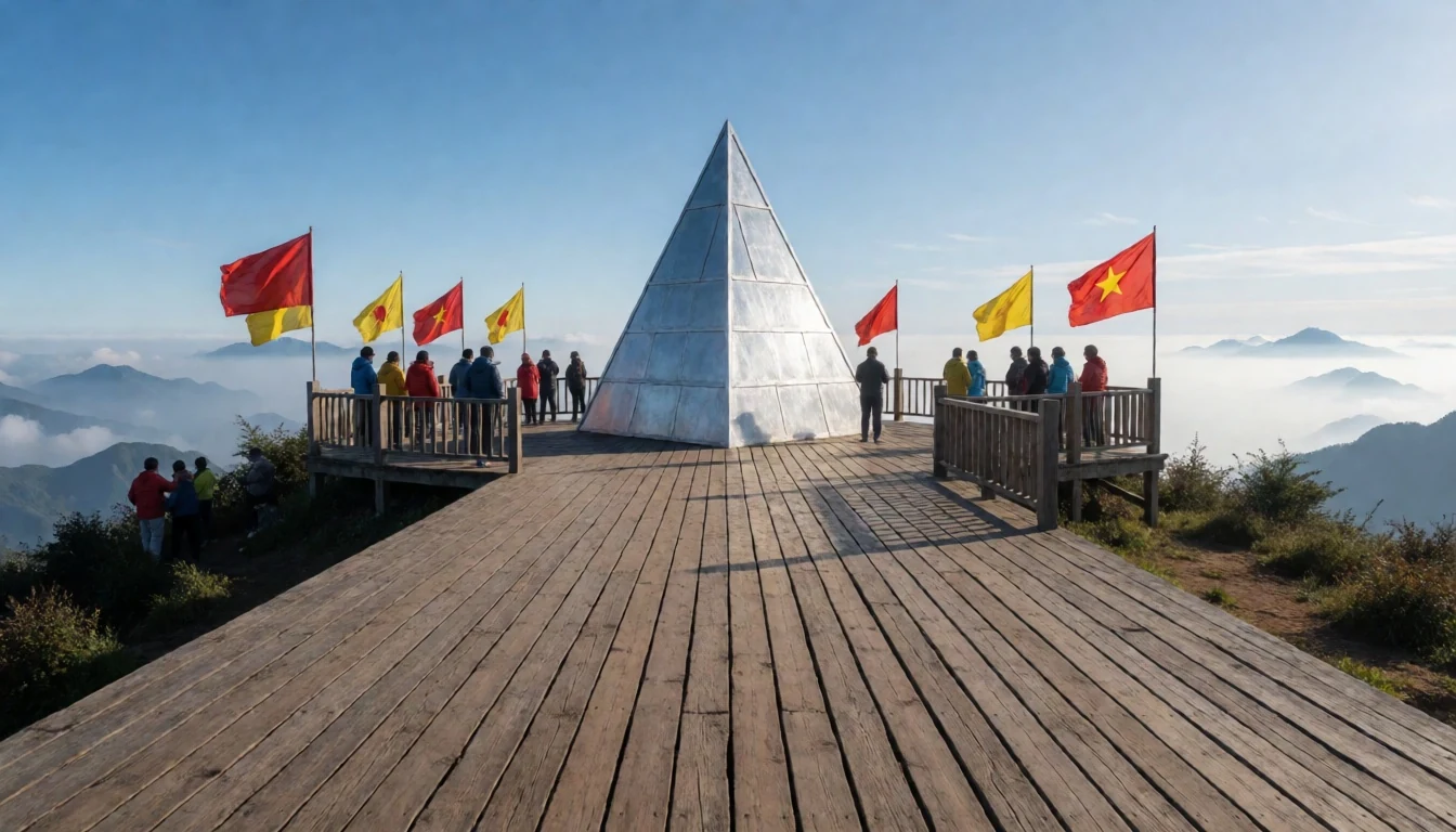
- Amitābha Statue — Upper Spiritual Complex
This massive bronze statue of Amitābha Buddha sits majestically on the upper ridges of the mountain. Cast from copper and engineered to withstand severe weather, the grand figure overlooks cloud-filled valleys. A series of stone stairways and terraces lead pilgrims up to the base of the monument.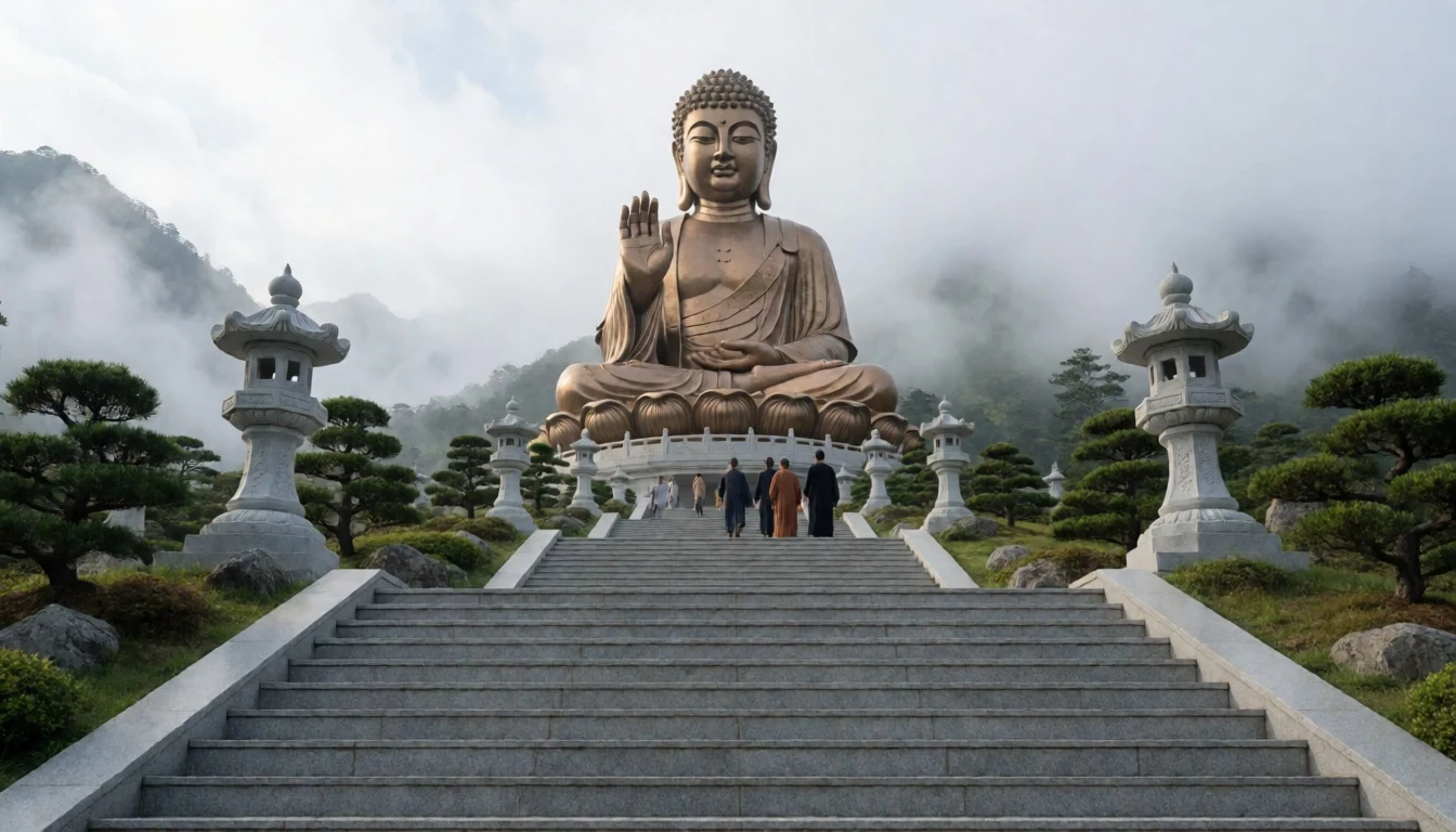
- Bảo An Pagoda — Lower Cable Car Terminal
Located near the entrance of the lower cable car station, this serene temple complex showcases traditional Vietnamese wooden architecture. Curved tiled roofs, ornate doorways, and burning incense burners greet travellers before they ascend the mountain, offering a peaceful space for reflection and quiet prayer before taking to the skies.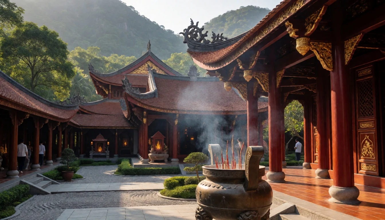
- Fansipan Express Monorail — Muong Hoa Valley to Station
This red funicular train climbs through the lush scenic landscapes of the Muong Hoa Valley. Passing through colourful flower fields, mountain tunnels, and terraced slopes, the short rail journey connects the mountain resort hub directly to the cable car station while providing beautiful views of rural highland life.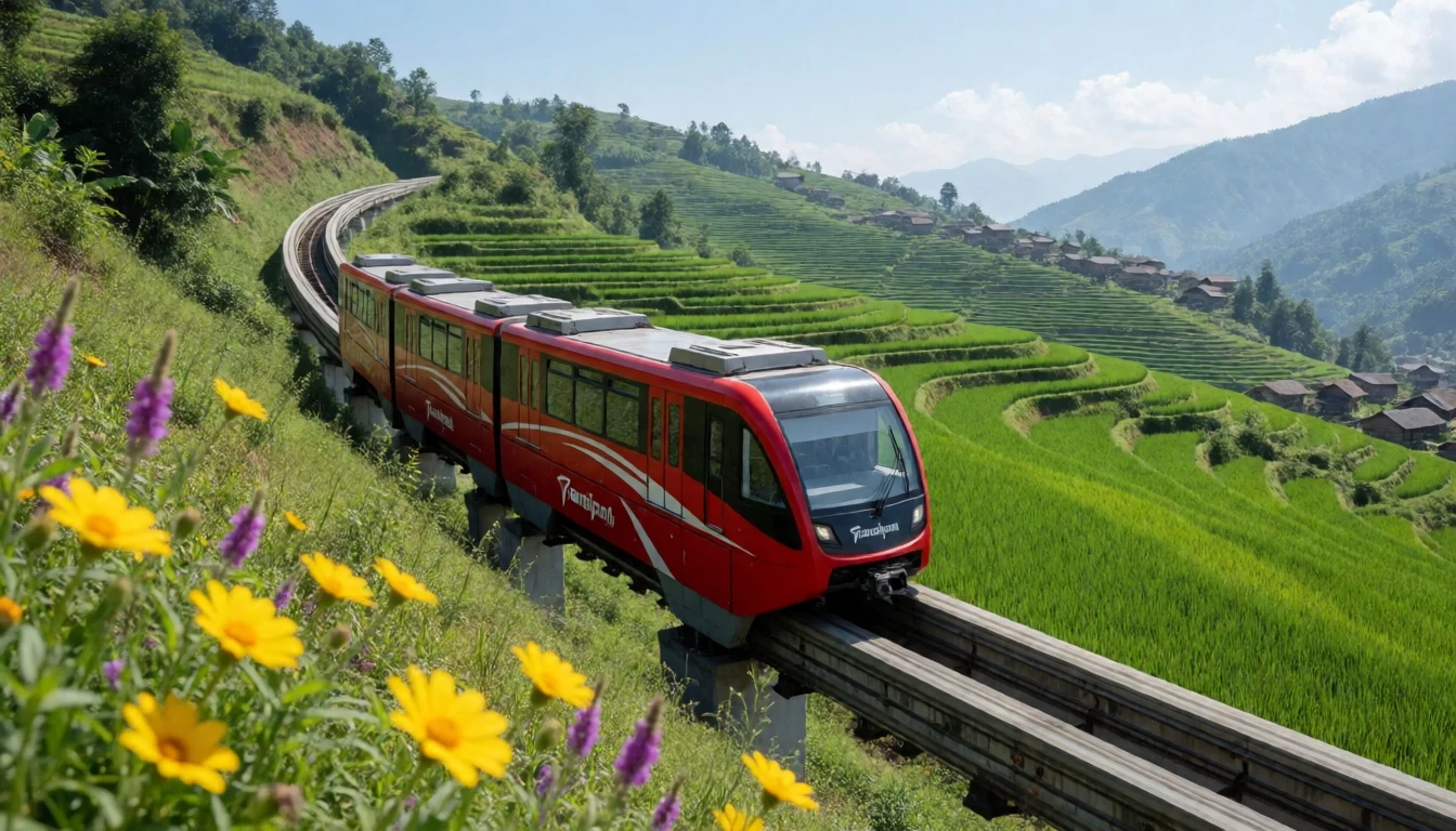
- Hoàng Liên Forest Trails — Hoàng Liên National Park
For those choosing to trek, the forest trails wind through dense bamboo groves, rhododendron woods, and rugged mountain ridges. Passing old wilderness campsites and steep rock faces, these footpaths offer a rustic alternative to the cable car, showcasing the raw biodiversity of the protected national park environment.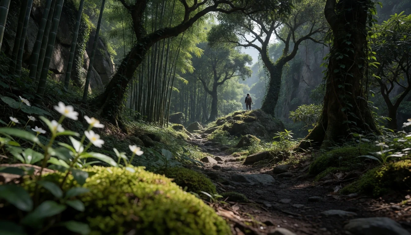
Culture
Phan Xi Păng lies in a region rich in ethnic diversity, where Hmong, Dao, Tay, and Giay communities have lived along the mountain slopes for centuries. Local social customs place great emphasis on deference and respect toward elders, a value deeply rooted in family life across northern Vietnam. When interacting with local residents in surrounding market towns, displaying politeness and a patient demeanour goes a long way. Visitors should expect friendly curiosity from locals, who frequently ask direct questions about your age, marital status, and family back home. These personal inquiries are traditional icebreakers designed to establish appropriate social titles and show genuine warmth rather than intrusiveness. The spiritual complex at the mountain top is treated with reverence by pilgrims who come to pray at the shrines. Always dress modestly with covered shoulders and knees when visiting the temples on the mountain, and speak quietly near the prayer altars.
What to wear
Around Phan Xi Păng and the neighbouring highlands, traditional clothing remains a vibrant part of everyday identity for local ethnic minority communities. Hmong women wear intricate indigo-dyed hemp jackets, heavily embroidered skirts, and silver jewellery, while Red Dao women are distinguished by bright red headscarves decorated with tassels and silver coins. These handcrafted textiles feature complex geometric needlework that tells family histories and regional origins, worn both for daily tasks and festival gatherings. Modern Vietnamese urbanites and town residents wear standard contemporary casual wear such as jeans, t-shirts, and light jackets. For visitors ascending the mountain, dressing in flexible layers is essential due to rapid altitude and temperature changes. Strong winds and cold mist at the peak require a windproof outer jacket, fleece layers, and sturdy walking shoes with good grip for damp steps. When visiting the sacred pagodas along the summit ridge, ensure shoulders and knees remain covered to conform to regional modesty standards.
What to eat
- Vietnamese Iced Coffee (Cà Phê Sữa Đá) — Highland cafes and roadside stalls in Sa Pa
Strong dark-roast coffee brewed through a metal drip filter onto thick sweetened condensed milk, served over crushed ice. This intensely rich drink provides a perfect morning pick-me-up before heading up the cool mountain slopes.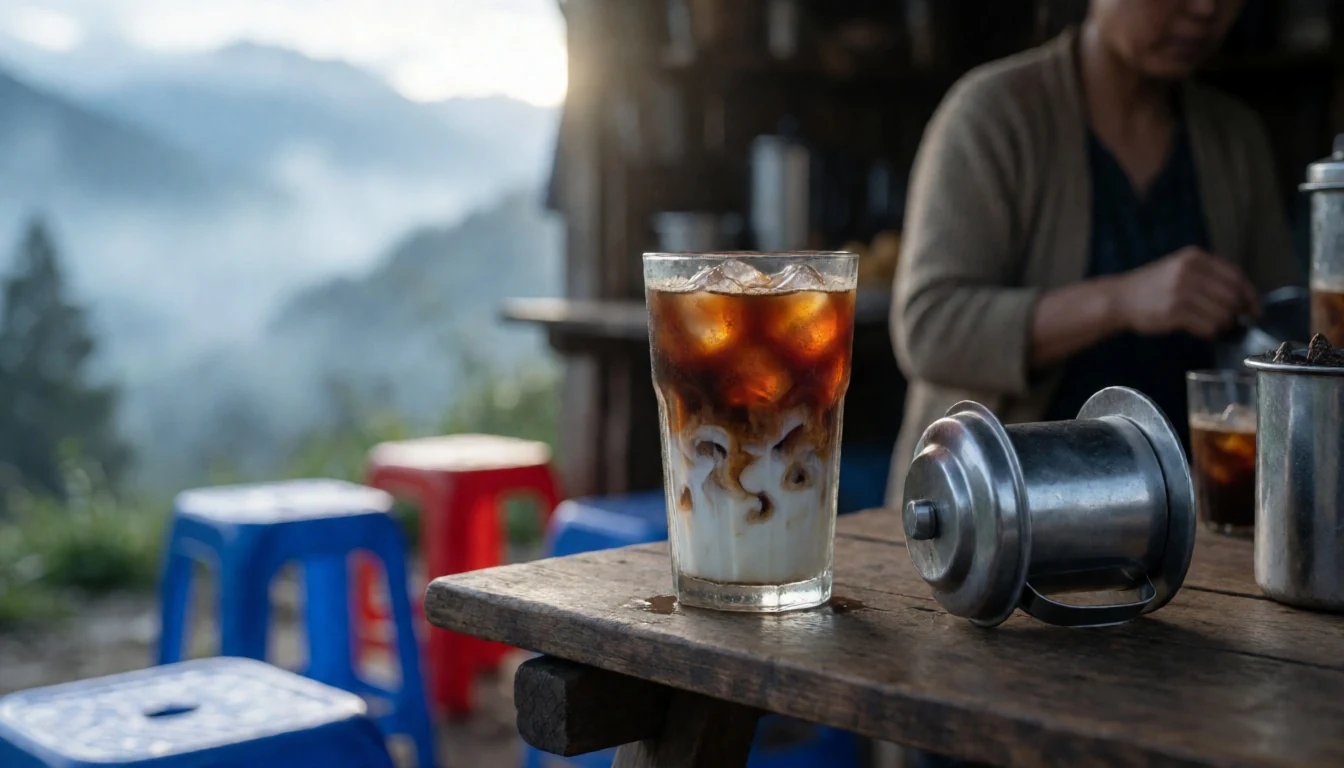
- Thắng Cố — Weekly ethnic highland markets
A traditional mountain soup slow-cooked in large iron vats with horse meat, offal, and aromatic wild herbs like cardamom and lemongrass. Eaten piping hot alongside corn wine, it offers a deep, rustic flavour beloved by local villagers.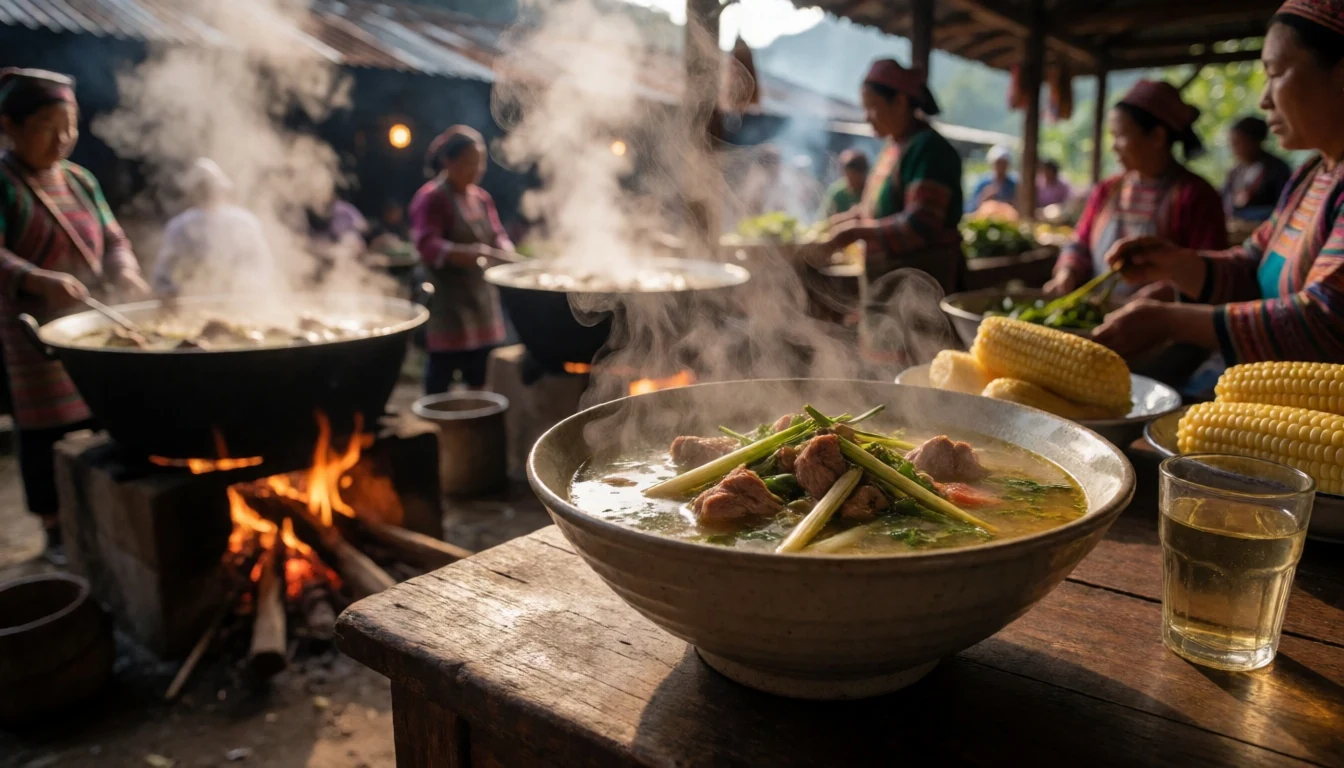
- Grilled Pork Skewers (Thịt Nướng) — Night market stalls near the central square
Tender pork marinated in wild pepper, garlic, and honey, grilled over glowing charcoal braziers. Skewered alongside local vegetables, these smoky bites are sold straight off the coals to keep visitors warm during cold mountain evenings. - Bamboo Sticky Rice (Cơm Lam) — Street food carts around the mountain base
Glutinous rice cooked inside sealed bamboo tubes over open flames, infusing the grain with a subtle woody aroma. Split open and served dipped in crushed peanuts and salt, it makes a portable and filling highland snack. - Stir-Fried Mountain Greens (Rau Mầm) — Highland eateries and local family restaurants
Fresh chayote shoots and tender hill greens flash-fried in a hot wok with garlic and fish sauce. Crisp and fragrant, these local vegetables highlight the fresh seasonal produce grown across the terraced valleys.
Plan it
Best time. March to April for clear dry days and spring blooms, or September to November for cool weather and golden rice terraces; June to August brings heavy rains.
How long. 2–3
Getting there. Overnight train or sleeper bus from Hanoi to Lao Cai, followed by a short minibus climb to Sa Pa; the mountain peak is reached via cable car or multi-day trek.
Budget. mid
Tips
- Book cable car tickets online early to avoid long morning queues at the base
- Check cloud coverage webcams in town before heading up the cable car
- Carry a windproof jacket as temperatures at the top are much colder than the valley
- Bring cash for local transport, street markets, and light snacks
Etiquette
- Remove shoes before stepping into temple shrine rooms along the mountain complex
- Dress modestly with covered shoulders and knees when visiting sacred pagodas
- Ask for permission before taking close-up photographs of ethnic minority elders
Nearby
Sources
- Wikidata Q123782 (CC0)
- Wikipedia (rev 1369133611) (CC BY-SA 4.0)
- Wikivoyage (rev 5410523) (CC BY-SA 4.0)
- Photo photos/01-fansipan-summit.jpg (CC BY-SA 3.0 de)
- Photo photos/02-fansipan-train-through-the-flower-field-sa-pa-vietnam.jpg (CC BY-SA 4.0)
- Photo photos/03-cable-car-station-going-fansipan.jpg (CC BY-SA 4.0)
- Photo photos/04-fansipan-peak-uplink.jpg (CC BY-SA 4.0)
- Photo photos/05-amit-bha-statue-on-fansipan-1.jpg (CC BY-SA 4.0)
- Photo photos/06-amit-bha-statue-on-fansipan-2.jpg (CC BY-SA 4.0)
- Photo photos/07-bao-an-pagoda.jpg (CC BY-SA 4.0)
- Photo photos/08-base-camp-of-the-fansipan.jpg (CC BY-SA 4.0)


