Mývatn
Mývatn, Iceland
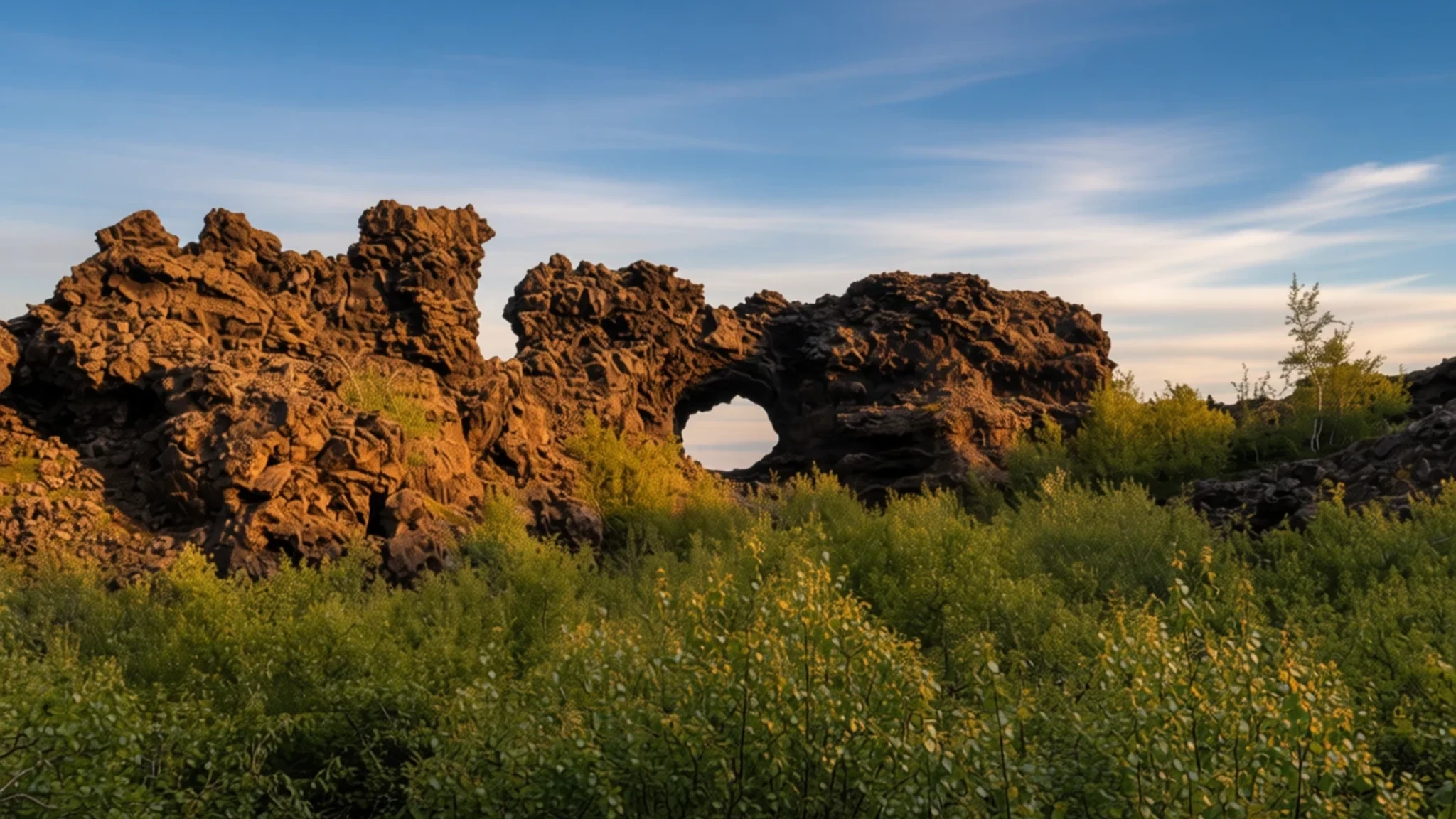
Mývatn offers a mesmerising encounter with Iceland's volcanic core, featuring bubbling mud pools, dramatic lava pillars, and a rich expanse of wetlands.
The place
Mývatn is a wide, shallow expanse set within an active volcanic zone in the northern reaches of Iceland. The geography here is raw and immediate, shaped by subterranean heat and shifting basalt. Bordering the water are intricate mazes of lava pillars, jagged arches, and clustered mounds known as rootless cones or pseudocraters, formed when molten rock once poured over soggy wetlands and triggered steam explosions. The wetlands themselves teem with biological life, particularly waterbirds that congregate by the thousands during the warmer months, giving the water its distinctive character.
Life around the lake is quiet and rural. The surrounding settlements, collectively known as the local farming community, sustain a permanent population that swells slightly during the peak visitor season when travellers arrive to explore the dramatic geological formations. The air often carries the faint tang of geothermal steam, and the ground beneath the surface remains restless, echoing the volatile nature of the northern volcanic belt. Visitors find themselves navigating a surreal terrain where black volcanic sand meets shimmering water, and distant jagged peaks frame an expansive Arctic sky. It is a place of stark contrasts, where fragile ecosystems thrive right alongside the stark, blackened remnants of ancient eruptions.
Its story
The biography of Mývatn is written in fire and ice. The basin itself was carved out and shaped long ago during glacial periods, but the defining chapter of its creation occurred thousands of years ago when a massive basaltic eruption reshaped the entire topography. Molten rivers of rock poured across the landscape, damming valleys and creating the shallow lakebed seen today. Because this region sits squarely along the western edge of the volcanic fissure zone that bisects Iceland—itself an extension of the great Mid-Atlantic Ridge—the earth here never truly sleeps.
Over the centuries, the local inhabitants of the surrounding district adapted to this turbulent environment, harvesting trout from the effluent river and gathering sustenance from the resilient land. In more recent decades, the area gained wider attention as a living laboratory for vulcanology and ecology, drawing scientists and travellers alike. Major volcanic episodes nearby, such as the intense period of fracturing and eruptions known as the regional fires of the late twentieth century, reminded everyone that the landscape is continually evolving. Today, the local community balances traditional rural stewardship with welcoming visitors who come to witness the raw, earth-shaping forces that continue to pulse just beneath the surface of northern Iceland.
What to see
- Hverfjall Crater
A massive, nearly symmetrical tephra ring that rises sharply from the dark volcanic plains. A well-defined hiking trail leads up the steep slopes, offering sweeping views across the entire lake basin and the surrounding rugged lava fields.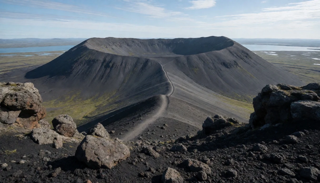
- Dimmuborgir
A labyrinthine expanse of dramatic lava arches, towering pillars, natural bridges, and hidden caves along the eastern shore. Walking trails wind through these dark, fantastical rock formations that resemble the ruins of an ancient, deserted citadel.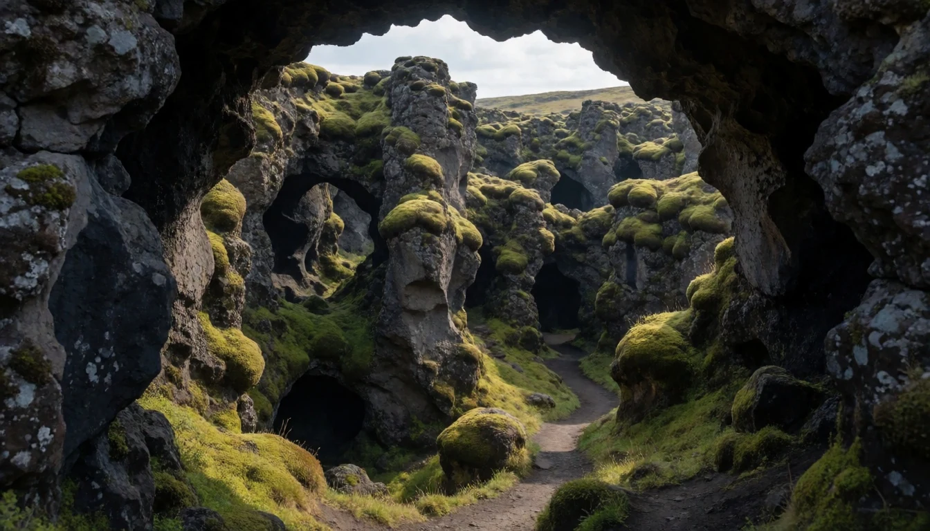
- Skútustaðagígar
A remarkable collection of pseudocraters clustered along the southern shores of the lake. These medium-sized grassy mounds were formed by steam explosions when hot lava advanced over wet ground, creating an unusual pitted landscape.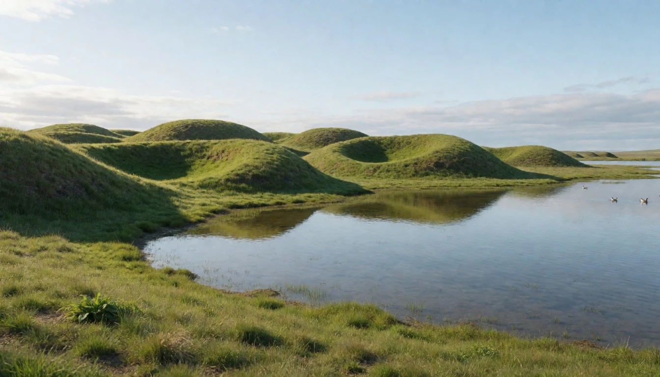
- Námaskarð
A vibrant, barren mountain pass where the earth boils and steams. Here you can walk near hissing fumaroles, roaring steam vents, and bubbling pools of grey mud set against mineral-stained rust-coloured soil.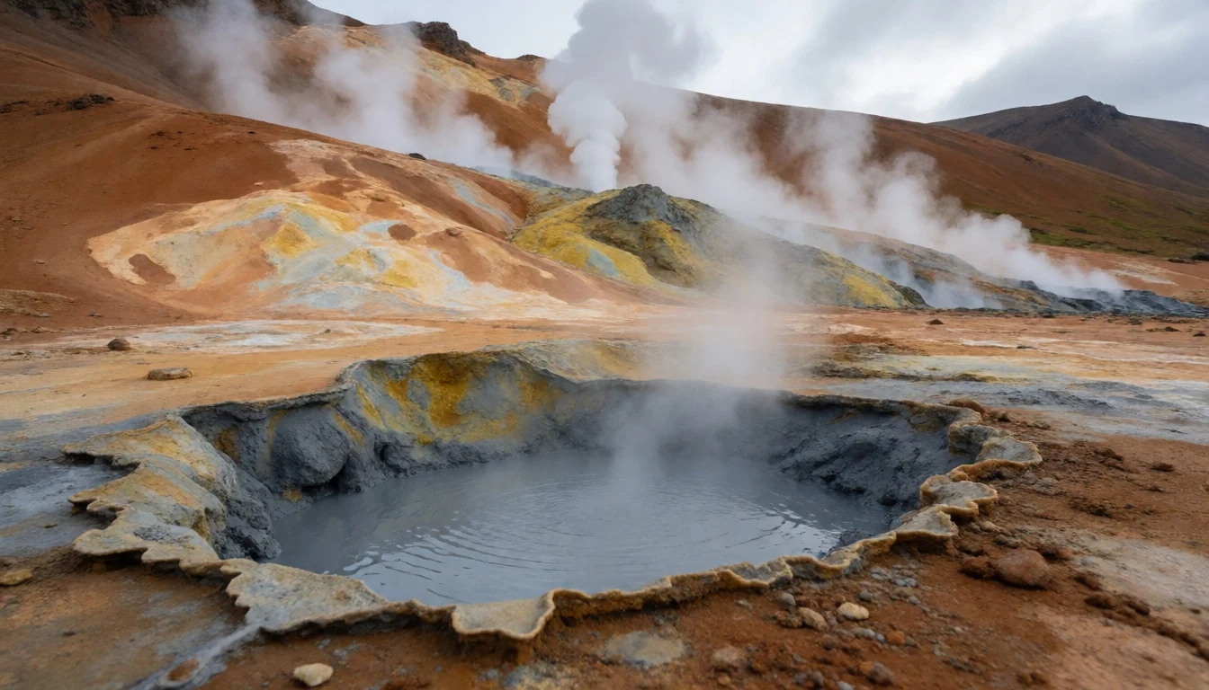
Culture
The cultural fabric of the Mývatn district is deeply rooted in resilient rural traditions, farming heritage, and a profound respect for the unpredictable forces of nature. For generations, local families have lived in harmony with the changing seasons, relying on sustainable fishing in the nearby river and traditional food preservation methods tied to the geothermal landscape. Community life in the settlements is close-knit and welcoming, characterized by quiet self-reliance and a strong sense of stewardship for the protected nature reserve that encompasses the wetlands and surrounding habitats. Modern entrepreneurship has also taken root, with locals developing winter tourism initiatives, ice-based recreation, and hospitality that shares the unique character of the north with curious travellers. Visitors should always respect marked trails and fragile habitats, ensuring they never drive or walk off-road to protect sensitive nesting grounds and delicate moss beds.
What to wear
Traditional clothing in rural northern Iceland was designed entirely for survival against harsh weather, relying heavily on homespun wool, durable hides, and layered garments to fend off biting winds and damp cold. While everyday dress is now modern, practical, and casual—mirroring contemporary European styles—functional outdoor wear remains an absolute essential for anyone stepping outside. Because the weather around the lake can shift from bright sunshine to biting wind, sleet, or fog in a matter of minutes, visitors should dress in reliable layers. The golden rule for exploring this volcanic region is to pack a windproof and waterproof outer shell, sturdy hiking boots with reliable ankle support for walking over rough lava rocks and loose gravel, moisture-wicking thermal base layers, woollen hats, and gloves, regardless of the season.
What to eat
- Hverabrauð — Local cafes and grocery shops around the lake
A dense, sweet molasses rye bread that is traditionally baked underground for twenty-four hours using natural geothermal heat. It is sliced thickly and served smeared with local butter, often found at cafes and shops around the lake.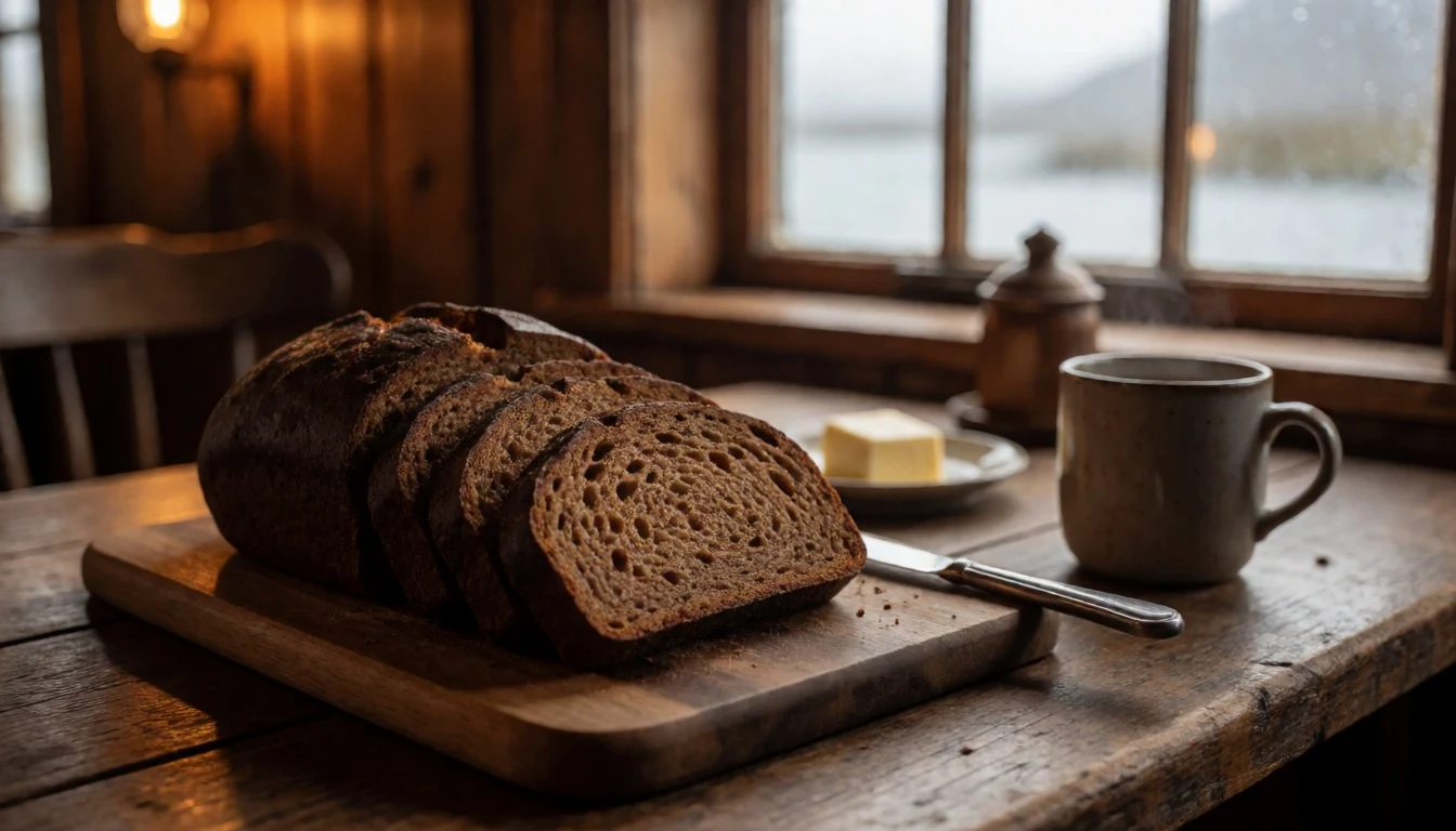
- Smoked Trout — Regional food shops and farm-gate markets
Delicate freshwater fish caught in the local lake and effluent rivers, then traditionally smoked over birch or dried peat. It has a rich, savoury flavour and is prized across the country.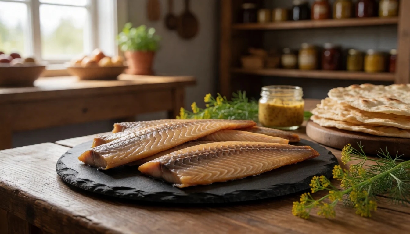
- Farmstead Dairy — Working farm cafes just south of the main village
Fresh dairy products sourced directly from local working farms, offering a taste of northern agricultural traditions with creamy skyr and rich milk.
Plan it
Best time. June to August offers the mildest weather, accessible hiking trails, and endless daylight, though midges can appear in summer; winter brings subarctic cold, snow, and opportunities for northern lights and ice adventures.
How long. 2–3
Getting there. Fly into Akureyri or take a domestic or international flight to Keflavík, followed by a drive east along the ring road, or catch regional bus services connecting from Akureyri, Húsavík, or Egilsstaðir.
Budget. high
Tips
- Always monitor weather forecasts and road conditions closely before setting out.
- Keep a respectful distance from boiling mud pools and unstable geothermal vents.
- Wear sturdy, broken-in hiking boots suitable for sharp lava rocks and uneven terrain.
- Bring insect repellent with a head net, as the summer swarms of midges near the water can be intense.
Etiquette
- Stay strictly on designated paths to protect fragile moss and bird-nesting areas.
- Observe all safety barriers and warning signs around active geothermal zones.
Nearby
Sources
- Wikidata Q212051 (CC0)
- Wikipedia (CC-BY-SA 4.0)
- Wikivoyage (CC-BY-SA 4.0)