Mount Cameroon
Mount Cameroon, Cameroon
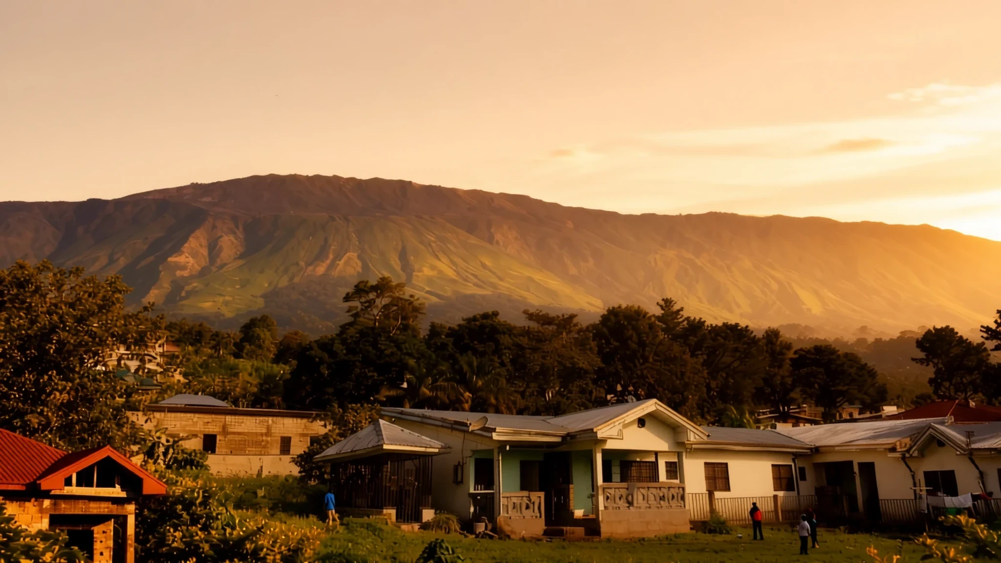
Climb West Africa's most dynamic stratovolcano, ascending from lush rainforests to stark volcanic heights overlooking the distant Atlantic Ocean.
The place
Mount Cameroon dominates the geography of the Southwest Region, soaring sharply from the coastline near the Gulf of Guinea. Locally known as Mongo ma Ndemi, or the Mountain of Greatness, this giant stratovolcano stands as an extraordinary landmark in Central Africa. The surrounding landscape transitions dramatically as you move upward, starting from settled agricultural slopes and dense tropical woodlands before giving way to stark, open volcanic rock near the upper elevations. Because the mountain rises so steeply from the coastal plains, the upper reaches offer sweeping vistas across surrounding forests and out toward the Atlantic waters.
The terrain is characterized by ancient lava flows, cinder cones, and deep fissures formed by tectonic activity along a massive regional belt of volcanoes. Soil across the lower and middle slopes is remarkably rich, sustained by weathered volcanic ash that nourishes thriving ecosystems of mahogany trees, delicate wild flora, and diverse fungi. Climatic conditions shift swiftly on the slopes; brilliant sunshine in the foothills can quickly turn into thick mist and rain as moisture rolls in from the sea. Walking these paths means experiencing multiple ecological zones in a single day, from humid lowland greenery to chilly, exposed heights where plant life struggles against wind and shifting ash.
Its story
Human history around Mount Cameroon has long been shaped by the fiery temperament of the earth beneath. Indigenous communities historically regarded the heights with profound reverence, viewing the rumblings and smoke as manifestations of powerful spiritual forces. When German colonial administrators established their territorial headquarters in nearby Buea during the nineteenth century, they soon discovered that the mountain could disrupt even the most carefully laid plans of governance.
A significant eruption in the early twentieth century forced the colonial administration to temporarily relocate their administrative capital away from Buea down to Douala as molten rock threatened settlements. Over subsequent decades, recurring activity continued to remind inhabitants of the volatile ground they farmed. The 1922 event sent rivers of lava all the way toward the ocean, while more recent pulses of activity at the turn of the millennium and into the twenty-first century demonstrated that the volcanic conduit remains very much alive.
Scientific study of the mountain has revealed complex subterranean pathways where mantle magma ascends through dense crustal fractures. Researchers mapping these geochemical signatures continue to unravel how the regional volcanic line connects deep-earth phenomena across thousands of kilometres. Yet beyond academic charts and historical ledgers, the enduring story of Mount Cameroon is written in the resilience of the communities living on its flanks, who farm the fertile black soils and guide visitors upward through the changing mists.
What to see
- Buea Town — Southern foothills
Serving as the primary gateway for travellers heading up the mountain, Buea sits directly on the lower southern slopes. Historic colonial architecture blends with bustling local markets, vibrant street life, and panoramic views looking down toward the coastal plains and out across the distant expanse of the Gulf of Guinea.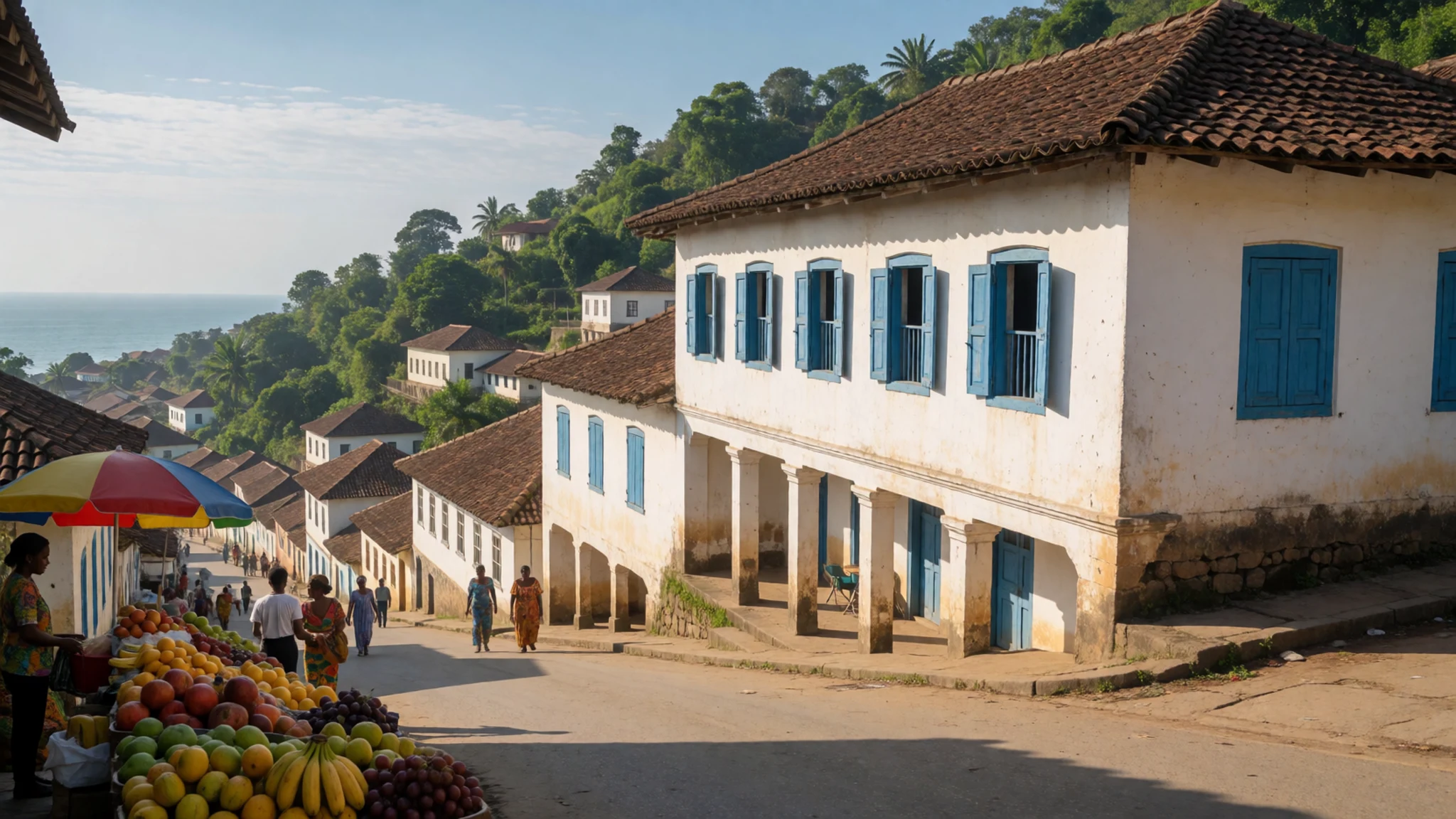
- Mount Cameroon National Park Rainforest — Lower and middle slopes
The lower and middle slopes are blanketed by dense tropical rainforest protected within the national park. Towering mahogany trees, rich ferns, and diverse fungal species thrive in the fertile soil, creating a humid, vibrant canopy that echoes with wildlife before the trees begin to thin out significantly.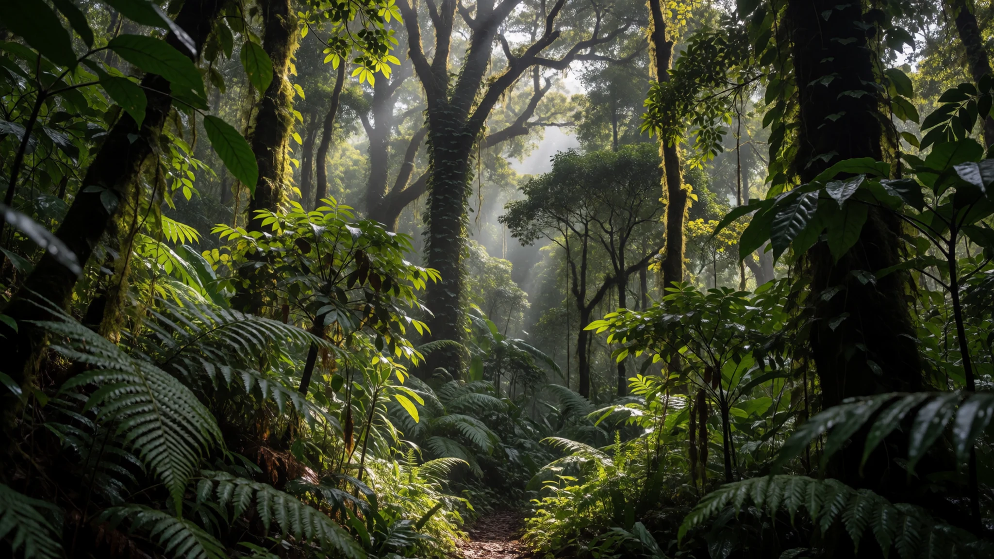
- Fako Summit — Upper summit area
Representing the highest of the mountain's two main peaks, Fako offers a demanding physical objective and sweeping vistas across the entire region. Standing at the uppermost point rewards the resilient trekker with stark landscapes of dark volcanic cinder and an overwhelming sense of isolation above the clouds.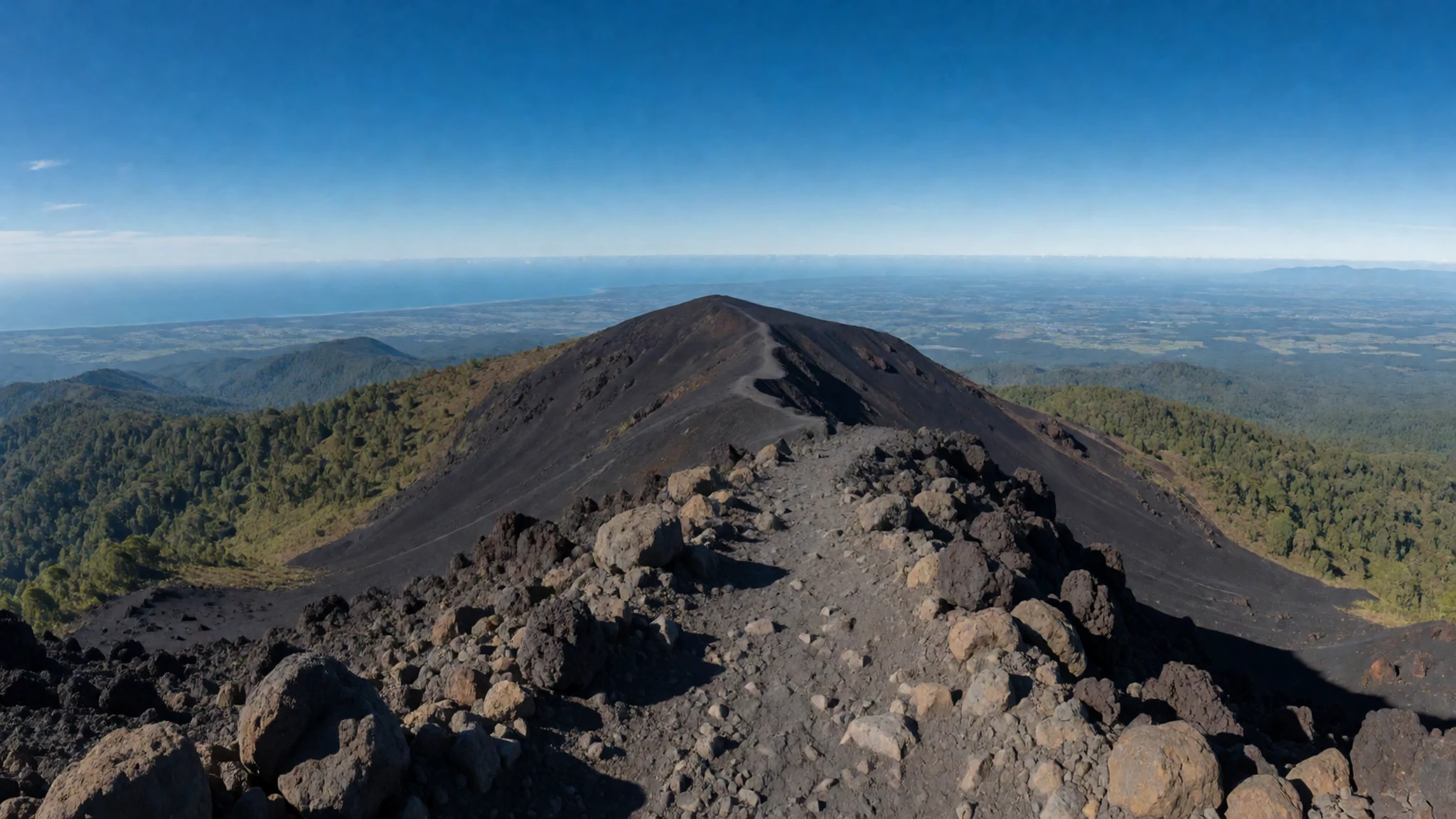
- Volcanic Cinder Fields — Upper elevation zones
Above the tree line, the landscape transforms into an otherworldly expanse of black basalt, ancient ash, and loose scoria. These barren fields bear witness to historical eruptions, presenting a stark, monochromatic beauty where little vegetation manages to take root against the harsh alpine winds.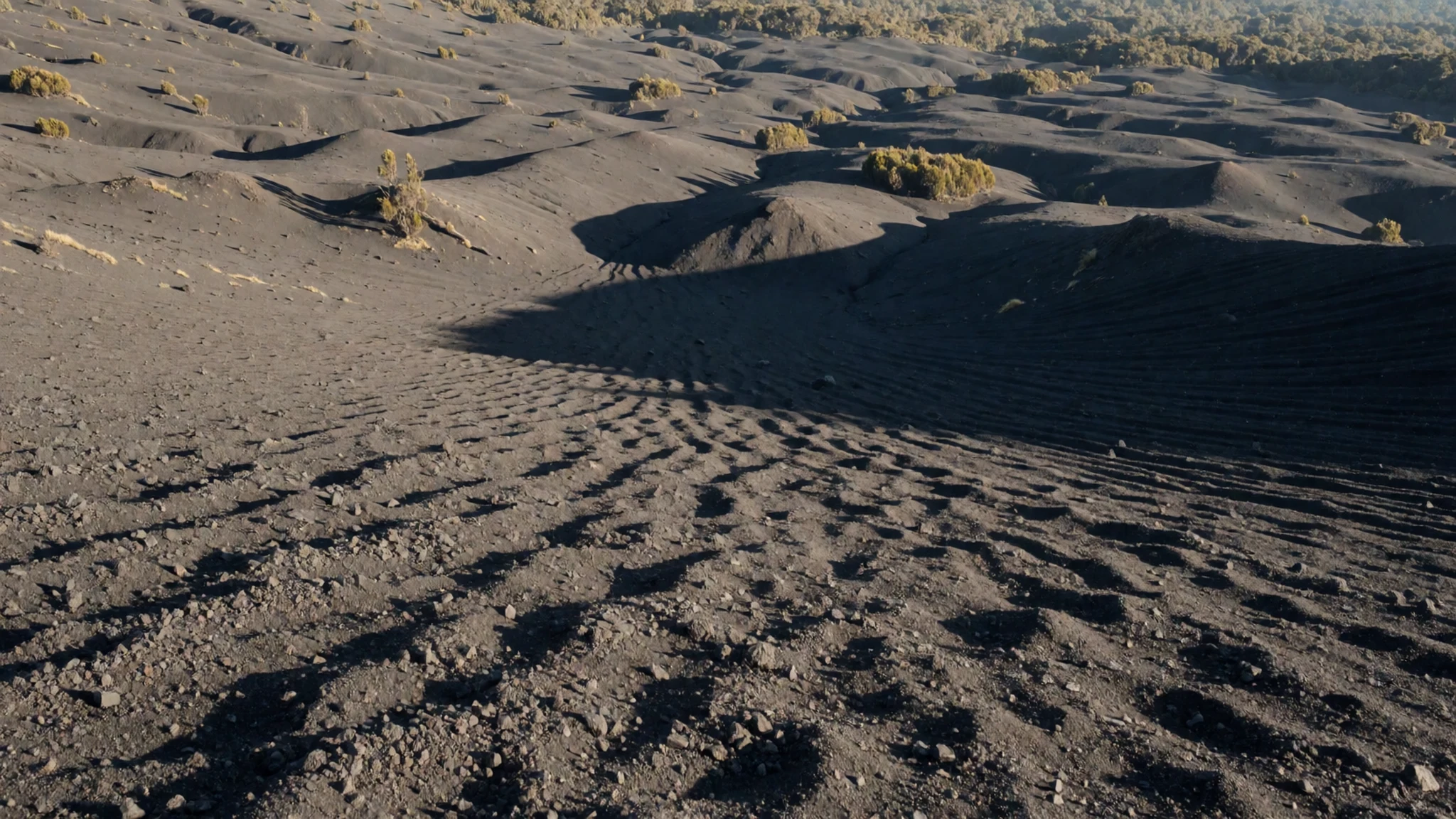
Culture
Cultural life around Mount Cameroon is deeply rooted in traditions that honour the ancestral spirits believed to inhabit the mountain slopes. Local communities, predominantly Bakweri people, maintain a strong spiritual connection to the landscape, viewing the volcano as a living entity that demands respect and careful stewardship. Traditional ceremonies and gatherings often mark significant agricultural seasons or community milestones, accompanied by rhythmic music, storytelling, and shared feasting using produce harvested directly from the volcanic foothills. Visitors will find warmth and hospitality among residents, who are proud to share stories of the mountain and guide travellers through their ancestral lands. When engaging with local residents or exploring village neighbourhoods, always ask permission before taking photographs of individuals or sacred sites.
What to wear
Traditional dress around Mount Cameroon reflects both regional practicality and vibrant West African textile heritage. Local residents frequently wear colourful patterned wrappers, known locally as kaba or traditional loincloths crafted from rich cotton prints, which provide comfort in the humid lowland heat. For everyday modern wear around Buea, people generally opt for casual, breathable clothing, including lightweight shirts and trousers suited for tropical weather.
For visitors tackling the mountain, fashion takes a distinctly utilitarian turn. Because temperatures drop sharply as you climb above the tree line, layering is essential. Travellers should pack moisture-wicking base layers, a warm fleece or insulated jacket for chilly nights on the upper slopes, and a reliable waterproof shell to counter sudden mountain mists and rain showers. Sturdy, broken-in hiking boots with aggressive tread are non-negotiable for navigating the loose volcanic scoria, jagged rocks, and slippery forest mud found along the trail.
What to eat
- Ndolé — Local eateries and chop houses in Buea
A celebrated national dish featuring bitter leaves cooked in a rich paste of crushed peanuts, flavoured with garlic, ginger, and typically combined with shrimp, fish, or beef. Find it at local eateries and neighbourhood chop houses across Buea.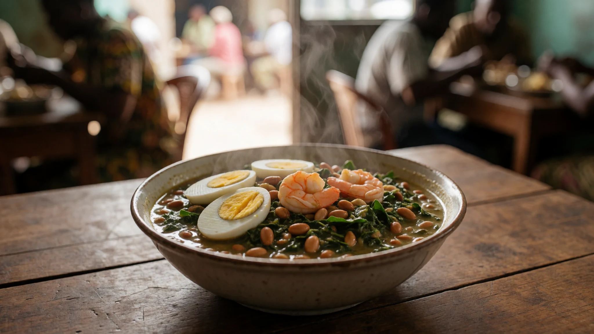
- Eru — Buea central market stalls
A traditional vegetable dish made from finely shredded wild forest leaves cooked down with palm oil, crayfish, and smoked meat or fish, often served alongside a stretchy accompaniment of pounded cassava or water fufu. Look for it in bustling market stalls.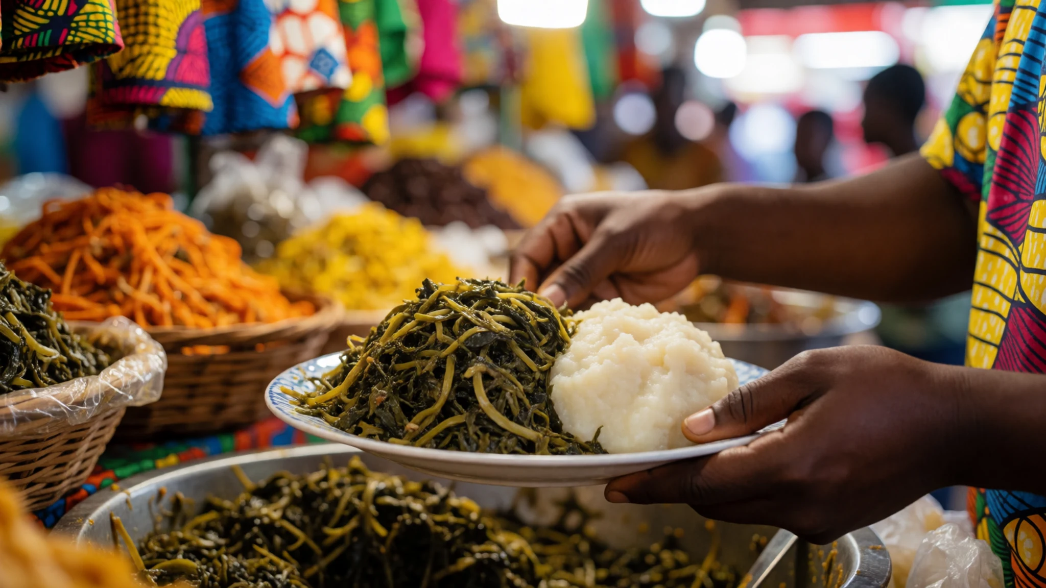
- Roasted Plantains and Fish — Roadside food stalls across Buea
Ripe or semi-ripe plantains roasted over open coals until sweet and tender, served alongside freshly grilled fish rubbed in local spices and pepper sauce. Enjoy this popular evening street food at roadside stalls throughout the town. - Koki — Morning markets and local canteens
A savoury steamed cake made from blended black-eyed beans mixed with red palm oil, chilli peppers, and spices, wrapped securely in banana leaves before cooking. Discover this comforting delicacy at local morning markets and family-run canteens.
Plan it
Best time. December to February offers the driest conditions and clearest skies for climbing, whereas June to September brings heavy tropical rains and slick trails.
How long. 3–4
Getting there. Fly into the international airport in Douala, then take a road journey of about 70 km along sealed roads northwest to Buea.
Budget. mid
Tips
- Hire an experienced local guide through official park authorities before attempting the ascent
- Break in your hiking boots thoroughly prior to arrival to handle the jagged volcanic terrain
- Pack layers for dramatic temperature drops between the humid forest and windy summit
- Carry sufficient cash for local purchases, park fees, and guide wages
- Start early in the morning to catch clear views before cloud cover builds up
Etiquette
- Always request permission before photographing local residents or traditional ceremonies
- Greet elders and community members respectfully when entering villages around the base
Nearby
Sources
- Wikidata Q190562 (CC0)
- Wikipedia (CC BY-SA 4.0)
- Wikivoyage (CC BY-SA 4.0)
- Photo 01 (CC BY-SA 4.0)
- Photo 02 (CC BY-SA 4.0)
- Photo 03 (CC BY-SA 4.0)


