Lake St Clair
Lake St Clair, Australia
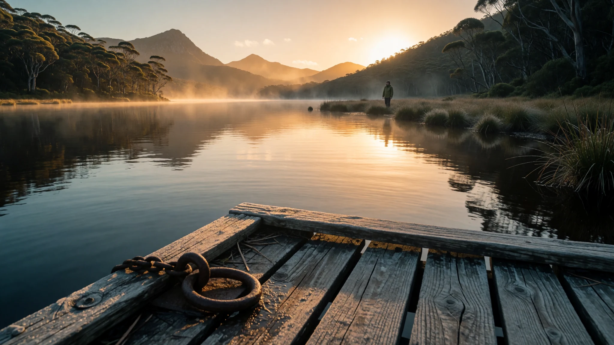
Lake St Clair offers raw wilderness at the foot of ancient Tasmanian peaks, combining deep glacial waters with challenging mountain walking trails.
The place
Lake St Clair stands as a magnificent natural freshwater basin situated within the rugged Central Highlands of Tasmania, Australia. Occupying the southern boundary of the dramatic Cradle Mountain-Lake St Clair National Park, the catchment spans extensive forests and glacial valleys shaped by ancient ice movements. Fed by several waterways including the Narcissus River, Cuvier River, and Hamilton Creek, the expanse ultimately gives birth to the significant River Derwent flowing toward the south. The surrounding territory is divided across multiple regional municipal boundaries, anchoring a remote landscape far removed from urban sprawl. Glacial erosion carved the basin deeply over millennia, producing dramatic underwater contours and steep shorelines flanked by dense native eucalyptus and temperate rainforest. Visitors arriving at the southern shore encounter a changing atmosphere dictated by shifting weather systems coming off the Southern Ocean, where calm morning mirrors can rapidly transform into windswept chop. The locality serves as both a secluded sanctuary for wilderness seekers and a crucial junction for endurance hikers completing legendary regional tracks through the heart of the island's high country.
Its story
Lake St Clair carries a deep heritage tied to the Big River Tasmanian Aboriginal nation, whose people hunted across the nearby button grass plains for millennia. Archaeological sites in the surrounding terrain confirm human presence stretching back thousands of years before European exploration reached the island's interior. European documentation began when surveyors mapped the rugged interior during the nineteenth century, paving the way for early tracks cut through dense forest to connect remote harbours and mining districts. During subsequent decades, the wider district attracted fur trappers and wilderness hunters who operated across the high country until regulations eventually transformed the region into a protected reserve. Mid-century engineering brought permanent changes when authorities dammed the infant River Derwent just below the outlet, installing a historic pumping station that allowed water levels to be manipulated for regional hydroelectric generation. This industrial intervention introduced fluctuating waterlines that continue to shape the shoreline ecology. Today, the heritage of the basin reflects a complex interplay between ancient Indigenous custodianship, pioneering exploration, resource extraction, and modern conservation efforts aimed at preserving one of the island's most dramatic natural treasures.
What to see
- Echo Point — Eastern shore of Lake St Clair
Echo Point sits on the eastern shore of Lake St Clair, providing a quiet campsite and a magnificent vantage point for watching the early morning mist roll across the dark water. Hikers finishing the famous multi-day Overland Track stop here for their final night before catching the ferry back down the lake.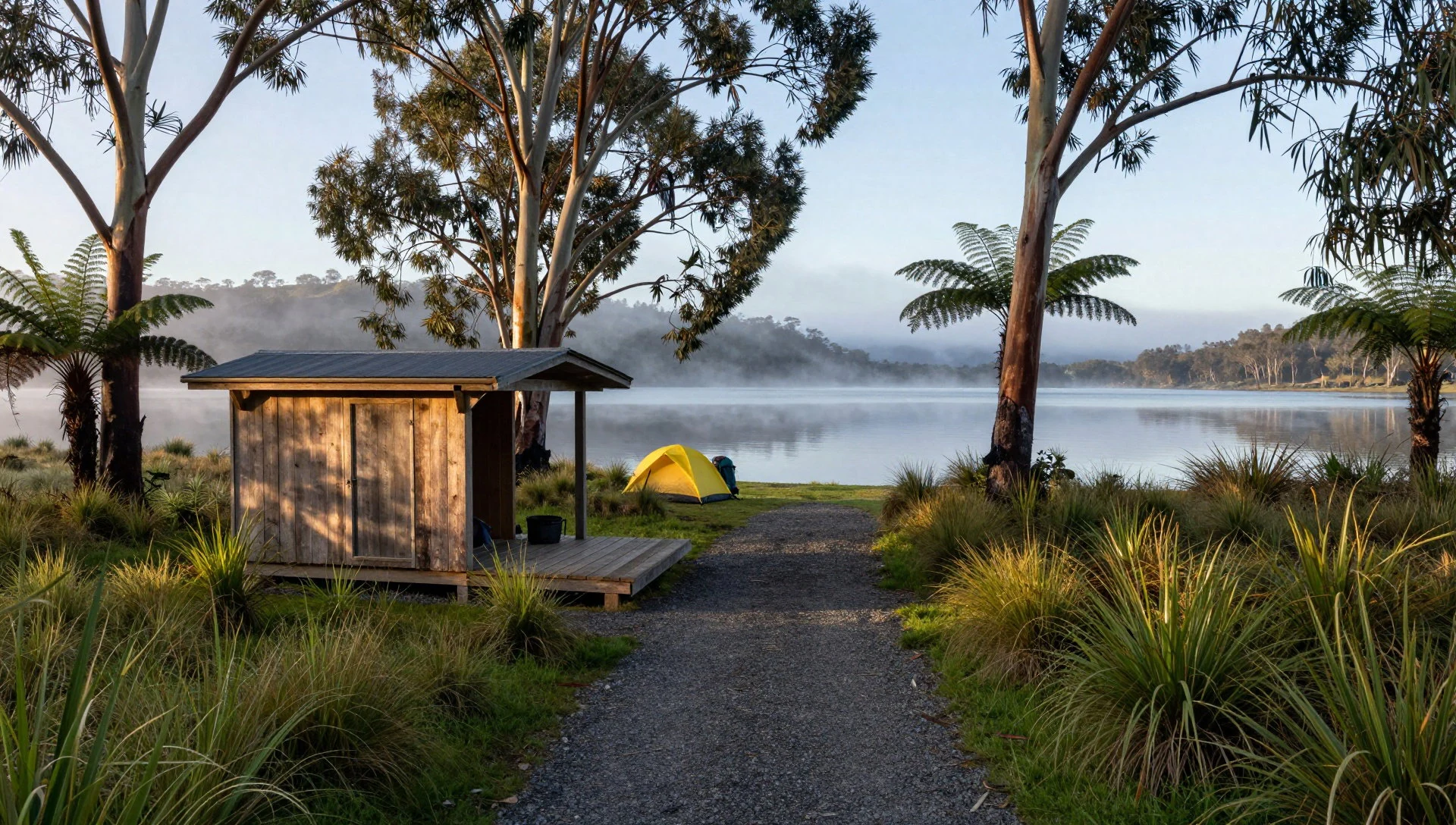
- Pumphouse Point — Southern end of Lake St Clair
Pumphouse Point is a striking industrial heritage building converted into unique accommodation, perched out over the middle of Lake St Clair at the end of a long concrete causeway. Originally built as part of the regional hydro-electric scheme, it now offers dramatic panoramic views through the mist.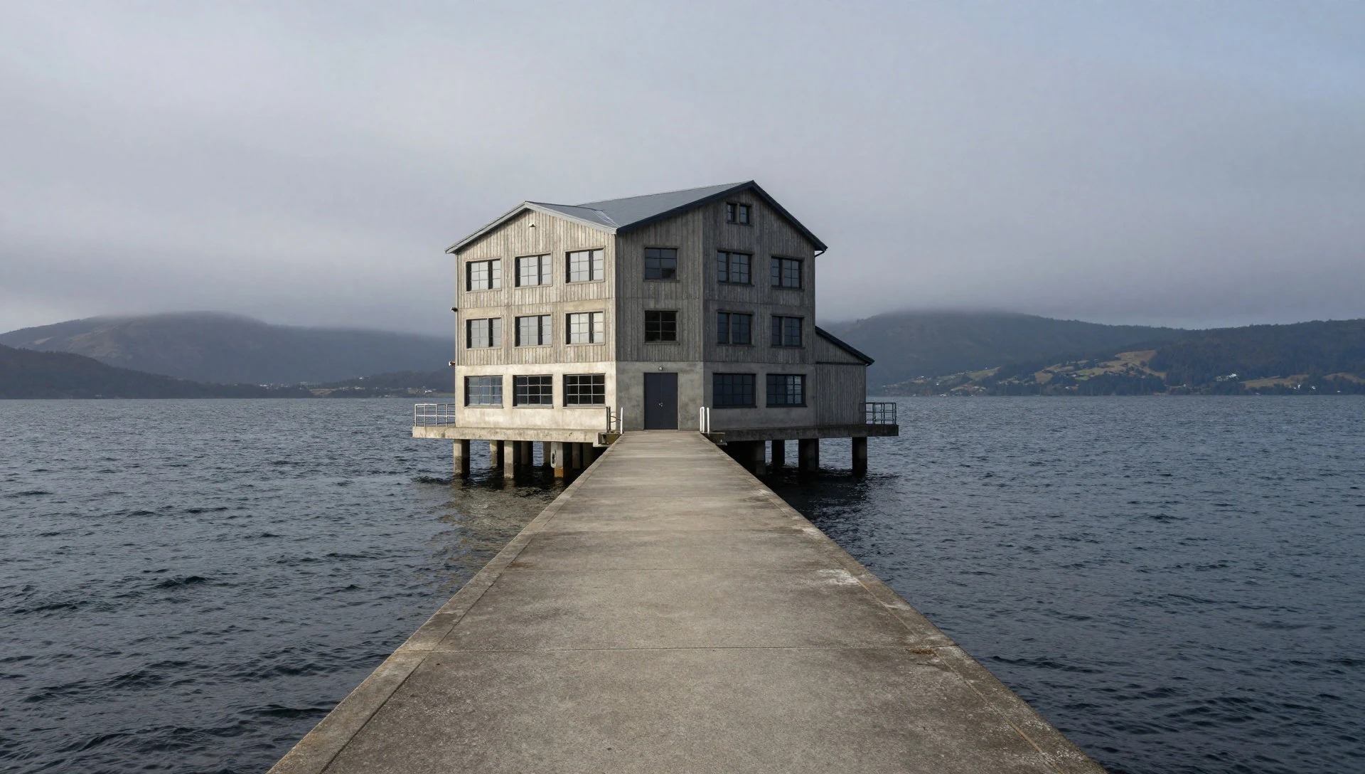
- Narcissus River Inlet — Northern end of Lake St Clair
The Narcissus River Inlet marks the northern gateway where wilderness rivers empty into the upper basin of Lake St Clair. This marshy, forested delta acts as a vital wildlife corridor and serves as the primary meeting point for long-distance trekkers waiting to board the seasonal wilderness ferry.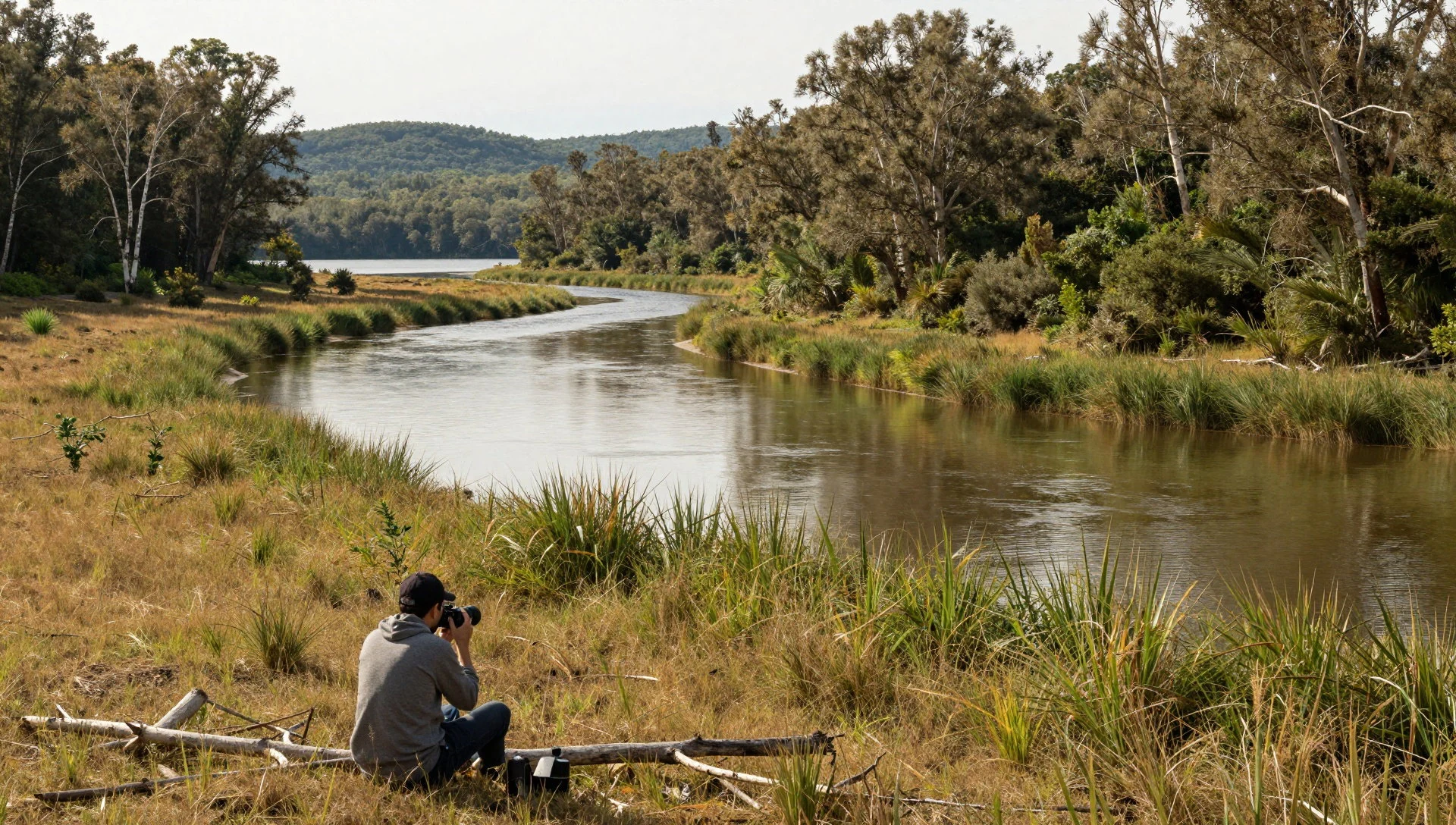
- Mount Olympus — Western side of Lake St Clair
Mount Olympus looms steeply above the western shore of Lake St Clair, presenting a formidable wall of dolerite columns and rugged scree slopes. Experienced climbers tackle its challenging ridges for sweeping aerial vistas across the entire glacial valley and surrounding highland wilderness.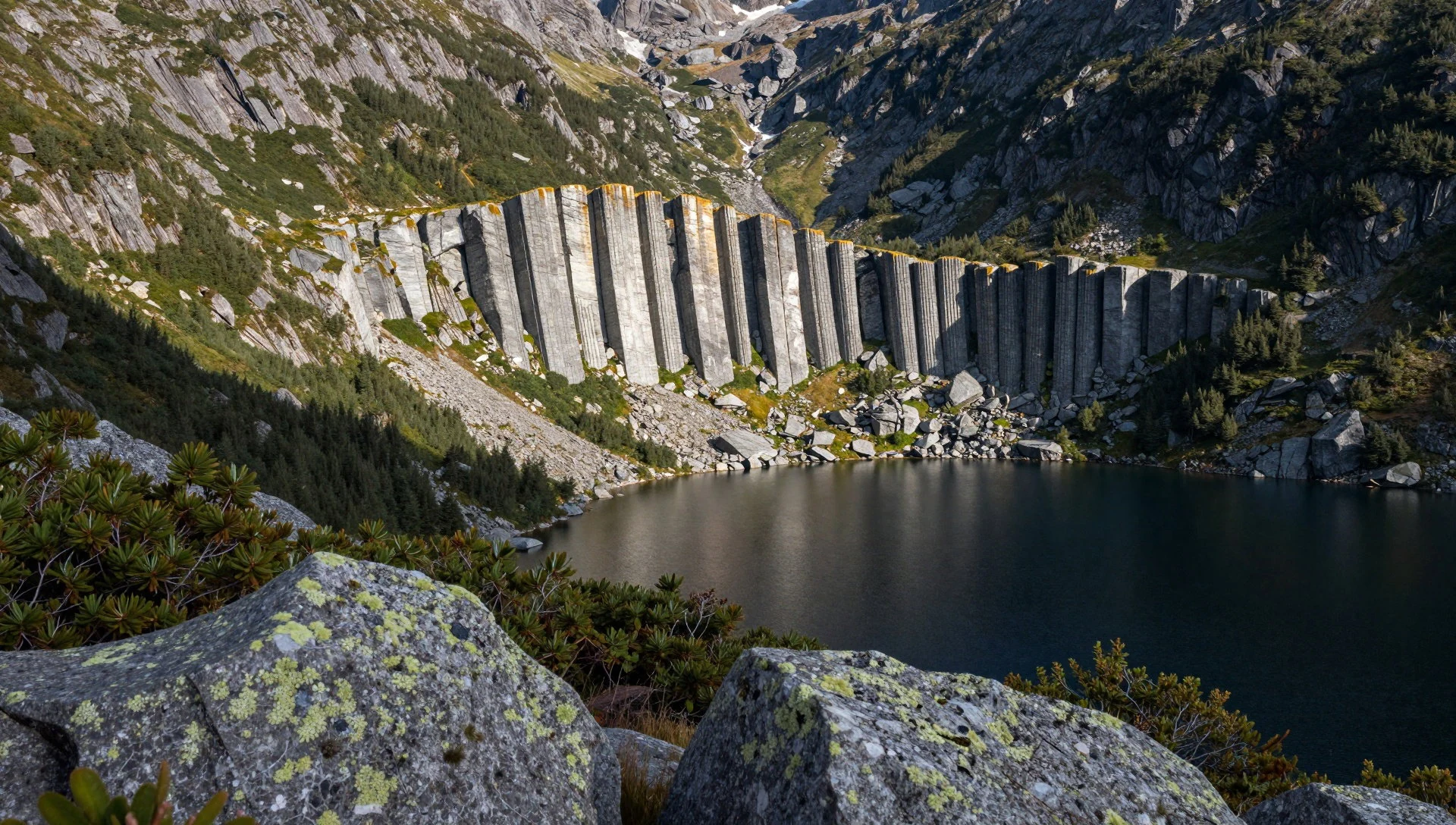
- Watersmeet Nature Trail — Southern visitor precinct
The Watersmeet Nature Trail offers an accessible walking circuit near the southern visitor centre of Lake St Clair, winding through cool temperate rainforest alongside rushing mountain streams. Interpretive signs along the mossy path highlight the unique flora, towering eucalyptus trees, and native fungi found throughout the reserve.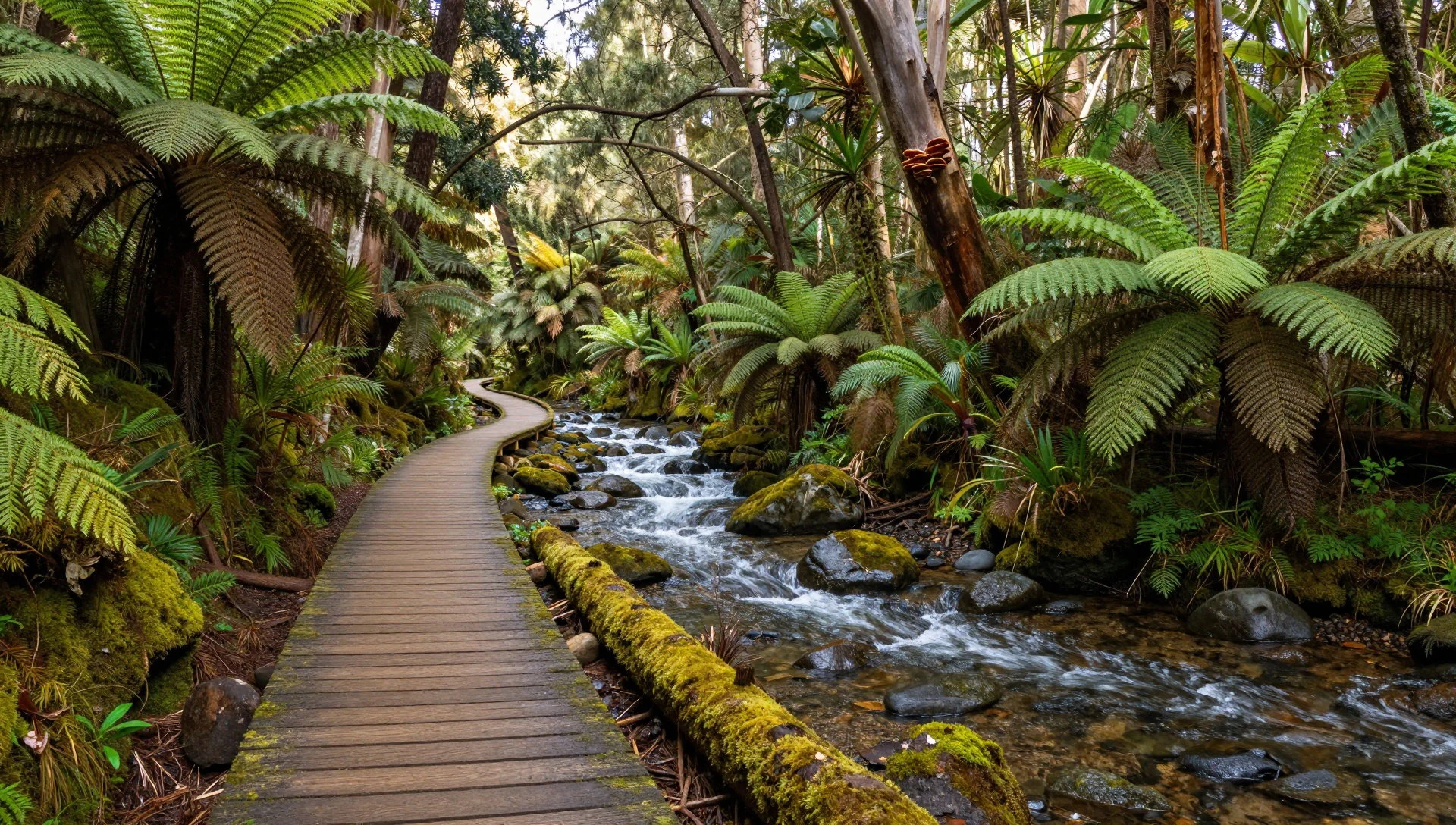
Culture
Locals across Lake St Clair and the wider Tasmanian region are famously laid-back, welcoming, and remarkably generous with practical advice when visitors require assistance in the bush. The community shares a distinct island identity rooted in rural resourcefulness and a deep appreciation for the surrounding natural environment. When engaging with residents, travellers will find open conversations about local history and maritime heritage, though certain tragic modern events like the Port Arthur tragedy remain sensitive and should be avoided in casual talk. Traditional custodianship by Aboriginal communities is acknowledged throughout the parks, and visitors are encouraged to respect sacred sites and ancient camp remnants scattered across the highland plains. Always clean your boots and camping gear thoroughly at designated wash stations before entering Lake St Clair National Park to prevent the spread of invasive plant pathogens and root rot fungi.
What to wear
Lake St Clair requires practical outdoor apparel rather than traditional costume, given the unpredictable and rapidly changing alpine weather conditions. Modern Tasmanians working and travelling around the region rely heavily on layered alpine gear, waterproof shells, and sturdy broken-in hiking boots capable of handling muddy tracks and rocky terrain. Visitors exploring Lake St Clair should pack durable woollen garments or high-performance synthetics, waterproof windbreakers, thermal base layers, and solid gaiters regardless of the season. Even during warmer summer months, cold fronts can sweep up from the Southern Ocean dropping temperatures drastically within hours, making fleece jackets and beanies essential items in any backpack. Cotton clothing should be avoided because it retains moisture and increases the risk of hypothermia when wet winds buffet the exposed lake shores.
What to eat
- Curried Scallop Pies — Local bakeries and roadside cafes across Tasmania
Curried scallop pies are a famous Tasmanian culinary tradition featuring tender seafood packed into a flaky pastry shell with a mildly spiced, creamy curry sauce, widely available at bakeries and roadside stops across the island.
- King Island Cheeses — Regional gourmet delis and farm gate shops
King Island cheeses represent some of Australia's finest gourmet dairy produce, crafted in the Bass Strait using rich local milk to create award-winning bries, cheddars, and blues found in regional delicatessens.
- Cascade and Boag's Beers — Traditional pubs and bottle shops statewide
Cascade and Boag's beers are the historic brews of Tasmania, produced by the country's oldest operating breweries using pure mountain water and locally malted barley to create crisp lagers and dark ales. - Cool-Climate Wines — Cellar doors and regional wine bars
Cool-climate wines from Tasmanian vineyards showcase exceptional crisp Chardonnays and elegant Pinot Noirs nurtured by long, sunny autumn days and cool island breezes. - Tasmanian Atlantic Salmon — Seafood eateries and harbourside restaurants
Tasmanian Atlantic salmon is celebrated for its rich flavour and firm texture, harvested from pristine southern marine lease sites and served fresh at dedicated seafood restaurants.
Plan it
Best time. December to March offers the most reliable weather, longer daylight hours, and milder temperatures for hiking, though sudden cold fronts can occur at any time of year.
How long. 2–3
Getting there. Fly into Hobart Airport, hire a vehicle, and drive northwest via the Lyell Highway toward the Central Highlands, taking roughly two and a half hours.
Budget. mid
Tips
- Check weather warnings with park rangers before setting out on overnight walks
- Book accommodation and ferry transfers well in advance during peak summer months
- Carry cash for remote park honesty boxes and minor rural outposts
- Pack comprehensive wet-weather gear regardless of the morning forecast
- Respect all fire ban regulations during dry summer periods
Etiquette
- Clean all footwear and equipment at wash stations to protect native flora
- Take all rubbish with you and leave no trace in the wilderness
- Keep a respectful distance from all native wildlife and never feed them
Nearby
Sources
- Wikidata Q1199171 (CC0)
- Wikipedia (rev 1366517049) (CC BY-SA 4.0)
- Wikivoyage (rev 5358751) (CC BY-SA 4.0)