Ingapirca
Ingapirca, Ecuador
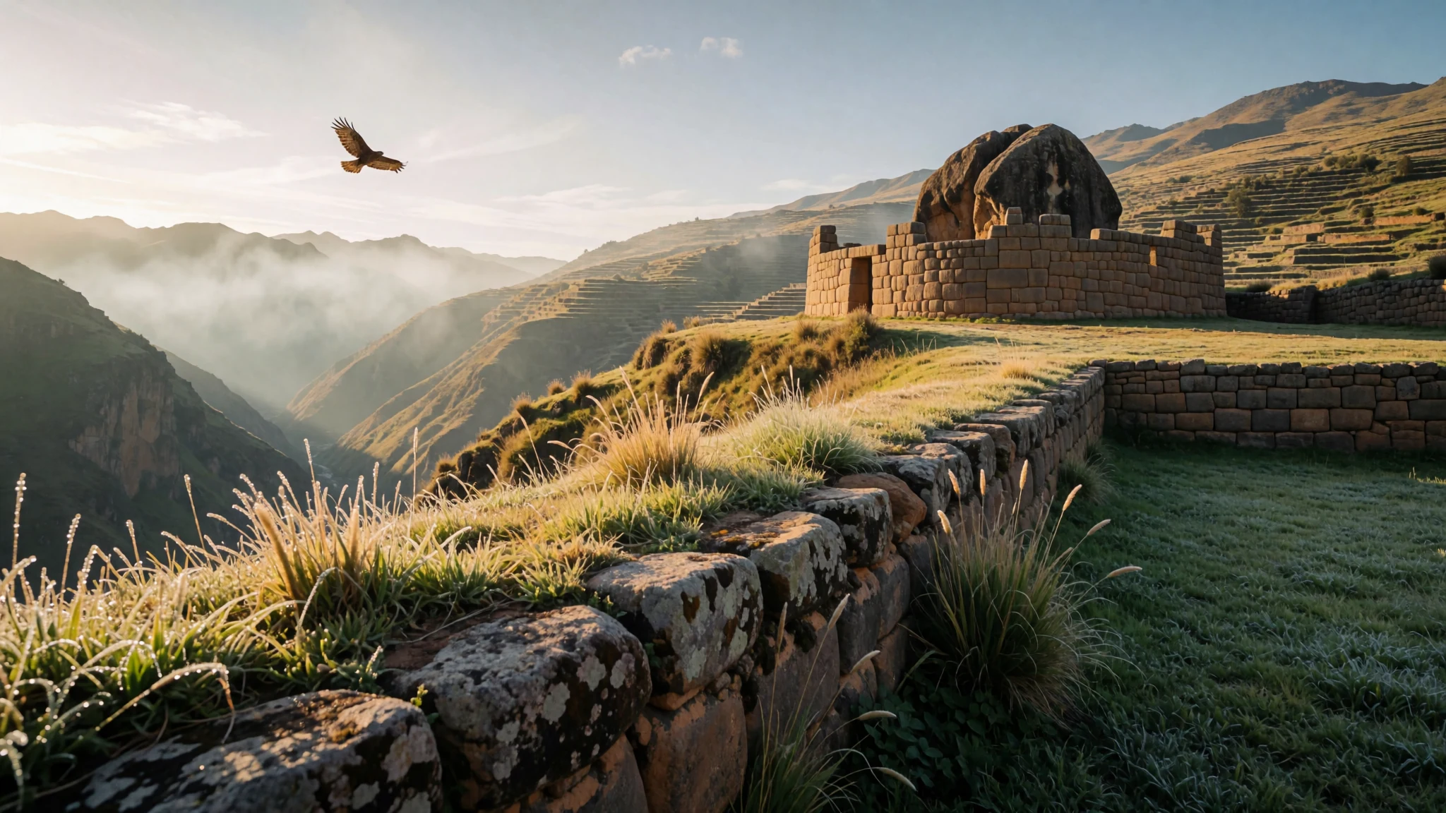
Ingapirca is where Cañari and Inca worlds overlap in stone, with the Temple of the Sun still holding its shape.
The place
Ingapirca (Inga Pirca; Kichwa: Inka Pirka, “Inca wall”) sits in Ecuador’s Cañar Province as both a small town and the best-known name for the older Inca ruins nearby. It’s the kind of place you don’t “pass through” — you slow down, because the setting matters as much as the archaeology.
The main draw is the surviving stone core of a Cañari-Inca complex. The structures are notable for how the stone was shaped and fitted, and for how the site reads as more than one period: older Cañari foundations, Inca planning, and later layers of interpretation. The Temple of the Sun is the standout feature, its elliptical form built around a large rock and left as partial ruins that still feel intentional rather than accidental.
At ground level, you get a sense of why people cared about this spot. The layout and building choices point to community life: defence or storage in one area, water management beneath the surface, and a monumental religious focus up top. The approach routes (and the surrounding valleys) give you that Andean “wide sky” feeling, but the closer you get, the more the ruins become the star.
Altitude is part of the experience here: Ingapirca sits at 3,123 m, so plan for slower steps and a bit less rushing. Weather can shift quickly in the highlands, so bring layers even when the day starts bright.
Its story
Ingapirca’s story starts long before the Inca arrive. The area was home to the Cañari, known locally as Hatun Cañar. As the Inca expanded south into what is now southern Ecuador, they encountered resistance — not just a battlefield problem, but a political one.
Accounts describe Inca Túpac Yupanqui facing difficulties conquering the Cañari. The strategy that followed is often told as a mix of alliances and reshaping: marriage into Cañari leadership and improvements to the Cañari city of Guapondelig, later associated with Tumebamba or Pumapungo (linked with today’s Cuenca). Over time, the Inca and Cañari are described as settling differences and living together, with cultural practices continuing side by side rather than one side fully replacing the other.
Under Inca Huayna Capac, an astronomical observatory is linked with the site, suggesting that the complex was not only about control and storage but also about tracking the sky and organising the community’s rhythm. The Inca name Ingapirca is tied to this period, with the complex evolving into a castle-like system whose purpose is still debated. What feels clear is function: a fortress and storehouse idea for resupplying Inca troops moving north.
The stones themselves carry the craftsmanship. The Temple of the Sun is described as built in the Inca way, without mortar, with carefully chiseled blocks fitted together. Beneath the compound, water planning shows up too: an underground aqueduct system developed to carry water to the wider area. In other words, Ingapirca isn’t just a “temple visit” — it’s an example of how engineering, politics, and belief were stitched into one physical place.
What to see
- Temple of the Sun
Ingapirca’s key monument, the Temple of the Sun, is preserved as partial ruins. It’s an elliptically shaped building built around a large rock, with stonework that relies on tight fitting rather than mortar. Photo it from different angles; the proportions stay readable even in broken sections. - Cañari–Inca stone complex
Ingapirca’s castle-like complex comes from Cañari-Inca origin, and its exact role isn’t pinned down. You can still trace how it functioned as a fortress and storehouse, a built-up base that helped manage people and provisions within the wider Inca system. - Underground aqueduct system
Ingapirca isn’t only about visible walls. The site is also associated with a complex underground aqueduct system developed to provide water across the compound. It’s the kind of detail that makes you look for clues in the ground plan, even if the water channels aren’t fully on display. - Ruins and viewpoints over the ravine
Ingapirca sits amid highland valleys, so the walk isn’t flat: it rises and dips with the terrain. Along the compound edges you get valley views and a sense of how the ravine and routes would shape movement, with the stonework set against a big Andean sky. - Local approach and map orientation
Before you get deep into the ruins, use the on-site mapping to understand where the major buildings sit and how the site’s spaces relate. Ingapirca can feel like a maze if you enter without a plan; orientation turns the stones into a readable layout rather than scattered remnants.
Culture
Ingapirca is an archaeological visit in Ecuador, so you’re sharing space with both local communities and other travellers — and the etiquette is mostly about respect and calm. Ecuadorian everyday greetings are often “buenos días”, “buenas tardes” or “buenas noches”, and people commonly add a handshake; you’ll also notice cheek-kissing in some situations, depending on relationship and familiarity. With friends and acquaintances, “hola” is very common.
If you speak Spanish, a practical detail is the pronoun choice: “tú” is informal, while “usted” is formal. It’s customary to use “usted” with older people and with people you don’t know well.
Within the site, the main “rules” are about not treating ruins as play areas. Keep your voice low, follow marked paths where present, and avoid climbing on stones that look fragile or ceremonial. In highland weather, it’s also sensible to check your footing — loose rocks and sudden drizzle happen — and to give yourself time to breathe at altitude.
Visitor etiquette: keep to pathways, speak softly around the ruins, and avoid climbing or touching delicate stonework.
What to wear
For Ingapirca, dressing for altitude and shifting highland weather matters more than style. Ecuador’s coast can feel tropical, but inland high elevations like Ingapirca are cooler, and that temperature swing is noticeable once you’re up on site.
Traditional dress across Ecuador varies by region, but in everyday highland towns you’ll most often see modern clothes with some traditional influence. When traditional outfits are worn, they typically reflect Spanish-heritage and Amerindian influences, and you’ll see structured garments and woven textiles suited to cooler temperatures. Look for layers that can handle wind and sun: woven shawls, long skirts or trousers, and practical footwear.
What you’ll usually see now is a mix: jeans, trainers, fleece layers, and light jackets during the day, with warmer layers for mornings and evenings. For visiting ruins, aim for comfortable trousers or skirts that won’t restrict movement, plus a warm layer. Wear closed-toe walking shoes with grip — the terrain and stone edges are not ideal for thin soles. Bring a hat and sunscreen for sun breaks, and a light rain layer for sudden Andean showers. If a site area feels sacred or restricted, choose modest coverage and keep any bags secured so you’re not brushing stone as you pass.
What to eat
- Potatoes with lunch and dinner — Family eateries and lunch spots in highland towns
In Ecuador’s Sierra, potatoes often show up alongside the main meal at lunch and dinner. It’s simple, filling food that matches the cooler highland temperatures — great when you’re dealing with altitude and need steady energy. - Soups at lunch and dinner — Cooked-food counters and local restaurants
Soup is a common part of lunch and dinner in Ecuador, especially in colder inland areas. Expect it to be warming and hearty, often acting as the first course before rice, potatoes, or other staples. - Breakfast toast, eggs and juice or fruit — Morning cafes and small eateries
In many Ecuadorian breakfasts you’ll find toast with eggs, plus juice or fruit. It’s an easy start before heading out, and it’s handy when you want something familiar but still local to the routine. - Batidos (fruit shakes) — Street stalls and market-side drink stands
Batidos — fruit shakes — are popular as breakfast items or snacks. You’ll often see them sold in casual settings, and they’re a quick way to get something sweet and refreshing between walks, especially after a chilly morning. - Empanadas and other stuffed bites — Markets and bakery-style stalls
Ecuadorian coast breakfasts often include stuffed bites such as empanadas. These are typically made with fillings that can include cheese, pork or fish, making them satisfying if you want a portable snack. - Plantain and yuca breakfast meals (coast-style) — Coastal breakfast spots and market cafes
On the coast, breakfast spreads can feature green or sweet plantain and yuca, prepared in various ways. You might see combinations with cheese or savoury fillings, and they’re usually very filling, making them easy to share while travelling.
Plan it
Best time. March–April and October–November for comfortable highland conditions; June is the rainy season and August is often hot and humid.
How long. 3–4
Getting there. Fly into Ecuador’s main airports (for most visitors this means going via a larger city), then continue by road to Cañar Province for the last leg to Ingapirca; check current transport options locally on the ground.
Budget. mid
Tips
- Go earlier in the day to avoid the busiest visitor waves at the main ruins.
- Wear layers and bring a light rain layer, since highland weather can turn quickly.
- Take altitude seriously: move slowly on the first hour so you don’t feel winded.
- Carry cash for small purchases around towns and markets, and keep some smaller notes handy.
Etiquette
- Stick to paths and don’t climb on fragile-looking stones.
- Keep noise down around temple areas and let other visitors look without crowding.
- If you greet locals, match formality by using “usted” with elders or people you don’t know.
Nearby
Sources
- Wikidata Q1478056 (CC0)
- Wikipedia (Ingapirca, rev 1365073903) (CC BY-SA 4.0)
- Wikivoyage (Ecuador, rev 5399135) (CC BY-SA 4.0)
- Photo photos/01-ingapirca-03.jpg (CC BY 3.0)
- Photo photos/02-ecuador-ingapirca-inca-ruins.jpg (CC BY-SA 1.0)
- Photo photos/03-ingapirca-archaeo-01.jpg (CC BY 3.0)
- Photo photos/04-quebrada-de-ingapirca.jpg (CC BY 3.0)
- Photo photos/05-mapa-de-ingapirca.png (CC BY-SA 4.0)
- Photo photos/06-pl-xx-vue-du-palais-et-citadelle-que-les-rois-incas-avoient-.jpg (CC BY 2.5)
- Photo photos/07-avistamiento-del-palacio-de-los-reyes-incas-en-el-corregimie.jpg (Public domain)
- Photo photos/08-plano-a-reo-del-palacio-de-los-reyes-incas-en-el-corregimien.jpg (Public domain)


