Chichén Itzá
Chichén Itzá, Mexico
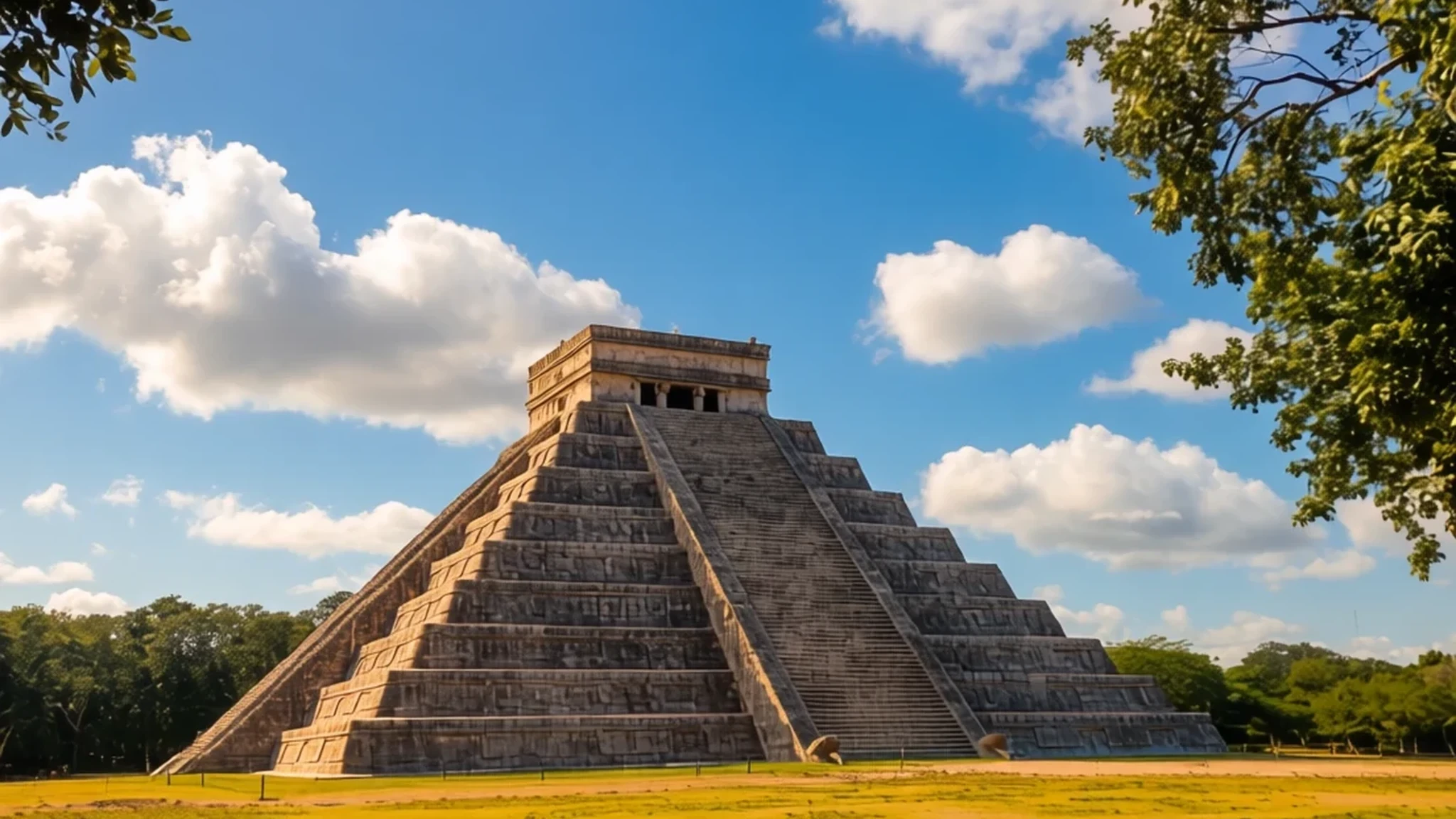
Chichén Itzá stands as an extraordinary pre-Columbian city, uniting diverse Mesoamerican architectural traditions in the northern lowlands.
The place
Chichén Itzá sits within the Yucatán Peninsula of Mexico, occupying a strategic limestone plain between the modern cities of Mérida and Valladolid. As a large pre-Columbian urban centre built by the Maya people, the zone flourished notably through the Terminal Classic period and into the early portion of the Postclassic era. The architecture across the ruins reveals a fascinating convergence of styles, blending traditional regional forms with distinct central Mexican influences that arrived through cultural diffusion and trade networks. Scholars recognise that the settlement accommodated a remarkably diverse population compared with other contemporaneous centres in the region, which likely generated the rich variety of building facades, columned halls and sculptural programmes visible across the cleared plazas. Federal property today, the archaeological zone is carefully preserved and maintained by national authorities under the Instituto Nacional de Antropología e Historia. Visitors walking across the expansive central lawns encounter a landscape where dense green jungle canopy frames immense stone terraces, open ballcourts and towering staircases built by master architects centuries ago. The scale of the layout underscores the historical importance of the settlement as a major capital that once directed political, economic and ideological life throughout the northern lowlands. While modern infrastructure brings countless travellers daily to marvel at the stone monuments, the ancient spatial organisation remains remarkably legible, inviting quiet contemplation beneath the tropical sun.
Its story
The historical trajectory of Chichén Itzá unfolded in distinct phases of construction and political consolidation. The core layout began taking shape during an earlier occupation phase, while the final monumental configuration developed after the turn of the millennium. During the tenth century, the settlement emerged as a dominant regional capital, extending its administrative and economic reach across central Yucatán and along both the eastern and western coasts of the peninsula. Early epigraphic records discovered within the ruins trace a timeline marked by hieroglyphic dates carved into stone lintels and temple interiors. Initial settlement activity was centred near natural water sources, specifically the regional sinkholes that provided vital freshwater across the porous limestone terrain. Local Maya communities established the foundational architecture, while subsequent groups arriving from elsewhere in Mesoamerica gradually integrated into the social fabric. Over generations, these interacting populations fused their cosmological beliefs, artistic traditions and engineering methods. The architectural transitions reflect this dynamic history, shifting from regional styles towards monumental colonnades and serpent iconography. Even after the political primacy of the capital waned, the sacred nature of the site endured in local memory, drawing pilgrims and later foreign explorers who documented the stone structures for the modern world.
What to see
- The Pyramid of Kukulcán — Central Plaza
Often called El Castillo, this magnificent limestone temple-pyramid served as a sacred monument dedicated to the Feathered Serpent deity. The structure demonstrates precise astronomical alignment, casting dramatic serpentine shadows during the equinoxes that continue to draw large gatherings of curious spectators every year.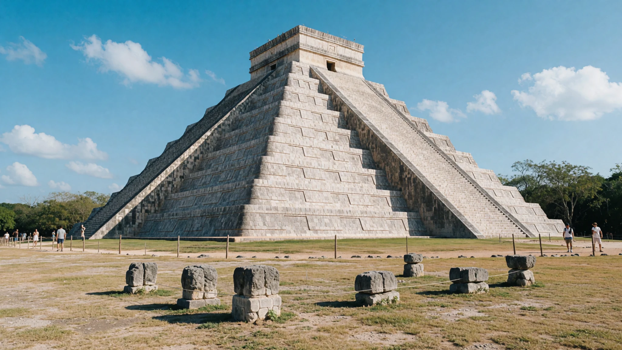
- The Great Ballcourt — Western Sector
Spanning an enormous rectangular field flanked by towering vertical walls with stone rings, this is the largest and most impressive Mesoamerican ballcourt ever discovered. Intricate low-relief carvings along the benches depict scenes of ritual sacrifice and ballgame players in elaborate ceremonial attire.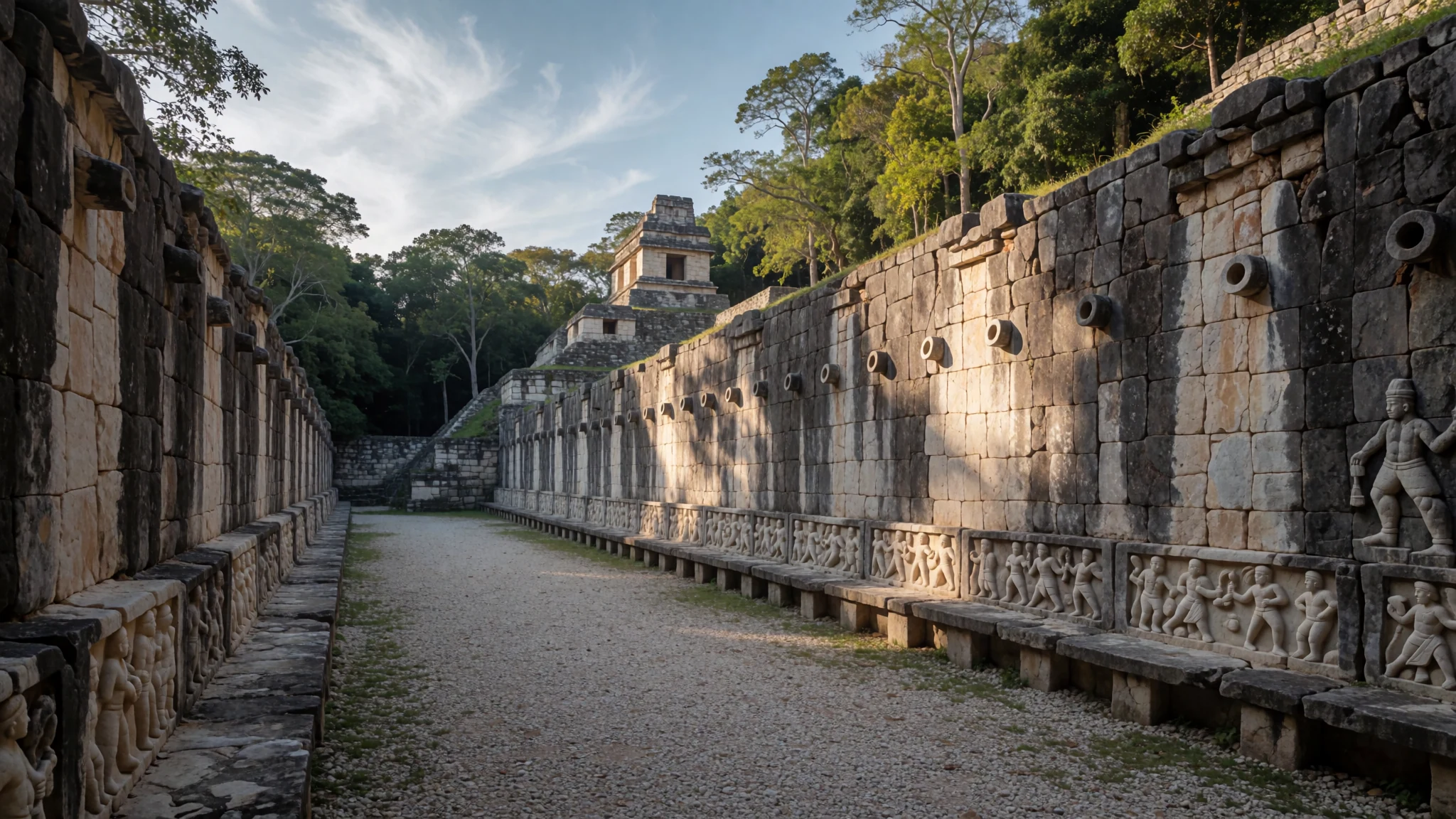
- Group of a Thousand Columns — Eastern Plaza
An extensive colonnaded hall fronting the Temple of the Warriors, featuring hundreds of square and round stone pillars once supporting an elaborate roof system. Each column is meticulously carved with reliefs depicting ancient warriors, rulers and mythical figures standing in formal rows.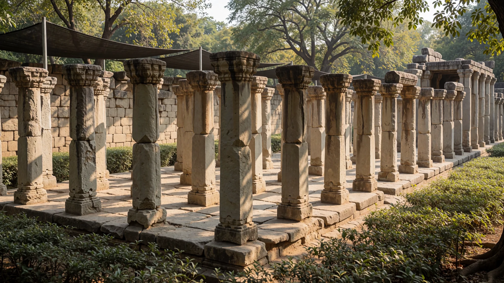
- El Caracol — Southern Zone
This unique circular observatory stands upon a large rectangular platform, earning its local nickname referencing the spiral staircase hidden inside. Ancient astronomers utilised strategic window apertures aligned with celestial bodies to track planetary movements and establish the agricultural calendar.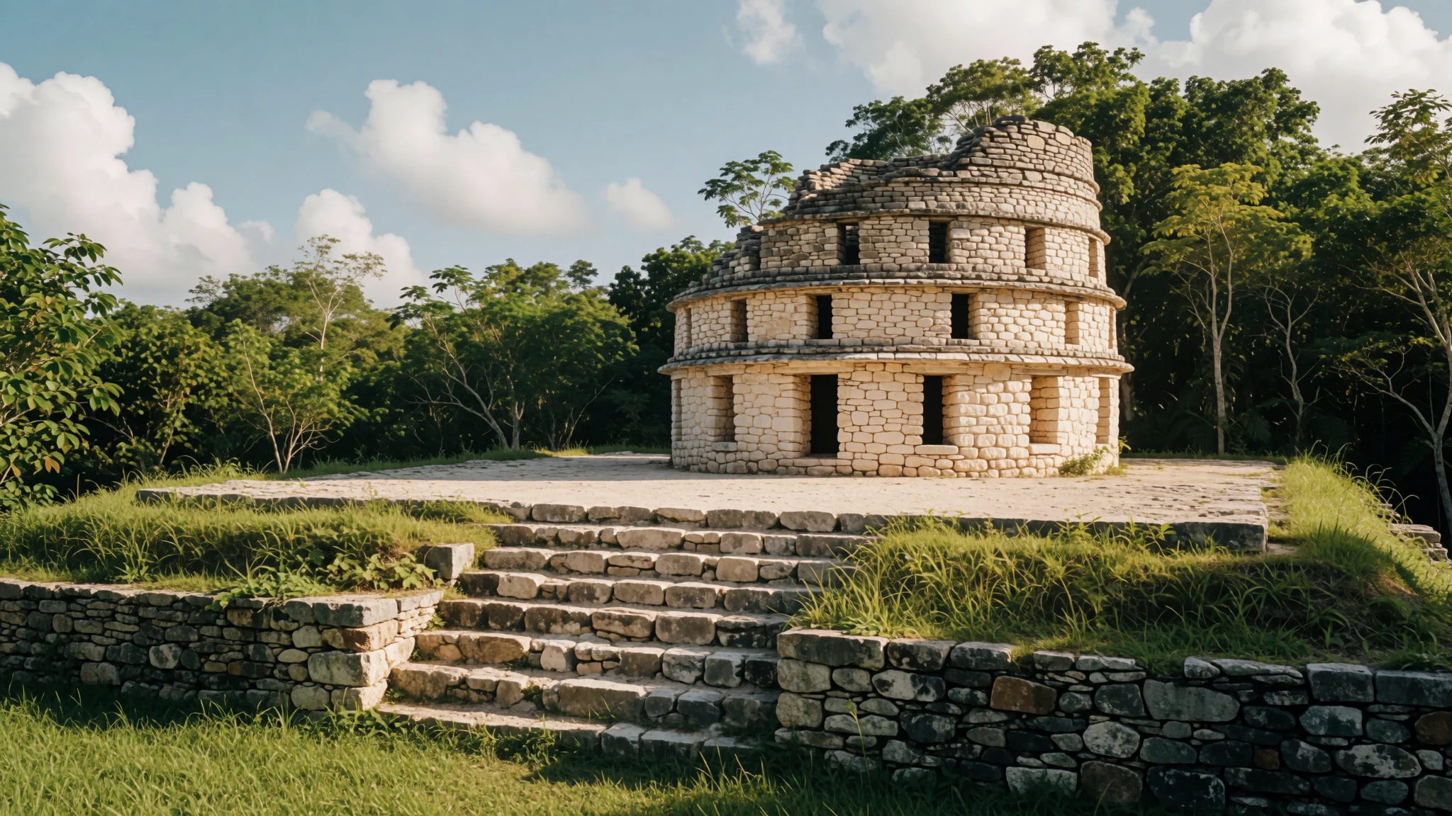
- Temple of the Warriors — Eastern Plaza
A monumental tiered pyramid guarded by a striking Chac Mool sculpture and rows of carved pillar statues representing armed fighters. Although climbing the upper sanctuary is no longer permitted, visitors can admire the detailed bas-reliefs and eagle-and-jaguar friezes from the surrounding stone pathways.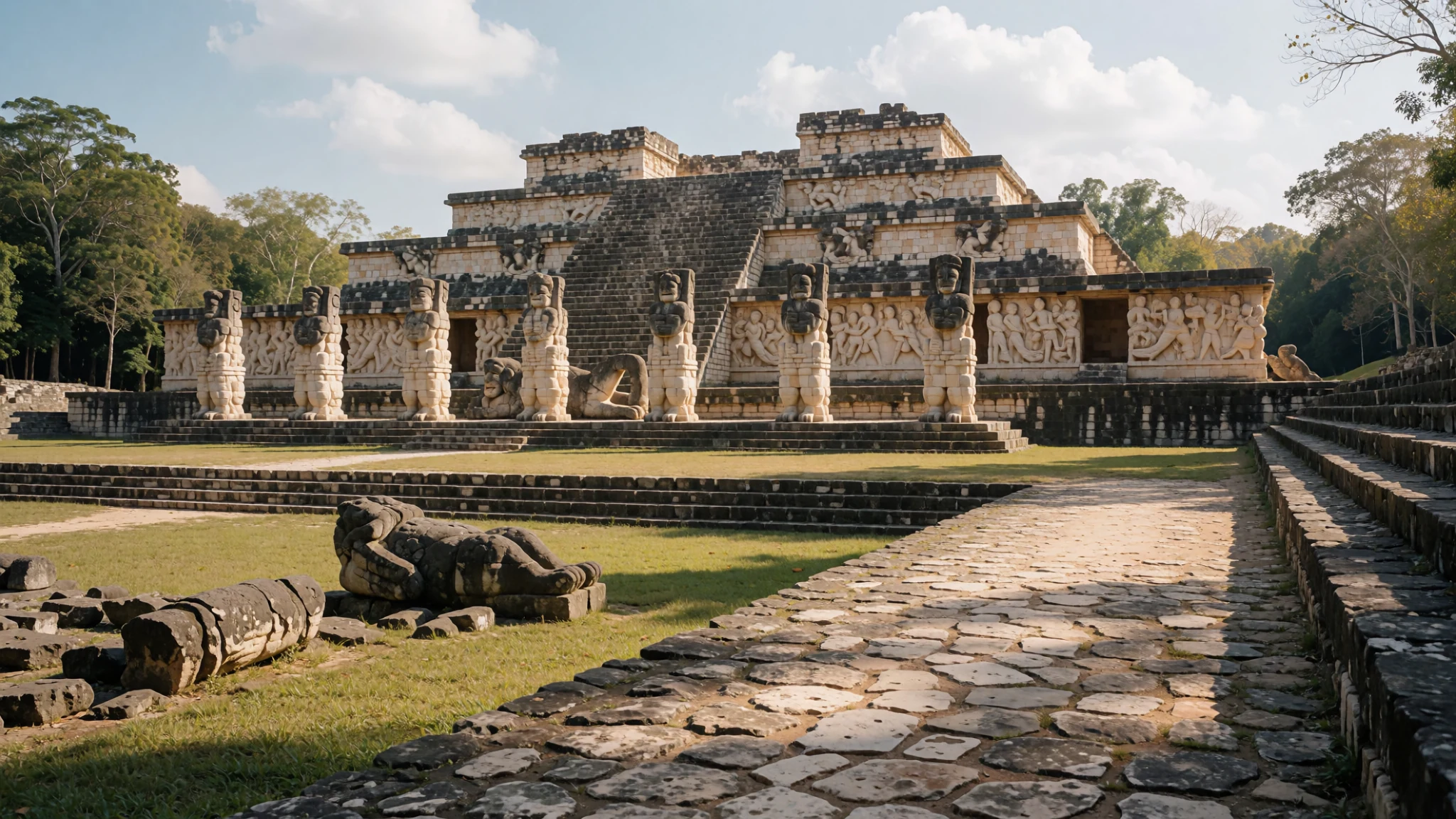
- Cenote of Sacrifice — Northern Path
A deep natural sinkhole connected to the ceremonial core via a wide sacred pathway, historically utilised for high-status offerings and ritual deposits. Divers in past decades recovered precious jade ornaments, gold artefacts and wooden objects thrown into the dark depths by ancient priests.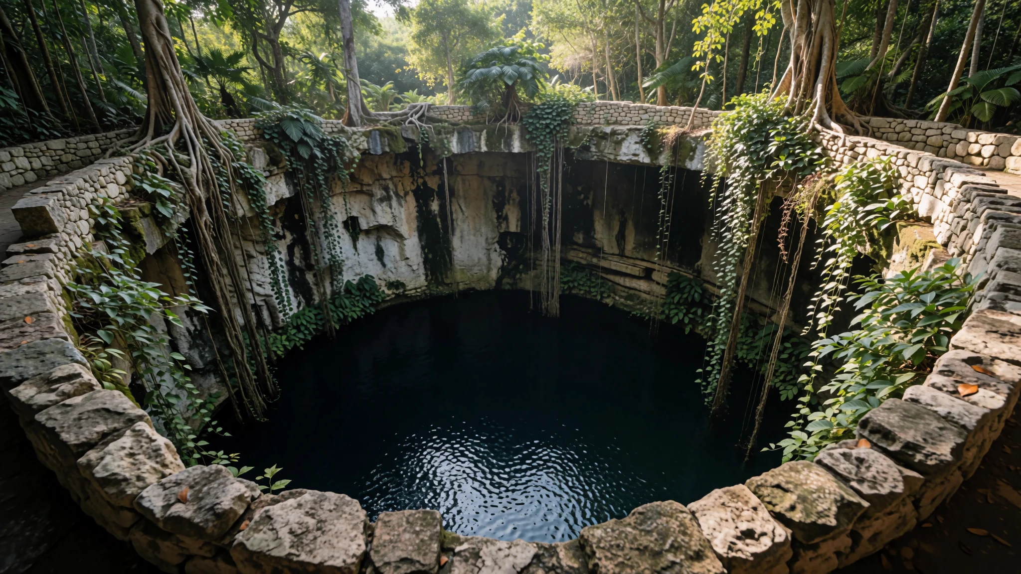
Culture
At Chichén Itzá and the surrounding Yucatán Peninsula, contemporary culture is deeply rooted in a vibrant Maya heritage blended with centuries of Mexican traditions. Local communities maintain ancestral agricultural practices, linguistic traditions, and spiritual connections to the surrounding landscape, including the sacred cenotes that punctuate the limestone bedrock. Traditional festivals and community gatherings frequently incorporate regional music, dance, and culinary arts passed down through generations. Visitors interacting with local artisans and guides will find a warm, welcoming atmosphere, often accompanied by Spanish or Yucatec Maya greetings. When exploring archaeological ruins or rural communities, dressing modestly and treating sacred spaces with quiet respect is greatly appreciated by residents. Always ask permission before photographing local craftspeople or ceremonial practitioners at work.
What to wear
Traditional dress in Chichén Itzá and the wider Yucatán region reflects a rich fusion of indigenous Maya heritage and colonial Spanish influences. Women often wear the huipil, a loose-fitting white cotton tunic featuring vibrant, hand-embroidered floral motifs around the square neckline and hem, traditionally paired with a long underskirt known as a fustán. Men historically wore light cotton trousers and shirts suited for the tropical climate. Today, local residents in nearby towns dress in standard contemporary casual attire, though many older women continue to wear embroidered huipils for daily life and festive occasions. For travellers visiting Chichén Itzá, practical considerations are paramount due to the intense sun and heat. Lightweight, breathable linen or cotton garments in light colours provide the best comfort. Sturdy, closed-toe walking shoes or trainers are essential for navigating uneven stone pathways, loose gravel, and ancient staircases across the expansive archaeological zone. A wide-brimmed hat, sunglasses, and a reusable water bottle complete the standard outfit for a comfortable day exploring the ruins.
What to eat
- Cochinita Pibil — Local eateries in Pisté
Slow-roasted pork marinated in achiote paste, bitter orange juice, and local spices, traditionally wrapped in banana leaves and baked in an underground pit until tender. Find this savoury specialty at local fondas and eateries in nearby Pisté.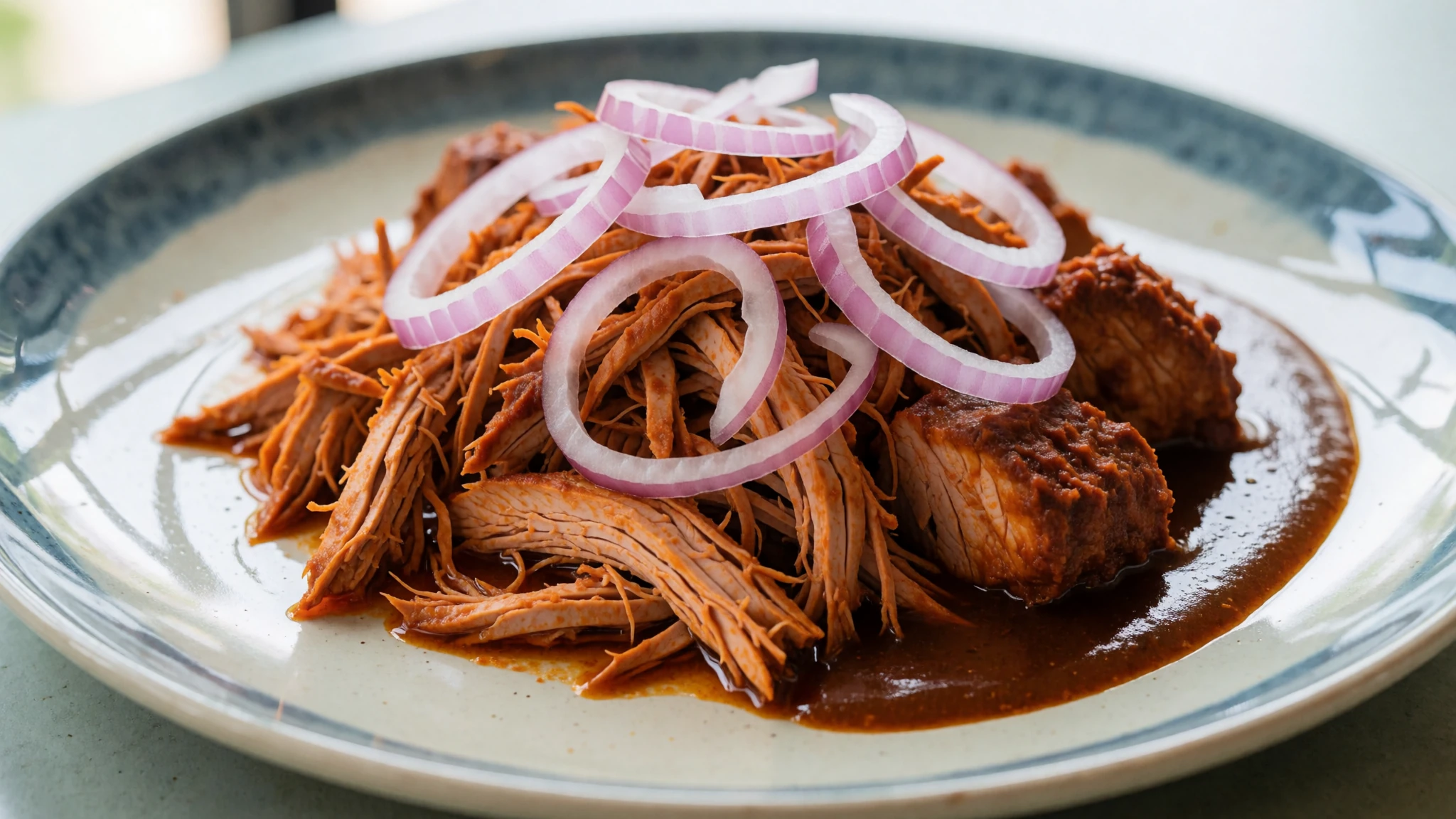
- Papadzules — Regional food markets
Rolled maize tortillas filled with hard-boiled eggs, drenched in a rich, velvety pumpkin seed sauce and drizzled with a mild tomato salsa. This comforting dish is widely served across regional markets and traditional dining rooms.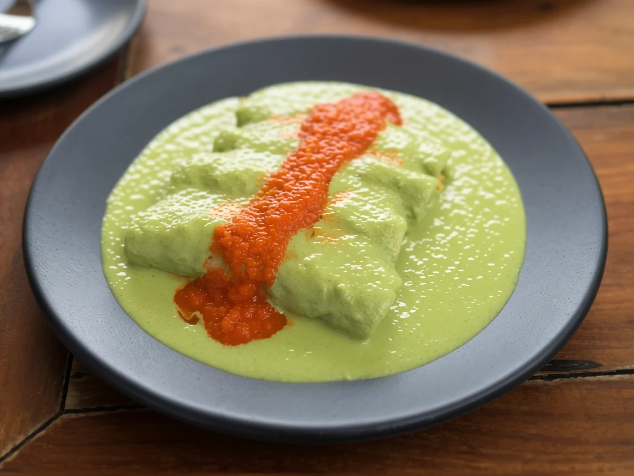
- Sopa de Lima — Roadside family restaurants
A fragrant, comforting chicken soup flavoured with tart local lime juice, shredded poultry, bell peppers, and crispy fried tortilla strips floating on top. Enjoy a warm bowl at roadside family restaurants throughout the Yucatán countryside.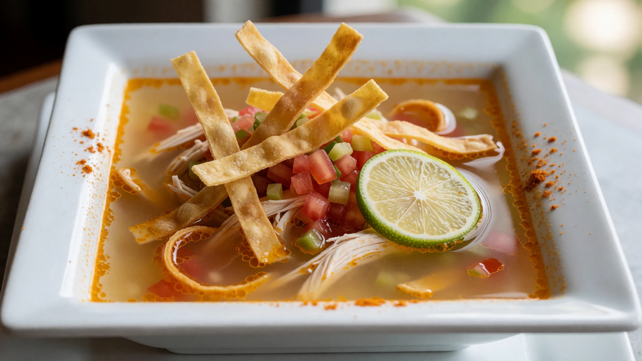
- Salbutes and Panuchos — Evening street food stalls
Lightly fried or puffed maize tortillas topped with shredded turkey or chicken, pickled red onions, avocado slices, and crisp lettuce. These popular antojitos are staples at evening street food stalls and casual neighbourhood eateries. - Agua de Chaya — Refreshment stands near the park entrance
A refreshing traditional drink prepared by blending fresh chaya tree spinach leaves with lime or pineapple juice and cane sugar. Seek out this nutritious beverage at refreshment stands located near the archaeological park entrance.
Plan it
Best time. December to February offers the most comfortable weather with cooler nights and the least rainfall; April and May are the hottest months, while June to October brings the heaviest afternoon rain showers, peaking in September.
How long. 1–2
Getting there. Fly into Cancún or Mérida, then take an ADO coach or hire a car to reach the site via the main highway or intercity rail links.
Budget. mid
Tips
- Arrive right at opening time to beat the heavy crowds and midday heat
- Wear sturdy walking shoes suitable for uneven stone terrain
- Carry bottled water and sun protection, as shade across the open plazas is scarce
- Keep small cash notes handy for local artisan stalls and public buses
Etiquette
- Do not climb onto the protected pyramids and restricted stone structures
- Ask permission before photographing local artisans and vendors
- Respect quiet zones and official barriers maintained by site authorities
Nearby
Sources
- Wikidata Q5859 (CC0)
- Wikipedia (rev 1381289591) (CC BY-SA 4.0)
- Wikivoyage (rev 5409128) (CC BY-SA 4.0)
- Photo 01-chichen-itza-3.jpg (CC BY-SA 4.0)
- Photo 03-chichen-itza-16.jpg (CC BY 3.0)
- Photo 04-chichen-itza-1000-warriors-columns.jpg (CC BY-SA 2.5)
- Photo 05-juego-de-pelota-chichen-itza.jpg (CC BY 3.0)


