Hajar Mountains
Hajar Mountains, Oman
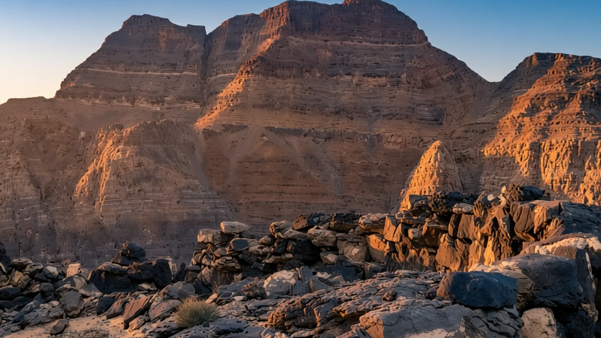
Explore ancient stone settlements, deep dramatic canyons, and towering rocky peaks rising directly from the desert plains.
The place
The Hajar Mountains form a formidable barrier across the eastern corner of the Arabian Peninsula, stretching through both northern Oman and parts of the neighboring United Emirates. Standing tall above the surrounding low coastal plains and baking inland plateaus, this rugged system carves a dramatic divide across the landscape. The range is composed primarily of ancient rock strata and distinct ophiolite sequences that tell a complex geological tale of ancient ocean floors thrust upward over millions of years. Deep winding wadis cut through the limestone and basalt massifs, creating hidden arterial corridors where date palms manage to flourish despite the surrounding arid expanse. Scattered throughout these valleys are traditional farming communities that have relied for centuries on ingenious underground water channels known as falaj networks to capture scarce rainfall and snowmelt from the higher elevations. Traversing the region means navigating steep, winding tarmac roads and gravel tracks that cling to sheer canyon walls, rewarding those who venture away from the coast with cool mountain air and vast panoramic vistas. Weather patterns vary sharply between the scorching lowlands and the cooler heights, where temperatures drop noticeably during winter nights. Travellers find an arresting wilderness where silence prevails, interrupted only by the rustle of wind through narrow gorges and the distant call to prayer echoing from whitewashed village mosques perched precariously on stony ledges.
Its story
For millennia, the stone ridges and hidden basins of these mountains served as crucial sanctuaries and trade routes for nomadic herders and inland settlements. Long before modern highways connected the coast to the interior, mountain dwellers carved out a challenging existence by tending terraces of wheat, fruit trees, and alfalfa watered by the intricate gravity-fed falaj irrigation systems. The archaeological record here stretches back into deep antiquity, marked by mysterious beehive tombs and prehistoric copper-smelting sites that prove this arid cordillera was once an active node in early regional trade networks. Centuries of tribal autonomy shaped the local culture, with historic defensive towers and mud-brick fortresses built upon rocky outcrops to guard water sources and narrow passes against rival factions. During the mid-twentieth century, internal conflicts brought external powers into the valleys, leaving behind weathered historical ruins such as bombed-out mud villages that stand today as quiet reminders of a turbulent past. In recent decades, improved infrastructure has linked these once-isolated hamlets to the national economy, shifting the local way of life from strict subsistence farming toward modern administration, tourism, and conservation. Despite these rapid transformations, the deep historical connection to the land endures in the stone masonry of ancient houses and the collective memory preserved by elders who recall the arduous days before electricity and paved roads transformed travel across the peaks.
What to see
- Al Hoota Cave — Central foothills near Al Hamra
Venture underground into a vast subterranean network stretching for kilometres beneath the rocky terrain. Inside, dramatic chambers display ancient stalactites and stalagmites formed over millennia, alongside a subterranean lake that provides a unique habitat for rare species of blind fish adapted to permanent darkness.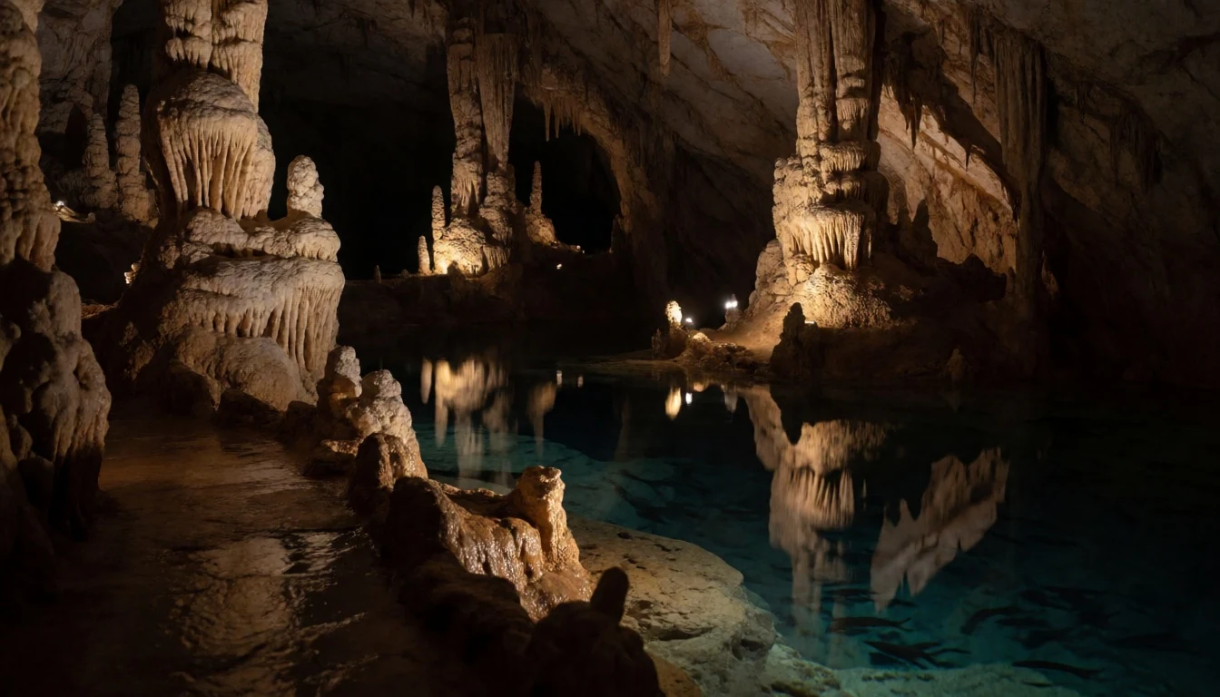
- Misfat al Abriyyin — Mountain slopes near Al Hamra
Wander through a remarkably well-preserved ancient village clinging to a steep mountain slope. Terraced agricultural gardens cascade down the terraces below traditional mud-brick houses, all nourished by an intricate network of historic water channels that continue to function exactly as they did centuries ago.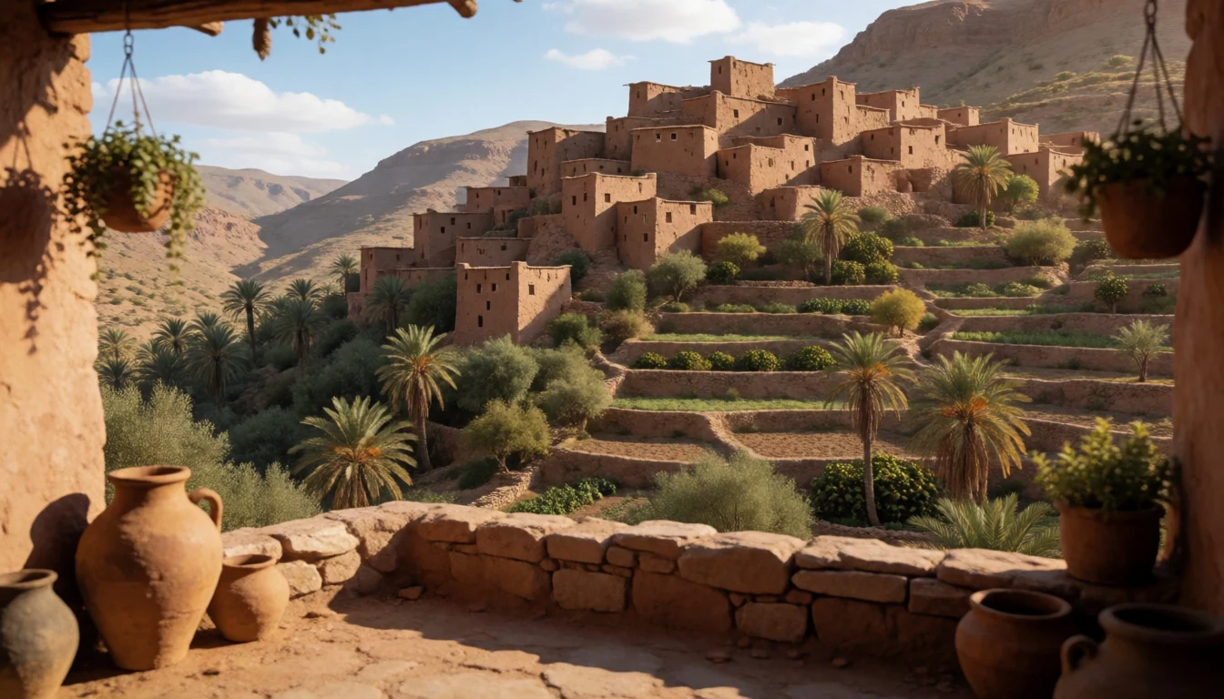
- Nakhal Fort — Northern foothills
Explore a magnificent defensive stronghold dramatically perched upon a jagged rocky outcropping at the northern base of the range. Dating back to pre-Islamic eras and extensively rebuilt in later centuries, the fortress features robust watchtowers, expansive courtyards, and sweeping views over surrounding date plantations.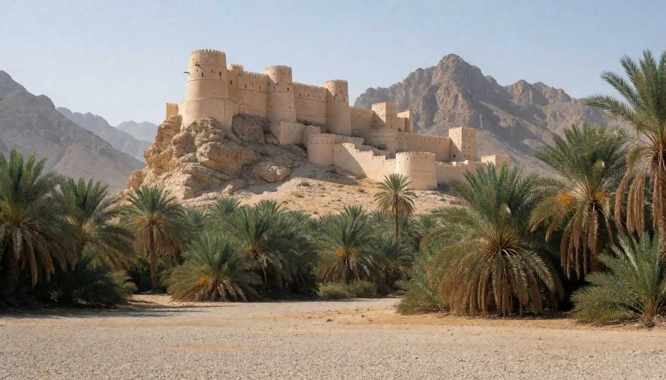
- Beehive Tombs of Al Ayn — Eastern interior plateau
Inspect prehistoric stone burial structures that date from the third millennium BCE, scattered across an arid ridge with the jagged, vertical cliffs of Jebel Misht providing a breathtaking geological backdrop. These unexcavated monuments remain remarkably intact, offering a tangible link to ancient desert civilisations.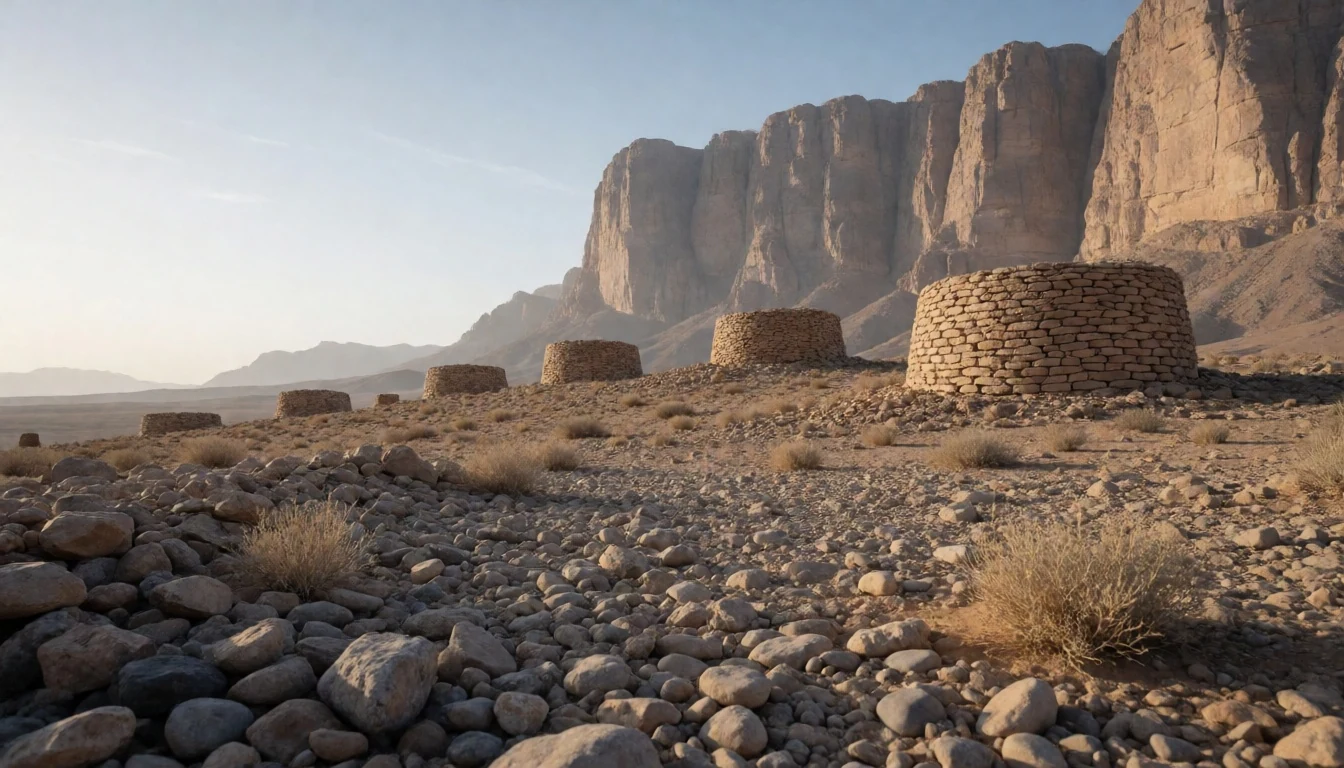
- Wadi Tanuf — Southern mountain foothills
Discover the haunting and highly photogenic ruins of an old village situated right at the mouth of a dramatic canyon. The abandoned stone and mud dwellings bear visible scars from historical conflicts, standing in stark contrast to the surrounding date palms and the rugged stone walls of the gorge.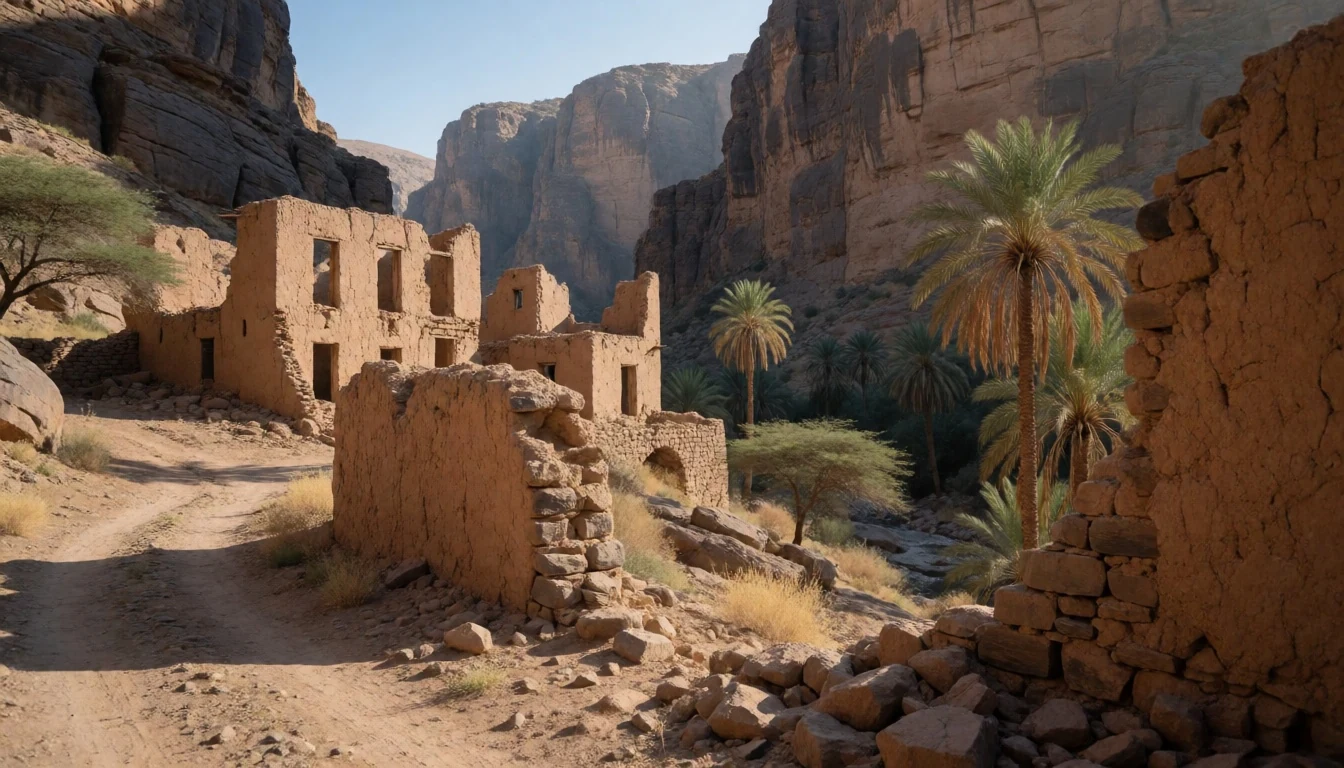
Culture
Life in the mountains revolves around traditional Islamic values, communal hospitality, and a deep respect for the harsh natural environment. Rural communities are closely knit, often structured around extended family lineages that have inhabited the same valley settlements for generations. Visitors are frequently greeted with profound warmth, often invited into local homes or shaded porches to share cardamom-scented coffee and sweet dates. Modesty is paramount in all public interactions, reflecting the conservative social norms of regional villages where traditional gender roles and family privacy are strictly observed. Dress codes lean heavily toward modest attire that covers shoulders and knees, particularly when walking through residential hamlets or visiting active religious sites. Arabic serves as the primary language, though basic English is widely understood in guesthouses and tourist-frequented areas. Respect local sensitivities by asking permission before photographing residents, especially women and children, in these close-knit rural environments.
What to wear
Traditional attire in the mountains is designed for both practical survival under a fierce sun and adherence to cultural modesty. Local men typically wear the *dishdasha*, a floor-length, collarless robe usually crafted from crisp white cotton, paired with an embroidered cap called a *kumma* or wrapped in a traditional woollen turban known as a *mussar*. During cooler winter evenings in the high altitudes, men often drape a heavy wool shawl over their shoulders. Women traditionally wear colourful tunics over loose trousers, complemented by a lightweight headscarf and sometimes an embroidered face mask that reflects specific tribal identities. Modern daily wear in towns has shifted toward contemporary western clothing under traditional outer garments for younger generations, though rural elders maintain classic styles. For visitors exploring the terrain, practical outdoor clothing is essential. You should pack lightweight, breathable fabrics that cover your shoulders and knees to respect local customs, sturdy hiking boots with aggressive tread for loose gravel paths, a wide-brimmed hat, and polarized sunglasses to combat intense daytime glare.
What to eat
- Shuwa — Traditional mountain feasts and local eateries in Nizwa
A celebratory feast dish consisting of marinated chunks of goat or lamb spiced with chili, turmeric, and garlic, wrapped in banana leaves and slow-cooked in an underground sand oven for up to two days until exceptionally tender, served at local guesthouses.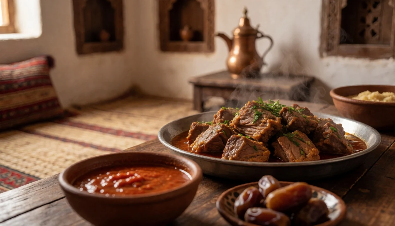
- Harees — Village homes and traditional rural roadside restaurants
A comforting, slow-simmered porridge made from cracked wheat and meat cooked together for hours until smooth and creamy, typically seasoned with ghee and aromatic spices during festive gatherings and cooler winter evenings.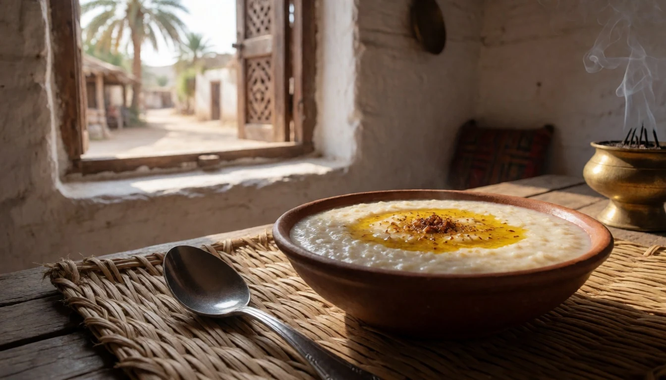
- Mashuai — Coastal foothill markets and regional family restaurants
Spit-roasted kingfish served over a bed of fragrant rice cooked with ghee and local spices, accompanied by a sharp, tangy mango dipping sauce that cuts through the rich oils of the fish. - Omani Halwa — Local sweet shops and traditional souks throughout the foothills
A dense, gelatinous sweet confection made from cornstarch, brown sugar, ghee, rosewater, and cardamom, generously studded with cashews, almonds, and pistachios, traditionally eaten alongside bitter cardamom coffee. - Khalli Fatty — Village bakeries and mountain lodge breakfast spreads
Soft, fluffy yeast bread rolls baked closely together in a pan and filled with rich cream cheese, then drizzled with sweet honey or sugar syrup for a popular breakfast or afternoon tea treat.
Plan it
Best time. October to April offers the main trekking season for exploring the mountains, while the scorching summer months bring extreme daytime heat.
How long. 3–4
Getting there. Fly into Muscat International Airport, rent a sturdy four-wheel-drive vehicle, and approach the southern ranges via Highways 15 and 21.
Budget. mid
Tips
- Always rent a reliable four-wheel-drive vehicle with good ground clearance before attempting mountain tracks.
- Carry at least 3 litres of drinking water per person every day to prevent severe dehydration.
- Monitor local weather forecasts closely and avoid all wadis immediately if skies look overcast or threatening.
- Bring a good supply of cash for small shops in remote villages where card machines are unavailable.
- Pack warm layers, as temperatures on high peaks plummet drastically after sunset.
Etiquette
- Always ask permission from village elders before setting up camp near cultivated fields or residential areas.
- Dress modestly in all rural settlements, ensuring shoulders and knees remain covered at all times.
- Refrain from photographing local residents without obtaining their explicit consent beforehand.
Nearby
Sources
- Wikidata Q1422726 (CC0)
- Wikipedia (rev 1382826561) (CC BY-SA 4.0)
- Wikivoyage (rev 5403563) (CC BY-SA 4.0)