Augrabies Falls National Park
Augrabies Falls National Park, South Africa
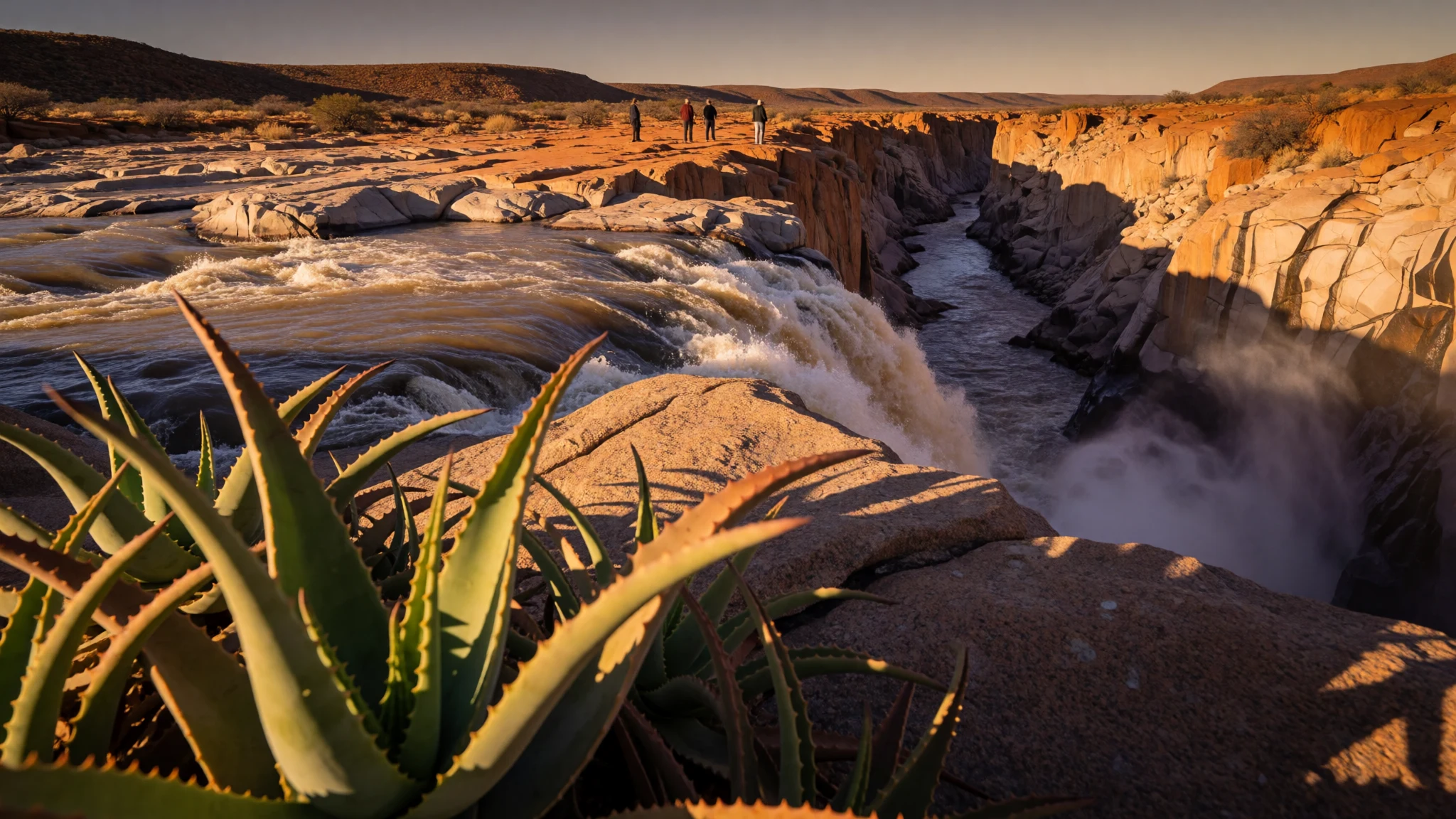
A desert river in the Northern Cape throws itself into a granite gorge, and quiver trees, baboons and huge night skies fill the dry land around it.
The place
Augrabies Falls National Park sits in South Africa's Northern Cape, about 120 km west of Upington, on a stretch of the Orange River where a dry, stony plateau suddenly splits open. The park stands at 621 m above sea level and covers 820 km² along the river. Away from the water it is hard, arid country: pale granite domes, thorny scrub, red sand and very little shade.
Then the river arrives at the edge and drops about 60 m. Below the falls, a gorge averaging 240 m deep carries it on for 18 km, cut into ancient granite that the water has been working at for a very long time. How the falls look depends heavily on the season and on what has fallen as rain upstream. After good rains the whole rim roars and the air fills with spray; in leaner months the water splits into narrower channels and the rock does most of the talking.
The contrast is the point of the place. A short walk from the reception area takes visitors to a series of lookout points, but the park is more than one view. Granite domes such as Moon Rock rise from the plateau, quiver trees stand like small sculptures on the slopes, and troops of baboons and dassies patrol the rocks near the rest camp. Distances are long and services are few, so most people arrive by car and stay at least a night. The park was established in 1966 and is run by South African National Parks.
Its story
Augrabies Falls National Park carries a name with two layers. The Khoikhoi who lived along the river called the falls Ankoerebis, which is usually explained as the place of big noises. Anyone standing near the rim when the river is high understands why. Later, Trekboer farmers moving through the region bent that word into Augrabies, and an older spelling with an extra h still turns up on some maps and old books.
The river itself is the Orange, which crosses a huge part of southern Africa before it reaches the Atlantic. Here it meets a hard granite basement rather than soft soil. Instead of wearing down gently, the water has carved a deep, narrow gorge, a textbook example of erosion into crystalline rock. The cliffs hold the heat of the day and give back echoes, which is one reason a spot in the park is called Echo Corner.
People have also left their mark on the plants. The quiver tree, known locally as kokerboom, takes its name from the San, who hollowed its soft branches into quivers for arrows. It is a plant made for this country, coping with fierce temperatures and thin soil, and it became an emblem of the Northern Cape.
The area was set aside as a national park in 1966. Since then its story has been one of protection and slow tourism: chalets, campsites, short trails and a longer three-day hike, all arranged around a river that long predates any of it.
What to see
- The main falls and lookout points — A short walk from the park reception
A short, easy walk from reception leads to several lookouts over the rim. In flood the river fills the whole gorge head with noise and mist; in lean months the water threads between boulders. Go in the early morning, and again in the evening when the falls are lit.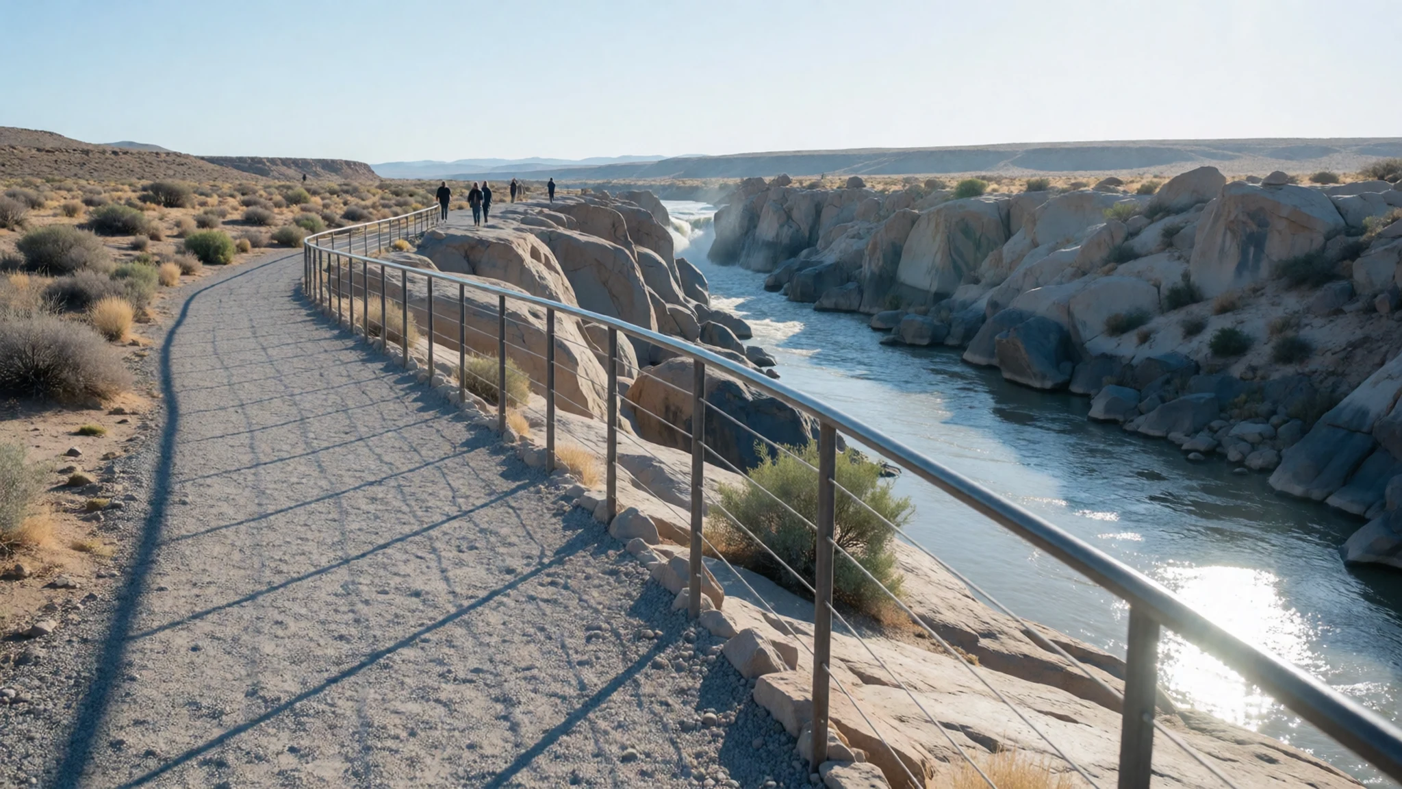
- Twin Falls — Along the river's edge in the park
Twin Falls shows the Orange River splitting into two separate drops over the granite. It is a good place to see how the rock, not the water, decides the shape of the falls. Look for the way channels shift as the river rises and falls.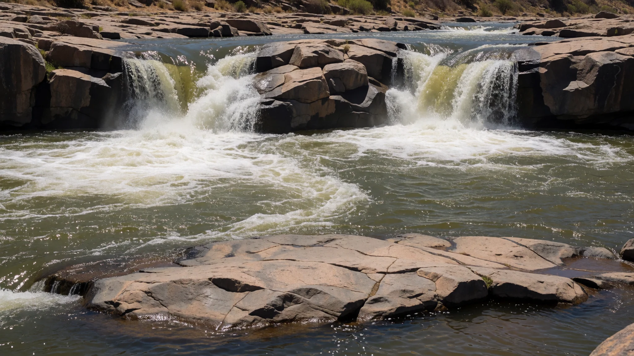
- Echo Corner — Edge of the gorge
Echo Corner looks into the gorge, where sound bounces between the cliff walls. Shout, clap or just listen. The deep, shadowed canyon below makes a stark contrast with the bright, bare plateau, and the rock walls show the layered texture of the granite.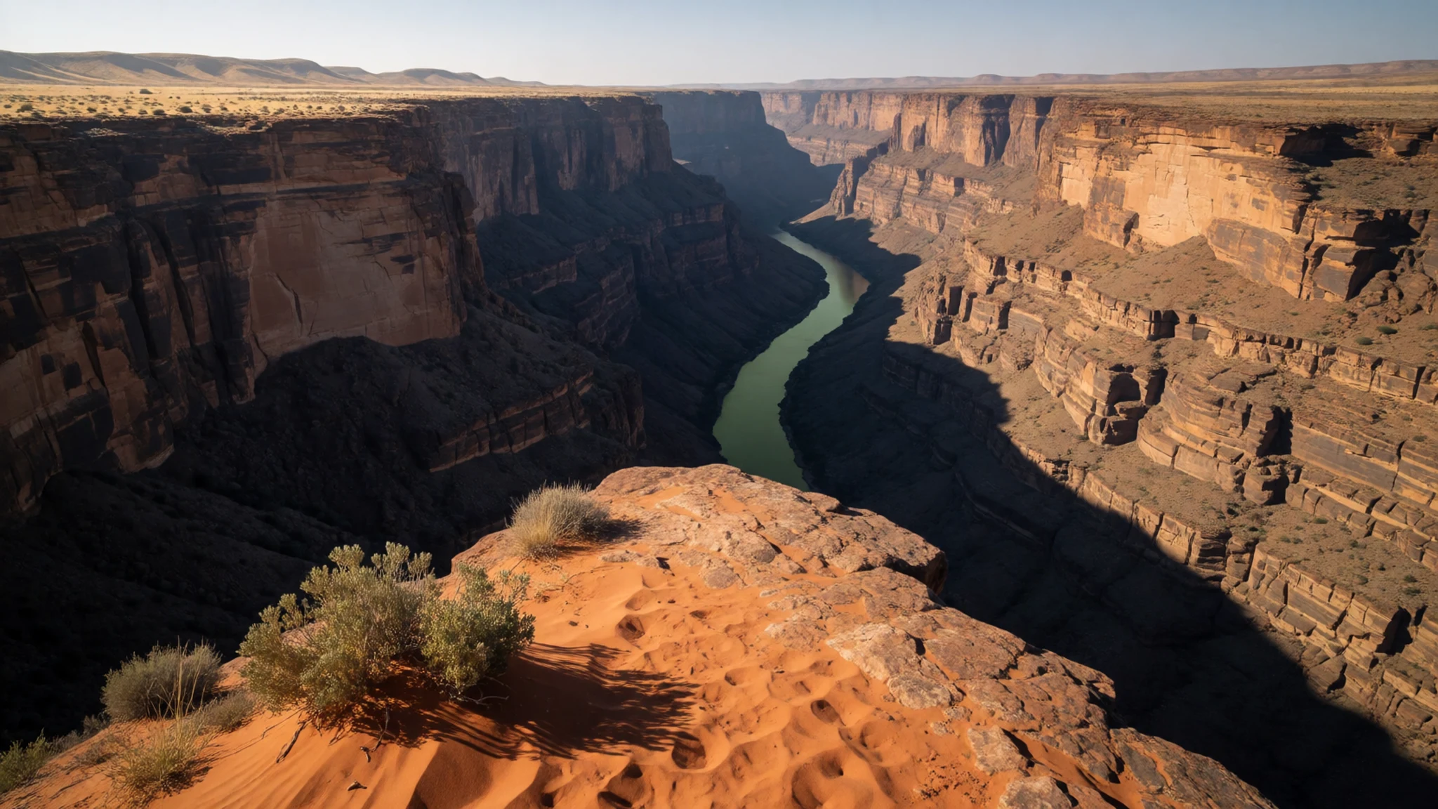
- Moon Rock — On the plateau within the park
Moon Rock is a huge, smooth granite dome that rises from the plateau, formed as outer layers of rock peel away like the skin of an onion. It is a prominent landmark of the park, and its pale surface glows at sunrise and sunset.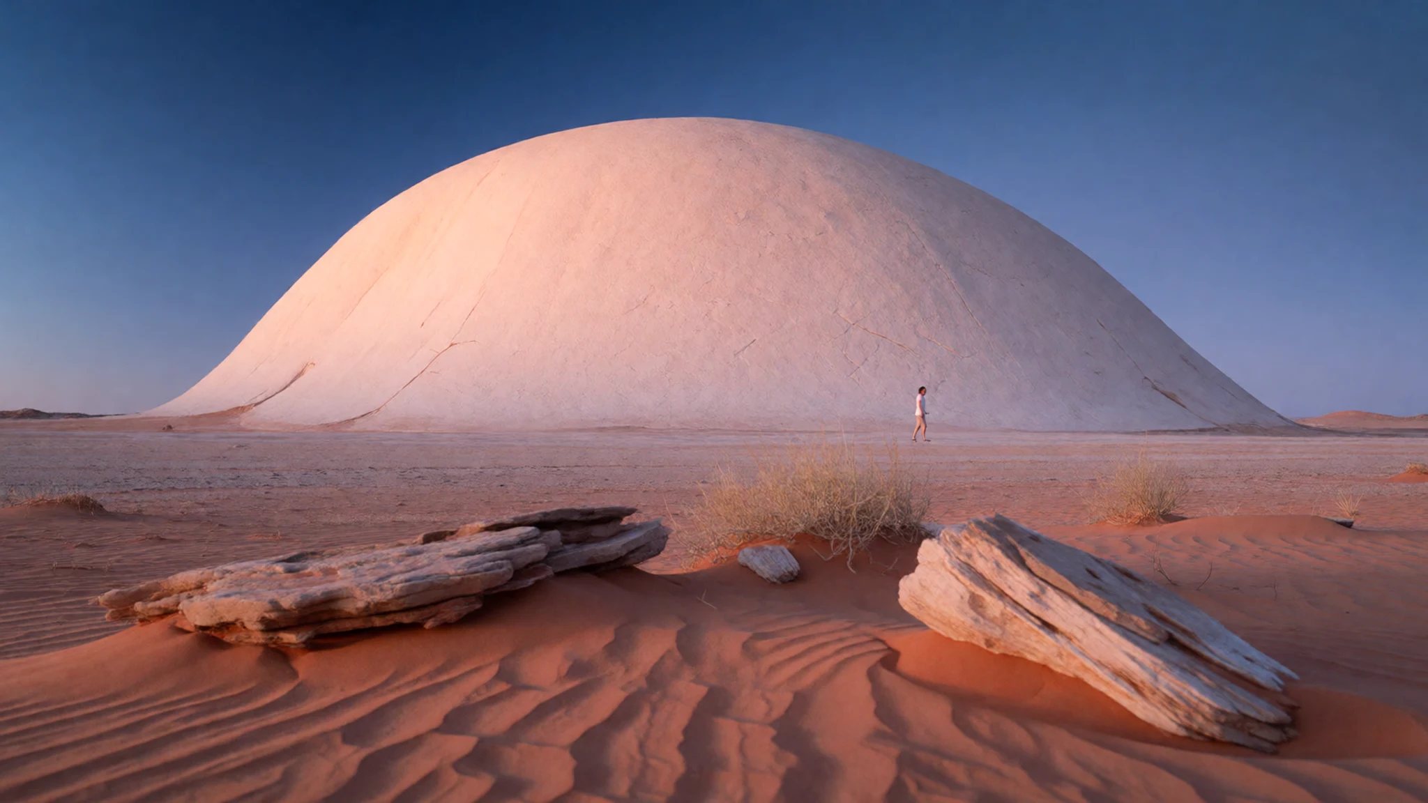
- Quiver trees and weavers' nests — Rocky slopes across the park
Quiver trees grow on the dry rocky slopes, with thick pale trunks and forked, spiky crowns. Sociable weavers often build their enormous straw nests in the branches, creating a shared apartment block for birds. Both are easy to spot from the road and short walking routes.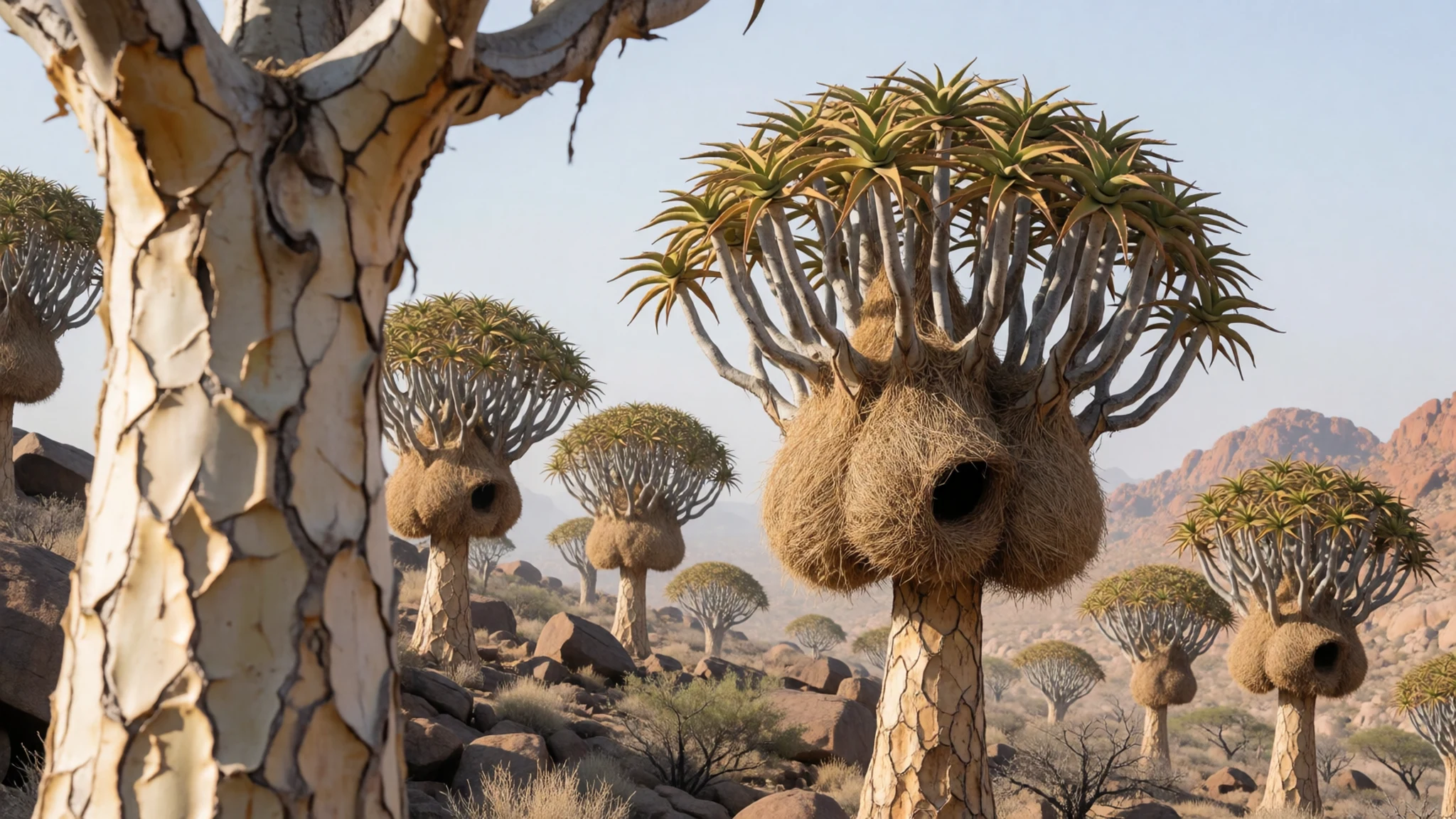
- Dassie Trail — Walking route from the rest camp area
The Dassie Trail is a self-guided 5 km walk with waymark signs, giving a close look at the desert plants, rock formations and wildlife. Start early, carry plenty of water, and watch where you put your hands and feet, since snakes and scorpions live here.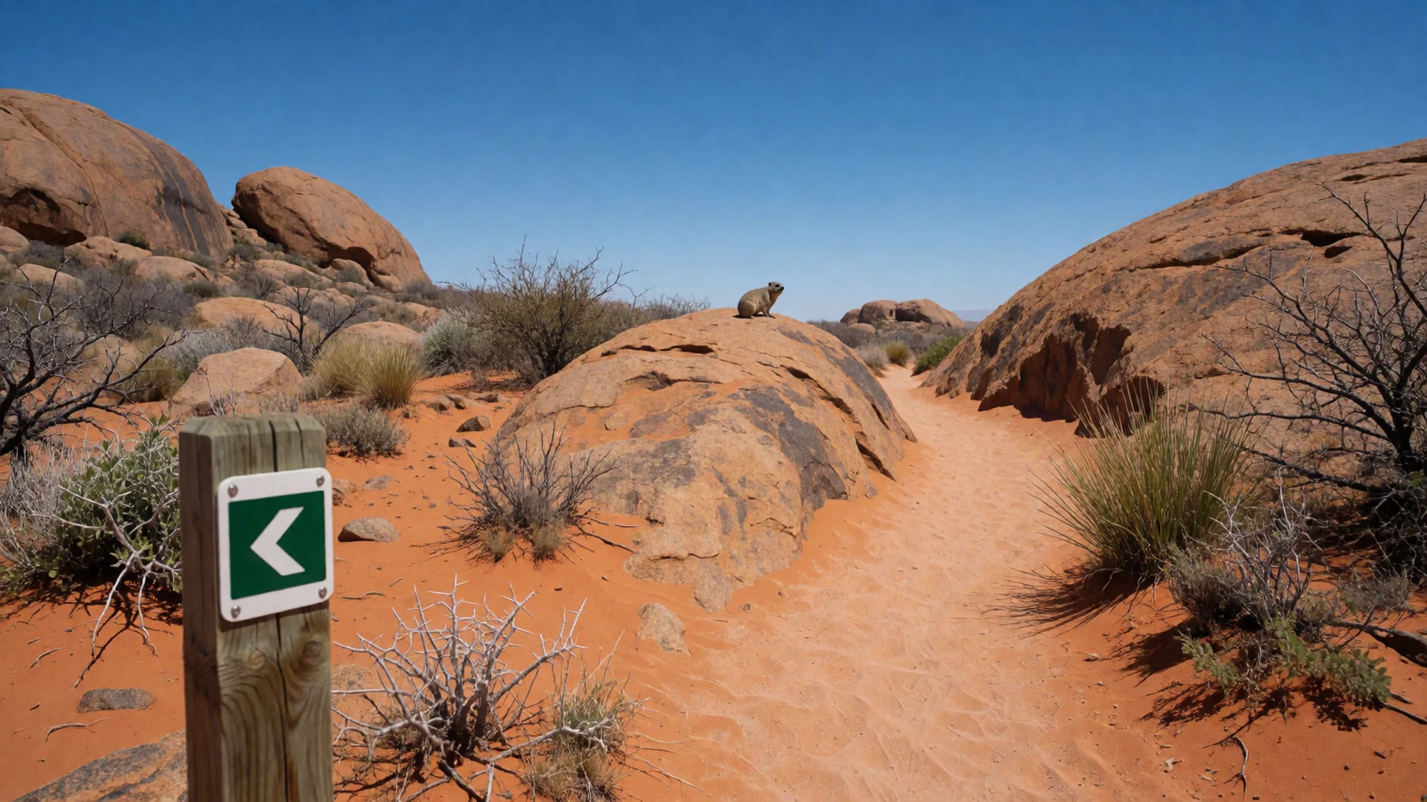
Culture
Augrabies Falls National Park lies in a region shaped by several peoples, and its culture is best read through names and plants. The Khoikhoi called the falls Ankoerebis, a name that captures the sound of the water, while the San used the quiver tree to make arrow cases. Trekboer farmers later settled the surrounding land, and their language gave the park its current name. Many place names in the Northern Cape come from Khoi, Nama, Afrikaans or later colonial sources, often layered on top of one another.
Life in this part of South Africa is still tied to the river. Farms along the Orange River grow crops in otherwise dry country, and people in the nearby villages and in Upington know the river as a lifeline as well as a landscape. Afrikaans is widely spoken here, along with English and Nama and other languages, and a few words of greeting are warmly received.
The park itself is quiet and managed for conservation. Evenings are social, with people gathering for a braai, watching the sky and swapping stories of baboon raids. Visitors tend to be a mix of South African families, road-trippers and international travellers heading between Cape Town, Namibia and Kgalagadi.
Keep all food locked away and windows closed, and never feed the baboons or monkeys, as habituated animals become dangerous and have to be dealt with by rangers.
What to wear
Augrabies Falls National Park sits in country where the traditional dress of several peoples overlaps. The Khoikhoi and San historically wore soft animal hides and leather cloaks, and used ostrich eggshell beads for jewellery and ornament. In the wider Northern Cape and Namaqualand, Nama women are known for long, full dresses in Victorian-influenced style, worn with matching headscarves, usually for church, festivals and family occasions rather than daily life.
What people actually wear today is practical. Farm workers, rangers and local residents wear work trousers, long sleeves, wide-brimmed hats and sturdy boots to cope with strong sun and rough ground. In town, ordinary casual clothes are the norm, with smarter outfits for church on Sundays.
For a visit, dress for heat and rock. Summer is extremely hot, so choose light, loose cotton or quick-dry fabrics in pale colours, with long sleeves and a hat for sun protection. Sunglasses and strong sunscreen are essential. Winter mornings and nights can be much cooler, so pack a fleece or jacket for early starts and evenings by the fire.
Footwear matters most. Closed, grippy shoes or light boots suit the granite and loose sand, and they also protect against scorpions and snakes on the trails. Sandals are fine at the rest camp but not for walking. No special modesty rules apply in the park, though swimwear is for the pool only.
What to eat
- Braai — Campsite and chalet grills, and the evening gatherings at the rest camp
The braai, South Africa's version of a barbecue, is the social centre of an evening here. Expect lamb, beef or sausage cooked over wood or coals while people sit outside and talk. It suits the dry air and the long, clear nights.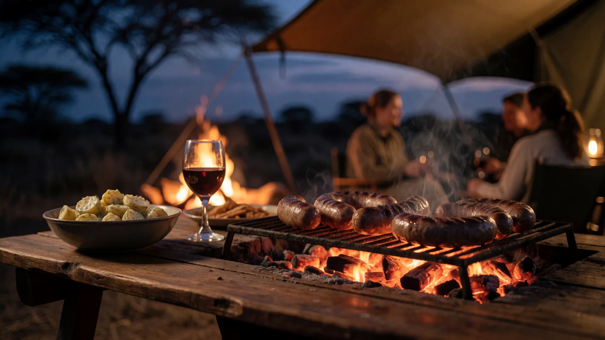
- Boerewors roll — Roadside stalls, petrol-station shops and farm stalls on the drive in
Boerewors is a coarse, spiced beef sausage, usually coiled on the grill and served in a soft white roll. It is a simple road-trip meal on the long drives to the park, often eaten with mustard or tomato relish.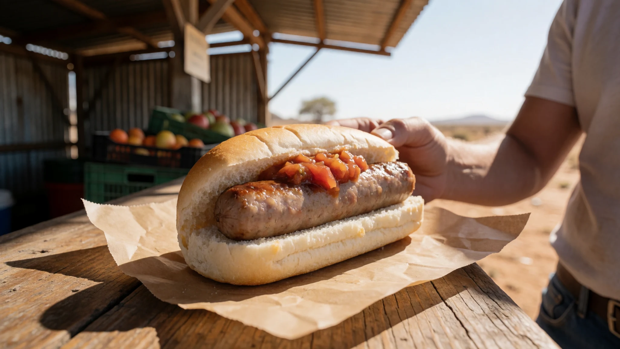
- Biltong — The park shop, village shops and butchers in Upington
Biltong is air-dried, spiced strips of meat, usually beef or game. It is a staple snack for hikers and drivers, light to carry and well suited to the dry climate. Vegetarians should look for dried fruit and nuts instead. - Potjiekos — Cooked at campsites by visitors and at family gatherings in local communities
Potjiekos is a slow stew cooked in a cast-iron three-legged pot over a fire, layered with meat, potatoes, carrots and whatever else is to hand. It takes hours and works best with a crowd, so look for it where groups are camping. - Koeksisters — Church sales, village bakeries and farm stalls in the Northern Cape
Koeksisters are plaited doughnuts dipped in sugar syrup, sticky, sweet and best with strong tea or coffee. They turn up at fundraisers, bakeries and roadside stalls, and travel reasonably well in a cool bag. - Rooibos tea — The park restaurant, shops and village cafés
Rooibos is a caffeine-free red herbal tea from South Africa, drunk hot with milk or cold with ice and lemon. In summer heat it is a good way to keep up fluids alongside plenty of plain water.
Plan it
Best time. June–July are the most comfortable months, with the coolest daytime temperatures, and the river often still carries water after the rainy season, which runs mainly from January to April. Summer is extremely hot, though the lit falls give a cooler night view, and the three-day Klipspringer hike is closed then.
How long. 2
Getting there. Fly to Upington airport, then drive the remaining 120 km west to the park. From Cape Town, take the N7 north, then either the R358 (more direct, about 10½ hours, mostly dirt road) or continue to Springbok and take the N14 east to Augrabies village (about 11 hours in total).
Budget. mid
Tips
- Book accommodation and activities through the SANParks website; check the official site at http://www.sanparks.org/parks/augrabies for current rules, hours and fees
- In summer, carry far more water than seems necessary, walk early and rest in the shade at midday
- Lock food away and keep chalet windows closed, as baboons and vervet monkeys will steal anything left out
- Watch for scorpions and snakes when walking, and wear closed shoes
- Fill up with fuel and supplies before long drives, as distances are large and services are thin
Etiquette
- Never feed baboons or monkeys, and keep food out of sight
- Stay on marked paths and viewpoints near the gorge edge
- Keep noise down at the rest camp after dark so others can enjoy the night sky
Nearby
Sources
- Wikidata Q760459 (CC0)
- Wikipedia: Augrabies Falls National Park (rev 1369176208) (CC BY-SA 4.0)
- Wikivoyage: Augrabies Falls National Park (rev 5202780) (CC BY-SA 4.0)
- Augrabies Falls, March 2008 (Zaian) (Public domain)
- Augrabie Falls in South Africa 2005 (woertz) (CC BY-SA 2.5)
- Sociable Weavers nest in Quiver Tree (Bernard DUPONT) (CC BY-SA 2.0)
- Echo Corner in Augrabies Falls National Park (amanderson2) (CC BY 2.5)
- Hikers in Augrabies Falls National Park (Rad Dougall) (CC BY 3.0)
- Accommodation, Augrabies Falls National Park (South African Tourism) (CC BY 2.5)
- Augrabie Falls in South Africa 2005, second view (woertz) (CC BY-SA 2.5)
- Augrabies Twin Falls (NJR ZA) (CC BY 3.0)


