Zhangye National Geopark
Zhangye National Geopark, People's Republic of China
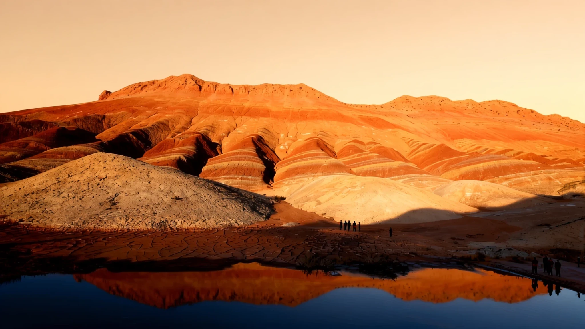
Zhangye's banded red and ochre hills are best seen in clear spring or autumn light, outside the hottest summer weeks.
The place
Zhangye National Geopark lies in Gansu province in north-western China, on the northern foothills of the Qilian Mountains. It covers ground in Linze and Sunan counties, both administered by the prefecture-level city of Zhangye, so it is a landscape spread across several areas rather than a single gorge. The name refers to danxia, a family of landforms carved from thick layers of sandstone and mudstone that were laid down, lifted and then worn away over a very long time. The result is ridges and bluffs banded in red, orange, ochre, cream and grey, with stripes sharp enough to look painted.
The most visited section is the Linze Danxia Scenic Area, west of Zhangye city. Its paths wind between the colour-banded hills, and it has the facilities most visitors expect. Binggou, on the north bank of the Liyuan River, is higher and cooler, with a different mix of rock and green valley, and suits a separate day. The Sunan Danxia Scenic Area lies further south, beyond Linze, and is less developed. Together they make the park feel bigger than any single viewpoint.
The colours are most vivid in clear light, so a grey or hazy day can flatten the view. The land is dry and exposed, and the wind can make the high ground feel colder than expected. The park is also a UNESCO Global Geopark, which recognises its geology as much as its scenery.
Its story
Zhangye National Geopark sits in a province that for centuries has been more corridor than destination. Ideas and goods moved along its valleys between the Chinese heartland and Central Asia, and Gansu was a centre for East–West cultural exchange as early as the Han and Tang dynasties. Zhangye grew up in that stream of traffic, a place where travellers could rest, trade and prepare before crossing the desert or heading into the mountains.
The landforms of the geopark have their own long story, written in stone rather than in records. Sediment built up over a very long period, was folded and lifted, and was then cut by water and wind into the striped shapes visible today. Nobody needs a timeline to appreciate the result, although geologists have spent a long time reading the layers.
The modern story is one of recognition. The area first held provisional status before it was formally designated as a national geopark, and it later joined the UNESCO Global Geopark network. Those steps mean the rocks are now protected and managed, with walkways and viewpoints laid out so visitors can see the colours without damaging the slopes.
Readers of Chinese media polls have picked the formations as among the country's loveliest natural sights. That attention has shaped the park: the Linze area is the most developed section, which is where most people arrive first, while the outlying areas remain quieter and rougher, closer to how the land looked before anyone photographed it.
What to see
- Linze Danxia Scenic Area — West of Zhangye city, in Linze county
The core of the park and the section most people visit first. Its footpaths and lookouts give close views of the banded ridges, and the colour changes noticeably as the light moves across the slopes through the day. Allow a full day here if you want to walk rather than simply look from the road.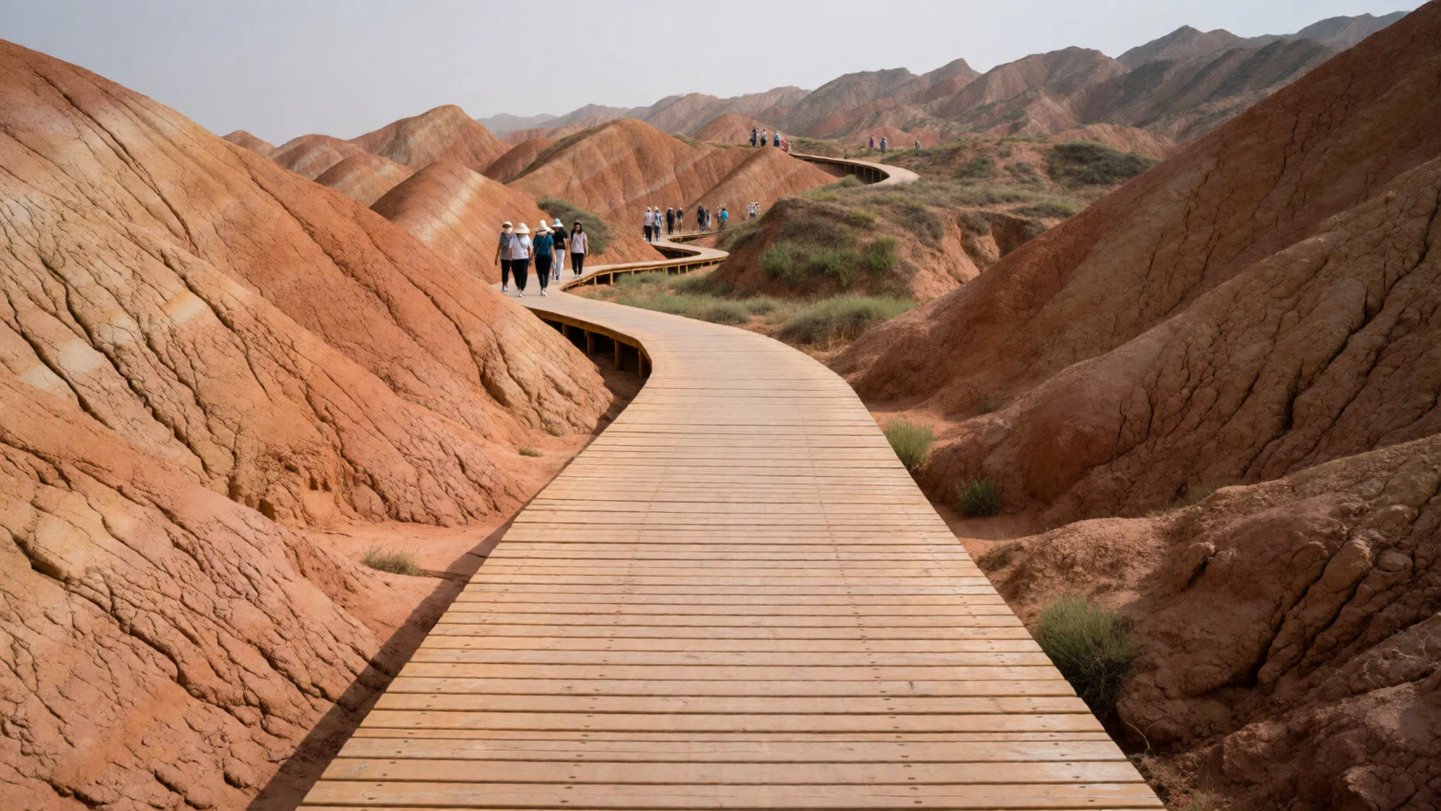
- Binggou — North bank of the Liyuan River
A second scenic area on the north bank of the Liyuan River, set higher and cooler than Linze. The terrain is more varied, mixing striped rock with green valley ground, so it suits a slower day with fewer people around. Go prepared for wind and changeable temperatures.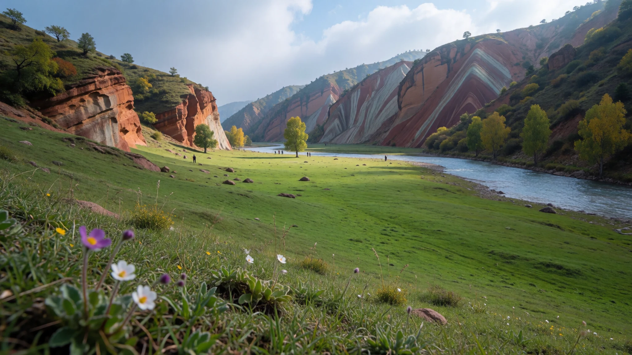
- Sunan Danxia Scenic Area — South of Linze, near Ganjun
The southern area of the geopark, reached beyond Linze and closer to Ganjun. It is less developed than the main scenic area, so facilities are thinner and you should plan transport in advance. The striped slopes here reward a patient visit with a camera.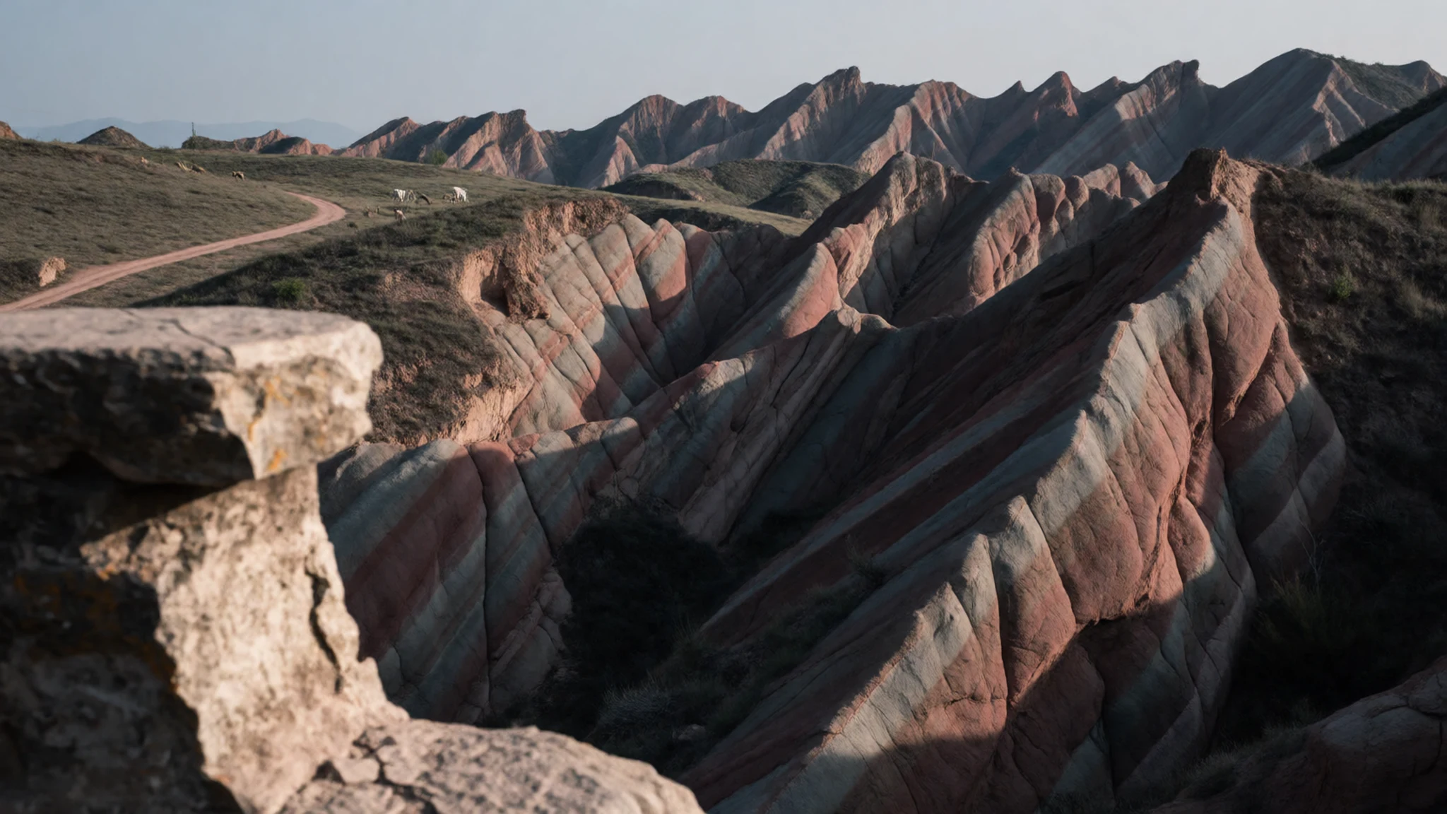
- Water Curtain Thousand Buddha Caves — Luomen, in the wider Zhangye area
A cave temple site where a shrine has been built inside a cave and a large Buddha is carved into the cliff face. It offers a change of pace from the bare rock of the park, and the carvings reward a slow look. Check the official site for opening arrangements before you travel.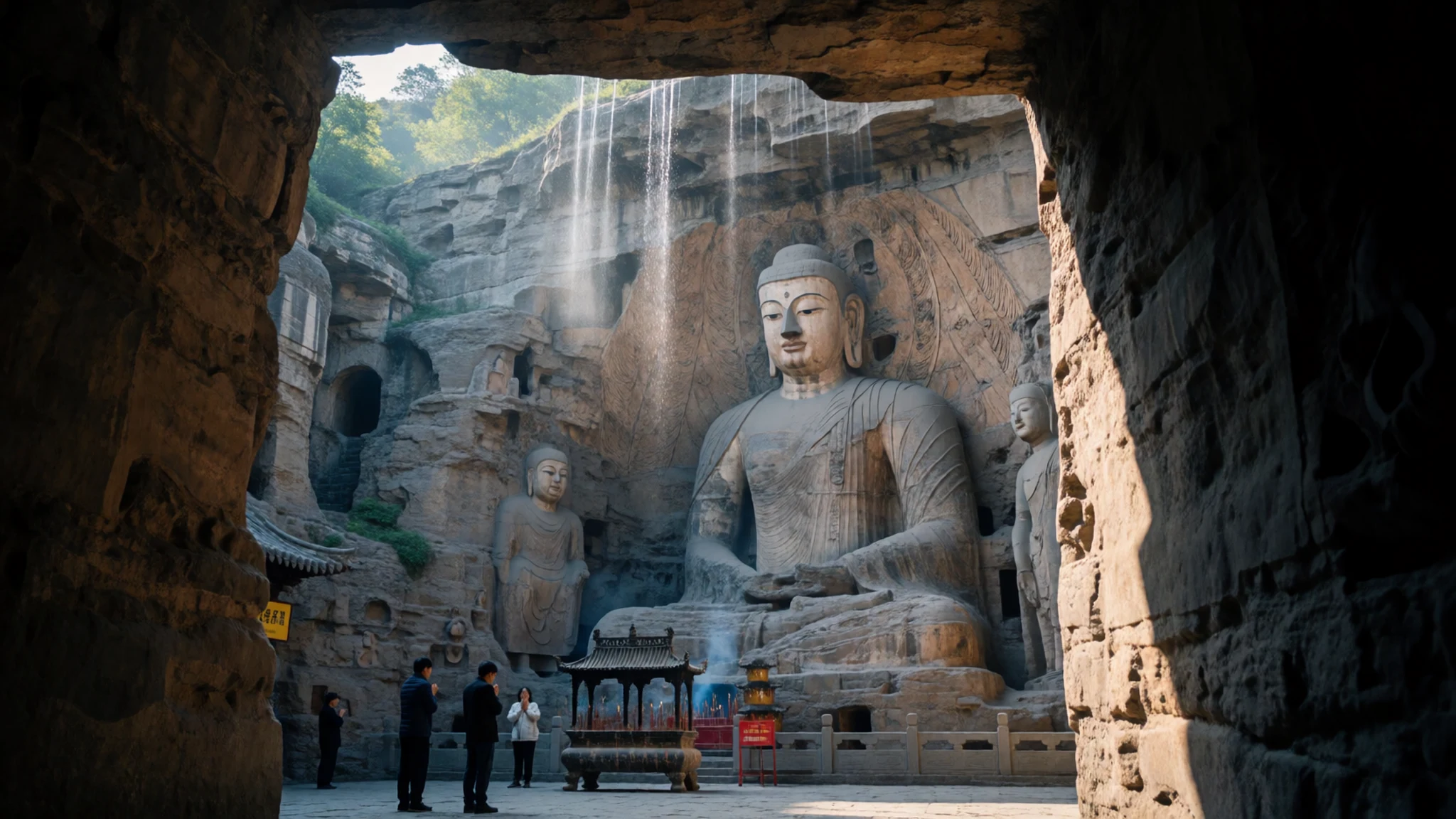
- Qilian Mountains — Southwest of Zhangye, along the foot of the range
The snow-capped range that rises to the southwest of the park, with grassland spread across its foot. From the foothills the mountains give the colourful hills a striking backdrop, and the train from Zhangye towards Xining passes through this country. Expect cold air at altitude even in summer.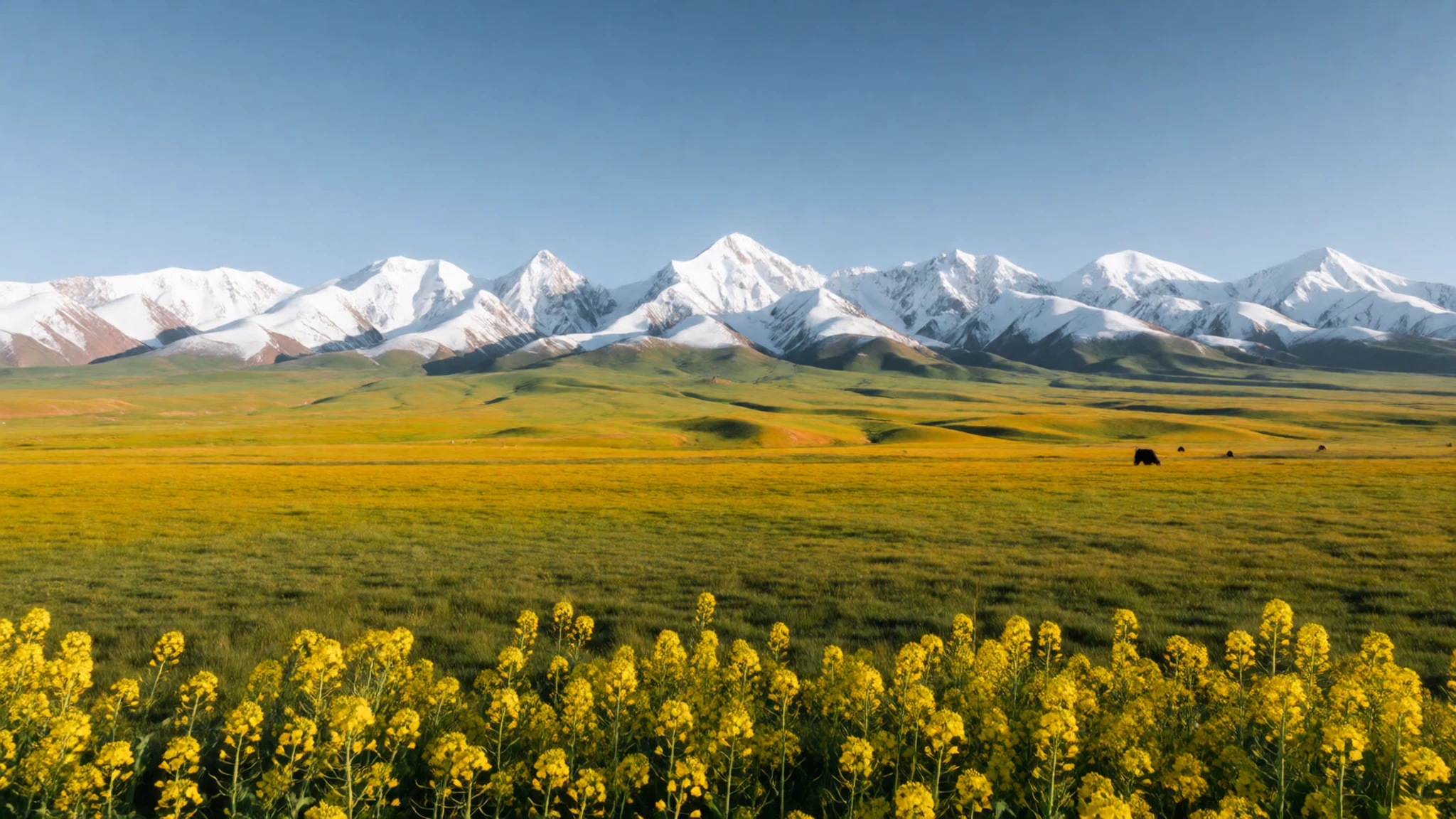
Culture
Zhangye National Geopark is a natural site, but it sits in a region of mixed communities. Gansu is home to Han Chinese, Hui Muslim and Tibetan people, and the Buddhist monasteries of southern Gansu are working places of worship rather than museums. In Zhangye city and the villages near the park, daily life runs on family businesses, noodle counters and market stalls, and people are generally friendly to visitors who make an effort.
The park has its own practical customs. Drivers and guides often work to set routes, so ask before you change plans. Hospitality is warm in the countryside, and accepting tea or a small snack is a welcome gesture, though you are never obliged to eat more than you want.
When you visit a temple, mosque or monastery, dress modestly, speak quietly and follow any signs about where you may walk. Ask before photographing monks, herders or market traders, and a smile with a gesture usually helps. Please keep to the marked paths and never climb the formations, since the soft rock crumbles and the damage cannot be undone.
What to wear
Zhangye National Geopark sits near communities whose dress reflects Gansu's mixed heritage. Tibetan men and women in the south of the province have traditionally worn the chuba, a long robe often made of heavy wool or felt, belted at the waist and worn with silver or coral jewellery. Hui women commonly wear headscarves, and Hui men often wear white or embroidered caps, a practice tied to Islamic custom. Sheepskin and felt have long been practical materials for herders in the cold, dry climate.
Day to day, people in Zhangye city dress much as they would anywhere in urban China: jeans, trainers, padded jackets in winter and light cotton in summer. Older rural women may still wear traditional headwear or quilted jackets, while younger people mostly choose modern clothes that suit the weather.
For a visit, dress in layers. Days near the desert edge can be warm and bright, but the wind and cold evenings call for a fleece or light jacket. Pack a hat and sunglasses for the exposed paths, and choose shoes with good grip, because the loose, sandy rock on slopes can be slippery. At monasteries and mosques, cover shoulders and knees, and remove your hat when you go inside.
What to eat
- Lanzhou lamian (兰州拉面) — Any noodle counter on the main streets of Zhangye city
Lanzhou lamian is the best-known Gansu dish, hand-pulled noodles in a clear, savoury broth with beef or lamb and a little chilli oil. Find it at almost any noodle counter in Zhangye city, where it is quick, filling and inexpensive to order.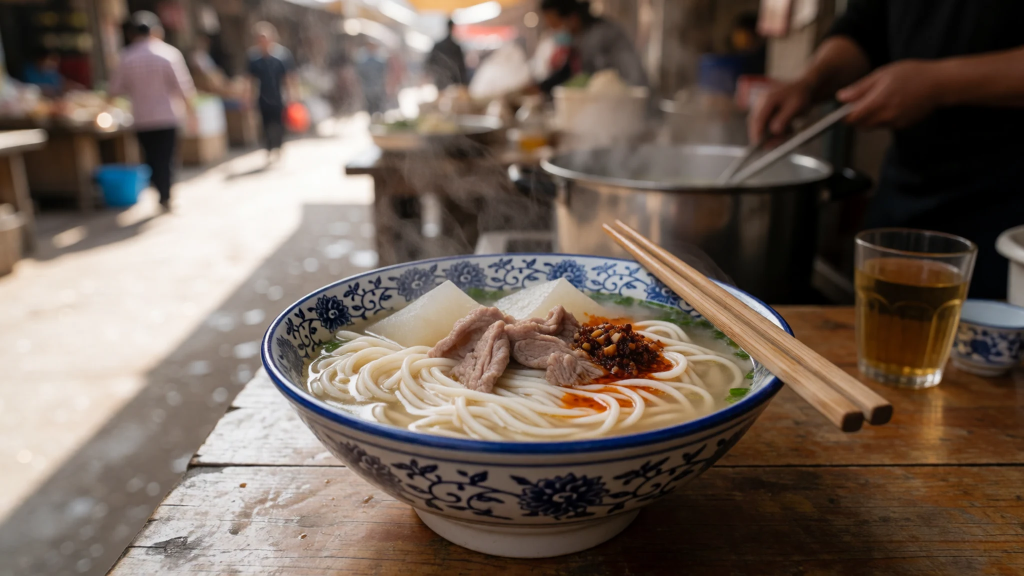
- Shou-zhua lamb (手抓羊肉) — Family-run restaurants in Zhangye city
Boiled lamb served in the plain shou-zhua style, so the meat's own flavour comes through, with a dip on the side. Local lamb is mild and tender, from animals grazing dry, saline pasture. Ask for it at family-run restaurants in Zhangye city.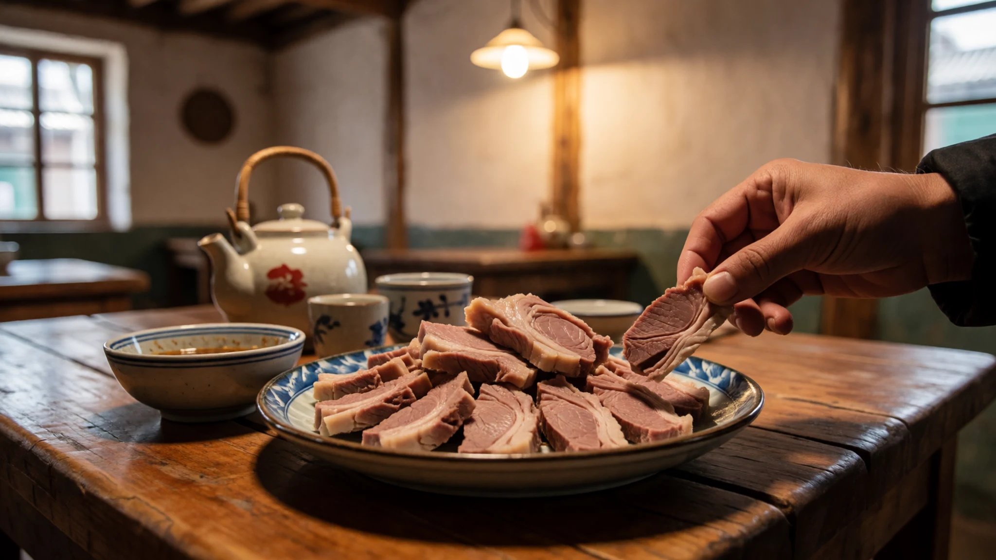
- Yak meat, butter and yoghurt — Eateries in the Tibetan-influenced south of Gansu, and restaurants serving herding communities
Yak meat, butter and yoghurt are staples of the Tibetan-influenced south of Gansu, and yak milk is drunk fresh in herding areas. Yoghurt is often eaten plain and makes a simple, cooling break between meals. Choose a Tibetan-run eatery over a tourist set menu. - Scrambled eggs with tomato — Simple restaurants close to the park entrances
A simple, comforting dish that appears on many menus, scrambled eggs cooked with tomato and served with rice or noodles. It is mild and quick, a useful choice if the spicier lamb or yak dishes are not to your taste. Expect it most often where menus are aimed at visitors.
Plan it
Best time. March to April and October to November are the strongest months, when the air is dry and skies are usually clear. Summer days can be hot in the sun and the high ground stays cool at night, so bring layers at any time of year.
How long. 2–3
Getting there. Zhangye Ganzhou Airport (YZY) is the closest airport. Alternatively, fly to Lanzhou (LHW) and continue to Zhangye by rail or road, with the last leg into the park by taxi or organised transfer.
Budget. mid
Tips
- Start walks early, before the tour groups arrive at the main scenic area
- Give the Linze area a full day and leave Binggou for a separate visit
- Carry some cash for small stalls, and check at the ticket office whether cards or mobile payment work
- Bring water, sun cream and a warm layer, since the dry air dehydrates you quickly
- Check the official site for ticket and shuttle details before you set out
Etiquette
- Keep to marked paths and never climb the coloured formations
- Ask before photographing people, especially at monasteries and in villages
- Keep voices low inside temples and mosques
Nearby
Sources
- Wikidata Q17638329 (CC0)
- Wikipedia: Zhangye National Geopark (rev 1362954203) (CC BY-SA 4.0)
- Wikivoyage: Gansu (rev 5362885) (CC BY-SA 4.0)
- Zhangye Danxia (YubYub41) (CC BY-SA 4.0)
- Zhangye National Geopark 5 (H2v5o68z) (CC0 1.0)
- Striated rocks in Zhangye National Geopark (Terry Wu) (CC BY-SA 2.0)
- Colorful strata (Zhangye National Geopark) (Terry Wu) (CC BY-SA 2.0)
- Buildings in Zhangye National Geopark (Terry Wu) (CC BY-SA 2.0)
- Flickr image 29851221553 (Terry Wu) (CC BY-SA 2.0)
- Flickr image 30483606125 (Terry Wu) (CC BY-SA 2.0)
- Colourful mountains of the Zhangye National Geopark (Terry Wu) (CC BY-SA 2.0)


