Tsavo East National Park
Tsavo East National Park, Kenya
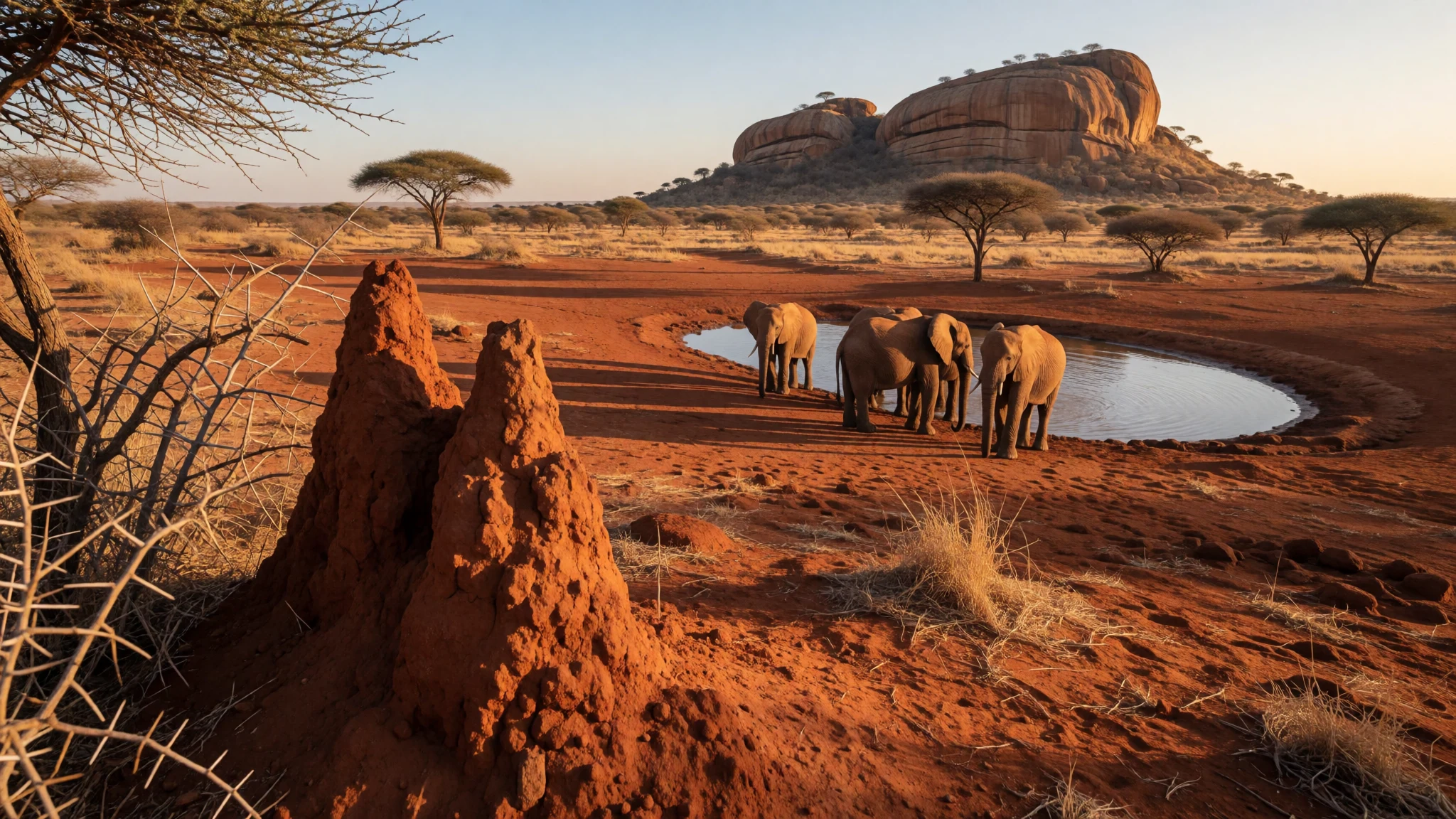
Tsavo East National Park is red-dust savanna where elephants gather at rock-fed waterholes and the horizon feels endless.
The place
Tsavo East National Park sits in south-eastern Kenya, in Taita-Taveta County, and was set up in 1948 on semi-arid country once called the Taru Desert. It covers 13,747 square kilometres and, together with neighbouring Tsavo West, forms a protected block of about 22,000 square kilometres. Most of it is flat: dry grassland and thorny savanna broken by a few landmarks. The Tsavo River crosses from west to east and meets the Athi inside the park, and from there the combined water carries on as the Athi-Galana-Sabaki River, the green ribbon that holds much of the wildlife in the dry months. Along the western edge the Yatta Plateau runs for about 290 km, a long ridge of old lava that began at Ol Donyo Sabuk Mountain. Further along the river the water tumbles over rocks at Lugard Falls, which are rapids rather than a true waterfall. Away from the rivers the land is hot, dusty and red, and distances are long. Tsavo West, next door, is wetter and more mountainous, with swamps, Lake Jipe and Mzima Springs, so the two halves feel quite different even though they are managed together. Tsavo East is the drier, more open half, and its wide views make animals easier to spot when the grass is short. Most routes are dirt tracks, and a day's game drive here often means a long stretch between one waterhole and the next.
Its story
Tsavo East National Park carries a story that is retold across Kenya: in 1898 two lions hunted the workers building the Kenya–Uganda Railway through this country. Known as the Tsavo man-eaters, they killed many labourers, and the episode is the reason the name Tsavo is recognised far beyond Kenya. The railway also explains why the area was opened up at all. A line from the coast towards Uganda had to cross a thirsty, thinly settled landscape, and camps of workers moved through bush that saw little other human traffic. Half a century later, in 1948, the land was set aside as a national park. Before that it was known as the Taru Desert, a name that shows how outsiders saw it: empty, dry, hard to cross. Yet the rivers and rock catchments made it a refuge for large herds. Other names on the map record the same era. Lugard Falls is named after Frederick Lugard, and Aruba Dam was built across the Voi River in 1952, only four years after the park was established, to hold water that animals and waterbirds still use today. The story of Tsavo East is therefore partly about people trying to move through difficult land, and partly about a decision to leave it to wildlife. Today the park is managed by the Kenya Wildlife Service, and the man-eaters remain a favourite tale at lodge campfires.
What to see
- Mudanda Rock — Near Voi, southern part of the park
Mudanda Rock is a long outcrop of layered stone, about 1.6 km from end to end, rising above Tsavo East's plains. Rain runs off it into a natural dam at its base, and in the dry season elephants and other animals come to drink. A short walk onto the top gives a view over the water.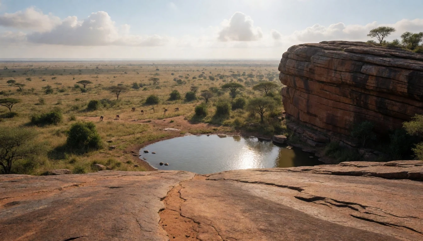
- Lugard Falls — Galana River, central park
Lugard Falls is a stretch of white-water rapids on the Galana River, named after Frederick Lugard. It is not a waterfall in the usual sense; the river squeezes and churns through channels of worn rock. Use the designated viewing points only, since wildlife uses the river and walking along the bank is not safe.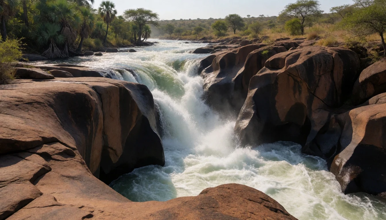
- Aruba Dam — Voi River, south of the park
Aruba Dam was built across the Voi River in 1952, and the reservoir behind it has become a gathering place for animals and waterbirds. It suits a slow hour in the vehicle, scanning the shoreline for elephants and buffaloes and the birds wading in the shallows. The water is busiest in the dry season.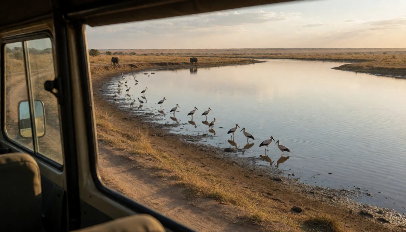
- Yatta Plateau — Western boundary of the park
The Yatta Plateau runs along the park's western boundary above the river, a lava ridge roughly 290 km long that flowed from Ol Donyo Sabuk Mountain. From the plains it reads as a long, flat-topped line on the horizon rather than a peak, so it rewards a pause at a roadside stop with a good view.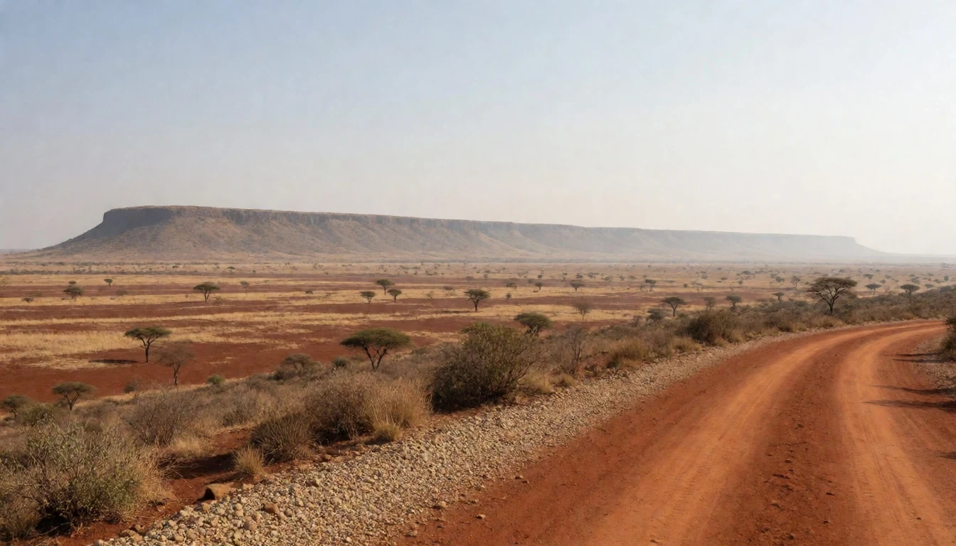
- Tsavo and Athi river confluence — Central park, along the rivers
Inside the park, the Tsavo and Athi rivers meet and continue as the Athi-Galana-Sabaki River. The junction shows why wildlife clusters where it does: the greenest strips of the landscape follow the river, and animals follow the water. Ask a ranger or guide which tracks reach it safely.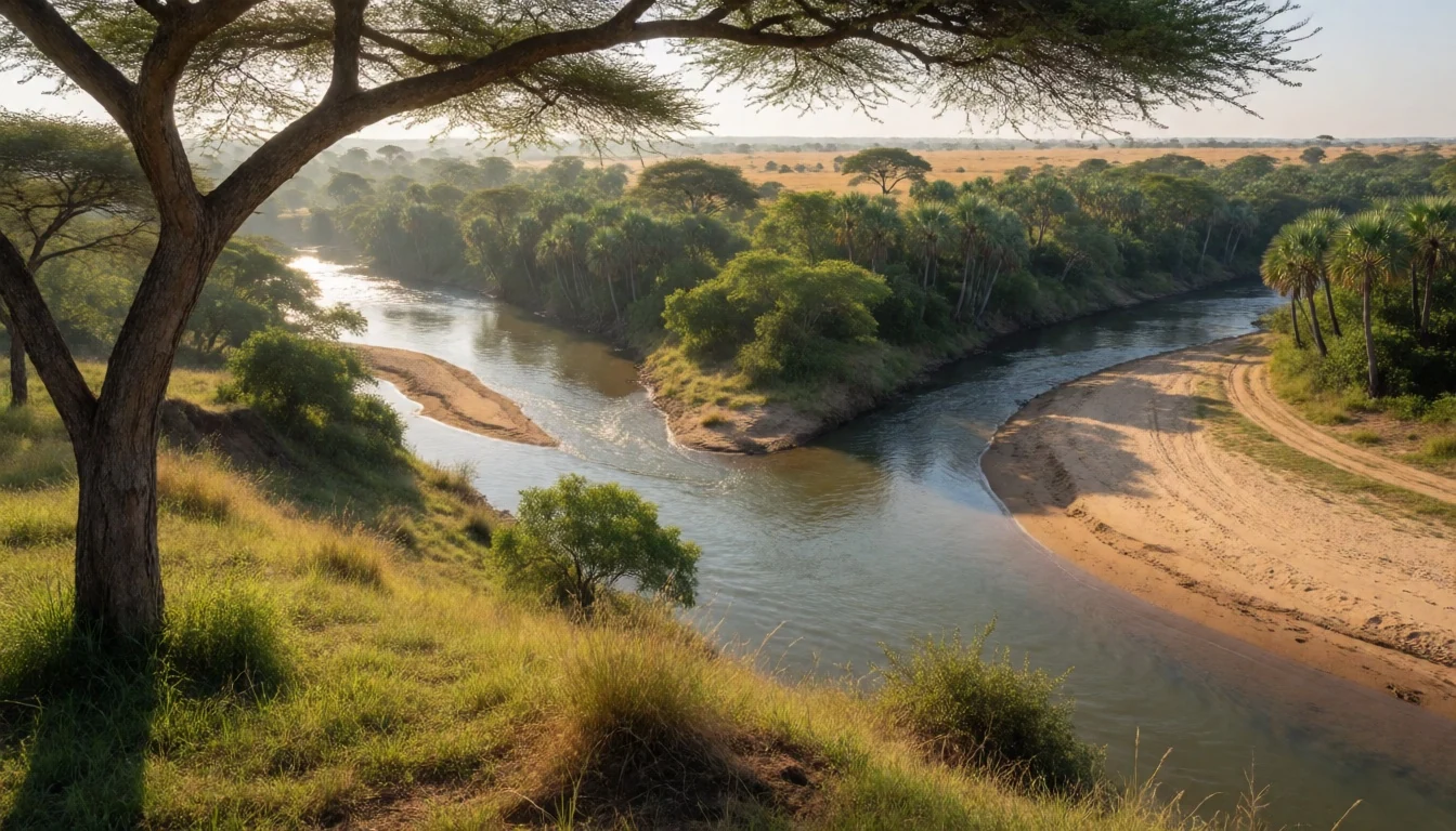
Culture
Tsavo East National Park is wildlife country first, but the culture around it is worth noticing. The park lies in Taita-Taveta County, and the towns on its edges, such as Voi, are working Kenyan towns where Swahili and English are both used daily. A few words of Swahili go a long way: 'jambo' or 'habari' as a greeting, 'asante' for thanks, and 'karibu', which visitors hear as welcome. Safari culture here is shaped by guides, drivers and rangers, who are often glad to share stories, including the railway lions of 1898. Conservation is a livelihood as much as an idea: lodges, cooks, drivers and rangers depend on visitors, which is why behaving well matters. Days follow the animals' rhythm. Game drives start at dawn, lunch is a long, quiet break through the midday heat, and evenings end early. Conversation around a fire often turns to rainfall, because everyone in this dry country watches the sky, and to elephants, since most staff have a favourite herd and a story about a close encounter. Listening with interest is the easiest way in. Ask before photographing any person, including drivers and staff, and keep your distance from wildlife, staying inside your vehicle except at designated places.
What to wear
Tsavo East National Park lies in a part of Kenya where everyday clothing is practical and cotton-heavy. Traditional dress across the country includes the kanga and the kikoi, rectangular cotton cloths printed with bold patterns; the kanga often carries a Swahili proverb along its border. Women wrap them as skirts, head ties or shawls, and men wear a kikoi around the waist, especially on the coast and at home. Ceremonial dress varies by community and appears mostly at weddings, festivals and family occasions rather than daily. What people actually wear now is mixed: jeans, shirts, dresses and shorts in towns like Voi, school uniforms on weekday mornings, and the green uniforms of Kenya Wildlife Service rangers inside the park. With mosques along the coast, modest clothing with shoulders and knees covered is common beyond the lodges. For a visitor, the climate decides. Tsavo East is hot and dusty, so choose loose long-sleeved cotton or linen shirts and trousers in khaki, olive or sand. Dark blue and black attract tsetse flies, and camouflage patterns are best left at home. Bring a wide-brimmed hat, sunglasses and sunscreen, a light fleece for dawn drives, and closed shoes with grip for any walk at a designated stop. Sandals suit lodge evenings. Cover shoulders and knees in towns and villages.
What to eat
- Nyama choma — Roadside grill eateries in Voi and nearby towns
Nyama choma is grilled meat, usually goat or beef, chopped into pieces and eaten by hand with salt, kachumbari (a tomato and onion salad) and ugali. Find it at roadside grill eateries in Voi and the towns along the highway, ordered by weight and shared.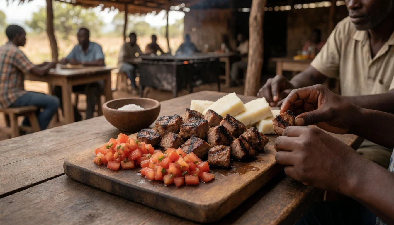
- Ugali and sukuma wiki — Local eateries in Voi and lodge dining rooms
Ugali is a firm maize-meal cake, pulled apart with the fingers and used to scoop up sukuma wiki, braised collard greens, or a bean or meat stew. It is the everyday staple at local eateries and is often on offer at safari lodges too.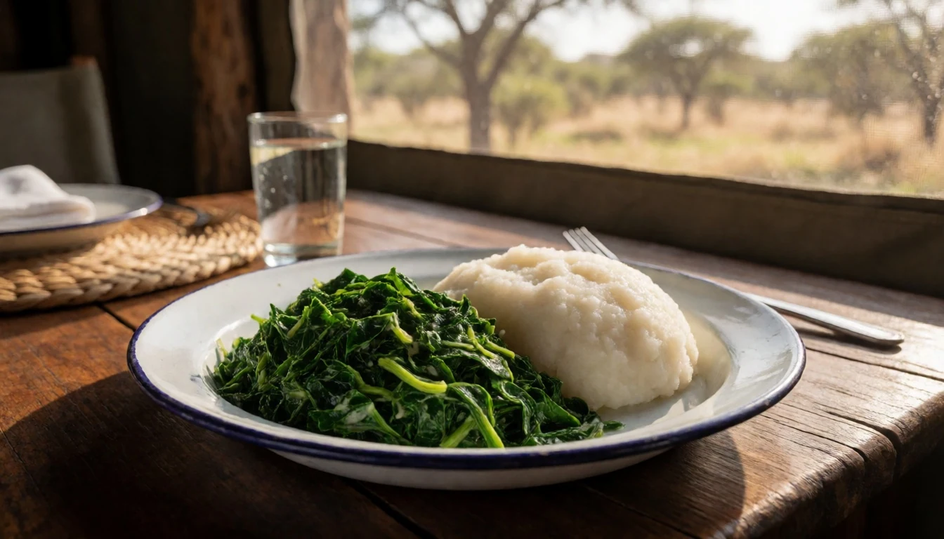
- Pilau — Eateries in Voi, towns on the Mombasa road, lodge buffets
Pilau is spiced rice cooked with meat in a broth of cumin, cardamom and cloves, a legacy of the Swahili coast. Look for it at eateries in Voi, on the road towards Mombasa, and at lodge buffets, usually with a tomato and onion salad. - Mandazi and chai — Roadside kiosks in Voi and lodge breakfast tables
Mandazi are lightly spiced fried dough triangles, often a little sweet, eaten at breakfast or with afternoon tea. Chai in Kenya is milky, sweet and brewed with the leaves boiled in the pot. Look for both at roadside kiosks in Voi and at lodge breakfast tables. - Fresh tropical fruit and juice — Roadside fruit stalls outside the park and lodge breakfast tables
Mango, pineapple and passion fruit arrive from farms and roadside stalls across the region, served at lodge breakfasts and pressed into juice. Seasons vary, so ask what is ripe. Buy from stalls when the vehicle stops outside the park, and wash or peel the fruit before eating.
Plan it
Best time. August to September is the best time for wildlife, when the grass is lower and views carry further, though safaris cost more then. May to June is the low season and cheaper. Heat is constant, so early mornings and late afternoons are the best hours on the road.
How long. 2–4
Getting there. Fly to Nairobi or Mombasa, then travel by road to Voi Gate, the main entrance; Manyani, Buchuma and Sala gates are the other three. Many visitors join a safari from Nairobi or the coast, and the last leg is on dirt tracks inside the park.
Budget. mid
Tips
- Get your park smartcard at Voi Gate and load money on it before entering; check the Kenya Wildlife Service official site for current fees and rules
- Book lodges and safari operators ahead for August–September, the busiest and priciest weeks
- Start game drives at dawn, when animals are active and the heat is bearable
- Carry plenty of drinking water and fuel, because services are far apart and the park is remote
- Most campsites are unfenced and elephants may walk through, so ask about arrangements before booking a tent
Etiquette
- Stay inside your vehicle except at officially designated places, and keep doors closed
- Keep at least 20 m from animals, give them right of way, and never feed them
- Ask before photographing people, including staff and drivers
Nearby
Sources
- Wikidata Q1368818 (CC0)
- Wikipedia: Tsavo East National Park (rev 1381870176) (CC BY-SA 4.0)
- Wikivoyage: Tsavo East National Park (rev 5322438) (CC BY-SA 4.0)
- Photo: Mudanda Rock in Tsavo East National Park (CT Cooper) (CC BY 3.0)
- Photo: Tsavo Park, Athi river, Toyota door water (Guus Gorter) (CC BY-SA 4.0)
- Photo: Tsavo Park, Athi river, Tsavo camp (Guus Gorter) (CC BY-SA 4.0)
- Photo: Tsavo Park, view from Kelaguni lodge (Guus Gorter) (CC BY-SA 4.0)
- Photo: Kenya, Tsavo Inn, landscape (Guus Gorter) (CC BY-SA 4.0)
- Photo: Kenya, Tsavo Park, yellow tree, slide 3 (Guus Gorter) (CC BY-SA 4.0)
- Photo: Kenya, Tsavo Park, yellow tree (Guus Gorter) (CC BY-SA 4.0)
- Photo: Kenya, Tsavo Park, split baobab (Guus Gorter) (CC BY-SA 4.0)


