Toniná
Toniná, Mexico
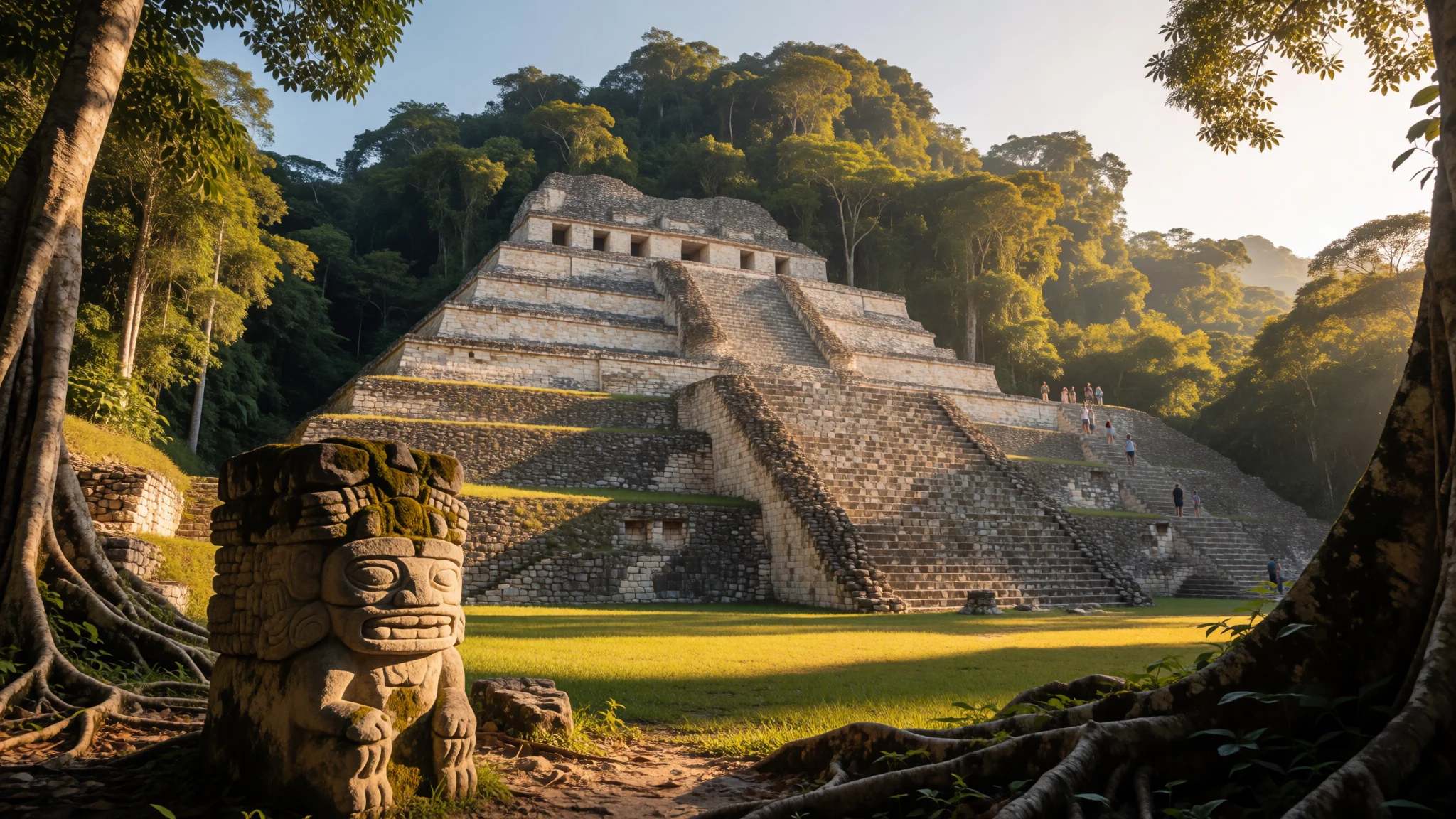
Climb the towering terraced pyramids of Toniná to witness the dramatic final stronghold of the Classic Maya civilization in the Chiapas highlands.
The place
Toniná stands as an imposing pre-Columbian archaeological site of the Maya civilization, positioned within the verdant landscape of the Mexican state of Chiapas. Set amid the mountainous terrain of the region, the ancient city occupies an upland setting characterised by steep limestone slopes and dense surrounding vegetation. The architectural complex is defined by monumental temple-pyramids arranged across massive artificial terraces that climb high above a central plaza. Unlike many lowland Maya settlements that sprawl horizontally through the jungle, Toniná rises vertically, exploiting the dramatic natural topography to create an acropolis of striking physical presence. A substantial court for playing the traditional Mesoamerican ballgame sits near the base, framed by formal stone structures that once hosted ritual athletic contests. Throughout the grounds, numerous carved stone monuments and remnants of painted stucco decoration emerge from the earth, bearing silent witness to centuries of skilled masonry. The surrounding valley sustains a cooler upland climate compared to the tropical lowlands further north, shaped by seasonal rains that maintain the thick vegetation blanketing the hillsides. Today, the ruined city remains quiet and remote, visited by travellers drawn to its monumental scale and its position away from the main tourist routes of the Yucatan Peninsula. The site provides an exceptional vantage point for observing how ancient engineers reshaped entire hillsides to project political dominance and cosmic order across the southern highlands.
Its story
During the Early Classic period, Toniná maintained an active presence, though these early remains are largely buried beneath later construction phases. Hieroglyphic inscriptions recovered from the stones offer glimpses into a dynastic lineage stretching back centuries, including references to early rulers known primarily through titles and carved altars. By the Late Classic period, the city emerged as an aggressive military state, carving out a powerful regional kingdom through sustained warfare and the subjugation of neighbouring polities. For generations, Toniná engaged in bitter rivalry with Palenque, its great western adversary, eventually asserting dominance over the western Maya region through calculated military campaigns and political alliances. Rulers such as K'inich Hix Chapat and his successor, Ruler 2, who acceded to power in the latter half of the seventh century, stamped their authority onto the landscape by commissioning dynamic stone sculptures depicting bound prisoners and military victories. This period saw the development of a distinctive in-the-round sculptural tradition, setting Toniná apart from contemporary centres through its remarkably lifelike artistic execution. The historical narrative of the city reached its definitive culmination in the early tenth century, when scribes recorded the final known Long Count date on any ancient Maya monument, marking the closing chapter of the Classic Maya era before the settlement was abandoned to the encroaching forest.
What to see
- The Great Pyramid — Central archaeological zone
Rising steeply across massive artificial terraces, this monumental pyramidal structure towers above the central plaza. It showcases the architectural ambition of the ancient city's builders, who reshaped the natural hillside into a tiered acropolis that served as both a religious sanctuary and a defensive stronghold during the height of the Classic period.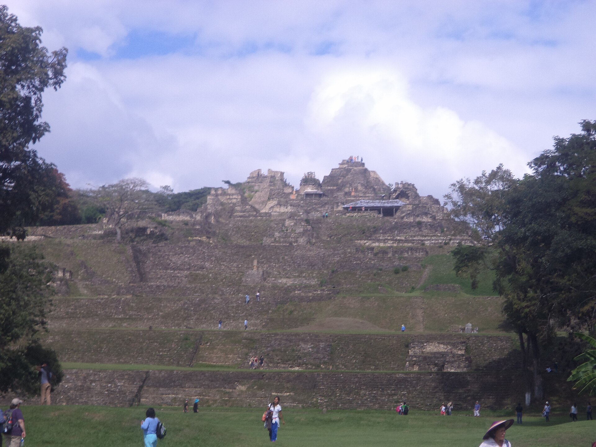
- Temple of the Cosmic War — Upper terrace level
Positioned high along the terraced slopes, this significant temple site preserves intricate stonework and remnants of ancient stucco reliefs. Inscriptions found here detail the complex political relationships and military conflicts that defined the city's dominance over rival polities throughout the Chiapas region.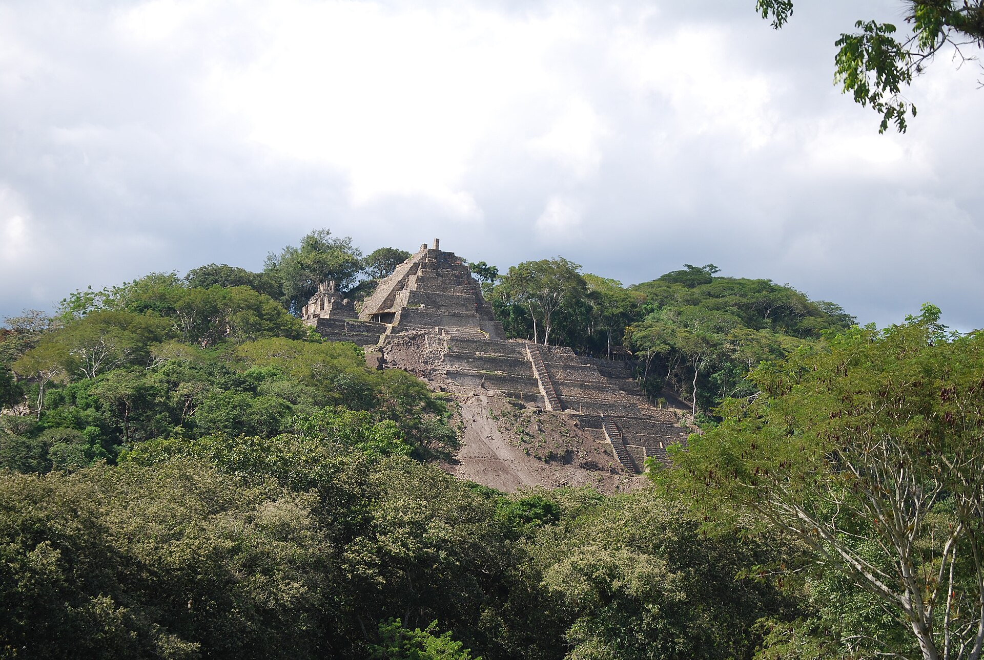
- The Ballgame Court — Lower plaza area
Set on a grand scale near the lower administrative plazas, the stone-lined court provided the stage for sacred Mesoamerican ballgames. These ritual athletic matches carried profound religious and political significance for the ruling elite, often concluding with public ceremonies recorded on nearby stelae.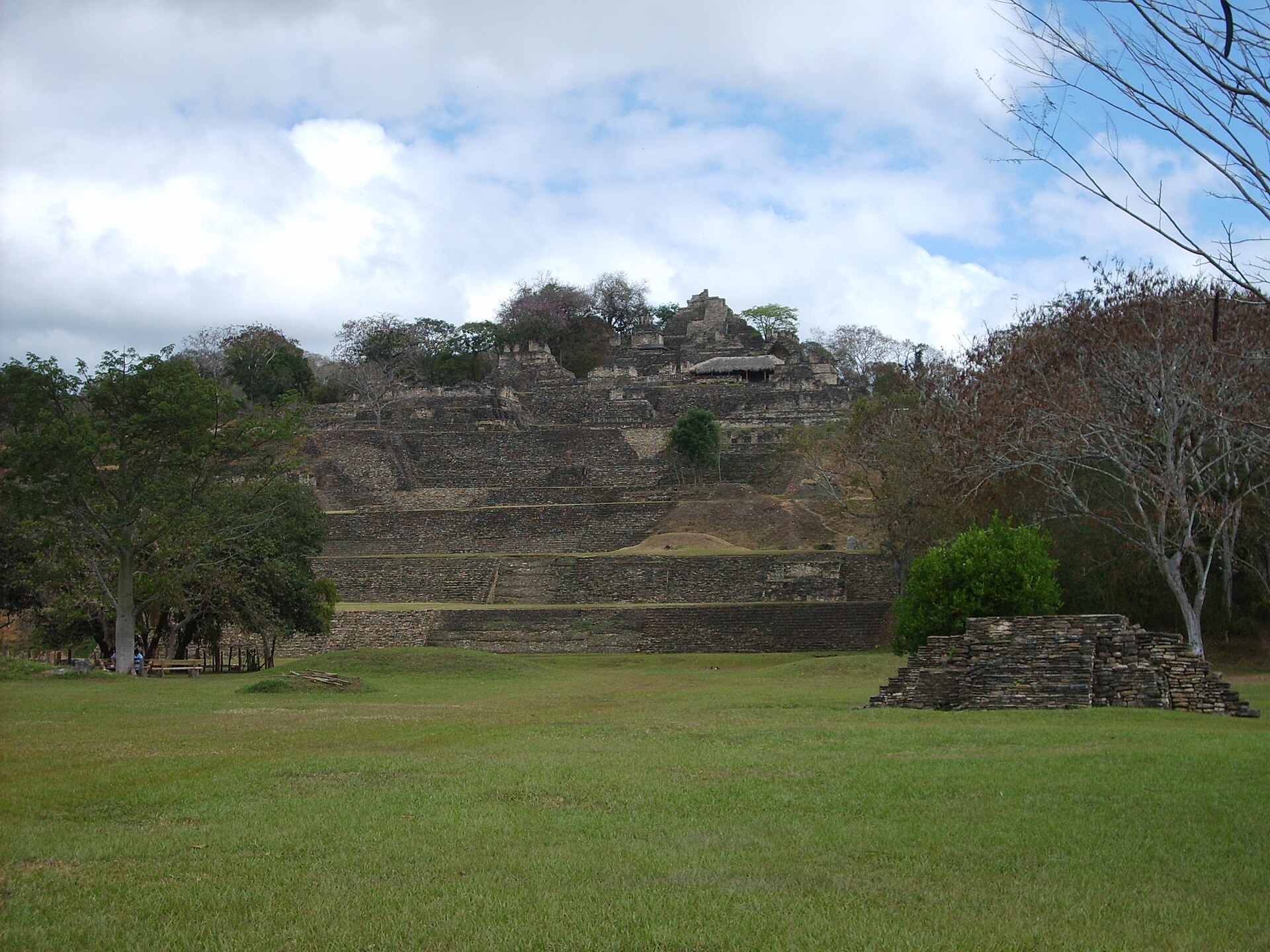
- Palace of the Underworld — Mid-level terrace
This atmospheric architectural complex features dark vaulted chambers and stone entryways associated in Maya cosmology with the spiritual realm of the underworld. The subterranean design reflects ancient beliefs regarding ancestor veneration, royal authority, and the cyclical journey of the soul through the cosmos.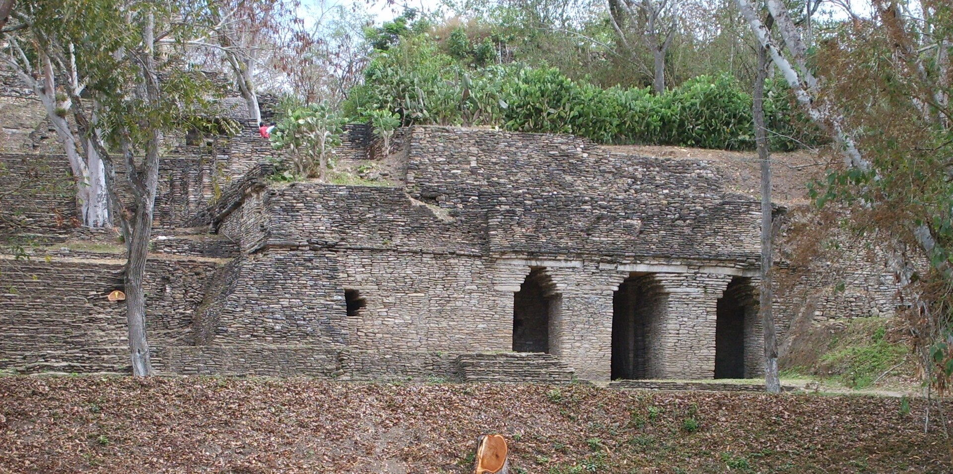
- Site Museum — Site entrance zone
Positioned near the entrance, the museum houses an exceptional collection of carved stelae, portrait sculptures of captured rulers, and detailed interpretive displays. The exhibits explain how the tiered acropolis mirrored Maya mythology and display intact stucco fragments rescued from the ruined structures.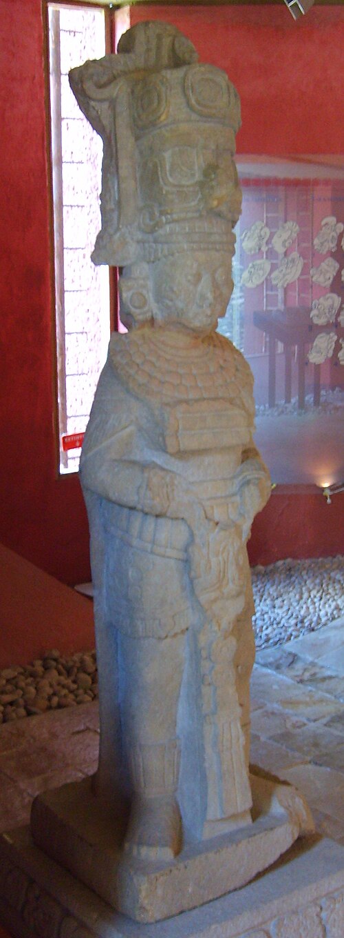
Culture
The cultural heritage of the area surrounding Toniná is deeply rooted in Tzeltal Maya traditions, visible in the daily life, language, and spiritual practices of the rural communities living throughout the Chiapas highlands. Local residents maintain agricultural rhythms tied to maize cultivation, alongside traditional craft practices such as backstrap weaving and pottery production. Traditional spiritual life blends ancient indigenous beliefs with Catholic practices, creating vibrant local festivals that mark the agricultural calendar and honour patron saints with processions, music, and traditional dancing. Visitors should always ask permission before photographing local residents, particularly village elders and individuals participating in traditional ceremonies.
What to wear
Traditional dress in the surrounding Chiapas highlands features hand-woven textiles rich in symbolism, with women often wearing embroidered cotton blouses known as huipiles, wrapped woolen skirts secured with woven belts, and intricately patterned shawls that vary in colour and motif from one community to another. Men traditionally wear woven wool tunics or simple cotton shirts and trousers suited for agricultural labour. In the nearby towns and municipal centres, people now wear contemporary casual attire such as jeans, shirts, and practical footwear, though older generations frequently retain traditional garments for daily wear and festive occasions. For travellers exploring the archaeological site, practical outdoor clothing is essential: lightweight, breathable layers protect against the highland sun, while sturdy walking shoes with reliable grip are necessary for climbing the steep, uneven stone steps of the pyramids.
What to eat
- Chiapas Quesillo — Ocosingo market and local eateries
A rich, stringy local cheese produced across the highland region, frequently served fresh or melted into traditional dishes at family-run eateries around the main plaza in Ocosingo. - Black Bean Soup — Traditional food stalls near the town square
A comforting, earthy broth prepared with locally harvested black beans, seasoned with epazote, and often garnished with crumbled fresh cheese and crisp tortilla strips. - Pozol Drink — Ocosingo municipal market
A traditional nourishing beverage made from fermented maize dough and cacao, served chilled in local markets to refresh travellers navigating the warm highland afternoons. - Tamales Chiapanecos — Small family-run restaurants in Ocosingo
Masa dough filled with chicken or pork, vegetables, and local mole sauce, wrapped securely in banana leaves and steamed until tender in neighbourhood kitchens.
Plan it
Best time. March to April for drier weather and comfortable temperatures, or late October to November when the landscape remains lush following the rainy season.
How long. 1–2
Getting there. Fly into Tuxtla Gutiérrez or Villahermosa, then travel by road to Ocosingo via highway MEX 199. From the Ocosingo market, take a local colectivo or taxi for the final 13 km stretch to the ruins.
Budget. low
Tips
- Arrive early in the morning to explore the pyramids before the midday heat sets in
- Carry sufficient cash for local transport, admission fees, and meals in Ocosingo
- Wear sturdy footwear with good grip for climbing the steep, uneven stone stairs
- Bring drinking water and sun protection, as shade is limited on the upper terraces
Etiquette
- Always ask permission before photographing local residents and indigenous weavers
- Do not climb on restricted walls or damaged stone carvings within the archaeological zone
Nearby
Sources
- Wikidata Q1042074 (CC0)
- Wikipedia (rev 1365082215) (CC-BY-SA 4.0)
- Wikivoyage (rev 5387582) (CC-BY-SA 4.0)