Sundarbans
Sundarbans, India
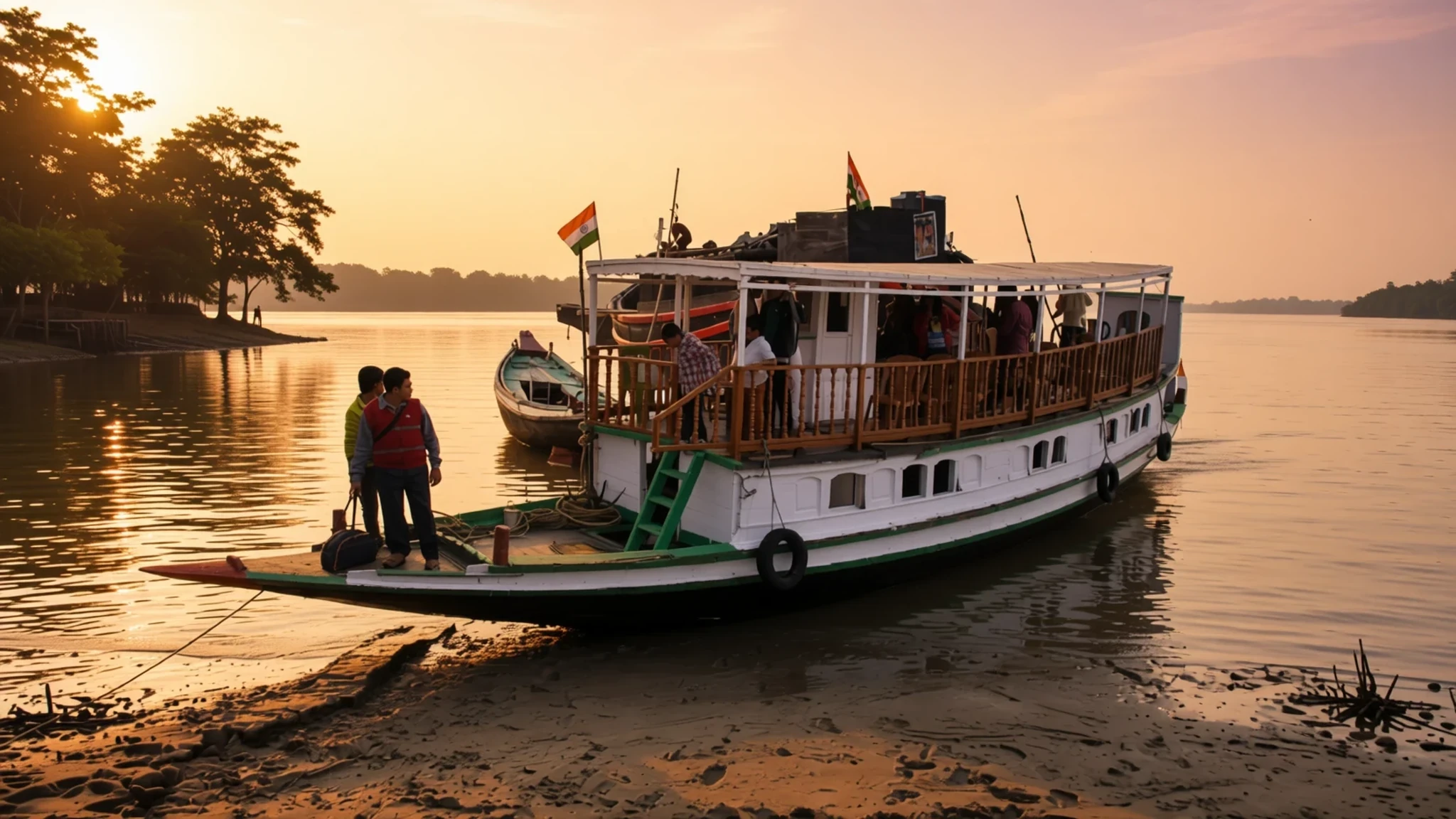
The world's largest mangrove forest, a tidal maze of channels shared by India and Bangladesh, and home to tigers.
The place
The Sundarbans is a mangrove delta at the head of the Bay of Bengal, where the Ganges, Brahmaputra and Meghna rivers reach the sea and spread into a web of channels. It straddles the border. The Indian part lies in West Bengal, in the South and North Parganas districts, while the larger share, around the Khulna Division, is in Bangladesh. Across the whole delta the forest covers roughly 10,277 km, which is why it is usually called the world's largest mangrove forest. It is not one unbroken wall of trees. Dense closed mangrove sits beside open forest, farmland on higher ground, mudflats and bare patches of sand, and all of it is cut through by tidal streams that rise and fall with the sea.
Two tree species dominate: sundri, which is the most abundant, and gewa. The waterways support a surprising range of wildlife, from spotted deer and many birds to the Bengal tiger, which is rarely seen but is the reason many people come.
People live here too. The population is over 4 million, mostly in villages on the forest's edge, where rice and vegetables are grown on land that floods in the monsoon. The delta is also exposed. Cyclone Sidr in 2007 damaged a large part of the forest, and Cyclone Aila in 2009 caused heavy loss of life. Rising salt in the water, linked to sea-level rise and less fresh water from upstream, is changing which trees thrive. Visit with that in mind. This is a working landscape under pressure, not a museum.
Its story
The Sundarbans has been lived around for a very long time. Settlement here goes back to the Mauryan era, and folklore points to an abandoned city in the Baghmara forest block, linked to Chand Sadagar, a figure from Bengali legend. Archaeologists have also excavated the remains of an early medieval town at Kapilmuni, just north of the forest in Bangladesh. Under the Mughals, local rulers leased out tracts of forest for new settlements, so the edges of the delta were cleared and farmed piece by piece.
The British East India Company gained proprietary rights over the area in 1757 and had it mapped by 1764. Systematic forest management, though, came much later. The first forest division with jurisdiction over the Sundarbans was set up in 1869, and in 1875 a large part of the mangroves was declared reserved forest under the Indian Forest Act. The remainder followed a year later, and the forest passed from civil district administration to the Forest Department. A division based in what is now Khulna followed in 1879, and foresters soon began writing management plans for the timber and fuel the forest supplied.
That history explains much of the present. The forest was valued for its wood long before anyone thought of it as a refuge for tigers, and the boundaries drawn in the nineteenth century still shape where villages, farms and protected land meet today. The modern story is one of cyclones, salinity and the slow search for a balance between livelihoods and wildlife.
What to see
- Sundari forest along the tidal channels — Indian side, Sundarbans National Park, South 24 Parganas district
Sundri is the most abundant tree in the forest, and it gives the Sundarbans much of its character. Boats follow the tidal channels between walls of trees, and the light changes quickly as the canopy closes in. Go on a guided trip rather than alone. The banks look similar for miles, and a good guide knows where the water stays deep enough at low tide.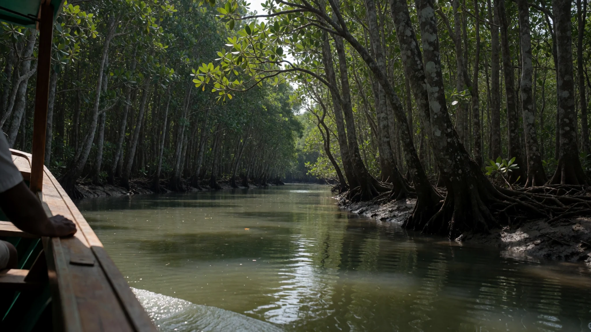
- Tiger reserve waterways — Sundarban Tiger Reserve, West Bengal
Bengal tigers live in these waters, and the Indian part is managed as a tiger reserve. Your chance of seeing one is low, and no guide can promise a sighting. Watch the muddy banks for fresh tracks and listen to your guide, who will know which stretches have been used recently. Treat any sighting as a bonus rather than the point of the trip.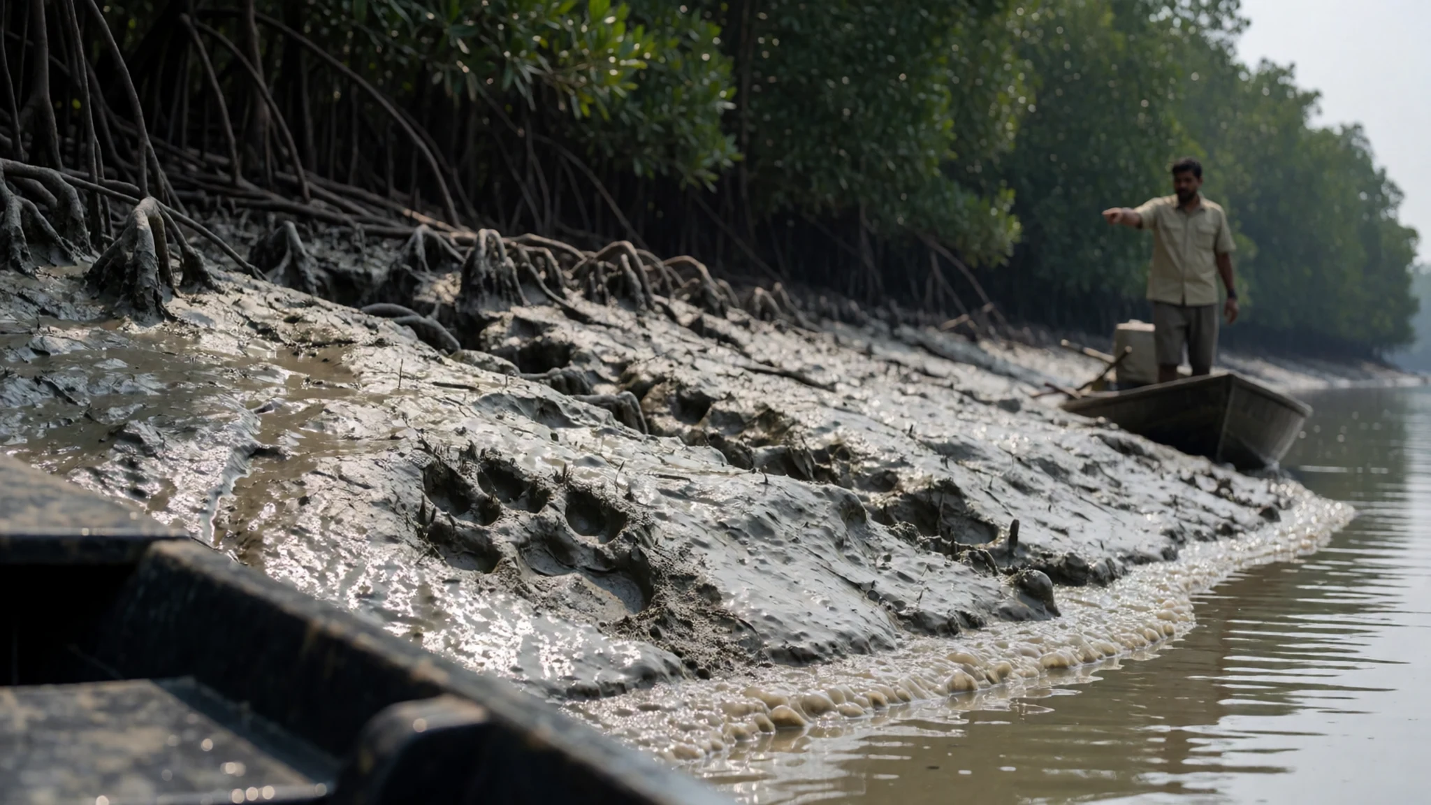
- Chital herds in the open forest — Bangladeshi Sundarbans, Khulna Division
Chital, the spotted deer, move through the more open stretches of the forest in small herds. They are easier to see than tigers and often appear at the water's edge in the early morning. Keep the boat quiet and do not chase them along the bank. Their presence is a good sign of how the forest is doing.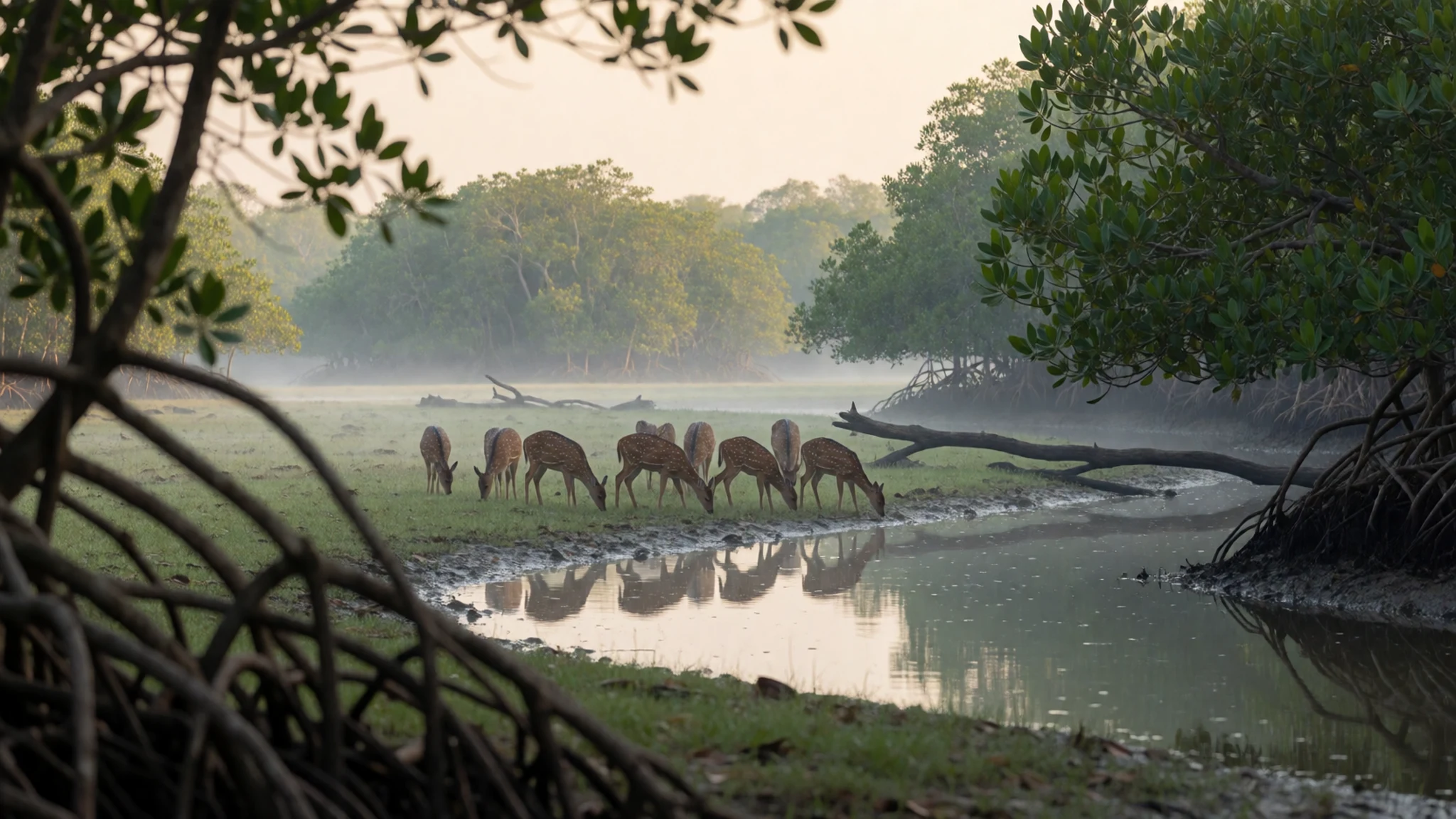
- Farmland and villages on the forest edge — Forest edge, Indian side, South 24 Parganas district
Some of the land along the forest edge is shielded from tidal flow, and here you find villages, rice fields and fish ponds. In the monsoon, low fields are waterlogged, so farmers grow floating rice. In winter the land is used for grazing and vegetable crops. A walk through a village gives a sense of how closely people's lives are tied to the tides.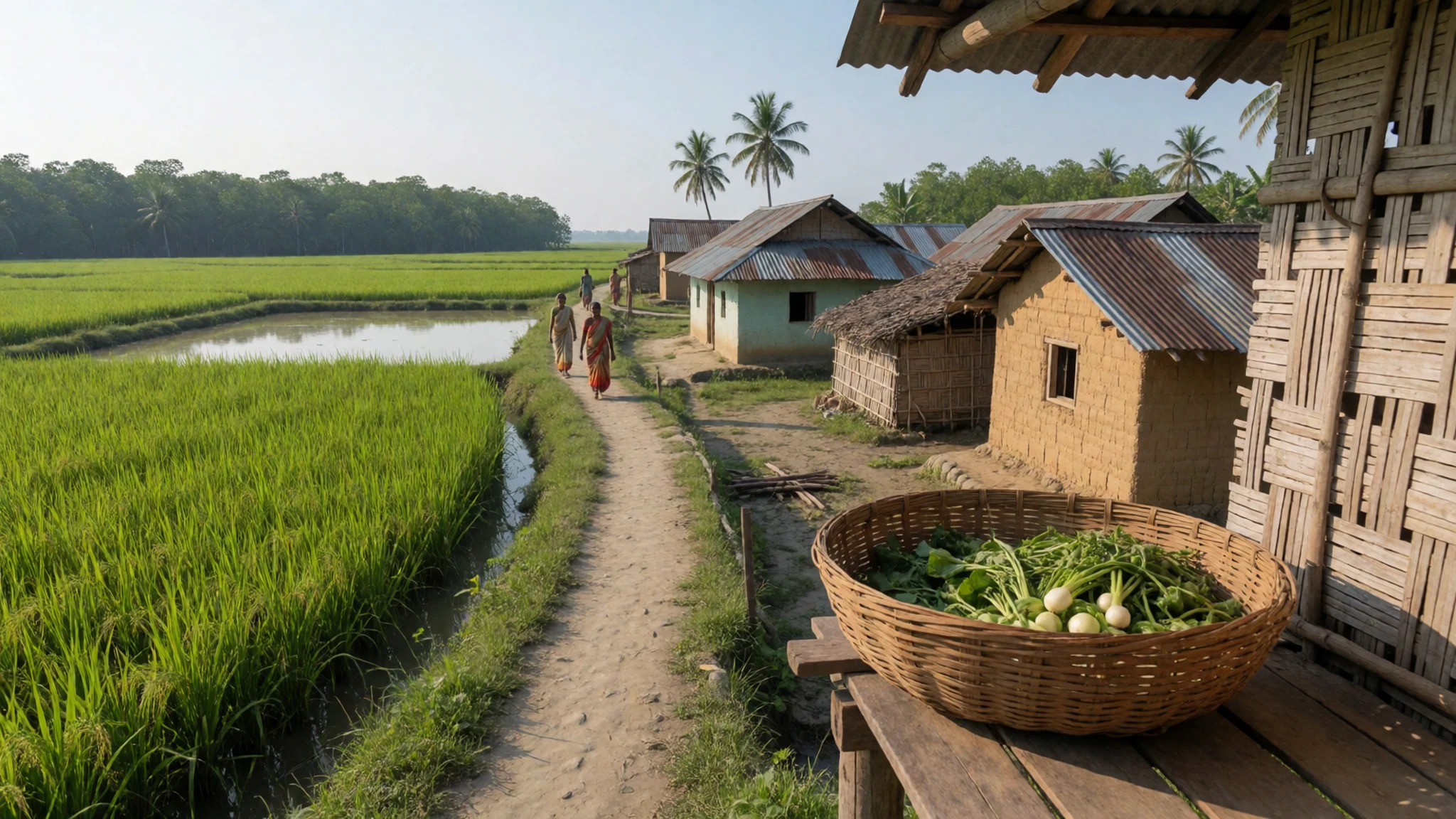
- Natural heritage forest on the Bangladesh side — Bangladeshi Sundarbans, Khulna Division
The Bangladeshi part of the Sundarbans includes protected areas that are listed as World Heritage Sites, and the wider forest is one of the most studied mangrove systems in the world. Visiting rules and permits differ between the two countries, so check the official site before you plan a crossing. Plan to travel with a licensed operator.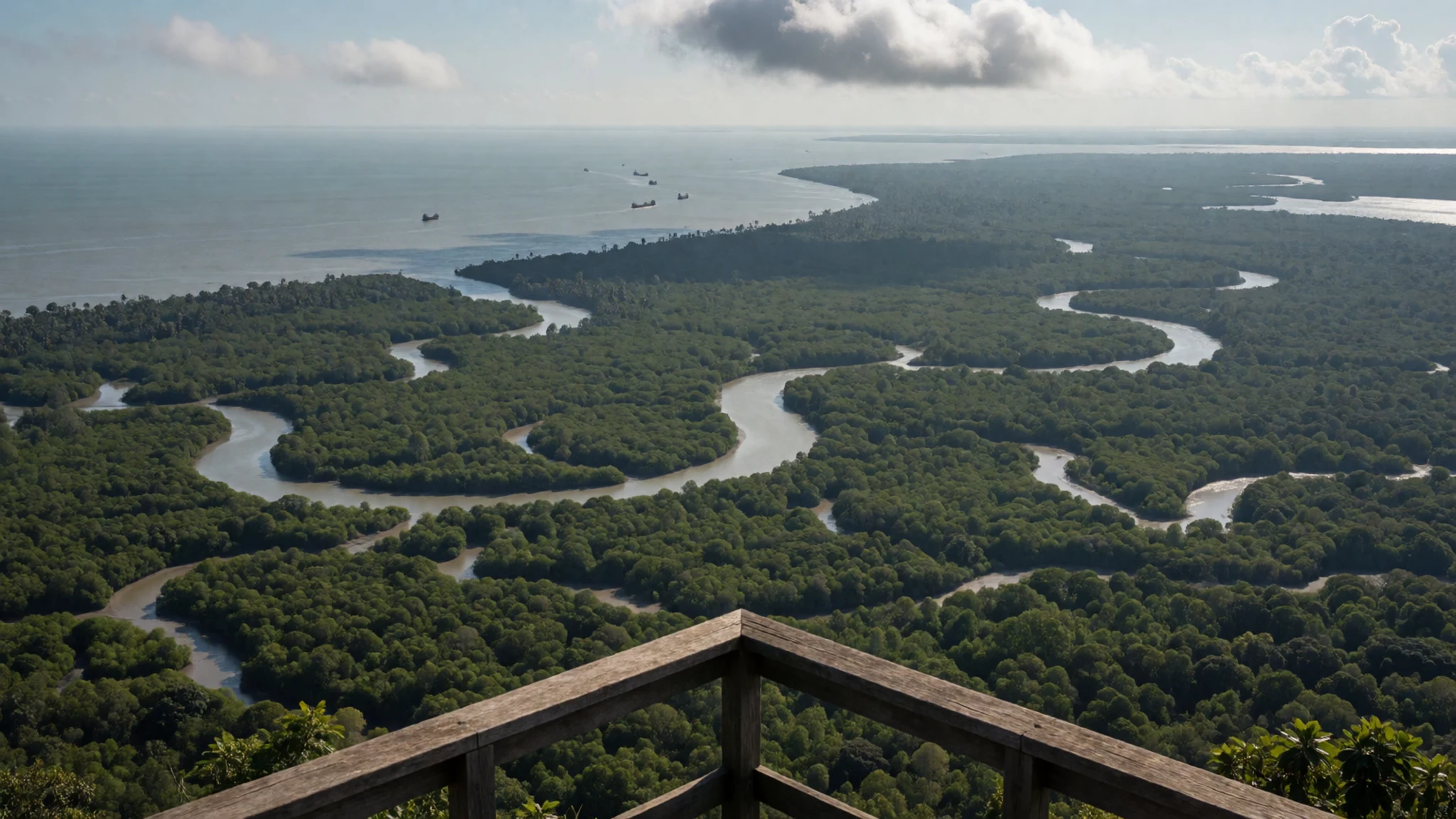
Culture
In the Sundarbans, you are a guest in other people's working landscape. Many villages depend on fishing, crab catching, honey collection and farming on land that floods, and daily life follows the tides. Bengali is the everyday language on the Indian side, and Bangla is spoken across the border, so a few words of greeting go a long way. Hospitality is generous, and people are usually glad to talk about their work and their homes. Religious life is mixed, with Hindu and Muslim communities living side by side, and shrines sit near the water on both sides. Expect to be asked for small tips at jetties and by boat operators, so carry small notes in cash rather than large ones. Forest rules protect both the wildlife and the people who enter the forest for honey and fish, so follow your guide and do not leave plastic on the boat or the banks. Ask before photographing anyone at home, especially women, and take your shoes off wherever others do.
What to wear
Traditional dress in the Sundarbans is Bengali. Women wear the sari, often in cotton or handloom silk, with the end draped over the shoulder. Lighter cotton saris are the everyday choice in the delta, while silk is kept for weddings and festivals. Men traditionally wear the dhoti or the lungi, a checked cloth tied at the waist, usually with a plain cotton shirt. Handloom weaving, using locally grown cotton, has long been part of village life across West Bengal and Bangladesh.
What people wear now is more mixed. In the villages you will see saris and lungis alongside jeans, T-shirts and school uniforms for children. Younger men wear trousers and shirts, and many women wear the salwar kameez, which is practical on wet ground.
For a visitor, the sensible choice is light, loose, long-sleeved cotton in neutral colours, which keeps off sun and mosquitoes. Long trousers or a long skirt suit village visits better than shorts, and a shawl or scarf covers the shoulders at religious sites. Pack closed shoes or sandals with grip for the jetties and slippery mud, and bring a wide-brimmed hat and a light rain layer for the monsoon months.
What to eat
- Bhetki paturi — Fish eateries in the Bengali market towns near the jetties
Bhetki is a firm white fish, marinated in mustard, coconut and green chilli, then wrapped in banana leaf and steamed. It is a classic Bengali dish and a good sign that the cook knows the local catch. Ask for it at a fish eatery that cooks to order.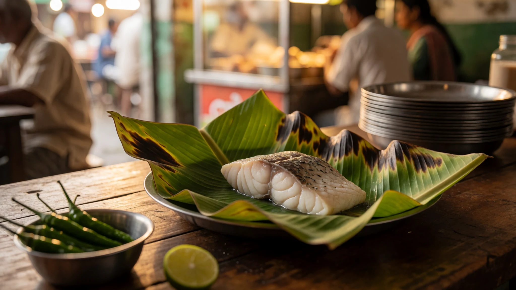
- Chingri malai curry — Family kitchens in the delta villages and simple eateries near the jetties
Prawns cooked in a mild, creamy sauce of coconut milk and spices. It is rich rather than hot, and it is often served with plain rice. Good versions come from home kitchens, so ask a guide or boat operator whether a family can cook it for you.
- Crab curry — The morning fish market in the jetty towns
Mud crabs from the creeks are cooked in a thin, fragrant curry with onion, ginger and mustard oil. Eating it means working through the shell with your fingers, which is part of the pleasure. It is usually a lunch dish.
- Forest honey — Roadside stalls and small shops in the market towns near the forest
Honey gathered from the forest is dark and strong, and it is sold in small jars at roadside stalls. Villagers who enter the forest collect it, and buying it directly helps them. Ask where it came from and whether the seller collected it themselves. - Winter pitha — Winter village fairs and sweet stalls in the market towns
Pitha are rice-flour cakes filled with date palm jaggery or coconut and steamed or fried. They appear mainly in winter, when harvest festivals bring fairs and sweet stalls. They make a good snack on a cold morning out on the water.
Plan it
Best time. November to February, when the days are cool and dry and the water is calmer for boat trips. June to September is the monsoon, when much of the delta is underwater and storms are a real risk.
How long. 2–3
Getting there. Fly to Kolkata, then drive south to the jetties at Godkhali or Canning and board a licensed boat into the forest. On the Bangladesh side, travel is by road and launch from Khulna.
Budget. mid
Tips
- Book a licensed boat and guide through the forest department or a reputable operator, and confirm permits before you travel
- Go out at first light, when wildlife is more active and the water is calmer
- Carry cash in small notes, because cards are rarely accepted in villages and jetty towns
- Bring drinking water, insect repellent and a light rain layer, since the air is humid and mosquitoes are common
- Check weather warnings before you set out, because storms can change your plans quickly
Etiquette
- Stay in the boat or on marked paths when your guide asks, and do not land on mudflats without supervision
- Keep voices low near wildlife and do not feed or chase animals
- Take all litter back to the boat
Nearby
Sources
- Wikidata Q4526 (CC0)
- Wikipedia, Sundarbans (rev 1382863928) (CC BY-SA 4.0)
- Wikivoyage, Sundarbans (rev 5112307) (CC BY-SA 4.0)
- Photo 01, Sundari trees in Sundarbans, Monster eagle (CC BY 3.0)
- Photo 02, Save the Sundarbans 20, Shihabur Rahman (CC BY-SA 4.0)
- Photo 03, Hindu village in the Sunderbuns, Frederic Peter Layard (Public domain)
- Photo 04, Farm on an island in the Ganges delta, Arne Hückelheim (CC BY 3.0)
- Photo 05, NASA satellite image, Jesse Allen, Earth Observatory (Public domain)
- Photo 06, Nypa fruticans in Yap, Eric Guinther (CC BY 3.0)
- Photo 07, Bengal tiger at Sundarban Tiger Reserve, Soumyajit Nandy (CC BY-SA 4.0)
- Photo 08, Chital in the Bangladeshi Sundarbans, Fabian Lambeck (CC BY-SA 4.0)


