Serra da Capivara National Park
Serra da Capivara National Park, Brazil
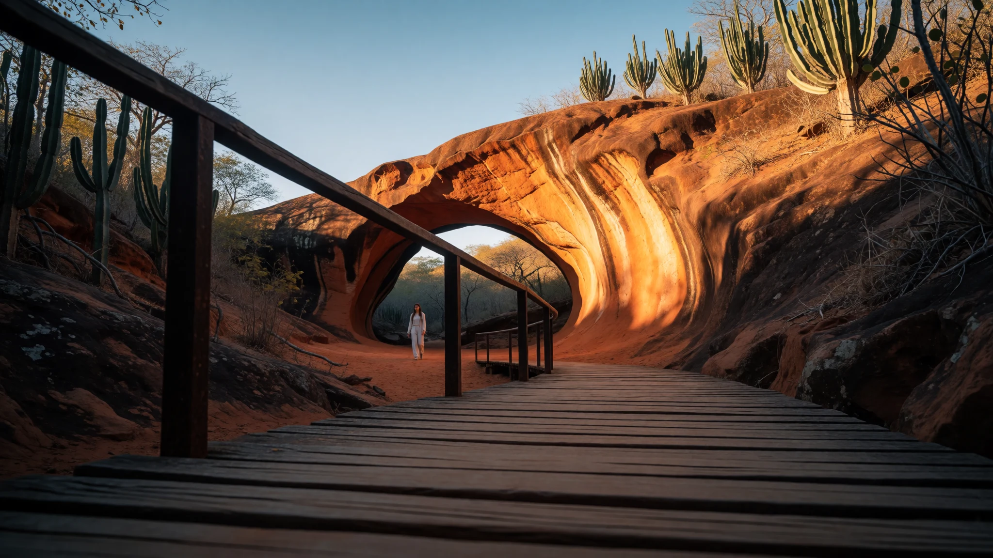
Serra da Capivara is a dry, dramatic park where canyon walks meet prehistoric paintings and rock formations.
The place
Serra da Capivara National Park (Parque Nacional Serra da Capivara) sits in Brazil’s Northeastern region, in the state of Piauí. The landscape is defined by the Capivara mountain range—its name translates as “Capybara Hills”—and it’s the sort of place where the scenery does most of the talking even before the archaeology begins. Expect a semi-arid setting of stone, ridges and cut valleys, with colours that shift across the day as the sun moves over pale rock.
What draws travellers here is the density of prehistoric sites, including painted rock shelters and rock formations tied to those sites. The park is not centred on one grand monument; it’s spread across different valleys and canyons, which makes the experience feel like a chain of discoveries rather than a single viewpoint-and-done day. A key landmark is Pedra Furada, mentioned as the park’s best-known archaeological site, and it also stands out in how visitors experience the area—along boardwalks and on evening visits when the rock formation is lit.
Logistics cluster around the nearby town of São Raimundo Nonato, which functions as the practical base for lodging, supplies and the local guides needed to explore the wider park circuits. In terms of “how it feels”, Serra da Capivara is remote and heat-exposure is real, so the best days are planned around cooler hours. The trade-off is worth it: fewer big-city distractions, a real connection between landscape and human history, and the kind of quiet that’s rare in mainstream routes.
Its story
Serra da Capivara National Park was created to safeguard the prehistoric artefacts and paintings found across its valleys and canyons. That conservation purpose is the backbone of the visitor experience: even when the route is only a few kilometres, the points of interest are tied to where human activity once happened, and where it’s still visible in pigment on stone.
The park gained wider international attention through excavations led by archaeologist Niède Guidon, beginning in the 1970s. Since then, the story of Serra da Capivara has been shaped by ongoing scientific work: researchers link the mountain range to long-term occupation patterns and have dated materials from sites in the wider area.
A major highlight is Pedra Furada, often treated as the flagship archaeological site. But it’s the variety of places that makes the history feel layered rather than repetitive: along with Pedra Furada, there are other well-known sites such as Toca da Tira Peia, Toca da Pena, Baxao da Esperanca and Sitio do Meio. Each location represents a different “chapter” in the evidence—tool use, habitation traces, and painted shelters—spread across the same rugged stone geography.
When planning a visit, it helps to think of Serra da Capivara as a living field site. The park is co-administered by a federal conservation agency (ICMBio) and the Museum of the American Man Foundation (Fundação Museu do Homem Americano, FUMDHAM), which explains why guided access and interpretation matter so much. The result is history you can walk to—literally across canyons and rock formations—rather than read about from behind glass.
What to see
- Pierced Rock (Pedra Furada) — Baixão da Pedra Furada area
The iconic stone arch is the park’s headline formation and a focal point for visitor routes. During evening visits, the main boardwalk leading to the arch is set up for night viewing, with floodlights that make the sandstone stand out against the dark desert sky. - Rock formations across the canyons — Valleys and canyon circuits
Serra da Capivara’s sights are scattered through different valleys, so you’ll see repeated “views within views”: rock walls, canyon edges and natural ledges. Photo spots often come from small changes in angle rather than single landmarks. - Canyon of Hope — Canyon circuits
The canyon route is named in a way that sounds gentle, but the environment is still remote and exposed. The point is to experience the scale of the canyon while following a guided circuit that connects the terrain to the sites in the park. - The Museum of the American Man — Museum zone near the main base
A museum stop helps connect what’s on the landscape with what researchers have found. It’s also one of the clearer “orientation” breaks on a day that otherwise moves between hot outdoor sections and quieter interpretive spaces. - Hike the archaeological circuits — Desfiladeiro and Alto da Pedra Furada routes
Serra da Capivara’s trail networks link multiple sites, from easier walks near some formations to rougher routes through canyons. The circuits vary in intensity, so timing and footwear matter if you want to keep the day comfortable rather than rushed.
Culture
Serra da Capivara National Park is cultural heritage you reach by walking—prehistoric paintings on rock and archaeological sites spread across canyons and valleys. That means the “rules of the place” are as important as the sights themselves: access is guided, and routes are designed around protecting what’s fragile as well as giving context. The park’s interpretation is strongly tied to the institutions managing it and to how scientists describe long-term occupation in the region.
The mood can be quite different from other popular parks. Here, you’ll spend long stretches in exposed terrain where shade is limited, and you’ll move according to the practical rhythms of the day—cooler mornings first, then slower pacing as the heat builds. Nights can be interesting too: evening visits may illuminate major formations, shifting how the landscape photographs and how it feels.
In short, Serra da Capivara rewards visitors who treat it like an outdoor museum with corridors made of stone: go in with a calm pace, listen carefully, and don’t treat every stop as a quick selfie moment. Respect the fact that many areas contain archaeological evidence that can be damaged by careless movement.
Visitor etiquette: follow your guide’s route, stay away from rock art surfaces, and keep voices low in enclosed shelters or near paintings.
What to wear
In Serra da Capivara you won’t see a single “park uniform”, but the region’s everyday clothing is adapted to heat and sun. Traditional dress in northeastern Brazil often includes textiles that are woven and dyed for local identity, and you’ll spot influences in regional markets and festivals—however, in the park itself the practical side of dress matters more than “traditional” outfits.
What people wear day to day is usually lightweight, breathable clothing: cotton or similar fabrics, loose shirts and long skirts or trousers that reduce sun on the skin. Footwear tends to be sturdy enough for uneven ground, especially on guided circuits where the path can be rocky.
For a visit to Serra da Capivara, dress for exposure: wear a hat with a wide brim, long sleeves or a sun-protective layer if possible, and breathable trousers to protect legs during canyon hikes. Trainers or hiking shoes with good grip are the safer choice because terrain can be rough and dusty. At museums and visitor areas, modesty is sensible and comfortable—think “cover up from the sun” rather than dressing for beach weather. Finally, carry a light layer for cooler early mornings, when the air can feel sharper before the day warms up.
If visiting evening boardwalk sessions, a comfortable layer can make the difference between “pleasant” and “chilly” once you stop moving.
What to eat
- Prato feito lunches at visitor-centre cafes — Centro de Visitantes do Baixão da Pedra Furada area and the Museu da Natureza restaurant
Near major entry points, visitor-centre snack bars serve simple set lunches during park operating hours, alongside coffee and cold drinks. Look for light savoury pastries (salgados) if arriving early and planning a longer circuit. - Trail provisions (dried fruit, nuts, high-energy snacks) — On archaeological circuit hikes
Inside the canyons there are no vending options on many circuit routes, so a daypack typically becomes the meal plan. Pack foods that travel well in heat—dried fruit, nuts, and other high-energy snacks. - Bode assado / Carne de sol — Gateway towns of São Raimundo Nonato and Coronel José Dias
In São Raimundo Nonato and Coronel José Dias, regional staples often appear as slow-cooked goat (bode) or sun-cured beef (carne de sol). These are usually served with sides like cassava and staples such as rice and beans. - Baião de dois — Gateway-town restaurants and churrascarias
Baião de dois is a northeastern mix built around rice and cowpeas or black-eyed beans, brought together with melted cheese and typically accompanied by dried meat. It’s a filling option after a long day outdoors. - Galinha caipira — Local restaurants in São Raimundo Nonato and Coronel José Dias
Free-range chicken stewed with regional spices is a common evening dish in the surrounding towns. It’s often served with pirão, a thick manioc flour gravy that soaks up sauce and helps with post-hike recovery.
Plan it
Best time. March–April and October–November for more comfortable outdoor temperatures; plan early starts because the park is semi-arid and sun exposure is a constant factor.
How long. 3–4
Getting there. Fly into Petrolina (PNZ) for more frequent connections, then drive to São Raimundo Nonato as the main gateway; alternatively, fly into Teresina (THE) and travel by road to the same base, then transfer to the park entrance areas for guided circuits.
Budget. mid
Tips
- Base in São Raimundo Nonato to arrange logistics and licensed local guiding for the circuit days
- Start with the longer routes in the morning and allow time for slower sections near archaeological sites
- Carry more water than planned: the park’s heat and sparse shade can make dehydration a real risk
- Use sturdy, grippy footwear for rocky canyon edges and uneven boardwalk sections
- If planning an evening visit to Pedra Furada, confirm arrangements in advance with your guide
Etiquette
- Stay strictly on the guided route around archaeological areas and rock shelters
- Keep a respectful distance from any painted surfaces and avoid touching stone features
- If wildlife is nearby, move calmly and give it space rather than crowding for photos
Nearby
Sources
- Wikidata Q267394 (CC0)
- Wikipedia (rev 1368889933) (CC BY-SA 4.0)
- Wikivoyage (rev 5382464) (CC BY-SA 4.0)