Seram
Seram, Indonesia
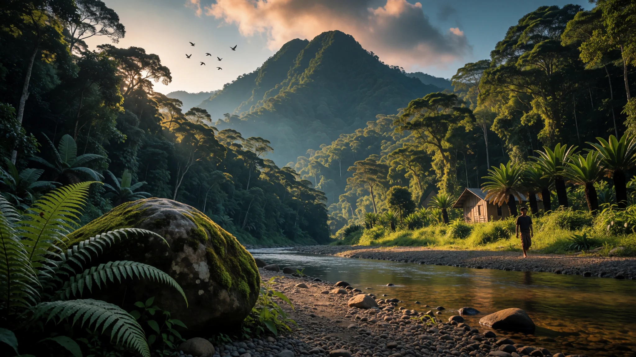
Seram is Maluku's largest island, a forested mountain interior with waterfalls, caves and villages, for travellers who prefer effort to polish.
The place
Seram is the largest island in Indonesia's Maluku province, lying just north of Ambon and a cluster of smaller islands that includes Saparua, Haruku and Nusa Laut. About 219,000 people live on it, mostly in coastal towns and villages, which leaves a great deal of the island under forest. A mountain range runs through the middle, and Mount Binaiya, its highest point, is wrapped in dense rain forest. The rugged shape owes much to a restless geology. Several small tectonic plates meet here, and Seram's own plate has been twisted round by roughly 80 degrees over about eight million years, pushing up ridges and leaving limestone country riddled with caves. Hatu Saka, near the village of Sawai, is a deep cave known to specialist cavers. Islanders have long called Seram Nusa Ina, Mother Island, and the name hints at how central it feels to people across the Moluccas. For a traveller, the draw is forest trails, rivers and waterfalls, quiet coastline and village stays rather than resorts. Roads are limited, journeys are slow, and plans bend around ferries and weather. Seram suits people who enjoy a loose itinerary, a local guide and long humid days outdoors. It is a poor match for anyone who wants polished services or fixed schedules.
Its story
Seram's story starts with its own people. Many central Moluccans regard the island as their ancestral home, which is why it is still called Nusa Ina, Mother Island. In the fifteenth and sixteenth centuries it sat mostly within the orbit of the Ternate sultanate, often governed through Buru, a Ternaten vassal. European contact began in 1512, when a Portuguese expedition led by António de Abreu, with Francisco Serrão, sailed along the whole southern coast; Portuguese missionaries followed in the sixteenth century. The Dutch opened trading posts in the early seventeenth century and held nominal control from around 1650, though the Tidore sultanate pressed its own claims and was given authority over the east for decades. Seram's forests and coves also made it a refuge. In the 1780s the island became a key base for Prince Nuku of Tidore during his long rebellion against Dutch rule. A later uprising used the same terrain: from 1954 to 1962, guerrillas of the Republic of South Maluku movement, led by Chris Soumokil, fought Indonesian rule from the mountains. The remoteness that sheltered rebels still keeps much of the interior quiet today. Sketches of Dutch trading-company forts survive in archives, but the island's history is carried far more in its villages and place names than in standing monuments.
What to see
- Mount Binaiya and the central range — Interior mountains
Binaiya is the highest point of Seram's central range, and the forest around it is dense and wet. Reaching it is a multi-day trek with local guides and porters, not a casual walk. Ask a Masohi or Ambon operator about permits and conditions before committing. - Sawai and the north coast villages — North coast
Sawai is a small coastal settlement backed by forested hills and reached by boat or long road journeys. It works as a base for village stays, snorkelling in calm bays and day trips inland. Expect simple lodging, shared meals and plenty of time spent waiting for transport.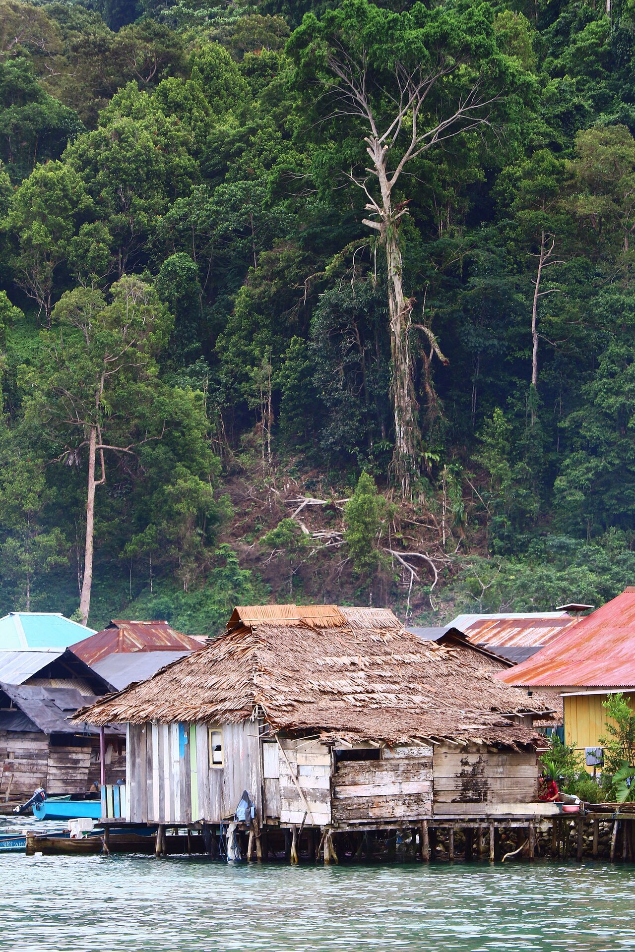
- Hatu Saka cave country — Hills near Sawai
Limestone karst rises in the hills near Sawai, and Hatu Saka is a deep cave there. It is serious caving territory, not a show cave. Only go with experienced guides and proper equipment, and ask locally before visiting any karst area, since some caves matter to nearby communities. - Tona Waterfall — Forest streams
Seram's rainfall feeds many cascades, and Tona Waterfall is one that has found its way into photographs. Waterfalls here are best after a few dry days, when the paths are less slippery and the water is clearer. Ask villagers about the route, and about whether swimming is welcome.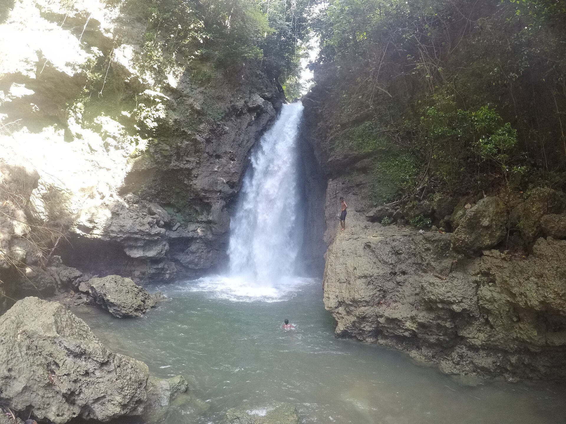
- Masohi and the south coast — South coast
Masohi is a working town and an administrative centre rather than a sight, but it is where most visitors find supplies, cash machines, transport and guides. It is informally divided into Christian and Muslim neighbourhoods. A walk through both sides shows how the island's communities live alongside each other.
Culture
Seram has long been linked with the animist traditions of the Alfur, among them the Nuaulu, a West Melanesian people whose customs are tied to the forest and to ancestral places. Headhunting is remembered in accounts of the past but belongs to history. Today most people on Seram are Muslim or Christian, through conversion and migration, while some Manusela communities follow Hinduism; the number is around 7,000. Seram was drawn into the violent conflict between communities that swept Maluku at the turn of the century, displacing tens of thousands of people across the province. After a peace accord signed at Malino, tempers cooled, and the island has been peaceful for many years. Memory lingers, though, and towns such as Masohi still have informally separate Christian and Muslim districts. Village life revolves around the church, the mosque and customary law, known as adat, and the village head is the person who can open doors for visitors. Foreigners are still uncommon in many places, so expect curiosity: locals may call out, stare, or ask for photographs, sometimes with a boisterousness that can feel overwhelming but is rarely meant unkindly. A smile and a greeting go a long way. Ask permission before photographing people, houses or ceremonial places, and introduce yourself to the village head before wandering through a settlement.
What to wear
Seram's traditional dress varies between peoples, and visitors should treat any single description with care. Among the Nuaulu, men have been associated with red headcloths, and ceremonial dress can include woven cloth, shell and feather ornaments, worn for rituals and customary events rather than daily life. Across Maluku more widely, wrapped cotton sarongs and cloths with printed or batik-style patterns are common, tied at the waist for the home, the mosque or the river. Day to day, most people wear what is practical in a hot, wet climate: T-shirts, shorts or trousers for men and long skirts or loose dresses for women, with a headscarf worn by many Muslim women. Sunday brings out neat shirts and dresses for church. Visitors should dress for heat and for humility. Pack light, quick-drying clothes that cover shoulders and knees, and long trousers for forest trails to protect against leeches, thorns and insects. Sturdy shoes with good grip are essential on muddy paths, and sandals or water shoes help at rivers and boat landings. A light rain jacket is worth carrying in any season. Swimwear belongs on remote beaches and boats, not in villages, where shorts and a T-shirt are more appropriate in the water. At a church or mosque, dress modestly and follow local guidance.
What to eat
- Papeda with fish in yellow soup — Home kitchens and simple eateries in coastal towns
Papeda is a glossy, sticky porridge made from sago starch. It is eaten with a turmeric-yellow fish soup, usually using fresh local catch. The texture surprises first-timers, but the sour, spiced broth is the point. Ask for it at homestays and eateries. - Grilled fish with colo-colo — Waterfront stalls and village evening meals
Fish is grilled over coals and served with colo-colo, a raw sauce of chilli, shallot, lime and sometimes tomato. It is simple and direct, and the best versions come straight from a boat. Choose what is freshest at the stall that day. - Sagu lempeng — Markets and roadside shops
These are hard sago biscuits, baked in clay moulds until crisp and dry, and they keep well for long journeys. Locals dip them into tea or coffee to soften them. They are a useful snack for trail days, if plain. - Cassava and sweet potato with sambal — Village meals and morning markets
Where rice is scarce or costly, starchy roots such as cassava and sweet potato are boiled or fried and served with a fiery chilli sambal. They are filling and cheap, and give a fair sense of everyday eating away from the towns. - Local fruit and fresh coconut — Roadside stalls and morning markets
Seasonal fruit appears at roadside stalls and markets, along with young coconuts cut open for the water inside. Prices are modest, and you can usually see what you are buying. Wash or peel fruit before eating it.
Plan it
Best time. Roughly October to December tends to be the more settled window for sea crossings and trekking, but Maluku's rain does not follow a neat pattern and varies between coasts. Check the forecast for the specific coast you plan to visit, and expect showers at any time in the rain forest.
How long. 4–7
Getting there. Fly to Pattimura Airport in Ambon, then take a ferry or fast boat across to the Seram coast, with onward travel by road or small boat to Masohi, Sawai or your village base. Schedules change, so confirm locally. Most visitors need an Indonesian e-Visa via the official immigration site and must complete the All Indonesia arrival card before travel.
Budget. mid
Tips
- Arrange guides and boats through a local operator or homestay before you leave Ambon
- Carry plenty of cash in small notes, since cash machines and card payments are scarce outside Masohi
- Allow slack in the itinerary for delayed ferries and weather
- Bring a water filter or purification tablets, insect repellent and a dry bag
- Treat trek dates as flexible and agree prices with guides in advance
Etiquette
- Greet the village head and ask permission before staying, trekking or photographing
- Dress modestly in villages and around churches and mosques
- Do not enter caves or ceremonial places without local permission
Nearby
Sources
- Wikidata Q185532 (CC0)
- Wikipedia: Seram Island (rev 1364199078) (CC BY-SA 4.0)
- Wikivoyage: Indonesia (rev 5427177) (CC BY-SA 4.0)
- Photo: Seram de (Lencer) (CC BY 3.0)
- Photo: Seram en (Lencer) (CC BY 3.0)
- Photo: The fort at Loki and Company troops in the interior (Caspar Schmalkalden) (Public domain)
- Photo: Illustration from 'Liefde-macht' (H. Krayer van Aalst) (Public domain)
- Photo: A remote Sawai village, Maluku (Tiket2.com) (CC BY 2.5)
- Photo: A view of Tona Waterfall (Magattediop) (CC BY-SA 4.0)
- Photo: Access for all (USAID Indonesia) (Public domain)
- Photo: Fort Lissidi sketch (unknown author) (CC BY-SA 4.0)


