Samaipata
Samaipata, Bolivia
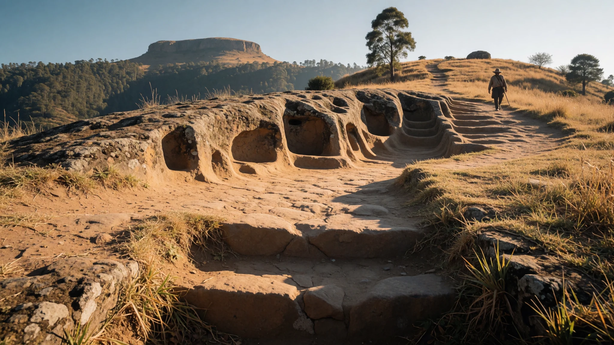
Samaipata pairs a mysterious carved-rock ceremonial site with a mild, unhurried Andean-foothill town, where the highlands drop toward the lowland forest.
The place
Samaipata sits in the eastern foothills of the Bolivian Andes, in Santa Cruz department, at an elevation of 1,904 metres. The name covers two things: a small town of cafés, guesthouses and quiet streets, and the archaeological site of El Fuerte ("the Fort") on a hilltop outside it. The town is where visitors stay, and the ruins are the reason most of them come. Despite its name, El Fuerte was never only a fortress. It worked as a ceremonial centre and a place to live as well, and it holds buildings left by three cultures: the Chané, the Inca and the Spanish. The site is a UNESCO World Heritage property. The setting matters as much as the stonework. Here the dry Andean highlands begin to fall away toward the humid lowlands, so the air is cooler than in Santa Cruz city, the hills turn green in the wetter months, and the views run across forested ridges to a flat-topped mountain called La Muela. Samaipata is popular with Bolivians and foreign travellers alike. Many come as a break from lowland heat, and others use the town as a base for walking and for trips into Amboró National Park. It stays quiet compared with the busier Andean sites, though weekends and holidays bring more people. Santa Cruz city is the transport hub for the region, and almost every journey to Samaipata begins there. The wider department is lowland, varied and full of people who have moved from elsewhere in Bolivia, which gives the area a blend of Andean and eastern habits that shows in the food and the clothes.
Its story
The story of Samaipata is one of layers, each laid over the last on the same hilltop. The Chané, a people of Arawak origin, probably began the site, shaping a great rock outcrop and the ground around it into a place for ritual and daily life. Later, as the Inca empire pushed east from the highlands into the subtropical foothills, the newcomers added their own plaza and residences. Neither group held the region in peace. Ava Guaraní warriors, also called Chiriguano, raided the Chané, the Inca and eventually the Spanish, and then settled in the area. They took control of the plains and valleys of Santa Cruz and kept it well into the colonial period, which is a useful corrective to any picture of the Inca as the final power in the east. The Spanish built their own settlement at the fort, and traces of Andalusian-style buildings can still be found there. The hilltop did not suit them for long. They abandoned it and moved down to a nearby valley, where they founded the town of Samaipata that visitors walk through today. The old site was left to the weather and, for a long time, to local memory. Its later recognition as a UNESCO World Heritage property brought archaeologists, conservation work and a steady stream of travellers. Even now, the purpose of the carved rock itself is argued over, and that open question is part of the draw.
What to see
- The carved rock of El Fuerte — El Fuerte archaeological site
The centrepiece of El Fuerte is a huge rock outcrop carved by hand into channels, steps, seats and animal-like shapes. Archaeologists still debate what it was for, and ceremonial use is the usual guess. It reads best in low morning or late afternoon light, when shadows pick out the grooves.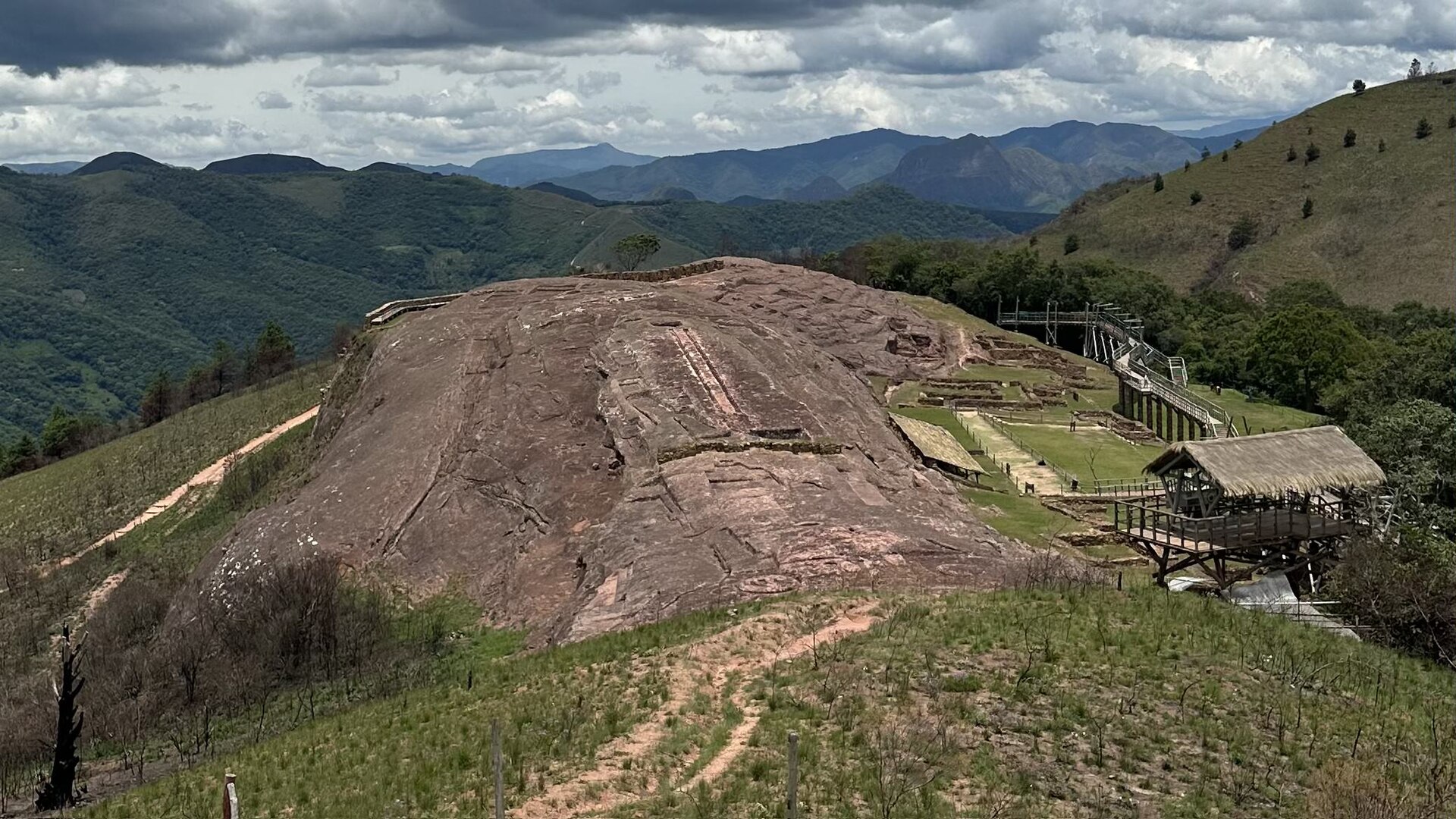
- Inca plaza and residences — El Fuerte archaeological site
Near the carved rock stand the remains of an Inca plaza and residences, left when the empire pushed east from the highlands into the foothills. Their straight walls and regular layout contrast with the freer carving nearby, and show how a new power reshaped an older site.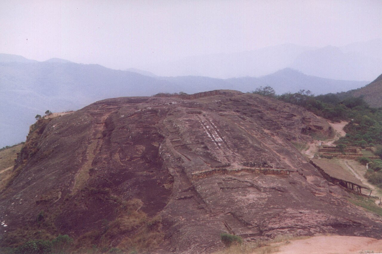
- Spanish-era remains — El Fuerte archaeological site
The Spanish also built on the hilltop, and traces of Andalusian-style architecture survive among the older stonework. Their settlement did not last, as the colonists soon moved down to a valley nearby. What remains is a reminder that this hill was occupied, abandoned and occupied again by successive peoples.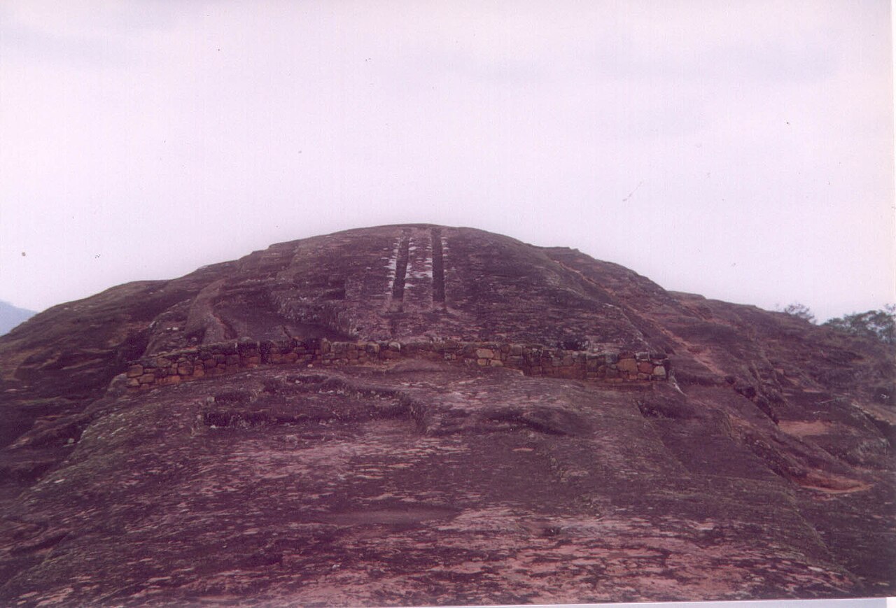
- La Muela viewpoint — Beyond El Fuerte
La Muela is the flat-topped mountain that holds the horizon when looking out from the ruins. The view across forested ridges explains why the hilltop was worth holding. Go on a clear morning, when haze is thin and the light is soft, and allow time to sit and look rather than only walk.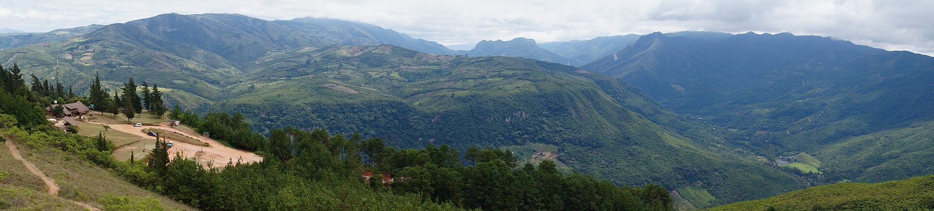
- Samaipata town — Samaipata town
The town of Samaipata, founded by the Spanish after they left the hilltop, is a compact grid of cafés, craft shops and small guesthouses around a main plaza. It is the practical base for the ruins and a relaxed place to spend an evening after a day outdoors. - Amboró National Park — North of Samaipata
Amboró National Park lies to the north and ranges from rainforest, home to monkeys, to rugged mountain country. Samaipata is a common starting point for visits. Trails can be hard to follow and access varies, so ask locally about guides and conditions before setting out.
Culture
Samaipata carries the memory of several peoples at once, and visitors meet that mix in the ruins, the town and the wider Santa Cruz region. The Chané, the Inca and the Spanish each left buildings at El Fuerte, while the Ava Guaraní, who raided and then dominated the surrounding lowlands, remain part of the region's history. Local guides and small museum displays tend to present the site as a layered place rather than the work of a single civilisation, and the carved rock is still discussed as an open question rather than a settled one. Day-to-day life in the town is relaxed and friendly. Many residents are Bolivians from elsewhere in the country, and there is also a long-standing community of foreign settlers, so cafés, craft shops and yoga studios sit beside ordinary village shops. People in the Santa Cruz lowlands are known for an easygoing, outdoor style, with long lunches, music and festivals that gather families in the plaza. Seasonal events in the region include baroque music, theatre and orchid shows, mostly based in the city but sometimes reaching provincial towns. Political rallies do occur in Bolivia, and visitors are wise to learn about them first rather than join in. At El Fuerte, stay on the marked paths and do not climb or walk on the carved rock surfaces, which wear easily and are the main thing the site exists to protect.
What to wear
Samaipata sits where highland and lowland dress meet, so the traditional picture is mixed. In the Andean highlands, women wear the pollera, a full gathered skirt, with a bowler hat and a woven shawl, and carry goods in a bright aguayo cloth. In the Santa Cruz lowlands the best-known women's garment is the tipoy, a long, loose dress in light cotton, often white or brightly printed, worn at festivals and folk events. Men's festive dress is simpler, usually a white or pale cotton shirt and trousers. Everyday clothing now is casual and practical: jeans, T-shirts, football shirts, sandals, caps and light jackets for the cool evenings. In town, the style leans toward relaxed, outdoorsy and a little bohemian, and travellers add hiking gear and sun hats. For visitors, the hilltop ruins are open, sunny and uneven, so wear sturdy closed shoes with good grip, a hat, sun cream and sunglasses, and bring a water bottle. Layers are sensible, since mornings and nights are cool at this elevation and midday can be warm. In the wetter months, add a light rain jacket, and expect muddy paths. There is no strict dress code at the ruins, but cover shoulders and knees when entering a church, and avoid beachwear in town.
What to eat
- Majadito — Family-run lunch spots in Samaipata town and market stalls
Majadito is the lowland rice dish of Santa Cruz, cooked with charqui, the dried and shredded beef, then topped with a fried egg and often plantain. It is filling, savoury and a sound lunch before or after the ruins. - Cuñapé — Bakeries and market stalls in town
Cuñapé are small baked rolls made from cassava starch and local cheese, chewy inside and crisp outside. They are an eastern Bolivian staple, eaten warm at breakfast or with coffee in the afternoon, and easy to carry on a walk. - Locro cruceño — Simple eateries and home-style restaurants in town
Locro is a thick chicken and rice soup of the Santa Cruz lowlands, seasoned with local herbs and served very hot. It is warming on the cool evenings that the town's altitude brings after sunset. - Masaco — Market stalls and local eateries
Masaco is mashed green plantain or cassava, often mixed with dried meat or cheese, served as a hearty side in eastern Bolivia. It tastes plain on its own and works best beside grilled meat or a soup. - Sonso — Street sellers and market stalls
Sonso is grated cassava mixed with cheese and wrapped round a stick, then roasted over coals. Sold as a snack, it is smoky, stretchy and best eaten hot, straight from the coals.
Plan it
Best time. May to October is the drier season, with clearer skies, cool mornings and cool nights, which suits walking at the ruins. November to April is wetter and greener, with afternoon storms and muddy paths, though the scenery is lush.
How long. 2–3
Getting there. Fly to Santa Cruz city, either Viru Viru International Airport (VVI) or El Trompillo Airport (SRZ), then continue by road to Samaipata. Ask at the bus terminal or your guesthouse about shared taxis and buses for the last leg.
Budget. low
Tips
- Visit El Fuerte early in the day, before the sun is high and while the light on the carved rock is soft
- Carry water, sun protection and a layer for cool evenings, as the town sits at 1,904 metres
- Bring some cash for small cafés, market stalls and taxis, as card acceptance can be patchy
- Check the official site (http://www.samaipata.com/ingles.htm) and ask locally about opening times and road conditions before you go
Etiquette
- Stay on marked paths at the ruins and do not climb on the carved rock
- Ask before photographing people, especially at markets and in traditional dress
- Do not join political demonstrations without first finding out what they are about
Nearby
Sources
- Wikidata Q876451 (CC0)
- Wikipedia: El Fuerte de Samaipata (rev 1365402982) (CC BY-SA 4.0)
- Wikivoyage: Santa Cruz (department, Bolivia) (rev 5156043) (CC BY-SA 4.0)
- Photo: Fuerte03.jpg (Mhwater, Dutch Wikipedia) (CC BY 3.0)
- Photo: View of Fort Samaipata Rock.jpg (Dpasten) (CC BY-SA 4.0)
- Photo: Samaipata.jpg (Marcelo Claros Marzana) (CC BY 3.0)
- Photo: Scenery at the UNESCO, El Fuerte de Samaipata site (Madereugeneandrew) (CC BY-SA 4.0)
- Photo: Elfuerte1.jpg (Haroldarmitage) (Public domain)
- Photo: Elfuerte2.jpg (Haroldarmitage) (Public domain)
- Photo: Elfuerte3.jpg (Haroldarmitage) (Public domain)
- Photo: Elfuerte4.jpg (Haroldarmitage) (Public domain)


