Rakiura National Park
Rakiura National Park, New Zealand
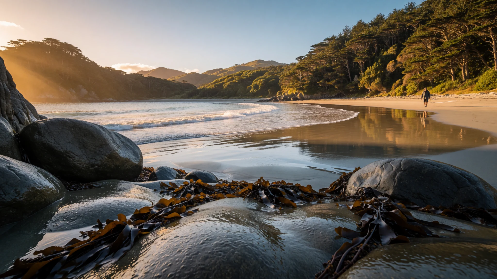
Rakiura National Park covers most of Stewart Island, offering walking tracks, forest birdsong and southern skies at the edge of New Zealand.
The place
Rakiura National Park fills most of Stewart Island / Rakiura, the small island south of New Zealand's South Island, across Foveaux Strait. The park protects about 85% of the island, which comes to close to 1,400 square kilometres. What it leaves out is telling: the little township of Oban around Halfmoon Bay, a few roads, and pockets of private or Māori-owned land inland. Nearly everything else is public, and nearly everything else is wet, green and quiet.
The landscape is coastal forest, beaches, inlets and low hills rather than the glaciated peaks of Fiordland. Paths run through dense bush, over boardwalks and bridges across tidal inlets, and out to sandy bays where there may be nobody at all. Weather arrives straight off the Southern Ocean, so rain, wind and mud are the normal condition, and a dry day feels like a bonus rather than a promise.
The park is also a young one. It opened in 2002 and is New Zealand's newest national park, stitched together from former nature reserves, scenic reserves and State Forest. That history shows in how it feels: less a single grand set piece, more a long run of protected coast and bush that people walk through over several days.
Visitors are few compared with the crowds at better-known southern destinations. Most come for the walking, the birdlife and the sense of distance. Oban is the base, with a small number of places to eat and sleep, so planning ahead matters.
Its story
Rakiura National Park carries an older story than its date of opening suggests. In Māori tradition, the South Island was the canoe of the demigod Māui, and Rakiura was the anchor that held it steady. One of the island's names, Te Punga o Te Waka a Māui, means exactly that: the anchor of Māui's canoe. The name Rakiura itself is often translated as 'glowing skies', a nod to the southern lights that can colour the night here.
The national park is the modern chapter. It was officially opened on 9 March 2002 by the Prime Minister, Helen Clark, together with the Minister of Conservation, Sandra Lee, and the mountaineer Sir Edmund Hillary. It was assembled from a network of earlier protected areas, including nature reserves, scenic reserves and State Forest, rather than carved out of untouched land in one move.
The myth was built into the opening itself. A chain sculpture at the park entrance, designed by the Southland sculptor Russell Beck, represents the link between the anchor and the canoe. It was unveiled as part of the ceremonies. In 2008 a matching sculpture was erected at Bluff, on the mainland, to mark the other end of the chain.
For visitors, the story is a useful way in. The island is not a remote leftover at the edge of a map but, in the local telling, the point that holds the country in place. That framing sits comfortably alongside the practical reality of a protected park that people now walk, study and look after.
What to see
- The chain sculpture — Oban, Halfmoon Bay
The chain sculpture at the entrance to Rakiura National Park stands near Oban and is an easy first stop on foot. Designed by the Southland sculptor Russell Beck, it ties the island to the Māori story of Māui's canoe and anchor. A matching piece in Bluff marks the far end of the chain.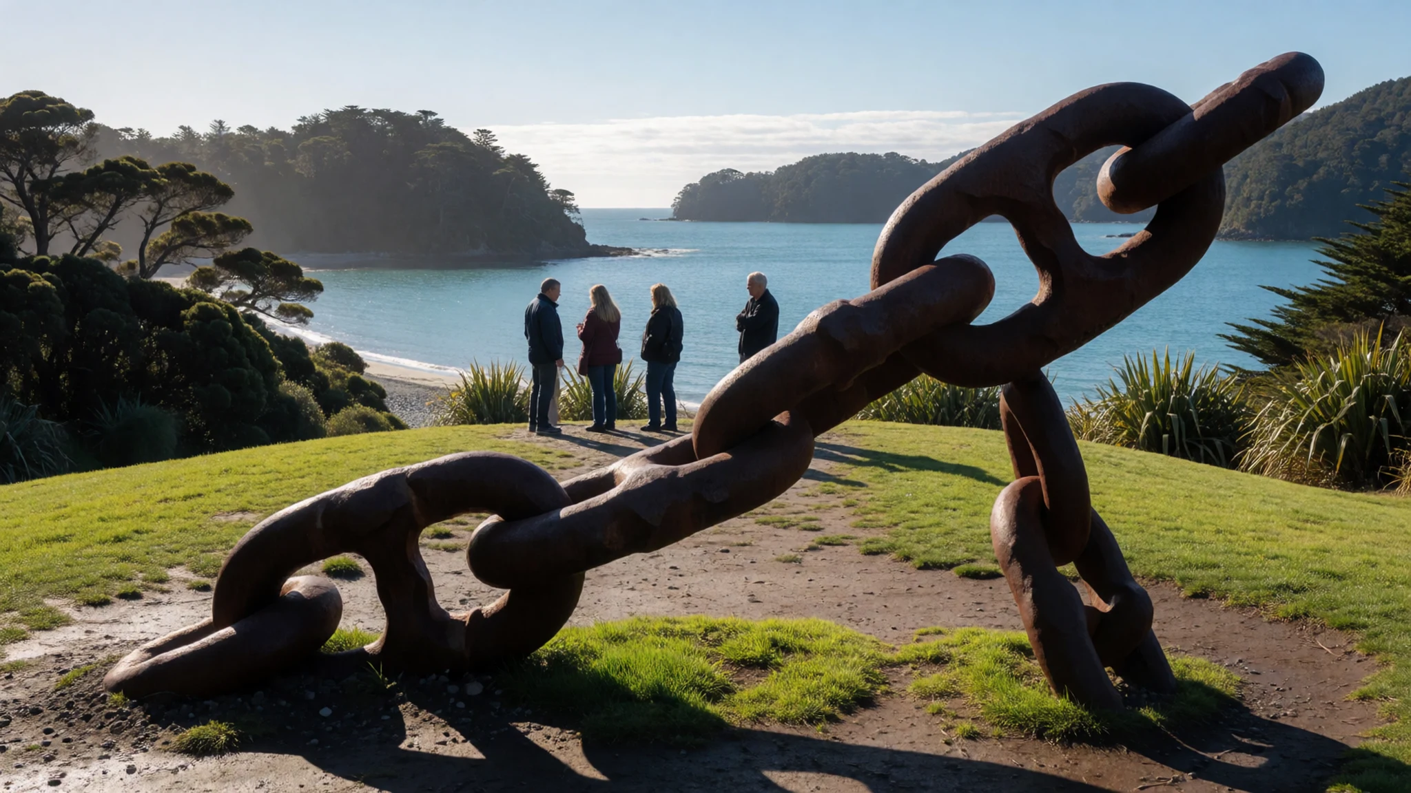
- Rakiura Track — Near Oban to Port William
The Rakiura Track is the park's signature Great Walk, a loop through coastal forest, over bridged inlets and past quiet beaches, starting near Oban. Huts and campsites make it a multi-day trip, so booking through the Department of Conservation comes first. Near Port William Hut the path runs close to the shore, and mud after rain is normal.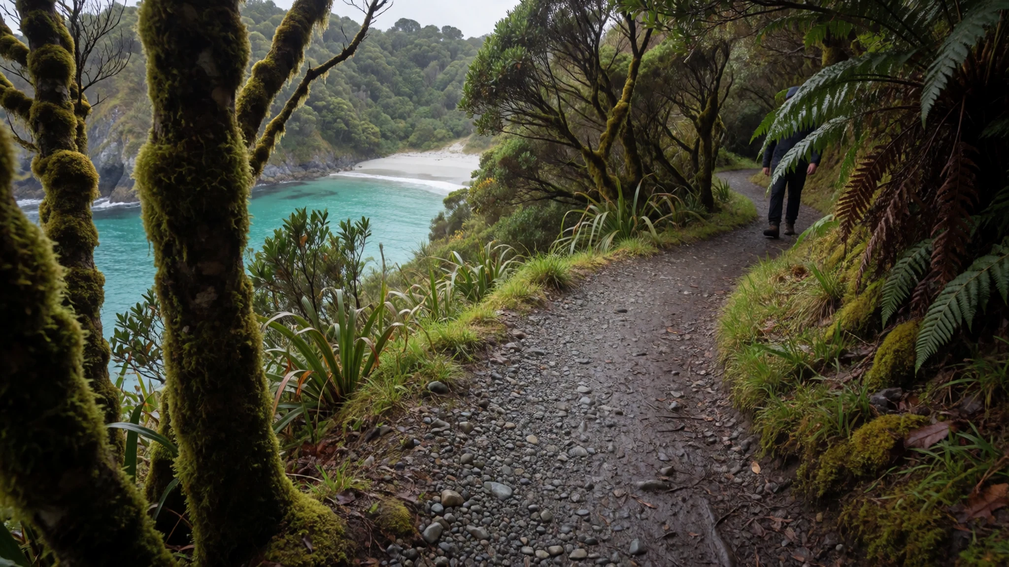
- Māori Beach — Rakiura Track, east coast
Māori Beach lies along the Rakiura Track, with a campsite behind the sand and a creek at its south-east end running toward Port William. Early morning is the time to arrive, when light comes in low across an empty bay. Tides and weather decide how easy the creek crossings are, so check conditions first.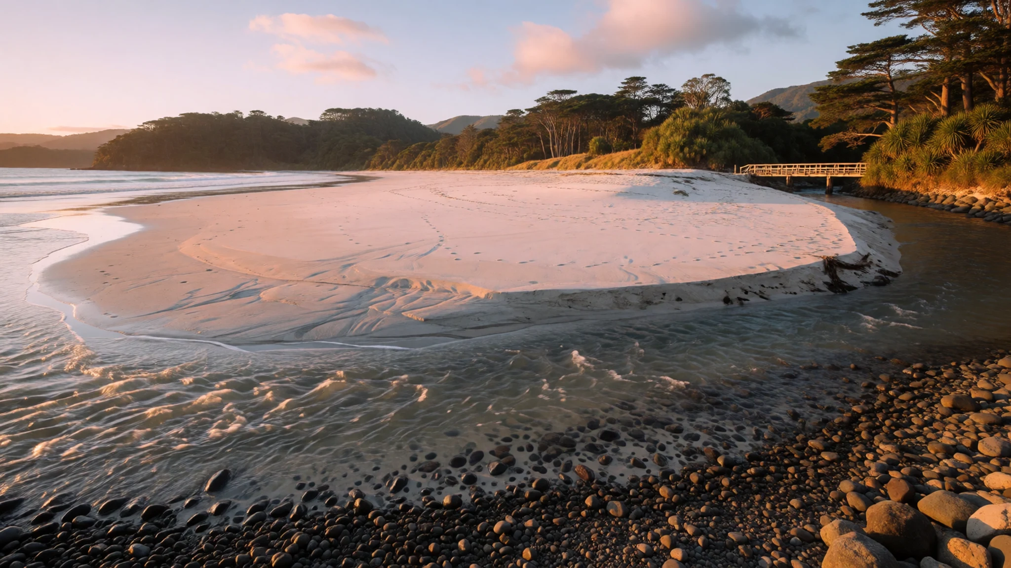
- Mason Bay and the North West Circuit — Western Stewart Island
Mason Bay sits on the wild western side of Rakiura National Park, reached on foot along the North West Circuit or by a short flight from Oban. Long dunes and open sand give it a remote feel. The tracks here are serious multi-day walking, with boggy ground and river crossings, and suit experienced, well-equipped walkers.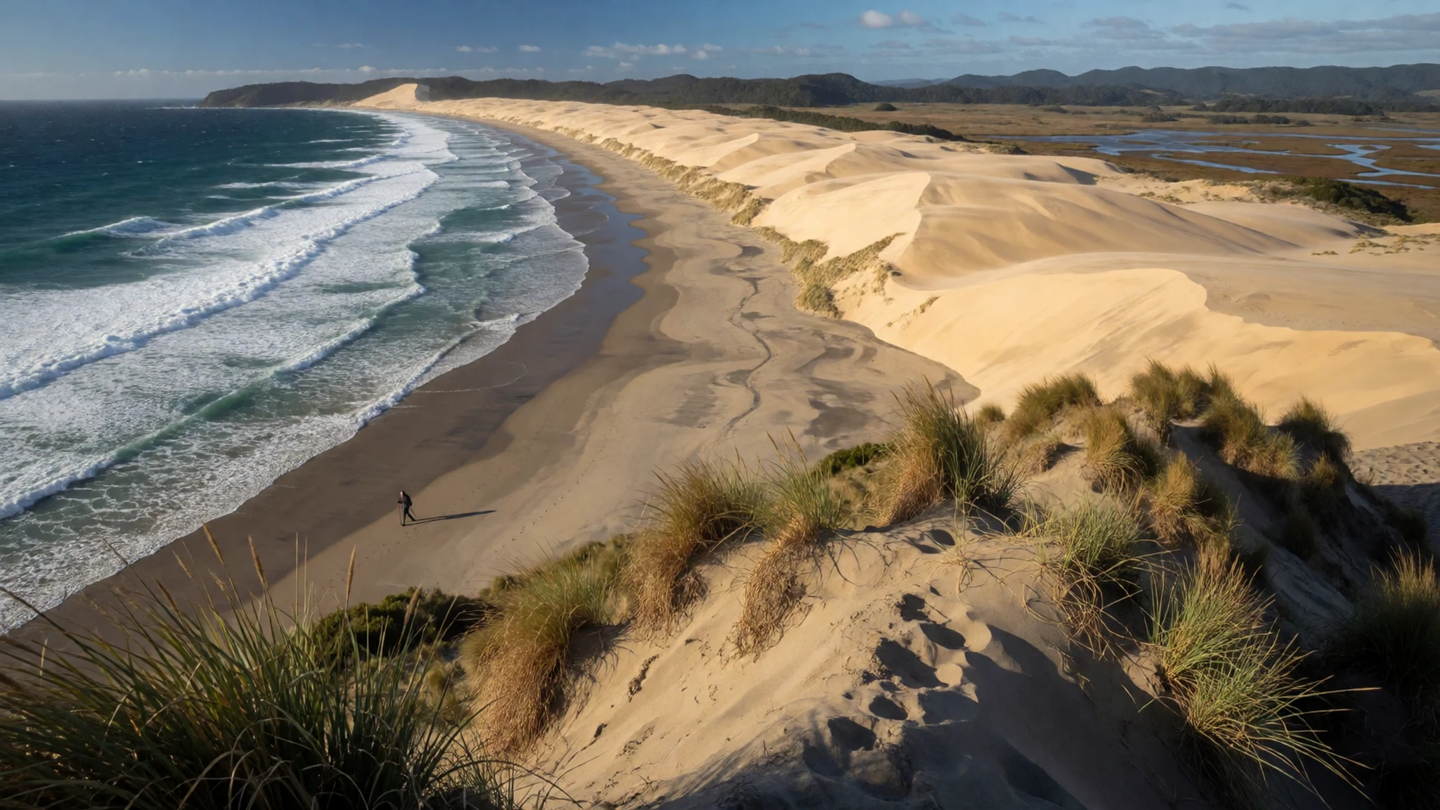
- Ulva Island — Paterson Inlet, near Oban
Ulva Island sits in Paterson Inlet, a short water taxi from Oban, and is a protected bird sanctuary within Rakiura National Park. Forest birds are far easier to see here because the island is managed to keep predators out. Walk slowly, listen before looking, and expect to stop at almost every tree.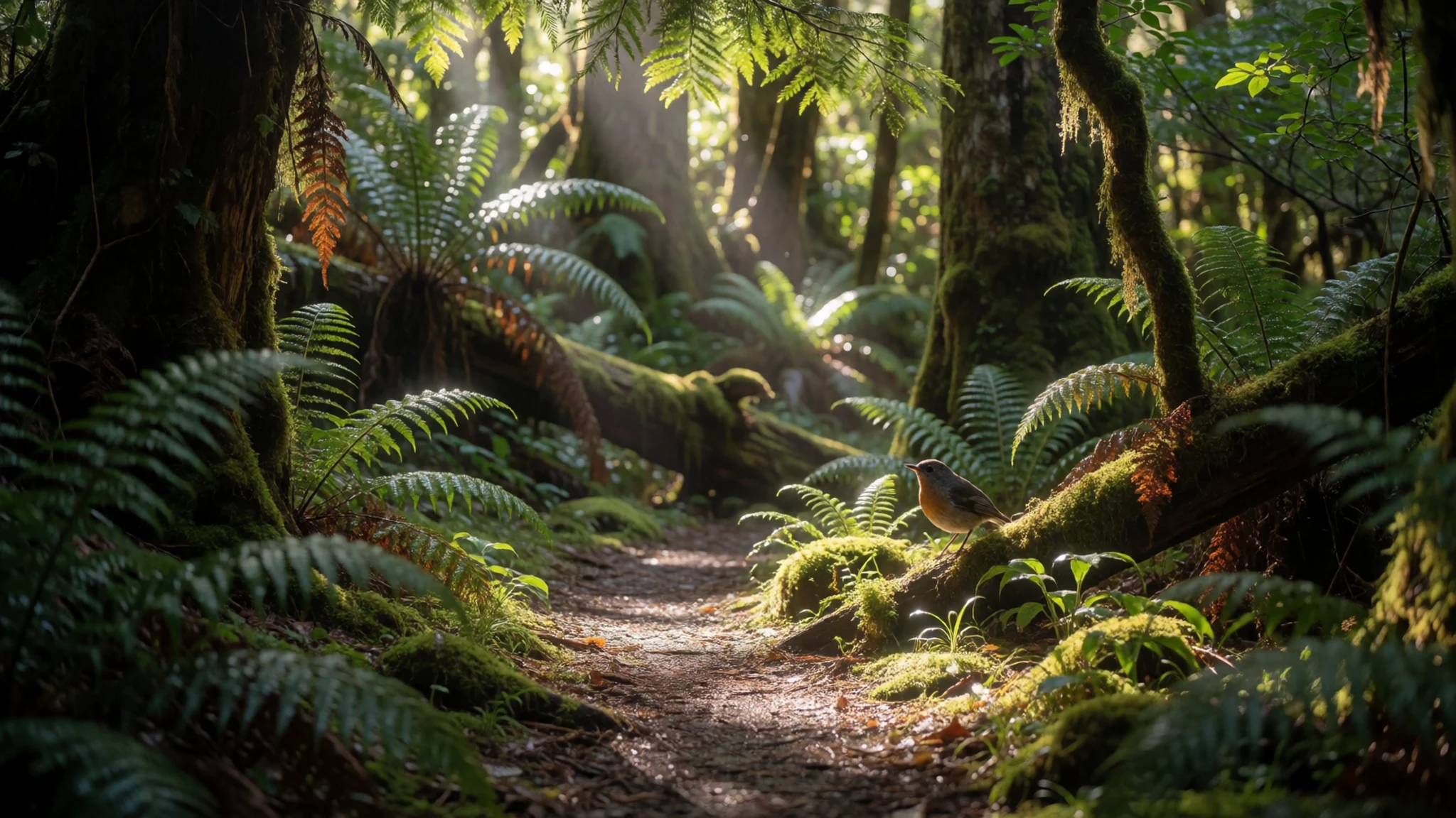
Culture
Rakiura National Park sits on an island with deep Māori roots, and the culture here is as much about relationships with land and sea as about buildings or festivals. The island's Māori names, including Rakiura and Te Punga o Te Waka a Māui, carry stories that predate the national park by a long way. Some of the land beside the park is still Māori-owned, and the park exists alongside that ownership rather than over it.
Island life today is small-scale and practical. Oban is a fishing and visitor community where people tend to know each other, and conservation is part of everyday talk: trapping predators, protecting birds and keeping tracks in order. Many residents work in fishing, aquaculture, tourism or conservation, and the seasons shape the pace of the place.
The chain sculpture at the park entrance is the clearest meeting of culture and landscape, turning the island's mythic role as anchor into something people can stand beside. Visitors who read a little about it before arriving tend to see the island with more patience, and the walking becomes less a sporting challenge and more a way of travelling through a story.
Stewart Island is also a place where quiet is valued: boat engines, birdsong and wind carry the sound, and loud groups stand out. Locals are friendly and happy to give weather and track advice, and it is worth taking it.
On tracks and in sanctuary areas, keep to the marked path, clean your boots before landing and leave nothing behind, so the birds and plants that people come to see are not disturbed.
What to wear
Rakiura National Park lies in Māori homeland, and the best-known traditional garment of Māori culture is the korowai, a cloak woven from harakeke (flax) fibre with feathers or tassels attached. Cloaks like these are worn on formal and ceremonial occasions, such as graduations, welcomes and funerals, and they are treated as treasured heirlooms rather than costume. Weaving is a skill passed down through families and community groups, and visitors will see it more often in museums and galleries than on the street.
Everyday dress on Stewart Island is straightforward and built for weather. Locals wear wool jumpers, fleeces, waterproof jackets, practical trousers and gumboots, and many people carry a rain jacket even when the sky looks clear. Fishing gear, hi-vis and work boots are common around the wharf. Nobody dresses up for dinner in Oban, and smart-casual is the upper limit.
Visitors should plan around wind, rain and mud rather than fashion. Layers work best: a base layer of merino or synthetic fabric, an insulating fleece, and a proper waterproof jacket and over-trousers. Boots with good grip and ankle support matter on the Rakiura Track, and gaiters help on boggy ground. Spare dry socks make a real difference. Bring a warm hat and gloves even in summer, sun protection for bright spells, and insect repellent for sandflies. There are no modesty rules to worry about, though a spare dry set of clothes for the end of the day is worth the weight.
What to eat
- Blue cod and chips — Takeaways and the waterfront pub in Oban
Blue cod is the island's everyday fish, usually served battered with chips. It is firm, white and mild, and eating it near the harbour with the boats in view is a simple local pleasure after a day of walking.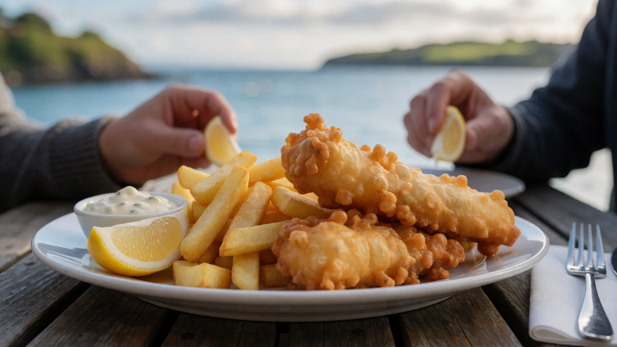
- Bluff oysters — Restaurants and seafood counters in Oban, when in season
Oysters from the waters of Foveaux Strait are a southern speciality, served in season. They are usually eaten plain or with a squeeze of lemon, and are best treated as a short seasonal treat rather than a guaranteed menu item.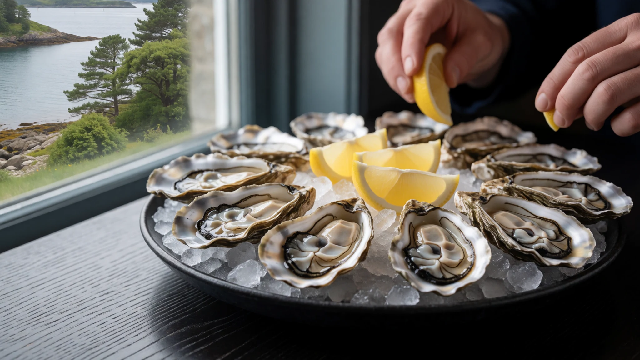
- Crayfish — Seafood restaurants in Oban
Rock lobster, locally called crayfish, is caught around the southern coast and served boiled or grilled with butter and salad. Supply depends on season and catch, so it is worth asking rather than assuming it will be available. - Smoked salmon — Cafes and the village shop in Oban
Salmon farmed in the sheltered waters off the island is often smoked and sold as a local product. It appears on cafe plates, in sandwiches and as a picnic staple for the track, and travels well in a rucksack. - Mussels — Restaurants and the pub in Oban
Green-lipped mussels are widely farmed in New Zealand and appear on island menus steamed in garlic, wine or a light broth. They are filling, simple and a sensible meal after a wet day on the trail.
Plan it
Best time. December to March is the most settled and mildest period, with the longest days for walking, though rain, wind and cold snaps can arrive in any month. Winter is colder and darker, and the southern lights are easier to catch on clear nights.
How long. 3–4
Getting there. Fly to Invercargill Airport (Air New Zealand flies there from Christchurch and Wellington), then take a ferry across Foveaux Strait from Bluff or a short scheduled flight to Oban. Check current operators' timetables before booking; the crossing can be rough.
Budget. mid
Tips
- Book ferry or flight, accommodation and any Great Walk huts well ahead, especially for summer.
- Check the official Department of Conservation website for track conditions, hut rules and weather before setting out.
- Pack for rain and mud whatever the forecast says, and carry spare dry clothes in a waterproof bag.
- Bring snacks and any specialist supplies from the mainland, as shops in Oban are small.
- Use insect repellent for sandflies, particularly near the coast and in still weather.
Etiquette
- Stay on marked tracks and clean boots, bags and gear before landing on predator-free sites such as Ulva Island.
- Take all rubbish out with you and keep noise low near wildlife and in huts.
- Treat Māori-owned land and cultural sites with respect and keep to open public routes.
Nearby
Sources
- Wikidata Q282066 (CC0)
- Wikipedia: Rakiura National Park (rev 1380637781) (CC BY-SA 4.0)
- Wikivoyage: Southland (rev 4903852) (CC BY-SA 4.0)
- Photo: Stewart Island Rakiura Track (Public domain)
- Photo: Stewart Island 28 (CC BY-SA 4.0)
- Photo: Stewart Island 27 (CC BY-SA 4.0)
- Photo: Maori Beach in the morning (Public domain)
- Photo: Bridge over inlet north of Kaipipi Bay (Rakiura Track) (Public domain)
- Photo: North West Circuit Track between Mason Bay and Freshwater River (Public domain)
- Photo: Coast east of Peters Point towards Bobs Point (Public domain)
- Photo: Creek at southeast end of Maori Beach towards Port William (Public domain)


