Pinnacles Desert
Pinnacles Desert, Australia
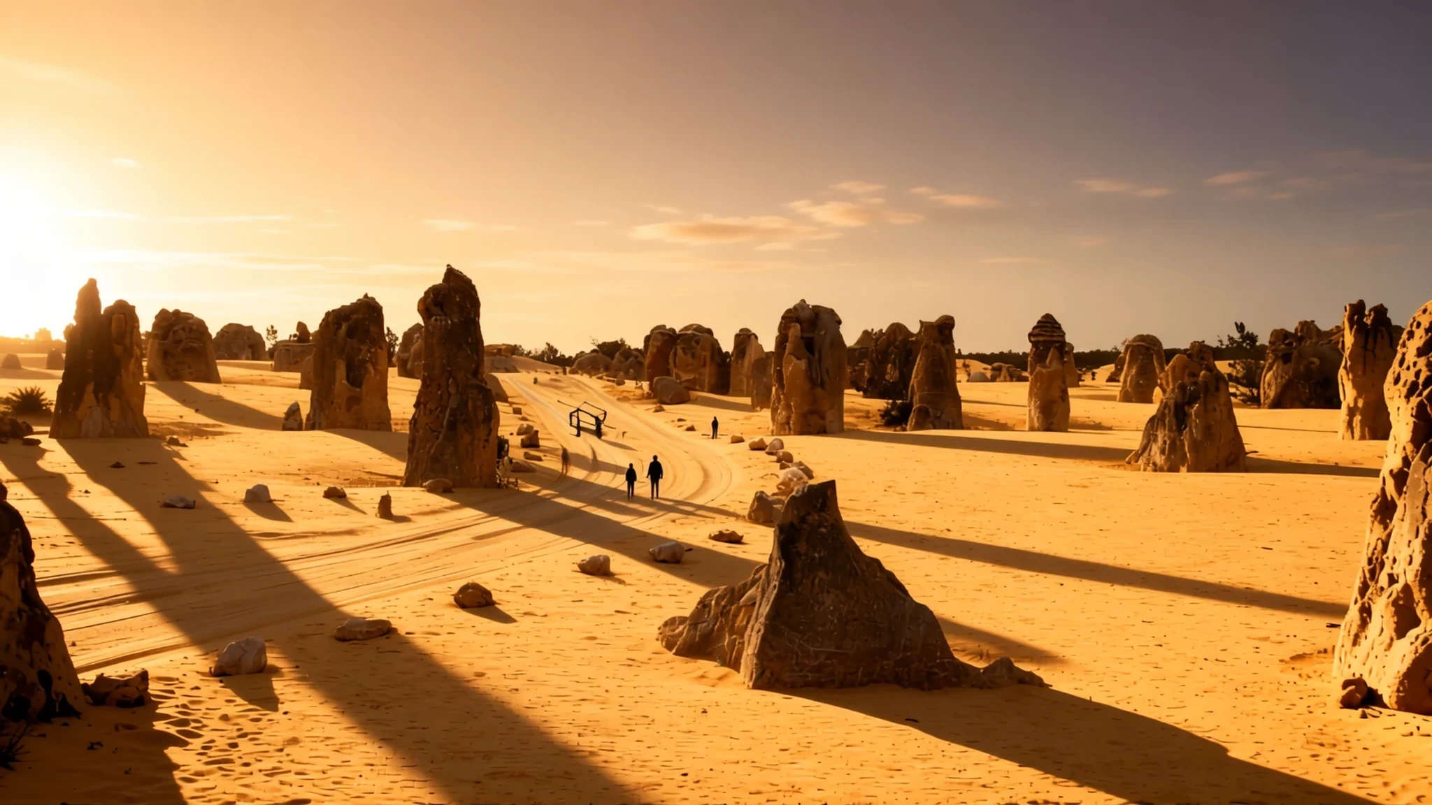
Thousands of weathered limestone pillars rise from yellow sand in a quiet national park a few hours' drive north of Perth.
The place
The Pinnacles sit inside Nambung National Park, close to the small coastal town of Cervantes in Western Australia. The formations are limestone, and thousands of them stand across a flat floor of yellow sand. Some of the tallest reach up to 3.5 metres (11 ft) above that base. That is modest by mountain standards, but it is striking when you stand among them in late afternoon light. Many columns are much taller than they are wide, which gives the place its name, while others are shorter and blunter, closer to a row of stumps than to anything dramatic.
The landscape is best understood as the remains of a long process. The pillars were not built up from the ground. They are what survives after softer rock wears away around a harder core. Walking between them, the terrain changes over short distances: a cluster of tall columns, then a stretch of low forms, then a flat patch with little rock at all. Nothing here is wooded, so the sky tends to dominate the view.
Because the area is a protected national park, the visit is simple. A loop road links the main viewing areas, and most people combine a drive with short walks across the sand. The ground is soft in places and the sun is strong for much of the year, so a hat, sturdy shoes and plenty of water matter. Facilities are modest compared with a city park, so arrange fuel, food and water before you arrive, and allow an unhurried half day.
The site draws visitors without the crowds of Australia's best-known landmarks. Early and late in the day you may have stretches of sand to yourself. Expect more company around midday and on public holidays.
Its story
The Pinnacles Desert is the product of very slow change. Its limestone was built from sand that drifted and settled in layers over long periods, and those deposits still carry the marks of how they formed. In many columns, diagonal banding called cross-bedding shows where the angle of the sand changed abruptly as the prevailing winds shifted during deposition. That banding is a record of wind rather than water, and it is one of the clearest clues to how the rock took shape.
The shapes came later. Across parts of the limestone runs a hard crust of calcrete, a cemented layer that resists erosion more than the rock beneath it. Where the crust sits on top of a block, the softer material below wears away faster, and the capped top survives. The result is a column with a cap that looks like a mushroom, or a tall pillar protected by its hard top and left standing as the ground around it lowered. How the pillars took shape is still debated, with several explanations on the table, including limestone dissolution, cemented casts of tree roots, and plant-driven movement of material.
What stands today is a snapshot of a long contest between hardening and wearing away. The pillars are not being built now. They are being slowly reduced, and each one carries its own history in its layers. The name came from the way the taller columns look from a distance, like a cluster of spires. The sand around them holds the rest of the record.
What to see
- The main pinnacle field — Nambung National Park, near Cervantes
The main pinnacle field is the reason most people come. Thousands of limestone columns stand across a floor of yellow sand, some crowded together and others spaced far enough apart to walk between. Keep to marked paths where they exist, and go out early or late in the day, when the low sun brings out the texture of the stone and the shadows stretch across the sand.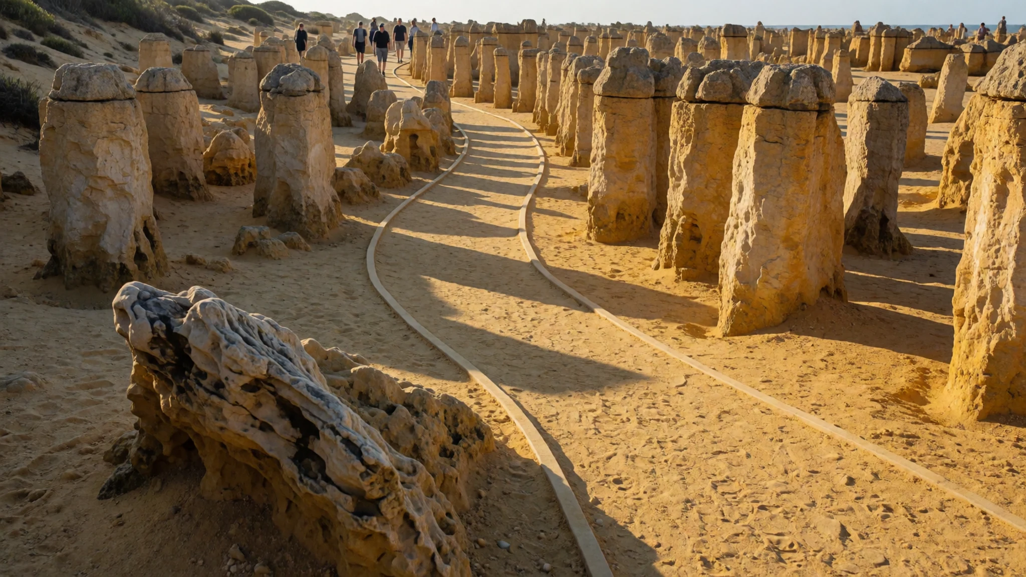
- The tall columns — The central and northern parts of the field
The tallest columns are the ones that look like the name. Some rise as high as 3.5 metres (11 ft) over the sand, and they are much taller than they are wide, so they stand out from the flatter forms around them. They are best seen from a little distance, where their slender outlines separate from the rest of the field and the cross-bedding bands become visible.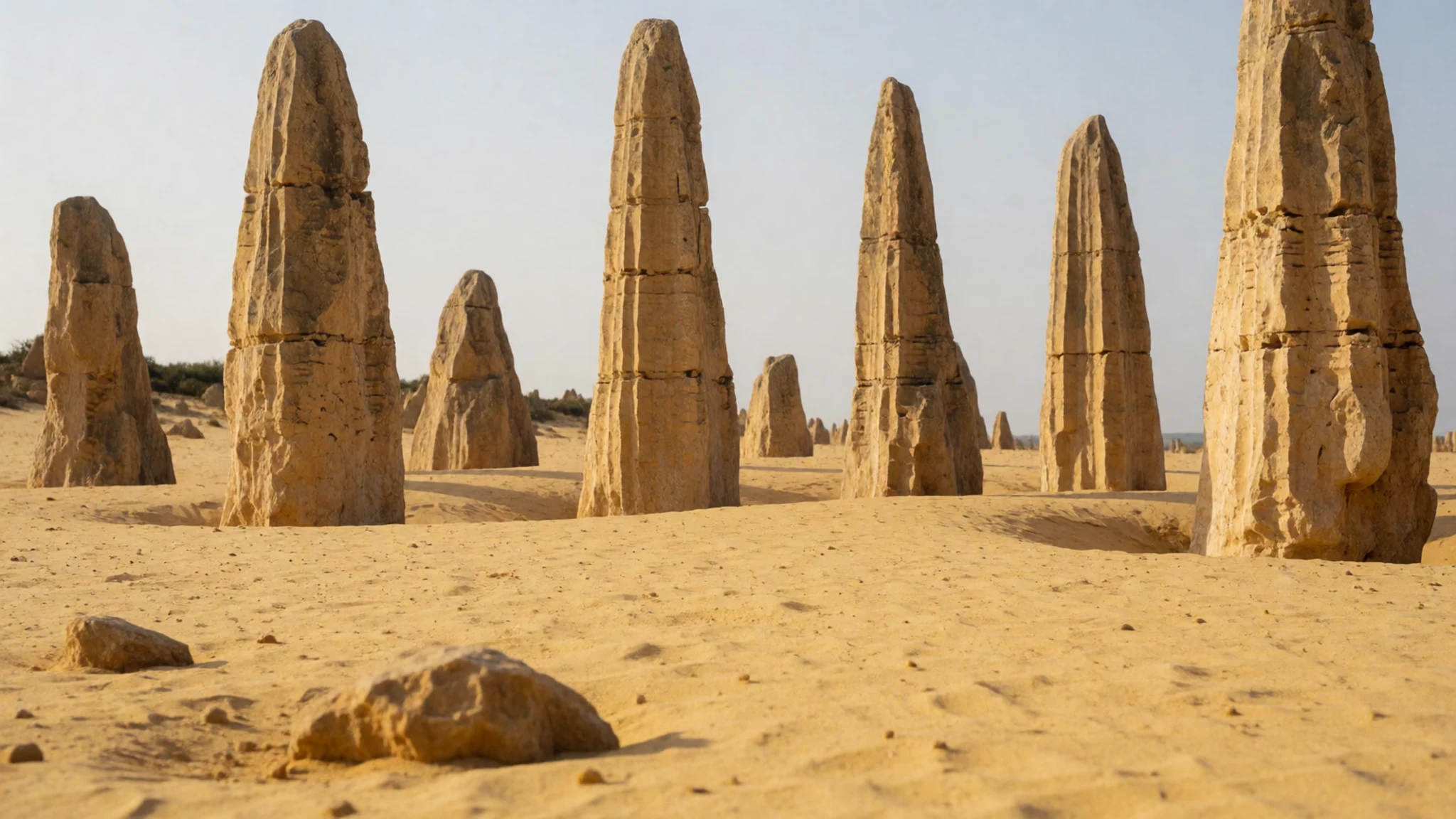
- The short tombstone forms — Scattered stretches between the taller clusters
Not every pillar is tall. Many of the shorter forms are only about a metre high and wide, and they look a little like worn headstones, which is why they are sometimes compared to tombstones. They make a good contrast to the columns, and they show how the same process can produce very different shapes across a short distance.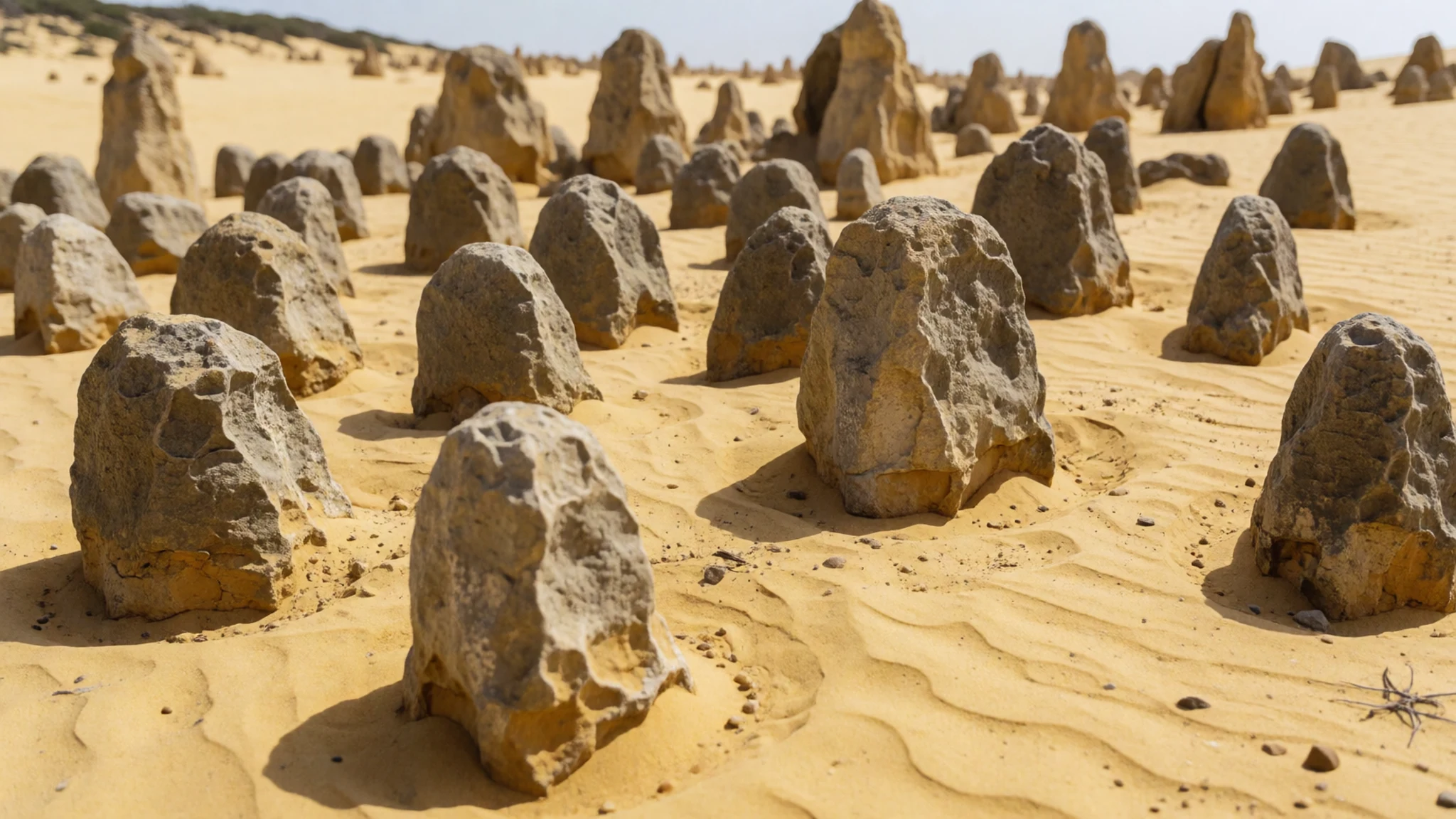
- The mushroom-capped pillars — Among the taller clusters, near the marked paths
Look for pillars with flat, wider tops, which resemble mushrooms. These form where the calcrete crust is harder than the limestone beneath it, so the lower section wears away faster and leaves the cap behind. Photographers like them for their shapes, but they are fragile: the soft base is slowly giving way, so resist climbing or leaning on them.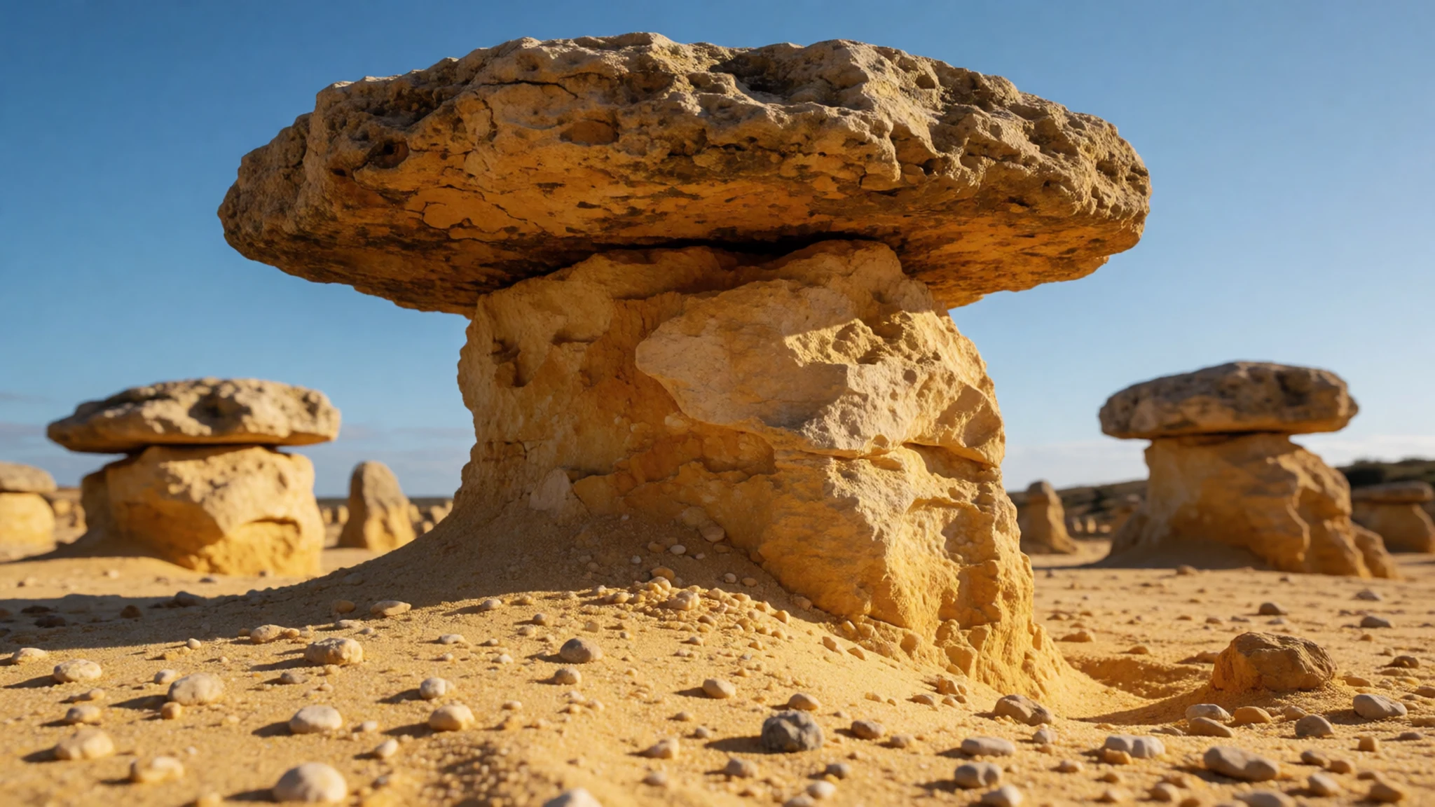
- The cross-bedding faces — The taller columns on the eastern side of the field
Look closely at the faces of the taller columns and you can see diagonal bands of cross-bedding. Each band marks a moment when wind-blown sand was laid down at a new angle, because the prevailing winds had shifted. The pattern is clearest in the mid sections of the columns, and it is easy to miss from the path, so stop for a moment and look.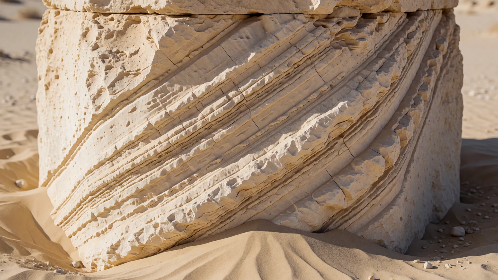
Culture
The Pinnacles sit on land that Aboriginal peoples have cared for over a very long time, and that history matters more than any single rock formation. Across Western Australia, mining and native title remain difficult subjects. Mining earns much of the state's income, yet consultation with Indigenous landowners has not always been adequate, and some sacred places have been lost. Juukan Gorge, a sacred site, was blasted by a mining company in 2020. These debates also shape how people talk about conservation, renewable energy and the coast, so visitors may hear strong views from locals on several sides.
Day to day, the atmosphere around the park is unhurried. Stay on the tracks, avoid taking rock or sand home, and leave the place as you found it so that it stays intact for the next visitor.
Do not climb on the pillars or push them over, even the smaller ones that look ready to topple.
What to wear
Traditional dress around the Pinnacles was shaped by the land and by ceremony rather than by fashion in the modern sense. Clothing and adornment were made from natural materials such as plant fibres, animal skins, feathers and pigment, and many items carried meanings tied to family, country and season. Much of that material culture is now held in museums, and local Aboriginal organisations are the right places to learn specific detail.
Today, people in the region dress for the weather and the work. Shorts, cotton shirts, sandals and sun hats are common in summer, and jeans and jumpers appear in the cooler months. The look is practical and unfussy rather than styled, and few visitors would stand out in a rural Australian town.
For a visit to the Pinnacles, wear light, long-sleeved layers that protect your arms from the sun, along with a wide-brimmed hat and sunglasses. Choose closed shoes with a firm sole, because the sand gets hot and the limestone can be sharp underfoot. A warm layer helps on early starts, since mornings are often cooler than midday. Nobody expects formal clothes out here, so comfort comes first.
What to eat
- Marron — Trendy restaurants in Perth in season; a licensed catch from a dam or waterway; south-west marron farms
Marron is a freshwater crustacean whose meat is tender and sweet, unlike its saltwater relatives. Trendy restaurants serve it in season, but the best way is a simple campfire boil, once you hold a fishing licence to catch it legally. South-west marron farms sell them frozen or still alive.
- Local truffle — Perth's fine-dining restaurants
Truffles grown in Western Australia are a surprise to many visitors and turn up on fine-dining menus. The local variety is not held to the same standard as European ones, but it carries the same earthy aroma, which justifies its price. Ask for it shaved over eggs or pasta.
- Country pub meal — The local pub in Cervantes or other small towns nearby
In most country towns, the local pub is the easiest place for an evening meal. Expect plain, hearty plates of steak, roast or fish and chips, and kitchens often close early, so go before closing time. - Roadhouse burger or sandwich — Roadhouses on the highways between the coast and inland towns
Roadhouses on the long highways carry a menu of toasted sandwiches, burgers and sometimes a cooked dinner. They are practical rather than fancy, and they suit anyone crossing the long distances between towns. Buy a snack and plenty of water before a long stretch of driving. - Thai-influenced dishes in Perth — Perth's central restaurants and cafes
Perth's restaurants lean on Australian-influenced Thai and Chinese cooking, with local seafood and produce making their way onto menus. Look for Thai curries and noodle dishes made with Western Australian produce, and cafes that serve brunch alongside them. Eat in the city before or after your trip, when the choice is widest.
Plan it
Best time. Autumn and spring are the most comfortable times for walking on open sand, roughly April to May and September to October, since summer heat peaks from December to March and the ground offers little shade. Visit early or late in the day whatever the season, and check the official park site for current conditions.
How long. 1–2
Getting there. Fly into Perth, then drive north to the park near Cervantes. The last leg is easiest by hire car.
Budget. low
Tips
- Go early or late in the day for softer light and fewer people
- Carry water and a hat, because shade is limited on the open sand
- Bring cash or a card for fuel and food before you reach the park, as small towns may have limited options
- Allow a half day so you can linger without rushing
- Check the official site for current opening details before you set out
Etiquette
- Stay on marked tracks and keep off fragile crust where signs ask you to
- Take your rubbish home and leave rock and sand where they lie
- Do not climb on the pillars or push them over
Nearby
Sources
- Wikidata Q2415778 (CC0)
- Wikipedia: The Pinnacles (Western Australia) (CC BY-SA 4.0)
- Wikivoyage: Western Australia (CC BY-SA 4.0)
- Photo: Nambung National Park (W. Bulach) (CC BY-SA 4.0)
- Photo: Pinnacles panorama (Neil Creek) (CC BY-SA 2.5)
- Photo: Pinnacles (User:Gnangarra) (CC BY 2.5 au)
- Photo: Tourists at the Pinnacles (Caoglish) (CC BY 3.0)
- Photo: Cervantes Pinnacles (W. Bulach) (CC BY-SA 4.0)
- Photo: Nambung Nationalpark (W. Bulach) (CC BY-SA 4.0)
- Photo: Western Australia Nambung National Park (W. Bulach) (CC BY-SA 4.0)
- Photo: Nambung National Park, Western Australia (W. Bulach) (CC BY-SA 4.0)


