Piedras Negras
Piedras Negras, Guatemala
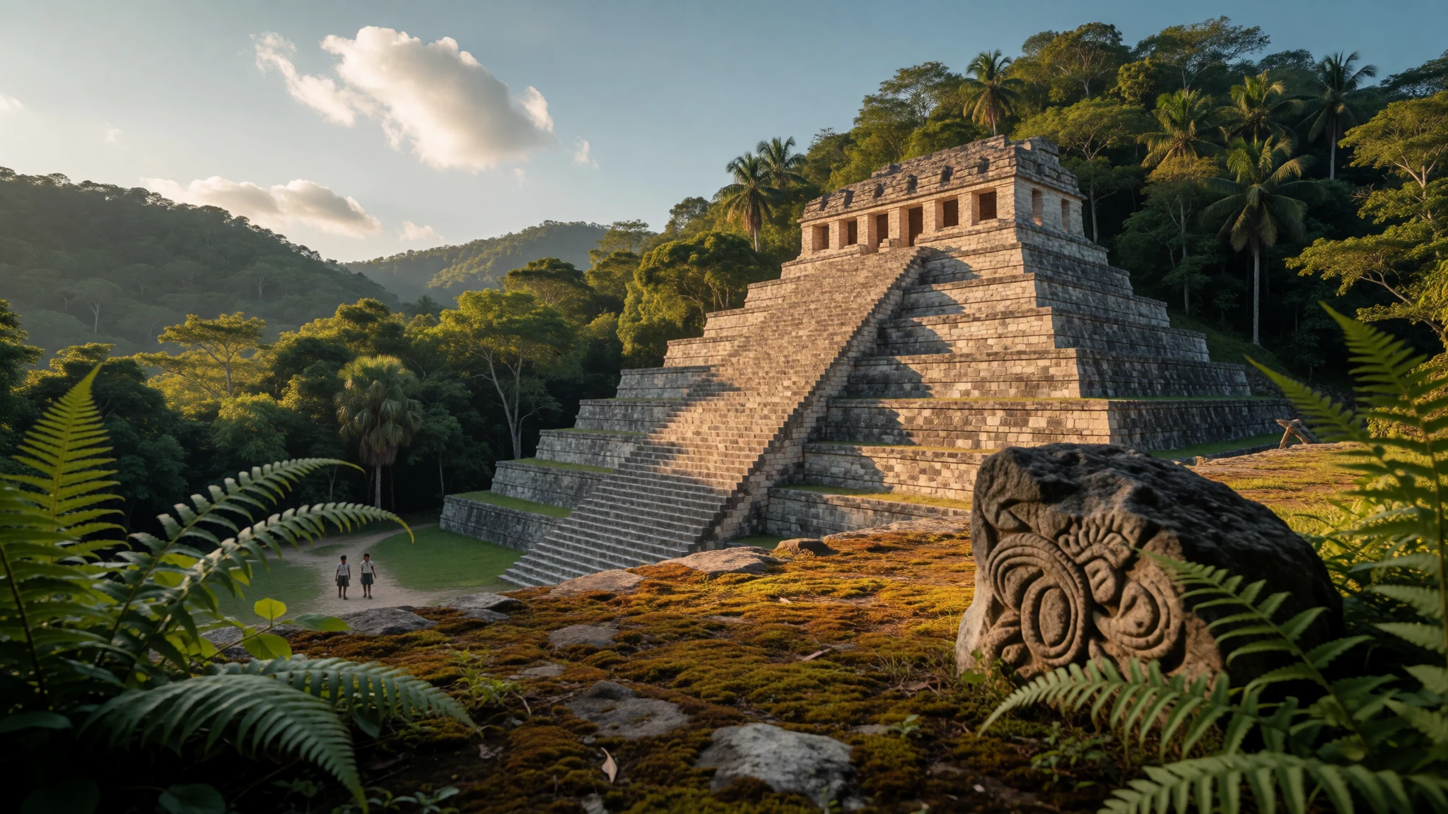
Piedras Negras is a Maya city lost in Petén jungle, reached by river, where carved stone still tells the story of its kings.
The place
Piedras Negras stands on the Usumacinta River in the Petén department of northwestern Guatemala, with the Mexican bank just across the water. Its ancient name was Yo'k'ib' (also written Yokib'), while the Spanish name on modern maps means 'black stones'. The ruins lie inside the Sierra del Lacandón national park, and forest has reclaimed most of what the Maya built. There is no street grid. Plazas anchor the layout, and the buildings climb a run of hills that gave the city a natural defensive shoulder above the river. Excavation has shown vaulted palaces, temple pyramids, two ball courts and a temple connected to a cave. Down at the river's edge, a large boulder carved with the city's emblem glyph lies facing the sky.
The site is remote. No road reaches it, and the practical route is a boat along the Usumacinta from the Chiapas side of Mexico, so this is a trip for people comfortable with jungle, humidity and very basic facilities. Much of the best sculpture no longer stands here. Stelae, panels and the well-known throne were taken away over the past century and now sit in museums, in Guatemala and abroad. What remains is the setting: wooded hills, quiet plazas, the sound of the river and a strong sense of distance from anywhere. Archaeologists prize the place because its carvings carry dates and names, so the lives of its rulers can be followed with unusual precision. A visitor who cares about Maya writing and politics will get far more from it than one who wants a quick photograph of a pyramid.
Its story
Piedras Negras was settled by the 7th century BC and grew steadily, reaching a first population peak around 200 BC before shrinking for several centuries. A second peak came in the Late Classic period, in the later 8th century, when the main settlement held an estimated 2,600 people and the wider polity perhaps 50,000. For most of the Classic period it was an independent city-state, sometimes allied with its neighbours and sometimes paying them tribute. Its partnership with Yaxchilan, upriver in what is now Chiapas, is well attested.
The great burst of sculpture and building ran from about 608 to 810. The carvings work like a political newspaper. One famous panel shows three neighbouring rulers as bound captives of a king that scholars call Ruler C. One of them may be a king of Yaxchilan who carried on reigning afterwards, which suggests that being pictured as a prisoner was a claim of dominance, not a literal capture. If that reading is right, Piedras Negras was asserting authority over the middle Usumacinta as early as the 6th century AD.
The sculptors themselves left a trace, too. Their names appear on many monuments, giving individual craftsmen an identity that is seldom recoverable in the ancient world. Ceramics show people living here until about 850, after which the hills were left to the forest. Teobert Maler's early photographs and drawings, and later excavations, preserved the record of what the city once looked like.
What to see
- Plazas and vaulted palaces — Central plazas
Piedras Negras is arranged around plazas, not a grid, and the vaulted palaces around them show how the royal court lived and met visitors. Much is overgrown or consolidated only lightly, so a guide who knows the layout makes the difference between a pile of stones and a readable city.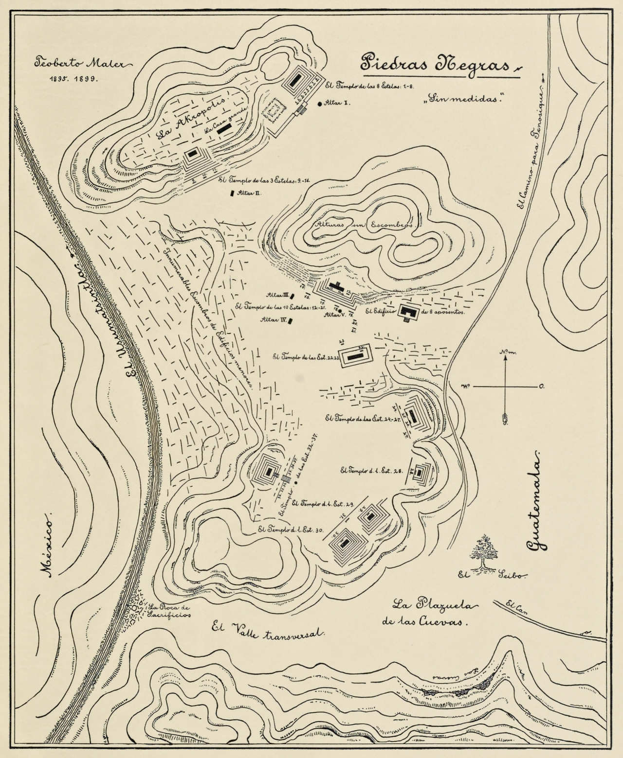
- The cave temple — Hill temples
One of the temple pyramids at Piedras Negras is tied to a cave, a pairing that mattered in Maya belief, where caves were doorways to the underworld. Check with your guide whether the cave is open and safe, since conditions inside change with the rains. - The ball courts — Near the main plazas
Piedras Negras has two ball courts, long sunken alleys where teams played a ritual game with a rubber ball. The setting is quiet and shaded now, and it is easy to picture the stands of spectators and the weight of the ceremonies that surrounded each match.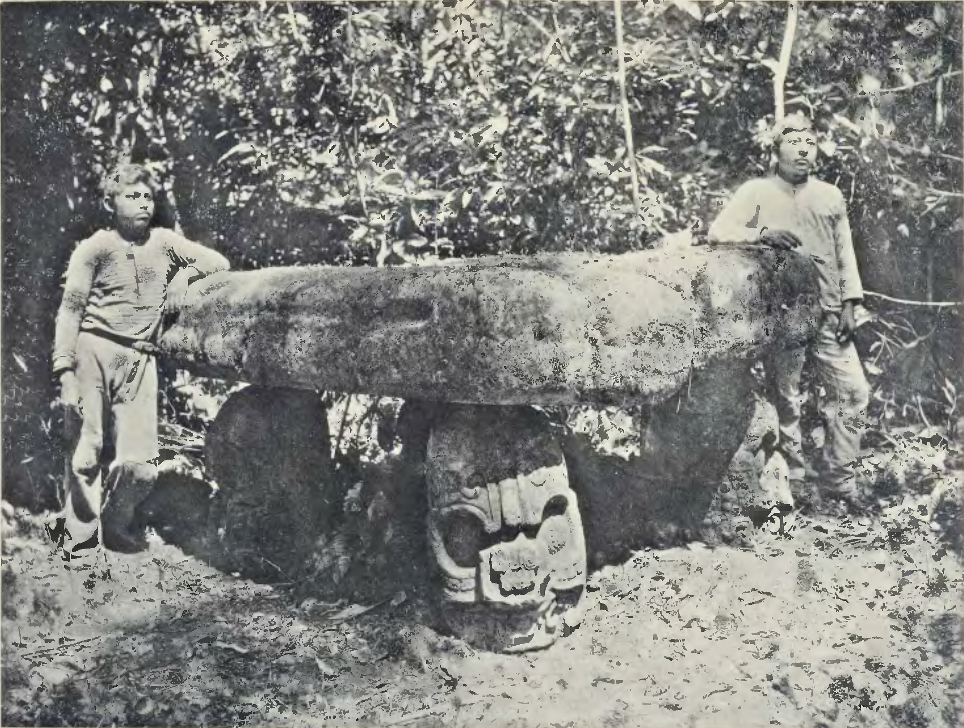
- The emblem glyph boulder — Riverbank
At the river's edge near Piedras Negras lies a large boulder with the city's emblem glyph carved on its upward face. It is a modest sight beside the palaces, but it is a signature in stone, naming the kingdom to every canoe passing on the Usumacinta. - The throne and carved panels in museums — Museums in Guatemala and abroad
The finest carvings from Piedras Negras are no longer on site. The royal throne, shown in the reference photographs, and many panels are displayed in museums, so it is worth pairing the jungle visit with a look at them. They show courtly scenes, captives and the signed work of named sculptors.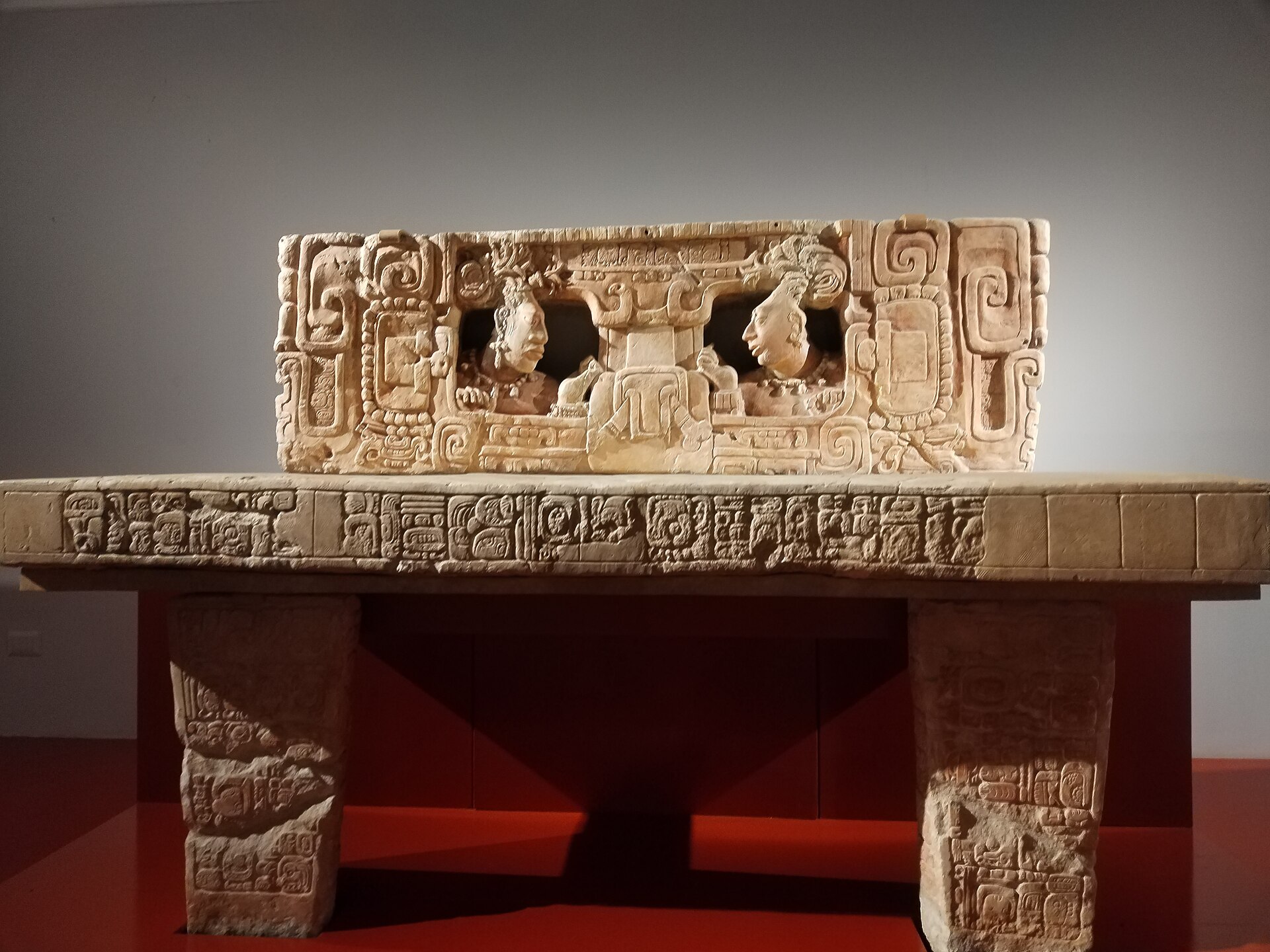
- Carved stelae — Museums in Guatemala and abroad
Piedras Negras produced tall limestone stelae that record accessions, birthdays and victories with exact dates. Several now stand in museums, among them the national museum in Guatemala. Look for the seated rulers, the crowded glyph columns and the fine, confident lines that made the sculpture famous.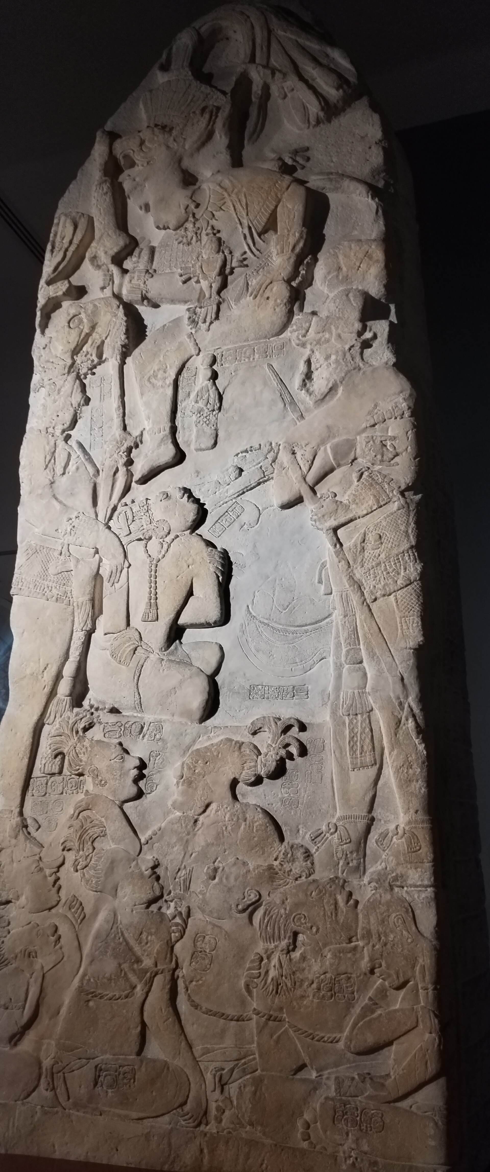
Culture
Piedras Negras belonged to the Classic Maya world, a patchwork of kingdoms ruled by sacred kings who recorded their deeds in hieroglyphs, stone and painted pottery. Power was personal. A ruler's accession, wars, marriages and rituals were carved and dated, which is why this city's history can be read in such detail. Alliances with places like Yaxchilan, and the display of captured rivals, were part of a constant negotiation for status along the river.
Religion and politics were hard to separate. Kings performed rituals meant to keep the cosmos in order, ball games had ceremonial meaning, and caves were treated as sacred thresholds. The artists and scribes who made the monuments were respected specialists, and the habit of naming them on the stone shows how much their skill was valued.
Maya culture did not end with the abandonment of the city. Maya communities live across Guatemala and southern Mexico today, speaking their own languages and keeping their own calendars, farming traditions and beliefs. Many still regard ancient sites as part of a living landscape, not just a museum, and that is a good attitude to carry into the forest here. Keep voices low, stay on marked paths, and leave the stones as you find them. Do not climb on, lean against or touch any carved monument, and follow your guide's instructions about where it is safe to walk.
What to wear
Piedras Negras is known for its carved portraits of elite Maya, who appear in cotton garments, feathered headdresses, jade ornaments, jaguar-skin details and elaborately woven belts and capes. These sculptures are one of the best guides to what the court wore at ceremonies. Cotton was the main fabric, woven on backstrap looms, and that technique survives in Maya communities today.
In modern Guatemala, traditional dress is still worn daily or at festivals in many Maya communities. Women wear the huipil, a woven or embroidered blouse, with a wrapped skirt called a corte, and each region has its own colours and patterns. In the Petén lowlands, everyday clothes are more often jeans, T-shirts, sandals and caps, with the traditional garments saved for celebrations and markets.
For a visit to Piedras Negras itself, dress for heat, humidity and insects, not for formality. Pack light long sleeves and long trousers in quick-drying fabric, a wide-brimmed hat, and a thin rain jacket, since showers can arrive without warning. Sturdy closed shoes or light boots with good grip are essential on muddy, root-tangled paths and riverbank landings. Bring repellent and sun protection. In villages on the way, modest clothing, with shoulders and knees covered, is polite and helps you blend in. There is no dress code at the ruins, but respect for the place suggests a tidy, practical look.
What to eat
- Frijoles negros with tortillas — Small family eateries in river villages and market stalls
Black beans simmered until soft, served with hot corn tortillas, are the backbone of a meal in Petén and across Guatemala. Often there is a little cheese or fried plantain beside them. Plain, filling and cheap, they suit a long day of walking. - Tamales — Morning market stalls and street vendors in towns near the river
Corn dough wrapped in leaves and steamed, usually with chicken or pork and a mild sauce inside. Guatemalan versions are often wrapped in banana or plantain leaf. They are a common breakfast and festival food and travel well in a day bag. - Caldo de gallina — Local comedores, the simple eateries found in most market towns
A hearty hen broth with vegetables, herbs and sometimes a piece of corn on the cob, eaten with tortillas and a squeeze of lime. It is a restorative dish after hot, humid days and a favourite for a slow Sunday meal. - River fish — Riverside eateries near the boat landings
Freshwater fish from the Usumacinta and nearby lakes is fried or grilled whole, then served with rice, salad and tortillas. Ask what was caught that day, and check that it is cooked through, especially when eating in remote areas. - Atol — Market stalls and corner stands at dawn
A warm, thick drink made from ground maize, sometimes with cinnamon or sugar. It is comforting early in the morning before a boat trip and has deep roots in Maya food traditions, where maize is central to daily life.
Plan it
Best time. March to May is usually the drier stretch, which makes river travel and jungle paths easier, though it is hot and humid. The rainy months bring mud, high water and cancelled boats, so check river conditions before committing.
How long. 2
Getting there. There is no road to the site. The easiest route is a boat down the Usumacinta from the Chiapas side of Mexico, arranged through a licensed operator. Fly to a regional airport such as Flores in Guatemala or a city in Chiapas, then travel overland to the river and make the last leg by boat.
Budget. mid
Tips
- Book the boat and a guide well ahead, and confirm that permits and park access are in order
- Check current safety advice for the border area before you travel
- Start early; mornings are cooler and the forest is quieter
- Carry cash, water, repellent and a dry bag for your phone and camera
- Pair the visit with Yaxchilan or Bonampak to make the river journey worthwhile
Etiquette
- Stay on marked paths and keep off the carved stones
- Ask permission before photographing people in riverside villages
- Take all rubbish back out with you
Nearby
Sources
- Wikidata Q2031261 (CC0)
- Wikipedia, Piedras Negras (Maya site), rev 1364974501 (CC BY-SA 4.0)
- Wikivoyage, Piedras Negras, rev 4891473 (CC BY-SA 4.0)
- Throne of Piedras Negras, Konjiki1 (CC BY 4.0)
- MUNAE Stela 36, Ymblanter (CC BY-SA 4.0)
- Stele, Piedras Negras, Rautenstrauch-Joest-Museum, Daderot (CC0 1.0)
- Maler, Researches in the Central Portion of the Usumatsintla Valley, Plate IX (Public domain)
- Maler, Researches in the Central Portion of the Usumatsintla Valley, Plate XXXIII (Public domain)
- Estela 12 de Piedras Negras, Konjiki1 (CC BY 4.0)
- Estela 6 de Piedras Negras, Konjiki1 (CC BY 4.0)
- Maler, Researches in the Central Portion of the Usumatsintla Valley, Plate VII no 1 (Public domain)


