Peneda-Gerês National Park
Peneda-Gerês National Park, Portugal
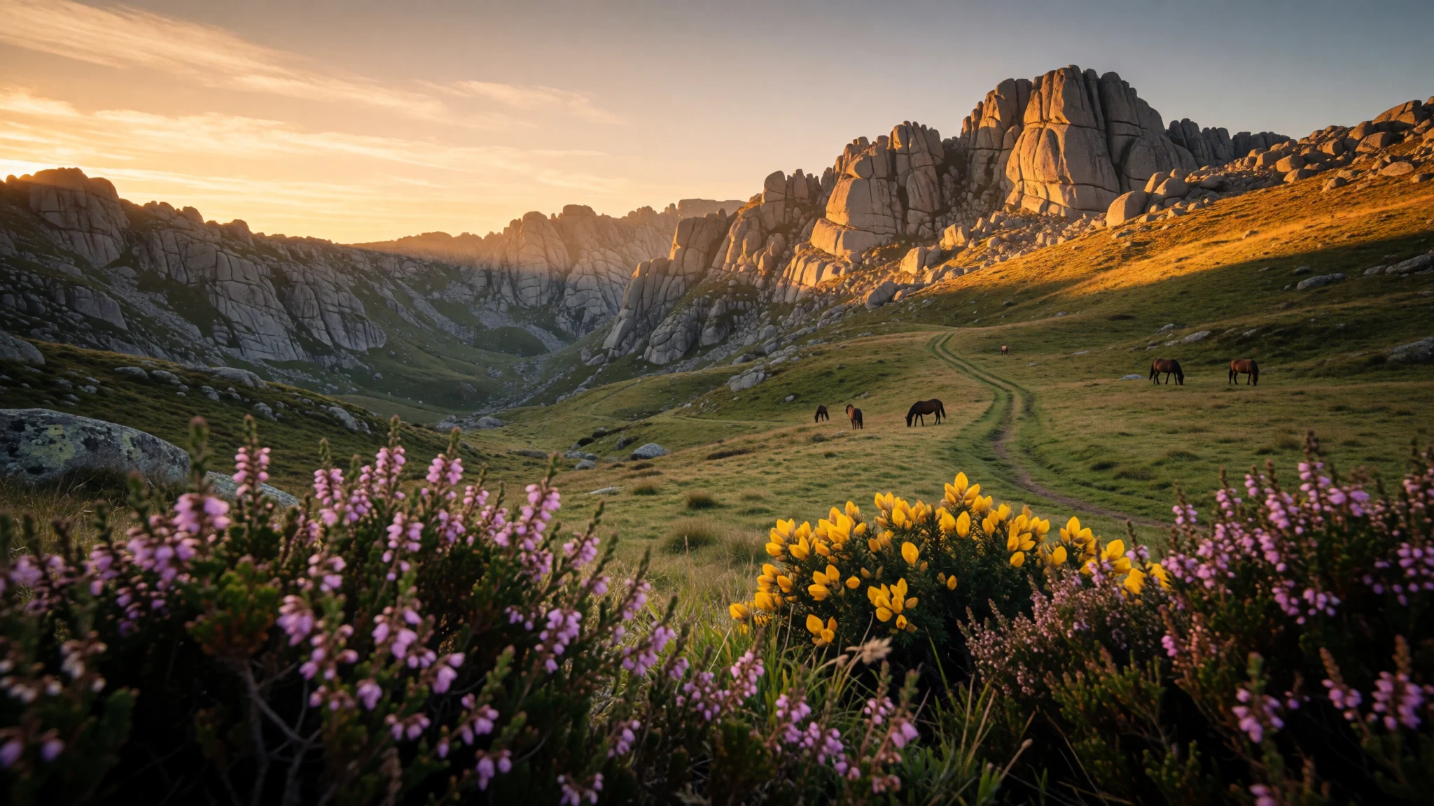
Peneda-Gerês is Portugal’s wild mountain country: granite ridges, river valleys, and hikes through forests that feel properly remote.
The place
Peneda-Gerês National Park (Parque Nacional da Peneda-Gerês), often shortened to Gerês, sits in Portugal’s Norte region and is the country’s only national park. The park is all about contrasts: rounded forested slopes and steep granite massifs, with deep valleys cut by fast-flowing streams. In practice, that means short drives can land a visitor in completely different landscapes—open viewpoints one minute, then cool, green woodland the next.
Geographically, Peneda-Gerês is defined by several mountain systems, including the Serra da Peneda and the Serra do Gerês, plus ranges such as Serra Amarela and Serra do Soajo. Those heights feed the rivers and shape the vegetation. Lower valleys tend to hold lush temperate broadleaf and mixed woods, while the climate and exposure shift the feel as the terrain rises.
This is also a place with a natural timeline. Alongside the forests, the park’s human story is visible in megalithic structures and Roman traces. It’s one of those destinations where the scenery and the layers of settlement sit side by side—granite outcrops, old roads, and small mountain chapels.
Visitor reality check: this isn’t a theme-park. Roads can be winding, trails can be muddy in wetter months, and the countryside can feel quiet away from main towns like Gerês. If the goal is slow travel—walking, looking, listening to water in the valleys—Peneda-Gerês delivers.
Its story
Peneda-Gerês National Park’s story reads like a long argument between mountains and people. The earliest signs of settlement in the wider area are very old, but the mountain setting limited how many people could stay year-round. Over time, megaliths such as dolmens remained dotted through the landscape, while everyday life leaned heavily on animal husbandry and small-scale agriculture.
Roman presence adds another layer. A Roman road, the Geira, once connected major Roman centres and crossed what is now the park, with stretches preserved along the Homem river and remnants such as Roman bridges and mile-marker stones. Later, the region also saw Germanic movements associated with the Suebi and the Buri, with settlement patterns shaped by the practical pull of river valleys between areas later known as Terras de Bouro.
Agriculture then reshaped vegetation in patchwork patterns: terraced slopes and cleared areas gave way to fields and pastures, and some of the natural balance shifted. Reforestation policies introduced in the twentieth century reduced available pasture land, which helped push rural communities to relocate.
What stays constant is the sense that water and stone run the show. Valleys funnel streams, forests gather where conditions allow, and the surviving routes—whether Roman roads or hiking paths—track the same geography that made settlement difficult in the first place.
What to see
- Soajo (granaries and chapel area) — Serra do Soajo area
Soajo is known for its many granaries built to protect crops from rodents. The town’s chapel is also a draw, and the setting helps: mountain weather turns the streets into a dramatic backdrop, especially when clouds roll over the ridges.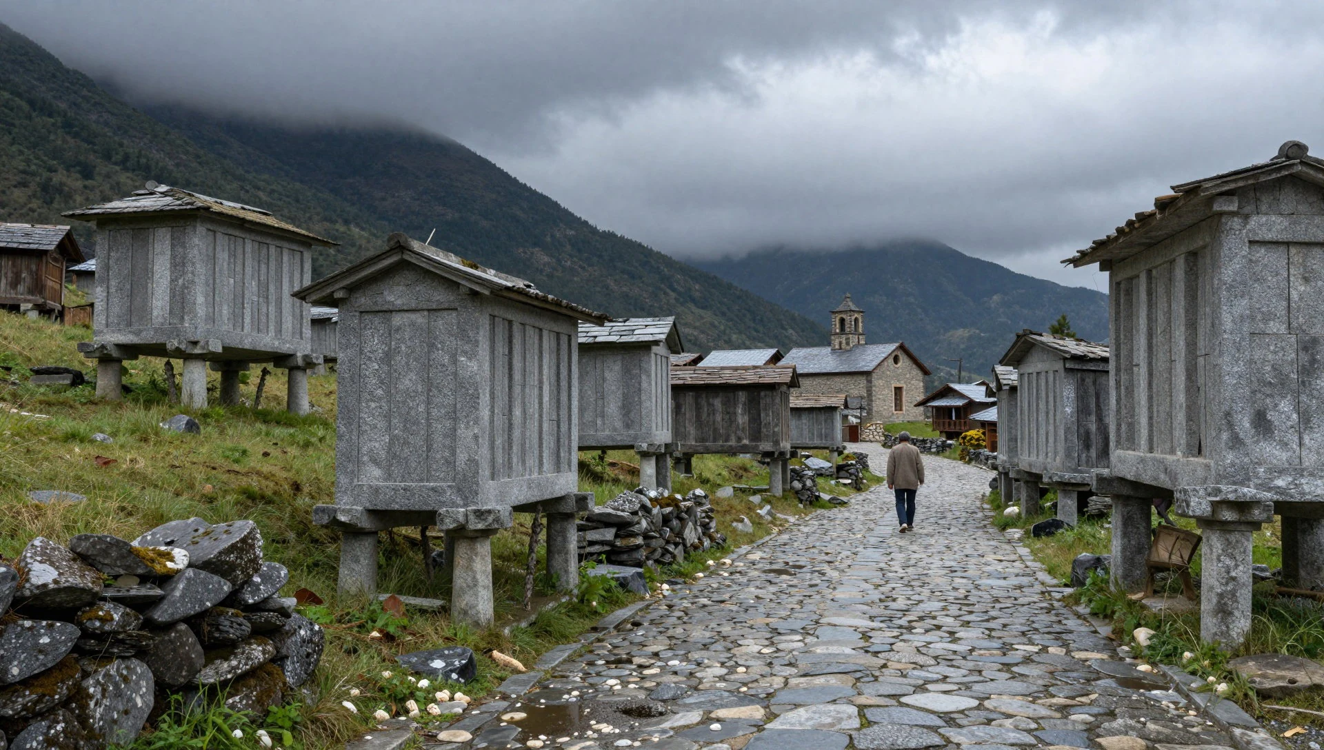
- Santuário de Nossa Senhora da Peneda — Serra da Peneda / Peneda massif
Santuário de Nossa Senhora da Peneda is a shrine dating from the 18th century, reached by a notable staircase nicknamed the “staircase of virtues”. Inside are spaces with traditional religious character, along with features such as the “Yard of the Evangelists”.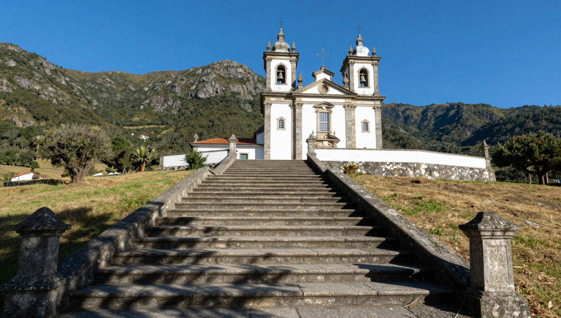
- Santuário de São Bento da Porta Aberta — northern slopes near the Gerês valleys
Santuário de São Bento da Porta Aberta is a 19th-century shrine where visitors often come for the blue tiles inside the main chapel. It’s a calmer, more intimate stop than some viewpoint parking areas, and it helps break up hiking days.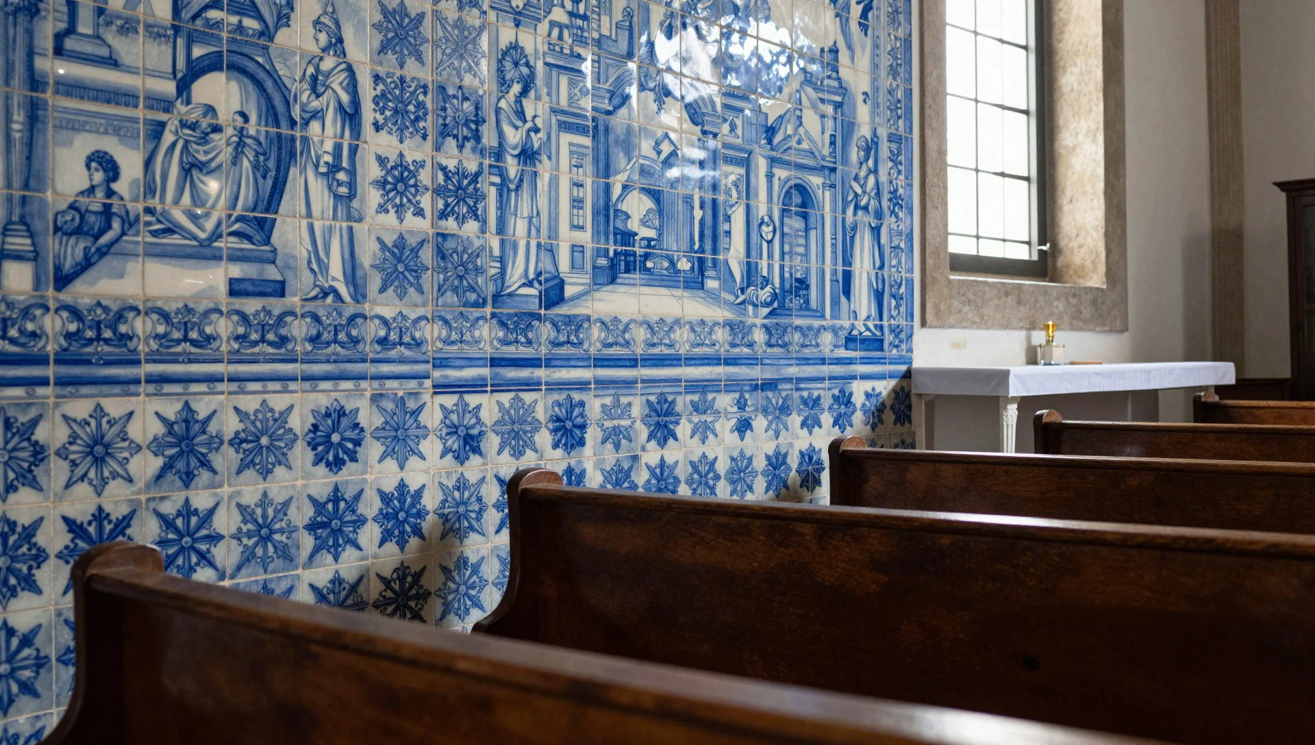
- Mata da Albergaria (botanical reserve) — woodland reserve zones
Mata da Albergaria is a botanical reserve associated with oak-rich woodland—trees that are emblematic of the region’s vegetation. It’s the kind of place to slow down and notice leaf textures, light filtered through branches, and the cooler feel under canopy.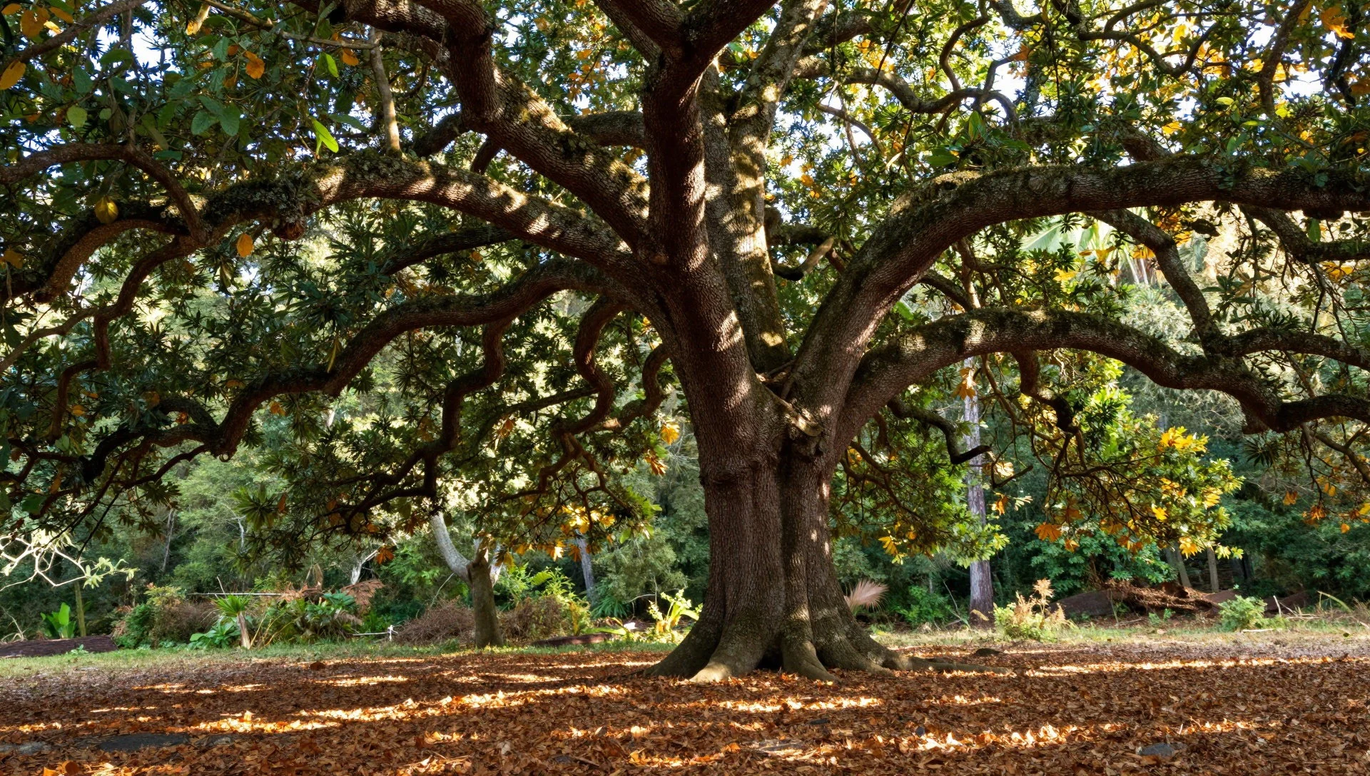
- Gerês hiking circuits (PR trails) — Gerês town area
Around the town of Gerês, two signed routes are often used for day hikes: a longer circuit that includes forest, a viewpoint, rock formations and a return via an asphalt road without traffic, and a shorter “lazy trail” looping through forest. Both are practical intros to the park.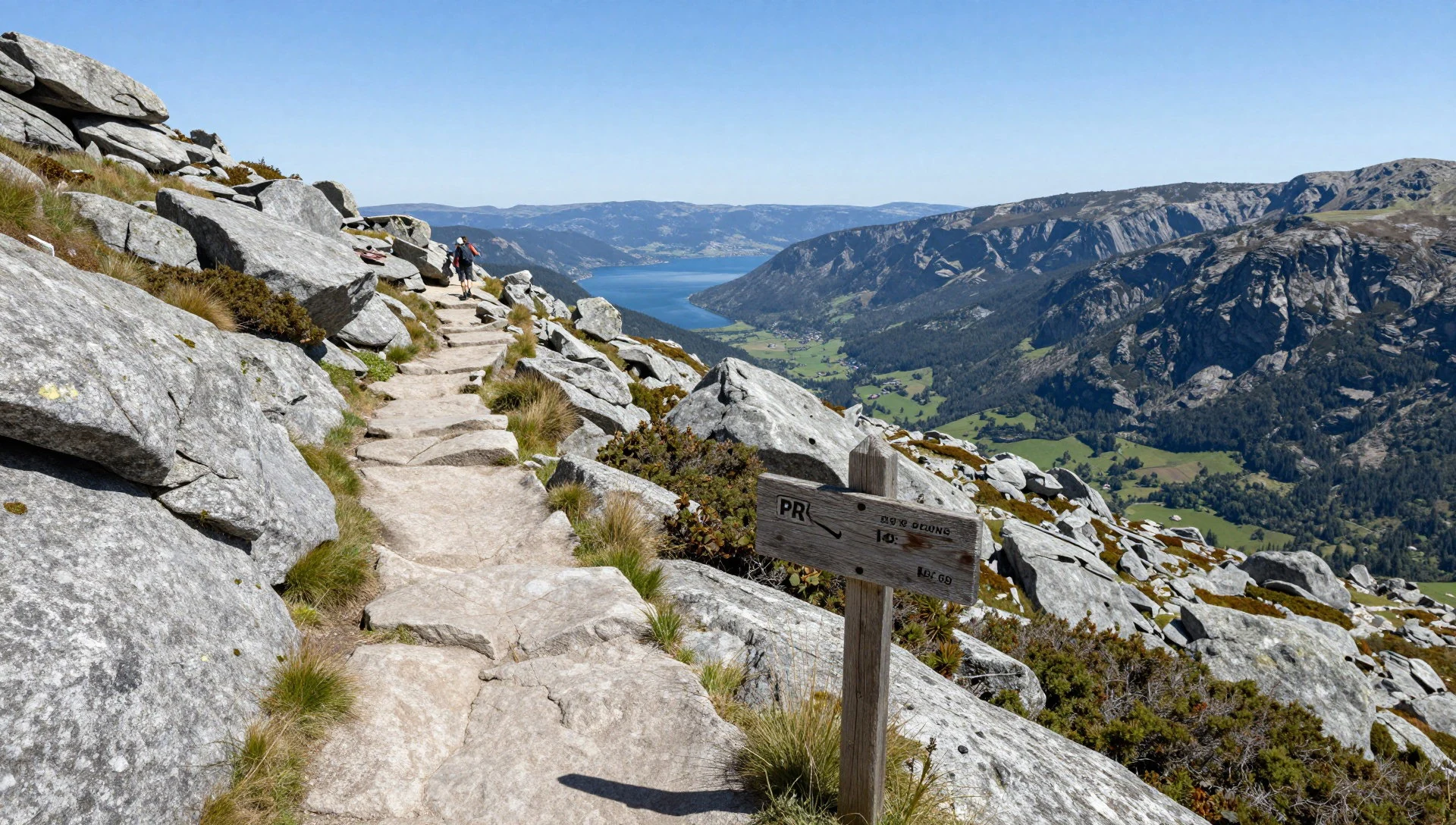
Culture
Peneda-Gerês National Park sits in a living rural part of Portugal, where tourism exists but day-to-day life still revolves around land, water, and seasons. Small communities and religious sites shape local rhythms, and that’s visible in places like shrines and chapels scattered around the valleys. Roman-era traces and older megaliths add weight, but the park doesn’t feel like a museum—more like a countryside that has gathered history.
If wildlife is the headline, it’s worth remembering that animals live here, not as an attraction. Tracks can be damp, and vegetation is active; the best cultural move is simply to walk thoughtfully and keep noise down, especially early in the day when birds and insects are most active.
Eating out tends to be straightforward—local dishes in family-run settings are common in the broader region—so take cues from what’s available rather than expecting a restaurant scene.
Visitor etiquette: keep to marked paths, avoid trampling vegetation near shrines, and respect other hikers’ space on narrow trails.
What to wear
In Peneda-Gerês, traditional dress still appears during regional celebrations, but day-to-day life is mostly practical. When people wear traditional outfits, you’ll usually see locally rooted textiles—wool-rich garments and layers suited to mountain weather, with colours and details that echo the area’s heritage. That said, these are not everyday hiking clothes.
What people wear now in and around Gerês is what you’d expect for a Portuguese mountain park: casual layers, breathable tops, and warm outerwear when temperatures drop in the valleys. Footwear matters more than fashion. Paths can be uneven and sometimes muddy, so trainers with grip are the minimum; sturdier walking shoes are better for slippery conditions.
For a visit, bring a rain layer even in shoulder season, plus a fleece or light jacket for mornings. If visiting shrines, a modest, covered look is appreciated—comfortable trousers or skirts are fine, and shoulders should be relaxed rather than exposed. Carry a small day bag: water, a light snack, and a dry layer can be the difference between a good hike and a cold one.
What to eat
- Traditional gastronomy (regionally inspired plates) — Gerês
For a proper sit-down meal, look for traditional regional cooking in family-friendly settings—often in or alongside accommodation in Gerês. A commonly listed example is Restaurante Castrum Villae, where you’ll find the kind of home-style dishes that suit rainy-day hiking plans.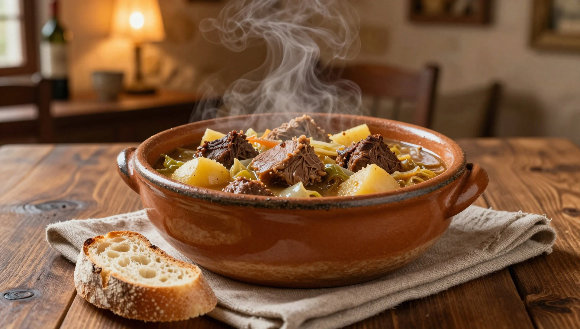
Plan it
Best time. April to early May and October to November tend to be the most comfortable walking windows because the park’s higher country is less punishing than peak summer heat or wetter winter conditions; March and April also catch greener landscape after drier spells.
How long. 3–4
Getting there. Drive in via Portugal’s A3 motorway (Autoestrada de Entre-Douro-e-Minho), then take exit 11 to the N203 into the park; the N103 runs close to the park’s southern edge, and connecting access roads include the N304.
Budget. mid
Tips
- Pick a base around Gerês and use short day drives to reach different trailheads and viewpoints.
- Start hikes early when mist and cool air make the valleys feel calmer; afternoon weather can shift quickly.
- Ask locally for track information: tourist information in Gerês may focus on nearby routes, while broader track details come from national park offices.
- Carry water and plan for wet ground—forest sections can be slippery after rain.
- If using buses from the region, check weekend schedules in advance because service can be sparse.
Etiquette
- Stay on marked paths and keep away from fragile vegetation near reserve areas.
- At shrines, be respectful in volume and movement, and follow any local guidance on where to stand or how to approach.
- When sharing narrow trails, pause at wider spots to let others pass safely.
Nearby
Sources
- Wikidata Q1473702 (CC0)
- Wikipedia (rev 1375762799) (CC BY-SA 4.0)
- Wikivoyage (rev 5414122) (CC BY-SA 4.0)
- Photo photos/01-near-campo-do-ger-s-portugal-373505187.jpg (CC BY-SA 2.0)
- Photo photos/02-serra-amarela-3998067385-2.jpg (CC BY-SA 2.0)
- Photo photos/03-anta-do-mezio.jpg (CC BY 3.0)
- Photo photos/04-dsc-0513-a.jpg (CC BY-SA 4.0)
- Photo photos/05-parc-de-ger-s-banner.jpg (CC BY-SA 4.0)
- Photo photos/06-serradogeres.jpg (CC BY-SA 4.0)
- Photo photos/07-rio-lima-1.jpg (CC BY-SA 2.5)
- Photo photos/08-peneda-ger-s-19370742083.jpg (CC BY 2.5)


