Paparoa National Park
Paparoa National Park, New Zealand
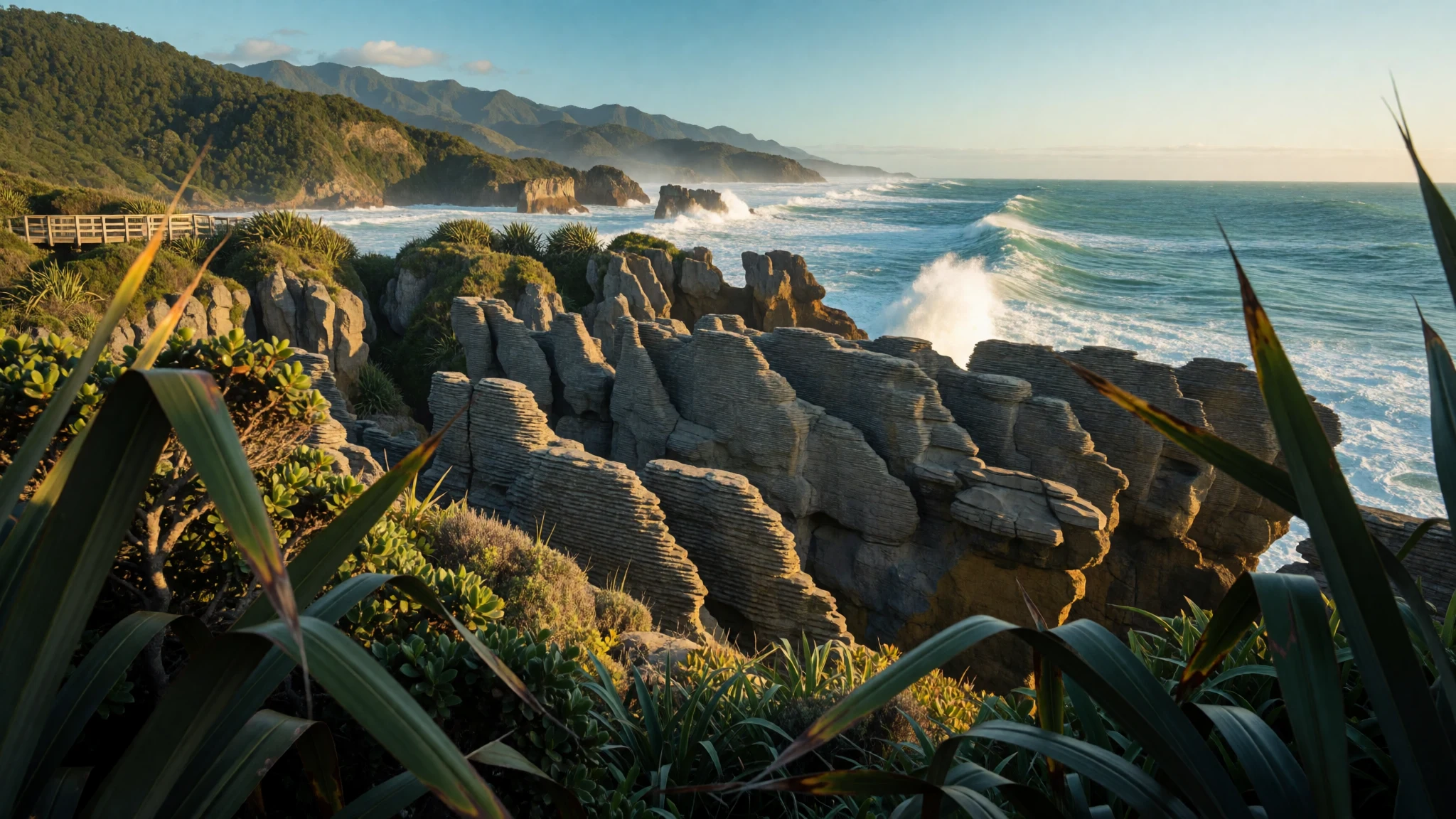
Paparoa National Park packs limestone cliffs, rainforest gorges, caves and surf-pounded blowholes into a narrow strip between the Tasman Sea and the mountains.
The place
Paparoa National Park lies on the northern West Coast of New Zealand's South Island, a strip of land between the Tasman Sea and the Paparoa Range. It was established in 1987 and climbs from the shoreline, in places almost from the surf, to the high ridges of the range. Its natural limits are the Buller River (Kawatiri) to the north and the Grey River (Māwheranui) to the south, and the main block covers the seaward side of the mountains. Smaller detached pieces sit inland along the Inangahua River, and another northern section is centred on Ananui Creek.
The defining feature is limestone karst, rock that water has dissolved into caves, gorges, sinks and springs. Several caves lie inside the park, and Metro Cave / Te Ananui Cave is the one run as a commercial attraction. Rivers such as the Punakaiki, Pororari and Fox (Potikohua), along with Bullock Creek (Punungairo), cut through the limestone and drain the western slopes. Most of the ground is clothed in forest of many kinds, and the steep rise from sea to mountain makes its own weather, so rain and low cloud are ordinary companions rather than exceptions.
The small settlement of Punakaiki sits on the park's edge beside the Pancake Rocks and Blowholes, and State Highway 6 runs past it between Westport and Greymouth. Barrytown is also close. In practice, most travellers stop briefly at the rocks beside the road and then drive on, which leaves the river gorges, the forest and the Paparoa Track, one of New Zealand's Great Walks, far quieter than the car park suggests.
Its story
Paparoa National Park exists because of a long campaign rather than a single decision. Mountain clubs first singled out the northern Paparoa Range as wilderness worth keeping, and a forest-protection group soon argued for a much larger park than the one that eventually appeared. Officials then looked at the western side of the range as a candidate. In 1979 scientists and museum staff secured protection for the core of the area, the lowland limestone forests, which were gazetted as the Pororari Ecological Area.
The first big proposal was turned down. After many rounds of submissions, with groups such as the Royal Forest and Bird Protection Society pushing hard, the park was gazetted in November 1987, smaller than the campaigners had hoped.
Later chapters were harder. In 1995 a scenic viewing platform above Cave Creek collapsed and fourteen people died, a loss that is part of the park's history and a reason the barriers and signs along its tracks deserve respect.
The park's legal protection from mining has also been tested. In 2010 a government discussion paper floated lifting that protection from part of the Inangahua sector. After a very large public response, the government decided against it and left the protection as it was. Then in 2015 the environment minister announced that land around the Pike River Mine, bought by the government once the mining company had been liquidated, would be added to the park. The park's story is therefore still being written, mostly by people arguing over what should be left alone.
What to see
- Pancake Rocks and Blowholes — Punakaiki, on State Highway 6
At Punakaiki, layered grey limestone stands in stacks that really do look like piled pancakes, and geologists have not fully settled how the layering formed. A paved loop winds through coastal vegetation, with some steps. The blowholes perform best at high tide with a strong westerly swell, when surf booms up through the gaps. Expect company.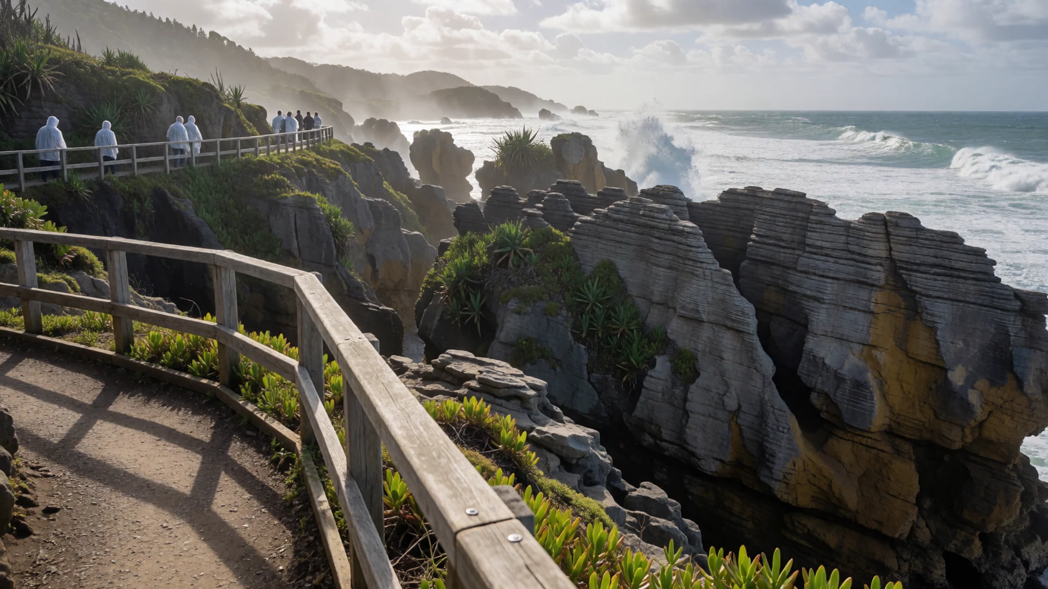
- Pororari River Track — Pororari River, near Punakaiki
The Pororari River Track follows a river through a limestone gorge lined with forest, starting close to Punakaiki. It suits a half-day outing, and the clear water, mossy rock and nikau palms make a quiet contrast to the busy coast road. Check conditions with the Department of Conservation after heavy rain, because West Coast rivers rise quickly.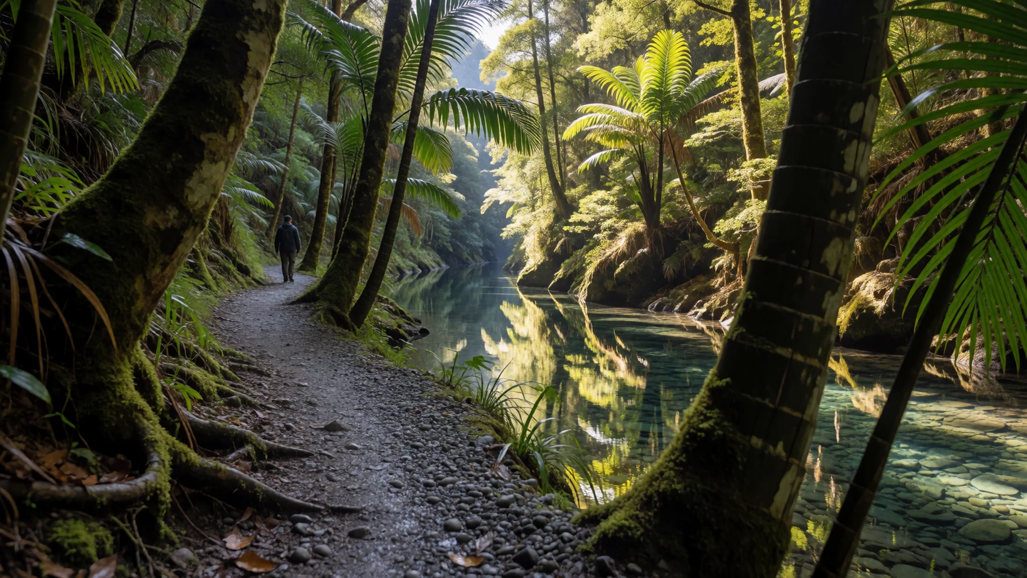
- Fox River (Potikohua) — Fox River valley, northern Punakaiki area
The Fox River (Potikohua) cuts a gorge between forested limestone cliffs and gives walkers a way into the quieter interior of the park. Tracks here are rougher than the paved paths at Punakaiki, so sturdy footwear matters and river levels should be checked first. Expect birdsong, dripping rock and few other people.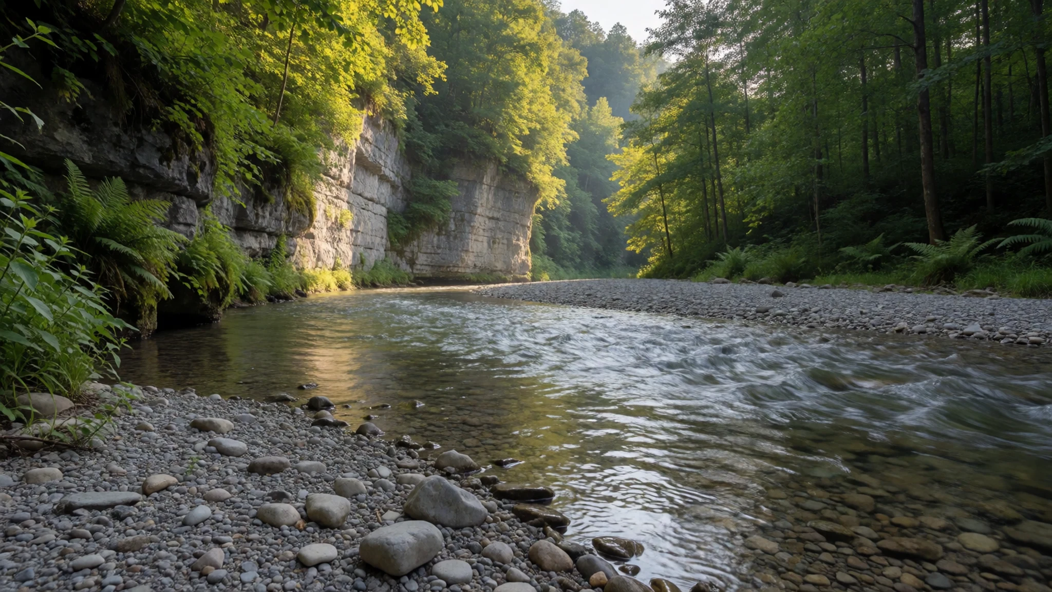
- Paparoa Track — Paparoa Range
The Paparoa Track is one of New Zealand's Great Walks, a multi-day route through the range. It suits people who want ridgeline views and a proper journey rather than a roadside stop. Huts and bookings are managed by the Department of Conservation, so check its official site well ahead, especially for summer dates.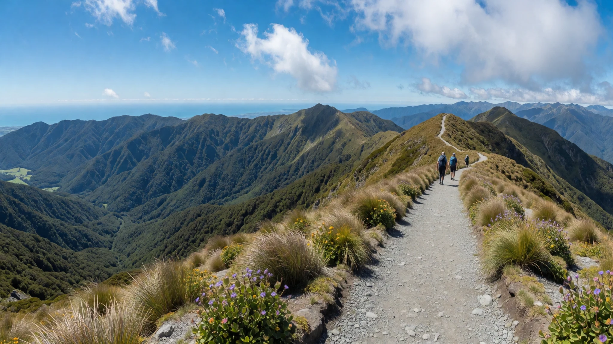
- Caves and the Cave Creek resurgence — Inland from Punakaiki
Limestone caves are scattered through the park and its hinterland. Metro Cave / Te Ananui Cave is the commercial one, and some others are easy to reach, though a torch and good shoes are essential and a few hold glow-worms. At Cave Creek a stream re-emerges from underground, showing the karst at work.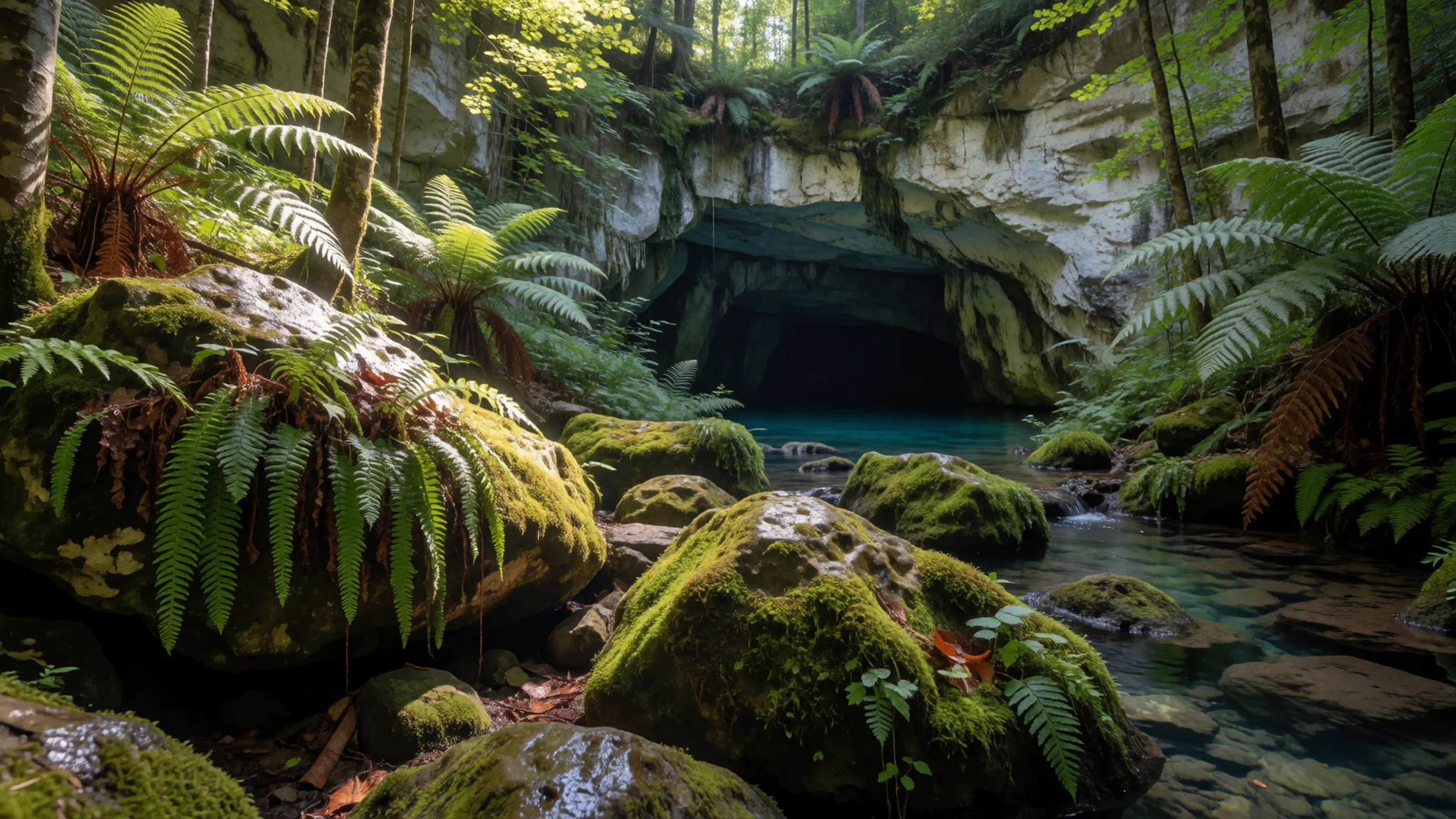
Culture
Paparoa National Park carries Māori and English names side by side: Kawatiri and Buller, Māwheranui and Grey, Potikohua and Fox, Punungairo and Bullock Creek, Te Ananui and Metro. The pairs are a reminder that these valleys were known, named and used long before the highway arrived, and visitors who learn a few of the Māori names tend to read the map more richly.
Local life centres on the small settlement of Punakaiki and on conservation work in and around the park. Campaigners spent years winning protection, and public feeling about keeping the park free of mining has proved strong more than once. The Cave Creek tragedy is also part of local memory, which is why barriers, signs and track closures are taken seriously here rather than treated as an inconvenience.
West Coast hospitality is plain and friendly. Cafés and shops along the highway are small, the weather shapes everyone's plans, and talk of rain, rivers and road conditions is an ordinary way to start a conversation. Travellers who arrive on a day of heavy rain will find locals unbothered, and flexible plans are the sensible response.
Keep to the boardwalks and stay behind the railings at the Pancake Rocks, especially when the swell is up, and take every scrap of your rubbish with you.
What to wear
Paparoa National Park has no costume of its own; the dress traditions behind the region are Māori, and the best known is the korowai, a cloak woven from flax (harakeke) fibre and often finished with feathers or woollen tassels. Cloaks like these appear at ceremonies, graduations and formal welcomes, alongside carved greenstone (pounamu) pendants. Visitors are far more likely to see them at an occasion than on a track.
Everyday clothing on the West Coast is practical and weatherproof. People wear wool and merino layers, waterproof jackets, quick-drying trousers and rubber boots (gumboots) in muddy weather. Fleeces and beanies are common even on summer evenings, and nobody dresses up for a café or a pub.
A visitor should dress for rain first. Pack a proper waterproof jacket, a warm mid-layer, quick-drying clothes and a hat. Boots or sturdy trail shoes with good grip are worth having for river tracks and slippery roots, while sandals only suit the paved Pancake Rocks loop in dry weather. Insect repellent helps against sandflies near water, and sun protection is useful on bright days because the coast offers little shade. There are no modesty rules at the park, though covered arms and legs are sensible against sandflies anyway. For caving, wear clothes that can get wet and muddy.
What to eat
- Whitebait fritter — cafés along State Highway 6 in Punakaiki, Westport and Greymouth
A West Coast speciality when the small fish are in season: whitebait folded into a light egg batter and fried into a fritter, often served in a bread roll. Ask at roadside cafés along State Highway 6 whether it is available, since supply depends on the season.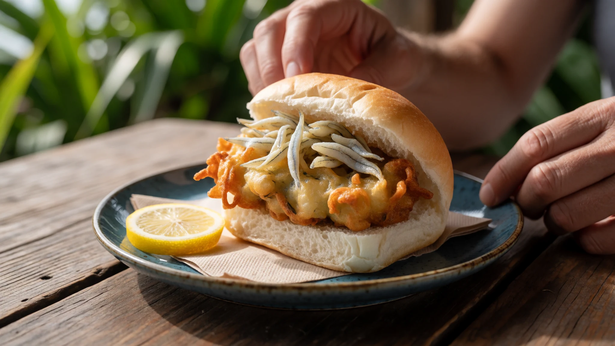
- Savoury meat pie — bakeries and dairies in Westport, Greymouth and Barrytown
The standard New Zealand road-trip lunch: a hand-sized pastry filled with minced beef, steak and cheese, or similar. Locals buy them warm for a walk or a long drive, and the quality varies pleasantly from one small bakery to the next.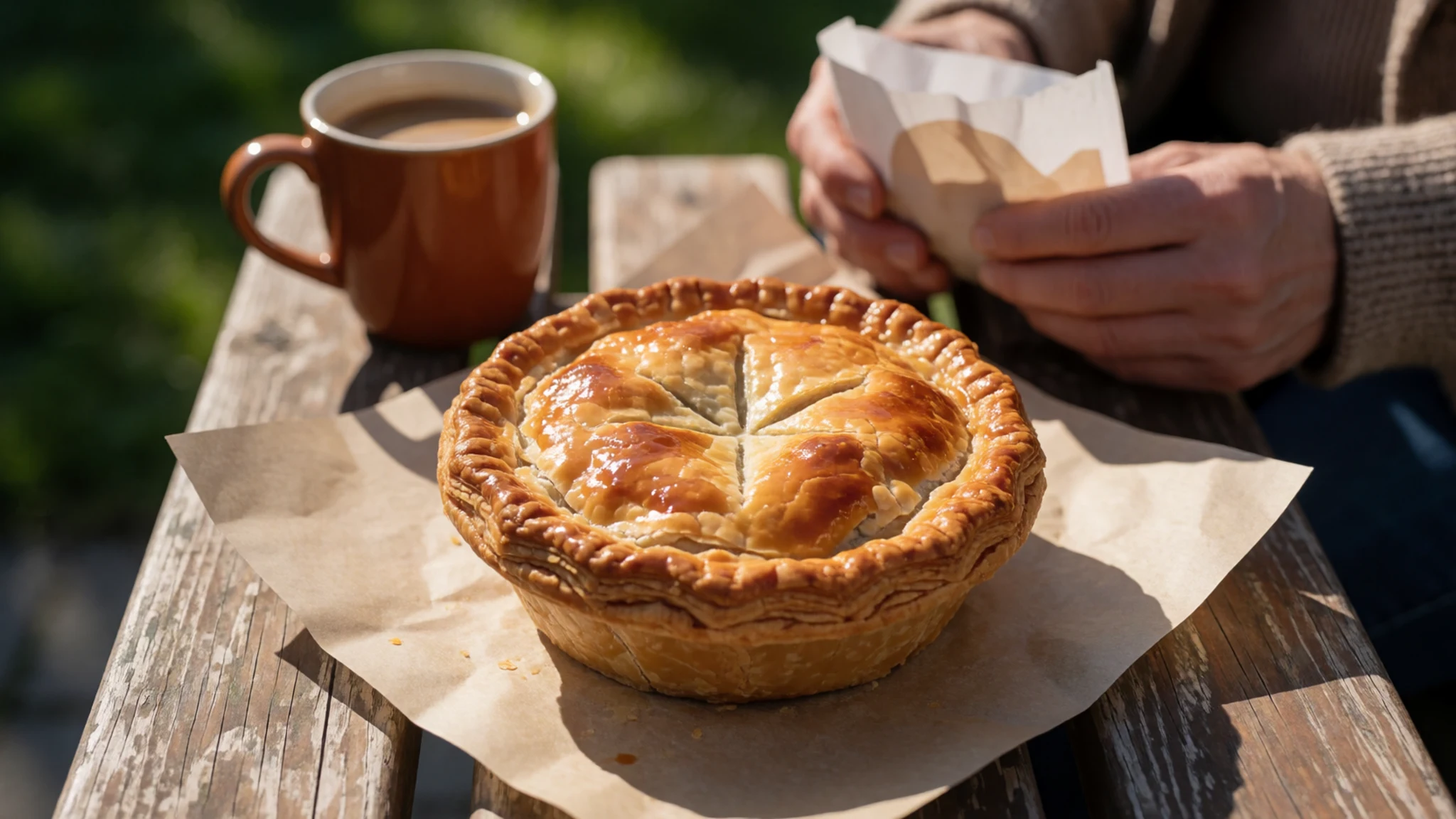
- Fish and chips — takeaway shops in Westport and Greymouth
Fresh fish, usually a white local variety, battered or crumbed and served with thick chips in paper. Eaten on the coast after a day of walking, it needs no occasion, only a view of the sea if the weather allows. - Venison — pubs and restaurants in Westport and Greymouth
Wild or farmed deer is common on South Island menus, served as a casserole, sausage or roasted cut with a berry sauce. It suits a wet, cold evening after a river walk better than anything light. - Flat white with a scone — cafés in Punakaiki beside the highway
A flat white is New Zealand's everyday coffee, smooth and milky, and a cheese or fruit scone is the usual partner. Together they make the standard stop when rain interrupts a walk near the Pancake Rocks.
Plan it
Best time. December to March is usually the easiest stretch for walking and the Paparoa Track, with longer days. Rain can arrive in any month, because the mountains rise steeply from the sea, so pack waterproofs whenever you come. Winter is quieter but wetter, with shorter days.
How long. 2–3
Getting there. Christchurch is the usual gateway, then a long drive or coach ride across the Southern Alps to the West Coast. Punakaiki lies on State Highway 6 between Westport and Greymouth, so the last leg is by road. Check what flights, coaches and rental cars are running before you commit.
Budget. mid
Tips
- Check tide times and swell forecasts, since the blowholes are best at high tide with a strong westerly
- Book Paparoa Track huts and slots early through the Department of Conservation's official site
- Carry insect repellent for sandflies and a waterproof jacket in every season
- Fill the fuel tank and withdraw cash in Westport or Greymouth, since Punakaiki is small
- Check river conditions with the Department of Conservation before any gorge walk after rain
Etiquette
- Stay on marked tracks and behind railings, especially at the blowholes and above gorges
- Take all rubbish out, and keep clear of cave formations and wildlife
- Respect closures and warning signs; they exist for good reasons
Nearby
Sources
- Wikidata Q1075151 (CC0)
- Wikipedia: Paparoa National Park (rev 1340130919) (CC BY-SA 4.0)
- Wikivoyage: Paparoa National Park (rev 4413915) (CC BY-SA 4.0)
- Photo: Pancake Rocks near Punakaiki, Krzysztof Golik (CC BY-SA 4.0)
- Photo: Pancake Rocks near Punakaiki, Anagoria (CC BY 3.0)
- Photo: Paparoa Visitor Centre, Wildman NZ (CC BY-SA 4.0)
- Photo: Cave Creek resurgence, Marshelec (CC BY-SA 4.0)
- Photo: Pororari River Track, Wildman NZ (CC BY-SA 4.0)
- Photo: Pancake Rocks, Punakaiki, Christian Michel (CC BY 2.5)
- Photo: Fox River, Paparoa National Park, Michael Schwab (CC BY-SA 2.0)
- Photo: Paparoa Track (Pororari river), Wildman NZ (CC BY-SA 4.0)


