Omo National Park
Omo National Park, Ethiopia
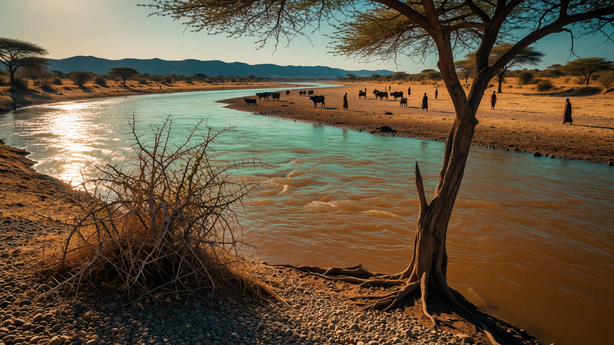
Omo National Park is for travellers who want wild savannah, a great brown river and a long, honest journey, with almost no infrastructure along the way.
The place
Omo National Park lies in the far south-west of Ethiopia, on the west bank of the Omo River in the lower Omo Valley. It covers about 4,068 square kilometres and sits roughly 870 kilometres south-west of Addis Ababa. Across the river are Mago National Park and the Tama Wildlife Reserve. The park stretches about 140 kilometres from north to south and is up to 60 kilometres wide near its headquarters on the Mui River. Most of the ground is low, open country at around 800 metres, falling to about 450 metres in the south towards the Neruze River. On the western side the Maji Mountains climb to 1,541 metres. Vegetation is mostly open savannah, thickets and riverine woodland, broken by the Sharum and Sai plains in the north and the Illibai plains and Dirga Hills in the south. There are three hot springs, and every stream in the park eventually drains into the Omo. Wildlife counts run to 73 mammal species and 312 birds. Buffalo, zebra, eland, beisa oryx and Grant's gazelle form the big herds, while elephant, lion and leopard are present but seldom seen. Lonely Planet's guide to Ethiopia and Eritrea calls this the country's most remote park. That is a fair summary: there is almost no tourist infrastructure inside it, and a visit is an expedition rather than a day trip.
Its story
Omo National Park has a recent history that is mostly about who gets to use the land. The lower Omo Valley has long been home to pastoralist and farming communities, among them the Mursi, Suri, Nyangatom, Dizi and Me'en. Their herds, fields and seasonal movements followed the river and the rains well before anyone drew a park boundary around them. When the boundaries were formally demarcated, and management of the park was handed to the conservation group African Parks, those communities were reported to be at risk of losing access to grazing and farmland. Accounts at the time also described people being pressed to sign papers they could not read. African Parks later withdrew from Ethiopia, saying that running the country's parks sustainably did not fit with how some of the local groups lived, and that it struggled to deal with people continuing their traditional way of life inside the park. Tourism never filled the gap. A 1999 report found that no agency, in Ethiopia or abroad, would arrange tours here, and an announced budget for roads, recreation centres and communications was meant to draw more visitors. Today the park remains thinly visited, with wildlife, herders and a contested legal status sharing the same ground. Anyone reading about it should treat the tension between conservation and local livelihoods as part of the place, not a footnote to it.
What to see
- The Omo River — Eastern boundary of the park
The Omo River forms the park's eastern edge and is the reason the whole valley exists. Seen from the Karo village of Doose, it is wide, slow and brown, with muddy banks and green fringes of trees. Crocodiles and hippos use it, so stay well back from the water's edge.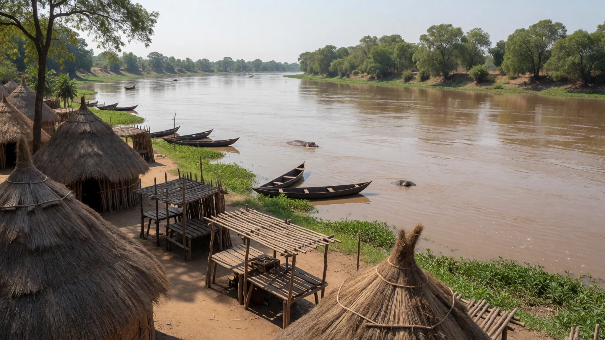
- Mui River and park headquarters — Central park, Mui River
Flowing through the park's centre, the Mui River joins the Omo, and the headquarters sit on its banks. This is the practical centre for any visit: where rangers and scouts are arranged, where the airstrip lies, and where riverside woodland holds monkeys and birds.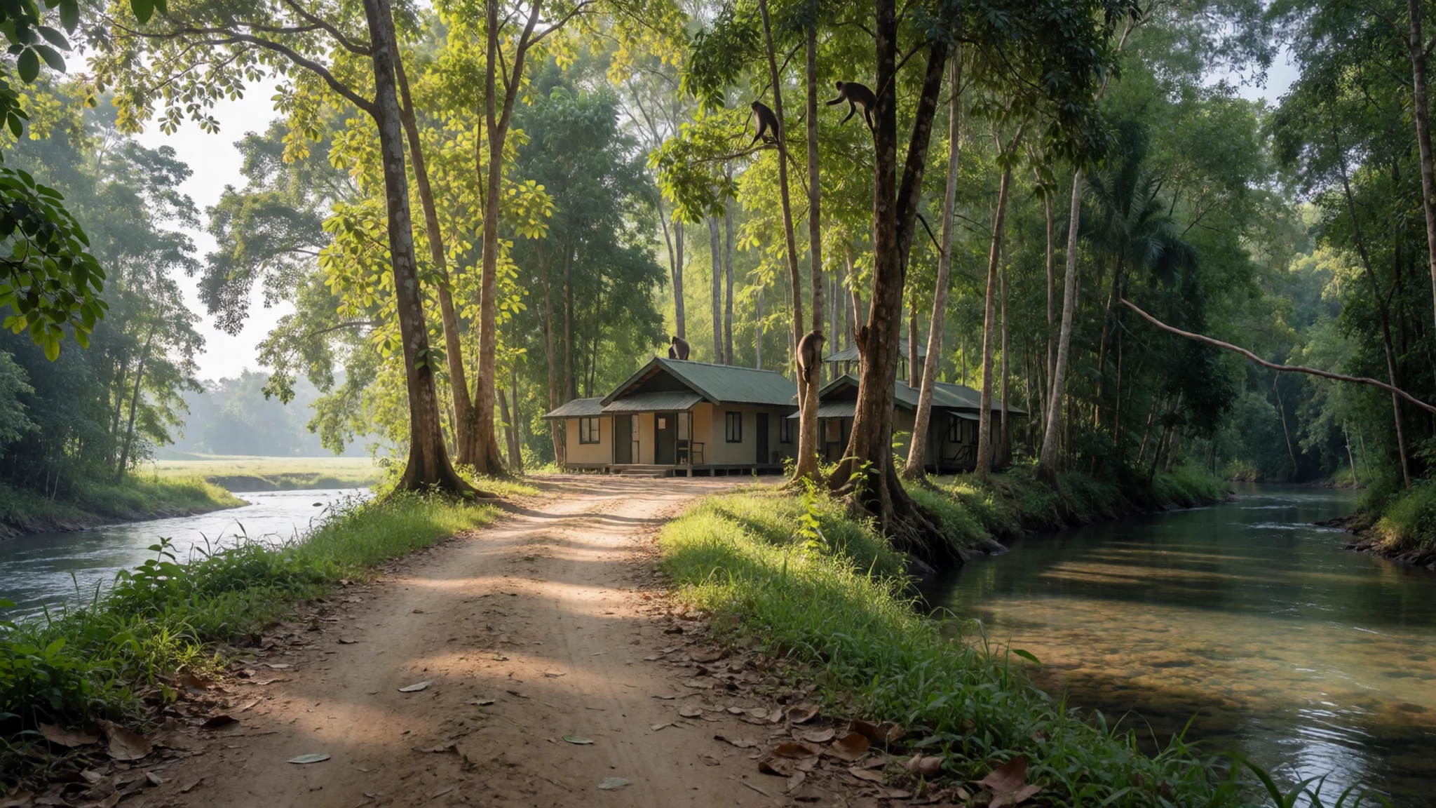
- Maji Mountains — Western side of the park
The Maji Mountains form the western skyline, with a peak of 1,541 metres inside the park. The slopes are cooler and greener than the plains, with forest patches where guerezas, olive baboons and De Brazza monkeys can be heard before they are seen. Expect rough tracks and long drives.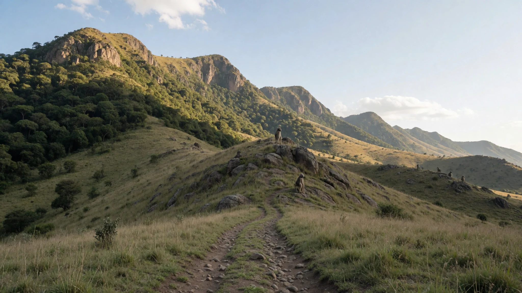
- Sharum and Sai plains — Northern and western park
In the north and west, the Sharum and Sai plains are open grassland where game is easiest to spot. Herds of buffalo, eland, zebra, oryx and Lelwel hartebeest graze here, and early morning gives the clearest views before heat haze builds. Binoculars matter more than a long lens.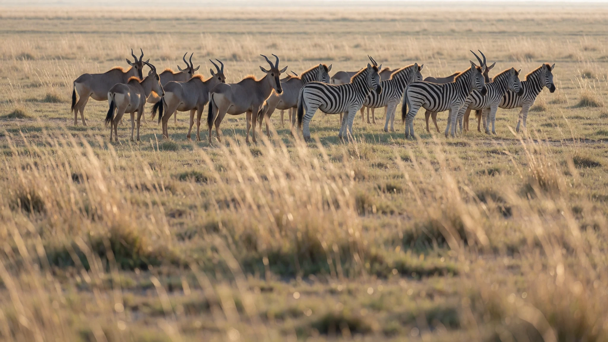
- Illibai plains and Dirga Hills — Southern park
The southern end of the park, towards the Neruze River, is the lowest and driest part, with scrubby thickets, the Illibai plains and the low Dirga Hills. Wildlife is thinner and more skittish here, but the emptiness is the point. Few visitors reach it, so it demands a capable vehicle and guide.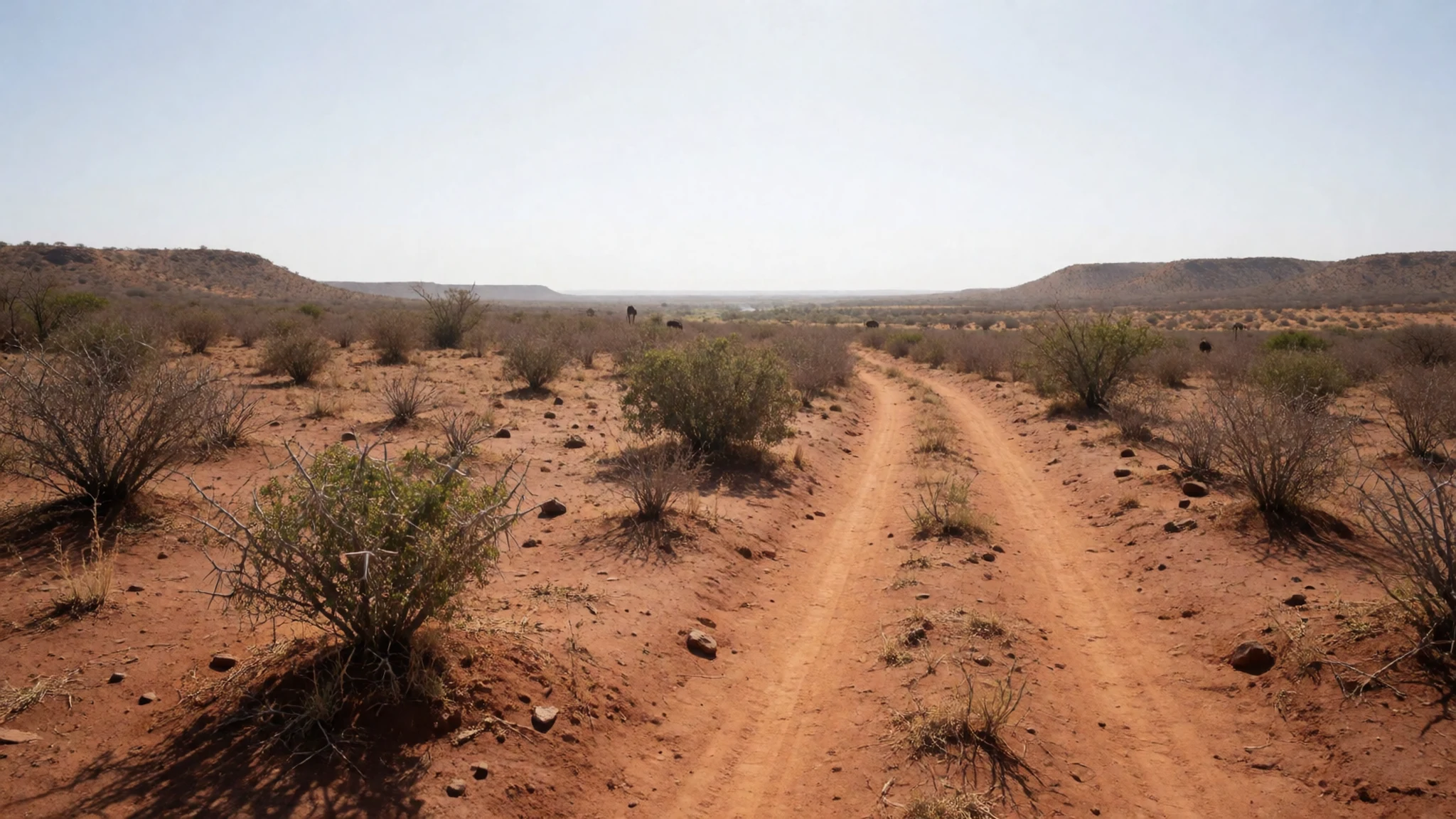
Culture
Omo National Park cannot be separated from the people who live around it. The lower Omo Valley is home to the Mursi, Suri, Nyangatom, Dizi and Me'en, among others, and each group has its own language, livelihood and customs. Cattle are central for many of them, as wealth, as food and as part of marriage and social life, so grazing land and river access are not abstract matters. Farming along the flood-fed banks matters just as much. These are working communities, not exhibits, and some of the best-known images of the region have created expectations that do not always sit comfortably with daily life. Visitors will probably meet people along tracks, near the river or in villages outside the park boundary, and the quality of those meetings depends on how they are handled. Hiring a licensed local guide who knows the community and speaks its language makes a real difference, as does visiting without a fixed shopping list of sights and photographs. Conversations about payment, gifts and photography should be settled openly and calmly, ideally through your guide, rather than improvised. It is also worth knowing that land rights inside the park have been disputed, so people may have views about visitors that are shaped by that history. Listening is a better starting point than asking for a performance. Always ask permission before photographing anyone, agree any payment through your guide beforehand, and put the camera away if the answer is no.
What to wear
Fashion in the Omo region is closely tied to herding, farming and ceremony, and the traditional look differs from group to group. Many communities have long used cattle hide and goat skin for wraps and skirts, with beadwork, metal bracelets, necklaces and carefully styled hair. Body decoration, including painted patterns made from clay, ash and plant pigments, is part of celebrations and social life in several groups, and some women among the Mursi are known for wearing clay lip plates. These items carry meaning about age, status and occasion, and are not worn every day by everyone. Day-to-day clothing has changed a great deal. In towns and on the road, people mostly wear shirts, trousers, wraps, skirts and sandals, often cotton or synthetic and bought at local markets, and some people mix modern clothes with beads or traditional jewellery. Visitors should dress for heat, dust and long drives. Choose light, loose cotton or linen in muted colours that cover shoulders and knees, partly for sun and insects and partly out of respect in villages. Bring a wide-brimmed hat, sunglasses and a light scarf for dust. Closed, sturdy walking shoes are better than sandals on thorny, uneven ground, and a light waterproof is worth carrying in the rainy months. Avoid camouflage patterns and military-style clothing, which can attract unwanted attention.
What to eat
- Injera with wot — Roadside eateries in towns such as Jinka
Injera is a soft, slightly sour flatbread made from fermented grain, and it is the base of most meals. It comes topped with wot, a spiced stew of lentils, vegetables or meat. Look for it in simple eateries in the market towns on the way to the park.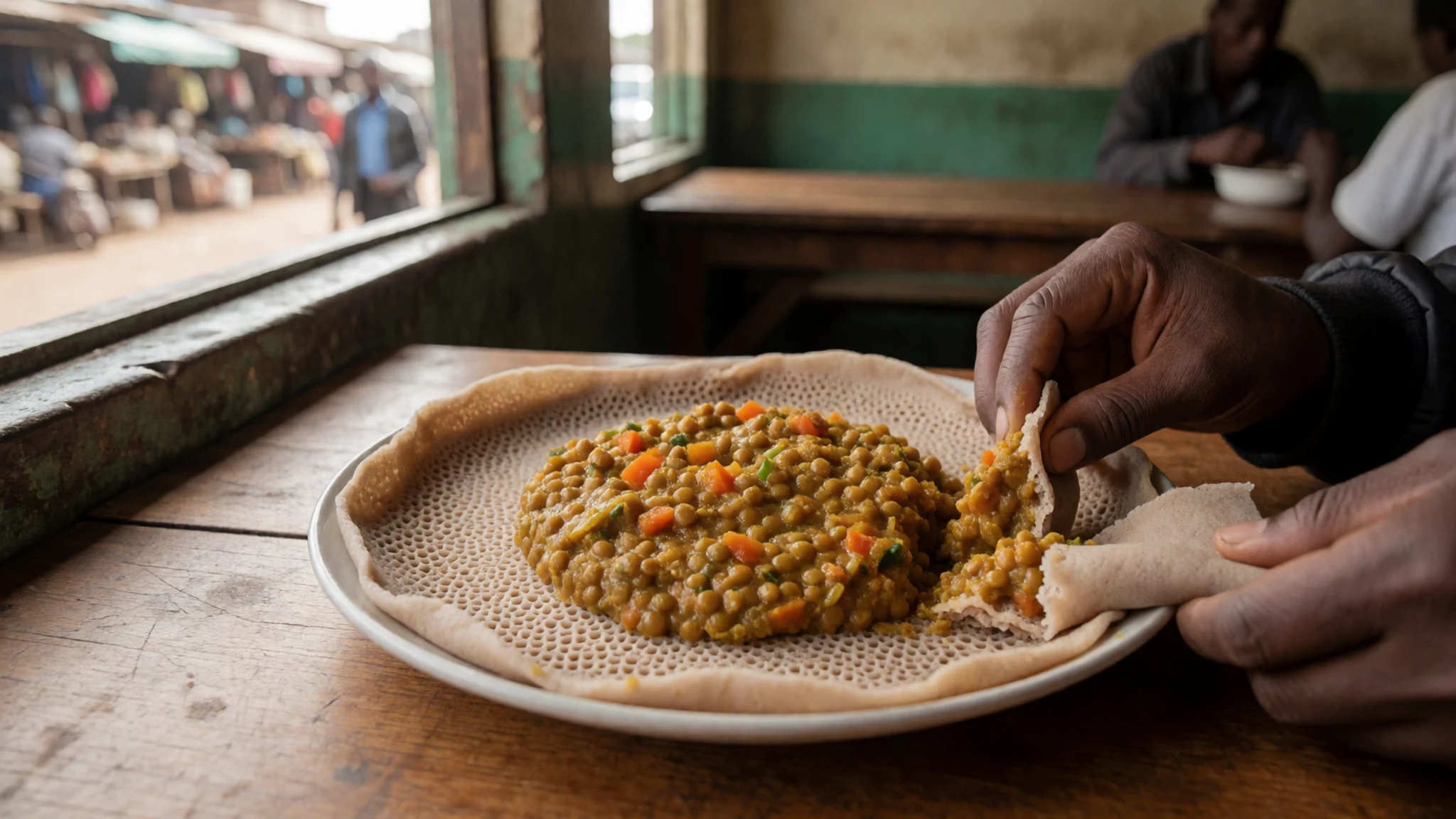
- Tibs — Town restaurants and local eateries on the main roads
Tibs are pieces of beef or goat quickly fried with onion, pepper and sometimes rosemary, then served with injera or bread. They are a reliable choice on a long trip because they are cooked to order and arrive hot.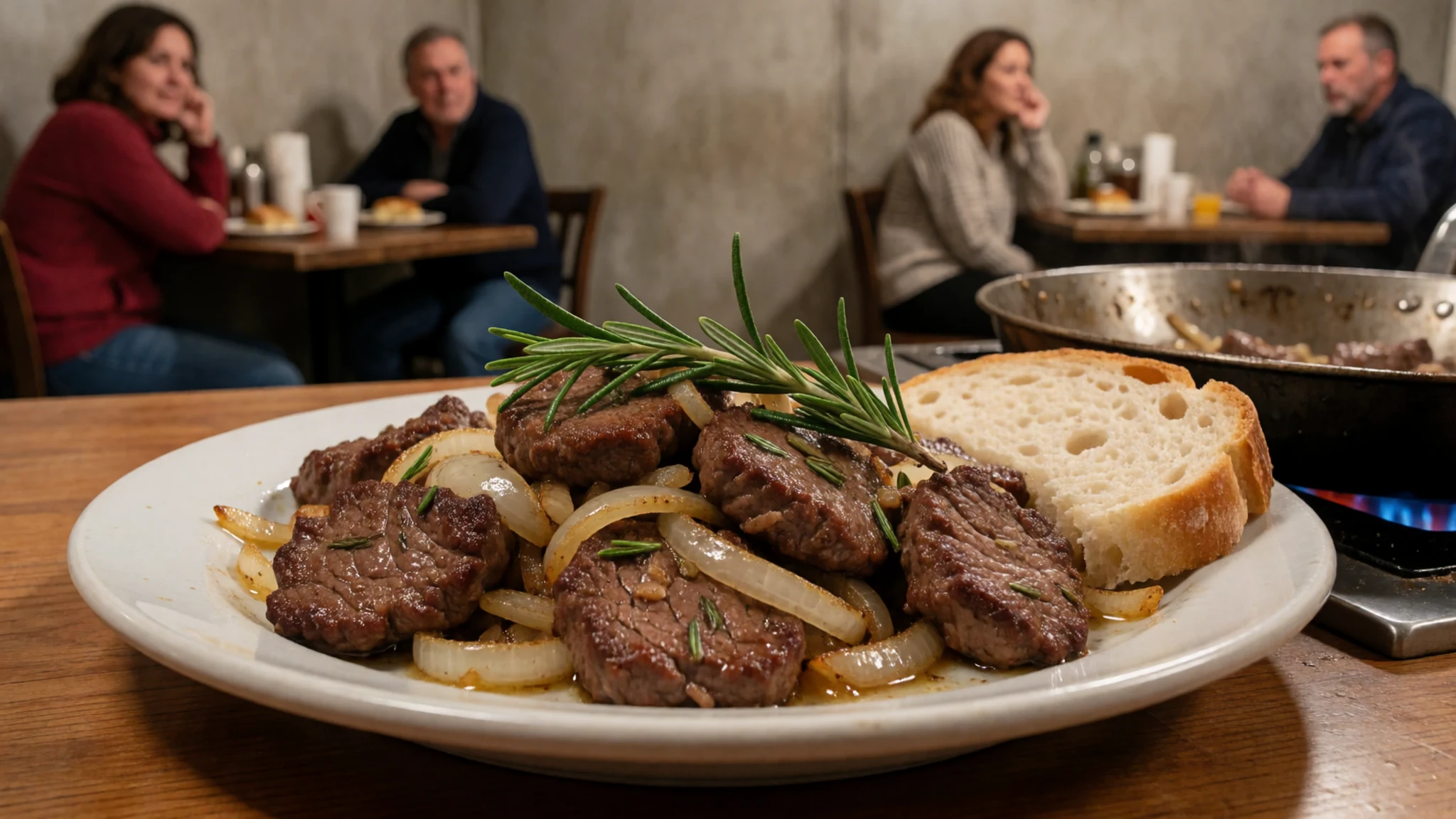
- Shiro — Any small local eatery in a market town
Shiro is a smooth, spiced chickpea or bean stew, often eaten on fasting days and easy to find in any simple eatery. It suits travellers who want a filling vegetarian option, and it is usually served with injera. - Fresh river fish — Lakeside and river-town eateries in southern Ethiopia
Fish from rivers and lakes in the wider region is sometimes grilled or fried and served with lemon and chilli. Ask locally what is fresh that day, and avoid it if it has clearly been sitting around in the heat. - Ethiopian coffee — Cafés and market stalls in towns, or in a home if invited
Coffee is served in small cups, often after a ceremony in which beans are roasted, ground and brewed in a clay pot. It is strong, slightly bitter and usually offered more than once. Accepting a second cup is a polite gesture.
Plan it
Best time. January and February are the best bet: these are the driest months, when tracks are easier and animals gather near water. The lowlands are hot all year, and heavy rain in the wet months can make roads impassable.
How long. 3–5
Getting there. Fly to Addis Ababa, then continue south-west to the Jinka area by a domestic flight or a long overland drive. The final leg is a rough track in a four-wheel-drive vehicle with a licensed guide, as the airstrip near the park headquarters is not a regular service. Check road and access conditions with the park authorities before you set out.
Budget. high
Tips
- Book a guide, driver and vehicle well ahead, since there is almost no tourist infrastructure inside the park
- Carry cash in small notes, as cards and cash machines are scarce outside larger towns
- Bring more drinking water, sun protection, insect repellent and basic medicines than you think you need
- Start drives at dawn, when game is active and heat is manageable
- Check the current security and access situation locally before travelling
Etiquette
- Ask permission and agree any payment before photographing people
- Use a local guide for village visits, and follow their advice
- Keep well away from riverbanks, where crocodiles and hippos live
Nearby
Sources
- Wikidata Q1305538 (CC0)
- Wikipedia: Omo National Park (rev 1362889830) (CC BY-SA 4.0)
- Wikivoyage: Omo National Park (rev 4771596) (CC BY-SA 4.0)
- Omo River seen from the Karo village of Doose, photo by Bernard Gagnon, via Wikimedia Commons (CC BY-SA 2.5)
