Mount Nemrut
Mount Nemrut, Turkey
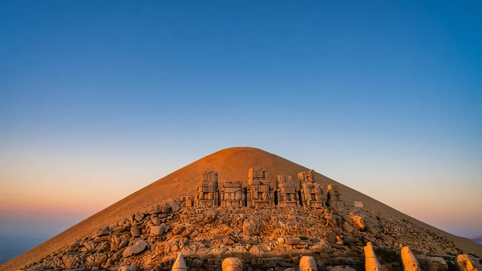
A 2,150-metre summit in south-eastern Turkey, crowned by giant statues of gods and a king who built his own tomb-sanctuary there.
The place
Mount Nemrut rises to 2,150 metres in the Anti-Taurus range of Adıyaman Province, in south-eastern Turkey. It is also spelt Nemrud, and it is best known for what sits on its summit: a large cone of loose stone, flanked by terraces of colossal seated figures. Most archaeologists read the cone as a royal tomb and the figures as parts of a sanctuary built to honour the dead king and the gods he claimed as protectors.
Getting to the top is part of the experience. The road climbs through rural country and the final stretch is open to the wind, which can feel cold even in summer. Nothing up there is tidy. Many statues have lost their heads, which lie scattered across the terraces, and the figures are not back in their original places. The site was listed as a UNESCO World Heritage Site in 1987, and it is run with a light touch: you will find information boards and a few guides, but little of the polish of a big museum.
The main draw is scale. The tumulus is a heap of rock roughly 49 metres high and 152 metres across, and the terraces stretch out on the east and west sides of it. Sunrise and sunset are the times people talk about most, when low light brings out the carved faces. Expect a few visitors on weekday mornings and more at the busiest hours. The place is quiet, exposed and worth the effort.
Its story
Mount Nemrut became a royal project in the 1st century BC. Antiochus I, ruler of the small kingdom of Commagene, chose the summit for his tomb and for a sanctuary dedicated to himself and a mixed group of deities. The monument is usually dated to 62 BC. Antiochus shaped his religious programme around his dynasty's ancestry, blending Greek and Iranian gods into composite figures such as a Heracles-Ares and an Apollo-Mithras-Helios-Hermes. He drew on Parthian and Armenian traditions to strengthen his claim to a long line of rulers.
The statues were once seated, and each god's name was inscribed on the figure. Over time the heads were struck from their bodies and left among the stones. The damage is concentrated on the noses, which suggests deliberate iconoclasm rather than simple weathering. The statues were never set back on their bases. Stone slabs carved with reliefs survive too, thought to have formed a long frieze showing Antiochus' Greek and Persian forebears.
Beneath the summit cone is still believed to lie the tomb itself, but later excavations have failed to find it. The heap of loose rock may have been a deliberate defence against robbers, because any tunnel dug into it would quickly fill with rubble. Today the mountain is a meeting point of archaeology, weather and pilgrimage-style visiting, and the heads are the most photographed remains.
What to see
- The summit tumulus — Summit, Adıyaman Province
The great cone of loose stone dominates the top of the mountain and marks the presumed tomb of Antiochus I. Walk the path around its base for the best sense of its size. Climbing the heap is discouraged, and the surface is unstable. Go early or late in the day, when the light is softer and fewer people are about.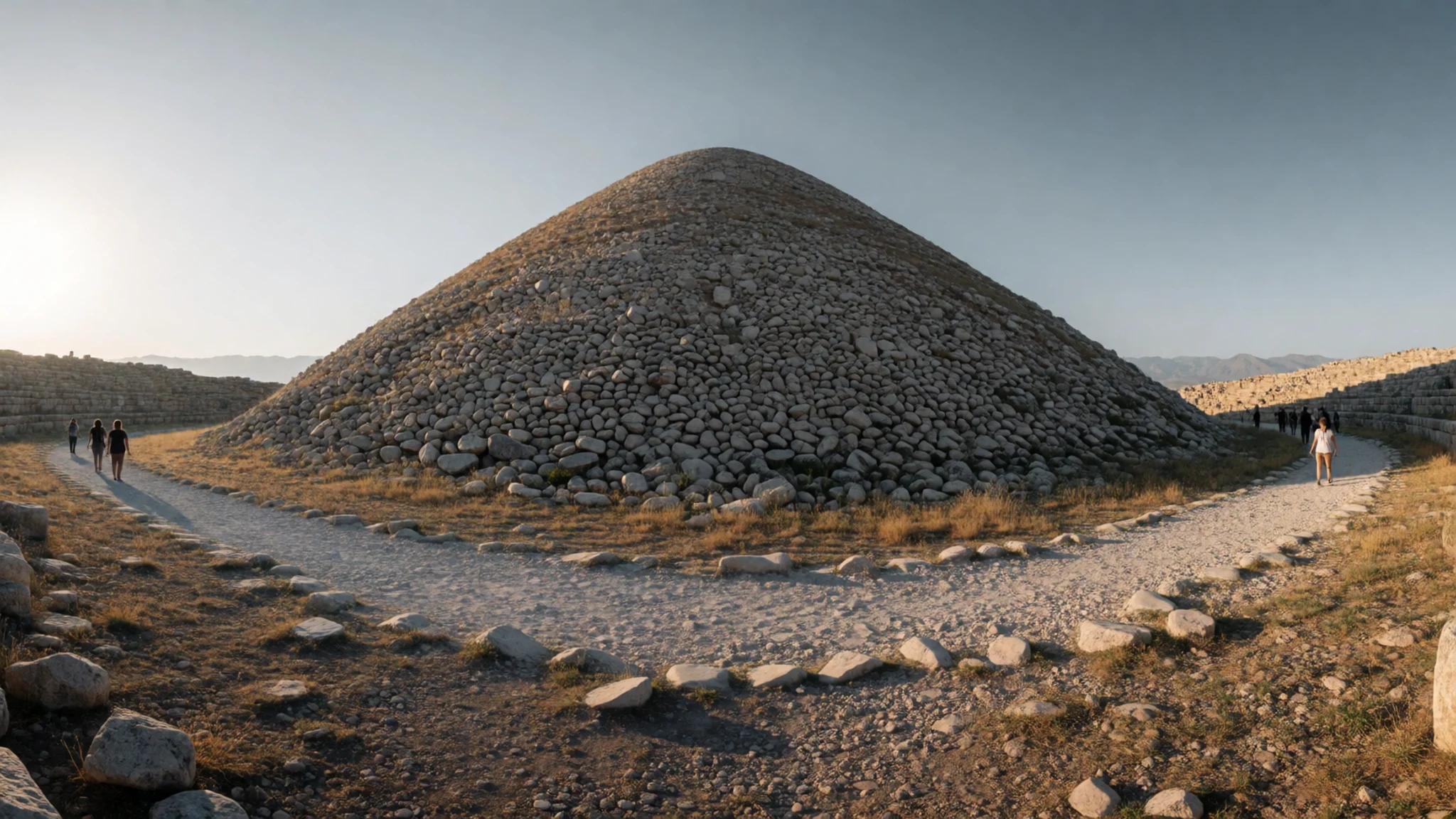
- The east terrace — East side of the summit
The east terrace is the best-known viewing area, where seated figures of gods and the king look out over the valley. Several heads rest on the ground here, and the taller seated figures still show the scale of the original design. Bring water and a hat, as there is little shade on the terrace.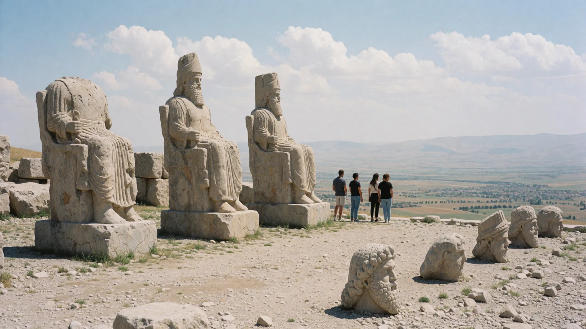
- The west terrace — West side of the summit
The west terrace holds some of the most striking remains, including a head of the king and fragments of other deities. Snow often lingers here into spring, which can make the stones slippery. Watch your footing near the carved blocks and keep to the marked paths.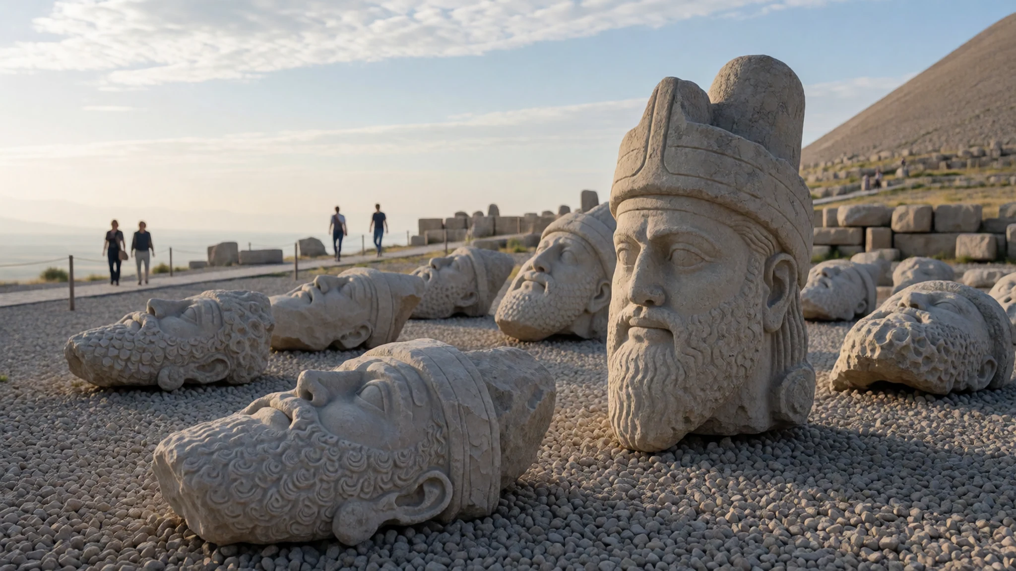
- The scattered heads — Across the summit terraces
Many of the carved heads lie at the foot of their former bodies or among the rubble, some still with their features clearly cut. They are the image most people remember from Nemrut. Take time to look at the faces rather than only the views, because the headless bodies make more sense once you see the fragments up close.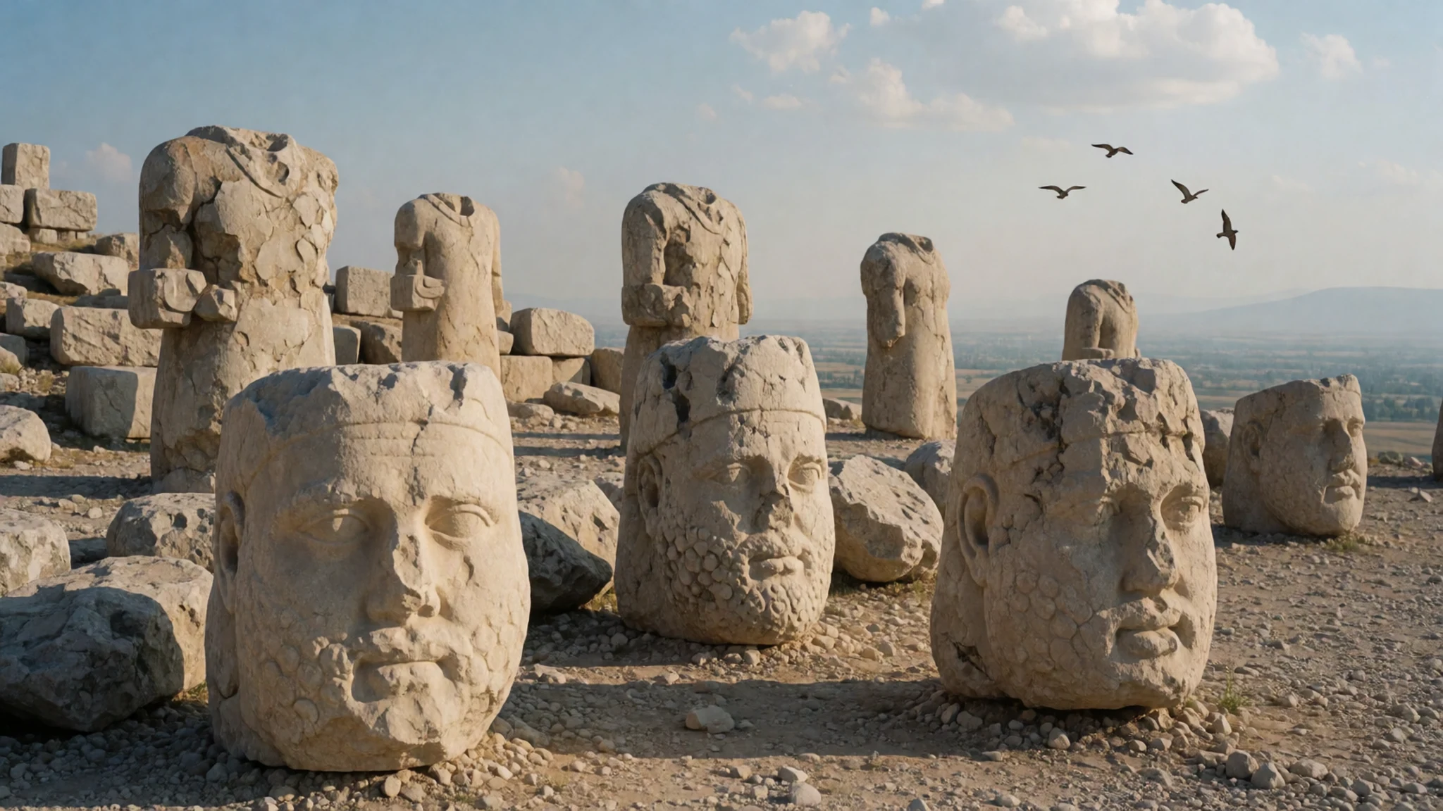
Culture
Visitors to Mount Nemrut arrive in a country where hospitality is central to daily life, and Turks are often described as friendly and polite, sometimes to a fault. Many people in the villages around Adıyaman are Kurdish or Turkish-speaking, and religious practice is common across the region, so a respectful manner goes a long way. Asking about a family or a village is a natural way to start a conversation.
If you are invited into a home, bring a small gift such as flowers or chocolate. Avoid alcohol as a gift, because many Turks do not drink, for religious or personal reasons. Thank your host for the invitation and compliment the home, but avoid asking for anything, since the host will offer. Remove your shoes at the door unless you are told to keep them on, and it is polite to remove them even then. Photographing the ancient statues is generally fine, but ask before photographing people, especially women and children, at village gatherings or small shops.
Remove your shoes at a Turkish home door unless the host says otherwise, and leave alcohol out of any gift.
What to wear
Mount Nemrut sits in a region where traditional dress has long been practical, shaped by farming, herding and cold winters. Older women in the villages of Adıyaman Province have worn headscarves and loose, layered garments, often with embroidered trim, while men have worn woollen jackets and sashes. Hand-woven kilims and cloth woven from wool and cotton remain common in homes and markets, and the patterns vary between villages. You are more likely to see these textiles in a shop or a home than on the mountain itself.
What people wear now is largely everyday clothing: jeans, jackets, sneakers and headscarves for many women, with traditional dress reserved for weddings, festivals and older generations. Dress is more conservative in villages than in the cities, and shoulders and knees are best covered when you visit a home or a mosque.
For your own visit, dress in layers. The summit is windy and can be cold even in summer, so carry a warm jacket and a wind layer. Wear sturdy closed shoes with good grip, because the terraces are uneven and the stones can be loose. A scarf is useful for sun, wind and modesty when you enter a village or religious building.
What to eat
- Bulgur pilaf — A lokanta in the market town of Kahta or Adıyaman centre
Bulgur wheat is the staple grain of south-eastern Turkey, cooked into a pilaf often with tomato, pepper or a little butter. It is a filling, earthy side dish that suits the cool mountain air. Ask for it at a lokanta, the simple home-style eatery found in town centres.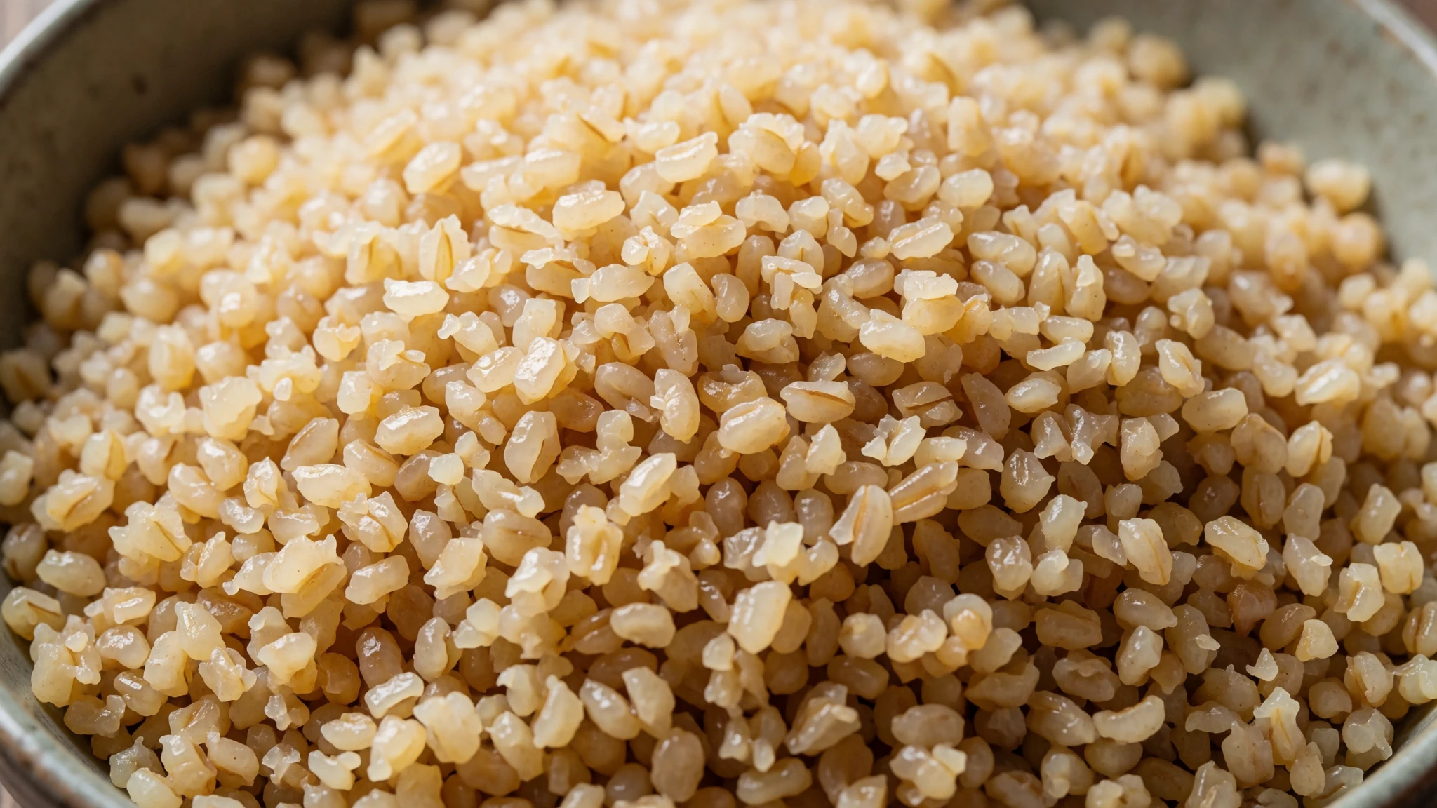
- Turkish coffee — Any local çay house in Kahta or the surrounding towns
Turkish coffee is made with very finely ground coffee boiled in a small pot and served in tiny cups. It is strong, and you should leave the grounds at the bottom of the cup. Sit with a glass of tea or coffee at a local çay house and watch the town go by.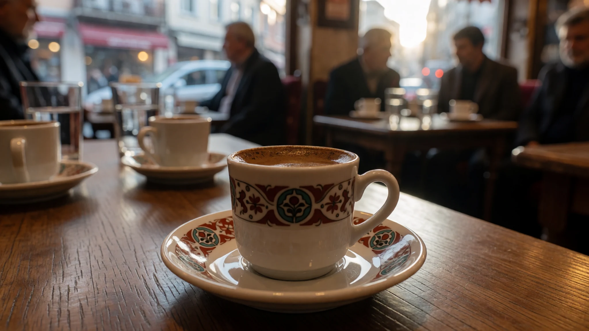
- Lamb or goat kebab — Grill houses (ocakbaşı) along the main roads of Kahta
Lamb and goat are the usual meats in the south-east, where beef and pork are less prominent. Kebabs are grilled over charcoal and often served with flatbread, onion and sumac. Eat them at a grill house in the town centre, where the meat is cooked to order and portions are generous. - Fresh flatbread — A village bakery or the morning bread stalls in the market in Kahta
Bread is common everywhere in Turkey and comes in many shapes. In the south-east, thin flatbread is baked on a hot surface and eaten warm with cheese, herbs or spiced meat. It is a good, cheap snack to take up the mountain for the long day. - Ayran — Any grocery shop, bakery or grill house in the area
Ayran is a cold drink of yoghurt, water and salt, and it works well after a hot climb or a meal of kebabs. It is sold in bottles and tubs at most shops and grill houses. Keep a bottle in your bag for the drive up the mountain.
Plan it
Best time. June to September, when the summit road is most likely to be open and the weather is warmest. Even in summer the top can be windy and cold, so bring layers. Spring and autumn can be pleasant but snow can block the road, so check conditions before you go.
How long. 2–3
Getting there. Gaziantep airport is the most practical gateway, followed by a road or bus journey to Kahta, the usual base for trips up the mountain. The last leg is by taxi, minibus or hired car up the mountain road.
Budget. low
Tips
- Start early in the morning to see the terraces before the midday light and the heavier crowds
- Check road and snow conditions with your accommodation or a local operator before you set out
- Carry cash for small purchases, tea and village transport, as card payment is less common in rural places
- Bring plenty of water, a hat and sun protection, because the summit is exposed
- Book a driver or a tour through a reputable operator in Kahta if you are unsure of the route
Etiquette
- Stay on marked paths and do not climb on the statues or the tumulus
- Ask before photographing people in villages or at small shops
Nearby
Sources
- Wikidata Q207917 (CC0)
- Wikipedia, Mount Nemrut (rev 1377823235) (CC BY-SA 4.0)
- Wikivoyage, Turkey (rev 5393139) (CC BY-SA 4.0)
- Photo 01, Nemrut Mountain Peak, Bjørn Christian Tørrissen (CC BY 3.0)
- Photo 02, Mount Nemrut East Terrace, Klearchos Kapoutsis (CC BY 2.5)
- Photo 03, Nemrut mountain and blue sky, Efekan06 (CC BY-SA 4.0)
- Photo 04, Apollon Nemrut Mountain, Mkrc85 (CC BY-SA 4.0)
- Photo 05, Mount Nemrut in Turkey, Mkrc85 (CC BY-SA 4.0)
- Photo 06, Mount Nemrut (1), Zhengan (CC BY-SA 4.0)
- Photo 07, Mount Nemrut (4), Zhengan (CC BY-SA 4.0)
- Photo 08, Heads on Mount Nemrut, Urszula Ka (CC BY 3.0)


