Nauru Island
Nauru Island, Nauru
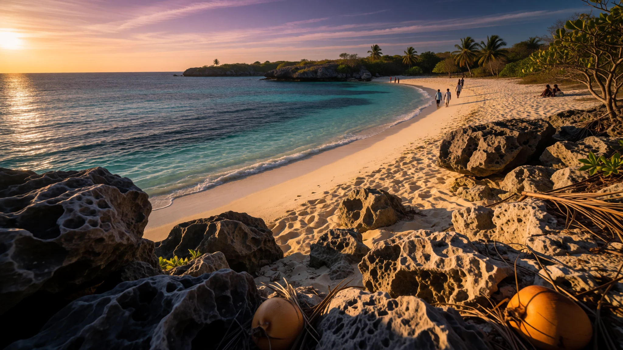
Nauru Island sets a mined limestone plateau, a palm lagoon and a single sandy bay on one small Pacific shore.
The place
Nauru Island is the only land in the Republic of Nauru, a limestone island in the South Pacific, in the Micronesian part of Oceania. The country is also known as Naoero. Eastward, the closest ground is Banaba in Kiribati, a gap of about 300 kilometres. Yaren carries out the work of a capital, but the state has no capital city of its own. 21 square kilometres hold about 12,000 people. On area, and again on population, only two countries are smaller, leaving aside colonies and overseas territories, and no member of the Commonwealth of Nations is smaller on both measures. Nauru also belongs to the United Nations and to the Organisation of African, Caribbean and Pacific States. Houses, a ring road and the phosphate port all sit on the coastal ribbon. Inland, the plateau is a stand of limestone pinnacles left after the phosphate rock was dug out, including later secondary cuts. Coral edges the beach. Open fresh water is rare: Buada Lagoon, sunk among palms, is the single freshwater body, so inbound cargo matters more than any river. Loading equipment marks the harbour. The interior looks worked, not wild. Anyone expecting a broad lagoon resort finds a compact, practical island arranged around one loop of road, with a living reef and a mined plateau in the same view.
Its story
Nauru Island was peopled from Micronesia. Settlement is put at 3000 years ago or earlier in one telling, and near 1000 BCE in another; a long isolation after that is the usual reason the Nauruan language stands apart. Polynesian contact is possible. Detail from that early time is scarce. 12 clans gave the island its social map, and each point of the star on the flag recalls one of them. Family lines ran through mothers. Protein came from a lagoon fishery: the young of the milkfish, ibija in Nauruan, were taken out of salt water, eased into Buada Lagoon, and grown on there. Coconuts and pandanus fruit were the crops beside that fish. The first Western report dates to 1798. John Fearn, master of the trader Hunter, saw the island and named it Pleasant Island for the look of it offshore. By 1826, whaling and trading crews were calling regularly for food and drinking water, and that sail-era traffic ended with a final whaler in 1904. A few men who left their ships stayed behind. Provisions were bartered for palm wine that was alcoholic, and for guns, which soon changed how power worked on shore. Annexation by the German Empire turned Nauru Island into a colony. After Australia's occupation in the First World War, the island was held as a mandate under the League of Nations, Australia administering it and New Zealand and the United Kingdom sharing the trust. In the Second World War Japan held the island for 3 years while Allied aircraft kept striking it. A United Nations trust territory followed. Australia stepped back at independence in 1968. From 2001, Australian aid has at times been tied to Nauru hosting the Nauru Regional Processing Centre, an offshore detention site that remains bitterly argued over.
What to see
- Anibare Bay — Anibare, eastern shore
Anibare Bay is the sandy shore on Nauru Island, with coral close in along the waterline. Elsewhere the coast is rockier and given over to harbour work, so swimmers head here. Fishing boats come ashore on this side of the island, and eateries sit just inland. Reef shoes help where coral meets the sand. - Aiwo Harbour — Aiwo
Aiwo Harbour is the main port on Nauru Island, sending phosphate out and taking in food, fuel and other cargo. The front is a working dock, and the phosphate loaders still stand over this coast. Kitchens nearby, several of them Chinese, serve fish with rice and noodles. A brief stop shows how the island stays supplied. - Buada Lagoon — Buada, central hollow
Buada Lagoon is the only fresh water on Nauru Island, set in a hollow near the middle and closed in by palms. Young milkfish, called ibija, used to be brought in from the sea and raised here once they could live in fresh water. The lagoon is the green centre of an island whose plateau was cut for phosphate. - Command Ridge — inland ridge
Command Ridge is the Second World War high ground on Nauru Island, held by Japanese forces for 3 years while Allied planes repeatedly struck the island. A surviving photograph shows a Liberator of the 7th Air Force leaving after one such raid on the facilities. What a visitor finds now is open ground and old positions above the coast, not a staffed museum. - Government buildings — Yaren
Nauru Island has no capital city, and the government buildings are plain offices on the ring road at Yaren, the administrative home. A whole state fits into a few low blocks, with immigration and ordinary services sharing the strip with houses. The Australian offshore processing centre is a separate, closed site, not one of these public offices.
Culture
On Nauru Island, 26 October is Angam Day, held for the years when war and the 1920 influenza cut the population down and for the climb back afterward. Much older custom gave way under colonial rule and later Western contact. Few of the older customs are still practised in full. Fishing, some music, and a scatter of arts and crafts are what still surface. Song was still being noted in 1970, including the folk piece 'Oh Bwio Eben Bwio'. Celebrations bring rhythmic singing and a traditional reigen, a dance done in a ring. Photographs preserve an older fish dance; dances still known by name include the frigate bird dance and the dogoropa. 'Nauru Bwiema', the national anthem, is the 'Song of Nauru'. No daily paper is printed. Mwinen Ko comes out once a fortnight, which suits a small island whose public memory also lives in a day, a song and a dance. Ask before photographing people, dances or homes on Nauru Island, and do not treat the immigration processing centre as a sight.
What to wear
Nauru Island's sources name no national costume, no ceremonial cloth and no fibre kept for a particular rite. That fits the wider picture: colonial and later Western contact displaced much indigenous daily custom, while fishing and a few crafts carried on. Everyday clothes now follow an ordinary equatorial Pacific pattern of light shirts, cotton dresses, shorts and sandals, for the road as much as for a gathering. On Angam Day, and when the frigate bird dance, the dogoropa or a reigen is performed, dress is neat and present-day, not a rebuilt ancestral outfit. Surviving craft is closer to small made objects and to skill with fish than to a wardrobe. A visitor's clothes should follow sun, coral and limestone. Breathable cotton and a hat suit the open coast and the bare plateau. Closed shoes matter off the road, where secondary phosphate digging left jagged pinnacles that shred thin sandals. Swimwear belongs at Anibare Bay only. Shoulders and knees should be covered at government offices and at a national gathering, with a light layer over beach clothes before walking into Yaren.
What to eat
- Ibija — Buada Lagoon
Ibija is the Nauruan name for young milkfish on Nauru Island. They were taken from the sea, settled into fresh water and raised in Buada Lagoon so a meal did not hang on a single reef day. Coconuts and pandanus fruit sat on the same table. - Reef fish — Anibare, by the boat landing
Reef fish is the catch Nauru Island actually eats, and the plate most kitchens are built around. Boats come in towards Anibare, and the eateries just inland cook that fish beside a few international dishes. The place for it is beside those landings. - Fried rice and noodles — Aiwo harbour district and Anibare
Fried rice and noodles are the steady Chinese-kitchen food on Nauru Island, commonly set down with fish rather than served as a plain starch. They turn up in eateries around the Aiwo harbour district and again in the Asian rooms towards Anibare. - Thai, Indian and Chinese plates — Anibare
Thai, Indian and Chinese cooking all appear on Nauru Island, sharing eateries at Anibare instead of occupying separate quarters of a town. A short row of rooms near the bay may offer several of those cuisines in one evening. - Seafood with a drink — Anibare bay district
A more formal seafood meal on Nauru Island is also an Anibare affair, fish served in a smarter room where alcohol is poured. That is less ordinary than it sounds: the island has a single public bar, and it sits in this same bay district.
Plan it
Best time. Nauru Island lies almost on the equator, and no wetter or drier month is named as a better time to visit. October is the month with a public date attached: Angam Day falls on the 26th and remembers a hard-won recovery in numbers. The two lodgings, and seats on the direct Brisbane flight, stay under pressure all year because Australian government staff travel them heavily.
How long. 2-3
Getting there. Direct flights link Brisbane with Nauru Island, and they are the way in. Book months ahead: Australian staff connected with the offshore processing centre take many of the seats. Once down, the ring road is the last leg, reaching Yaren, Aiwo and Anibare. Every foreign visitor needs a valid passport plus proof of lodging or a local sponsor. Citizens holding passports from Fiji, Kiribati, Samoa, Tonga, Tuvalu, Vanuatu, the Cook Islands, Niue, the Marshall Islands, Micronesia, Palau, Papua New Guinea and the Solomon Islands, plus Israel, Russia and Taiwan, can be granted a visa on arrival at no charge. All other nationalities must arrange a visa before the trip; send that request well ahead, using the principal immigration address, principal.immigration@naurugov.nr, or the visa address, visa@naurugov.nr, because processing is slow.
Budget. high
Tips
- Apply months ahead for a visa if your passport is outside the on-arrival list.
- Carry a passport and either proof of lodging or a local sponsor's name.
- Reserve the Brisbane flight early; official travellers fill a large share of the seats.
- Take drinking water inland; open fresh water is limited to Buada Lagoon.
- Leave the processing centre off the itinerary; it is a detention site, not a sight.
Etiquette
- Ask before photographing people, dances or private houses.
- Do not photograph or try to enter the processing centre.
- Cover shoulders and knees for government offices and for Angam Day.
- Keep clear of phosphate loaders at Aiwo; the harbour is a working dock.
Nearby
Sources
- Wikidata Q30151675 (CC0)
- Wikipedia (rev 1384053064) (CC BY-SA 4.0)
- Wikivoyage (rev 5415880) (CC BY-SA 4.0)
- Photo photos/01-nauru-island-under-attack-by-liberator-bombers-of-the-sevent.jpg (Public domain)
- Photo photos/02-nauru-satellite.jpg (Public domain)
- Photo photos/03-coral-reef-on-nauru.jpg (CC BY-SA 2.0)
- Photo photos/04-naurubuada077.jpg (CC BY 3.0)
- Photo photos/05-aerial-view-of-nauru.jpg (Public domain)
- Photo photos/06-nauru-cadet-police-on-training-exercise-2.jpg (CC BY 2.5)
- Photo photos/07-phosphate-loading-station-nauru.jpg (CC BY-SA 2.0)
- Photo photos/08-the-site-of-secondary-mining-of-phosphate-rock-in-nauru-2007.jpg (CC BY 2.5)


