Mount St. Helens
Mount St. Helens, United States
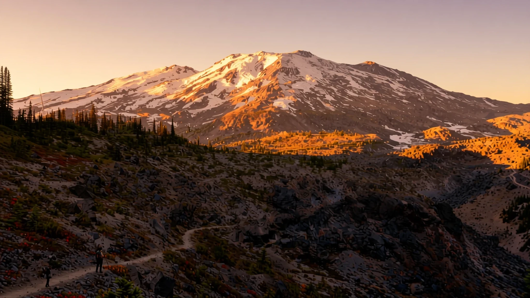
Witness nature’s raw power and dramatic ecological rebirth at this active Pacific Northwest volcano.
The place
Mount St. Helens rises as a formidable active stratovolcano in the Cascade Range of Washington State. Reaching an elevation of 2549 metres, the peak anchors a dramatic landscape of grey ash fields, steep crater walls, and rapidly regenerating evergreen forests. Located in the Pacific Northwest, the surrounding National Volcanic Monument offers stark evidence of how volcanic forces reshape mountainsides, rivers, and valleys in a matter of hours.
To the north, expansive blast zones remain littered with fallen trees, standing snags, and vast fields of light-coloured pumice. Despite the harsh terrain, plant life and animal populations have reclaimed the valley floors. Wildflowers now carpet the pumice plains during warmer months, while elk herds navigate the mudflows and replanted timber stands along nearby river valleys.
Visitors exploring the western and southern ridges experience sharply contrasting microclimates and landscapes. The southern flanks feature dense evergreen woodlands and ancient lava tubes, while the northern approaches bring travellers face-to-face with the crater's horseshoe opening and lava domes. Stream networks carry sediment through recovering lakes, creating a living laboratory for geologists and ecologists alike. Weather across the mountain is hottest in July, wettest in December, and most comfortable in July and August, when days are warm and rain stays light.
Its story
Mount St. Helens has long held deep cultural and spiritual significance for the Indigenous Cowlitz and Klickitat peoples, who known the mountain as Lawetlat'la and Loowit. Native traditions preserved oral histories of past volcanic eruptions, portraying the snow-capped peak as a living entity capable of dramatic transformations. European cartographers later renamed the summit in the late eighteenth century during coastal mapping expeditions along the Pacific coast.
Geological history shifted dramatically on 18 May 1980, when a major earthquake triggered a massive landslide on the northern slope. The resulting lateral eruption sheared off the upper portion of the mountain, lowering its summit to its present elevation of 2549 metres. Ash plumes climbed high into the atmosphere, while mudflows and pyrolastic surges swept down river valleys, altering watercourses and sweeping away bridges, highways, and forest habitats.
Congress designated the Mount St. Helens National Volcanic Monument in 1982 to preserve the crater and surrounding landscape for ongoing ecological research and public education. Subsequent dome-building episodes between 1980 and 2008 demonstrated that the underlying magma system remains active. Today, scientists monitor seismic activity and gas emissions around the volcanic crater, studying how ecosystems recover after severe natural disturbances while providing early warning alerts for surrounding communities in the Pacific Northwest.
What to see
- Johnston Ridge Observatory — West Side Highway WA-504
Positioned directly within the blast zone, this observatory delivers panoramic viewpoints directly into the horseshoe crater and lava dome. Interactive displays recount the 18 May 1980 eruption, seismic monitoring networks, and geologic events. Paved pathways along the ridgeline allow visitors to examine scorched terrain and sprouting vegetation against the backdrop of the open mountain core.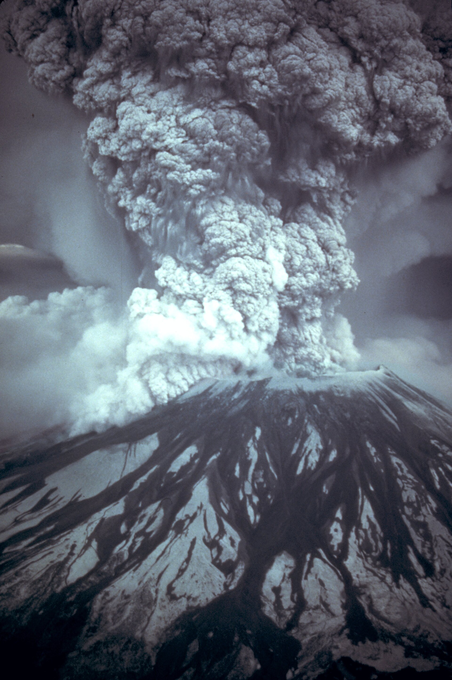
- Ape Cave — South Side Forest Road 90
Formed roughly two thousand years ago by subterranean lava streams, this extended basalt cave offers a cool underground trekking route. Visitors descend ladders into subterranean passages lined with hardened lava features. The lower section features an accessible paved walkway, while the upper route challenges hikers with boulder piles and dark lava chambers. - Forest Learning Center — State Route 504 milepost 33
Situated along the western approach route, this facility focuses on forest regeneration, timber replanting, and wildlife recovery following the volcanic blast. High-powered optical scopes positioned on the outdoor deck allow travellers to spot elk herds grazing in the Toutle River valley below, while indoor exhibits detail industrial forestry techniques. - Loowit Falls Hike — Mount St. Helens Blast Zone
From Johnston Ridge Observatory, binoculars pick out meltwater falls flowing out from the crater glacier. The surrounding terrain resembles a stark lunar landscape, devoid of high trees and exposed to mountain winds. Visitors watch the cascading waters from the observatory ridge, far across the open blast zone. - Mount St. Helens Visitor Center at Silver Lake — Castle Rock Highway WA-504
Located near Castle Rock along the main highway, this state park facility introduces the geological history of the Cascade Volcanic Arc. Visitors can explore walk-through model volcanoes, view historical photography collections, and walk along boardwalk trails through wetland habitats surrounding Silver Lake before driving further up the mountain.
Culture
Mount St. Helens occupies a distinct position in the cultural heritage of the Pacific Northwest, blending Indigenous traditions with modern geological research. For Cowlitz and Klickitat tribal nations, the peak is a revered ancestor and a place of traditional stories regarding land creation, volcanic fires, and ecological harmony. Local communities across southwestern Washington maintain deep ties to timber harvesting, river conservation, and wilderness preservation.
Following the eruption in 1980, the mountain transformed into an icon of natural resilience and scientific inquiry. Field researchers, botanists, and geologists gather from around the world to track how plant species, forest soils, and lake habitats regenerate after total disruption. Local visitor culture emphasizes outdoor stewardship, scientific curiosity, and deep respect for active volcanic landscapes. Community events in nearby gateway towns celebrate both forest conservation and mountain recreation throughout the year.
Always stay strictly on designated trails and paved paths within the volcanic monument to protect fragile recovering vegetation and avoid hazardous terrain.
What to wear
Mount St. Helens weather and outdoor culture dictate practical clothing choices rooted in Pacific Northwest traditions. Historically, Cowlitz and Klickitat peoples wore tailored deer hide clothing, woven cedar-bark capes, and tightly woven spruce-root hats designed to repel damp coastal weather during berry gathering and hunting expeditions across the Cascade foothills.
Today, local residents in surrounding forest towns favour rugged workwear and functional outdoor apparel. Heavy flannel shirts, durable canvas trousers, insulated fleece jackets, and waterproof shells form the standard everyday wardrobe for timber workers, park rangers, and local residents navigating damp rainforest climates.
Visitors planning to explore the trails around Mount St. Helens need sturdy, broken-in hiking boots with aggressive tread to handle loose pumice, volcanic gravel, and steep rock scrambles. Dress in synthetic or wool layers that can be adjusted as temperatures fluctuate between sun-exposed ridges and shaded canyons. Pack a dependable waterproof and windproof jacket even during midsummer, as weather can deteriorate rapidly at high elevations. If exploring Ape Cave, bring warm fleece layers and sturdy gloves, as underground temperatures remain cold year-round.
What to eat
- Cedar-Planked Pacific Salmon — Roadside eateries along State Route 504 near Toutle
Wild Pacific salmon grilled slowly over aromatic cedar planks, served with roasted potatoes and seasonal green vegetables. Local diners and casual eateries along the highway prep this classic Pacific Northwest dish with lemon butter, herbs, and locally gathered berries. - Wild Huckleberry Cobbler — Bakeries and cafes in Cougar and Randle
Warm baked fruit dessert made with wild mountain huckleberries harvested from Cascade forest slopes. Served with a heavy scoop of vanilla ice cream, this tart and sweet pastry remains a classic post-hike treat across gateway communities. - Hearty Logging Camp Stew — Diner counters in Toutle and Castle Rock
Slow-cooked beef stew loaded with thick-cut root vegetables, potatoes, and rich brown gravy. Served with warm cornbread or freshly baked buttermilk biscuits, this dense meal reflects the traditional timber-worker dining heritage of Skamania and Cowlitz counties. - Smoked Huckleberry Jam and Biscuits — Country stores and breakfast cafes along Forest Road 90
Flaky, buttermilk biscuits served hot alongside house-made jam prepared from wild forest huckleberries. The tart jam provides a bright contrast to buttered breakfast pastries, making it a staple morning order for hikers and campers heading toward the trails. - Pacific Northwest Clam Chowder — Timber town cafes along State Route 504
Thick cream soup packed with tender ocean clams, diced potatoes, smoky bacon, and sweet onions. Served in heavy ceramic bowls with oyster crackers, this warming meal offers comfort after damp morning hikes through the misty blast zone terrain.
Plan it
Best time. July to September brings clear weather, open high-altitude roads, and snow-free hiking trails. Winter and spring bring heavy snow, road closures, and cold rain.
How long. 1–2
Getting there. Fly into Portland International Airport or Seattle-Tacoma International Airport. Rent a car and take Interstate 5 to Exit 49 at Castle Rock for the West Side via WA-504, or Exit 21 at Woodland for the South Side via WA-503.
Budget. mid
Tips
- Check highway status and trail closures online before driving up the mountain, as winter snow and landslides block high-elevation roads
- Obtain climbing permits well in advance if planning to hike high onto the mountain
- Carry plenty of drinking water, food, and emergency gear, as there are no food outlets or petrol stations inside the national monument boundaries
- Bring cash for recreation passes, cave lantern rentals, and small mountain town shops where card reader networks can be unreliable
Etiquette
- Pack out all rubbish, food scraps, and waste to protect recovering ecosystems in the blast zone
- Never enter restricted volcanic zones or closed lava tube sections designated for bat protection and research
- Keep dogs on leash where permitted and off non-dog trails across the monument
Nearby
Sources
- Wikidata Q4675 (CC0)
- Wikipedia (rev 1380755554) (CC BY-SA 4.0)
- Wikivoyage (rev 5353982) (CC BY-SA 4.0)
- Photo photos/01-msh82-st-helens-plume-from-harrys-ridge-05-19-82.jpg (Public domain)
- Photo photos/02-mount-st-helens-one-day-before-the-devastating-eruption.jpg (Public domain)
- Photo photos/03-mount-saint-helens-from-the-air-with-mount-adams-in-backgrou.jpg (CC BY 4.0)
- Photo photos/04-east-dome-mount-st-helens.jpg (Public domain)
- Photo photos/05-msh-10b-mount-st-helens-erupts-portland-view-may-18-1980-226.jpg (Public domain)
- Photo photos/06-msh80-eruption-mount-st-helens-05-18-80.jpg (Public domain)
- Photo photos/07-whaleback-mount-st-helens-volcanic-crater-february-22-2005.jpg (Public domain)
- Photo photos/08-tree-snags-at-mount-st-helens.jpg (Public domain)


