Mount Damavand
Mount Damavand, Iran
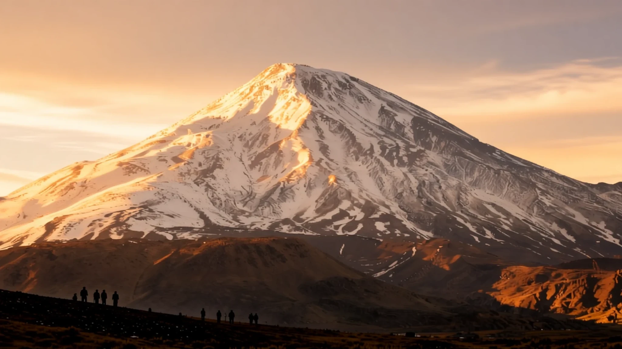
Iran's highest peak is a snow-streaked volcano in the Alborz range, a demanding summer climb for anyone who likes big views and a long steady effort.
The place
Mount Damavand is a stratovolcano standing in the Alborz range of northern Iran, between the Iranian plateau to the south and the Caspian Sea to the north. At 5,610 metres it is the highest peak in the country and the highest volcano in Asia, a pale cone that shows up across the valleys when the weather clears. It sits in Mazandaran Province, in Amol County, within reach of Tehran by road, though the drive takes longer than the map suggests once you leave the motorway. Geologists still count the mountain as dormant rather than extinct. The range itself rises because the Arabian and Eurasian plates are pushing together, and seismic readings from quakes around the volcano point to a body of magma a few kilometres below the surface. The ground is therefore alive in a slow way, even if nothing has erupted in living memory. For a visitor, the mountain is best understood as a serious high-altitude objective rather than a viewpoint you reach by car. The upper slopes are exposed, weather turns quickly, and the air is thin enough to affect people who arrive from sea level. Most climbers base themselves in villages on the southern approaches and start before dawn. Plan for cold nights even in summer, and treat the summit as a long day, not a casual outing.
Its story
Damavand has a place in Persian mythology that predates its use as a mountaineering goal. In the national epic, the Shahnameh, the mountain is the prison of Zahhak, a tyrant who was chained there after a hero named Fereydun overthrew him. Many Iranians still grow up hearing this story, and it gives the peak a moral weight that few mountains carry. The volcano's own history is quieter. Its cone was built by repeated eruptions over a very long time, and the sulphurous vents near the top still release steam and gas, which is why the summit area has a strange, smoky feel on calm mornings. Local people have long traded in the foothills, with herders moving animals between higher pastures and villages in the valleys. The modern story is one of access. Roads and guesthouses have made the southern routes more practical, and mountaineers from Iran and abroad now treat the summit as a rite of passage, often tied to a longer trip through the Alborz. The mountain has become a symbol as well as a summit, appearing in poetry, painting and school lessons. Its shape is so familiar that it is often used as a backdrop for national pride, even by people who have never set foot on its slopes.
What to see
- The southern summit route — southern slopes, Amol County
The most common line to the top begins on the southern side, from the villages that serve as bases for climbers. Trails climb through scree and loose volcanic ground toward a high camp, and the final push starts in darkness. Expect a long, cold night and a steady, slow pace. Local guides know the weather patterns well and can tell you when to turn back, which matters more than any single landmark on the way.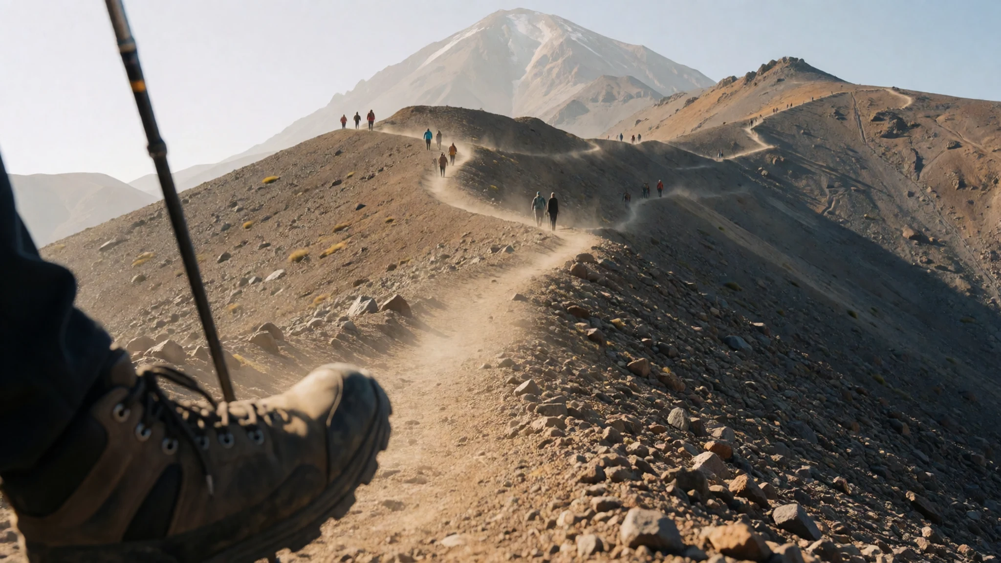
- The crater rim and smoke vents — summit crater, Amol County
Near the top, the crater rim is wide and rugged, with pale sulphur deposits and vents that send up steam. The air smells faintly of sulphur, and the view down into the crater is one of the reasons people push on. Keep to the marked path, watch your footing on loose rock, and avoid lingering near the vents if the wind shifts.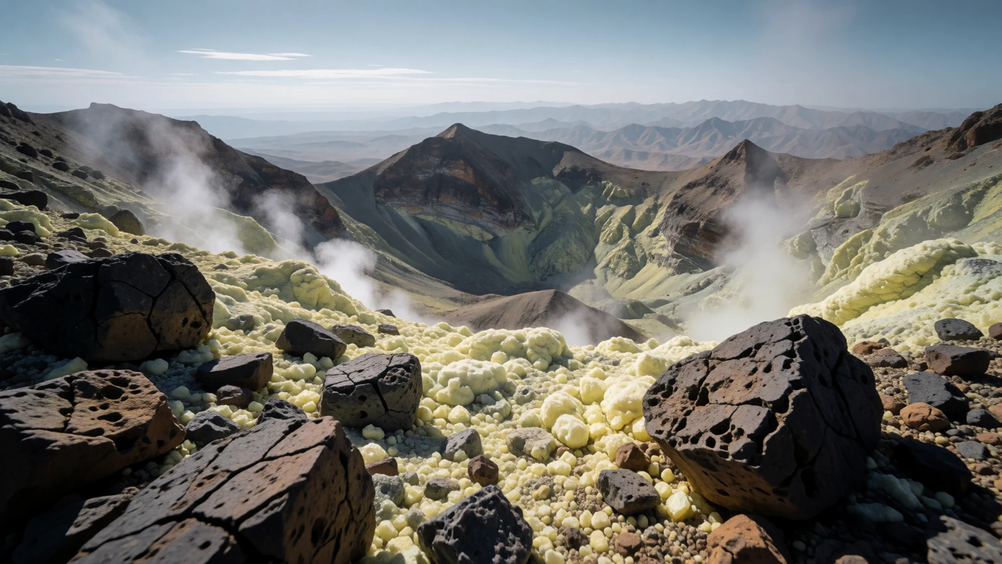
- Lar National Park and the Lar valley — Lar valley, north of Tehran
Lower down, the Lar area offers valleys, rivers and open meadows that make a good base before or after a climb. The river runs beneath the mountain, and on clear days the summit appears in reflections in the water. Go in late spring or early autumn for the easiest walking and the best light, and bring layers for sudden cold.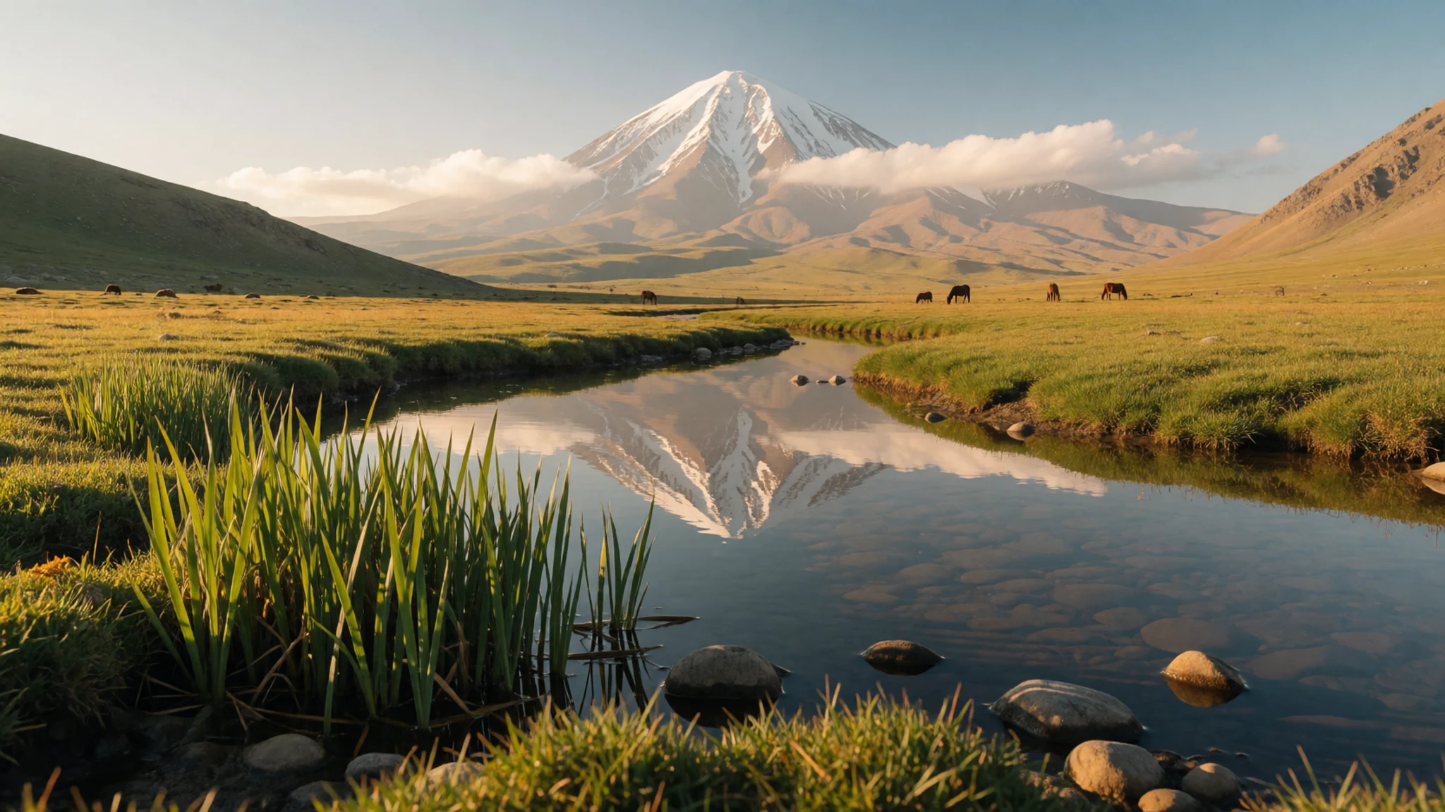
- The southern view from the foothills — southern foothills, Mazandaran
From the lower slopes on the south side, the mountain looks broad and layered, with snow lingering in gullies long into the warm months. This is the classic view that appears in photographs and postcards. Pull in at a safe pull-off rather than stopping on a bend, and go early when the summit is clearest before cloud builds through the afternoon.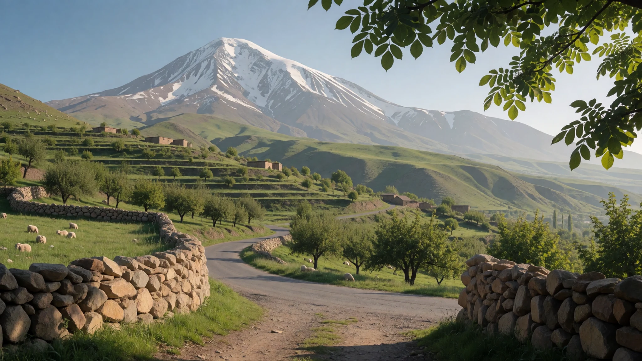
Culture
Damavand sits in a country where hospitality is a serious matter, and the people you meet around the mountain will often treat you as a guest before you have asked for anything. Iranians are warm and curious about foreigners, and it is common to be offered tea, fruit or pastries even in a brief conversation at a roadside stop. Accepting what is put in front of you is considered polite, even if you only take a small amount. Greetings follow a gentle formality. People often address one another with titles and a personal name, and older people in particular appreciate a respectful manner. Handshakes are a matter of care: a man should not offer his hand to a woman unless she offers hers first, and a woman will often place a hand over her heart instead. Public behaviour is more conservative than in many European cities, so keep voices moderate in villages and avoid public displays of affection. Photographs of people, especially women, should only be taken after asking clearly. When visiting a family home or a teahouse, accept the tea or sweets that are offered and wait for your host to indicate where to sit, since in Iran the seating order often reflects who is treated as the guest of honour.
What to wear
Mount Damavand lies in a region where traditional dress has been shaped by the mountains, the Caspian climate and the wider Persian textile tradition. Older women in the Mazandaran countryside have long worn loose, layered garments with headscarves made from cotton or light wool, and embroidered details at the collar and sleeves reflect local craft. Men's traditional clothing often included loose trousers and a long coat called a chokha in some regions, usually in wool or heavy cotton for winter herding. Today most people around the mountain dress in modern clothing that is similar to what you would see in Tehran: jeans, shirts, jackets and sports wear, with headscarves for women in most public places. Younger people in towns often wear a more relaxed style, though all women are expected to keep their hair covered and their clothes loose and modest when in public. For a visitor, the sensible approach is layered clothing that works on a cold summit and a warm valley. Women should carry a scarf for mosques and shrines, and loose sleeves and long trousers suit both the climate and local norms. On the mountain itself, wear sturdy boots with good grip for loose volcanic scree, a warm down jacket, waterproofs, gloves and a hat, since the wind near the top can be fierce even on a sunny day.
What to eat
- Chelow kebab — kebab houses on the main roads near Amol and Tehran
Long-grain rice steamed until light and fluffy, served beside grilled lamb or chicken, with sumac and a raw egg yolk on top for stirring in. It is the standard lunch in many restaurants. Order it with a little butter on the rice and a pot of grilled tomato on the side for a full meal.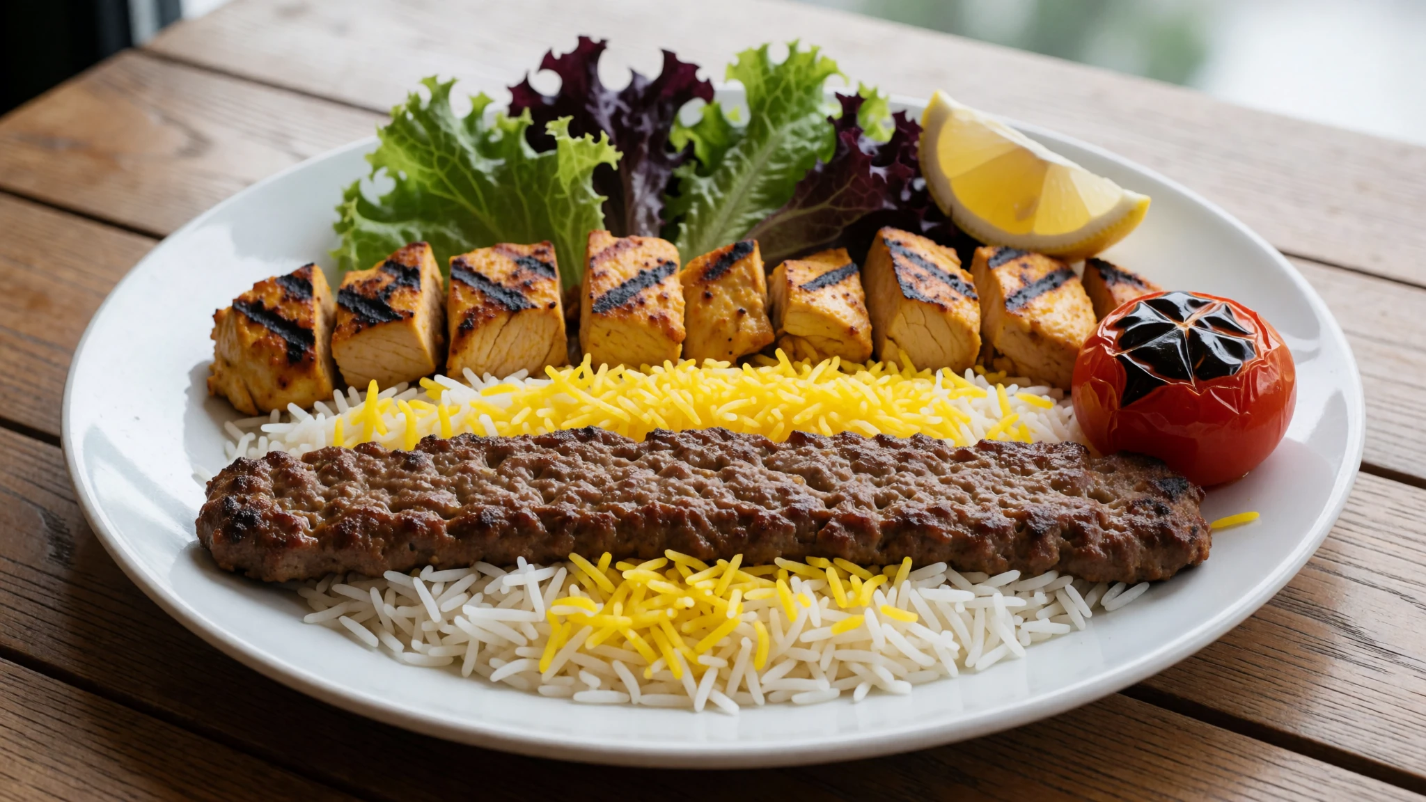
- Ghormeh sabzi — family restaurants and home kitchens in the north
A slow herb stew of parsley, coriander, fenugreek and spring onion, cooked with kidney beans and dried limes, and served over rice. It is a family dish, so you are most likely to taste it in a home or a traditional restaurant with a long menu.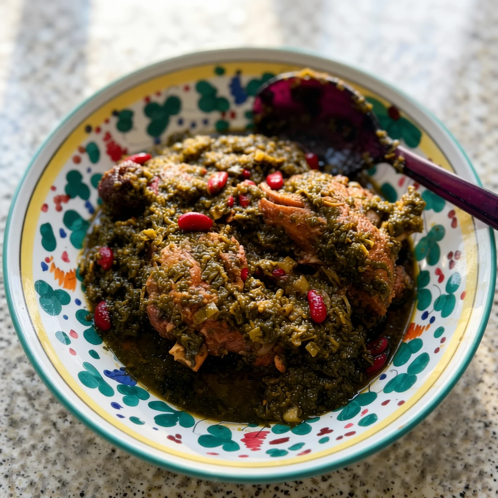
- Ash reshteh — soup stalls in Tehran's bazaar district and town centres
A thick soup of herbs, beans, lentils and flat noodles, finished with yoghurt, dried mint and fried onion. It is a winter favourite and is warming after a cold climb. Look for it at neighbourhood soup stalls on chilly mornings. - Sangak bread — neighbourhood bakeries in villages along the southern approaches
A long, thin flatbread baked on hot pebbles, with a blistered surface and a faintly smoky taste. Bakeries sell it warm from the early morning, and it makes a good picnic base for a day walk or a trip up the valley. - Tea and sweets in a teahouse — any chaikhaneh, or teahouse, on the road or in a town square
Black tea is served in small glasses with sugar cubes, often alongside pastries, dates or saffron ice cream. Teahouses are social places where people sit for long conversations. Ask for tea and let the owner bring a small plate of sweets, then pay when you leave.
Plan it
Best time. June to September is the usual climbing window, when the snow has eased on the southern routes and the nights are at least bearable. Spring melt and early autumn can also work, but expect more snow, shifting weather and colder nights outside those months.
How long. 3–4
Getting there. Fly into Tehran's Imam Khomeini International Airport, then travel by road toward Amol County or the Lar area. The final leg is usually by shared taxi or hired car on mountain roads, and the timing depends on the route you choose.
Budget. mid
Tips
- Arrange a licensed local guide or a reputable climbing agency, especially for the final push, since conditions change quickly
- Start the summit push in the dark so you reach the top before the afternoon wind builds
- Carry cash for small purchases in villages, as card payment is not reliable outside the cities
- Build in acclimatisation days and go slowly, because altitude sickness affects fit people too
- Check the official site or your guide for current access rules before you travel
Etiquette
- Dress modestly in villages and carry a scarf for religious sites
- Ask before photographing people, especially women and families
- Accept tea and sweets when offered, as refusing is considered impolite
Nearby
Sources
- Wikidata Q40758 (CC0)
- Wikipedia: Mount Damavand (rev 1378908315) (CC BY-SA 4.0)
- Wikivoyage: Iran (rev 5412767) (CC BY-SA 4.0)
- Safa Daneshvar, Damavand from the south (photo 01) (CC BY-SA 4.0)
- nima, Damavand clear as crystal (photo 02) (CC BY 2.5)
- Mahdi Kalhor, Damavand mount in water, Lar (photo 03) (CC BY 3.0)
- Mahdi Kalhor, Almighty Damavand (photo 04) (CC BY 3.0)
- Darabad andromeda, Inbound8331712065858174555 (photo 05) (CC BY-SA 4.0)
- AliHoseini90, Damavand Smoke Hole (photo 06) (CC BY-SA 4.0)
- M samadi, Damavand Volcanic Crater (photo 07) (CC BY 3.0)
- Siamax, Mazandaran Damavand map (photo 08) (Public domain)


