Maseru
Maseru, Lesotho
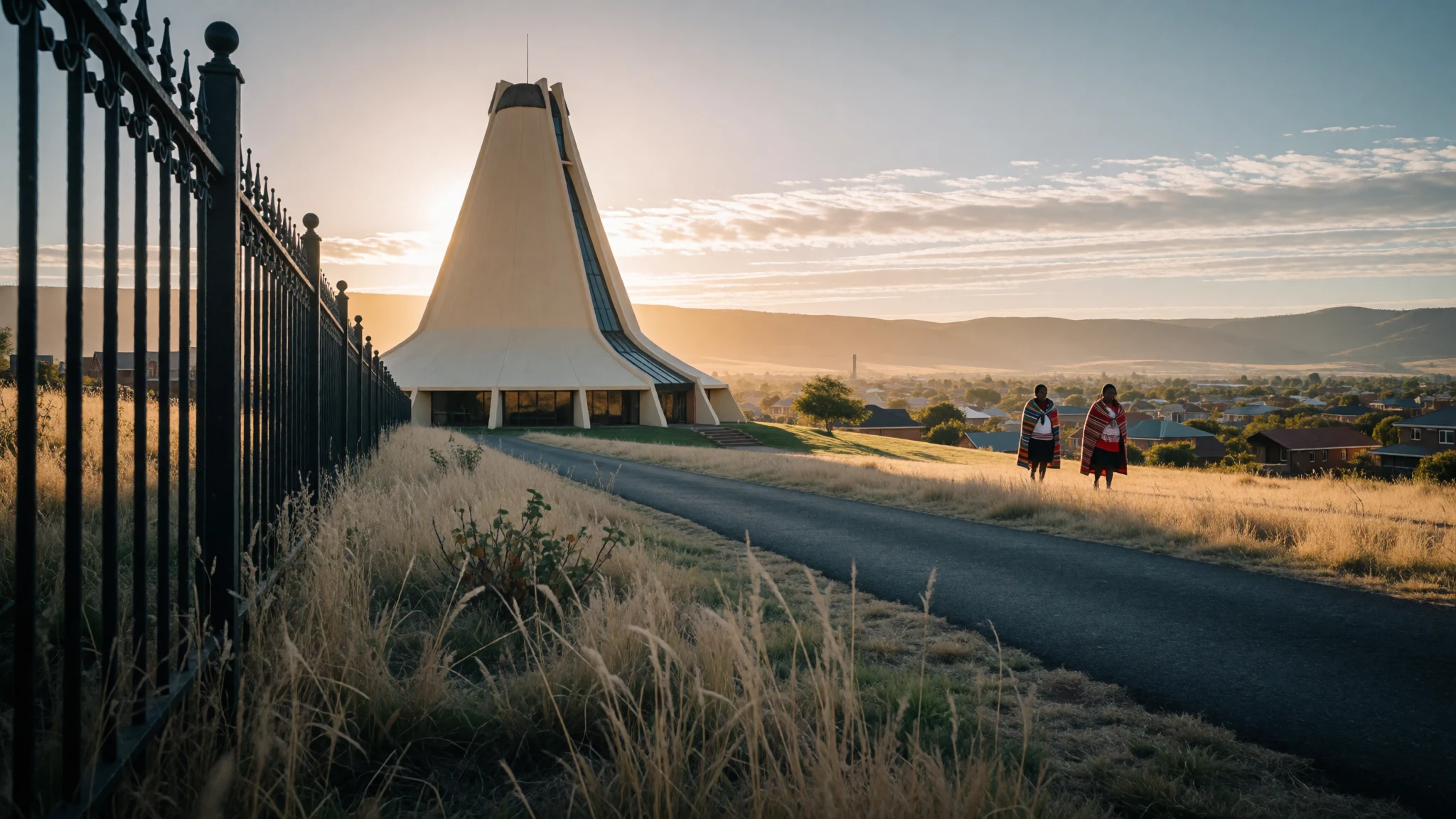
Maseru is a working border capital on a river, useful as a base for Lesotho's mountains and for a day of local life.
The place
Maseru is the capital of Lesotho, a kingdom entirely ringed by South Africa, and it sits right on the frontier. The Mohokare, also called the Caledon, runs along the city's edge, and a single bridge carries traffic and pedestrians over to the South African side. Ladybrand is the nearest town across the water. The name is a Sesotho word meaning red sandstones, a nod to the rock of the area. The city lies at about 1600 metres above sea level, in a shallow valley below the foothills of the Maloti range. Its population is 343,541, and it feels spread out rather than dense: low buildings, busy minibus taxi ranks, churches, government offices and a main commercial strip along Kingsway. Maseru is not a city of grand sights. It is where Lesotho's administration, banks, markets and transport all meet, so most travellers pass through it on the way to the highlands. The climate is mild at this altitude. Summers are warm and wet, with the heaviest rain around January, while winters are dry, bright and cold, with frost on clear nights. Afternoon thunderstorms can interrupt a summer walk. The city rewards a day or two of slow wandering, a visit to the museum and a lunch among office workers, before heading for the mountains.
Its story
Maseru began in 1869 as a police camp. Britain had just taken Basutoland under its protection after years of fighting between the Basotho and the settlers of the Orange Free State, and the camp was placed at the edge of land that Basotho had been forced to give up. It stood west of Thaba Bosiu, the mountain stronghold of King Moshoeshoe I, which had served as the effective centre of the kingdom. A market town soon gathered around the camp. Control then passed for a while to the Cape Colony, and the Basotho resented being treated much like subjects of an annexed territory. Resistance flared in the Gun War, and many buildings in Maseru were burned. Afterwards Basutoland returned to direct Crown rule and Maseru resumed its role as capital. For decades it stayed small. Colonial boundaries kept it tightly drawn, and Britain showed little interest in investing in it. That changed at independence, when Lesotho became a kingdom and Maseru kept its status as the seat of government. The city then absorbed nearby villages and grew several times over in area, which explains its sprawling, patchwork feel today, where older colonial streets give way to suburbs that were once separate settlements. The border bridge, the market streets and the government district all carry traces of this layered, rather unplanned history.
What to see
- Lesotho National Museum — Central Maseru
The national museum holds traditional sculpture, art and historical objects that explain Lesotho's past, from early Basotho life to the colonial period. It is a useful first stop in Maseru, giving context for the mountain villages and the royal story that most visitors go on to see. Check the official listings for opening times. - The Mokorotlo building — Maseru
This large building takes the shape of the Basotho hat, a conical straw form that is also a national symbol. It works like a small showcase of Basotho culture and craft, and is a handy place to look at hats, weaving and other goods. The photographs make it easy to recognise from the road. - Parliament Hill viewpoint — Parliament Hill, Maseru
From the rise by the parliament area, the city opens out below, with the river on one side and the South African farmland on the other. It is a good spot for understanding how close the border is, and for seeing Maseru's low, spread-out layout. Go in clear morning light. - Kingsway and the city centre — Central business district
Kingsway is the main commercial street, lined with shops, banks, offices and lunchtime food sellers. Walking it on a weekday gives a feel for everyday Maseru, from workers on break to minibus taxis hooting along the road. It is busy rather than pretty, and best before the afternoon heat or rain. - Thetsane and the Caledon river — Thetsane and the river edge
Thetsane, south of the centre, is a cluster of clothing factories whose weekday bustle contrasts with the quiet pace of the rest of Lesotho. For a calmer outing, local operators arrange canoe trips on the Caledon; contact them ahead to see what is on offer and to confirm conditions.
Culture
Maseru is the best place to meet the everyday culture of the Basotho, who speak Sesotho and share a strong sense of national identity built around their kingdom and its founder, Moshoeshoe I. The conical straw hat, the mokorotlo, appears as a national emblem and even as a building, and the wool blanket worn on the shoulders is perhaps the best-known mark of a Basotho person. Churches are central to community life, and on Sundays the city is quieter, with families dressed for services. Greetings matter here. A friendly lumela, followed by a question about how someone is, is expected before any request, whether in a shop, a taxi or an office. The pace of conversation is unhurried, and rushing straight to business can seem curt. Maseru itself is more of a government and trading town than a heritage city, so much of the culture is seen in daily life: the minibus taxi ranks, the lunchtime food vendors on Kingsway, the craft stalls, and the weekend gatherings. For deeper traditions, such as village life, horse riding and mountain herding, most people head into the highlands, but the capital gives a useful first introduction. Ask before photographing people, and be especially careful around the border bridge and government buildings, where taking pictures may be discouraged.
What to wear
Maseru shows Basotho dress in both its traditional and everyday forms. The signature garment is the Basotho blanket, a heavy wool or wool-blend wrap with bold geometric patterns, pinned at the shoulder and worn for warmth, at ceremonies and as a sign of status. It is paired with the mokorotlo, a conical straw hat, and with practical boots in rural areas. In the capital, blankets appear most often on older residents, herders passing through, and at celebrations, while the hat is a national symbol seen on souvenirs and buildings. Day to day, most people in Maseru wear familiar modern clothes: jeans, T-shirts, office shirts, school uniforms and, in winter, thick coats and woollen hats. Local factories turn out garments for export, so casual wear is part of the city's economy. A visitor should dress for altitude rather than for the tropics. Winter nights are cold, so bring layers, a warm jacket and a hat. Summer days are warm with frequent storms, so pack a light waterproof and sun protection. Comfortable shoes suit uneven pavements, and sturdy ones help if you plan to go on into the hills. Modest, neat clothing is sensible for churches and official visits. If you buy a blanket or hat, a stall or craft shop is the usual place.
What to eat
- Lunch box of chicken, rice and papa — Food vendors along Kingsway at lunchtime
Maseru's office workers lunch on boxed meals of chicken or pork with rice and papa, a stiff maize porridge. They are cheap, filling and cooked on the spot, and they make an easy introduction to the local staple. - Papa with moroho — Local eateries and family kitchens in the city
Papa is served with moroho, cooked leafy greens, often alongside stew or meat. It is plain, hearty food that suits cold evenings and is eaten with the hands or a spoon in many homes. - Grilled meat — Open-air cafés in the town centre
Grilled meat is a common order in Maseru, whether beef, chicken or pork, usually served with pap or chips and a simple salad. Cafés with open-air seating are popular at lunchtime. - Chinese home-style dishes — Eating rooms behind Chinese grocery shops near the centre
Maseru has a Chinese community, and some grocery shops have a small eating room at the back serving stir-fries, noodles and rice dishes. It is informal, with plastic chairs and a relaxed atmosphere. - Burgers and café plates — Cafés and chain restaurants around the central business district
Simple burgers, sandwiches and plated lunches are easy to find at French-style cafés and South African fast-food chains. They are reliable if you want a familiar meal before heading to the highlands.
Plan it
Best time. March–April and September–October, when days are mild and the worst rain or winter cold is avoided. January is the wettest month and thunderstorms are common, while winter from June to September is dry but frosty at night.
How long. 1–2
Getting there. Moshoeshoe I International Airport is the nearest airport, with flights from Johannesburg; a taxi must be arranged in advance. By road, South African coaches stop at the Maseru Bridge border post, where you can take a taxi into the city. Minibus taxis link Maseru with most places in Lesotho.
Budget. low
Tips
- Arrange airport transfers in advance, as taxis may not be waiting
- Carry some cash for markets, taxis and food vendors
- Pack layers; evenings are cold at this altitude, even after warm days
- Use Maseru as a base, then head for the mountains early in the day
- Check the official site or local operators for museum hours and canoe trips
Etiquette
- Greet people with lumela before asking for help or directions
- Ask before photographing people or the border area
- Dress neatly for churches and official buildings
Nearby
Sources
- Wikidata Q3909 (CC0)
- Wikipedia: Maseru (rev 1385109023) (CC BY-SA 4.0)
- Wikivoyage: Maseru (rev 5426925) (CC BY-SA 4.0)
- Maseru from Parliament Hill — OER Africa (CC BY 2.5)
- Part of Maseru City CBD — Lschefa (CC BY-SA 4.0)
- Roman Catholic Archdiocese of Maseru — Vanbasten 23 (CC BY 3.0)
- Basotho Hat Shop — Michael Denne (CC BY-SA 2.0)
- Maseru, Lesotho — Paramente Phamotse (CC BY 3.0)
- Maseru City Council seal (CC0 1.0)
- Maseru Panorama 1-2007 — Netroamer (CC BY 3.0)
- 362 Kingsway — Seotsanyana (CC BY 3.0)


