Makalu Barun National Park
Makalu Barun National Park, Nepal
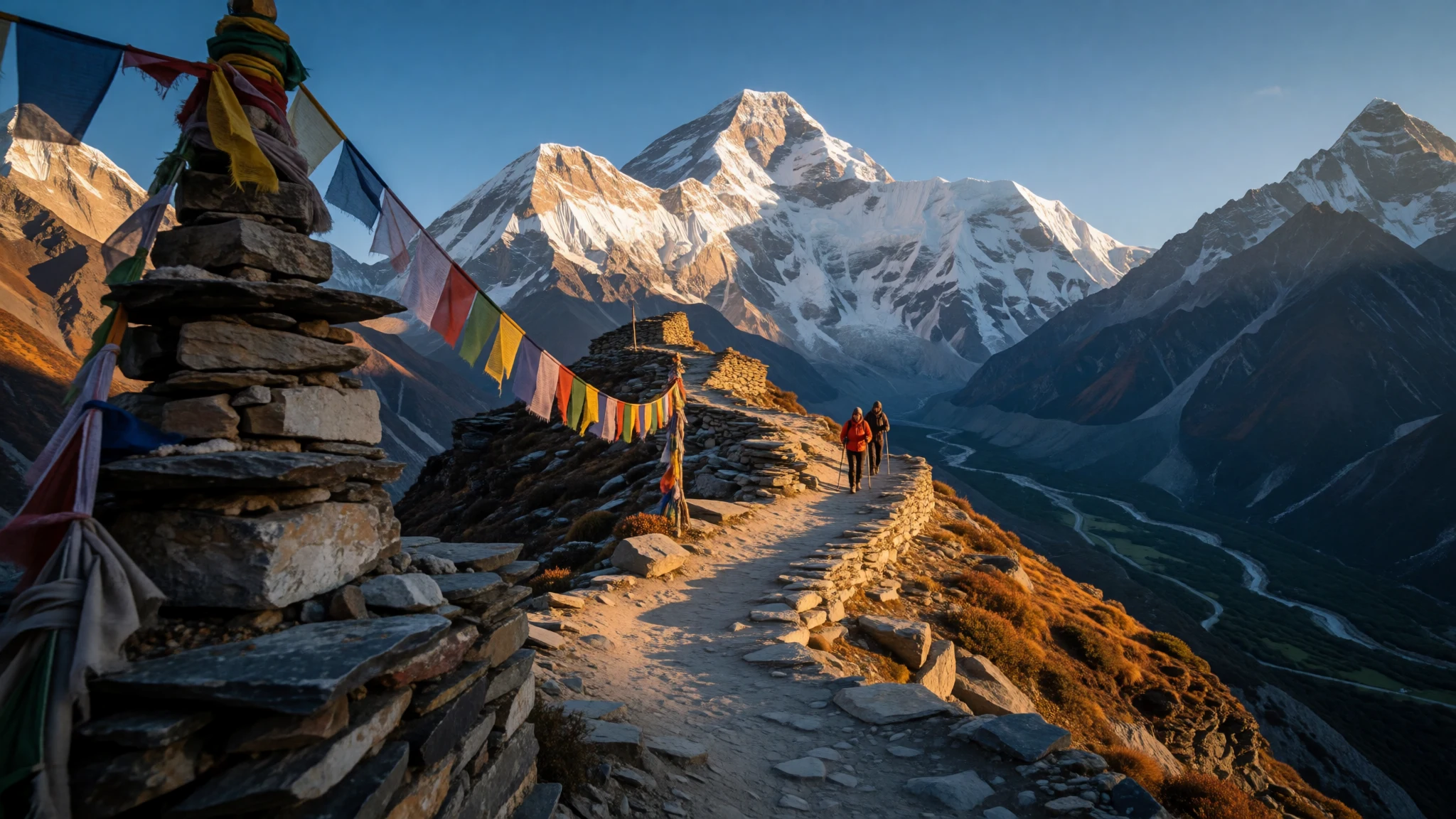
Makalu Barun National Park drops from warm subtropical river valleys to glaciers beneath the fifth highest mountain on Earth, all within one protected area.
The place
Makalu Barun National Park sits in the Himalayas of eastern Nepal, across the Solukhumbu and Sankhuwasabha districts, with Tibet along its northern edge. It was created in 1992 as the eastern neighbour of Sagarmatha National Park, the Everest park. What defines it is vertical drop. In the south-east the Arun river runs through warm lowland valleys only a few hundred metres above sea level, while at the head of the Barun Valley the summit of Makalu rises to 8,463 m, the fifth highest mountain in the world. Between those two points lie most of the climate zones the Himalaya has to offer: subtropical forest, oak and rhododendron woods, bamboo, high pasture, moraine and ice. Chamalang, Baruntse and Mera are also inside the boundary. The park covers roughly 1,500 sq km, and a buffer zone of villages and farmland wraps its southern and south-eastern sides. The weather is as layered as the land. Monsoon rain begins around June and eases off in late September, and annual precipitation is heavy, around 4,000 mm. The low valleys are frost-free and turn hot in April and May, while the upper camps are cold in any month. Reaching the park takes days rather than hours, and the trails are steep and demanding. Services on the upper routes are thinner than on the busiest trekking circuits, so it rewards walkers who plan carefully and are comfortable with simple conditions.
Its story
Makalu Barun National Park owes its existence partly to the Yeti. In the early and mid-1980s, staff of The Mountain Institute, led by its president Daniel Taylor, surveyed the Barun Valley hoping to explain the legend of the creature. They found no answer to the mystery, but they did find a valley of unusual biological richness, and that finding shifted the conversation towards protecting the whole area. A proposal was drawn up in 1985. By 1988 the Makalu-Barun Conservation Area Project was under way, run jointly by Nepal's national parks department and The Mountain Institute. The conservation area was officially gazetted in 1991, and the national park followed in 1992. What set the project apart was its attention to the people already living there. About 32,000 residents lived across 12 village development committees, mostly subsistence farmers from Limbu, Sherpa, Yakkha, Gurung, Tamang, Magar, Newar, Brahmin and Chhetri communities. Rather than treating them as outsiders, planners set up Community Forest User Groups with legal rights to use designated woodland on a sustainable basis. Ecotourism was encouraged as a way to create paid work beyond the farm while limiting damage to the landscape. Whether that balance holds today is best judged on the ground, but the model, a park built with its neighbours, is the thread running through its history.
What to see
- Barun Valley and Nghe — Sankhuwasabha district
The Barun Valley is the main route towards Makalu's base. Nghe, a stop along it, carries a Sherpa name meaning 'sacred place', and the surrounding forest, river and cliffs make it easy to see why. Expect long days on rough path, and keep time spare for weather delays.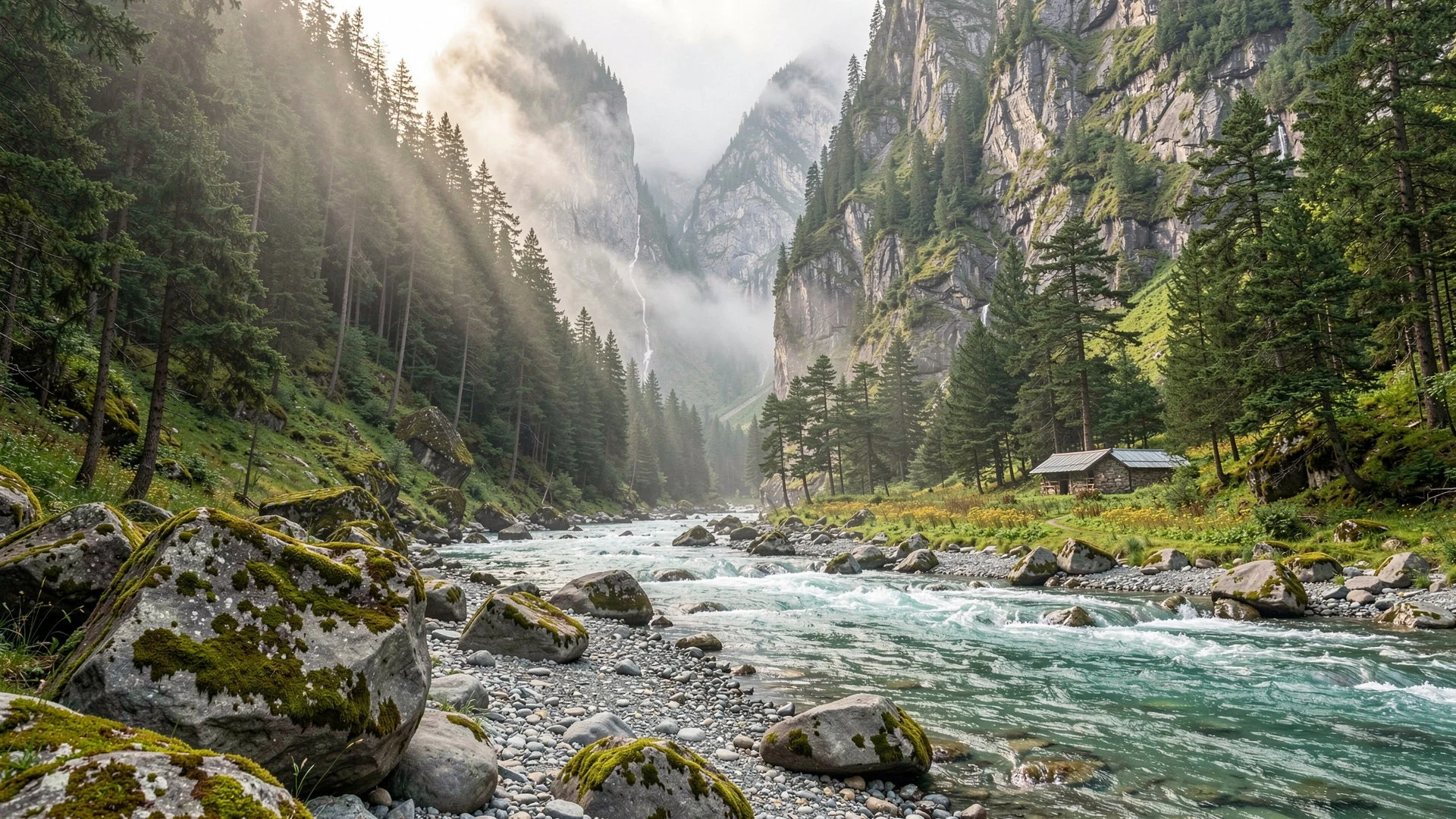
- Ripuk — Upper Barun Valley
Ripuk lies higher in the Barun Valley, where a glacier once flowed through and left a broad, open landscape of stone and meltwater. The air is thin here and nights are cold. It suits trekkers who have acclimatised slowly and want wide views of ice-bound ridges.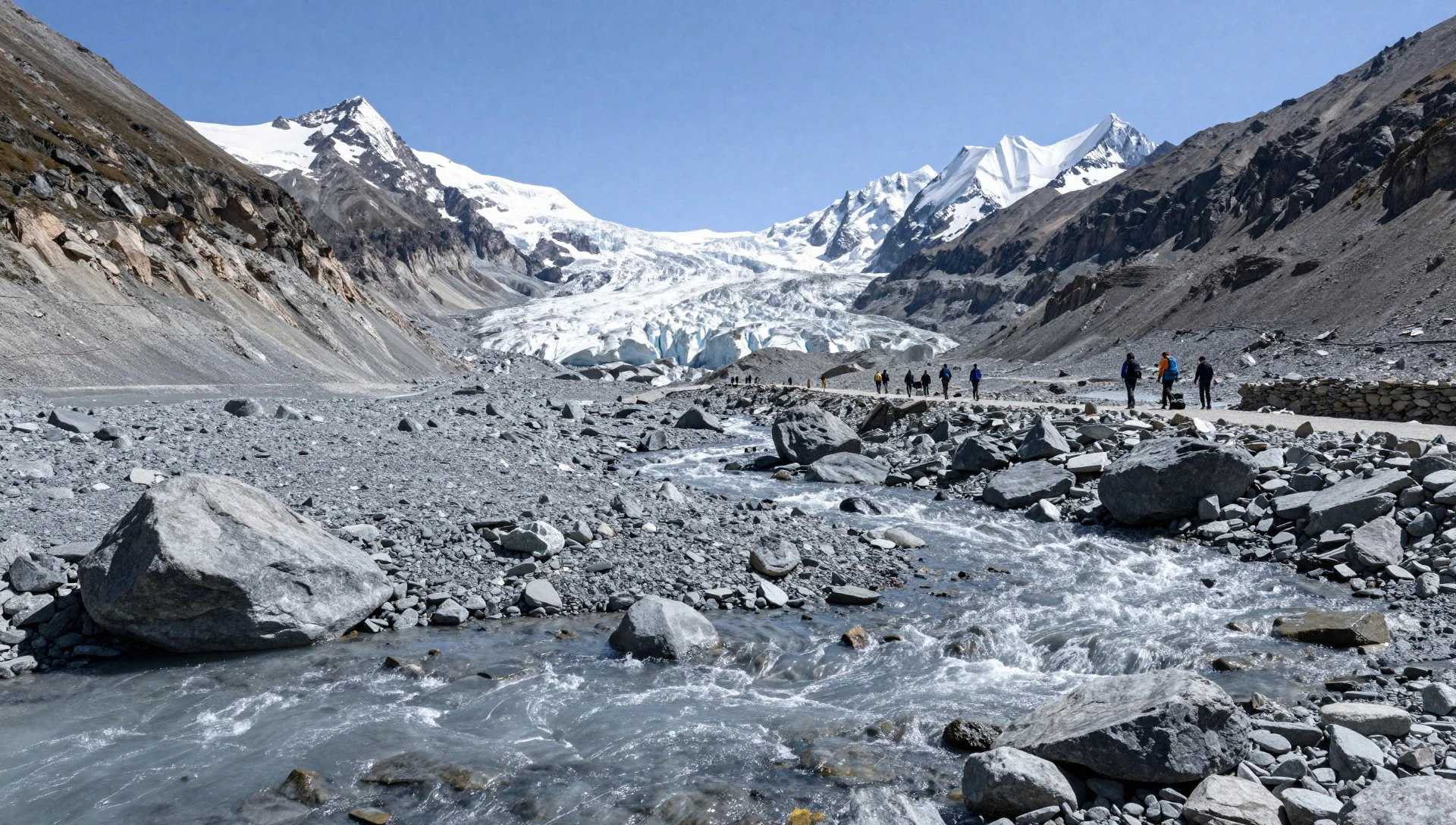
- Arun river valley — South-eastern park, Arun valley
The Arun is one of the tributaries of the Koshi, and in the park's south-east it flows through some of the lowest and warmest ground. Terraced fields, bridges and village trails appear here, so it is the place to see farming life before the climb into forest and rock.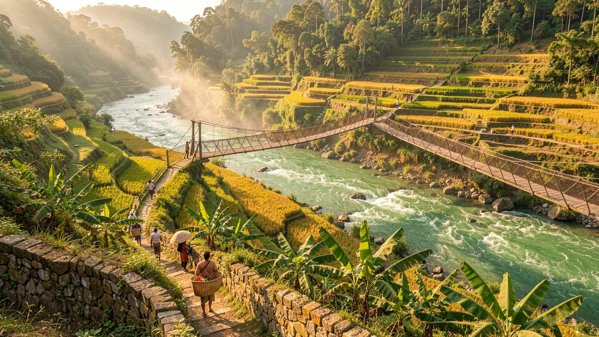
- Makalu and the high peaks — Northern park, Tibet border
Makalu, at 8,463 m, dominates the northern skyline, with Chamalang and Baruntse nearby. The summit is for mountaineers, but trekkers can see its pyramid shape from high viewpoints on clear mornings. Cloud usually builds by midday, so start early for the best views.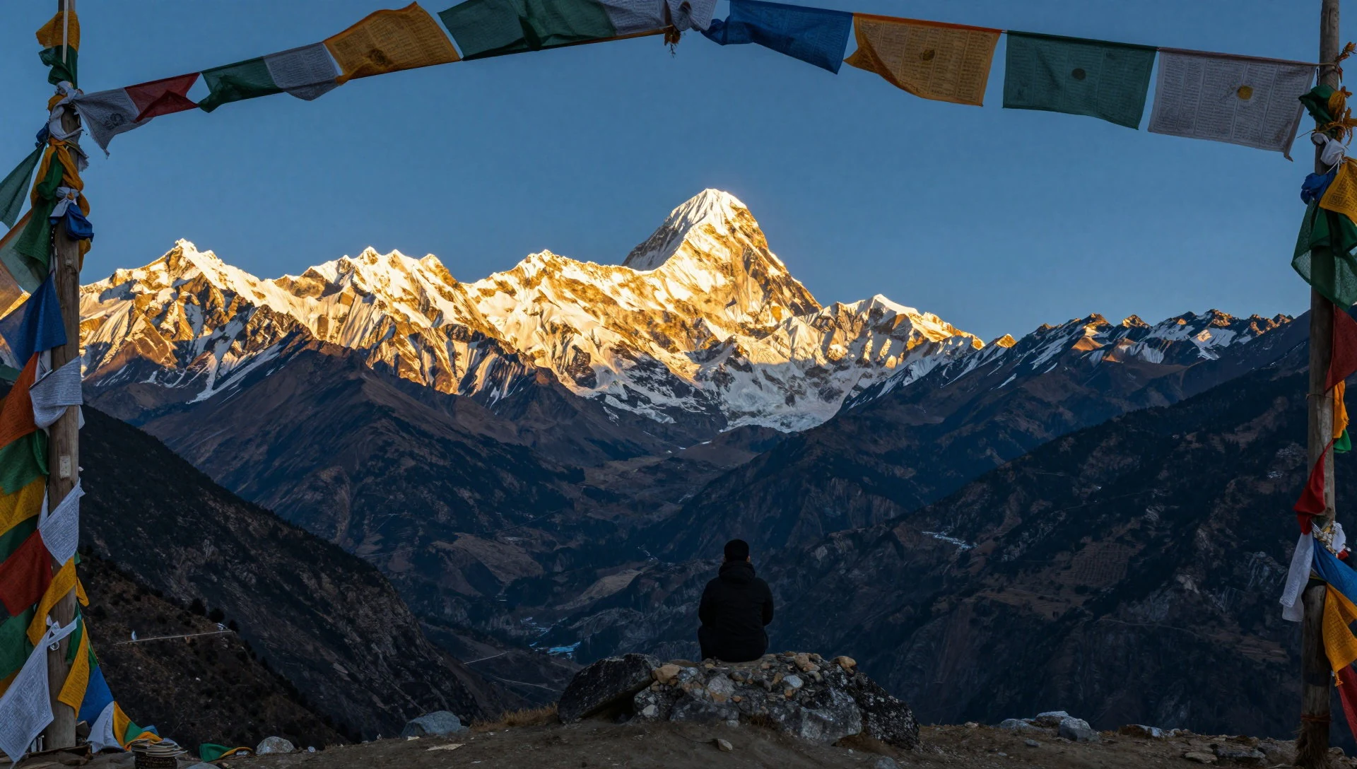
- Middle-elevation forests — Middle slopes, Sankhuwasabha
Between the warm river valleys and the alpine zone, the trails pass through broadleaf and rhododendron forest. Spring is the season for flowers, and birdsong carries through the trees. These slopes are also where the park's biodiversity, the reason for its protection, is easiest to notice.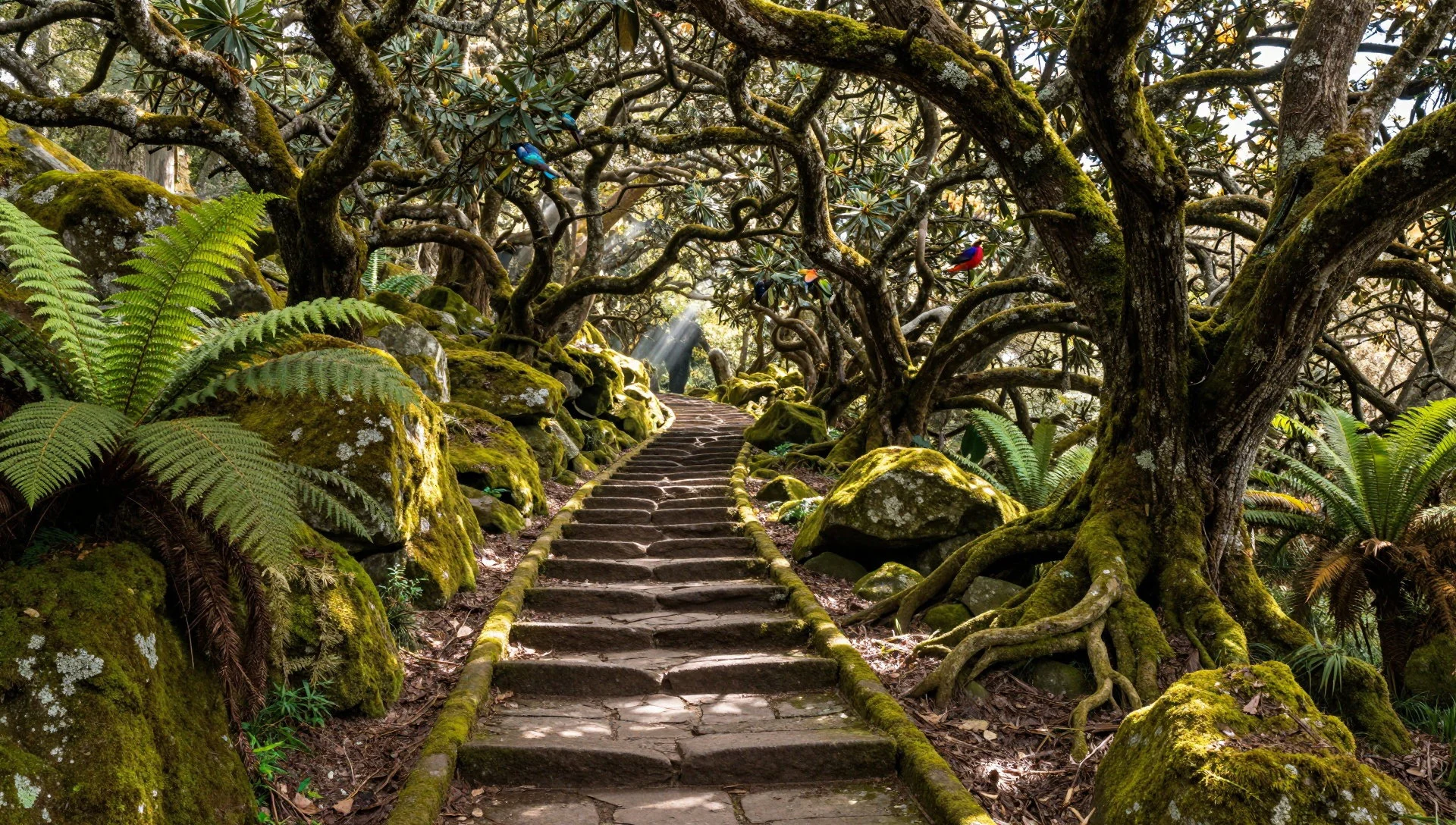
Culture
Makalu Barun National Park is home to farming communities of Sherpa, Limbu, Yakkha and several other groups, so a walk here is as much a passage through villages as through wilderness. Daily life follows the seasons, with planting, harvest, and animals moved between pastures. Many families also keep Buddhist or Hindu practices that shape the look of the trail, from prayer flags and mani walls to small shrines beside bridges. Greeting people matters. A warm namaste, palms together, is used for hello and goodbye, with namaskar as the more formal version for elders or people of standing; once per person per day is enough. Dhanyabaad is thank you. Respect for elders runs through everyday manners. Feet are considered unclean, so avoid pointing the soles at people or religious objects, and never step over someone sitting or lying down. The left hand is regarded as unclean, so pass food, money and gifts with the right hand or both hands. Shoes come off before entering a home, and it is worth watching what others do before entering a prayer room or monastery. Many guest houses have bidet-style water sprayers instead of paper, which is normal and worth being ready for. Visitors will find that patience, a smile and a few words of Nepali go a long way in remote places. Remove your shoes before stepping into a home, and walk round mani walls and chortens with the monument on your right, as locals do.
What to wear
Makalu Barun National Park covers a patchwork of communities, so traditional dress varies by group and altitude. Among Sherpa families, women wear the bakkhu, a wrapped woollen dress, often with a striped apron, while men wear the chuba, a long wool robe tied at the waist. Many Limbu and other hill groups wear the daura-suruwal for men and the gunyu-cholo for women, often with a topi in patterned dhaka cloth. These outfits come out for festivals, weddings and religious days rather than daily work. Day to day, people wear practical clothes: trousers or long skirts, sweaters, fleeces, caps, and sturdy shoes or sandals suited to steep paths and wet ground. Warm layers matter at any season, and cheap down jackets are common. Visitors should dress for a huge range of temperatures. Pack a base layer, insulating fleece, waterproof shell, warm hat and gloves for the upper valleys, and lighter, quick-drying clothes for the humid lower trails. Boots should be broken in, with good grip for mud and loose stone, and gaiters help in monsoon conditions. Modesty is appreciated in villages, so cover shoulders and knees. At monasteries, remove hats and avoid sleeveless tops. Sun protection is essential, since ultraviolet exposure rises quickly with altitude, even on cloudy days.
What to eat
- Dal-bhat-tarkari — Any trailside lodge or village eatery
The standard meal across Nepal: spiced lentils over boiled rice with cooked vegetables, often with pickle or yoghurt. Eaten traditionally with the right hand. Find it at village homes, local eateries and trailside lodges, and refills are usually offered.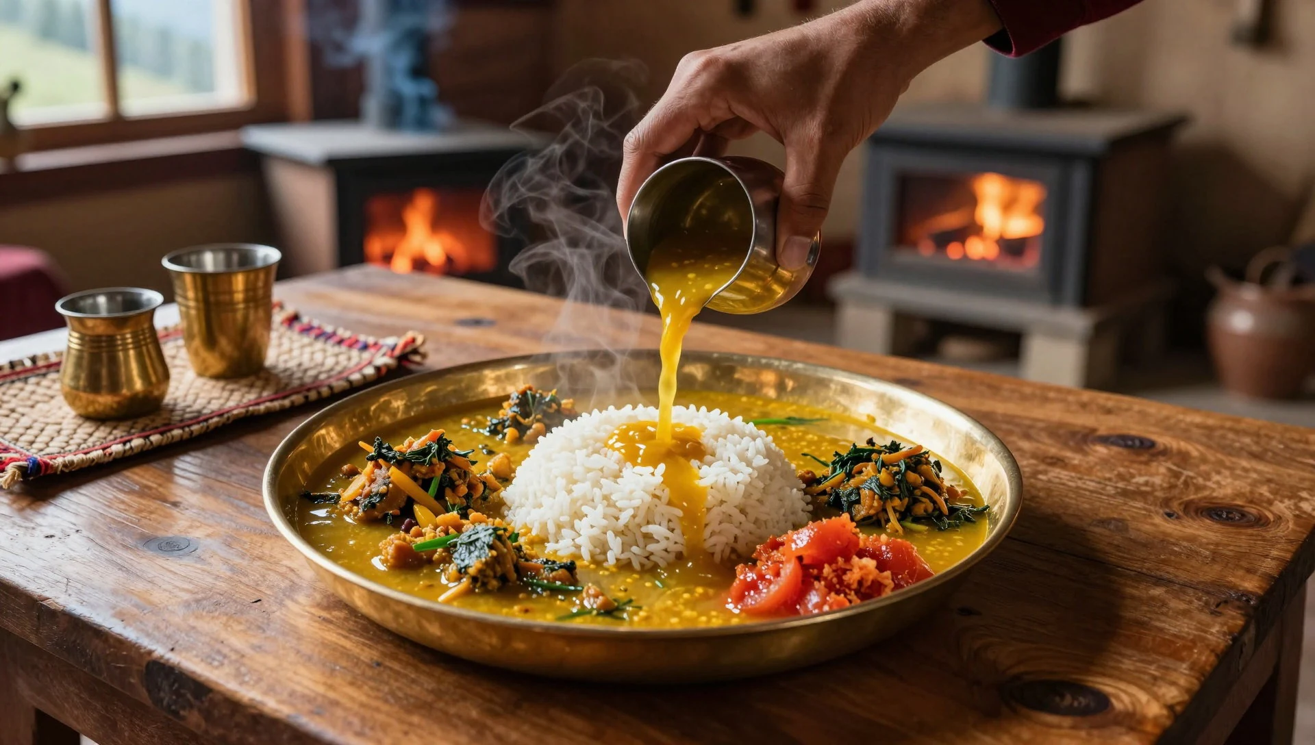
- Aata — Village homes and basic trailside eateries
A thick cornmeal porridge served where rice is scarce. It is filling food for hill farmers and walkers, usually served with lentils and vegetables. Barley or flatbread may appear in its place, depending on the household and the season.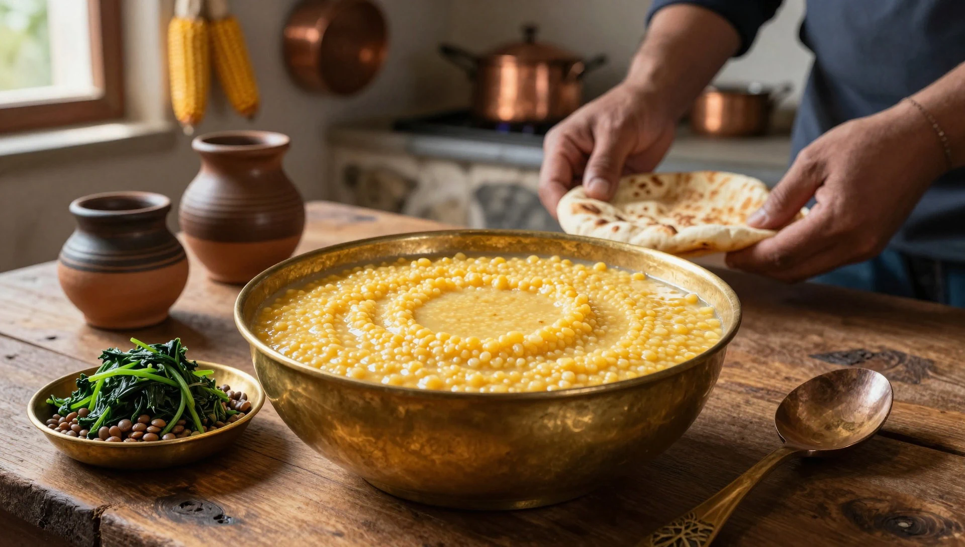
- Momo — Small eateries in towns and larger villages
Steamed dumplings stuffed with vegetables or meat, served with a sharp, spicy chutney. They are a popular snack after a long day's walk, and are easiest to find in larger villages and at the start of the trek. - Thukpa — Sherpa-run lodges and mountain eateries
A hot noodle soup with vegetables, and sometimes meat, that suits cold evenings at altitude. It is simple, warming and quick to prepare. Look for it in Sherpa-run lodges, where it often appears on the menu alongside tea. - Achaar and dahi — Served alongside dal-bhat in homes and lodges
Small side dishes of fiery pickle and yoghurt that come with the main meal. The pickle is very hot, so taste a little first. Yoghurt cools the mouth and is often made from milk produced in the village.
Plan it
Best time. March–April for rhododendron flowers and clearer skies, and October–November for crisp, settled weather and good mountain views. The monsoon runs from about June to late September, with heavy rain, leeches and cloud; the lower valleys turn hot in April and May.
How long. 10–14
Getting there. Fly to Kathmandu, then usually take a domestic flight towards the eastern hills (Tumlingtar is the common airstrip) or a long road journey; the last leg is on foot. Check current flights and roads before booking.
Budget. mid
Tips
- Check permit and registration rules on the park's official site (http://dnpwc.gov.np/protected_areas/details/makalubarunnationalpark); solo trekking rules and digital registration have tightened in recent years
- Carry enough cash, since cards and cash machines are unavailable on the trail
- Acclimatise slowly, add rest days, and know the signs of altitude sickness before going high
- Bring a water filter or purification tablets, and start walking early because cloud builds by midday
- Indian citizens can enter Nepal without a visa, but carry valid identification
Etiquette
- Use the right hand or both hands to pass and receive items
- Take your shoes off before entering homes
- Ask before photographing people, and leave no litter on the trail
Nearby
Sources
- Wikidata Q964013 (CC0)
- Wikipedia: Makalu Barun National Park (rev 1381168361) (CC BY-SA 4.0)
- Wikivoyage: Nepal (rev 5399421) (CC BY-SA 4.0)
- Photo: Makalu Barun National Park, Nepal — Sergey Pashko (CC BY 3.0)
- Photo: Barun Valley - Nghe — Dhilung (CC BY 3.0)
- Photo: Repuk Makalu Barun Valley Nepal — Dhilung (CC BY 3.0)
- Photo: Rhododendron arboreum subsp. nilagiricum — Marcus334 (CC BY 3.0)
- Photo: Arun river, Makalu-Barun National Park — Sagar jung karki (CC BY 3.0)
- Photo: Everest-Panorama-wiki — Toppi68 (CC BY 3.0)
- Photo: Everest-Panorama — Michael Toepfer (CC BY 3.0)
- Photo: Landscape in the Makalu Barun National Park, Nepal — Sergey Pashko (CC BY 3.0)


