Lake Taupō
Lake Taupō, New Zealand
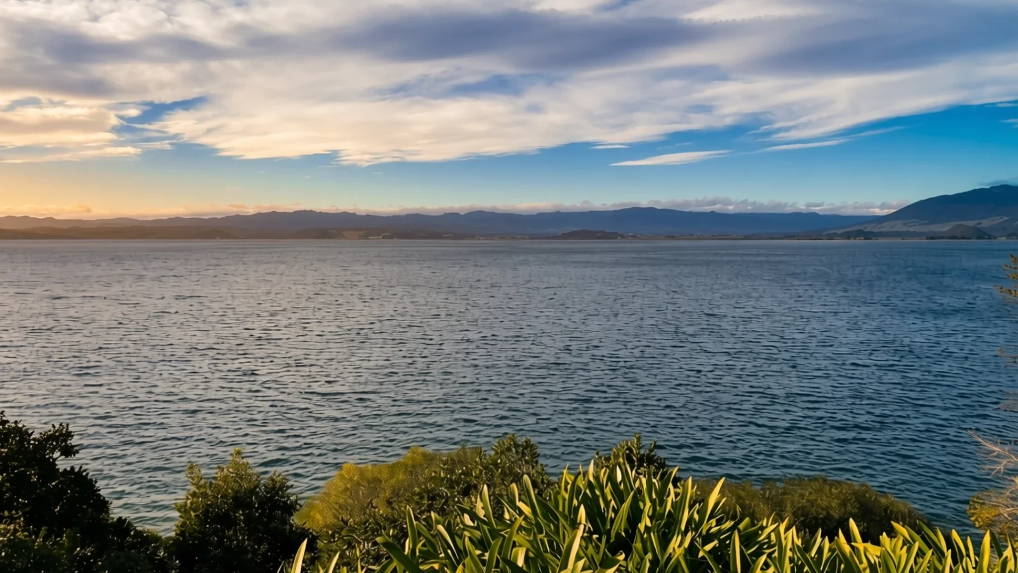
A vast volcanic lake in the heart of the North Island, good for swimming, trout fishing and cycling, with snowy volcanoes on the horizon.
The place
Lake Taupō fills the caldera of a large volcano in the centre of New Zealand's North Island. The town that gives the lake its name stands on a bay on the north-eastern side, and most visitors base themselves there. At about 616 square kilometres, the lake is the country's largest by area, and its deepest point, roughly 186 metres down, makes it a serious body of water rather than a pond with a view. The volcanic peaks of Tongariro, Ngauruhoe and Ruapehu rise to the south and west, and on a clear morning their snowy shoulders are mirrored across the water. The lake drains at its north-western end into the Waikato River, which carries the water a long way to the west coast. Trout fishing is a major draw, with brown and rainbow trout swimming in the bays and river mouths. Tourism is the town's main industry, with skydiving, a famous lake cycling event and an ironman race all drawing crowds. Summer, roughly December to February, is the busiest and warmest stretch, and the town fills up over the Christmas holidays, so book beds early. Rain falls in every month but is heaviest from June through December, so pack a waterproof whatever the season.
Its story
Before the modern town grew up, the land beside the lake's hot springs held a village of the Ngāti Tūwharetoa people, called Te Rapa, close to the springs of Maunga Kākaramea. On 7 May 1846 a landslide buried the settlement. Sixty people died, among them the iwi's chief, Mananui Te Heuheu Tūkino II, and the disaster remains a painful part of the region's history. The landscape around the lake was shaped by enormous volcanic eruptions long before any village stood on its shore, and the ground still shows that violence in its springs, pumice and steep ridges. Over the following century the lake became a centre for fishing and then for tourism, and the shoreline has changed as the water level has been managed. The level is set by the operators of the hydroelectric dams on the Waikato River downstream. They open gates to reduce flooding, conserve water and keep the river flowing. Those gates have been in use for decades, and their settings still shape the shoreline, the beaches and the boat ramps that visitors use today.
What to see
- Hobbiton Movie Set Tours — Matamata, Waikato
Set in farmland between Matamata, Cambridge and Tirau, this is the film set built for the Lord of the Rings and Hobbit films. Round doors, a painted hillside and the Green Dragon pub make it an easy hit for film fans. Tours are the way in, so book ahead, especially in the warmer months. Allow half a day including the drive from the lake, and wear comfortable shoes, since paths can be muddy after rain.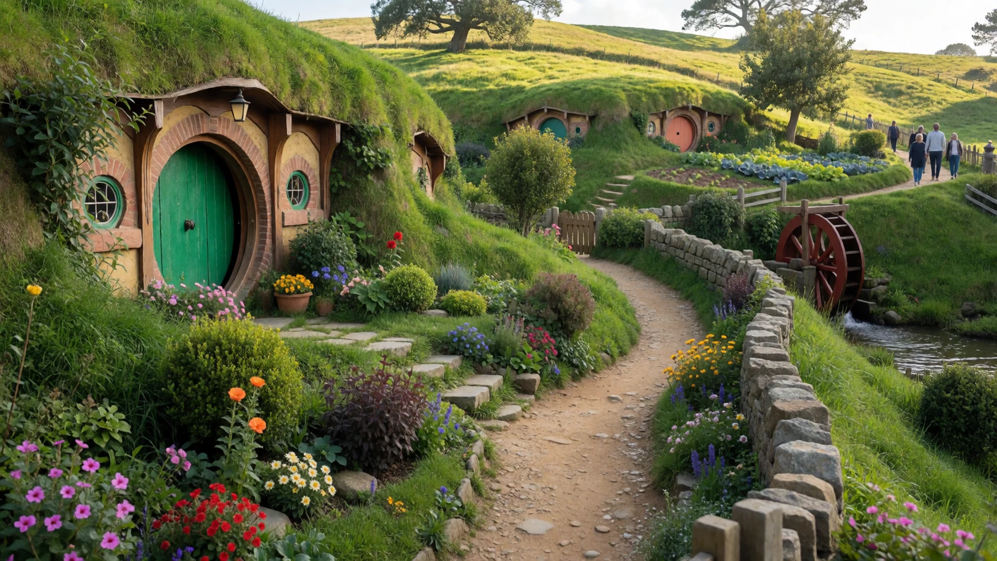
- Ruakuri Cave, Waitomo — Waitomo, Waikato
Ruakuri Cave is a limestone cave system near Waitomo, reached by a long spiral path that descends from the surface through a large drum-shaped entrance. A walkway winds down into the underground chambers, where lighting picks out formations and water features. Expect steps and some tight spots, and bring warm layers, since the cave stays cool all year. Tours run to set times, so check the official site before you travel.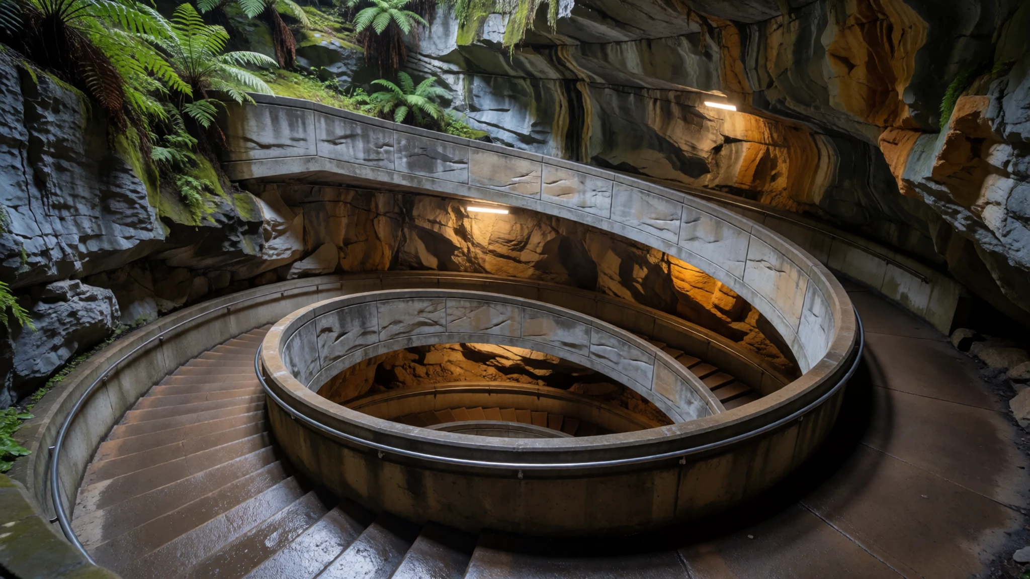
- Giant dog and sheep, Matamata — Matamata, Waikato
A roadside pair of oversized figures, a dog and a sheep, built from corrugated metal, stands in the countryside near Matamata. The sculptures suit a car journey through farmland, and most people stop briefly for a photograph. They make a light diversion on the way to or from Hobbiton. Keep clear of the road, and do not climb on the metal structures.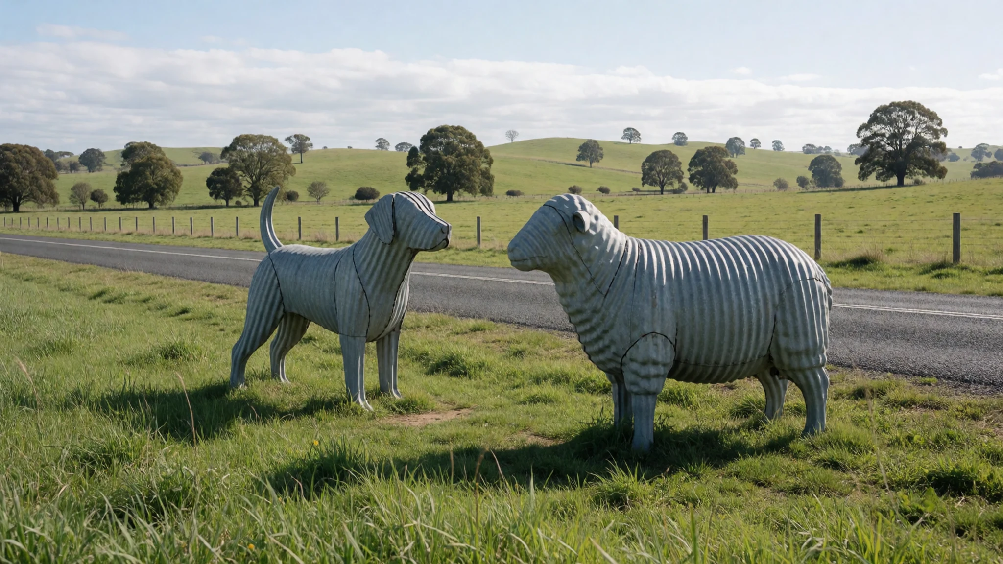
- Mine Bay rock carvings — Mine Bay, north-west shore
On the north-western shore, cliffs at Mine Bay carry Māori rock carvings made in the late twentieth century by two artists, Matahi Whakataka-Brightwell and John Randall. The carvings are cut into the rock face above the water and are best seen from a boat or from the shoreline track. They are a living expression of local culture rather than an old relic, so approach them with the same respect given to a marae.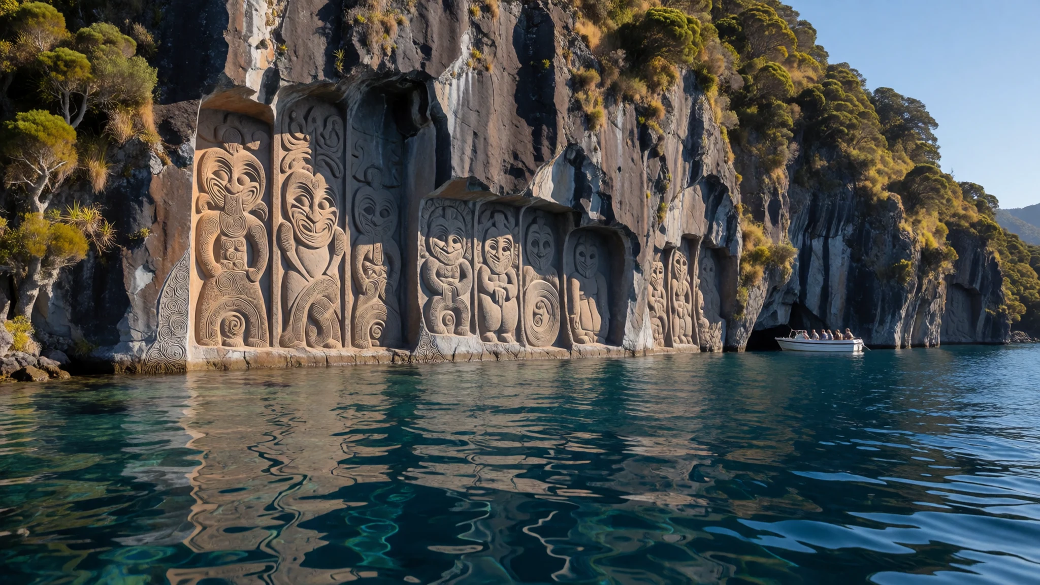
- Acacia Bay — Western shore, near Taupō
Acacia Bay, on the western shore a short drive from town, has a quieter stretch of lake than the town front. Lakeside reserves, sheltered beaches and views across to the volcanic peaks make it a good spot for a picnic or a summer swim. The shoreline is open, with little shade on the grass, so take water and sun protection.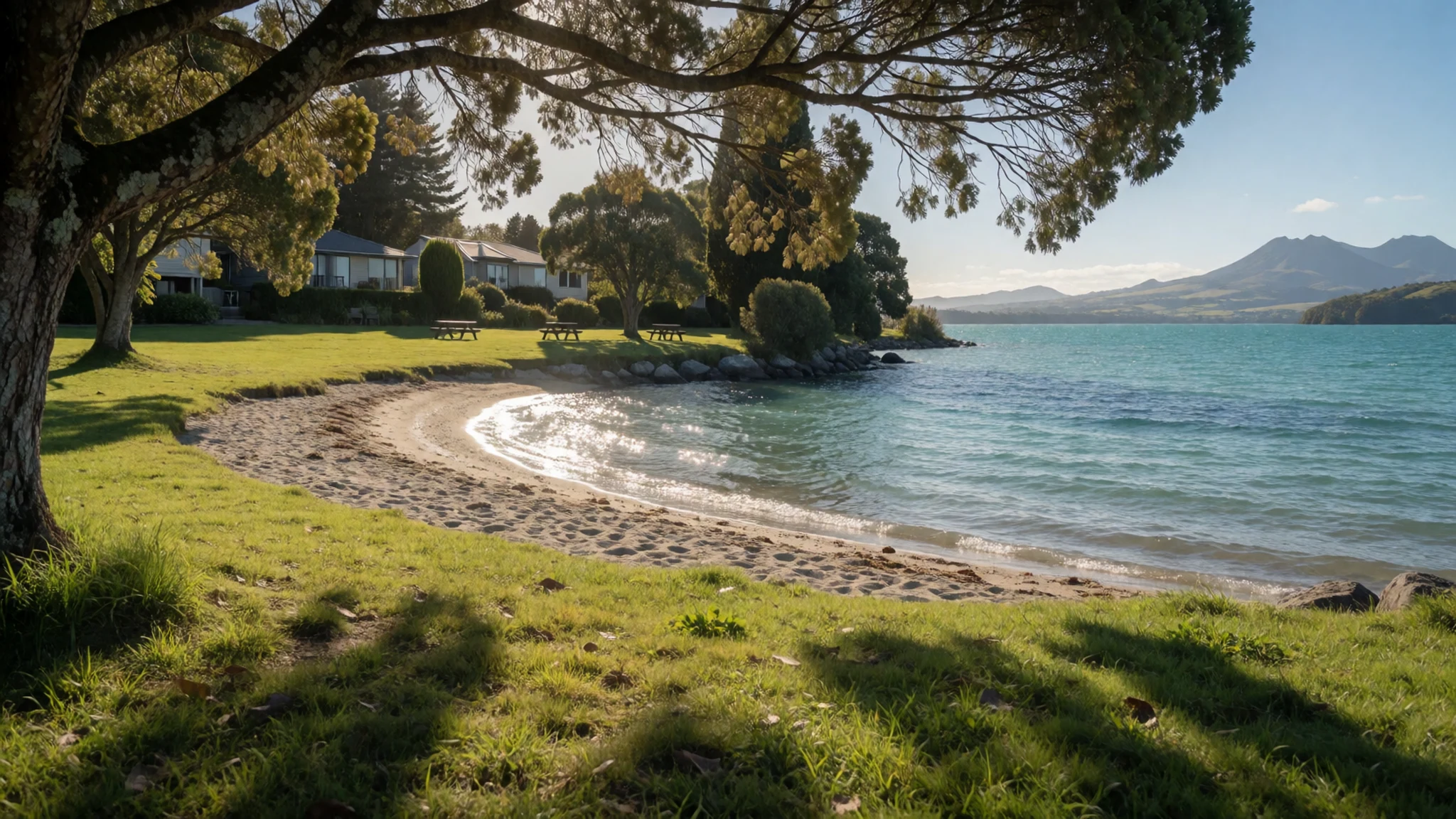
Culture
Taupō sits within the territory of Ngāti Tūwharetoa, and Māori culture is part of everyday life around the lake. The carvings at Mine Bay, the marae and the cultural programmes offered to visitors all carry tikanga, or customary protocol. Visitors are usually welcomed with a formal greeting when they visit a marae, and it is polite to listen before speaking and to follow the lead of hosts about photographs. Public life here is relaxed and friendly, with a strong outdoor culture: people chat in queues, dress casually and expect the shoreline to be shared. Tipping is not expected in New Zealand, so a simple thank-you is welcome. Opening hours can shift with the seasons, so check before planning a late meal. Keep to marked tracks near the Mine Bay carvings and never touch, chalk or climb the rock.
What to wear
At Lake Taupō, traditional dress survives mainly in ceremonial settings, where Māori cloaks such as kākahu, sometimes called kahu huruhuru when feather-decorated, are worn on formal occasions. These cloaks are woven from flax fibre, harakeke, and finished with dyed or natural feathers, and they signal the status and history of the wearer. Weaving is a skill passed down through families, and the finer cloaks can take months to complete. In daily life, people around the lake dress much as they do elsewhere in New Zealand: fleece, merino, waterproof jackets, outdoor trousers and sturdy footwear, because the weather changes quickly and trails are often wet. Sandals appear at the beach in summer, but boots take over on the hills. A visitor should pack layers that cope with strong sun at midday and a cool wind off the water in the evening, a light waterproof, a hat, sunglasses and walking shoes with grip for cave and forest tracks. At a marae, dress modestly, cover shoulders and knees, and take off hats and shoes where asked.
What to eat
- Smoked trout — a smokehouse or lakeside café in Taupō town
Trout from the lake turns up smoked, often served on crackers or in a salad with a squeeze of lemon. It is a natural lunch after a morning on the water. Look for it at a smokehouse or lakeside café in the town centre, where it is usually sold by the portion.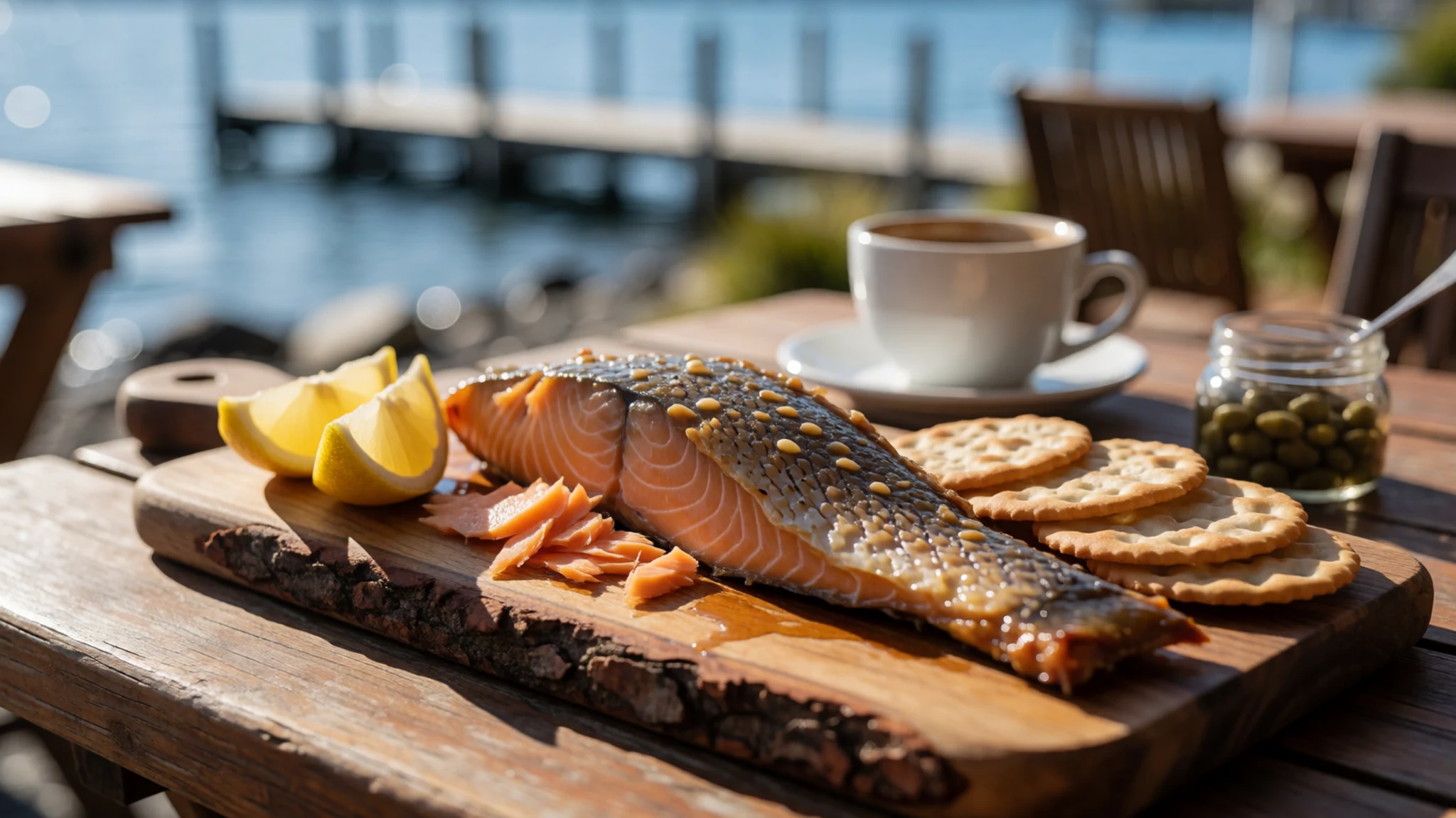
- Hāngi — a cultural tour or marae-hosted meal, booked in advance
Hāngi is food cooked slowly in an earth oven, traditionally with hot stones in a pit, and it is one of the most distinctive ways to eat in the region. It is usually served at events or as part of a cultural programme rather than from a shop. Ask at the visitor centre what is running before you plan a day around it.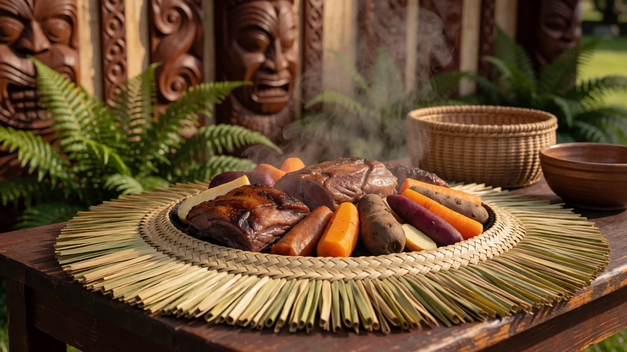
- Meat pie — a bakery on the main street of Taupō
Meat pies are a New Zealand staple, sold hot from bakeries and petrol-station counters. A flaky pastry filled with mince and gravy makes a simple lunch, and eating one on a bench by the lake is a local habit. Pick one up early in the day for the best selection. - Fish and chips — a takeaway near the lakefront
Fish and chips wrapped in paper and eaten on the lakefront is a relaxed meal that suits the town. Ask whether the fish of the day is local, since menus change with the catch and the season. Takeaway is quick, so it works well between activities. - Hokey pokey ice cream — an ice-cream parlour in the town centre
Hokey pokey is honeycomb toffee folded into vanilla ice cream, a sweet treat that pairs well with a warm afternoon by the water. Ice-cream parlours in town sell it in cones and tubs. It is a good way to finish a day of walking or cycling.
Plan it
Best time. December to February brings warm weather and long days, but it is also the busiest season for Lake Taupō. March to May and October to November are calmer, with fewer crowds and a gentler pace. June to December brings the most rain, so pack for wet weather if you come in winter.
How long. 2–3
Getting there. Most visitors fly into Auckland and drive south-east on the main road, a journey of several hours. Taupō has a small airport with limited flights. Check the official site for current coach and flight options before you travel.
Budget. mid
Tips
- Book Hobbiton and Waitomo tours ahead, especially in summer
- Start walks and cycling early, before the wind picks up on the lake
- Cards are widely accepted in town, but carry some cash for small stalls
- Pack sun protection, since clear skies and altitude make burns quick
- Check trail conditions before walking, because the weather changes fast
Etiquette
- Keep to marked tracks and treat carvings and sacred sites with care
- Ask before photographing people at a marae or cultural event
- Take your rubbish away from lakeside reserves
Nearby
Sources
- Wikidata Q199903 (CC0)
- Wikipedia, Lake Taupō (rev 1366280793) (CC BY-SA 4.0)
- Wikivoyage, Waikato (rev 5259464) (CC BY-SA 4.0)
- Lake Taupo in New Zealand's North Island (NASA) (Public domain)
- View of Lake Taupo, New Zealand (CC BY-SA 2.5)
- Wharf and small jetty on Lake Taupo (Albert Percy Godber) (Public domain)
- Lake Taupo with Mt Tongariro, Ngauruhoe and Ruapehu (Auckland Museum) (Public domain)
- 1898 pictorial 1 penny blue and brown (Lake Taupo) (Public domain)
- A Nice Rest Area at Lake Taupo NZ (Herman Darnel Ibrahim) (CC BY 3.0)
- Acacia Bay, New Zealand (Kiwi Flickr) (CC BY 2.5)
- Acacia Bay Taupo (Frozen-Coke-Rocks) (Public domain)


