Khao Yai National Park
Khao Yai National Park, Thailand
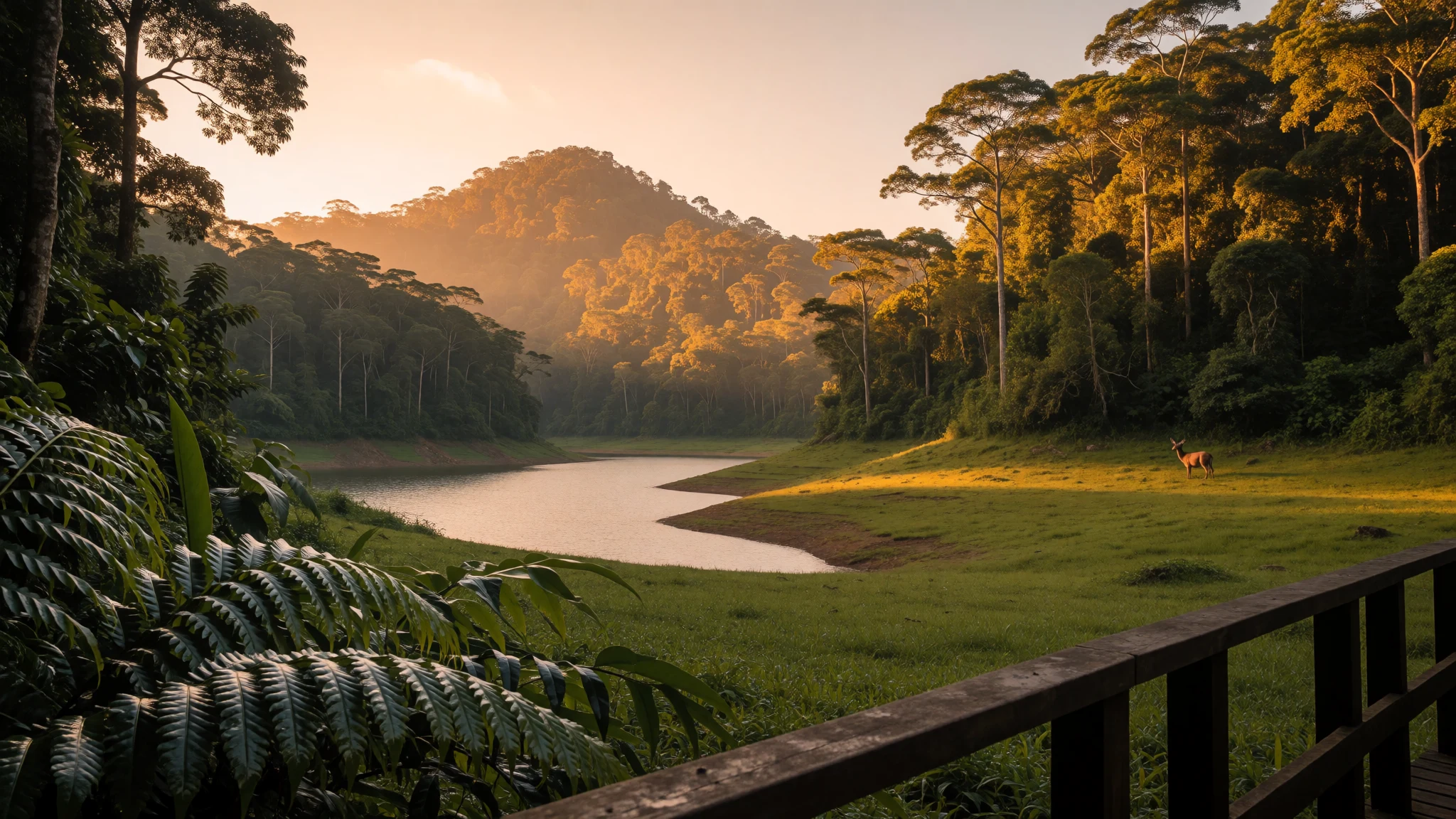
Khao Yai is Thailand's first national park, a cool upland forest of hornbills, gibbons, waterfalls and dusk bat flights within reach of Bangkok.
The place
Khao Yai National Park sits on the road between Bangkok and Nakhon Ratchasima (Korat), where the central plains begin to climb towards the Isan plateau. It was set up in 1962 as Thailand's first national park, and with an area of about 2,166 km² it is the third largest. Most of it is forest: evergreen jungle on the slopes, patches of open grassland, rivers that feed waterfalls, and a few reservoirs. The highest summit, Khao Rom, reaches 1,351 m and can only be climbed on foot. Its neighbour Khao Laem, called the Spiky Mountain by locals, is second in height and involves a long walk and a rope scramble near the top. The climate is worth understanding before a trip. The annual mean is about 23 °C, but the year splits into three: a wet season from May to October, a clear and cool season from November to February, and a warm, humid stretch in March and April. Streams run hard in the rains and the trails turn leechy, while cool-season mornings are crisp enough for a jumper. Wildlife is the draw: hornbills, gibbons, deer and, now and then, wild elephants on the roads or in clearings. Most visitors come from Bangkok for the weekend, so Saturdays are busier than weekdays. The park is big enough that moving between its sights takes a car or a lift on a ranger-run truck.
Its story
Khao Yai National Park was proclaimed by royal decree in September 1962 and published in the Government Gazette as the first national park of Thailand. The naturalist Boonsong Lekagul played a major part in getting it established, and his name is still linked with Thai conservation. The park took its name from a sub-district, a tambon, called Khao Yai, which no longer exists as an administrative unit. Recognition followed over the decades. The park became an ASEAN Heritage Park, and later it was inscribed as a World Heritage Site under the name Dong Phayayen–Khao Yai Forest Complex, a grouping that joins it with neighbouring parks in the same range and with forests in the Dong Phaya Yen mountains to the north. Status on paper has not removed the pressures. Land around the park has been developed into luxury hotels and golf courses, which makes it hard to buy extra land for wildlife, and that matters for animals such as elephants that range widely. Houses and villas have also been built illegally inside the protected boundary, and illegal logging remains a problem. The result is a park that is a conservation success story and, at the same time, a place under steady strain from its own popularity and from its closeness to Bangkok's money.
What to see
- Haew Suwat Waterfall — East of the visitor centre
Haew Suwat drops over a rock face into a broad pool, and is reached easily by road from the visitor centre, so it is busy at weekends. The surrounding forest is green and shady. Go early for quiet and softer light, and stay out of the water because of the crocodile warning.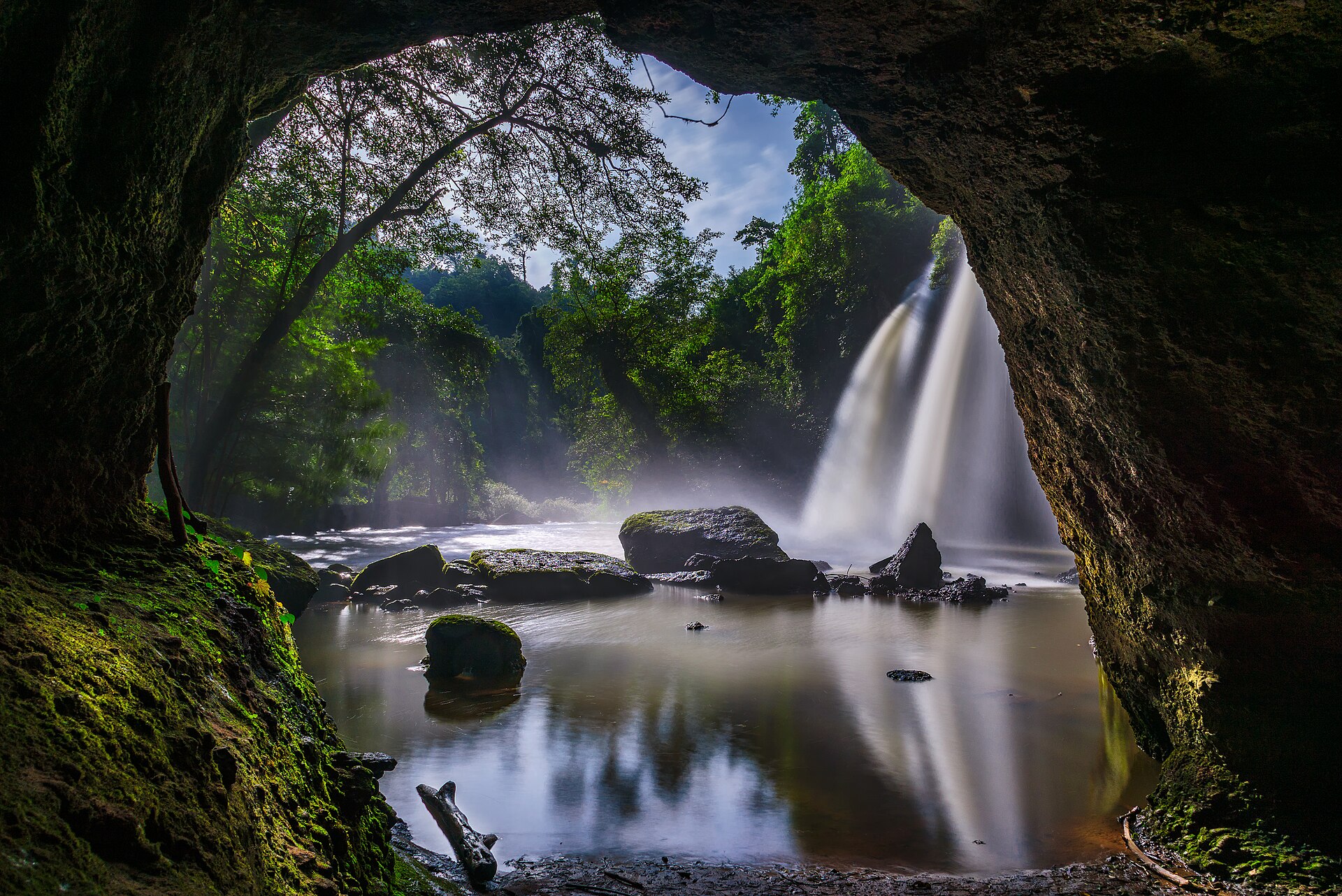
- Haew Narok Waterfall — Southern part of the park
Haew Narok is the largest waterfall in the park, falling in tiers to a lake at the bottom. It is most impressive in and just after the rains, when the streams are full. In the dry months it thins noticeably, so timing changes what is seen. - Nong Phak Chi observation tower — Central park, near the grassland
A tower over open grassland and a wetland edge, good for early mornings when hornbills, gaur and sometimes elephants appear and gibbons call from the trees. Bring binoculars, arrive before the tour groups, and be patient: wildlife watching here rewards sitting still more than walking.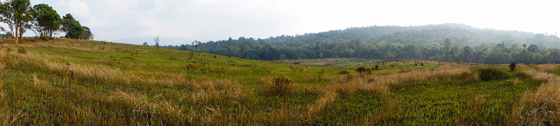
- Bat flight at dusk — Just outside the northern gate
Around half past five in the evening, a huge colony of wrinkle-lipped bats streams out of a cave just beyond the northern gate. They fly in a long ribbon across the sky, usually heading into the wind. Arrive a little early and bring a camera that copes with low light. - Walking trails — From the visitor centre
The park has a network of marked footpaths, from short easy walks to multi-day treks. The easiest trail has a hard surface, which keeps leeches and mud mostly at bay. Trails are one-way and animal tracks can look like paths, so a guide is sensible for anything longer.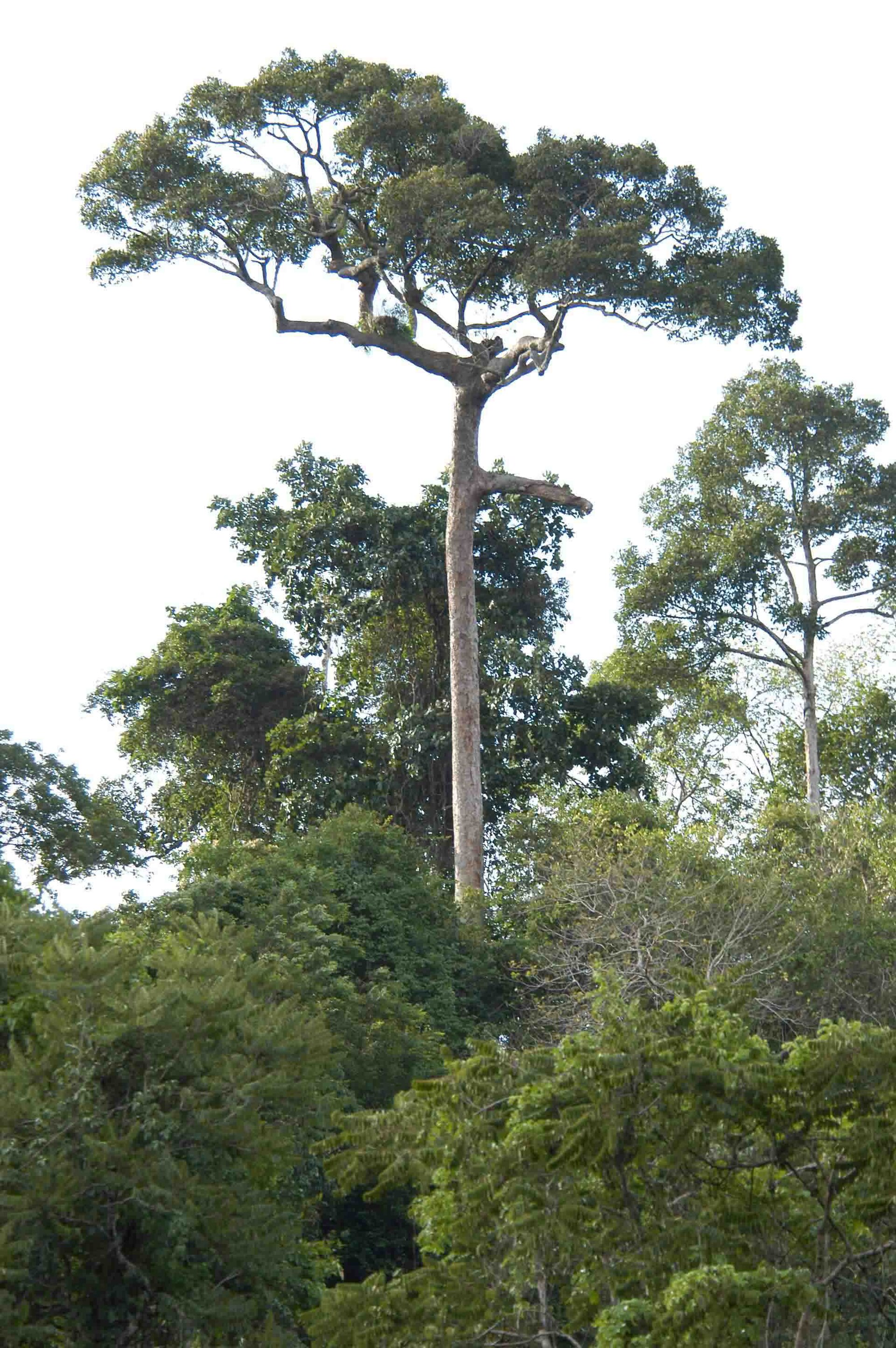
Culture
Khao Yai National Park is a good place to see how Thai attitudes to nature work in practice. Many visitors are Thai families and school groups from Bangkok and Korat, who treat the park as a weekend outing, with picnics, music kept fairly low, and plenty of photographs at the viewpoints. The idea of a national park is relatively young in Thailand. The first one, created in 1962, owes much to the naturalist Boonsong Lekagul, whose name still carries weight among Thai conservationists and birdwatchers. Rangers, guides and drivers form a small community of their own, and paying for a guide is both a safety measure and a way of putting money into it. Buddhist habits shape daily manners here as elsewhere in the country: a polite wai, a calm voice, and a dislike of open anger or fuss. Spirit houses, small shrines on posts, are common across Thailand, and people often leave a flower or a drink there. Hornbills, gibbons and elephants matter to Thais as much as to foreign visitors, and staff talk about them with obvious affection. Respect for the animals, rather than any single ritual, is the real etiquette of the park. Keep well back from wild elephants, never feed any animal, and stay quiet at observation towers so that everyone nearby can watch too.
What to wear
Traditional dress around Khao Yai follows the wider culture of Thailand's north-east. Silk and cotton are woven in the Korat area and across Isan, often in mudmee, a tie-dyed ikat pattern, and made into wrap skirts called pha sin, sarongs and shawls. These are worn for temple festivals, weddings and official occasions rather than on an ordinary day. In the park itself, people dress as hikers and weekenders do anywhere: quick-dry T-shirts, leggings or light trousers, caps, trainers, and the occasional matching family outfit for photographs. Rangers wear uniform. Visitors should dress for forest rather than beach. Long, light trousers and sleeves protect against leeches, nettles and mosquitoes, and closed shoes with a good grip matter more than anything else on wet trails. Leech socks are sold and worth wearing in the rains. A light rain jacket is useful from May to October, and in the cool season the mornings and nights can be cold enough for a jumper or fleece. A hat and sunscreen help on the open grassland, where there is little shade. The park has no formal dress code, but shoulders and knees should be covered when stopping at a temple or village on the way, and shoes come off at any temple building.
What to eat
- Som tam — Roadside stalls near the gates and in Pak Chong
Green papaya salad pounded in a mortar with chilli, lime, fish sauce and peanuts, the north-east's signature dish. Ask for it mild if chilli is a worry. It is easy to find at roadside stalls near the park and in Pak Chong. - Gai yang with sticky rice — Grill stalls along the road to Pak Chong
Marinated chicken grilled over charcoal, served with balls of sticky rice that are eaten by hand and dipped in a sweet-sour sauce. It is a classic Isan combination, and it pairs well with som tam. - Pad kra pao — Food stalls at the visitor zones
Stir-fried minced pork or chicken with holy basil and chilli, usually topped with a fried egg over rice. It is quick, filling and one of the most reliable dishes at the small food stalls inside the park. - Tom yum — Park restaurants and eateries in Pak Chong
A hot and sour soup with lemongrass, galangal, lime leaf and mushrooms or prawns. In the cool season it is a welcome end to a day of walking. Restaurants in the park and nearby towns usually offer it. - Fresh fruit and mango with sticky rice — Town markets in Pak Chong and roadside fruit stands
Seasonal fruit sold in bags from market stalls is a cheap, cooling snack after a hike. When mangoes are in season, they come with sweet coconut-soaked sticky rice, a simple dessert found across Thailand.
Plan it
Best time. November to February is the cool, clear season, with sunny days and cold nights, and it is the best time for hiking. March and April are warm and humid. May to October is the rainy season, when streams and waterfalls are at their fullest but trails are wet and leeches are common.
How long. 2–3
Getting there. Khao Yai lies on the Bangkok–Korat route. Take a train or bus from Bangkok to the town of Pak Chong, then hire or share a songthaew (a pick-up taxi with bench seats) to the northern gate. A southern entrance is reached from Prachinburi by road.
Budget. mid
Tips
- Book park lodges and cabins in advance, as some are open only at weekends
- Visit on weekdays if possible, because Saturdays and public holidays are crowded
- Carry plenty of water and snacks, since food stalls and restaurants can close early
- Hire a guide for anything beyond the easy trails, as paths are one-way and easy to lose
- Check fees, opening times and campsite rules on the official park website: http://www.dnp.go.th/parkreserve/asp/style1/default.asp?npid=9&lg=2
Etiquette
- Do not swim in the rivers and waterfalls, as crocodiles may be present
- Keep a safe distance from elephants and never feed wildlife
- Stay on marked trails and keep noise down near observation towers
Nearby
Sources
- Wikidata Q386420 (CC0)
- Wikipedia: Khao Yai National Park (rev 1362779871) (CC BY-SA 4.0)
- Wikivoyage: Khao Yai National Park (rev 5407059) (CC BY-SA 4.0)
- Photo: Khao Yai NP uitzicht, Jacco van Trigt (Jtri) (CC BY 3.0)
- Photo: Haew Suwat Waterfall, Nawit science (CC BY-SA 4.0)
- Photo: Fût émergeant de la canopée, Blaise Droz (CC BY-SA 2.0)
- Photo: Nong Phak Chi grassland, Athikhun.suw (CC BY-SA 4.0)
- Photo: Dhole feeding, Tontan Travel (CC BY-SA 2.0)
- Photo: Elephant at Headquarters, Bernard Dupont (CC BY-SA 2.0)
- Photo: hornbill over the canopy, Surasak banklang (CC BY-SA 4.0)
- Photo: Sai Son Reservoir, BerryJ (CC BY-SA 4.0)


