Kerkouane
Kerkouane, Tunisia
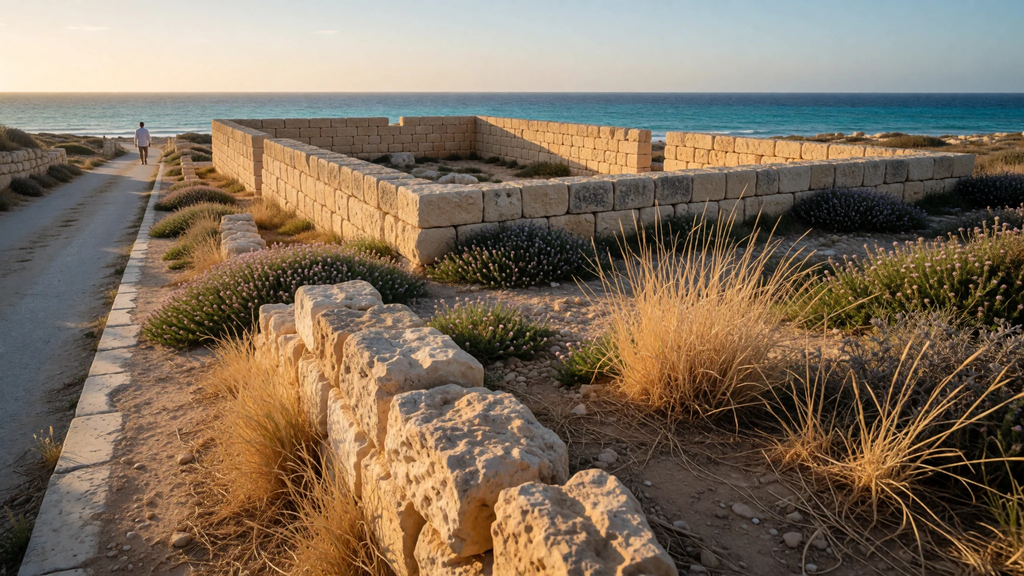
Kerkouane is a quiet Punic town by the Cape Bon shore, abandoned before the Romans came, with its streets and bathrooms still legible.
The place
Kerkouane is the ruin of a Punic town on the Cape Bon peninsula, in north-eastern Tunisia, facing the Mediterranean. Archaeologists chose the name, because nothing in the surviving ancient record tells us what its inhabitants called it. What remains is a low grid of stone-walled houses and streets laid out beside the shore, with a small museum next door and a necropolis nearby. Nothing here rises to monumental scale. Walls stand at roughly knee to waist height, and the interest lies in the layout: streets that meet at sensible angles, houses arranged around courtyards, and rooms set aside for washing. The town is counted alongside Carthage, Hadrumetum (modern Sousse) and Utica as one of the major Punic cities, and it is a UNESCO World Heritage Site together with its necropolis. Guides present it as probably unique, since the town was left empty and the Romans never built over it. That is why it feels different from sites where later centuries piled up on top of earlier ones. The setting helps. Wind comes off the sea, the horizon is open, and the nearest towns, Kelibia and El Haouaria, sit on either side. Crowds are rarely a problem; most visitors pass through in an hour or so, and the odd school group or tour coach is the main interruption. Summer is hot and shade is scarce, so timing matters. The coastal position also makes the site vulnerable to sea level rise over the very long term.
Its story
Kerkouane's story begins with Phoenician seafarers and ends, as far as anyone can tell, in the middle of a war. The town lived for almost 400 years as one of several Punic cities on this coast, tied by sea to Carthage across the gulf and to the wider Mediterranean. It was a coastal community, and the sea was almost certainly central to how it lived. Around 250 BC, during the First Punic War between Carthage and Rome, the town was probably abandoned. Whether it was attacked, evacuated or simply emptied by the pressures of the conflict is not settled, and any confident account of its last days deserves suspicion. What matters is the aftermath. The Romans, who went on to build over many Carthaginian places, did not rebuild here, so the streets lay under sand and scrub until modern excavation. The name in use today comes from archaeologists, because no surviving ancient document records the original. That gap is oddly fitting. Kerkouane is known almost entirely from its stones, its tombs and the objects found in them, not from anyone's written account. The result is a rare look at everyday Punic life without a heavy Roman layer on top. UNESCO recognised the town and its necropolis as a World Heritage Site in 1985.
What to see
- Kerkouane archaeological museum — Beside the ruins
The small archaeological museum beside Kerkouane is the sensible first stop, because it explains what the bare walls outside once held. It displays finds from the town and its tombs and sets out the history of the site. Entry is bundled with the ruins ticket, and the shop sells drinks and snacks.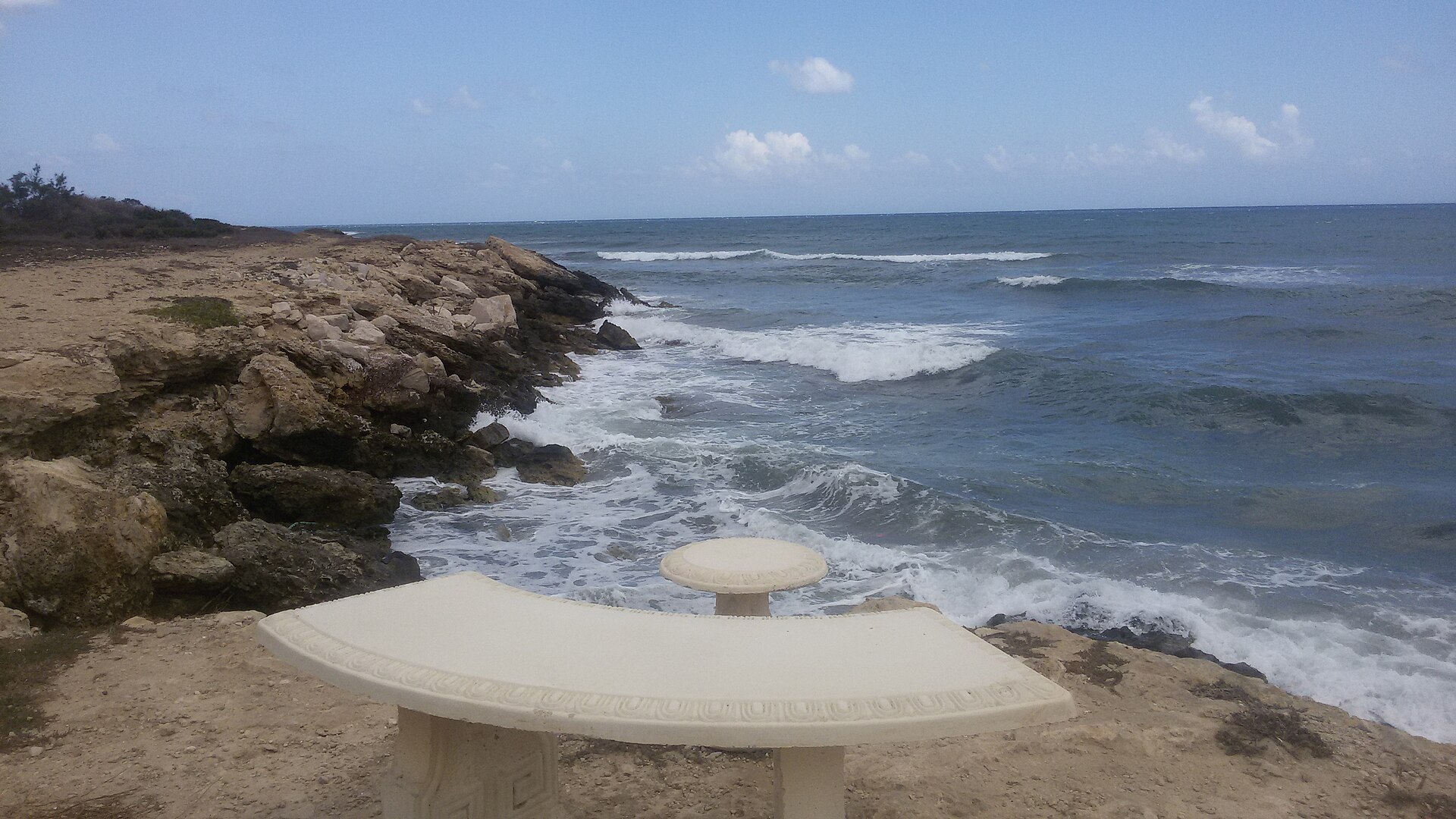
- The residential quarter — Main excavated area
The excavated houses are the heart of Kerkouane. Low stone walls mark out courtyards, doorways and narrow streets, and the regular layout shows deliberate town planning. Walking the lanes in sequence makes ordinary Punic life easier to grasp than any single monument could. The marked route takes the better part of an hour.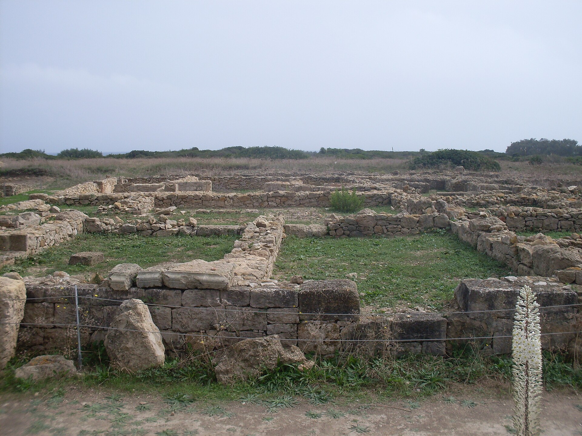
- Bathrooms and drains — Within the houses
Several Kerkouane houses had a dedicated washing room, and some keep a bath-shaped basin set into the floor. These small rooms are among the most human details on the site, evidence of domestic habits rather than temples or tombs. Drainage lines run beneath the streets as well, part of the same careful planning.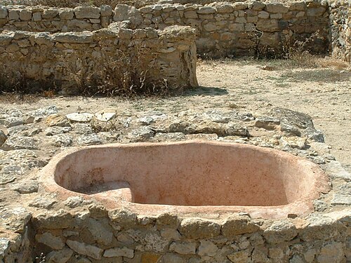
- The sign of Tanit in the mosaics — Floors of the excavated houses
Floors at Kerkouane carry simple mosaics, and the sign of Tanit, the goddess associated with Carthage, appears among them. They are minimalist, far plainer than the Roman mosaics found elsewhere in Tunisia, and easy to miss from the path. Slow looking and a few minutes of patience reward the effort.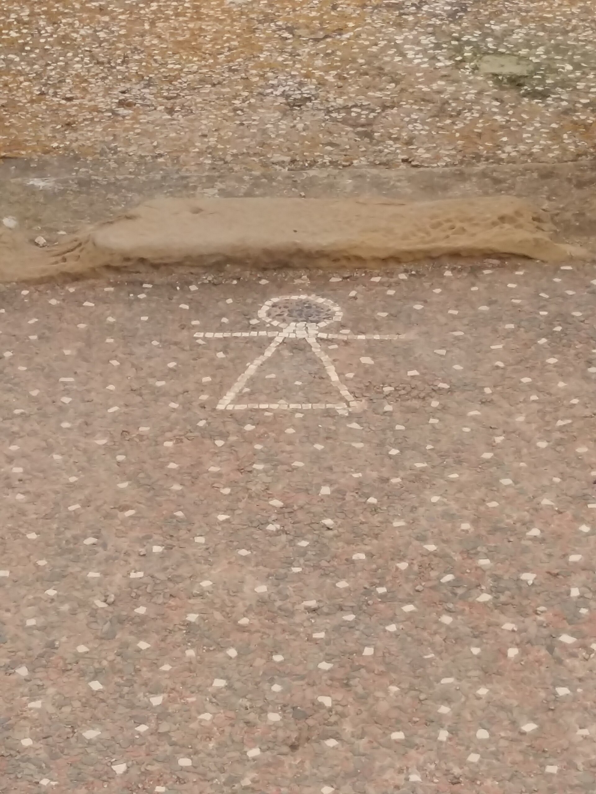
- The shoreline and old town square — Seaward edge of the site
The sea runs along the edge of Kerkouane and is often rough here, so the shore suits sitting and watching more than swimming. Visitors picnic in the old town square under a large tree. For a calmer swim, the beaches around Kelibia, to the south, are the usual choice.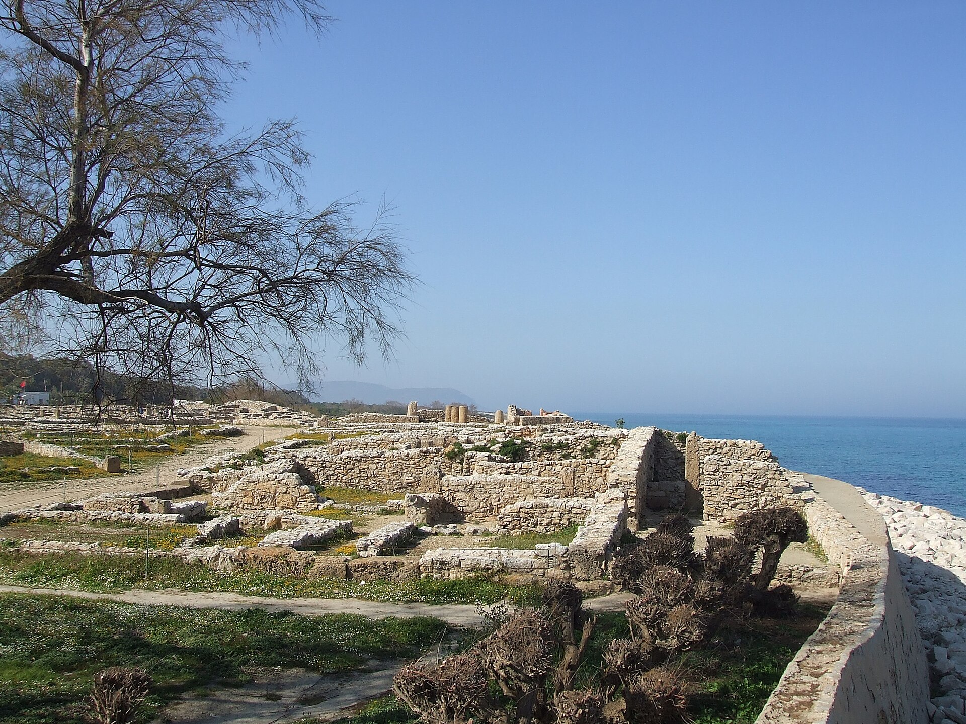
Culture
Kerkouane offers a view of Punic culture, the Phoenician-descended civilisation centred on Carthage, that is otherwise known largely through Greek and Roman writers, who were often hostile. Here the evidence is physical: houses, drains, tombs and the sign of Tanit. Religion is the clearest thread. Tanit appears in floor decoration, and the necropolis beside the town shows that the dead were given deliberate, organised resting places. The ruins also say something about domestic habits, since washing rooms and tidy courtyards suggest people who cared about comfort and order. Modern Cap Bon is farming and fishing country. Arabic is the everyday language, French is widely understood, and many Tunisians take pride in the Carthaginian past as part of a long local history that also includes Roman, Arab and Ottoman layers. The site itself is quiet and lightly staffed, with a calm, unhurried atmosphere that suits a short visit better than a rushed one. Conversations with staff at the museum or the gate are often friendly, and a few words of French or Arabic go a long way. Nearby Kelibia and El Haouaria are everyday working towns rather than resorts, and the pace there is set by local routines and the weather. Keep to the marked paths, do not climb or sit on the low house walls, and ask before photographing site staff or local families.
What to wear
Kerkouane has no surviving Punic clothing to show, so the dress of its people has to be inferred from the wider Phoenician world, which was known in antiquity for dyed and woven cloth. Tunisian traditional dress is easier to trace. Men wear the jebba, a long loose robe of wool or cotton, often with a red felt chechia cap. Women in towns have worn the white sefsari, a large wrap of silk or cotton, and coastal areas such as Cap Bon are associated with the fouta and blouza, a wrapped skirt and loose top. These appear mainly at weddings, festivals and in craft displays. Day to day, people in Kelibia and El Haouaria wear what most of the Mediterranean wears: jeans, shirts, tracksuits, lightweight jackets, and for many women a headscarf or long cardigan. A visitor should dress for sun, wind and uneven stone. A wide-brimmed hat, sunglasses and light long sleeves are worth having in summer, and a windproof layer helps in spring and autumn. Flat, closed shoes with grip suit the rough paths between the walls. In nearby towns, covered shoulders and knees are the polite default, and a scarf is useful if entering a mosque, where the rules differ and are best checked locally.
What to eat
- Brik — Cafés and snack counters in Kelibia
Brik is a thin pastry parcel, usually filled with egg, tuna, parsley and capers, then fried until crisp. It is a Tunisian staple and a good light lunch before or after the ruins. Eat it hot, and be ready for the egg to run. - Grilled fish — Seafront eateries in Kelibia and El Haouaria
Cap Bon is a fishing coast, and the usual order is whatever came in that morning, grilled with lemon and served with salad and bread. Pointing at the day's catch is normal. Local eateries by the harbour are the dependable choice. - Lablabi — Breakfast stalls and small eateries in town centres
Lablabi is a chickpea soup poured over torn stale bread and finished with olive oil, cumin, harissa and often a poached egg. It is cheap, filling and eaten early in the day. Locals customise it at the counter. - Fricassé — Bakeries and street counters
Fricassé is a small fried bun split and stuffed with tuna, olives, egg, potato and harissa. It is a handy picnic food, easy to carry to the old town square at Kerkouane. The fried dough is rich, so one is usually enough. - Mint tea with pine nuts — Cafés in Kelibia and other Cap Bon towns
Sweet green tea served in a small glass with a few pine nuts floating on top is the usual way to end a meal or take a break. Cafés are social places, mostly male-dominated in smaller towns. The museum shop at Kerkouane also sells drinks and snacks.
Plan it
Best time. April–May and October–November, when the weather is mild and walking the open site is comfortable. July and August are hot with little shade, and winter can be windy and wet on this exposed coast.
How long. 1
Getting there. Fly to Tunis, then take a louage (shared minibus) from Bab Alioua in Tunis to Kelibia, about 80 km away; there are no direct trains or buses on that route. From Kelibia, take a taxi to the site, or a local bus to the turn-off and walk about 1.5 km. Agree the taxi fare before setting off, since there are no meters.
Budget. low
Tips
- Base yourself in Kelibia if you want to stay locally; a day trip from Tunis, Hammamet or Nabeul also works.
- Allow about an hour for the ruins, plus time for the museum.
- Carry water, sun protection and a windproof layer, since there is little shade.
- Keep small change for taxis, snacks and tickets, and check the museum or local tourism office for current opening hours and prices.
- Combine the visit with a beach stop at Kelibia or a coastal walk at El Haouaria.
Etiquette
- Stay on marked paths and do not climb the low house walls.
- Ask before photographing site staff, taxi drivers or local families.
- Dress modestly in towns, with covered shoulders and knees.
Nearby
Sources
- Wikidata Q538061 (CC0)
- Wikipedia: Kerkouane (rev 1364715347) (CC BY-SA 4.0)
- Wikivoyage: Kerkouane (rev 5407017) (CC BY-SA 4.0)
- House in Kerkouane (Udimu) (CC BY 3.0)
- Kerkouane - panoramic view (CarlesVA) (Public domain)
- Kerkouane 002 (Touzrimounir) (CC BY 3.0)
- Kerkouane baignoire (Asram) (CC BY 3.0)
- Salle d'eau d'une maison à Kerkouane (Rais67) (Public domain)
- Vu sur des maisons du site archéologique de Kerkouane (Rais67) (Public domain)
- Hauptabwasserleitung in Kerkouane (Kritzolina) (CC BY-SA 4.0)
- Banc à l'extérieur du musée de Kerkouane (Hamdikhouloud) (CC BY-SA 4.0)


