Jim Corbett National Park
Jim Corbett National Park, India
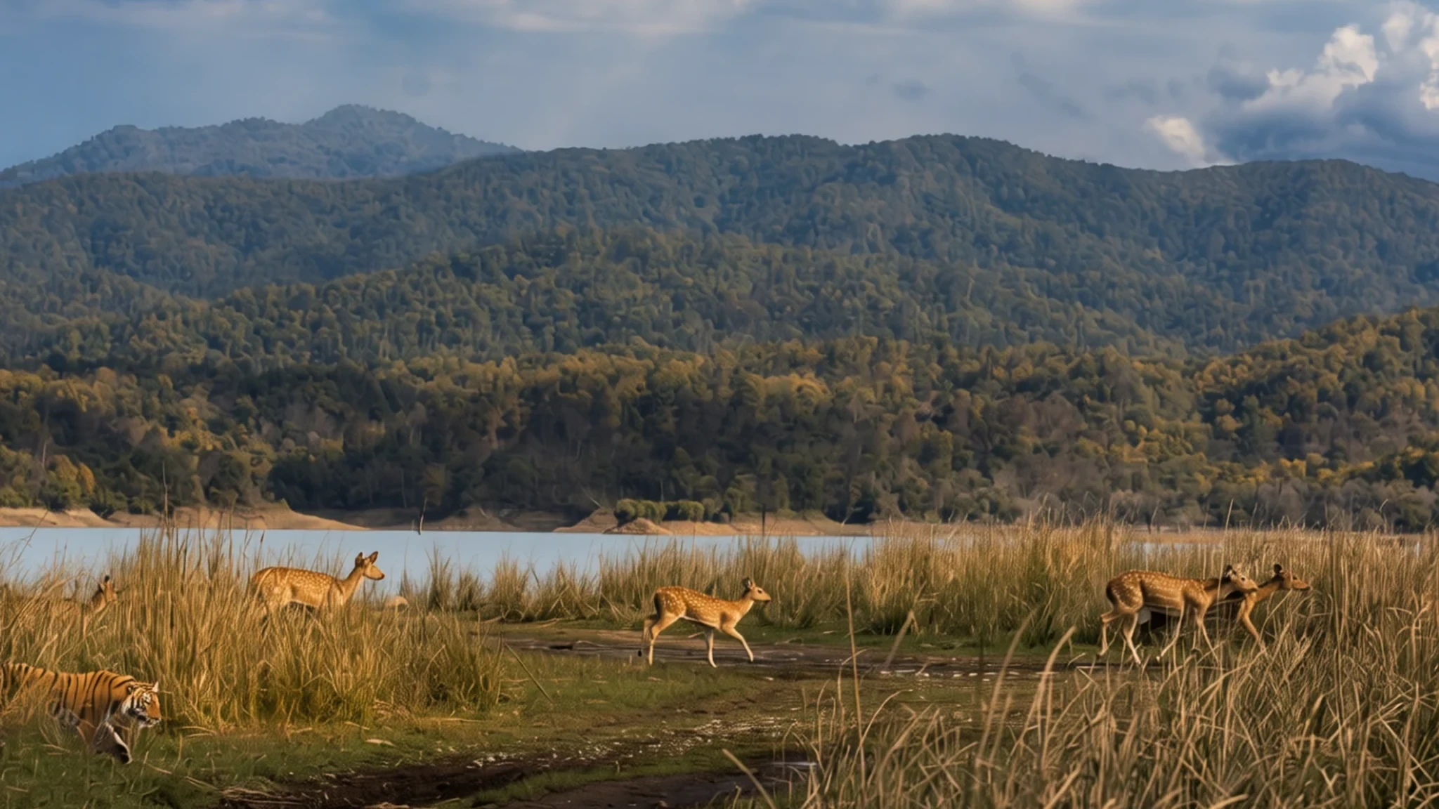
Jim Corbett offers grassland, sal forest and jeep safaris in search of tigers, elephants and deer, though the main zones close for the monsoon.
The place
Jim Corbett National Park lies in the Nainital district of Uttarakhand, spread across the Doon Valley between the Lesser Himalaya to the north and the Siwalik Hills to the south. For a park of its size the ground is remarkably varied: rounded hills, river belts, marshy hollows, open grassland and a large reservoir. Most of the land is moist deciduous forest, with sal as the main tree and peepal, rohini and mango scattered through it. The grasslands, called chaurs, are where most visitors spend their safari time, because open ground makes animals easier to spot, especially early in the morning.
The monsoon sets the rhythm of a visit. The rains arrive in summer, and the two main zones, Dhikala and Bijrani, close for the wet season, so the usual visiting window runs from late autumn into spring. Winter mornings are cold and often misty, and the grasslands sit under a pale haze that lifts after sunrise. Late spring is hot and dusty, which thins the undergrowth and draws animals to the water. The Jhirna and Sitabani buffer zones stay open all year, which makes them a useful fallback in summer.
Corbett is not a remote wilderness cut off from everything. The usual gateway is Ramnagar, and the park lies about two hours' drive north of the town. Inside, accommodation is limited to a handful of guesthouses and camps, and wildlife watching happens on set routes in jeeps rather than on foot. Expect the popular zones to fill up in peak season, and expect the forest to go quiet once the heat builds.
Its story
Jim Corbett National Park began as forest that many people had cut, farmed or hunted over for generations. Parts of the land once belonged to the princely state of Tehri Garhwal. Its ruler handed a section to the East India Company in return for help pushing the Gurkhas out of the region, and the forests were cleared partly for security reasons as much as for farming. Buksas, a people from the Terai lowlands, settled there and grew crops, but British rule brought their farming to an end in the decades that followed.
Protection came later and in stages. In the nineteenth century, Major Ramsay, the British officer in charge of the area, pushed for controls. The forest department took direct control, banned cultivation and the running of cattle stations, and turned the land into a reserve where tightly limited felling was allowed.
The idea of a true national park took shape in the early twentieth century. Officials such as E. R. Stevans and E. A. Smythies proposed one, and the colonial administration considered a game reserve. Marking out the boundaries only got under way in the 1930s. In 1936, when Sir Malcolm Hailey was Governor of the United Provinces, a reserve known as Hailey National Park was created, and it was Asia's first national park. The park was later renamed after Jim Corbett, who had been closely involved in its creation.
What to see
- Dhikala grasslands — Dhikala zone, core area
Dhikala is the park's best-known zone, with its forest rest house on the banks of the Ramganga River. From there you look out over the reservoir and the open grasslands, called chaurs, where elephant herds can be seen feeding in the long grass with sal forest rising behind them. The guesthouse is in high demand, so book well ahead.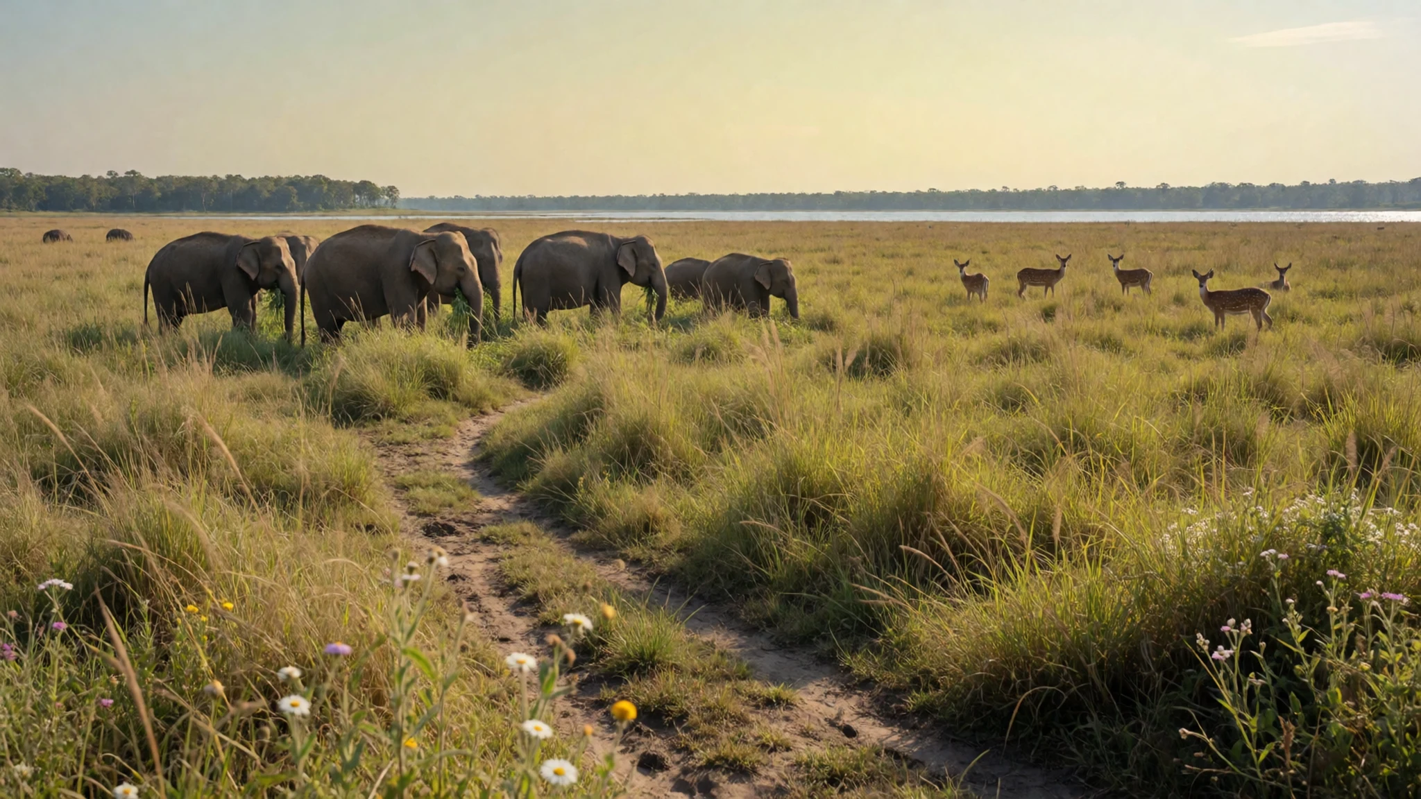
- Bijrani zone — Bijrani zone, closed in the monsoon
Bijrani was once part of a shooting block used by British hunters. Today it is a drier zone with more varied vegetation than Dhikala, and tigers have been photographed on its open tracks. It is worth a visit for a different mix of habitats, though sightings are never guaranteed on any single drive.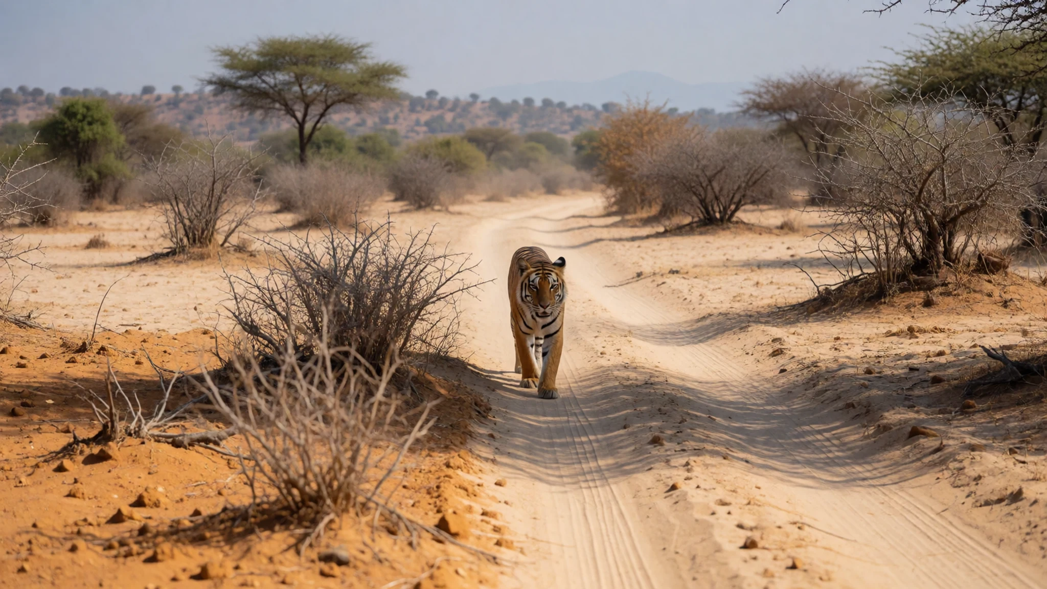
- Ramganga riverbanks — Along the Ramganga, near Dhikala
The Ramganga River runs through the park, and in the scorching summer months wild elephants come to its banks to wallow in mud and cool down. Watching them from a safe distance, usually from a vehicle, is one of the more memorable parts of a visit. Keep to the distance your guide suggests and never step out to get closer.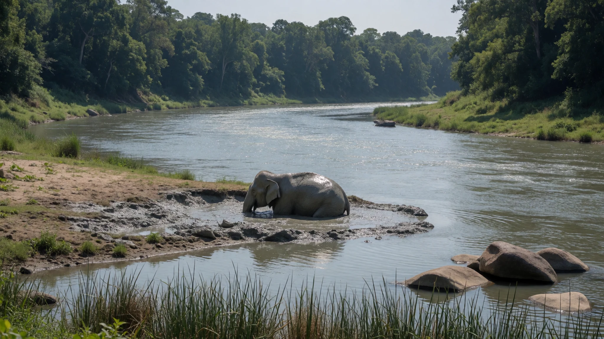
- Morning grasslands near Dhikala — Grasslands near Dhikala
Early morning is when the landscape looks its most atmospheric, with mist hanging over the grasslands until the sun burns it off. Plan your first safari to set off before the light is fully up, and expect the air in an open jeep to be cold even when the day warms quickly. Layers matter more than you think.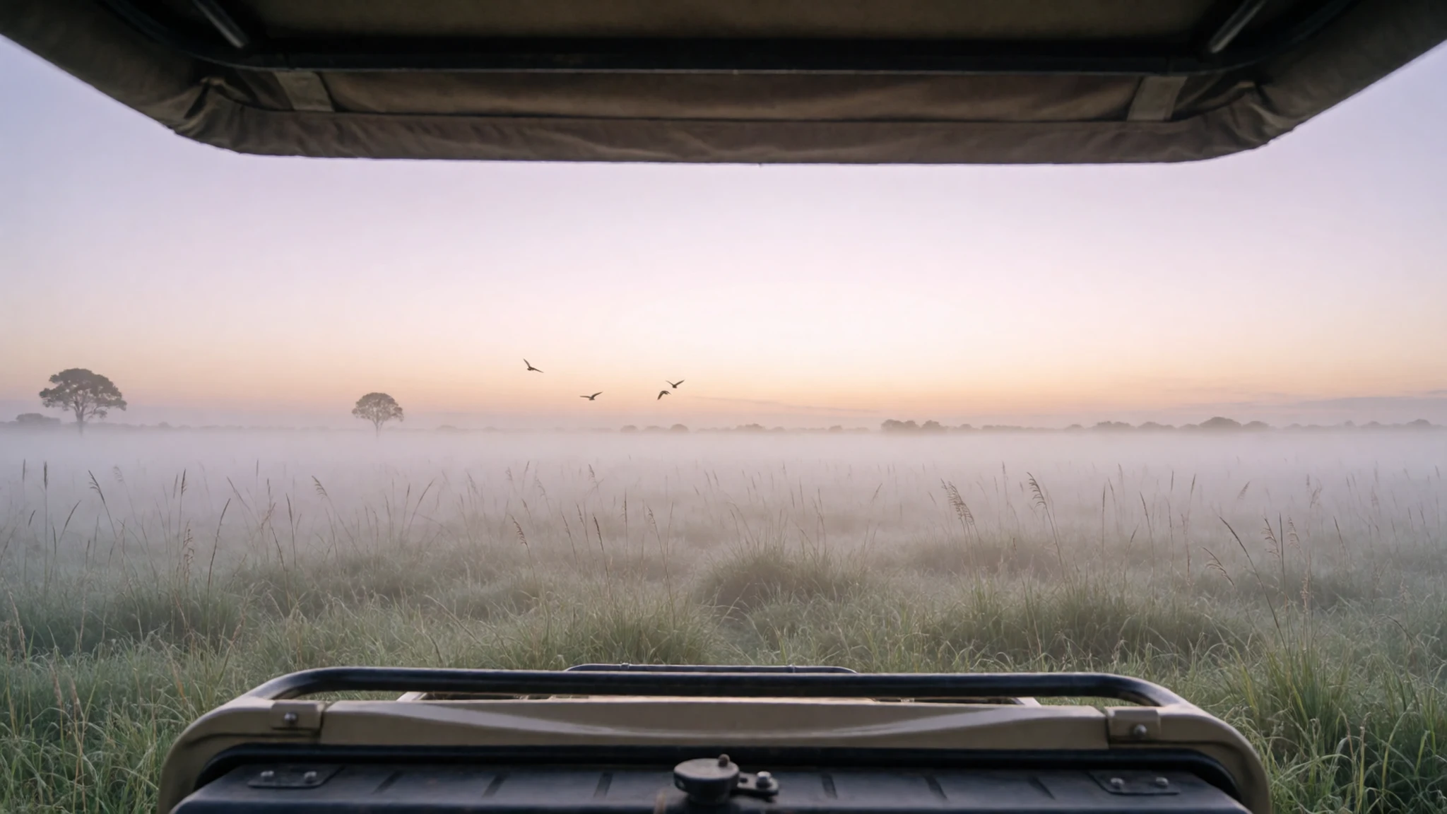
- Jhirna and Sitabani — Buffer zone, open year-round
Jhirna and Sitabani sit in the buffer zone and stay open all year, which makes them the practical choice when the main zones are closed. They offer a more limited set of experiences than the core areas, but they suit summer visits and shorter trips well, and they let you see the park's edges without committing to a long stay inside.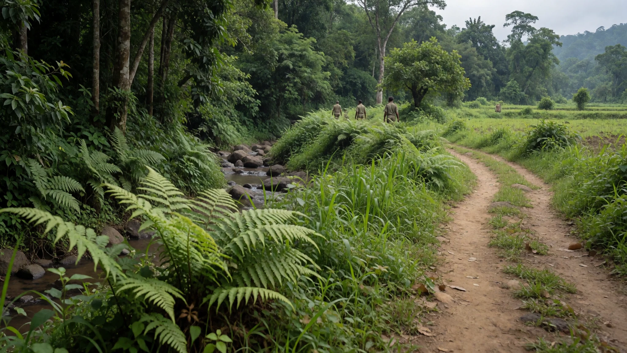
Culture
Jim Corbett National Park sits in a region where Kumaoni and Garhwali communities have long lived close to the forest, and village life shapes the edges of the reserve. Many people here follow Hindu practice, and the pilgrim routes into the hills, including the shrine at Yamunotri in neighbouring Uttarkashi district, draw devout visitors from across India. Much of daily life revolves around farming, small trade and the visitor economy that has grown up around Ramnagar.
Forest guides and drivers are the people who make a safari work, and it is customary to tip them at the end of a trip, in line with the service you have had. Take care with what you eat and drink: non-vegetarian food may not be brought inside the park, and alcohol is also banned there, so leave both out of your bag and your vehicle. Quiet matters as much as courtesy on a jeep ride, so stay seated and keep your voice low when animals are close.
What to wear
Traditional dress in the Kumaon hills is practical and built for cold. Women have long worn a full skirt with a wrapped shawl, and wool woven in the hills has been the main textile, sturdy and warm enough for mountain winters. Men have traditionally worn woollen caps and layered jackets. You may see some of these pieces at local fairs and in the markets around Ramnagar, though the older styles are less common in everyday life.
Most people now wear ordinary Indian and Western clothing: trousers and kurtas, jeans with cotton shirts, and sweaters and jackets through the cold months. Younger people in the towns dress much as they would in any city, while older villagers often keep to muted colours and woollen layers.
For a visit, dress for the terrain and the climate. Choose muted greens, browns and greys, because local advice is that bright clothing attracts animals. Mornings in an open jeep are cold even when afternoons are warm, so bring a fleece or windproof layer, a hat and sunscreen. Wear closed shoes with grip, because forest paths and river edges are uneven. At temples or pilgrim sites outside the park, cover your shoulders and knees.
What to eat
- Kumaoni thali — A resort café on the park's edge
A thali is a set meal of several small dishes on one plate, and in the Kumaon hills it tends to centre on lentils, seasonal greens and rice or flatbread. Ask for local Kumaoni dishes at the café attached to a resort on the park's edge, which specialises in local and traditional Indian cooking.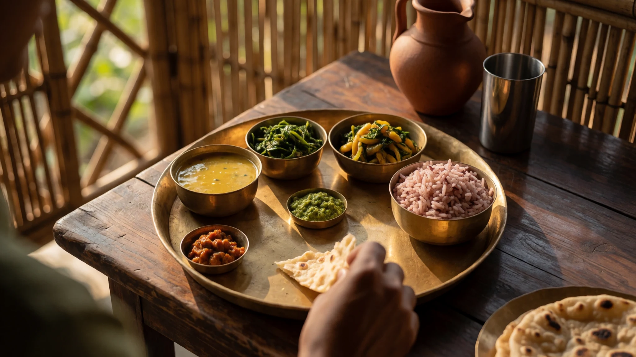
- Mandua roti — Village eateries and guesthouse kitchens near the gates
Finger millet, known locally as mandua, makes a dense, earthy flatbread that is often served with a lentil dish or a green vegetable. It is more common in home kitchens and village eateries than in tourist restaurants, so ask a guesthouse cook or a small eatery near the park gates.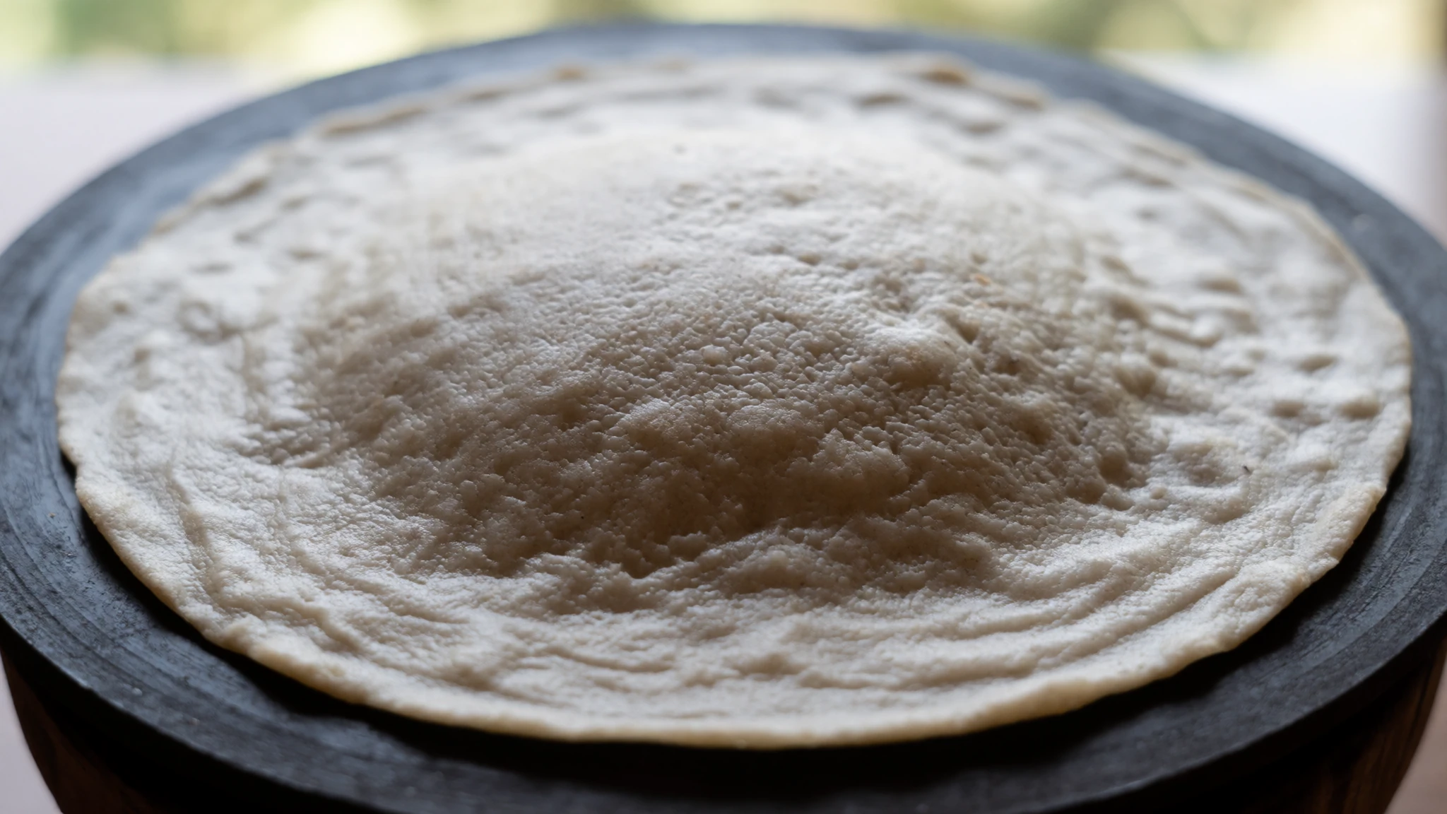
- Aloo ke gutke — Guesthouse canteens at Dhikala or Gairal
Small cubes of potato fried with cumin, chilli and a little ginger make a simple home dish that often turns up as a side on thali plates. Ask for it at the canteens of the Dhikala or Gairal guesthouses, if it is on the day's menu, where the food is simple and vegetarian. - Chai with pakoras — Roadside stalls at Dhangari gate and Ramnagar market
Sweet, milky tea poured hot from a roadside stall, served with pakoras, crisp vegetable fritters made with gram flour and green chilli. Stalls by the Dhangari entrance gate and in the Ramnagar market are the usual places for a snack before or after a drive. - Dal and rice — Guest canteens inside the park and eateries near the gates
Dal and rice on a steel plate is the everyday meal in the guesthouse canteens and eateries near the gates. It suits the park's rules well, since non-vegetarian food is not allowed inside. It is filling after an early start and cheap to eat, and it is the safest choice if you want a simple meal between safaris.
Plan it
Best time. Mid-November to mid-June, when Dhikala and Bijrani are open. November to February is cool and clear, with misty mornings; March to May is warmer and drier, and it gets hot by early summer. The monsoon closes the main zones from mid-June to mid-November, so plan around it.
How long. 2–3
Getting there. Ramnagar is the usual gateway, reached by road, and the park is about two hours' drive north of the town. For the last leg, arrange a vehicle from Ramnagar or through your guesthouse, and check the official site for transport options from Delhi.
Budget. mid
Tips
- Book guesthouses well ahead, since Dhikala and Gairal are the most sought after; advance bookings go through the tourism office in New Delhi, and on-the-spot bookings are possible at Ramnagar.
- Stay at Dhikala if you can, because its guesthouse sits in the core area and safaris start close to the animals.
- Go out at first light; sightings tend to be better in the early hours, and the forest goes quiet in the midday heat.
- Plan more than one safari, since tigers are not common and a single drive can easily miss them.
- Carry cash and water, and check the official site for current fees and opening details before you travel.
Etiquette
- Wear muted clothing, because bright colours attract animals.
- Do not bring food into Dhikala, where groups of monkeys will try to take it from you.
- Do not walk alone in the early morning or at night.
- Leave alcohol and non-vegetarian food outside the park, since both are banned inside.
Nearby
Sources
- Wikidata Q949297 (CC0)
- Wikipedia, Jim Corbett National Park (CC BY-SA 4.0)
- Wikivoyage, Jim Corbett National Park (CC BY-SA 4.0)
- Elephants in grassland, Dhikala (Timothy Gonsalves) (CC BY-SA 4.0)
- Bengal tiger, Corbett (Soumyajit Nandy) (CC BY 3.0)
- Calm and Clear (Sumatgupta) (CC BY-SA 4.0)
- Morning Mist Dhikala (Timothy Gonsalves) (CC BY-SA 4.0)
- Juvenile northern plains gray langur (Giles Laurent) (CC BY-SA 4.0)
- Wilderness, Corbett National Park (Rahul Nandi) (CC BY-SA 4.0)
- A spotted deer (Stag) (Subhrajyoti07) (CC BY-SA 4.0)
- Tusker, Corbett (Prateek0711) (CC BY-SA 4.0)


