Japanese Alps
Japanese Alps, Japan
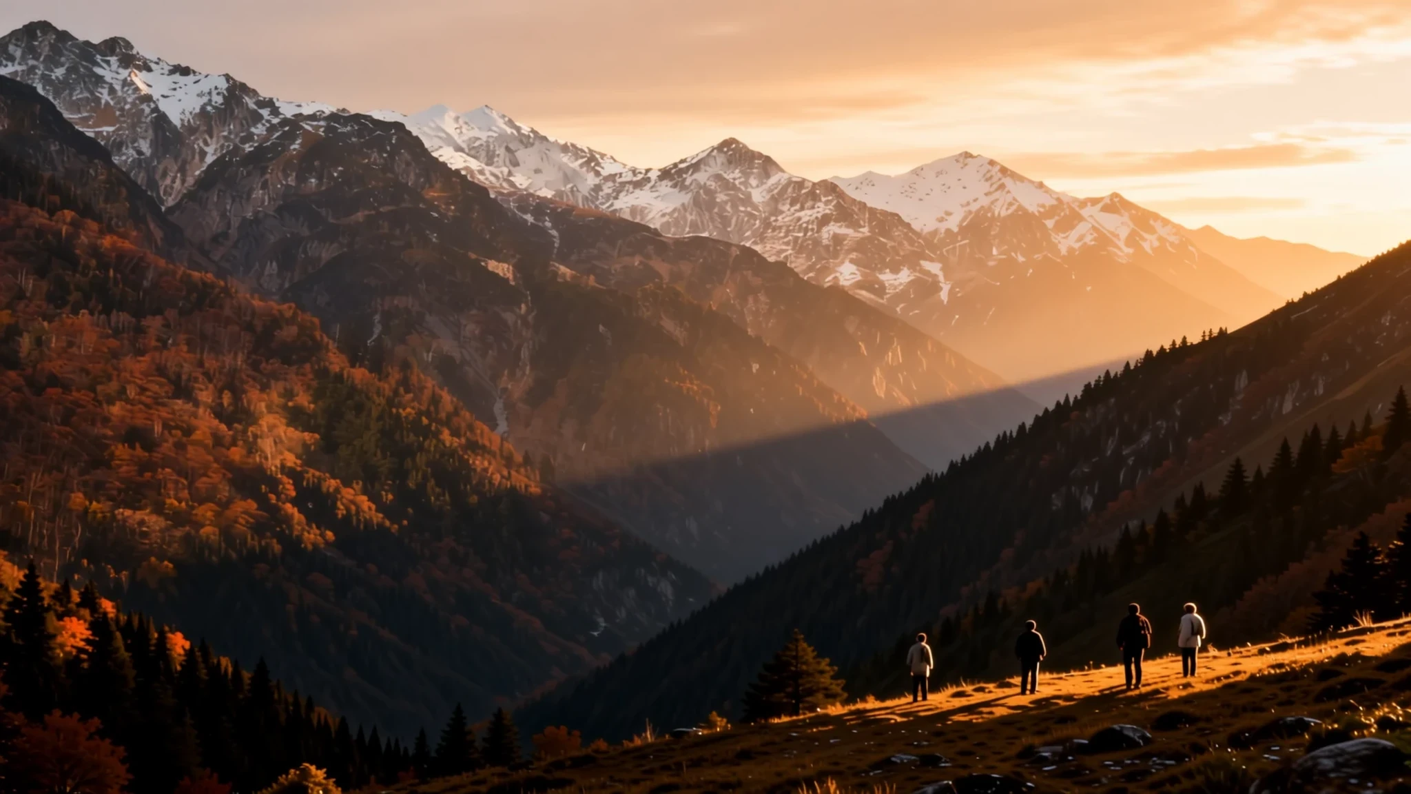
For alpine trails, deep-sky stargazing, and the smell of pine air far from Tokyo’s noise.
The place
The Japanese Alps (Nihon Arupusu) are not a single chain but three distinct ranges—Hida, Kiso, and Akaishi—that cut vertically through the spine of the main island, Honshu. Together they form a continuous wall of granite ridges, deep valleys, and high plateaus that bisect the country’s population centres. To the east lies the Kanto plain; to the west, the Sea of Japan. Because they divide the island, weather systems split here, making microclimates intense. One side of a ridge might be in full sun while the other is wrapped in fog.
Hida, the central and highest section, is the core of the range, home to the Hakuba basin, a valley famed for its powder snow and alpine grasslands. Further south, the Kiso Mountains descend towards the Pacific coast, while the Akaishi range connects the central spine to the southern highlands. The terrain is rugged and vertical. Steep ravines, often called 'gorges,' are carved by fast-flowing rivers fed by snowmelt. Travel is limited to narrow passes, tunnels, and winding roads that follow the riverbeds. High winter snowfall frequently restricts access to remote trails and peaks, turning the range into an isolation zone. In summer, however, the air coolness and the larch forests contrast sharply with the urban heat of the plains, drawing hikers, climbers, and those seeking solstice quiet.
Its story
The narrative of the range is etched in deep time and human persistence. For centuries, the mountains were not landscape but resource: timber, fuel, and medicine extracted by local communities who navigated the steep terrain with intimate knowledge. Buddhist monks and Shugendo practitioners established ascetic hermitages on high peaks, treating the harsh environment as a path to spiritual purification.
The modern identity of the 'Japanese Alps' is a 19th-century invention. In the 1860s, archaeologist William Gowland first viewed this terrain as forming one unified landscape akin to the European ranges, whereas Weston later documented two primary mountain systems defined by distinct geological formations. This comparison was amplified by the missionary Reverend Walter Weston, whose writings popularised the name and mapped the routes for early Western auditors. However, this external framing remained detached from the local reality for half a century. Local mountaineers in the 1890s explored the ranges practically, often without reliable maps, dividing them into north, central, and south zones based on customary geography.
The range also holds a martial history. In 1584, Sassa Narimasa’s forces executed the 'Sarasara-goe' (Sarasara crossing), a rapid winter traverse across the Hida high passes (Zara and Harinoki) that was considered a military feat of genius and terror. Today, the range is a venue for high-altitude hiking and avalanche research, bridging the gap between its sacred, utilitarian past and its contemporary status as a premier alpine destination.
What to see
- Hakuba Valley — Nagano Prefecture, Hida Range
The eastern face of the Hida range, accessible via the Tateyama Kurobe line. In spring, the 'snow walls' (yukigunbi) tower over the valley floor, creating dramatic vertical layers of compacted slush. It is the hub for alpine hiking, with multiple trails leading to sub-alpine lakes and high passes. The air here is thinner and cooler than the plains, perfect for extended trekking.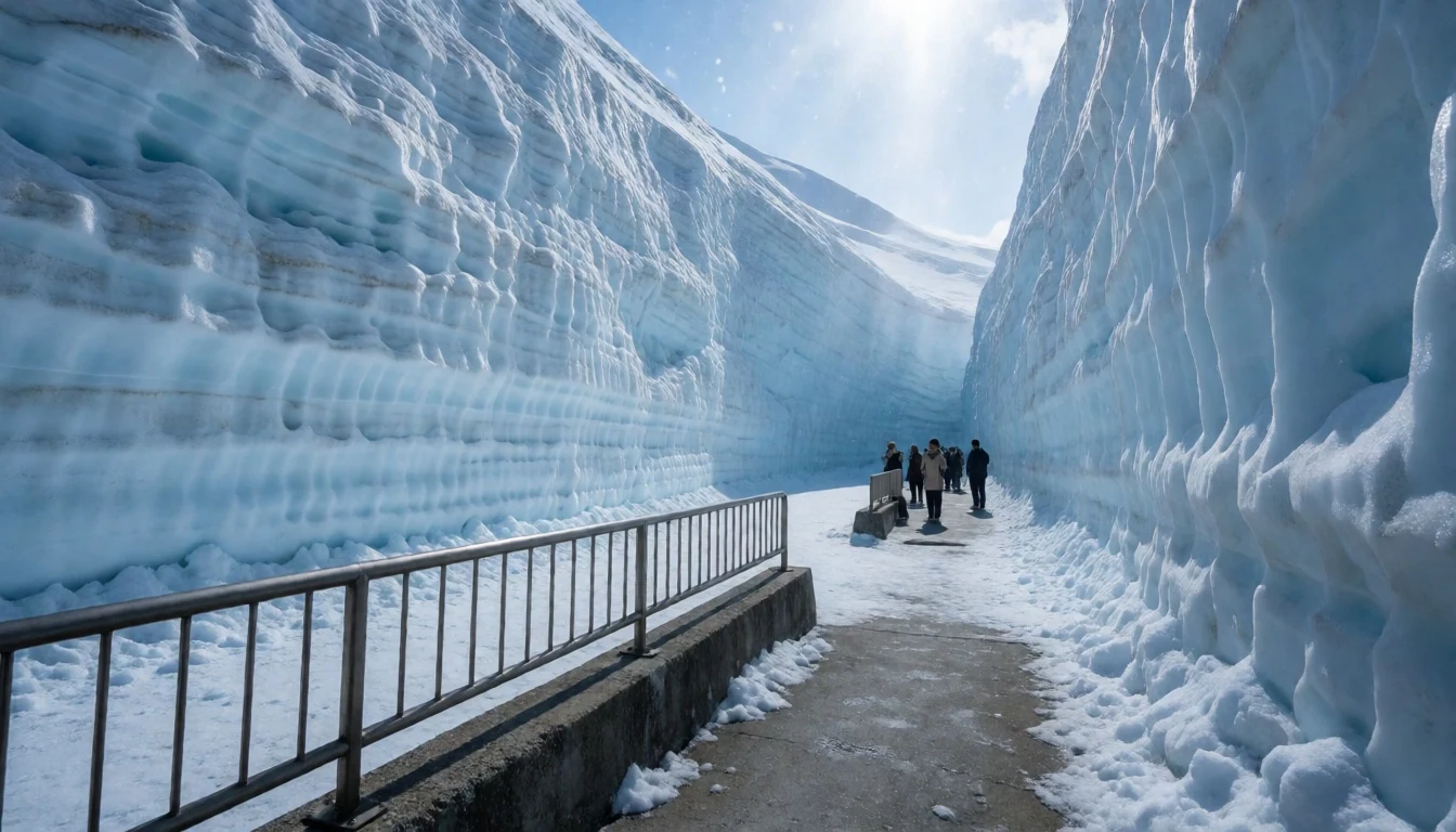
- Kamikōchi — Nagano Prefecture, Hida Range
A high-altitude valley in the Hida range, home to several alpine lakes with turquoise-green water. The area is a major centre for Shugendo practice, with trails leading to sacred waterfalls and shrines. It is easily reached by bus from neighbouring town, serving as a gateway for the famous Yari-gatake (Mount Yari) peaks, famous for its distinctive, four-faced pyramidal shape.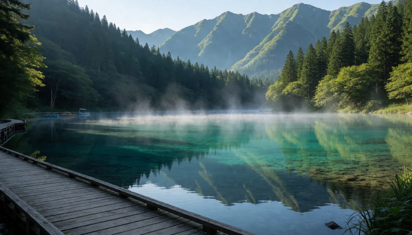
- Akaishi Mountains — Nagano/Yamanashi Prefecture, Akaishi Range
The southern extension of the spine, bordering the Ina basin. This range features rugged peaks and deep valleys that drop sharply towards the Pacific coast. The scenery here is wilder and less commercialised than the Hida section, with trails following the Aizu-Kawa river. It offers excellent visibility of the range's geological structure and serves as a major watershed boundary.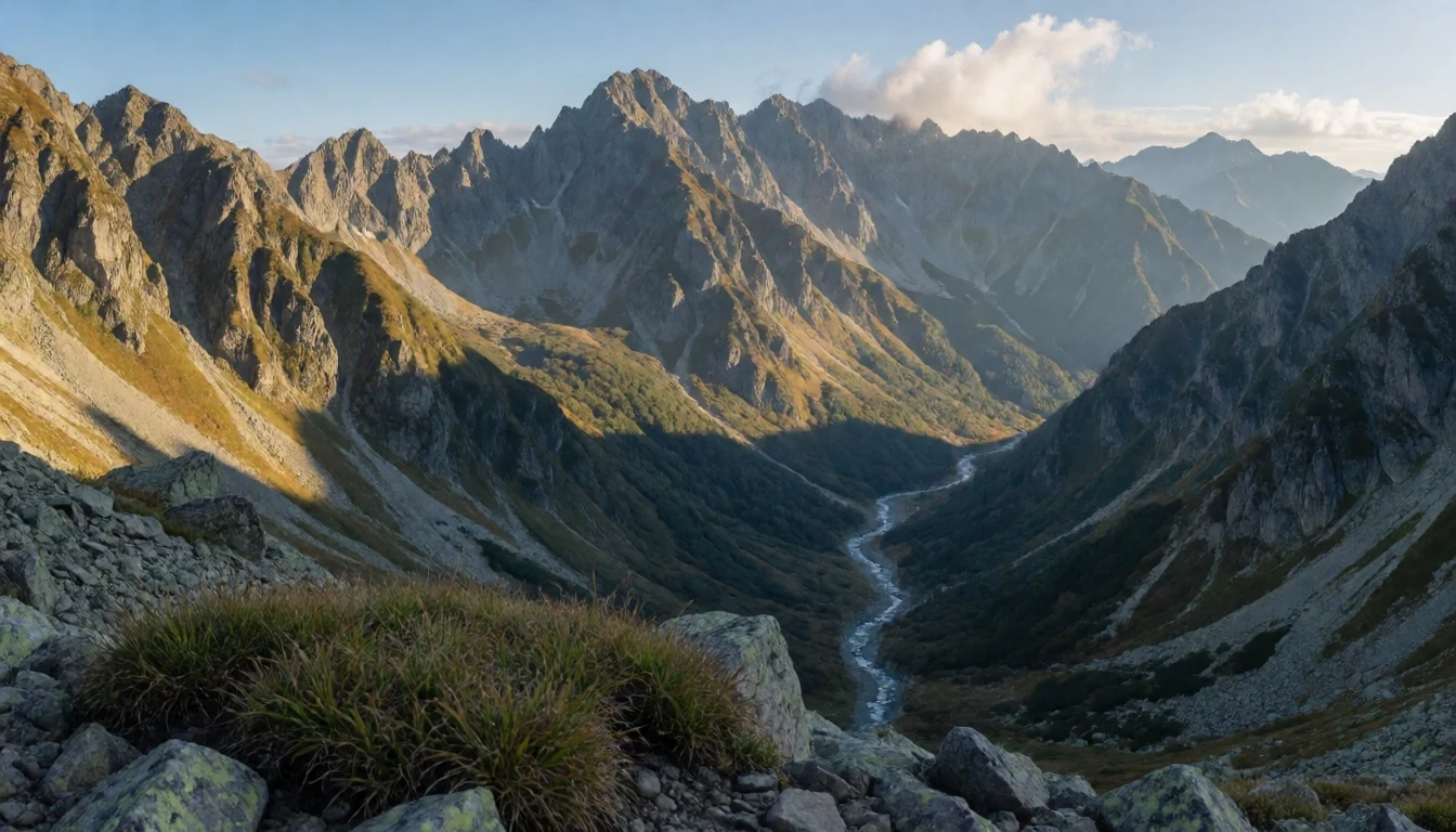
- Alpine Route Highway — Nagano/Gifu Prefecture, Kiso Range
A scenic arterial road traversing the range, connecting the Pacific and Sea of Japan sides. It passes through the Kiso section, featuring larch forests ('hinoki') that turn gold in autumn. The drive itself is a voyage, with switchbacks navigating narrow ravines. It is the primary access for those avoiding long rail journeys into the remote interior of the mountain spine.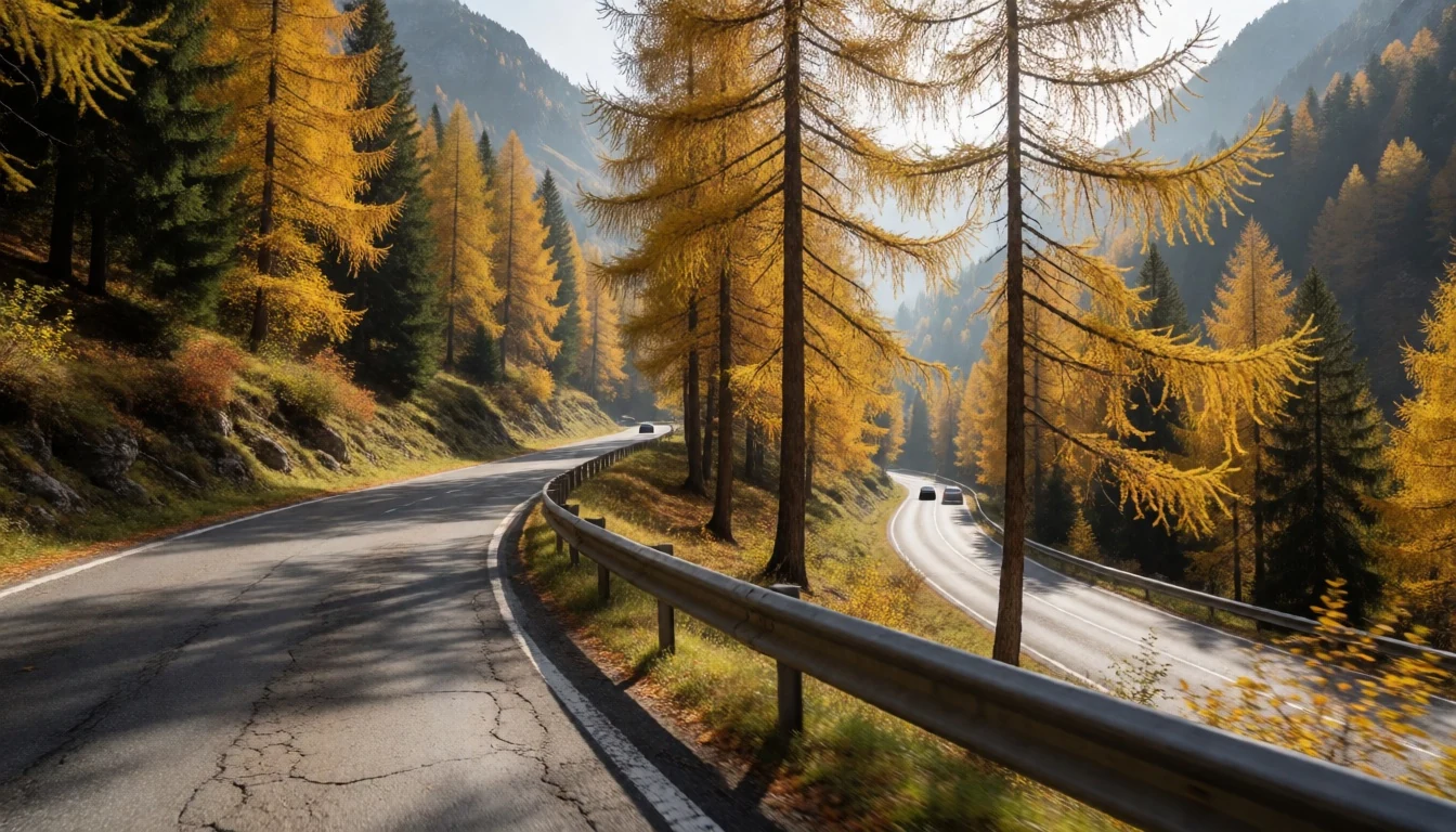
Culture
The culture of the Japanese Alps is a synthesis of mountain asceticism and resourceful survival. The Shugendo tradition, combining Shinto and Buddhist practices, left a legacy of mountain temples where rituals were performed in exposed, vertical locations. This is not just a tourist façade; local communities maintain these sites, and the landscape is still treated with a sense of reverence for its power.
Harsh winters and isolated valleys fostered a self-sufficient culture. The forest here provided timber for construction and fuel, but also the raw materials for paper-making and sake brewing. The isolation meant that local dialects and customs persisted, distinct from the urban influences of nearby cities.
Today, the balance between preservation and tourism is delicate. The mountains are a national treasure, but also a fragile ecosystem. Visitors arrive seeking spiritual quiet or athletic challenge, but the underlying ethos remains one of respect for the environment. The pristine nature of the range is a result of both geographical barriers and cultural stewardship.
When visiting mountain shrines or ascetic sites, it is important to move quietly, avoid touching sacred objects, and leave no trace behind.
What to wear
Traditional attire in the mountainous regions of Japan is deeply tied to function. Historically, the 'yukata' and 'kimono' made from local hemp or indigo-dyed cotton were worn, but in the high mountains, practicality ruled. Wool and heavy wool blends were common, with specific hats and gloves designed to withstand heavy snow loads. In modern times, traditional formal wear is rarely seen outside of specific festivals or funeral rites.
Contemporary locals and visitors alike dress for alpine conditions. The standard is functional mountain gear: waterproof hardshells, insulated puffy jackets, and technical hiking boots. In winter, layers are essential; a base layer of merino wool, an insulating mid-layer, and a windproof outer shell are the norm. Rain protection is crucial given the heavy precipitation.
Visitors should pack for a full range of weather, even in summer. Temperatures drop significantly with altitude. Non-slip footwear with good ankle support is mandatory for trail walking. If visiting sacred sites, dress modestly, covering shoulders and knees, but wear sturdy, clean footgear appropriate for uneven, potentially muddy terrain.
What to eat
- Yamame (Freshwater Trout) — River-side inns in Nagano/Gifu valleys
Crisp-fried or served as hotate (kama) at mountain inns. The small, jade-striped fish is caught in the cold, clear rivers of the valleys. It is a staple of the mountain cuisine, symbolising the purity of the water and the traditional fishing methods still used by local families.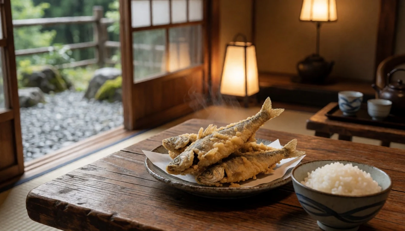
- Ito Dofu — Mountain inns and farm-to-table restaurants
A traditional, thread-like tofu made from soybeans, unique to the mountainous regions. It is delicate, slippery, and often served in clear dashi broth. It highlights the local abundance of high-quality water and soybeans, which thrive in the cool mountain climate.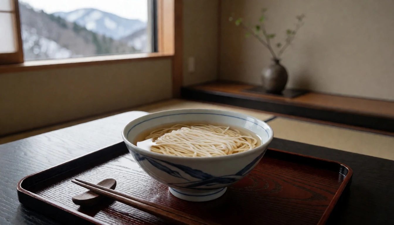
- Kiso Beef and Mountain Vegetables — Local restaurants in Akaishi/Ina valleys
Robust beef dishes featuring local root vegetables like burdock (gobo) and lotus root (renkon). These vegetables grow underground in the valley soils and are slow-cooked or served pickled with shoyu. The dish reflects the agricultural resilience required in the short growing season. - Nabe (Hot Pot Dishes) — Local cafes and inns
Communal pots used in winter, often containing mountain greens, mushrooms (such as matsutake), and tofu. They serve as warming refuels after a day of hiking. Specific regional varieties exist, highlighting the foraged fungi and leafy vegetation of the forest floor. - Mochi with Red Bean Paste — Station snacks and hilltop cafes
Steamed or grilled rice cakes, available year-round at mountain viewpoints. They are a convenience for hikers, requiring no utensils and providing quick carbohydrates. The red bean paste (anko) offers a sweet, warm finish to the savory mountain diet.
Plan it
Best time. Late spring (May) for fresh green landscapes and wildflowers; late autumn (October-November) for larch and maple colours. Winter is for snow sports, but heavy snow often closes trails.
How long. 3–4
Getting there. Fly into Chubu Centrair or Osaka Kansai. Take the Shinkansen to Nagoya or Takayama. From Takayama, reserve a taxi or rental car to reach the valley bases, as bus routes are limited and infrequent.
Budget. mid
Tips
- Carry cash for mountain cafes and simple meals.
- Reconfirm trail closures due to snow or weather before departure.
- Start hikes early to avoid afternoon thunderstorms.
- Water supply on high trails may be limited; carry a filter or enough bottles.
Etiquette
- Stay on marked trails to protect fragile alpine grassland.
- Pack out all waste; bin counts are limited in the wilderness.
- Respect quiet at sacred waterfall or shrine sites.
Nearby
Sources
- Wikidata Q645773 (CC0)
- Wikipedia (rev 1382620725) (CC BY-SA 4.0)
- Wikivoyage (rev 5264505) (CC BY-SA 4.0)
- Photo 01: Japanese Alps (Hakuba peaks) (CC BY 3.0)
- Photo 02: View of Japanese Alps from Mt. Yatsugatake (CC BY 3.0)
- Photo 03: Akaishi Mountains and Ina Basin (CC BY 3.0)
- Photo 04-08: Alpine route views (CC BY-SA 4.0)


