Huanglong
Huanglong, People's Republic of China
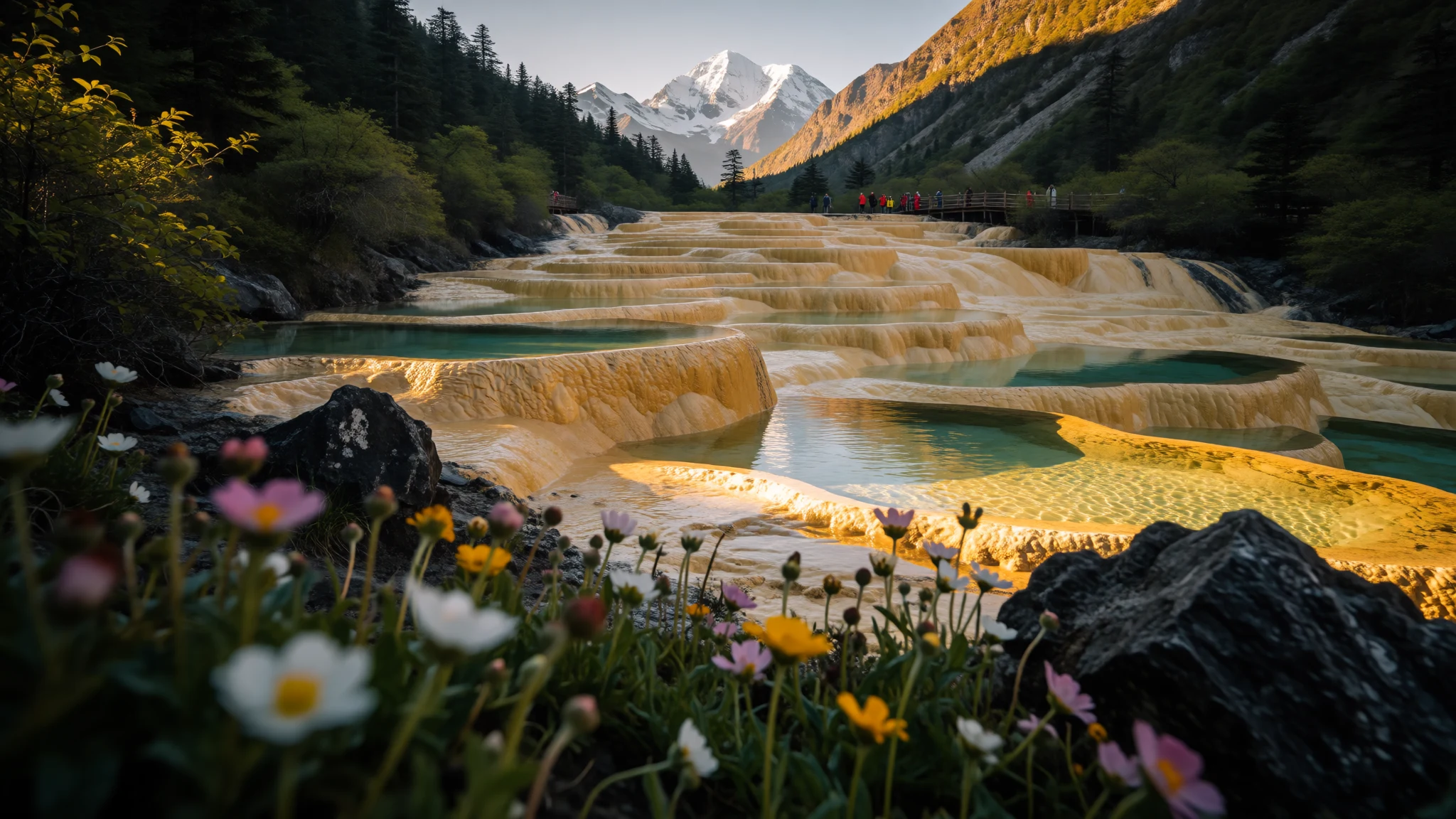
A high travertine landscape of coloured pools, snow peaks and forest in Sichuan, best seen as a single long day from Jiuzhaigou.
The place
Huanglong sits in the southern part of the Minshan range in northwest Sichuan, roughly 370 km north-northwest of Chengdu. The name means yellow dragon, and the reason becomes clear once you reach the valley floor. Mineral-rich water has been spilling down the slopes for a very long time, leaving behind terraces, banks and small dams of travertine, the pale rock that builds up where calcium-laden springs meet the air. Where the water lies still and shallow, it shifts through turquoise, emerald and milky blue depending on the light and the depth.
The park spans a wide range of altitude, from about 1,700 m up to 5,588 m at Xuebaoding, the highest peak in the Min Mountains. Most visitors never get near that summit. They walk the main valley, where the travertine runs for about 3.6 km, and climb gently past pools and waterfalls. Side valleys hold conifer forest, snowfed streams and hot springs, and the wider area supports rare wildlife, including an orchid found nowhere else.
The site has been a World Heritage Site since 1992, and it remains a protected scenic and historic interest area. The colours change with the light, the season and the water level, so no two visits look quite the same.
Its story
Huanglong's landscape is the product of ice, water and rock working together over a very long time. Repeated glaciations carved the valleys and left behind meltwater that carried dissolved minerals downhill. Where the bedrock is limestone, slightly acidic water picks up carbonate as it moves, then deposits it again as tufa when the water loses its dissolved gas and slows down. Over centuries, these deposits have built up dams, basins and steps, and the basins gradually fill with colour.
The high altitude adds its own effect. Strong, clear sunlight at this height, which sources describe as Arctic-alpine light, sharpens the tones in the shallow water and makes the pools look lit from within. Nobody planned any of this. The processes ran far beyond human timescales, long before anyone surveyed the valley.
Local communities in the surrounding mountains have lived alongside these valleys for generations, using the land and its streams. Outside attention arrived later. Chinese authorities listed the area as a World Heritage Site in 1992, which brought formal conservation rules and a stronger focus on protecting the travertine. The main challenge now is simple: the deposits are delicate, and footprints, touching and litter can change them quickly.
What to see
- Five-Coloured Pond — Huanglong Valley
The pool most photographs show: a shallow basin where the water takes on layered blues, greens and gold according to the light and the depth. The travertine rim is thin and breaks easily, so admire it from the boardwalk and keep your distance from the edge. Viewing points get crowded in the middle of the day, so arrive early if you want room to frame a shot.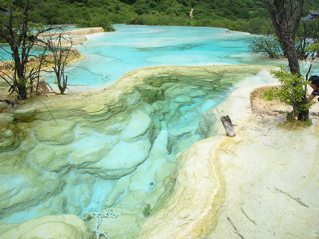
- Huanglong Valley terraces — Huanglong Valley, the main park route
The main route follows a valley lined with travertine banks, coloured ponds and small waterfalls, some sliding over the rock almost sideways. The travertine here totals about 3.6 km, so the walk up the valley is the heart of the visit. Look at each pool from more than one angle, because the colour shifts with cloud and sun.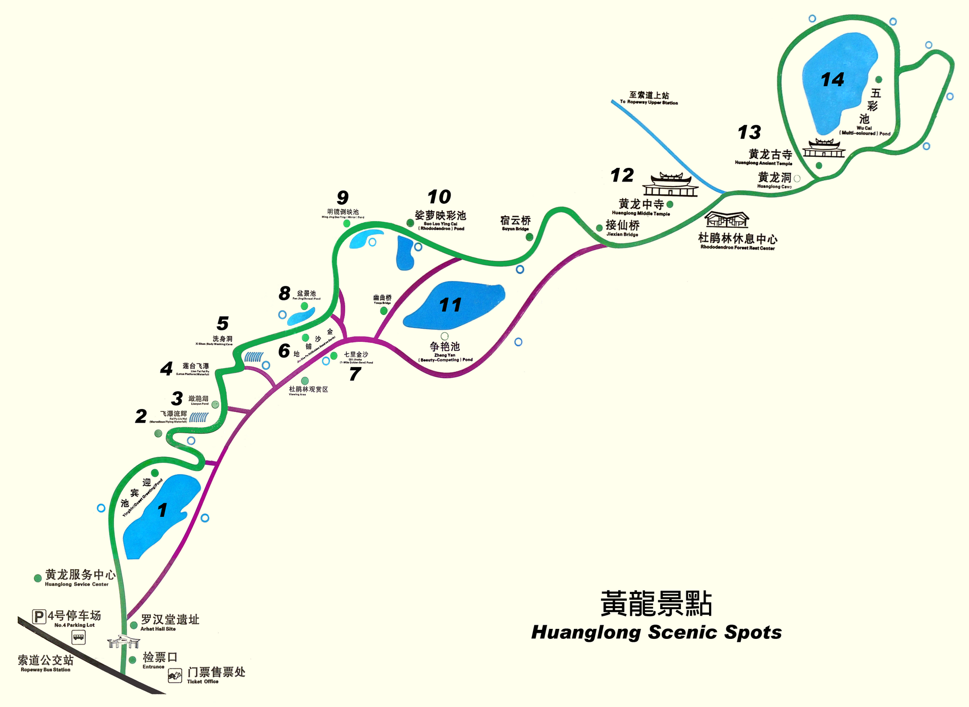
- Danyun Gorge — Danyun Gorge, beside the main valley
A deep canyon, more than 1,000 m deep, with a name meaning red cloud gorge. Snowmelt from the nearby Xuebaoding slopes runs through it and supplies much of the valley's water. The paths here can be steep and exposed in places, so watch your footing and keep children close.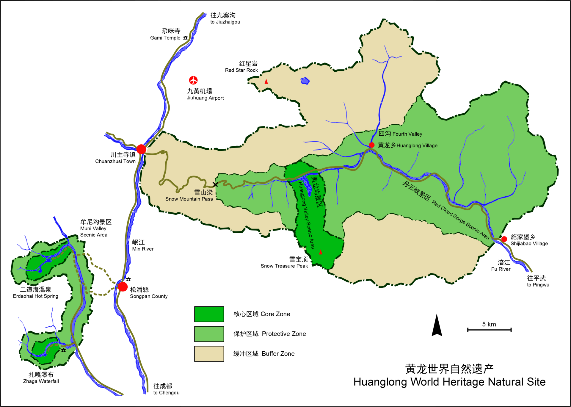
- Xuebaoding and the summit temple — Upper slopes above the valley
Xuebaoding, at 5,588 m, is the highest peak in the Min Mountains and dominates the skyline above the park. Most day visitors do not reach its summit. A Buddhist temple stands at the head of the main valley, where the principal water body begins, so visitors reach it on the valley walk rather than the summit climb, which is harder than it looks in the thin air.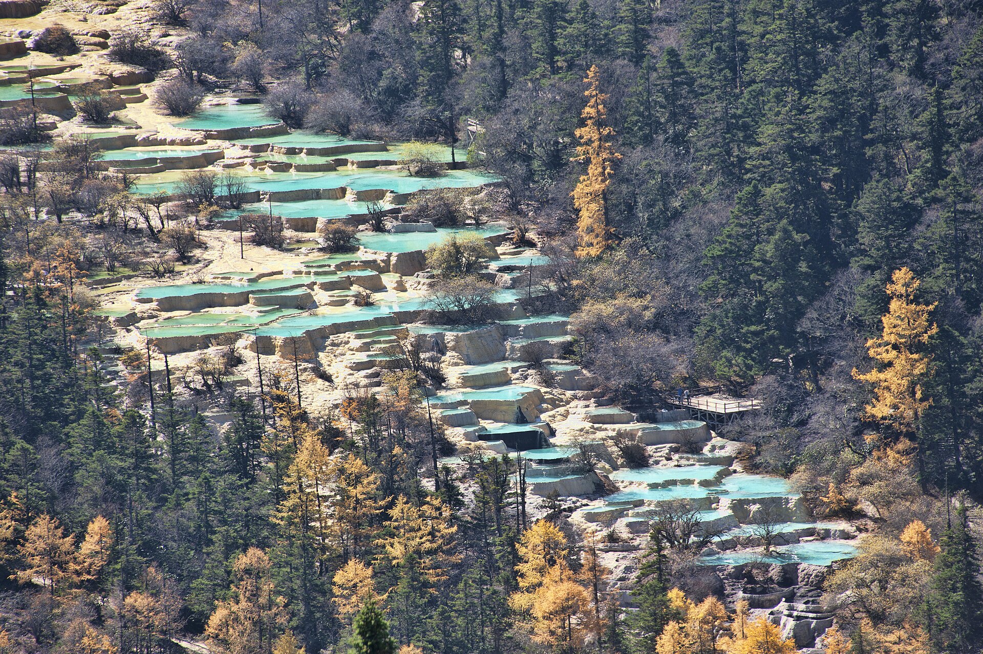
Culture
Huanglong is a protected scenic and historic area, and its landscape is best treated as a fragile system rather than a backdrop. The wider region has Tibetan and Qiang communities, and their faith and customs shape many of the temples and shrines on the mountain. Along the route you will meet pilgrims, guides and stallholders, and a greeting in Mandarin with a smile goes a long way where English is limited. Move quietly around temples, keep your voice low near the pools, and ask before photographing anyone at prayer. Stallholders are working people rather than exhibits, so buy something or ask politely before you take their picture. Stay on the marked paths, and never step onto the pool edges, because footprints and litter can damage the soft travertine.
What to wear
Traditional dress in the Huanglong area comes from the Tibetan and Qiang communities of the surrounding mountains. Tibetan men and women traditionally wear long chuba-style robes, belted at the waist, made from wool or sheepskin and often trimmed with contrasting borders. Qiang clothing is known for embroidery, usually on jackets and sleeves. Silver jewellery, coral and turquoise beads appear at festivals and family occasions, and the heavier woollens are worn in the high pastures. Today most people in the valley and on the road dress in everyday clothes such as down jackets, fleece and trainers, and traditional robes appear mainly at festivals, weddings and religious gatherings or on guides and stallholders who choose to wear them. A visitor should dress in layers that can be taken off as the day warms. The morning air is cold and damp, while the sun at altitude is strong, so pack a waterproof jacket, a warm fleece, a hat and sunglasses. Choose footwear with proper grip, since travertine is slippery when wet and the paths climb steeply. Modesty norms are relaxed, though covering the shoulders at temples is polite.
What to eat
- Dan dan noodles — small eateries in the nearest town on the approach road
Wheat noodles in a chilli, sesame and preserved vegetable sauce, the classic Sichuan street dish. It arrives hot and bold, so ask for a milder version if you prefer. A quick bowl makes a good start before the climb, when the eateries are still serving breakfast.
- Packaged snacks and instant noodles — small shops along the trail and near the summit area
Biscuits, nuts, dried fruit and instant noodles sold by the small shops along the mountain paths and near the top. They work for a light lunch, but the choice is limited and prices rise with altitude. Buy them before you start if you can. - Bottled water and soft drinks — stalls on the upper paths
Water and soft drinks cost more the higher you go, and the stalls on the upper paths carry only a few brands. Bring a refillable bottle and fill it before the climb. Drinking regularly matters at this altitude, so do not wait until you feel thirsty. - Tibetan-style butter tea — teahouses and family eateries in the nearby Tibetan-influenced communities
Salty tea churned with yak butter, a warming drink suited to cold mountain air. It is an acquired taste for many visitors, so try a small cup before ordering a full bowl. Serving customs vary between families, and it is polite to accept it when it is offered to you. - A simple meal in the nearest town — a busy eatery in the nearest town, on the way back
A plain rice and vegetable set or a bowl of noodles makes a good meal after the descent. Choose a busy eatery with a changing menu, since the food is usually freshly cooked. Eat before you set off on a long road journey, because roadside options are sparse.
Plan it
Best time. Late spring and early autumn give the clearest water and the most walkable paths. Winter brings snow and the high paths can close, while summer rain can make the travertine slippery and cloud the views. Check conditions and any closures on the official site before you commit to a date.
How long. 1 long day, or 2 if you base yourself in Jiuzhaigou
Getting there. Fly into Jiuzhaigou (Jiuhuang) Airport or travel to Chengdu first, then complete the journey by road. Buses run regularly from Chengdu, and the last leg into the park is by bus or taxi from Jiuzhaigou. Check the current timetable on the official site before you plan the day.
Budget. mid
Tips
- Start early, because the valley fills up by late morning and the pools look best in soft light.
- Pace yourself on the climb; the air is thin, so take regular breaks and do not rush the steep sections.
- Bring your own water and snacks, since prices rise the higher you walk.
- Carry cash for small stalls, and pack layers for sudden changes in weather.
- Keep the day trip simple: arrange a fixed departure time from Jiuzhaigou so you are not hurrying back.
Etiquette
- Stay on the marked paths and keep off the travertine ledges.
- Ask before photographing people, especially at temples and prayer sites.
- Take all litter away with you.
Nearby
Sources
- Wikidata Q4107 (CC0)
- Wikipedia: Huanglong Scenic and Historic Interest Area (CC BY-SA 4.0)
- Wikivoyage: Huanglongsi National Park (CC BY-SA 4.0)
- Water of Five-Colored Pond, Huanglong (Kounosu) (CC BY-SA 1.0)
- Huanglong pools aerial 2011 (chensiyuan) (CC BY-SA 2.0)
- HuangLong World Heritage Natural Site (Leungcwd) (CC BY-SA 4.0)
- Map of Huanglong Gully Scenic Spots (Leungcwd) (CC BY 3.0)
- Huanglong aerial panorama 2023 (Chensiyuan) (CC BY-SA 4.0)
- Huanglong Yingbin Pool (Leungcwd) (CC BY 3.0)
- HuangLong 2002-09-12 53 (unknown author) (CC BY 3.0)
- Huanglong Lianyan Lake (Leungcwd) (CC BY 3.0)


