Hawizeh Marsh
Hawizeh Marsh, Iraq
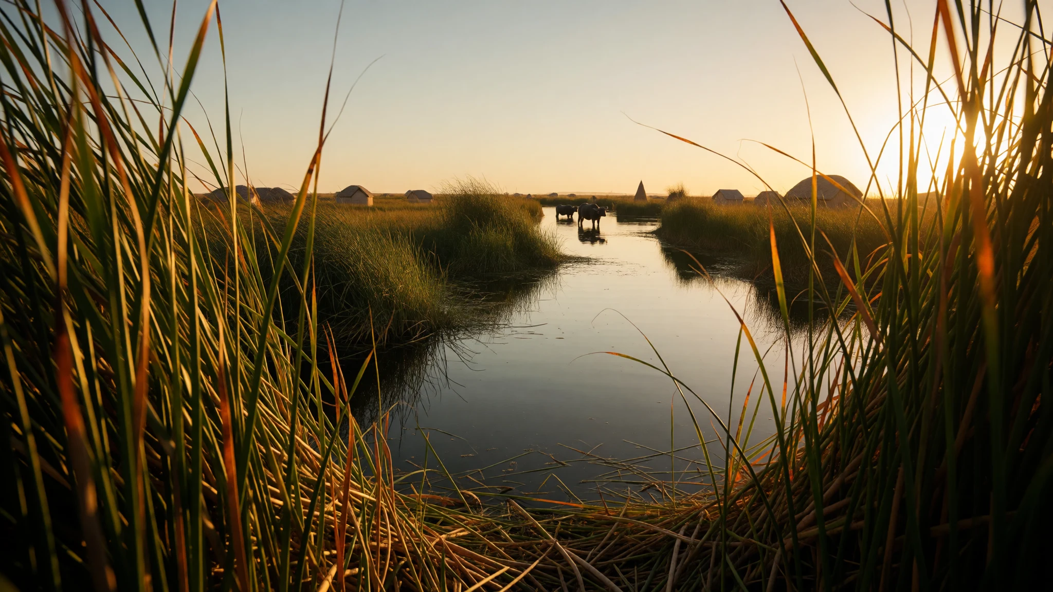
Hawizeh Marsh is a reed-fringed wetland on the Iran–Iraq border, where marsh life has endured for thousands of years.
The place
Hawizeh Marsh is a complex of wetlands that stretches across the border between south-western Iran and south-eastern Iraq. Its water comes from two branches of the Tigris in Iraq and from the Karkheh River on the Iranian side. An outflow channel, the Al-Kassarah, keeps the system moving rather than letting it settle into a stagnant, salty basin. Scientists treat it as a key part of the wider Mesopotamian Marshes, because its reed beds and open pools shelter birds and fish that may later recolonise other wetlands nearby.
Walking the edges, you notice how much of the landscape is water and reed rather than solid ground. Channels open between stands of tall reeds, and small boats are the normal way to get about. The area suits the people who have always worked it: fishing, keeping water buffalo and cultivating small plots where the ground rises above the flood line. Birds are the highlight for many visitors, with herons, eagles and hawks common over the open water. Sightings depend on the season and on water levels, which have shifted a great deal in recent decades.
Access is the main practical question. Iran's Khuzestan province is the usual gateway, with Ahvaz and Dezful as the nearest larger bases. The Iraqi side is harder to reach and needs careful checking. Conditions on the ground change quickly, so treat any plan as provisional until you have current advice from your own government and from local guides.
Its story
Hawizeh Marsh has been lived in for more than 5,000 years, and its story runs from ancient Mesopotamia to the present day. Settlement here is traced back to the time of the Sumerians and Babylonians, who fished, hunted and planted on land that the rivers had shaped. Around 3,000 BC the rivers spreading across the lowlands are thought to have created the marshes, bringing new fish, birds and plants and a fresh way of living.
Beliefs changed over the centuries as well. A split between Shia and Mandaean traditions left Shia practice dominant in the marshes. Local belief blended older Sumerian ideas with Islamic teaching, producing a rich folklore of ghosts, curses and strange beings that people in the reed villages still talk about.
The marsh cities were built on water. Houses were made from reed, and families moved between Iraq and Iran in mashoof, long canoe-like boats, because no line on the water divided their daily life. Schooling was limited and there was no electricity or cars, yet the communities were largely self-sufficient.
The modern chapter is painful. Under the Hussein government the marshes were drained, because officials believed an armed group was hiding in them, and most of the population left. Water and wildlife collapsed. Partial restoration has since brought some water back, but the marsh is not what it once was, and it remains a place where history and loss sit side by side.
What to see
- The marsh edge — Khuzestan, south-west Iran, near the Iraq border
The marsh is the reason to come, and the easiest way to see it is by boat from a village landing rather than by walking the banks. Reeds rise above head height, channels open and close with the water level, and birds gather over open pools. Go early, when the light is soft and the air is cooler. Ask locally before you go out, since water depths and access shift yearly. - Susa — Susa, Khuzestan, Iran
Susa is an ancient city with an Achaemenid palace, a museum of excavated finds and a shrine connected with the prophet Daniel. The archaeological site and the museum together make a full half-day. Visit in the cooler hours, because the open ruins offer little shade. Check current opening arrangements with the official site or with local guides before you set out. - Haft Tappeh — Near Susa, Khuzestan, Iran
Haft Tappeh is a mound of ancient settlement a short drive from Susa, dating to around 1500 BC. It is a quiet, uncrowded site where you can walk the excavated trenches and picture a town built on the plain. Bring water and a hat, because shade is scarce. Check access arrangements before you go, as signage can be limited. - Shushtar's water engineering — Shushtar, Khuzestan, Iran
Shushtar is known for its water engineering, with watermills, dams, bridges and tunnels that are around 2000 years old. The Sika watermills on the river show how old canals were used to grind grain. Wander the old quarter for the bazaar, traditional houses and the castle. Mornings are cooler and quieter. A guide helps, because the systems are hard to read without context. - Izeh and the Bakhtiari highlands — Zagros foothills, Khuzestan and Kohgiluyeh, Iran
Izeh and the Bakhtiari highlands sit on the slopes of the Zagros mountains, where nomadic and village life carries on. Nearby ancient Elamite sites include the Tarisha temple and Kool Farah, and the villages of Baghmalek and Haftguel are reached by winding roads. Go with a driver who knows the route. Ask before photographing people at work or at home.
Culture
Hawizeh Marsh is home to communities whose lives have followed the water for thousands of years. On the Iranian side the people are usually called Hawizeh, while in Iraq the wider marsh population is often known as Marsh Arabs. Their customs rest on hospitality, family ties and the rhythm of fishing and herding. Visitors are often welcomed with tea and conversation, and a few words of greeting go a long way.
Many families were affected by drainage and displacement in living memory. Talk about the past only when your host raises it, and do not treat the people as a backdrop for a photograph. Religious life is central. Shia practice is dominant, so observe mosque etiquette, dress modestly and avoid entering shrines while prayers are under way.
Politics and business can be sensitive, so keep conversations open and listen more than you speak. Follow local rules at every shrine and religious building, and remove shoes where you see a step up or a mat. Ask before taking a photograph of anyone, especially women and children, and never point a camera at a family home without a clear yes.
What to wear
Dress around Hawizeh Marsh has long been shaped by the wet climate, the reed and water economy, and the mix of Arab and Persian traditions on either side of the border. Traditional women's clothing often includes long, loose robes, sometimes in bright printed cotton, worn with a head covering. Men traditionally wore long shirts and a cloak in wool or cotton. Embroidery and printed cotton are the characteristic textiles of the wider area, while reed mats and woven reed goods are the craft of the marsh itself.
Today most people wear modern clothes in towns, and traditional dress is more common at weddings, festivals and in rural villages. Older women are more likely than younger ones to wear the full robes day to day.
What a visitor should wear comes down to three things: heat, religion and terrain. Loose, light, long-sleeved clothing protects against sun and mosquitoes. Carry a scarf to cover your hair and shoulders when you enter religious sites, and avoid shorts in towns. Footwear needs to cope with mud and wet boat landings, so choose closed shoes with good grip, plus sandals you can slip off at doorways. Avoid tight or revealing clothing in public.
What to eat
- Grilled river fish — Waterside eateries in marsh-edge villages and towns, and in Shushtar
Fish from the marsh and the rivers feeding it is grilled over charcoal and served simply with flatbread, herbs and a squeeze of lemon. Fish is the everyday food of the marsh communities, so it appears on most menus near the water. Ask what came in that morning. - Buffalo milk products — The morning market in a town near the marsh
Water buffalo are kept across the marsh, and their milk becomes fresh cream, soft curd and a thick, rich butter. Buy a small pot early, because the stock sells out. Eat it spooned onto warm bread for breakfast. - Warm flatbread — Any bakery on a busy street in the market quarter
Thin flatbreads are baked in clay ovens and sold hot, folded around cheese, herbs or fish. They are the cheapest and most useful thing to eat on the road. Watch the bakers at work, then eat the bread straight away. - Dates — Date stalls in the bazaar of Shushtar or Ahvaz
Date palms grow across the plains of Khuzestan, and fresh and dried dates are sold in quantity. Taste a few before you buy, since varieties differ a lot in sweetness and texture. They keep well and make a good snack for long journeys. - Tea in glasses — Any tea house on the main bazaar street
Strong black tea is served hot in small glasses, usually sweetened with sugar, and offered to nearly everyone who sits down. Drinking tea is a social act, so linger over the first glass. It is the easiest way to start a conversation.
Plan it
Best time. Winter, roughly December to February, is the most comfortable time at the marsh edges, with daytime highs of about 27 to 31°C, while summers are very hot and humid. Winter days are mild but nights can fall below freezing, the wettest months are December and January, and water levels move with the rivers, so check conditions before you commit.
How long. 3–4
Getting there. Fly into Abadan Airport (ABD) and continue by road to Ahvaz, the main gateway, then travel to the marsh edge by car with a local driver. The only mainline railway in this part of Iran runs north to south through Ahvaz and Dezful, with several trains a day. Shahrekord Airport (CQD) is further north and suits the highlands better.
Budget. low
Tips
- Hire a local driver or guide for marsh access, since roads and boat landings are hard to find alone.
- Travel in the cooler months and start outings early, before the heat builds.
- Carry cash, because card payment is unreliable in small towns.
- Take more water than you think you need, plus sun protection.
- Check current travel advice from your government for both Iran and Iraq before you book.
Etiquette
- Ask before photographing people, especially women and children.
- Dress modestly in villages and at religious sites.
- Accept tea when it is offered and sit where your host indicates.
Nearby
Sources
- Wikidata Q3892852 (CC0)
- Wikipedia: Hawizeh Marshes (rev 1366154107) (CC BY-SA 4.0)
- Wikivoyage: Khuzestan (rev 5279713) (CC BY-SA 4.0)
- Iraq - Marshes - Former Marshes and Water Diversion Projects in Southeastern Iraq (Public domain)
- تالاب هورالعظیم (1398122414390238419912094) (CC BY 4.0)
- تالاب هورالعظیم (1398122414390088419912094) (CC BY 4.0)
- تالاب هورالعظیم (1398122414390097819912094) (CC BY 4.0)
- تالاب هورالعظیم (1398122414390135319912094) (CC BY 4.0)
- تالاب هورالعظیم (1398122414390288419912094) (CC BY 4.0)
- Hawizeh Marshes in 2021 (07) (CC BY 4.0)
- Hawizeh Marshes in 2021 (08) (CC BY 4.0)


