Hattusa
Hattusa, Turkey
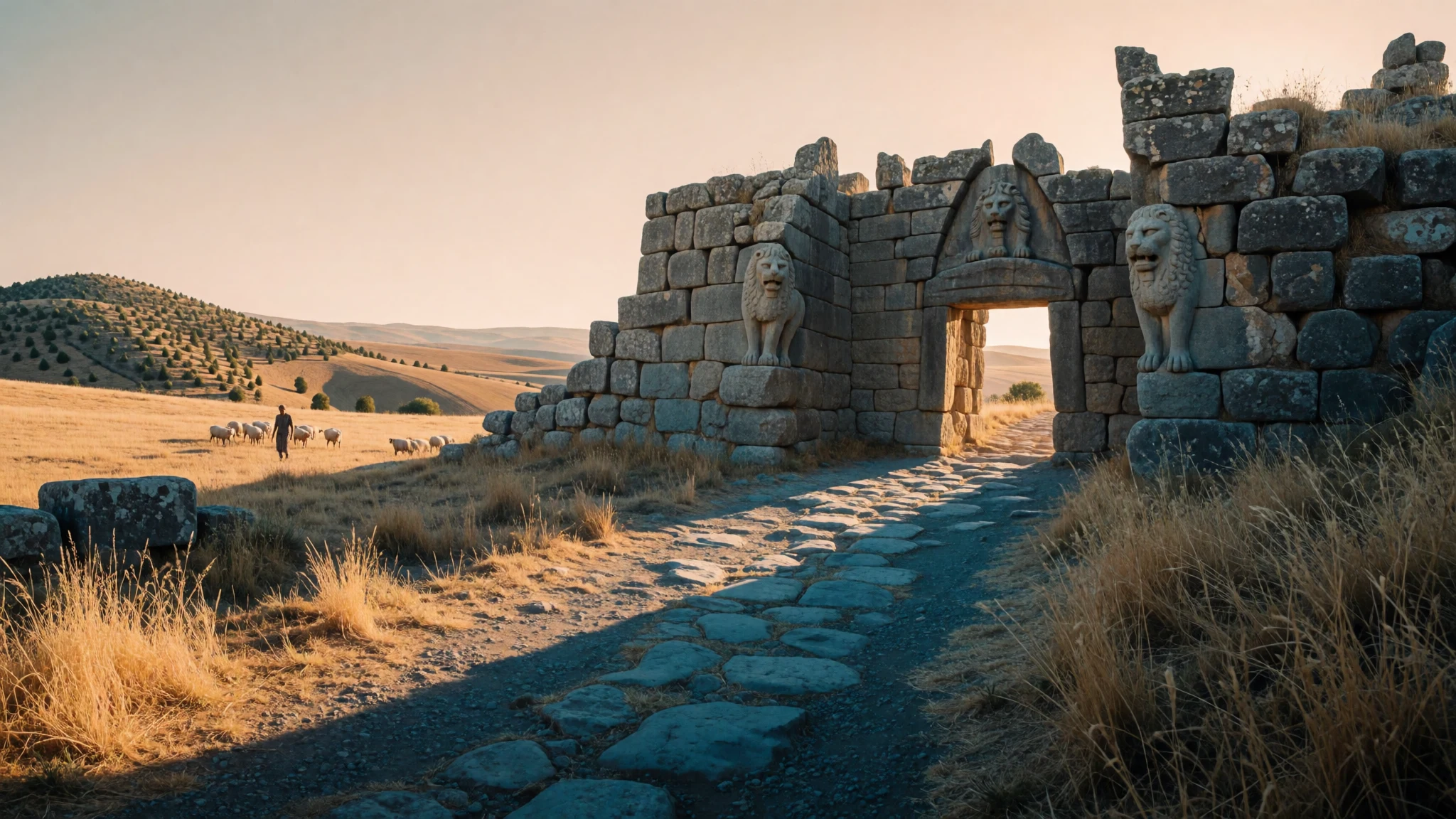
Hattusa is the ruined Hittite capital on a windswept Anatolian hillside, where gates, ramparts and carved rock chambers survive from the Bronze Age.
The place
Hattusa sits on high, open farmland in central Turkey, a short drive from the village of Boğazkale and inside the great bend of the Kızılırmak river. It was the capital of the Hittite kingdom in the late Bronze Age, and what survives is a sprawling ruined city draped over a rocky ridge rather than a single compact monument. UNESCO lists it under reference 377-001.
Seeing it means covering real ground. Gates, ramparts, temple foundations and carved outcrops are separated by dry slopes and stretches of grass, so a visit becomes a long loop on foot or by car, with stops along the way. Very little stands tall. Most buildings survive as stone footings, and the pleasure lies in reading the layout: the line of the walls along the ridge, the big temple precinct in the lower town, the sculpted chambers higher up. One stretch of rampart has been rebuilt in mud-brick on its original stone base, which helps explain the scale of the defences.
The setting is quiet. The plateau is wide, windy and almost treeless, and outside the summer holidays a visitor may share a gate with only a handful of others. There is little shade, and the weather swings from fierce sun to sharp cold, so the season matters. Boğazkale has a small museum and simple village guesthouses and eateries, while the larger town of Çorum has more choice. For opening times and fees, check the official site at https://muze.gov.tr/muze-detay?SectionId=BGO01&DistId=MRK before setting out.
Its story
Hattusa began as a Hattian settlement, well before the Hittites arrived, and the name comes from those earlier people. Merchants from Assyria later set up their own quarter in the lower town, trading across the plateau.
Around 1700 BC the town burned. King Anitta of Kussara claimed the destruction and left an inscribed curse calling down the Storm God on any later ruler who dared to resettle the place. The curse did not hold. Around 1650 BC a Hittite king, Labarna, made Hattusa his capital and took the name Hattusili, roughly 'the man from Hattusa'.
The city's fortunes then moved in waves. Raiders called the Kaskians pressed from the north and attacked it twice, and the royal court shifted to Sapinuwa for a time. Later, one king moved the capital south to Tarhuntassa, leaving his younger brother, the future Hattusili III, to govern Hattusa. It was a capital in two separate periods. At its height its rulers corresponded and negotiated with Egypt's New Kingdom.
After the Bronze Age the site faded from memory. Charles Texier, a French archaeologist, drew attention to the ruins after visiting in 1834. Sporadic exploration followed, and then the German Oriental Society and the German Archaeological Institute began systematic excavation early in the twentieth century. Digging continues today, and Hattusa joined the UNESCO World Heritage list in 1986.
What to see
- Lion Gate — South-western edge of the ancient city
The Lion Gate guards the south-western edge of Hattusa, two stone towers flanking an arch where carved lions face outwards. The lions are weathered but unmistakable, and the gate gives the quickest sense of how the city wished to present itself. Late afternoon light is kind to the stone. Expect a few tour groups at midday.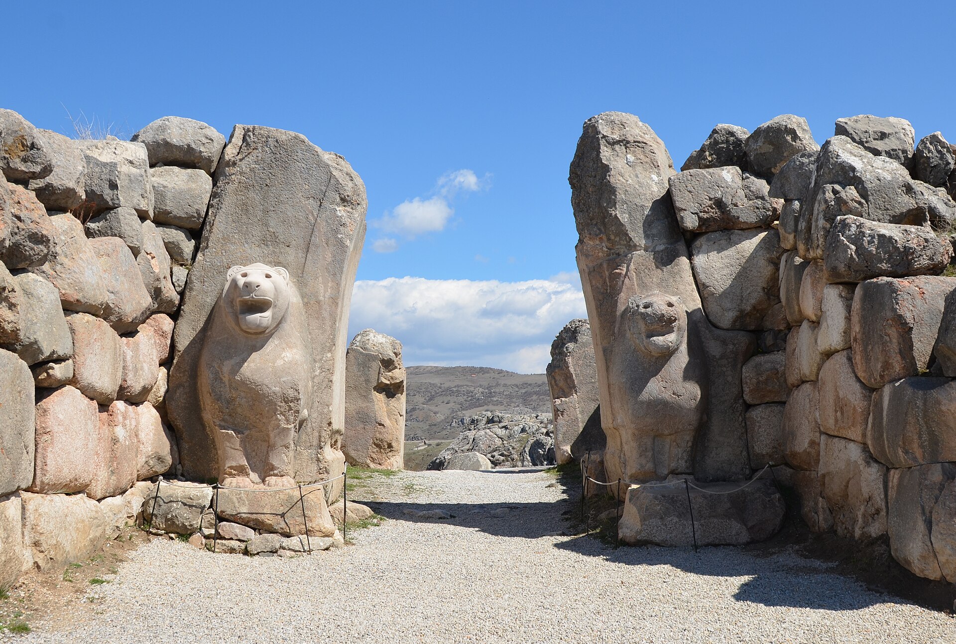
- Yerkapi rampart — Southern edge of the city
Yerkapi is a steep artificial bank of earth and stone along the southern edge of the city, pierced by a long tunnel through its base. Climbing it rewards with a wide view over the ruins and plateau. The slope is loose underfoot, so sturdy shoes matter, and the top is exposed to wind.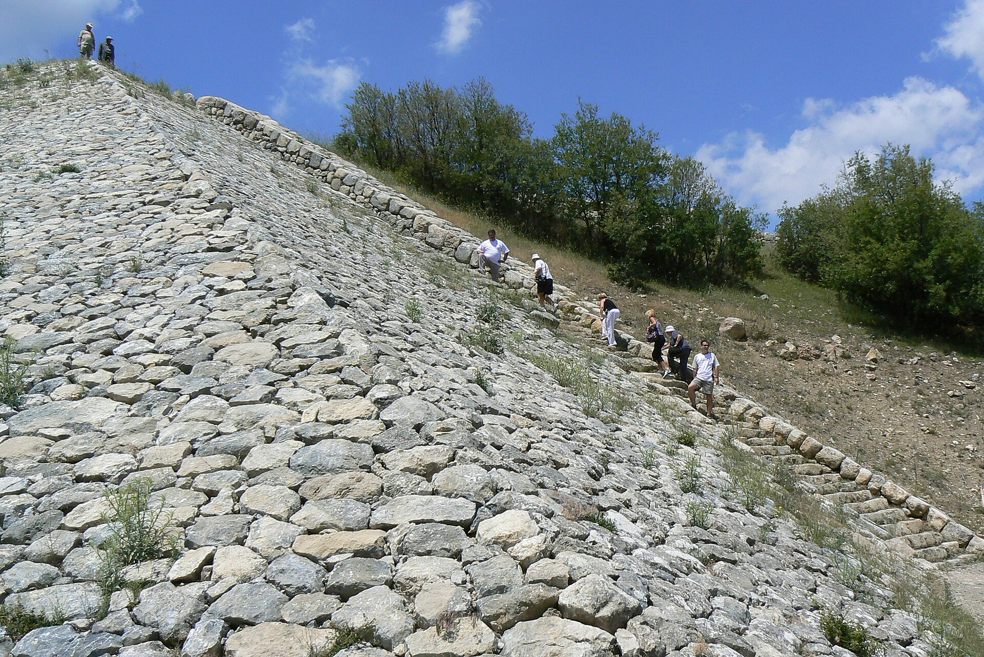
- The rebuilt wall — Upper town, along the ridge
A section of the defensive wall has been reconstructed with mud-brick above the original stone footing, with towers at intervals. It is the best place to picture what the ridge looked like when the city was occupied. The reconstruction is modern, so treat it as an illustration rather than a survivor.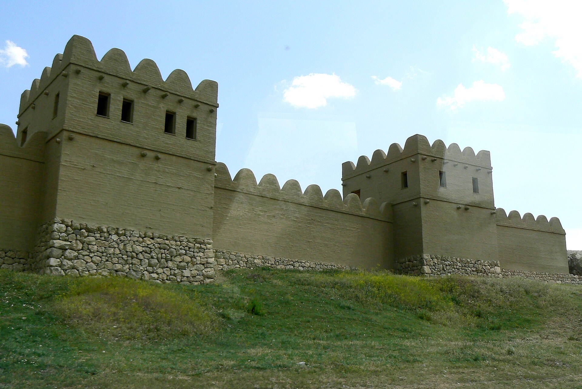
- Great Temple — Lower city
The Great Temple stands in the lower city, its foundations ringed by long rows of storerooms where goods and offerings were kept. The ground plan is easy to follow from the paths, and a block of dark green stone nearby draws visitors. Walls are low, so a short read of the site plan beforehand helps.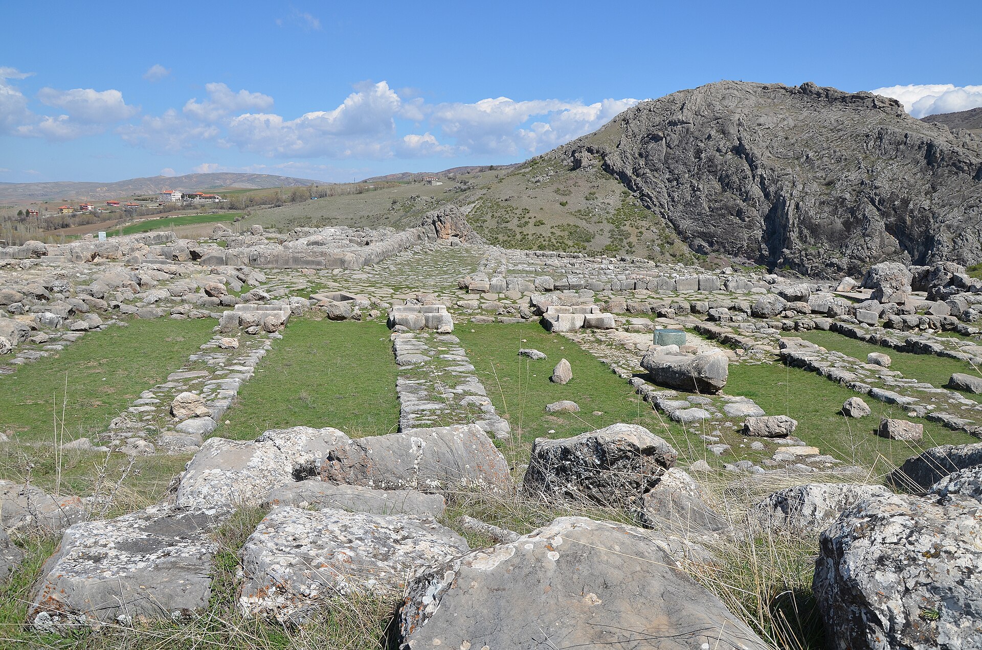
- Hieroglyph chamber — Upper town
This rock-cut chamber in the upper town carries hieroglyphic inscriptions and relief figures commissioned by Suppiluliuma II, the last Hittite king. The carving is shallow and best read in side light. It is small, quickly seen, and a good reminder that the Hittites wrote in more than one script.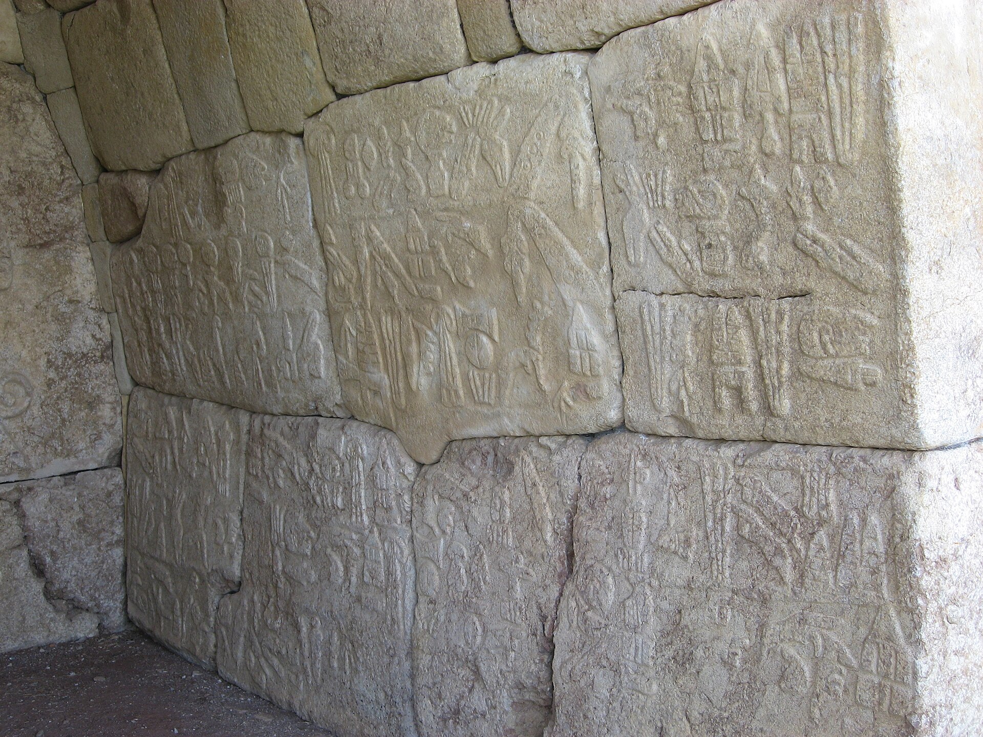
- Yazılıkaya sanctuary — Just outside the main ruins
Yazılıkaya is an open-air rock sanctuary a short distance outside the main city, its natural clefts carved with processions of gods. One narrow chamber shows a line of underworld deities striding in step. The rock is damp and cool even in summer. Allow time here, since it is the most atmospheric stop.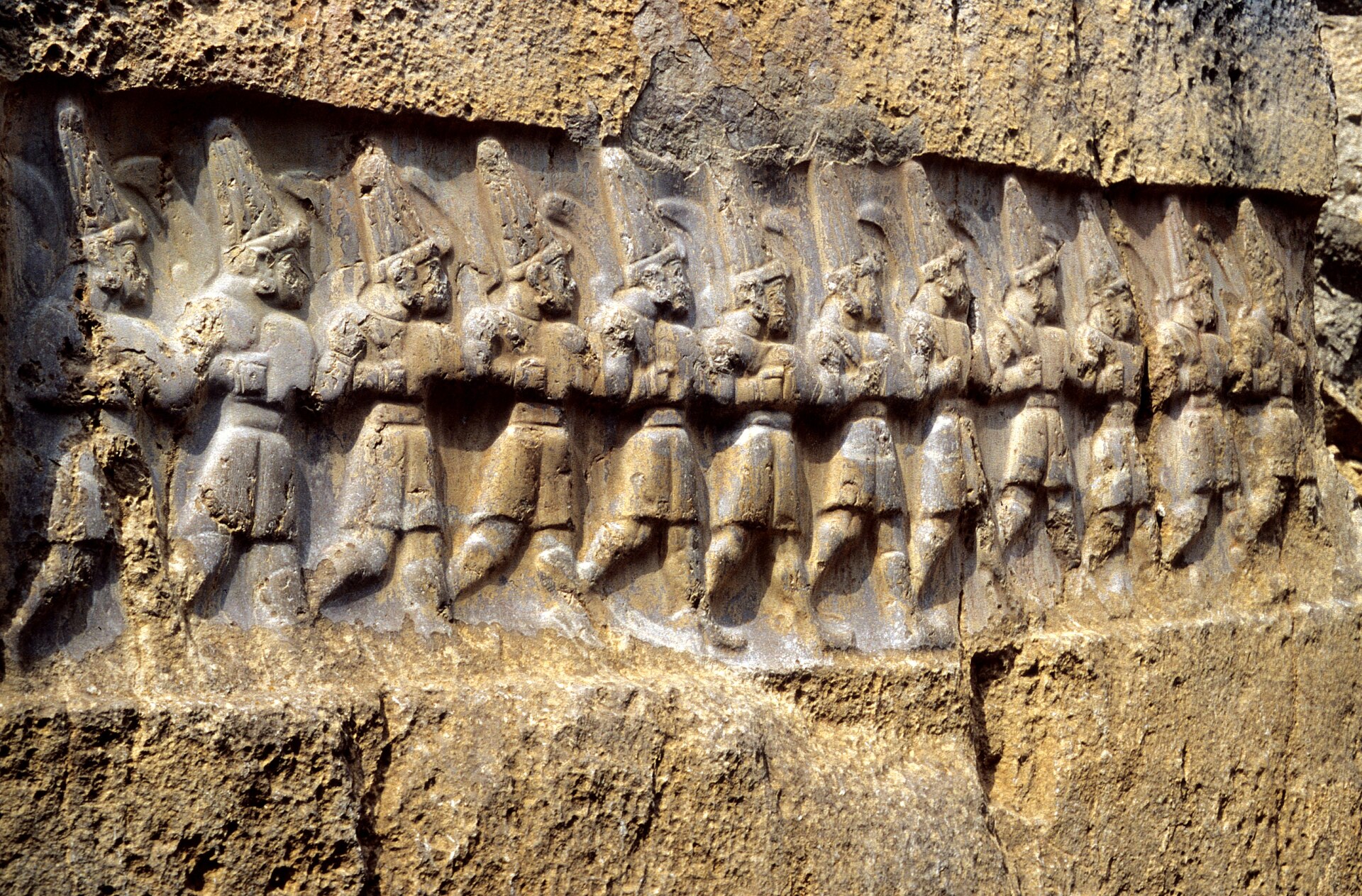
Culture
Hattusa belongs to a landscape of farming villages, and the culture a visitor meets today is that of rural central Anatolia: unhurried, hospitable and curious about foreigners. Boğazkale is a small place, and conversation often begins with tea, offered as a matter of course. Being asked where you come from is friendliness, not interrogation.
The ancient culture is present in a quieter way. The Hittites left their voices in carved stone and clay tablets, and the king Anitta's inscribed curse on any ruler who resettled the city is one of the more vivid survivals. Their religion filled the rocks around the city with gods, which is why sites such as Yazılıkaya feel like sanctuaries rather than ruins. The Hittites also dealt with their neighbours through letters and treaties, and the city sat at the centre of a network of diplomacy.
Daily life in the area follows the farming year and the call to prayer. Most people are Muslim, many do not drink alcohol, and shops and eateries may quiet down at prayer times and on Fridays. Gifts are welcome if one is invited into a home, but alcohol is a poor choice unless the hosts are well known. Photographs of people are usually fine when asked for politely, and children in particular enjoy being included.
If invited into a village home, take off your shoes at or just inside the door and thank the host for the tea that follows.
What to wear
Dress around Hattusa has layers of history. The Hittites themselves are known from stone reliefs, where figures wear short belted tunics or kilts, long robes for priests and rulers, and shoes with upturned toes, often with tall conical caps for gods. Textiles then were wool and linen, and the reliefs show pleats and fringed edges rather than colour, since the paint has long gone.
The rural Anatolian tradition that followed uses wool and cotton, woven on home looms. Baggy trousers called şalvar, long cotton dresses, embroidered waistcoats and patterned headscarves (yazma) still appear at weddings, festivals and in older villagers' daily wear. Kilims and felted rugs from the wider region carry the same geometric patterns.
What people wear now is practical and modest: jeans or work trousers, shirts, sturdy jackets in cold months, and for many women a headscarf, particularly in Boğazkale and the farms around it. Younger people in Çorum dress much as in any Turkish town.
A visitor should dress for the weather and the terrain first. The ruins are exposed, so a hat, sunglasses and sunscreen matter in summer, while spring and autumn evenings call for a warm layer and a windproof jacket. Shoes should be closed, with grip, for loose stones and steep slopes. In the village, and especially near any mosque, cover shoulders and knees. A light scarf is useful for sun, dust and for going into a mosque.
What to eat
- Mercimek çorbası — Any simple lokanta (eatery) in Boğazkale or Çorum
Red lentil soup is the standard opening to a meal across Turkey, and in central Anatolia it arrives hot, lemony and thick. A bowl with bread is a sensible lunch after a morning on the exposed ridge, and it is cheap. - Pide — Pide salons in Çorum town, and basic cafés in Boğazkale
Pide is oven-baked flatbread shaped like a boat and topped with minced lamb, cheese or egg. Eaten fresh from a stone oven, it is filling and easy to share, and a common choice for travellers working their way between ruins. - Gözleme — Roadside stalls and village tea gardens near the site
Gözleme is thin dough rolled out by hand, filled with spinach, potato or cheese, and cooked on a round griddle. In village settings it is often made in front of you by local women, and it goes well with a glass of tea. - Mantı — Family-run restaurants in Çorum
Mantı are tiny dumplings of minced meat, served under garlicky yoghurt and a drizzle of spiced butter. It is a labour-heavy dish, so a good plate usually means a home-style kitchen. Lamb is common in the inland diet. - Leblebi — Specialist nut and snack shops in Çorum town
Leblebi are roasted chickpeas, crunchy and salty, sold as a snack and a local speciality of the Çorum area. They are easy to carry, keep well and make a good picnic companion for a day walking the ruins.
Plan it
Best time. May–June and September–October. The site is a high, exposed plateau, so spring and early autumn bring mild days and clearer walking. Summer afternoons can be hot with little shade, and winters are cold with snow possible, which can make the upper ruins slippery.
How long. 1–2
Getting there. Fly to Ankara, then continue by road to Çorum, the nearest sizeable town, and on to Boğazkale. A hired car or taxi is the easiest way to cover the scattered site; check current bus and minibus timetables locally, as services are infrequent.
Budget. low
Tips
- Check opening days, fees and any museum pass on the official site, https://muze.gov.tr/muze-detay?SectionId=BGO01&DistId=MRK, before travelling; many Turkish sites close one day a week.
- Start early to beat the heat and the tour groups, and bring plenty of water because shade and shops are scarce on the site.
- Keep a car or driver for the day, since the main ruins, Yazılıkaya and the museum are spread over a wide area.
- Carry some cash for village cafés and stalls, as card machines are not guaranteed.
- Wear sturdy shoes; paths are uneven and the upper slopes are loose.
Etiquette
- Stay on the marked paths and never climb on or remove stones from the ruins.
- Dress modestly in Boğazkale and cover shoulders and knees near mosques.
- Ask before photographing local people, especially women and children.
Nearby
Sources
- Wikidata Q181007 (CC0)
- Wikipedia: Hattusa (rev 1383991768) (CC BY-SA 4.0)
- Wikivoyage: Turkey (rev 5393139) (CC BY-SA 4.0)
- Photo: Lion Gate, Hattusa (Carole Raddato) (CC BY-SA 2.0)
- Photo: Yerkapi rampart (Rita1234) (CC BY 3.0)
- Photo: Reconstructed city wall (Rita1234) (CC BY 3.0)
- Photo: Hattusa reliefs (Paul) (CC BY-SA 2.0)
- Photo: Great Temple area (Carole Raddato) (CC BY-SA 2.0)
- Photo: Yazılıkaya Chamber B (Klaus-Peter Simon) (CC BY 3.0)
- Photo: Büyükkaya and city wall (Ingeborg Simon) (CC BY 3.0)
- Photo: Museum Boğazkale (Ingeborg Simon) (CC BY 3.0)


