Ha Giang
Ha Giang, Vietnam
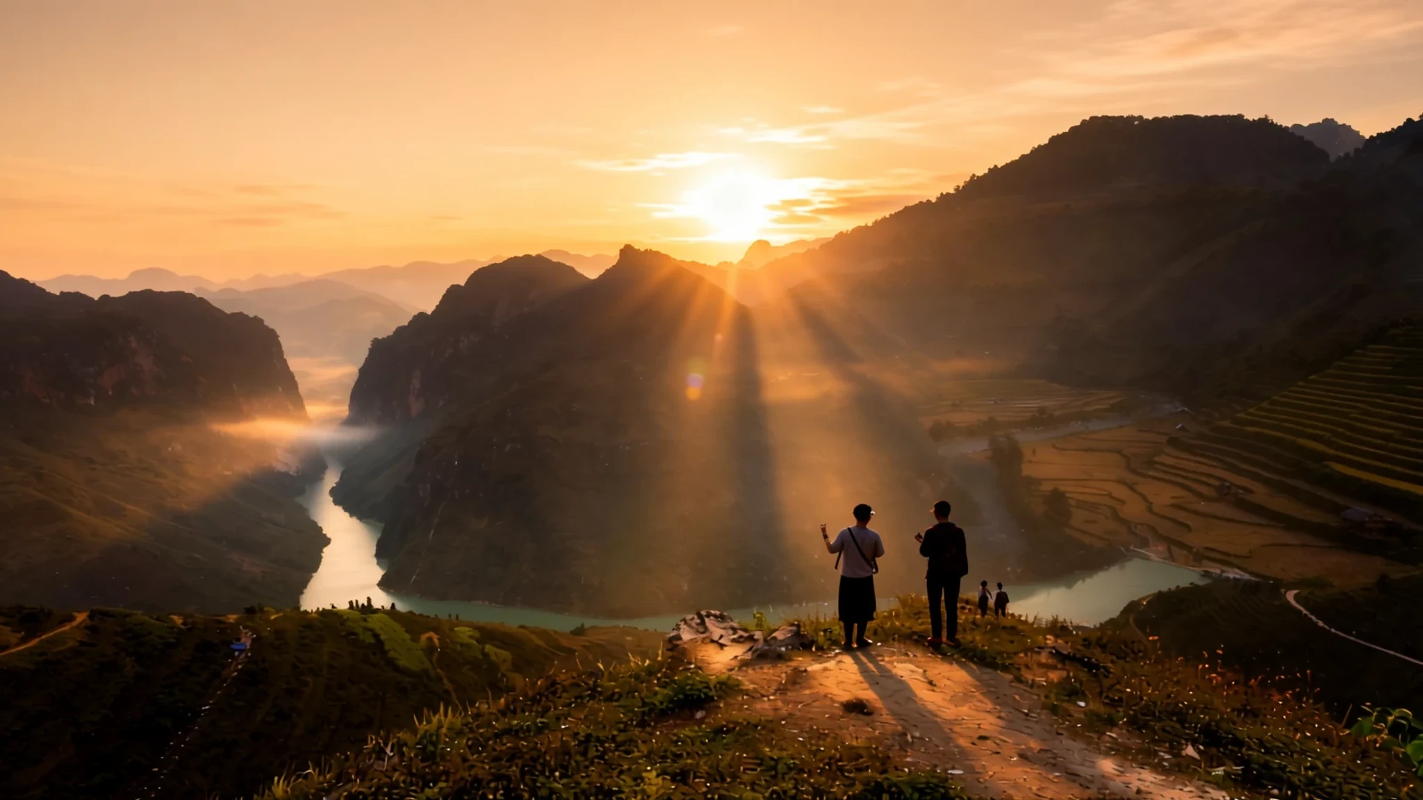
Ha Giang is Vietnam's far north: high limestone plateaus, steep loop roads and villages where many ethnic minority groups still weave by hand.
The place
Hà Giang is a mountainous region in the far north-east of Vietnam, and it contains the country's northernmost point. Its long border with Yunnan province in southern China earned it the nickname of Vietnam's final frontier. The provincial capital, also called Hà Giang, stands on the left bank of the Lô River and works as the usual base for travellers heading into the wider province. Until recently Hà Giang was a province in its own right, home to about 890,000 people; it has since been folded into neighbouring Tuyên Quang province.
The landscape is the main draw. Limestone ridges, rocky peaks and springs rise above the valleys, and further north around Đồng Văn the rock opens into a karst plateau. Weather here is highly local. The region's climate is described as temperate but with montane patterns that vary sharply from one district to the next, so a clear morning on one ridge can turn to cloud in the valley below.
Land is the hard part of life in Hà Giang. Steep slopes leave little room for paddy, so families grow maize, buckwheat and vegetables on terraces and carve routes along cliffs. For a long time the province counted among Vietnam's poorer areas, and roads, schools and clinics have reached the high villages unevenly. That tension between a rough, beautiful terrain and hard daily work is what gives the province its character.
Its story
Archaeologists working near Hà Giang city, at a low hill called Đồi Thông (Pine Hill), have dated human activity in the area to about 30,000 years ago. In the Bronze Age the Tày Yu peoples held the region, and their bronze drums, used in ceremonies, still appear among the Lô Lô and Pu Péo communities around Mèo Vạc today. Under the Ming occupation the district was called Bình Nguyên, and it was later renamed Vị Xuyên.
What the French later called Hà Giang province formed part of the ancient Văn Lang realm, in an area known as Tân Hưng. Colonial rule arrived when French forces took the region in 1886 and set up a garrison on the east bank of the Lô River. The post grew into a significant military base in northern Vietnam, and the surrounding mountains became a place of resistance.
Dao communities rose against the colonial state more than once. A rising in 1901, led by Triệu Tiến Kiến and Triệu Tài Lộc, was put down, and Triệu Tiến Kiến was killed in the fighting. In 1913 Triệu Tài Lộc, backed by a clan kinsman, Triệu Tiến Tiến, launched another revolt that lasted until 1915. Those episodes shaped how the region remembers the colonial period, and they explain why the old garrison and the cannon on display in the provincial museum still matter to local people.
What to see
- Đồng Văn Karst Plateau — Đồng Văn district, far north of the province
The karst plateau around Đồng Văn is a wide, grey landscape of limestone ridges, hollows and terraced fields, cut by narrow roads. Villages sit where soil collects between the rocks. The best light comes in the early morning, before the stone starts to glare, and the plateau is the setting for the buckwheat flower season.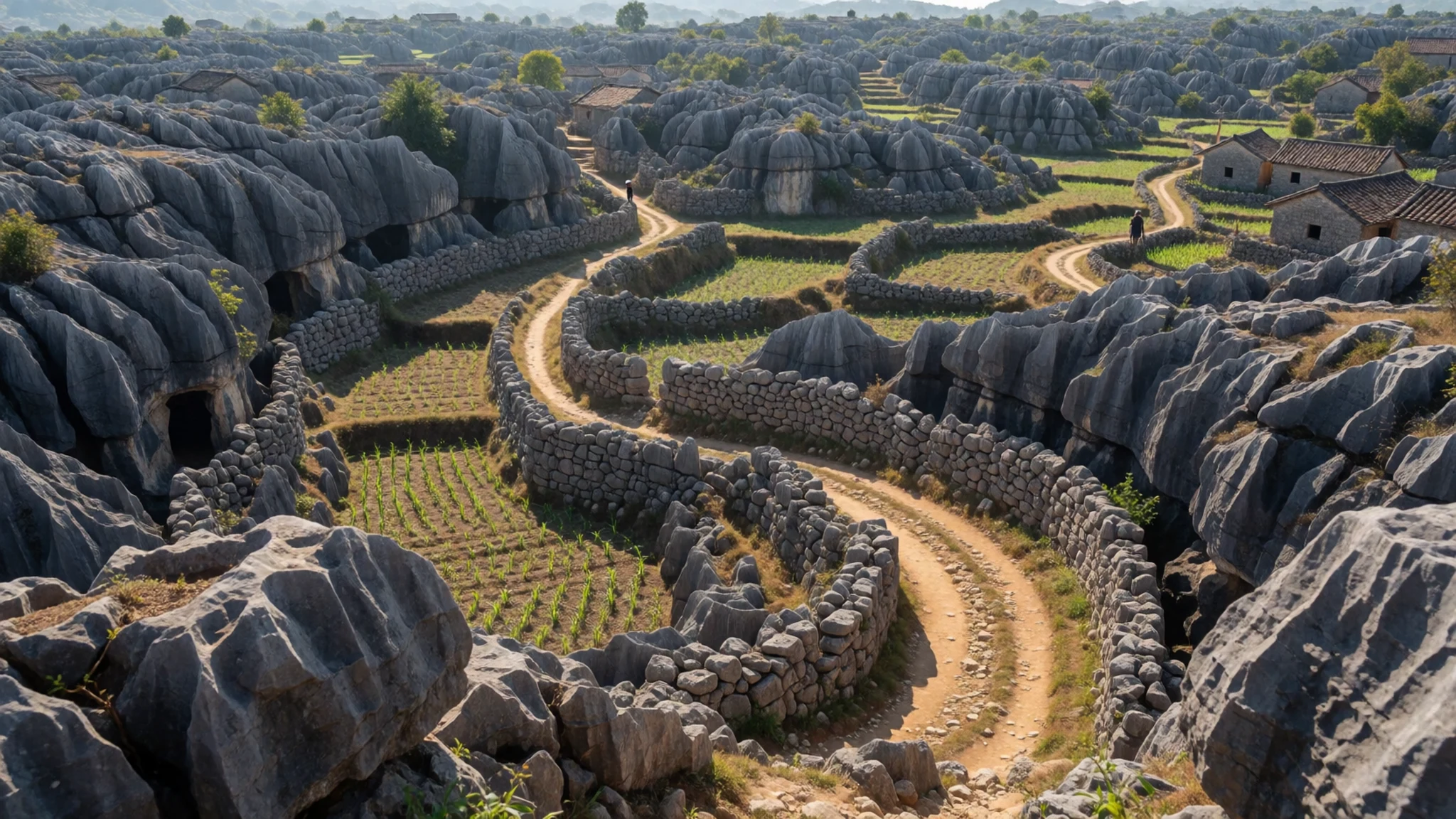
- Mã Pì Lèng Pass — the road linking Mèo Vạc with Đồng Văn
The Mã Pì Lèng Pass is the road that links Mèo Vạc with Đồng Văn, cut high above a deep river gorge. Drivers and riders stop at the viewpoints to look down into the valley. The road is narrow and exposed, so go slowly, keep to the inside line on bends, and avoid the pass in heavy mist.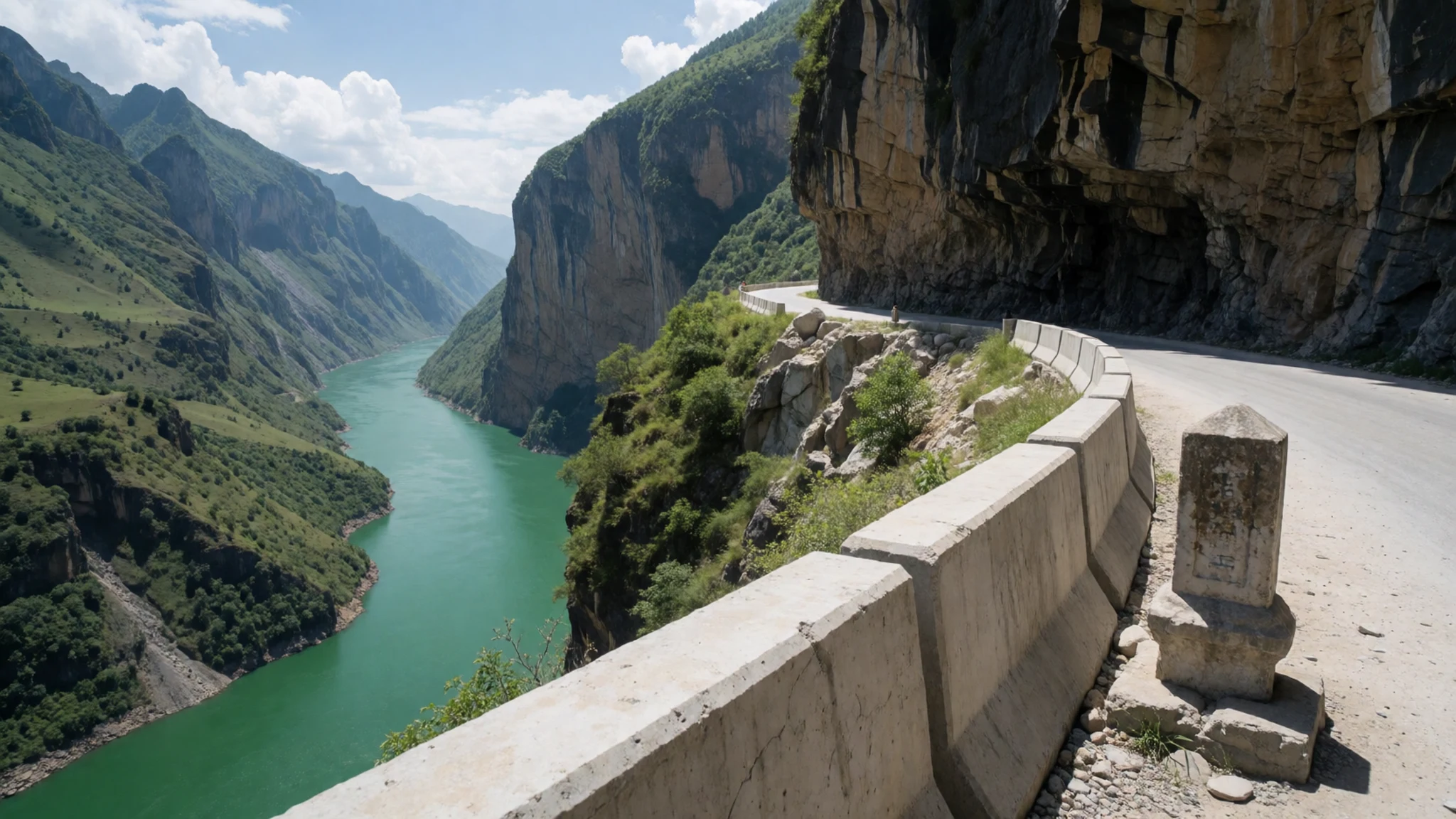
- Sà Phìn and Turtle Hill — Sà Phìn commune, Đồng Văn district
Sà Phìn is a commune where the Residence of the Hmong Lord stands on Turtle Hill, a traditional family house that once belonged to a local ruler. The building offers a glimpse of the old order, and the village still has older houses in daily use. Visitors should ask before entering private courtyards and keep the visit short.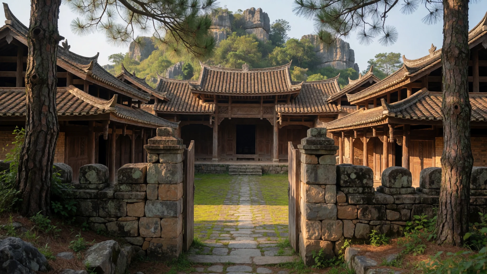
- Hà Giang provincial museum — Hà Giang city, on the Lô River
The provincial museum in Hà Giang city displays old cannon, a reminder of the garrison history that shaped the town. The displays focus on the region's past and its many peoples. Opening times change, so check the official provincial site before you plan a morning around it.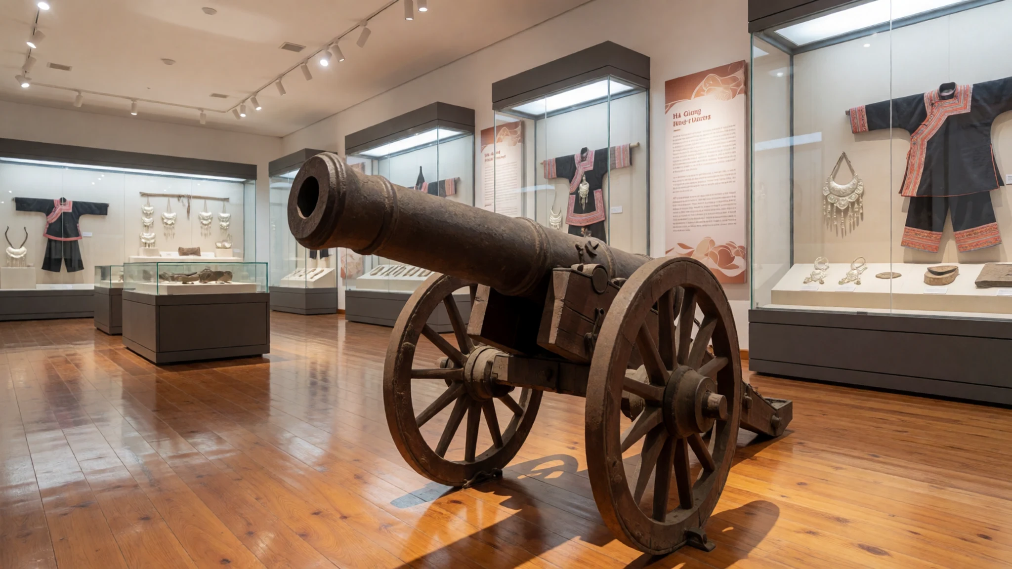
- Tam Sơn town — Quản Bạ district, on the northern loops
Tam Sơn is the district seat of Quản Bạ, a small town that makes a practical base for the northern loops. Its market and guesthouses serve travellers and local residents alike. The town is calm by Vietnamese standards, and it is a good place to break a long drive before climbing further north.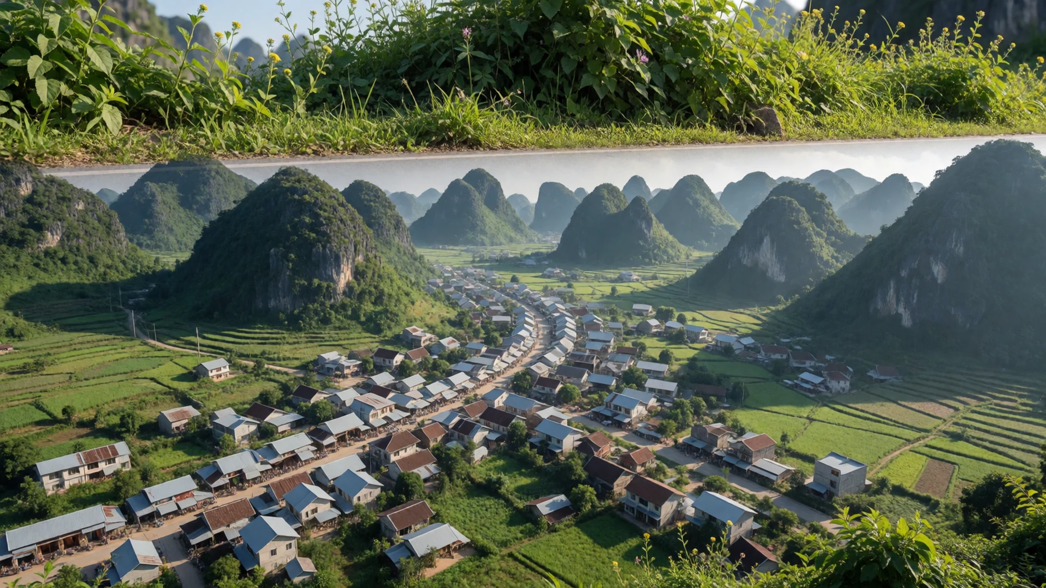
- Đồng Văn town — Đồng Văn district centre
Đồng Văn town is the administrative centre of the plateau district. It has a small market, a stretch of older houses and a busy morning when villagers come down from the hills to trade. Shops close earlier than in the cities, so plan your meals before dusk.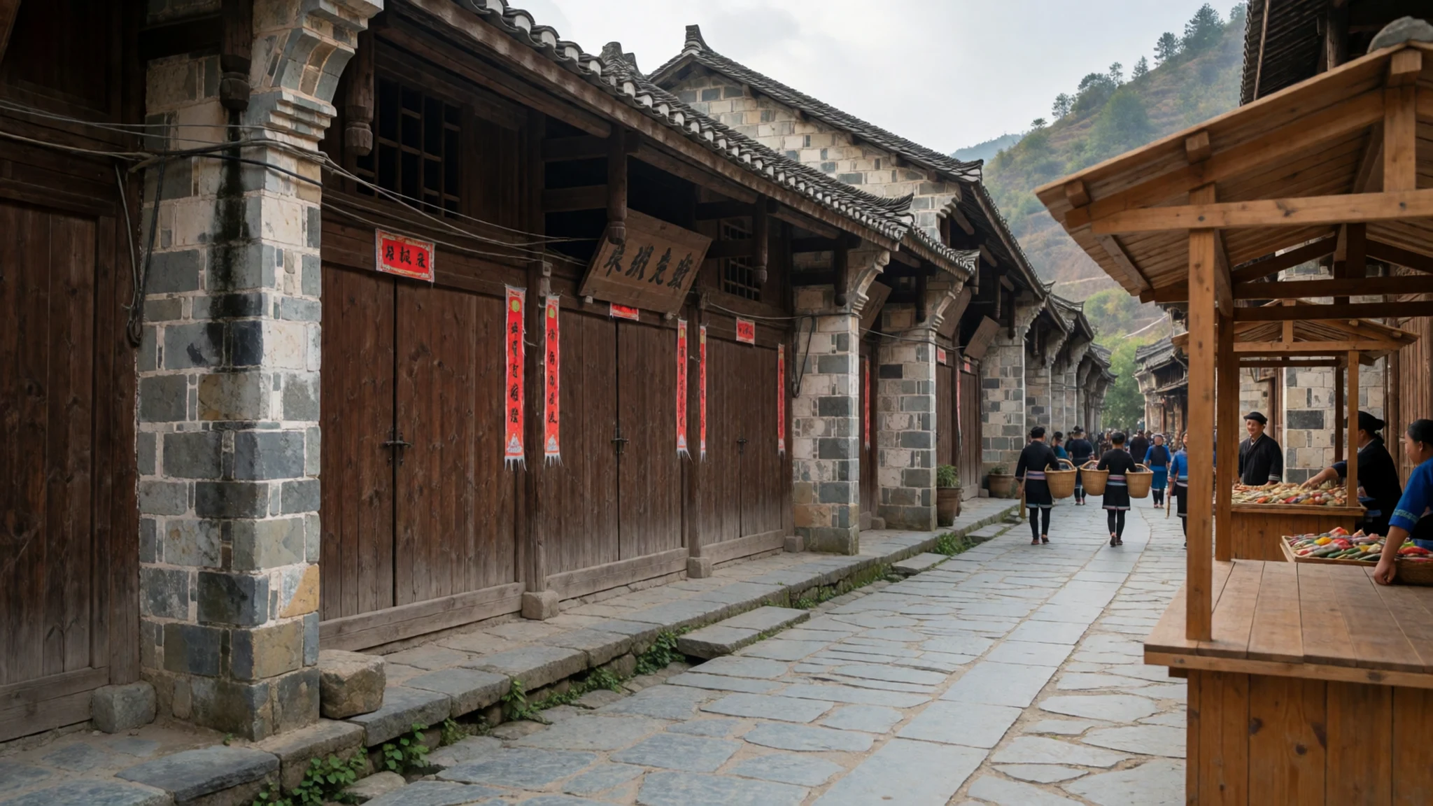
Culture
In Hà Giang, a province with many ethnic minority groups, cultural life is organised around the seasons and the fields. Many of these groups, including the H'Mông and Dao, are known for weaving and handmade textiles, and that craft still runs through family life and market stalls. The Spring Festival, held shortly after the Lunar New Year, brings singing, feasting and drinking to villages where the H'Mông and Dao celebrate together. The Buckwheat Flower Festival marks the blooming of buckwheat across the Đồng Văn Karst Plateau, while the Long Tong Festival is the Tày farming festival that marks the start of a new season in the fields.
Respect for elders runs deep in Vietnamese families, and it shapes how strangers are welcomed. Guests are often offered food and drink before any questions are asked, and an invitation to share a meal is a sign of friendship rather than a formal transaction. Conversation tends to be indirect, and voices stay measured in homes and at shrines.
Ask before photographing people, especially at festivals, at weaving work or at family altars, and take your shoes off before entering any home or temple.
What to wear
Traditional dress in Hà Giang varies by community, but the textiles share a common craft. H'Mông and Dao women have long woven hemp and cotton, dyed in indigo and decorated with batik, appliqué or embroidery. Pleated skirts, embroidered jackets and headwear are worn for festivals, weddings and funerals. The Lô Lô also make indigo cloth, and Tày weaving is another strong tradition in the region. Many garments are still made at home, and the patterns carry family and village identity.
In everyday life many people wear ordinary Vietnamese clothing: trousers, shirts and plastic sandals for the market, with younger people favouring jeans and jackets. Traditional outfits come out for festivals such as the Spring Festival and the Buckwheat Flower Festival, and for family ceremonies.
Visitors should dress for the altitude and the weather rather than for style. Pack a warm layer for the mountain passes, which can be cold and misty even when the valleys are mild, and wear long trousers and a helmet for motorbike loops. Sturdy shoes with good grip suit the stone roads and muddy paths. At temples and in village homes, cover shoulders and knees, and take shoes off where others do.
What to eat
- Thắng cố — the morning market in Đồng Văn town
Thắng cố is a dark, spiced broth of meat and offal, simmered for hours and served in bowls with maize or rice on the side. It is closely tied to highland communities, and it is a market-day dish, ladled from big pots.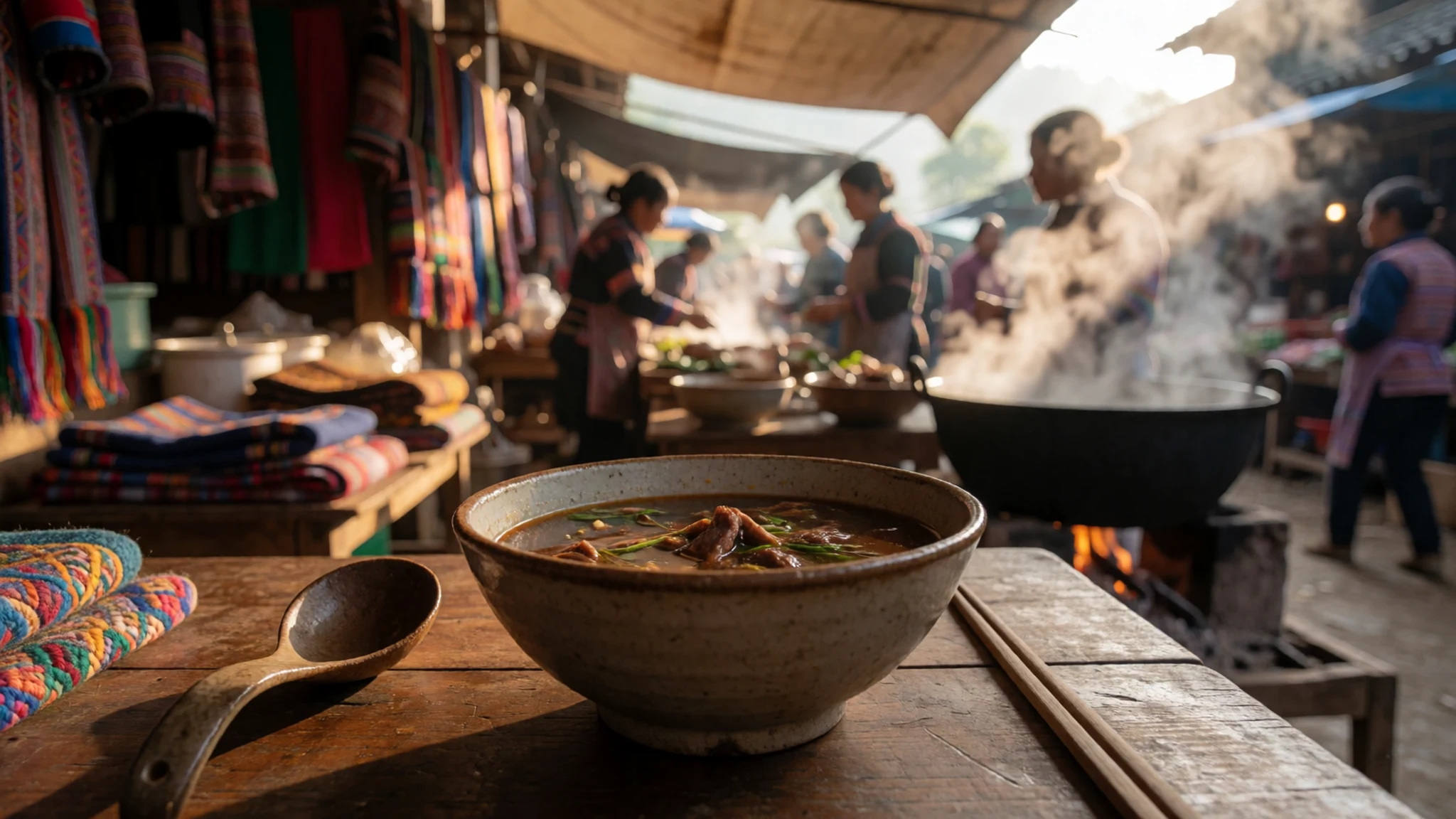
- Mèn mén — family kitchens in village homestays and simple eateries around Đồng Văn
Mèn mén is steamed maize flour, pressed into a mound and eaten with greens, pork fat or a sauce of chilli and salt. It is filling and plain, the kind of food that suits a long day in the hills.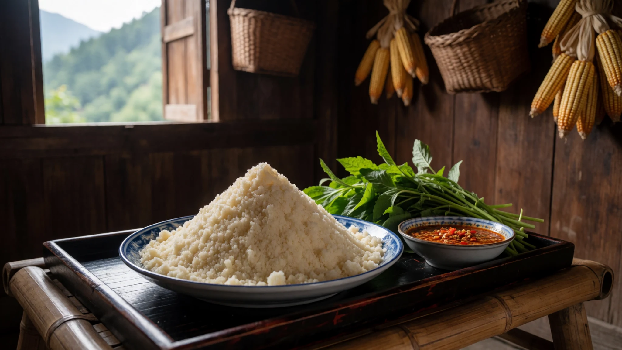
- Thịt trâu gác bếp — the evening food stalls in Hà Giang city
Buffalo meat is salted and smoked over the kitchen fire until it dries to a firm, dark strip. It is sliced thin and eaten with chilli salt and a small cup of rice wine, and it is often given as a gift for a feast. - Rượu ngô — roadside houses on the loop routes and village homestays
Corn spirit is distilled in small village stills, clear and strong, and poured into small cups at meals. Sample it in small measures, and ask the host how it was made before accepting a second cup. - Cà phê sữa đá — any street café in Hà Giang city
Strong coffee drips through a small metal filter onto condensed milk, then is poured over ice. It is served in cafés throughout town and is the easiest way to start a morning on the road.
Plan it
Best time. Late March to April and October to November suit most visitors. Weather in Hà Giang is highly local, so one valley can be misty while the next is clear. June to August brings heavy rain, which makes the loop roads slow and sometimes closes them.
How long. 3–4
Getting there. Fly into Hanoi, then travel north by overnight bus, train or hired car. Hà Giang city lies about 320 km from Hanoi along the main northern highway, and the road gets narrower and steeper beyond the provincial capital.
Budget. low
Tips
- Book a sleeper bus or a driver for the long first leg, because the road north is slow
- Start the mountain loops early, as cloud often clears in the morning and builds by afternoon
- Bring cash, since village stalls and homestays rarely take cards
- Carry water and snacks, because shops thin out quickly beyond the towns
- Hire a local driver for the high plateau roads unless you are an experienced motorbike rider
Etiquette
- Ask before photographing people, particularly at festivals and at weaving work
- Remove shoes before entering a house or a temple
- Accept food and rice wine politely, and sip rather than refuse outright
Nearby
Sources
- Wikidata Q36685 (CC0)
- Wikipedia: Hà Giang province (rev 1380986213) (CC BY-SA 4.0)
- Wikivoyage: Vietnam (rev 5410523) (CC BY-SA 4.0)
- Photo: Ha Giang Province, Northeast Vietnam (Nguyễn Vũ Hiệp) (CC BY 3.0)
- Photo: Đèo Mã Pì Lèng (haithanh) (CC BY 2.5)
- Photo: Súng thần công, Bảo tàng tỉnh Hà Giang (Hoangvantoanajc) (CC BY 3.0)
- Photo: Thị trấn Tam Sơn (Thái Nhi) (Public domain)
- Photo: Cao nguyên đá Đồng Văn (Hoangvantoanajc) (CC BY 3.0)
- Photo: Sà Phìn, Hà Giang (BacLuong) (Public domain)
- Photo: tt. Đồng Văn (trungydang) (CC BY 3.0)


