Gwaii Haanas National Park Reserve and Haida Heritage Site
Gwaii Haanas National Park Reserve and Haida Heritage Site, Canada
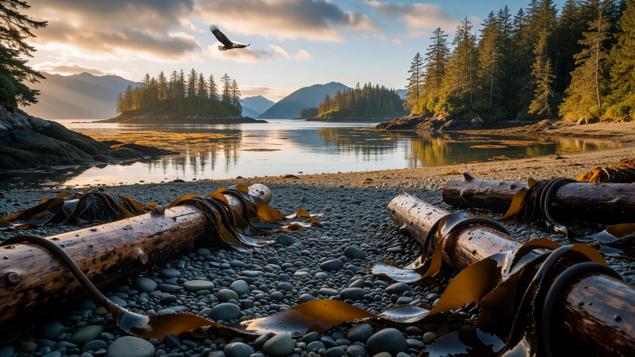
Gwaii Haanas is a roadless Haida-managed archipelago of rainforest, kelp coast and abandoned village sites, reached only by boat or floatplane.
The place
Gwaii Haanas National Park Reserve and Haida Heritage Site sits in the far south of Haida Gwaii, an island group about 130 km off the British Columbia mainland. It protects an archipelago of 138 islands and covers roughly 1,470 km². Moresby Island is the largest; Kunghit Island is the southernmost. The name comes from X̱aayda kíl, a southern Haida dialect, and means "Islands of Beauty".
There are no roads here. Nothing connects the reserve to the outside world except water and air, so every visit begins with a boat, a kayak or a chartered floatplane. Most travellers start from the small communities on neighbouring Graham and Moresby Islands. Trips range from a single day to a week or more, and every one needs a permit, so the planning matters as much as the paddling.
The landscape is a patchwork of dense, mossy forest, rocky headlands, small pebble and sand beaches, and sheltered inlets. Weather rolls in off the Pacific and changes fast. Wildlife is part of the daily rhythm, and the sea is the main thoroughfare.
The place is also a living homeland. The Haida people trace their presence on these islands back many thousands of years, and the Haida Nation takes part in running the reserve alongside the Government of Canada. That shared management shapes the rules, the guided programmes and the way visitors are asked to behave. Gwaii Haanas is not a wilderness emptied of people. It is a landscape in which old villages, forest and sea are all treated as one inheritance.
Its story
Gwaii Haanas National Park Reserve and Haida Heritage Site owes its existence to a long argument over trees. When plans to log Burnaby Island surfaced, they set off the first serious campaign to keep the southern islands intact. A document called the South Moresby Wilderness Proposal laid out the case for protection.
The Haida Nation did not wait for governments to act. In 1985 it declared a Haida Heritage Site covering roughly the southern third of the archipelago, taking in both land and sea. Logging nevertheless carried on while legal and political fights played out. It stopped in 1987, when Canada and British Columbia signed the South Moresby Memorandum of Understanding.
A year later, the South Moresby Agreement created a national park reserve. The word "reserve" mattered: land ownership claims between federal and Haida governments were still unresolved, so the area was held back for eventual full park status. Meanwhile it was run as though it were already a national park, which protected the forests and allowed the two governments to share responsibility.
The next step came in 1993, when Canada and the Council of the Haida Nation signed the Gwaii Haanas Agreement. It gave the reserve its Haida name and set out a joint commitment to look after the place, recognising both Canadian and Haida designations. The arrangement is often cited as a model of cooperative management.
Older history runs deeper still. Haida oral histories, the Ḵ'aygang.nga, describe people living here when the first trees returned as the glaciers melted. Pollen evidence suggests trees arrived about 14,500 years ago.
What to see
- SGang Gwaay — Southern Gwaii Haanas
SGang Gwaay is a small island in the south, home to the remains of a Haida village and a number of standing totem poles. Disease devastated the community in the 1880s. Visits are made with Haida Gwaii Watchmen on site, and the weathered poles lean quietly among the trees.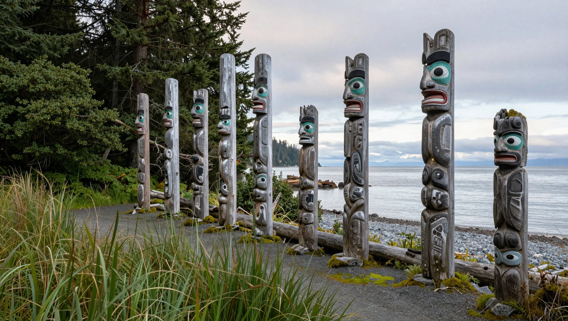
- Windy Bay forest — Lyell Island area
Windy Bay is where the argument over logging became concrete. Walking in, the scale is what strikes first: huge conifers, deep moss, fallen trunks sprouting new seedlings, and a floor so soft it muffles footsteps. Light arrives in thin shafts. It is damp, green and very quiet.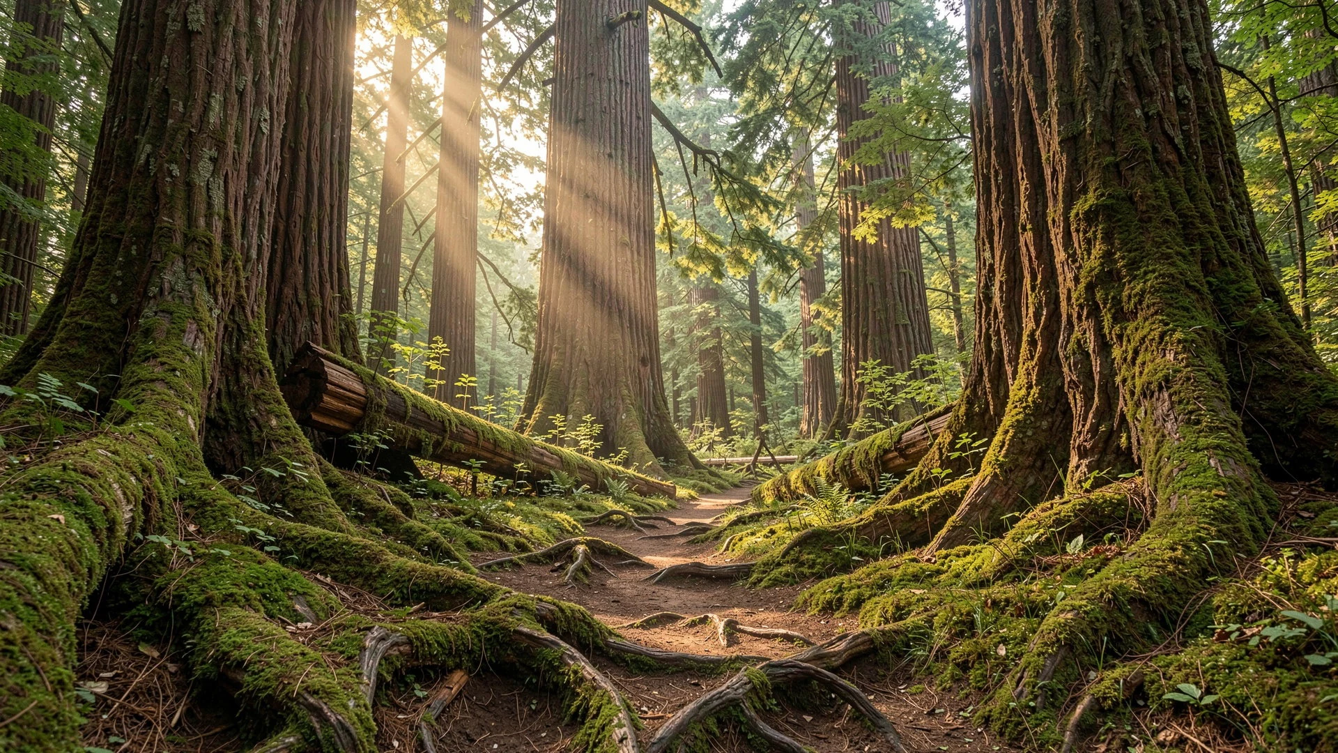
- Burnaby Island — Eastern Gwaii Haanas
Burnaby Island was the spot where proposed logging first drew organised opposition. Today it suits slow kayaking, with sheltered channels, tidal pools and rocky shores to explore. Paddlers often plan stops here because the water is calmer than on the exposed outer coast, though conditions still need respect.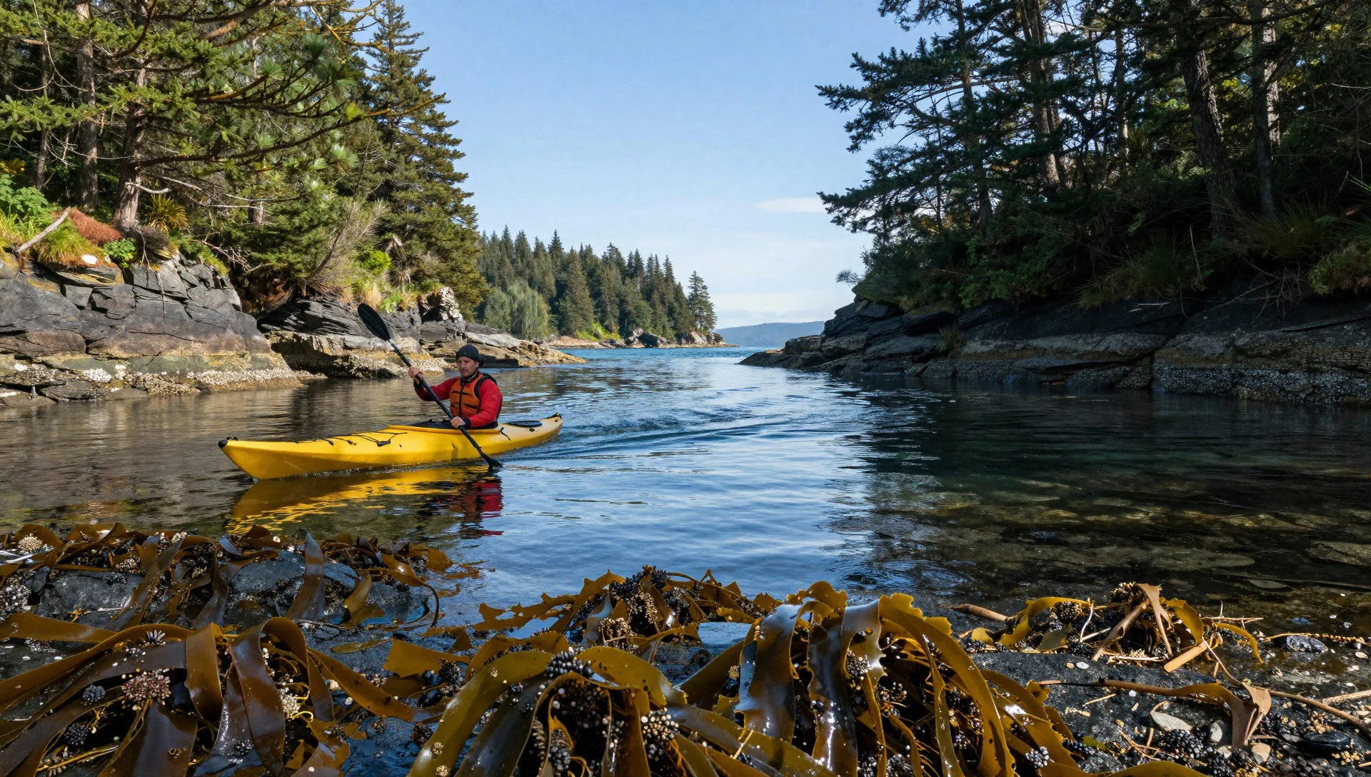
- Kunghit Island — Southern tip of the archipelago
Kunghit Island is the southernmost of the 138 islands and feels like the far end of the map. Reaching it takes real commitment, usually on a longer guided trip or a well-planned independent paddle. The reward is exposed Pacific coastline, few other people and a strong sense of remoteness.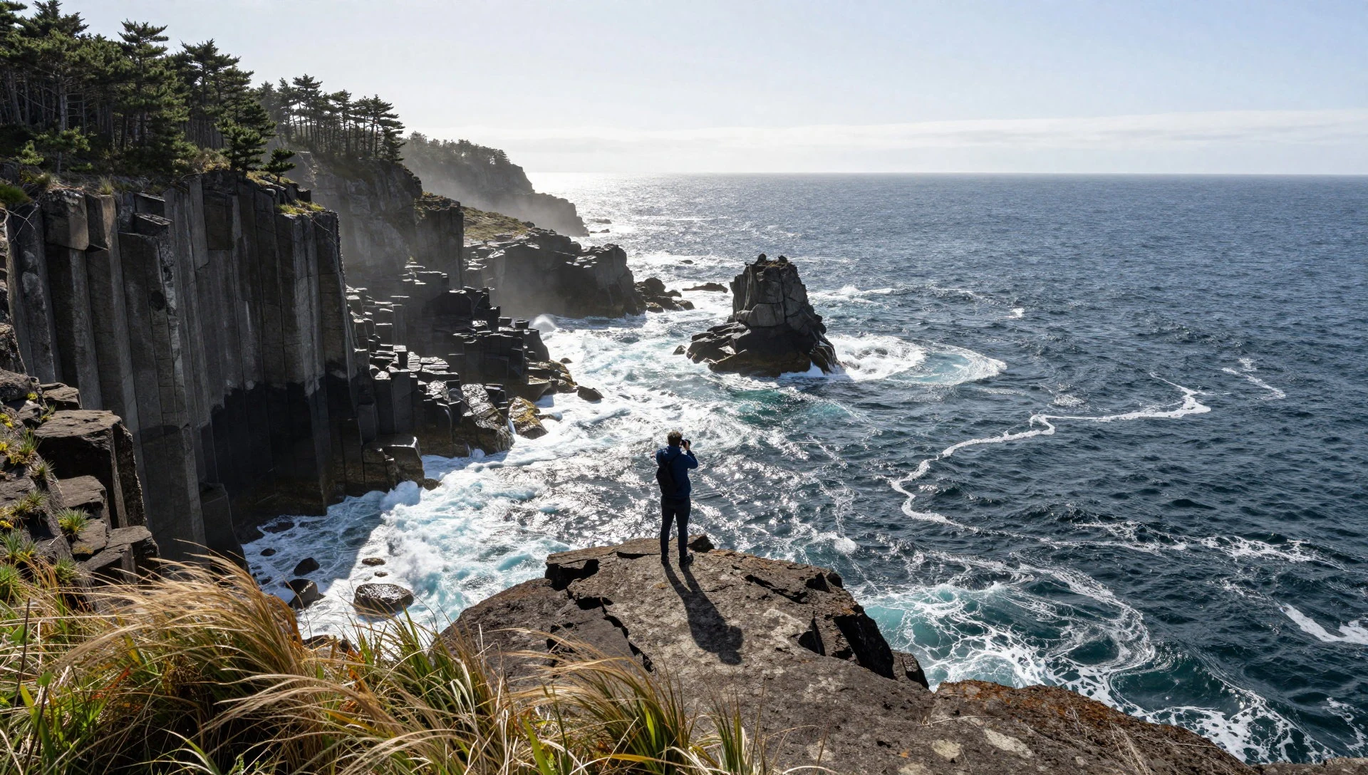
- Moresby Island coast — Western and central Gwaii Haanas
Moresby Island is the largest island in the reserve and the departure point for many trips. Its shoreline offers pebble beaches, small coves and headlands suited to informal camping. Kayakers, boat tours and floatplane flights all start from the communities nearby, so it works as the practical gateway.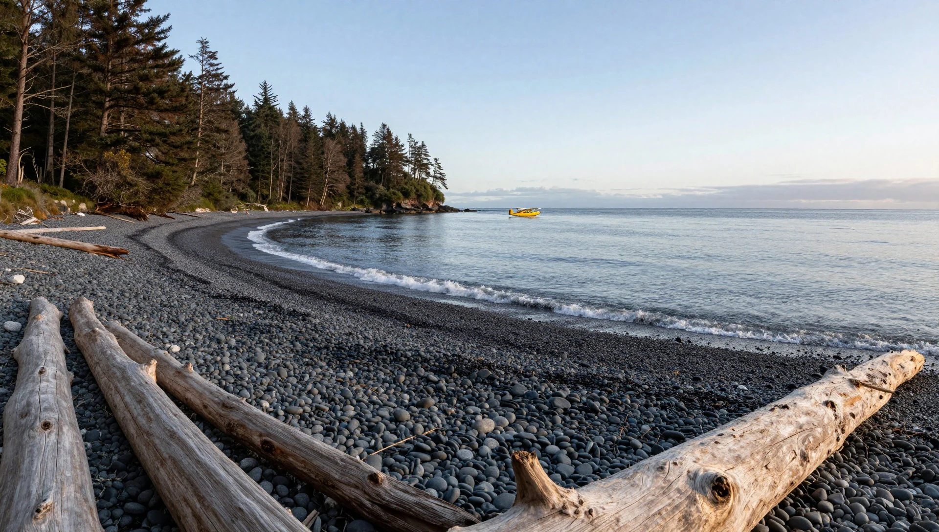
Culture
Gwaii Haanas is Haida territory, and Haida culture is present in every part of how the reserve runs. The Haida Nation and the Government of Canada manage it together under an agreement signed in 1993, so the rules visitors follow carry the weight of both governments. Haida Watchmen, local guardians, stay at several village sites during the season to look after them and to welcome travellers.
Haida art is best known for its carved cedar poles, which record family lineages, crests and important events. Poles at old village sites were never meant to be permanent. They stand, lean and eventually return to the forest, and that natural decay is part of the tradition rather than a failure of conservation. Oral history has equal standing with written record, and the Ḵ'aygang.nga holds accounts that go back to the arrival of the first trees.
The islands are known by their Haida names as well as English ones. Haida Gwaii replaced Queen Charlotte Islands, and Gwaii Haanas, the name of the reserve itself, is a Haida phrase. Using the Haida names is a small way of showing respect.
The village sites are places of ancestors, not outdoor museums. Many travellers find the experience quiet and moving rather than spectacular. Listen to the Watchmen, ask questions politely and take time rather than rushing between stops.
At village sites, follow the Watchmen's instructions, keep to marked paths, and never touch, climb on or remove anything from the poles, house remains or shoreline.
What to wear
Traditional Haida dress draws on the materials of the coast. Cedar bark, softened and woven, is made into capes, skirts and hats, and woven spruce-root hats shed rain well. Button blankets are wool robes with crest designs in red and black, outlined with shell buttons, usually mother-of-pearl or abalone. Together with carved headdresses and painted or woven regalia, they are worn at potlatches, dances and other ceremonial gatherings, not as everyday clothing.
Day to day, people in the Haida Gwaii communities dress for weather. Waterproof jackets, wool jumpers, fleeces, jeans and rubber boots are common sights. Fishing and boating gear is ordinary clothing here, and practical beats polished. Ceremonial regalia appears at gatherings, and artists often wear pieces of their own jewellery or carved work.
For visitors, the key is staying dry and warm on and around the water. Pack a proper waterproof jacket and trousers, not a light shower layer. Wool or synthetic base layers work far better than cotton, which stays wet and cold. Quick-dry trousers, a warm hat and gloves are sensible even in summer, when sea breezes cut through thin clothing.
Footwear matters. Rubber boots or sturdy waterproof shoes suit landings on wet, rocky or pebbly beaches, and many boat trips involve stepping out into shallow water. Bring a spare dry set of clothes in a waterproof bag. There are no dress codes at village sites, but modest, quiet and practical clothing fits the mood. Leave anything flashy or noisy behind.
What to eat
- Fresh halibut — Eateries in the island communities
Halibut is a staple of the cold Pacific waters around Haida Gwaii. It is typically baked, pan-fried or grilled and served simply. Look for it in the small eateries in the communities on Graham and Moresby Islands, or ask on a guided trip.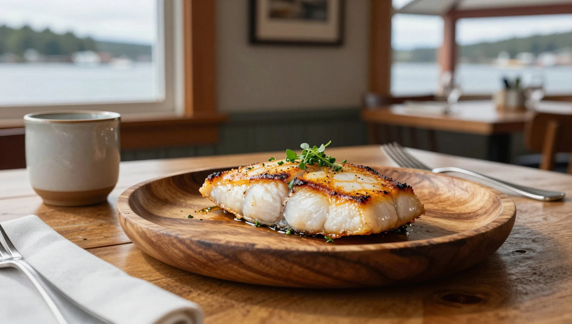
- Wild salmon — Community shops and markets on Graham Island
Salmon has long been central to Haida life, and it is still eaten smoked, barbecued or cooked over open fires. Smoked salmon makes a good picnic food for the trail. Ask at local shops and community markets for locally smoked fish.
- Dungeness crab — Harbour-side eateries and guided trips
Crab is a coastal treat in the islands, usually boiled and eaten with plain bread or butter. It tends to appear on menus when the fishing allows, so availability varies. Local eateries and guided trip dinners are the best bets. - Spot prawns — Seasonal menus in island communities
Spot prawns are sweet, fresh shellfish from the cold coastal waters. They are often steamed or lightly sautéed. Seasonal availability matters, so ask locally rather than expecting them on every menu. - Bannock — Community events and local cafés
Bannock is a simple fried or baked bread found across many Indigenous communities in Canada. Served warm with jam or alongside soup and smoked fish, it makes a filling snack for a damp day.
Plan it
Best time. May to September is the practical window, when the days are longest and boat and floatplane trips run most reliably. The coast is wet and changeable at any time, so expect rain and wind even in summer.
How long. 4–7
Getting there. Gwaii Haanas has no roads and can be reached only by boat, kayak or chartered floatplane. Most travellers fly or ferry to Haida Gwaii, stay in a community on Graham or Moresby Island, and join a guided trip or arrange a boat or floatplane from there.
Budget. high
Tips
- Every visit needs a trip permit, so check the official site and book before travelling: https://parks.canada.ca/pn-np/bc/gwaiihaanas
- Weather can delay boats and floatplanes, so leave spare days in the schedule
- There are no formal campsites; pitch above the high tide line on sand or rock and leave no trace
- Carry layers, waterproofs and a dry bag, and bring everything you need because there are no shops in the reserve
- Guided trips suit first-time visitors who are not experienced sea kayakers
Etiquette
- Follow the Haida Watchmen's guidance at village sites and never touch the poles
- Camp away from other groups so each party keeps its own privacy and quiet
- Take all rubbish out and leave each beach as you found it
Nearby
Sources
- Wikidata Q862285 (CC0)
- Wikipedia: Gwaii Haanas National Park Reserve and Haida Heritage Site (rev 1369405457) (CC BY-SA 4.0)
- Wikivoyage: Gwaii Haanas National Park Reserve (rev 5404168) (CC BY-SA 4.0)
- Windy Bay forest — Sam Beebe (CC BY 2.5)
- Gwaii Haanas 28832822035 — Brett Hodnett (CC BY-SA 2.0)
- Haida totem pole from Tanu — Vysotsky (CC BY-SA 4.0)
- Gwaii Haanas National Park 27482050431 — Christine Rondeau (CC BY 2.5)
- Gwaii Haanas 28827417155 — Brett Hodnett (CC BY-SA 2.0)
- Gwaii Haanas 28799733376 — Brett Hodnett (CC BY-SA 2.0)
- Gwaii Haanas National Park 27455540642 — Christine Rondeau (CC BY 2.5)
- Gwaii Haanas 28724808792 — Brett Hodnett (CC BY-SA 2.0)


