Gunung Mulu National Park
Gunung Mulu National Park, Malaysia
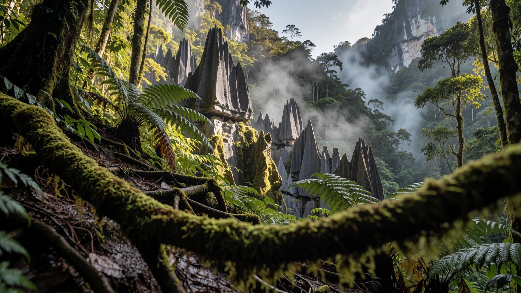
Go for one of the most studied tropical karst landscapes anywhere, with caves full of bats and swiftlets and trails through rainforest.
The place
Gunung Mulu National Park lies in Miri Division in the Malaysian state of Sarawak, on the island of Borneo, close to the Brunei border. It is a UNESCO World Heritage Site, and most people come for its caves. The explored passages run to about 295 km and shelter millions of bats and swiftlets. Gunung Mulu National Park is frequently called the most thoroughly researched tropical karst landscape anywhere on Earth. Above ground the landscape is equatorial rainforest broken by steep ridges, sheer cliffs, gorges, karst towers and terraces, with hot springs and waterfalls in between. The park takes its name from Mount Mulu, which at 2,376 m is the second highest mountain in Sarawak. Mount Api and Mount Benarat are limestone peaks, while Mount Mulu is sandstone, so the rock changes with each walk. The western side is lowland, about 38% of the park, and the eastern side rises into mountain ranges. The Melinau River shapes many of the routes in and out. Getting there is the main planning decision. The small airstrip sits just outside the boundary, and flights can be disrupted by cloud. The park headquarters is the base for guided walks and cave tours, and it is the place where most visitors start and finish their days.
Its story
The story of Gunung Mulu National Park begins with outsiders describing a landscape that local people already knew well. The first written mention of the caves came in 1858, when Spenser St. John, the British Consul in Brunei, described limestone masses full of caverns and natural tunnels in a book about the forests of the Far East. He later tried to reach the summit of Mount Mulu and was turned back by limestone cliffs, dense forest and sharp pinnacles. Charles Hose, an administrator in the Raj of Sarawak, also failed to climb it in the nineteenth century. Progress came through local knowledge. Tama Nilong, a Berawan hunter, found the south-west ridge that eventually led to the top, and in 1932 he guided Edward Shackleton and an Oxford University expedition to the summit, the first successful ascent. In 1961 G.E. Wilford of the British Borneo Geological Survey surveyed Deer Cave and the Cave of the Winds, and he predicted that more caves would be found. In 1974 the Sarawak government gazetted the mountain and its surroundings as a national park. The park's reputation rests on the expedition that followed. The Royal Geographical Society's 1977–1978 expedition, the largest ever sent from the United Kingdom, kept more than 100 scientists in the field for 15 months. A smaller group surveyed about 50 km of caves, among them Clearwater Cave, Green Cave, Wonder Cave and Prediction Cave. There was then no airport and no logging road, so the work was slow and physically demanding. The expedition launched more than 20 later expeditions, now grouped as the Mulu Caves Project.
What to see
- Clearwater and Wind Caves — Mulu cave system
Clearwater Cave is one of the passages the 1977–1978 Royal Geographical Society expedition explored and surveyed, and Wind Cave is part of the same network of caves. Expect guided walks, wet and slippery floors, and a steep approach, so wear closed shoes and carry a torch at all times. Allow a full day for the walks.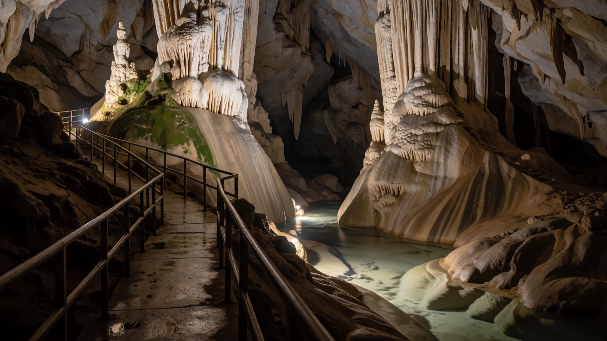
- Deer and Langs Caves — Park HQ area caves
Deer Cave was first surveyed in 1961 by G.E. Wilford, and it is the cave best known for the bat flight at dusk. Langs Cave lies close by and is usually visited on the same outing. Paths lead to the entrance, and the interior is dark, so bring a torch and keep to the marked route.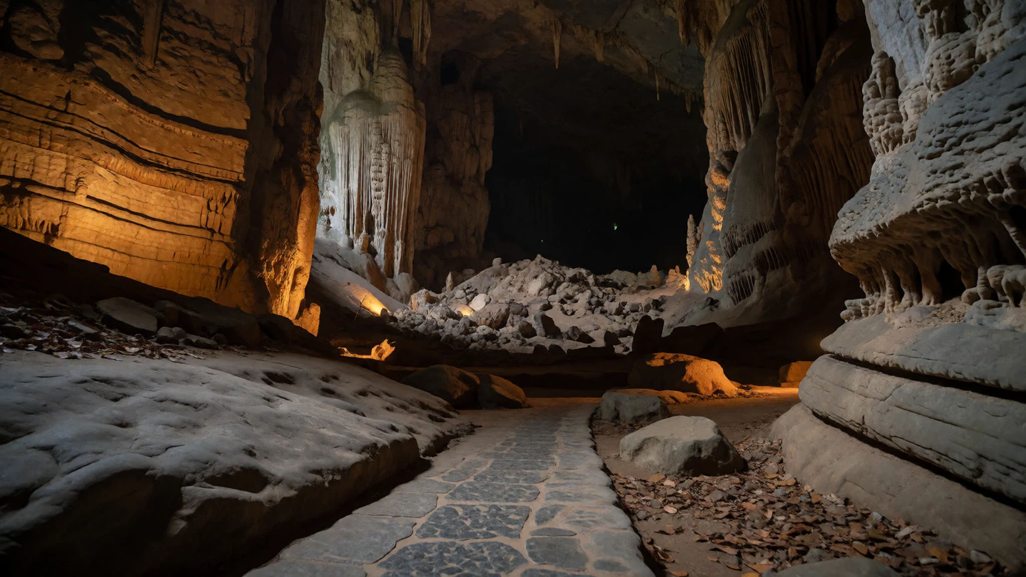
- Bat Exodus — Deer Cave mouth
The evening bat exodus is one of the park's signature sights. Large numbers of wrinkle-lipped free-tailed bats stream out of the cave mouths at dusk, and the flow goes on for some time. Watch from the designated viewing area, stay quiet, and keep flash photography off, since the bats are sensitive to light.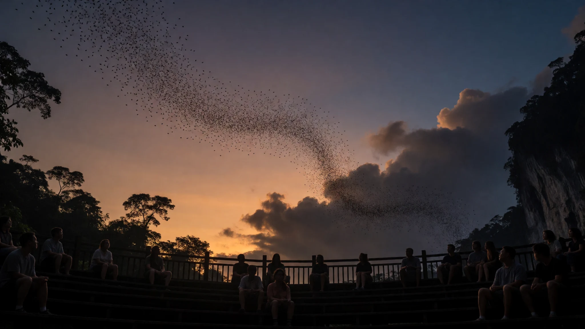
- Paku Waterfall — Forest trail near Park HQ
Paku Waterfall pours out of dense forest and cascades down a sloping cliff face. The natural pool at its base is a welcome place to cool off, because the humidity on the way there is heavy. It is a forest walk rather than a cave visit, so it suits anyone who wants water and trees rather than underground passages. Bring water and wear shoes with grip for the wet rock.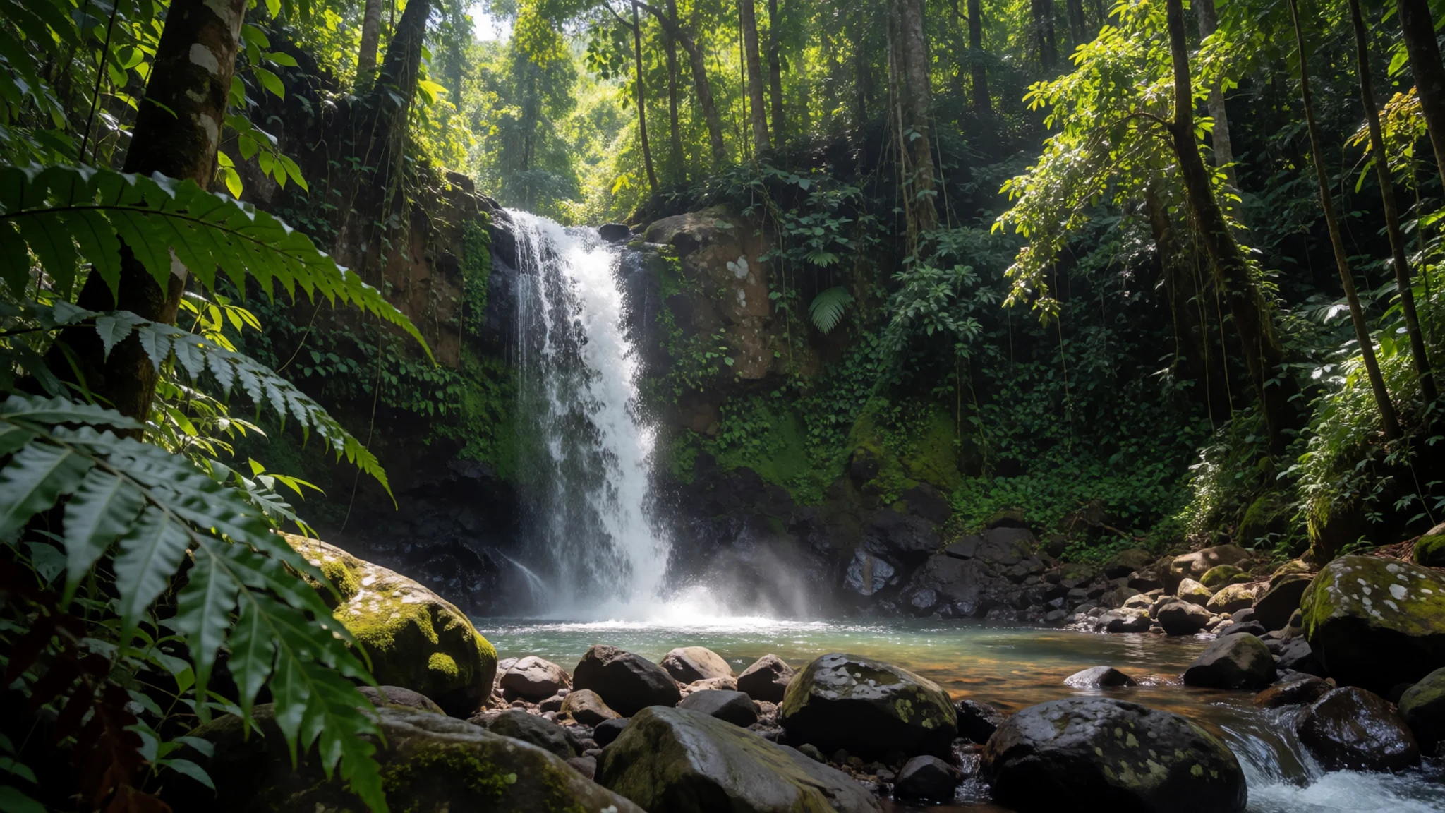
- The Pinnacles Summit Trek — Mount Api, north of the park
The Pinnacles trek is a three-day, two-night walk to the Pinnacles, the sharp limestone spires near Mount Api. It usually begins with a boat ride of one or two hours from the Melinau River to Kuala Berar, at the Berar delta. Arrange a guide before you go, and treat the trek as a serious undertaking rather than a stroll.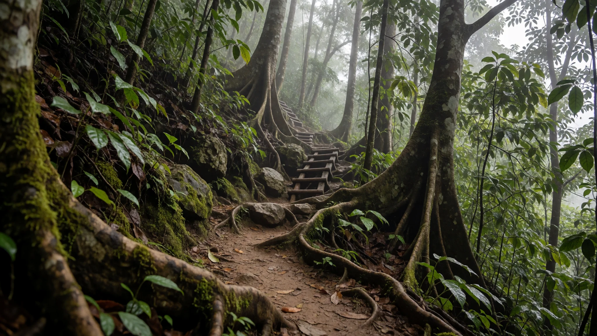
Culture
Gunung Mulu National Park is a protected landscape, but it sits within a Sarawak where many communities have longer ties to the forest than any expedition. Their histories run through the park's own story. The Headhunter's Trail follows the route the Kayan took from the Melinau River to the Melinau Gorge, so it is best walked as a route through the landscape rather than as a spectacle. Malaysia has a Muslim majority, but Sarawak has its own mix of faiths and customs, and local guides are the best source of information about what is expected in villages. Modest dress is simple to manage: cover shoulders and knees, and ask before entering a home or photographing a family. Inside the caves, the guide sets the rules for where to step, and in the forest plants, rocks and wildlife are left where they are. Near the bat exits at dusk, speaking quietly keeps the experience calm for everyone. Ask before photographing people or their homes, and keep to the marked paths, because stepping off them can damage cave floors and forest roots.
What to wear
Around Gunung Mulu National Park, traditional dress belongs to the many communities of Sarawak, and there is no single costume to describe. Older garments across the state were often woven and beaded, and the Iban pua kumbu, a ceremonial woven cloth, is among the best known textiles. Patterns, colours and materials differ between groups, so a local museum or an informed guide is the best source for specifics. Most people in the towns and villages now wear everyday clothes much like those in Miri or Kuching, and traditional dress is kept for festivals, weddings and ceremonies. Visitors should pack lightweight, long-sleeved clothing that dries quickly, because humidity and sweat are constant and rain is likely. Long trousers help against insects and leeches on the trails. Closed shoes with grip suit wet limestone and muddy paths, while sandals are fine for the boat. Bring a hat and a rain jacket, and dress modestly, covering shoulders and knees, when visiting villages.
What to eat
- Kolo mee — Coffee shops (kedai kopi) in Miri
Sarawak's everyday breakfast noodle, kolo mee, is dry egg noodles tossed with oil, spring onion and minced pork or char siu, served with a small bowl of broth on the side. It is eaten early, at coffee shops rather than restaurants. Look for it at the kedai kopi in Miri before or after your flight, since eateries inside the park are limited.
- Sarawak laksa — Hawker stalls in Miri
Sarawak laksa is a spiced broth with rice noodles, prawns and shredded chicken, finished with sambal and herbs. It is a filling meal at lunch or dinner. Find it at the hawker stalls and coffee shops of Miri, where it is cooked to order and comes in generous bowls.
- Nasi goreng — Cafes at Park Headquarters
Nasi goreng is fried rice with egg, chilli and whatever vegetables or meat are on hand. It is a dependable choice when options are few. The cafes at Park Headquarters, including Cafe Mulu, serve basic local meals that are a little pricey by local standards. - Fresh tropical fruit — Stalls and homestays in the village outside the park
Papaya, pineapple, bananas and rambutan are sold cut or whole at roadside stalls and at homestays in the village outside the park. Fresh fruit is a good way to get energy after a trek, and it is often sold in the heat of the day. Peel and eat it the same day for the best flavour.
Plan it
Best time. Mulu is equatorial, so it is warm and humid all year, with rain possible in any month. The drier stretch of roughly March to September suits trekking best, but flights are affected by cloud whenever the weather turns.
How long. 3
Getting there. Fly from Miri to Mulu airport (MZV), just outside the park boundary, with MASWings flights of about 30 minutes. The last leg is a minivan ride or a walk of about 1.5 km to Park Headquarters.
Budget. mid
Tips
- Build a spare day into your plans, because flights in and out are often delayed or cancelled by weather
- Check the official site for guided cave tours and trek arrangements before you travel
- Choose a homestay within a short walk of the airport to keep the last leg simple
- Carry water and boil it if you can, since tap water is potable but boiling is advised
- Carry some ringgit in cash for small purchases in the village
- Use a headlamp for cave visits and keep your hands free on wet, steep sections
Etiquette
- Keep to marked paths and cave routes, and follow your guide's instructions
- Ask before photographing people, longhouses or family homes
- Do not touch cave formations or take rock, plants or wildlife away
Nearby
Sources
- Wikidata Q61535 (CC0)
- Wikipedia, Gunung Mulu National Park (rev 1378709091) (CC BY-SA 4.0)
- Wikivoyage, Gunung Mulu National Park (rev 5247224) (CC BY-SA 4.0)
- Mulu Pinnacles photo, Gurazuru (CC BY-SA 4.0)
- Paku Waterfall photo, Bernard DUPONT (CC BY-SA 2.0)
- Entrance to Deer Cave photo, Bernard DUPONT (CC BY-SA 2.5)
- Wrinkle-lipped free-tailed bats photo, Bernard DUPONT (CC BY-SA 2.0)
- Nepenthes faizaliana, Pinnacles photo, JeremiahsCPs (CC BY 3.0)
- Penan Village on the Melinau River photo, John Mason (CC BY 2.5)
- Gunung-Mulu-Nationalpark, Flugplatz photo, Slimguy (CC BY-SA 4.0)
- Gunung-Mulu-Nationalpark, Pinnacles photo, Slimguy (CC BY-SA 4.0)


