Gokyo Lakes
Gokyo Lakes, Nepal
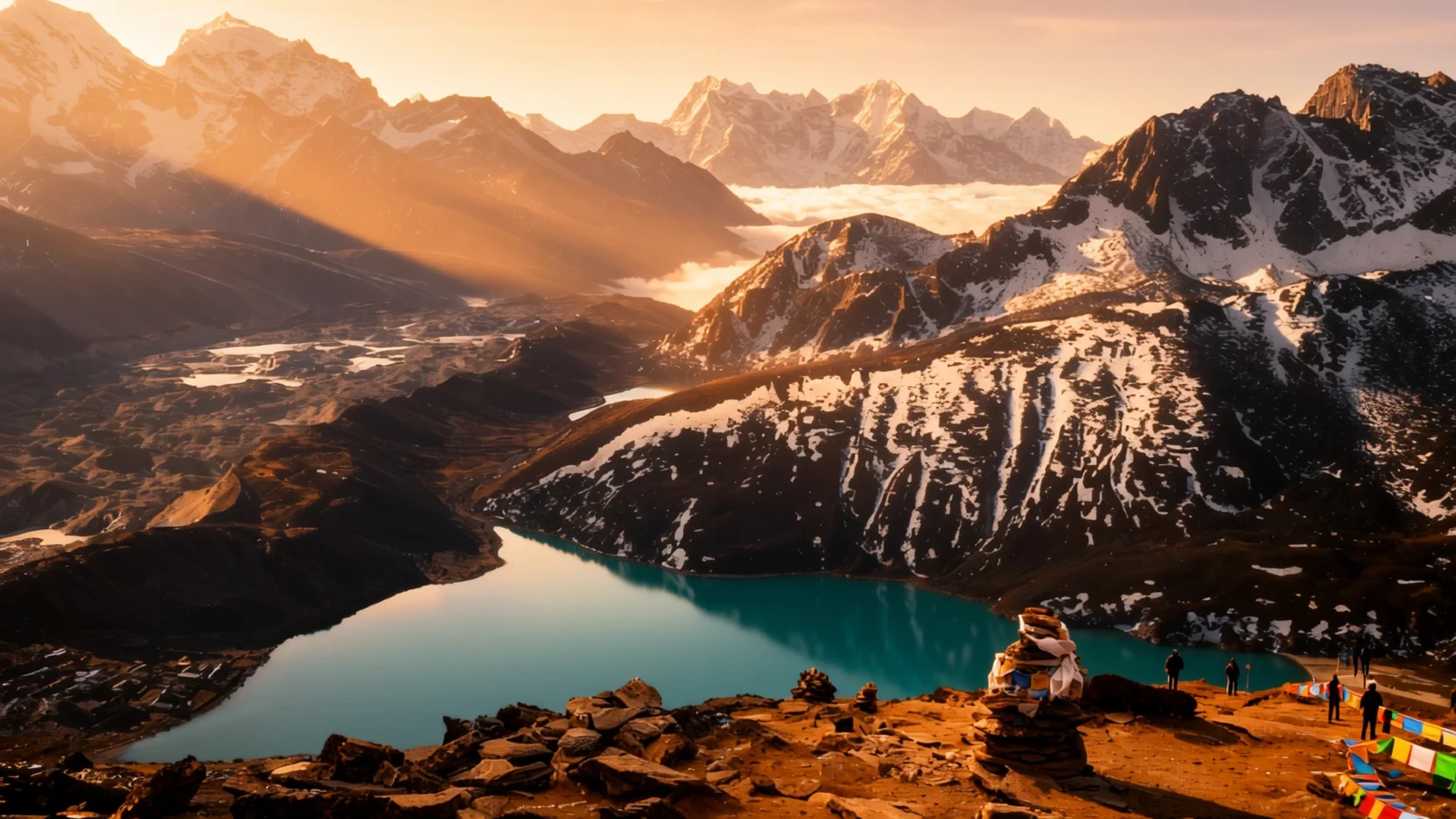
High-altitude lakes beneath Gokyo Ri, reached by a trekking route through Sagarmatha National Park, where the Everest view is the reward.
The place
Gokyo Lakes are a group of lakes in Nepal's Sagarmatha National Park, sitting in a high valley in the Khumbu region. They take their name from Gokyo Ri, the peak that rises above the lakeshore and is the usual reason people climb up here. The water is clear and cold, fed by meltwater from the surrounding mountains, and the lakes lie at roughly 4,700 metres, so the air is thin and the nights are bitter even in spring.
The area is a wetland as well as a lake system. In 2007 Gokyo and its associated wetlands were designated a Ramsar site, which recognises their value for water and birdlife. Around the lakes the land is mostly bare rock, scree and moraine, with patches of low shrub and grass in summer. Where meltwater runs, a green band stands out against the grey.
Most visitors arrive on foot as part of a longer trek, and the lakes are a high point of the valley route rather than a single destination. The main lakes lie in a loose chain along the valley, and the views take in several of the big Himalayan peaks. Weather changes quickly. Cloud can build over the ridges by midday and hide everything, so the best photographs and the calmest walking usually come in the early morning, when the air is still.
Its story
The story of Gokyo is partly the story of how people came to walk into it. For a long time the valley was known to the Sherpa communities whose villages lie lower down the Khumbu, who moved animals and goods through high pastures in season. Foreign trekkers arrived much later, drawn first by the route to Everest and then by the lakes that sit off to one side of it.
The lakes took their name from Gokyo Ri, the viewpoint above them. Climbing it became the way most people first saw the lakes laid out below, with the glacier running down toward them. That combination of lake, ice and peaks is what turned a quiet valley into a regular stop on trekking itineraries.
The glacier is the quiet centre of the story. Ngozumpa is a long, debris-covered tongue of ice that spreads across the valley floor, and it feeds the lakes slowly, through meltwater that has to find its way around and under the rubble. As the ice shifts and melts, water collects in new hollows, which is part of why the lake system keeps changing shape over the decades.
Recognition came in 2007, when Gokyo and its wetlands were designated a Ramsar site. The designation did not stop trekking, but it put the valley's water and birdlife into the same conversation as its views. For the people who live and work in the valley, the lakes remain both a livelihood and a landscape they know well.
What to see
- Gokyo Ri — Gokyo valley, above the lakes
Gokyo Ri is the viewpoint most people climb from the lakes, a rocky summit with a wide picture of the valley. From the top you look down on the lakes and the long glacier. The climb is steady rather than technical, but the altitude makes it slow, so start early, carry layers, and allow a full morning for the return.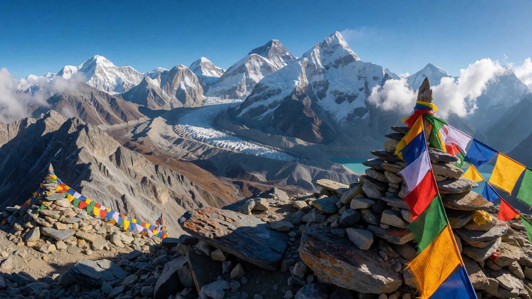
- Ngozumpa glacier and the peaks above — Gokyo valley, between the lakes and the peaks
Ngozumpa is a long glacier whose surface is covered in rock and gravel, so from a distance it looks more like a moraine ridge than ice. It runs down toward the lakes and feeds meltwater into them. Above the ice the peaks of the range rise steeply, and in clear weather their faces catch the light before the valley does.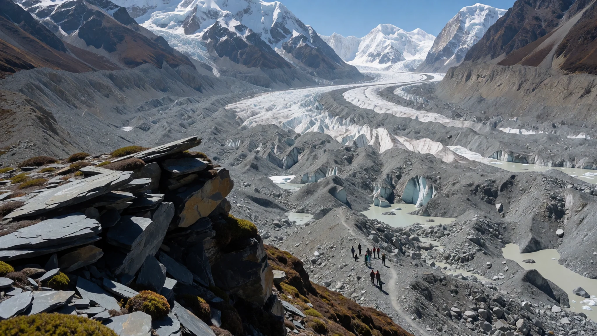
- Dudh Pokhari — Gokyo lakes, the lower end of the chain
Dudh Pokhari is one of the lakes in the chain, and it is a good place to pause on the walk along the shore. Its water is cold and clear, reflecting the slopes around it on still days. The altitude makes every stop a slow one, so take your time. Bring water and sun cream, since the light is strong even when it is cold.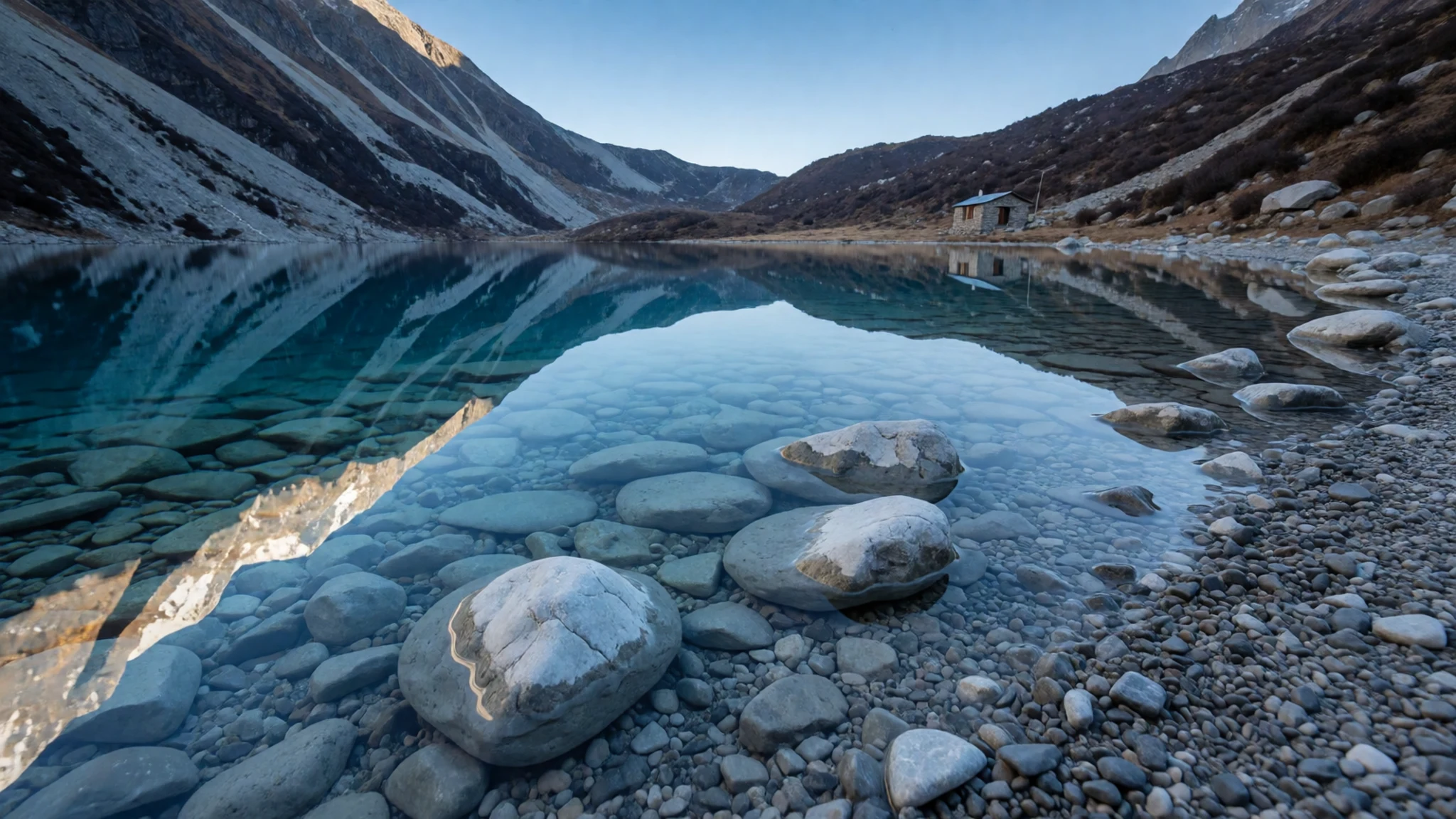
- The third lake — Gokyo lakes, middle of the chain
The third lake is the one photographers tend to remember, though the view changes by the hour. Cloud often gathers over the ridges after midday and drifts across the water, which is why the early light is worth the alarm. Wind can be sharp on the open shore, so a windproof layer matters more than it seems. Expect to share the viewpoints with other trekkers in the main season.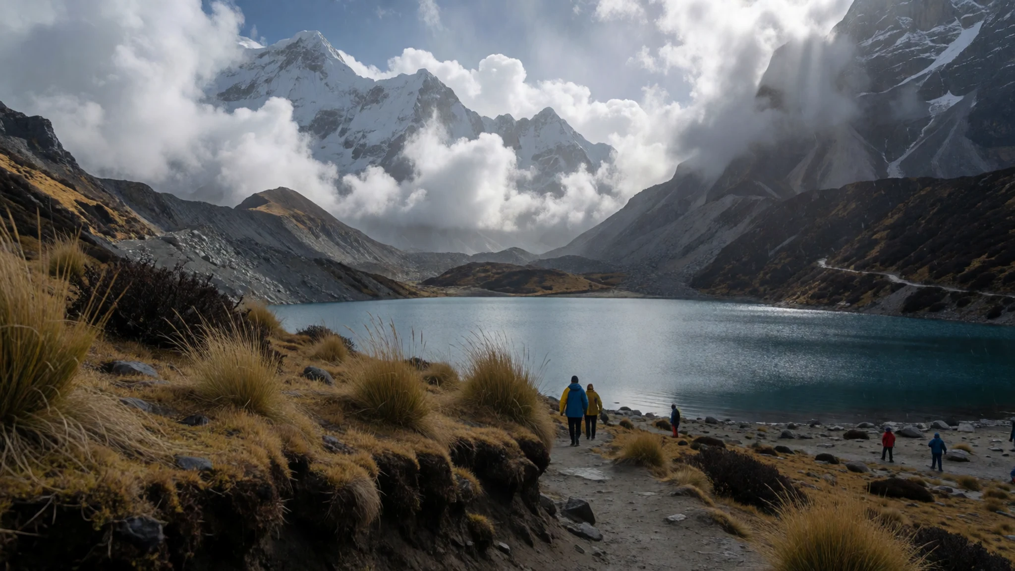
- The valley trail and the Everest view — Khumbu, the Gokyo valley route
The Gokyo valley trail is the route that brings most visitors here, winding up through villages, pastures and rough moraine. Along the way the view opens to Everest and its neighbouring peaks, most clearly on the high ground above the lakes. Days are long and the path is steep in places, so pace yourself and check your route with a licensed guide.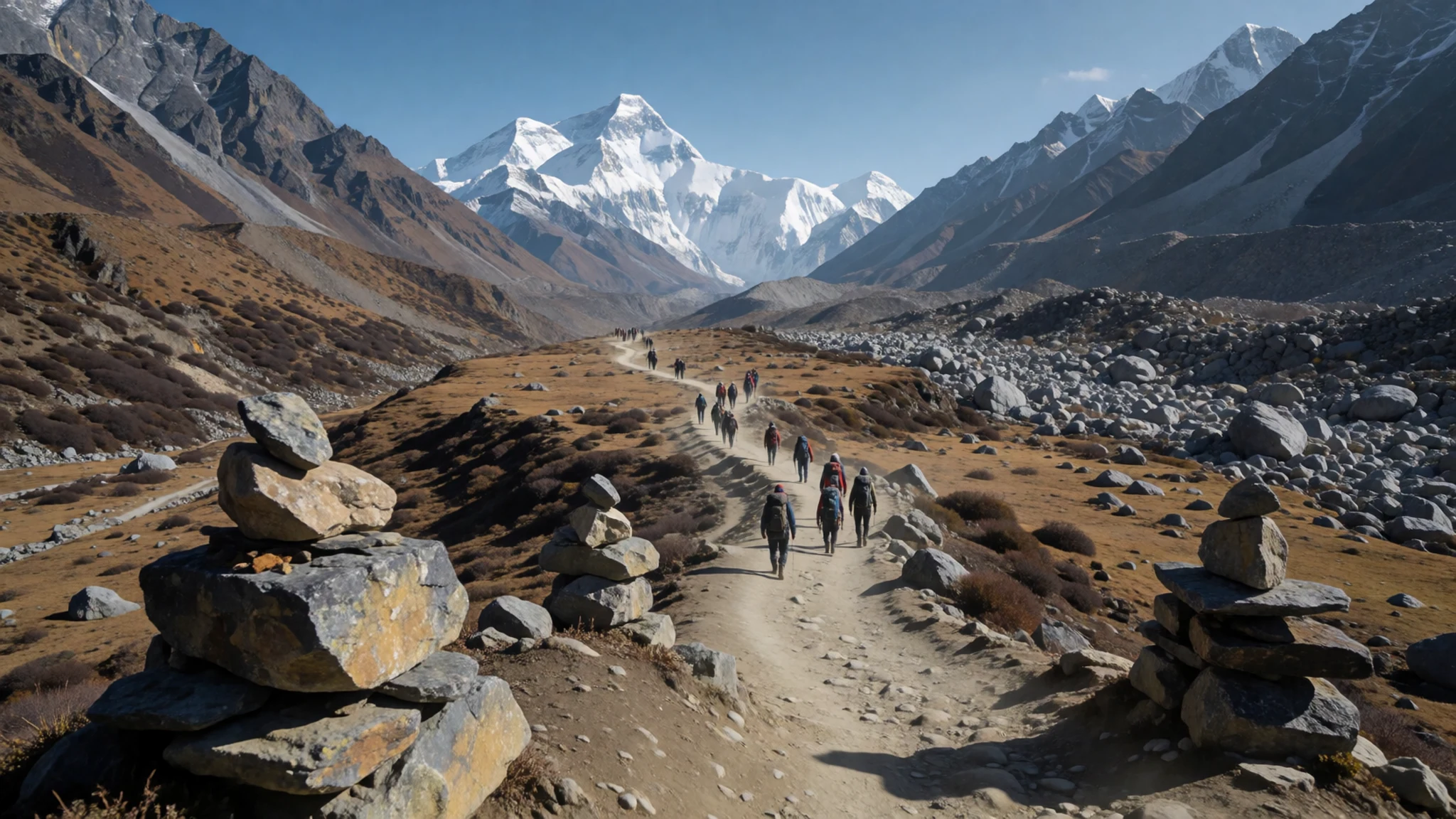
Culture
Gokyo sits inside Sagarmatha National Park, and the culture you meet here is mostly that of the Sherpa communities who live in the Khumbu. Buddhism shapes daily life in the villages, and you will see prayer flags strung above passes and mani walls carved with prayers beside the paths. Locals tend to be warm and practical about visitors, and the trekking economy depends on them, from lodge owners to porters and guides. Conversation is easy in the lower villages, where tea houses are run by families who have hosted walkers for years. Many people treat high passes and lake shores with quiet respect, and a short pause at a chorten or prayer wall is a sign of courtesy. Pass mani walls and chortens on the right, the way local walkers do, and never climb on the stones or take down prayer flags.
What to wear
Traditional dress in the Khumbu is closely tied to Sherpa and wider Tibetan Buddhist culture. Women traditionally wear the chuba, a long, wrap-around dress of wool, with a striped apron called a pangden over it and a wool shawl in colder months. Men wear a long woollen robe, often belted at the waist. The textiles are heavy, dyed in dark tones, and built to hold warmth at altitude.
What people wear now is a mix. In the villages and at lodges, many people dress in ordinary clothing: jeans, fleece, padded jackets and knitted hats, with the traditional pieces kept for festivals, weddings and temple visits. Trekking guides and porters often wear Western outdoor gear, with a bright cap or scarf as a personal touch.
What a visitor should wear is practical first. Dress in layers: a thermal base, a fleece mid-layer and a windproof, waterproof outer shell. Bring a warm hat, gloves and a sun hat, because the sun is strong even when it is cold. Sturdy boots that you have already walked in matter more than anything else. In villages and near prayer sites, cover shoulders and knees, and keep clothes simple rather than revealing.
What to eat
- Dal bhat — lodge dining rooms along the Gokyo valley route
Dal bhat is the staple of the trail: lentil soup poured over rice, with vegetables and pickle on the side. Most lodges serve it at lunch and dinner, and it is filling, reheatable and cheap by trekking standards. Ask for seconds; refills are common.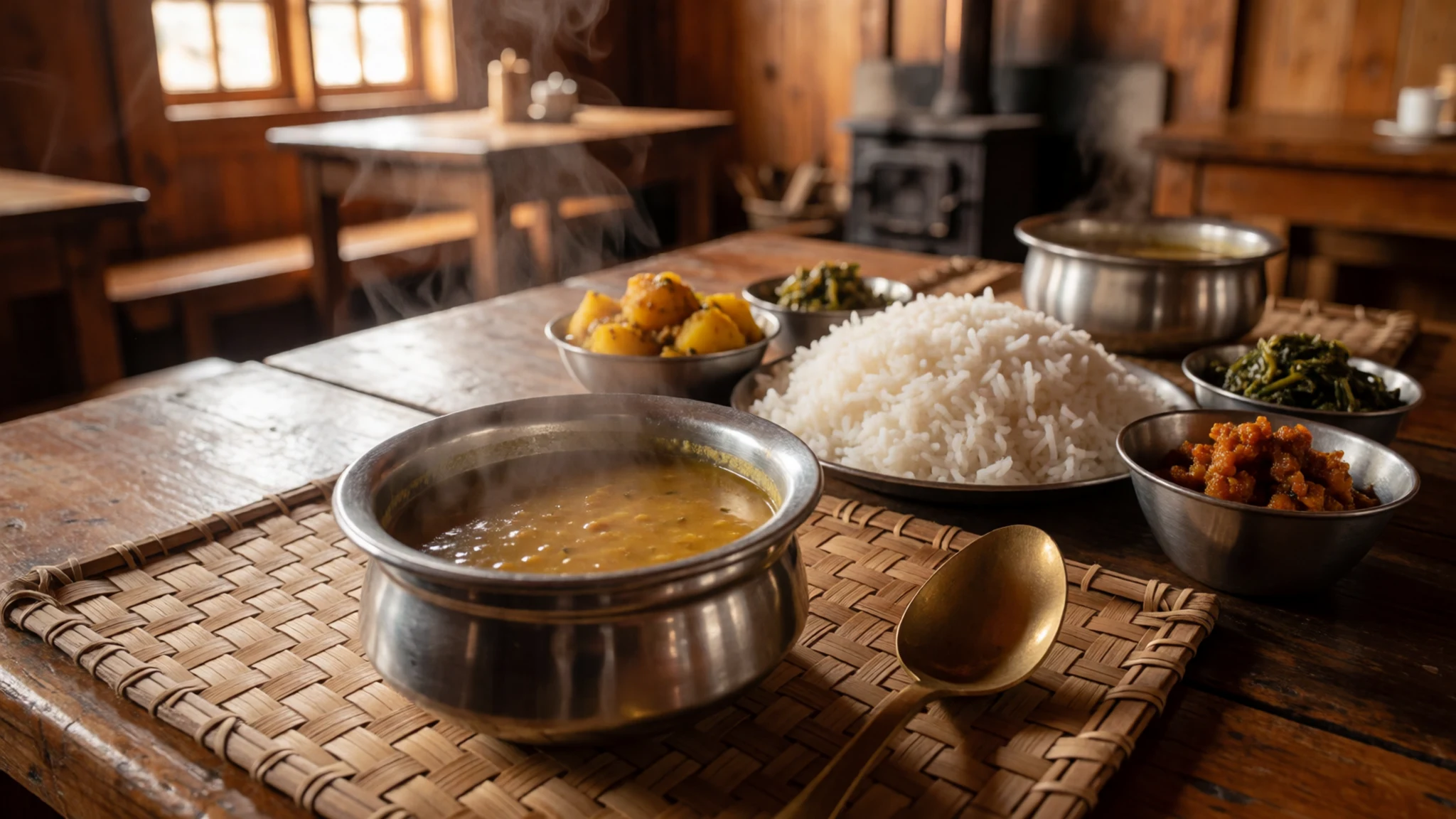
- Butter tea and tsampa — village houses and lodges in the upper valley
Butter tea is salted tea churned with yak butter, a warm drink that suits the cold and dry air. Tsampa is roasted barley flour, mixed into the tea with the fingers as a quick, portable meal. Taste is an acquired thing, so take a small cup first.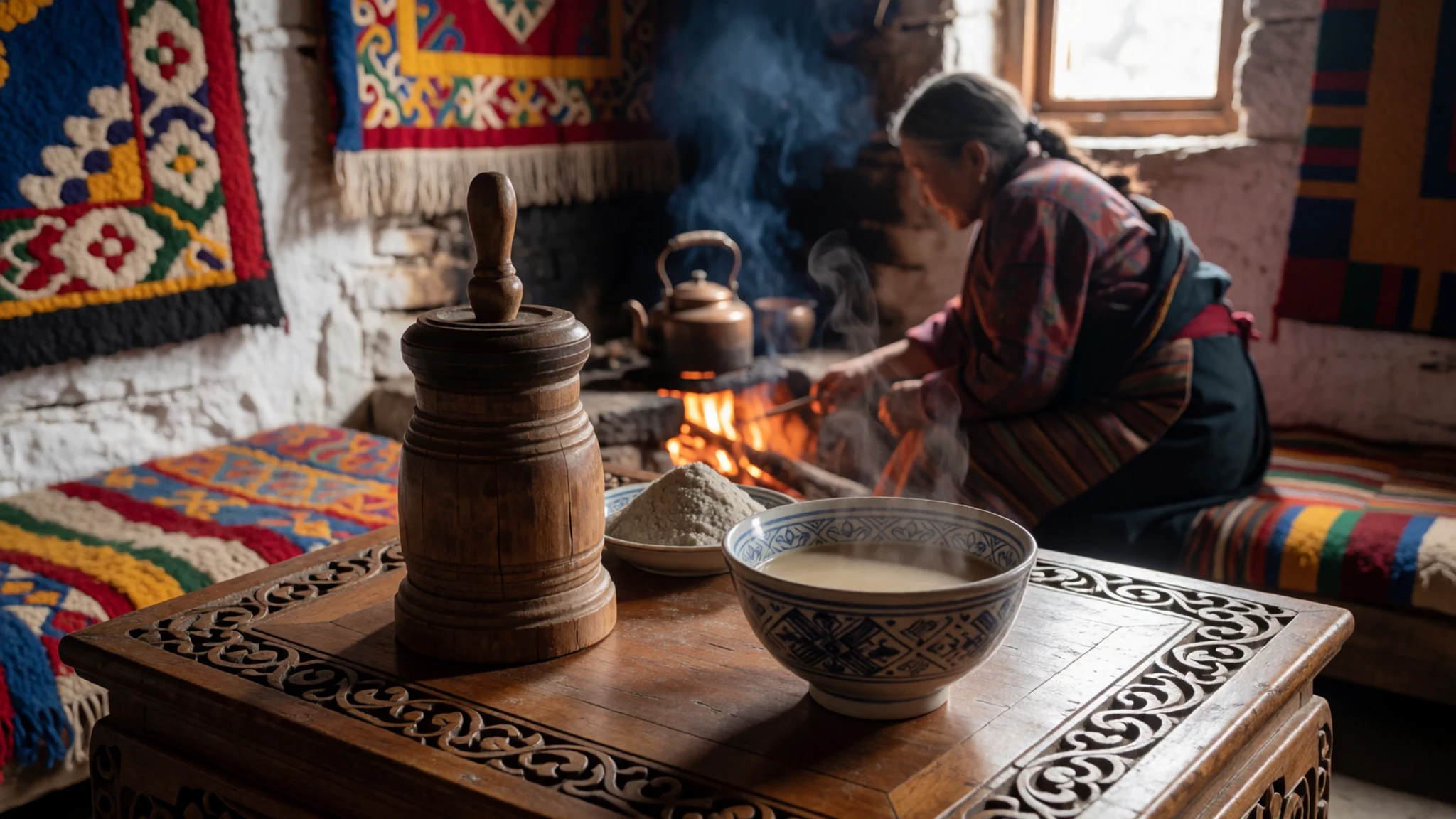
- Momos — tea houses and lodge menus along the trail
Momos are dumplings filled with minced buffalo or vegetables, steamed or fried and served with a chilli dipping sauce. They are the easiest thing to order at almost any lodge and a good midday snack on the trail. Most menus include vegetarian versions. - Thukpa — lodge kitchens in the upper villages
Thukpa is a noodle soup with vegetables or meat, in a broth flavoured with ginger and garlic. It is warming after a cold walk and easy to find at higher lodges, where fresh vegetables are harder to get. Order it on a cold evening after a long day.
Plan it
Best time. Spring, roughly March to May, has the clearest mornings and the most settled weather. Autumn, October to November, is the other main season, with dry air and good visibility. June to September is the monsoon, when cloud and rain are common and some paths turn slippery.
How long. 7–10
Getting there. Fly from Kathmandu to Lukla, then walk; the final leg is on foot up the valley via Namche Bazaar, with the Gokyo lakes reached by a side valley.
Budget. high
Tips
- Build flight days into your plan, because weather often delays flights to Lukla
- Take rest days to acclimatise and climb slowly to avoid altitude sickness
- Start early for the clearest views before cloud builds
- Carry enough cash for lodges, as card payment is unreliable in the valley
- Hire a licensed guide and check permit requirements before you go
Etiquette
- Keep to the path and stay off walls, cairns and prayer stones
- Ask before photographing people, especially at prayer sites
- Pass chortens and mani walls on the right
- Carry out all your rubbish, including wrappers and batteries
Nearby
Sources
- Wikidata Q135524 (CC0)
- Wikipedia: Gokyo Lakes (rev 1366014908) (CC BY-SA 4.0)
- Vyacheslav Argenberg, Gokyo Lake, Arakamtse, Cholatse, Nepal, Himalayas (CC BY 4.0)
- Vyacheslav Argenberg, Gokyo Ri summit, Gokyo Lake, Nepal, Himalayas (CC BY 4.0)
- valcker, Around Gokyo lakes (4700m) (CC BY 2.5)
- Marickew, Best morning in mountains (CC BY-SA 4.0)
- JP Vets, Chemin himalayen (CC BY-SA 4.0)
- Nirojsedhai, Clouds floating above Gokyo third lake (CC BY-SA 4.0)
- Kishan gondaliya, Dudh Pokhari Lake (CC BY-SA 4.0)
- Trekking Planner Nepal, Everest Gokyo Valley Trek (CC BY-SA 4.0)
- Wikivoyage (CC BY-SA 4.0)


