Gezer
Gezer, Israel
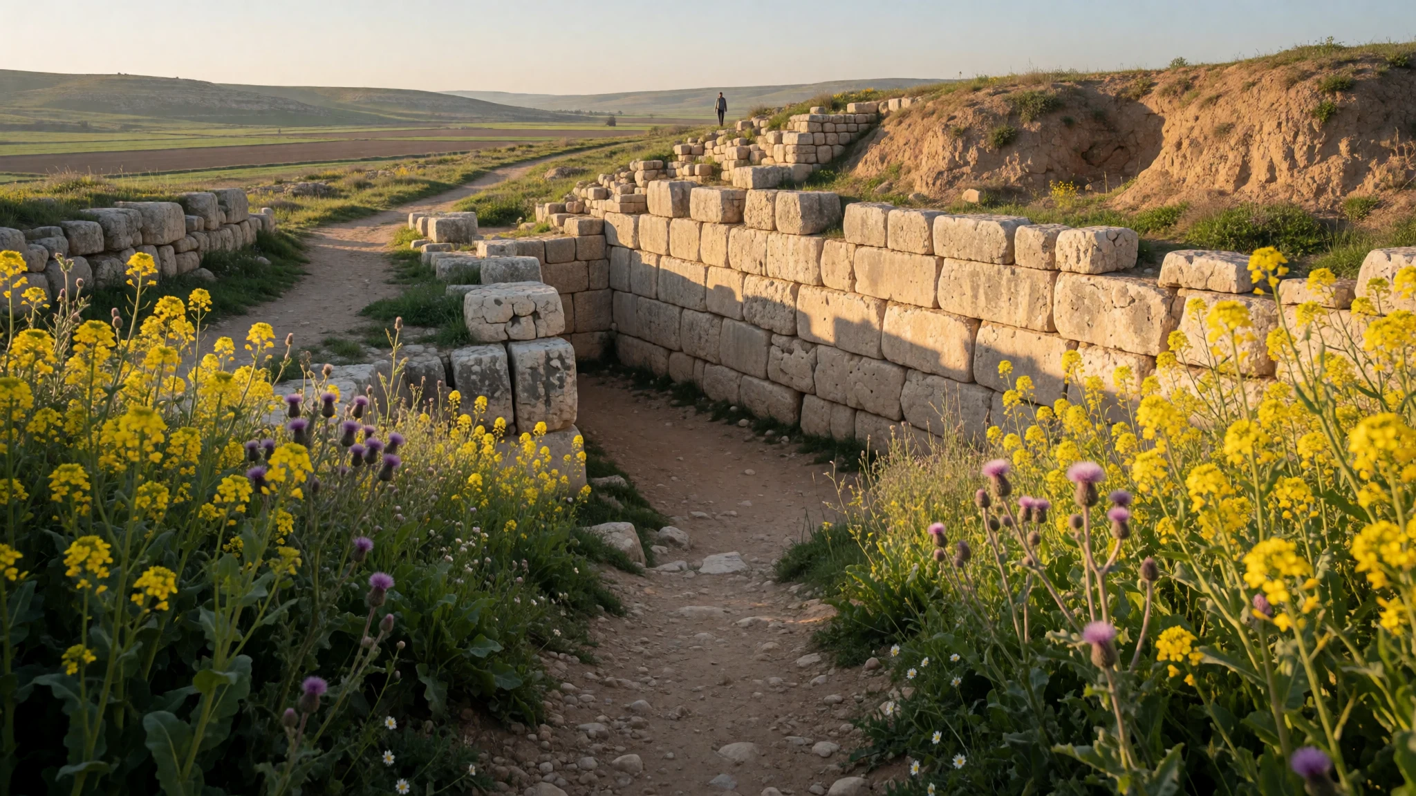
Gezer is a quiet hilltop of stone gates and Bronze Age water works, set where ancient Egypt's road to the north met the climb to Jerusalem.
The place
Gezer sits on a low limestone hill where the Judaean foothills ease down towards the coastal plain, roughly midway between Jerusalem and Tel Aviv. It is now an Israeli national park, and the hill itself is a tell: a mound built up from layer upon layer of rebuilt settlements. From the top the land opens out to the west, north and east, and the logic of the place becomes obvious. Whoever held this hill could watch everything moving below. That movement was the whole point. Gezer stood where the coastal highway linking Egypt with Syria, Anatolia and Mesopotamia met the road running up the Ayalon valley to Jerusalem and Jericho. Armies, merchants and messengers all passed beneath it, which helps explain why Egyptian inscriptions name the city and why the Hebrew Bible ties it to Joshua and Solomon. What remains today is modest in scale: stone gate towers, stretches of wall, a deep rock-cut water system and open fields. There is little shade, no grand reconstruction and usually few other people, mostly small groups, school parties and travellers breaking a drive between the two big cities. It suits those who enjoy reading a landscape more than ticking off monuments. Signs and a marked trail help, but a little reading beforehand makes the stones far easier to understand. Spring is the gentlest season, when the slopes turn green and wildflowers appear. High summer is hot and exposed, and the hill offers almost nowhere to hide from the sun.
Its story
Gezer's earliest settlers were cave dwellers. In the Chalcolithic period, people lived in large chambers cut into the rock of the hill. After that the story stutters. An unwalled Early Bronze Age village covered the mound, was destroyed, and the hill then stood empty for centuries, with further gaps in occupation through the early Middle Bronze Age. The place only took off in the later Middle Bronze Age, when Gezer became a walled Canaanite city-state with a large cult area, perhaps gaining as neighbouring towns such as Aphek lost strength. Its northern defences were layered. Excavators disagree about how many lines there were, but the sequence runs from a built-up earth bank to stone walls behind it, raised in different eras. Egyptian inscriptions name Gezer, a sign that the pharaohs thought the crossroads worth watching. The Hebrew Bible links the city with Joshua and later with Solomon. By Roman and Byzantine times few people lived on the hill. In the modern era, the Palestinian Arab village of Abu Shusha stood here; during the 1948 war its residents fled or were killed, and the village was emptied. Explorers surveyed the mound in the nineteenth century, and Macalister's early excavations uncovered the water system that visitors can still look into. Later teams have kept clearing and re-reading it, and the layers are still being argued over.
What to see
- The summit and its views — Tel Gezer National Park
The top of the mound at Gezer is the best place to grasp why the city mattered. The ground falls away to the plains on three sides, and it is easy to picture caravans and armies on the roads below. Go early or late, as there is almost no shade.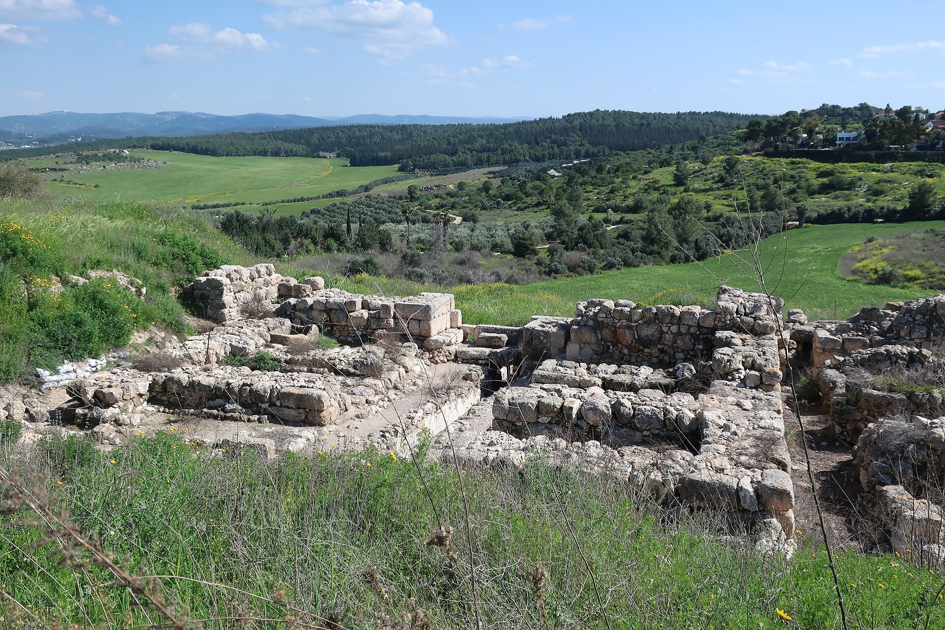
- The gate and its towers — Edge of the mound
Gezer's gateway survives as the footings of two flanking towers on either side of a passage. The stones are low and weathered, but the layout is clear, and it shows how traffic was funnelled, inspected and defended. Reading the plan on the signboard first helps a great deal.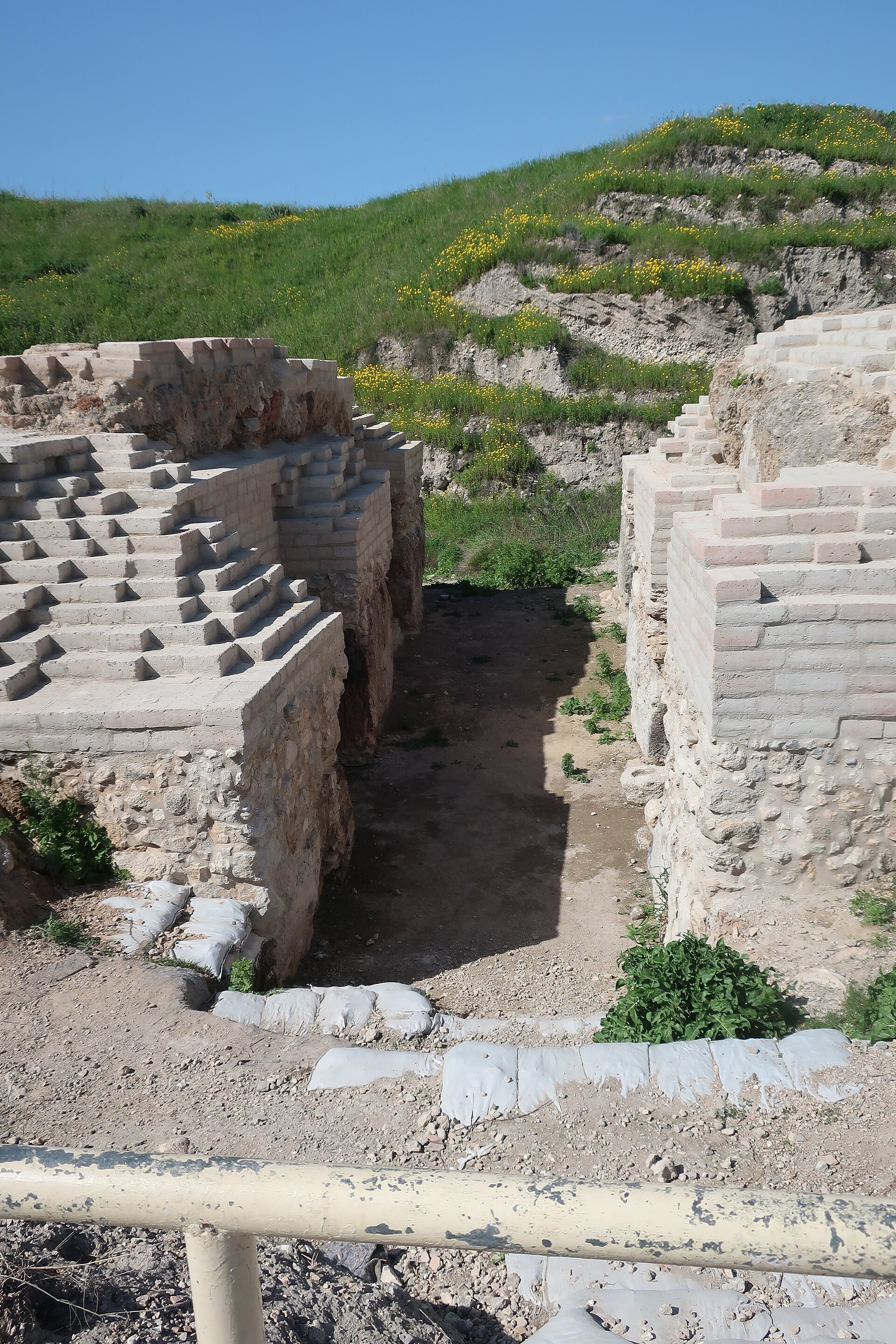
- The Bronze Age water system — Slope of the tell
A stepped shaft and tunnel cut deep into the rock once brought water to the city from below the hill. Macalister first dug it out, and later teams have cleared it again. Check on site whether access is open, and keep to any barriers.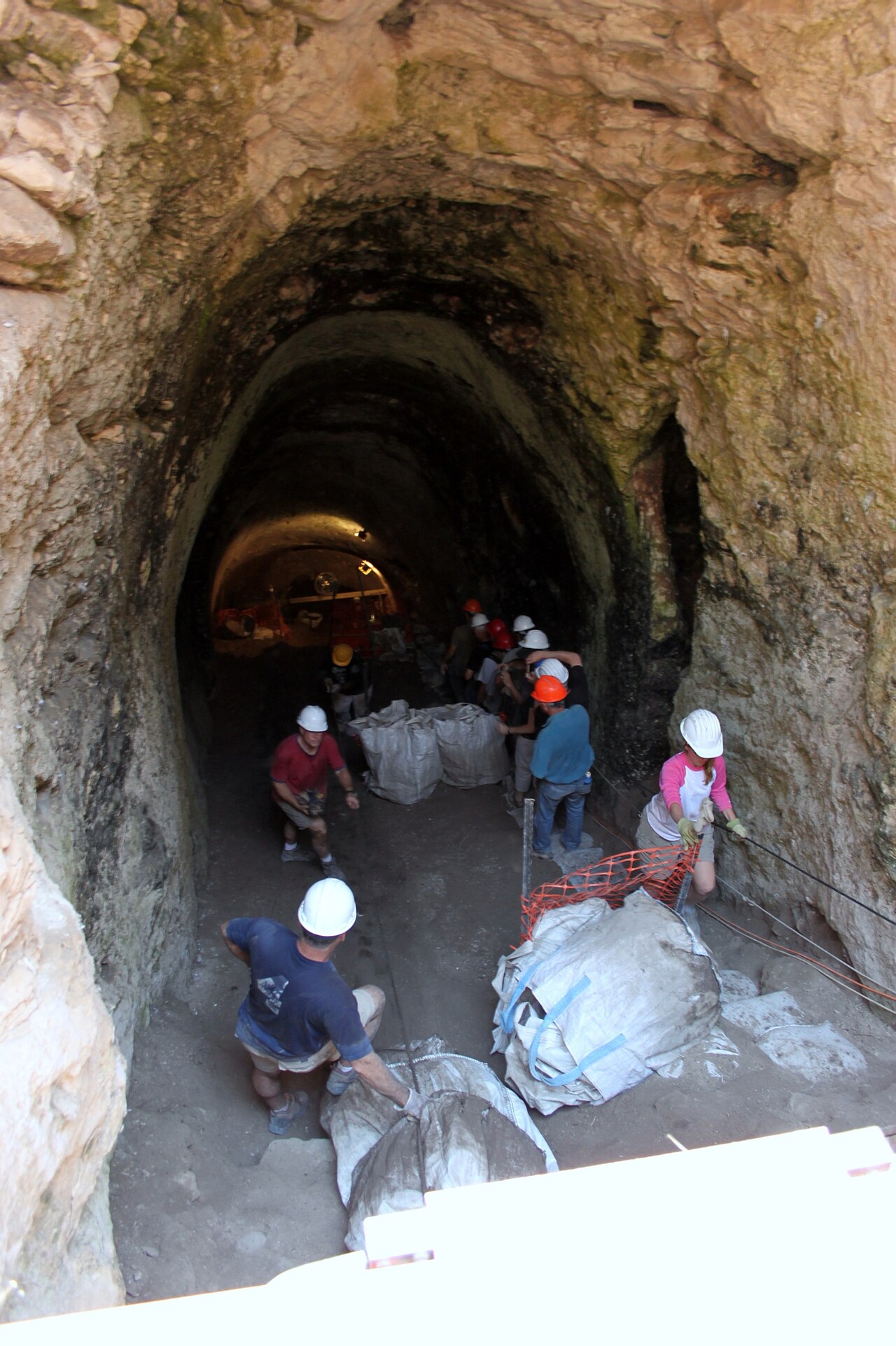
- Ruined tower and fortifications — Northern side of the mound
Fragments of towers and wall lines show where the city's defences ran. Stone and earth have been worn down by centuries, so a slow walk around the edge, comparing the photos on the signs with what is left, makes the sequence of building phases easier to follow.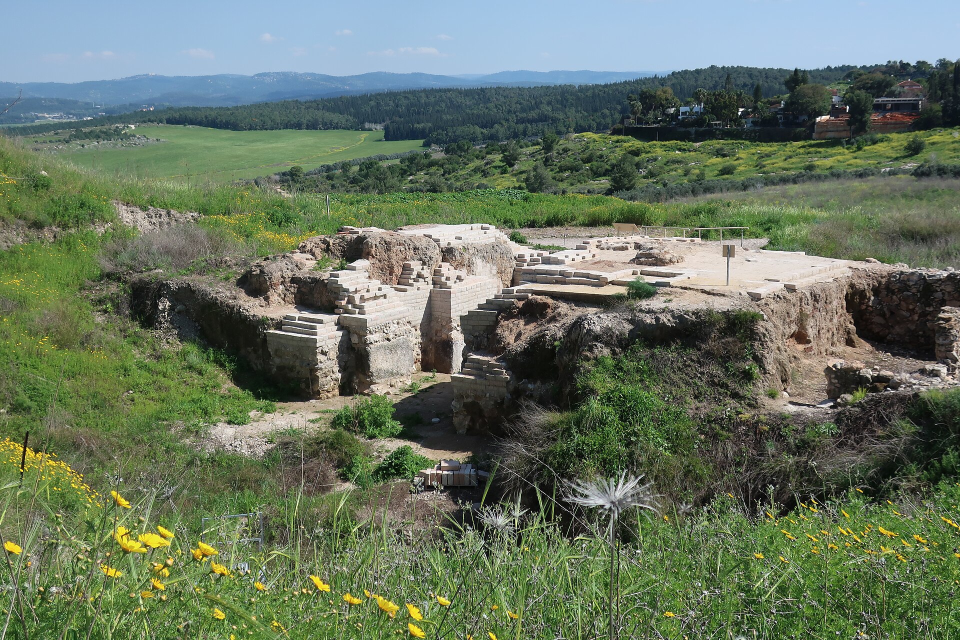
- The Gezer Calendar — Istanbul Archaeology Museums (not on site)
A small limestone tablet found at Gezer lists the farming year in short lines and is counted among the earliest Hebrew writing. It is not displayed at the site itself; the Istanbul Archaeology Museums hold it. A cast or photograph is the nearest substitute locally.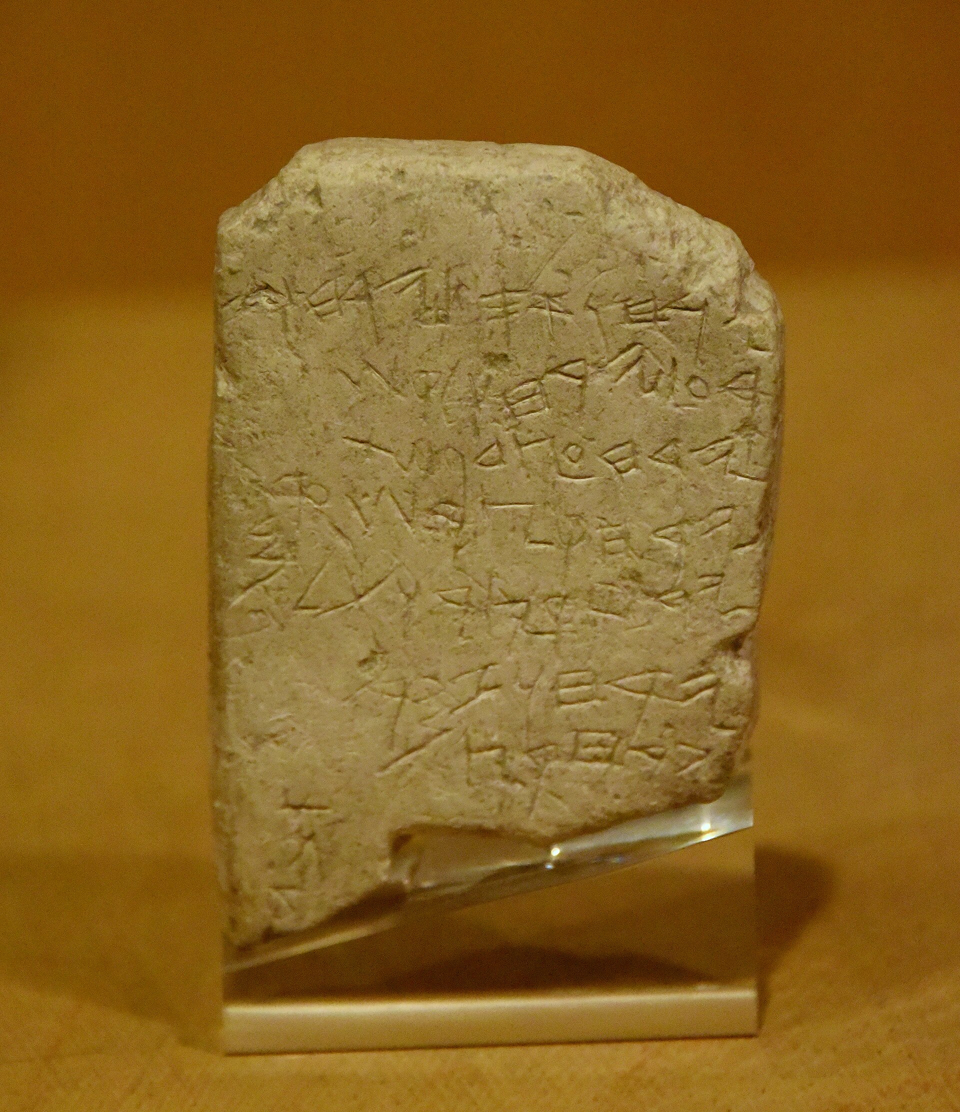
Culture
Gezer's culture is layered like its soil. Canaanite townspeople, Egyptian officials, the biblical tradition and later villagers all left marks, and those marks are read differently by different communities. For many Israelis the hill is a biblical and national-park site, linked with Joshua and Solomon. For Palestinians it is also the land of Abu Shusha, a village emptied in 1948, and some families still remember it. Both stories belong here, and local guides may tell them in very different ways. Archaeologically, the Canaanite city-state is the main attraction: its cult area, its walls and the knowledge that Egyptian scribes recorded its name. The Gezer Calendar, a short agricultural text in early Hebrew, shows how a farming year was kept before large books existed. Religion in the surrounding countryside runs through the week. Shabbat, from Friday afternoon to Saturday evening, shapes opening patterns and public transport across much of Israel, and many families spend weekends outdoors in parks like this one. Muslim and Christian communities in the region keep their own days of rest and festivals. Hospitality is warm and conversation is direct; people often ask where visitors are from and what brought them to such a quiet place. Treat the mound as an open-air museum and a place of memory: stay on marked paths, take nothing away from the ground, and ask before photographing people or any family picnicking nearby.
What to wear
Gezer has no single local costume, and dress here reflects the wider region. Historically, Palestinian villagers in the Judaean foothills wore long embroidered cotton and linen dresses called thobes, with cross-stitch patterns that differed from village to village, along with headscarves and woollen or cotton wraps in cooler months. Jewish communities brought their own traditions, from prayer shawls and head coverings to the dress of communities from Yemen, Morocco, Iraq and Europe. Many of these garments are now worn mainly at weddings, festivals and heritage events. Day to day, people in central Israel dress practically and casually: cotton shirts, shorts or light trousers, sandals or trainers, and caps in summer. Religious families, whether Jewish, Muslim or Christian, often dress more modestly, with long sleeves and skirts or trousers. Visitors to Gezer need to think about the sun and the ground more than about etiquette. Wear a hat, light long sleeves and trousers or knee-length shorts, and sturdy shoes with grip, because the paths are stony, uneven and dusty. Carry sunscreen and sunglasses, and bring a light jacket for spring and autumn mornings, which can be cool. If the same day includes Jerusalem or a religious site, pack a scarf or shawl and cover shoulders and knees, which keeps entry simple wherever modesty is expected.
What to eat
- Falafel — Stands near Machaneh Yehuda market, Jerusalem
Chickpea balls fried until crisp and stuffed into pita with salad and tahini. Gezer itself has little to eat, so the usual stop is a falafel stand in Jerusalem, near Machaneh Yehuda market. A busy stand is a good sign. - Hummus with warm pita — Neighbourhood hummus eateries in Jerusalem or Tel Aviv
A smooth chickpea and tahini paste served in a shallow bowl with olive oil, whole chickpeas and bread for scooping. It is a common late-morning meal in both Jewish and Arab eateries, and many places sell little else. - Shakshuka — Cafés and breakfast restaurants in towns and cities
Eggs poached in a spiced tomato and pepper sauce, served in the pan with bread. It is a standard breakfast and brunch dish across Israel and suits a morning before a hot walk on the tell. - Sabich — Small sandwich stands in city centres
A pita filled with fried aubergine, boiled egg, salad, tahini and pickles, sometimes with amba, a tangy mango sauce. It is cheap, filling and easy to eat on the move between sites. - Ethiopian injera platters — Ethiopian restaurants in central Jerusalem
Sour flatbread topped with stews of lentils, vegetables or meat, eaten by hand. Jerusalem has a long-standing Ethiopian community, and many dishes are vegetarian. Look for eateries busy with regulars.
Plan it
Best time. March–April and October–November. Spring brings green slopes and wildflowers, and autumn is mild. Summer is hot and shadeless on the mound, and winter can bring rain and mud.
How long. Half a day
Getting there. Fly into Ben Gurion Airport, which is close to the Tel Aviv–Jerusalem motorway and roughly between the city and the site. Gezer is in the foothills between Jerusalem and Tel Aviv, and public transport to the park itself is limited, so a hire car or taxi is the practical last leg. Check current bus options locally.
Budget. mid
Tips
- Go early in the morning or late afternoon, as the mound has almost no shade
- Carry plenty of water and a hat, since there is little on site to buy
- Check opening times and entry fees with the Israel Nature and Parks Authority before you travel
- Read about the site beforehand, because signs are limited and the ruins are low
- Combine it with Jerusalem or the coast, but allow for traffic on the main motorway
Etiquette
- Stay on marked paths and do not remove stones or pottery
- Ask before photographing local people
- Dress modestly if the day includes religious sites
Nearby
Sources
- Wikidata Q1466687 (CC0)
- Wikipedia: Gezer (rev 1384492959) (CC BY-SA 4.0)
- Wikivoyage: Jerusalem (rev 5405797) (CC BY-SA 4.0)
- Gazar mound, זאב שטיין (CC BY 2.5)
- Tel Gezer during the Spring, Davidbena (CC0 1.0)
- Gateway surrounded by two towers, Davidbena (CC0 1.0)
- Tell Jezer, Palestine Exploration Fund Survey (Public domain)
- Ruined tower at Tel Gezer, Davidbena (CC0 1.0)
- The Gezer Calendar tablet, Osama Shukir Muhammed Amin FRCP(Glasg) (CC BY-SA 4.0)
- Water plant in Tel Gezer, ד"ר אבישי טייכר (CC BY 2.5)
- Gezer water works, Oren Rozen (CC BY 3.0)


