Gesäuse National Park
Gesäuse National Park, Austria
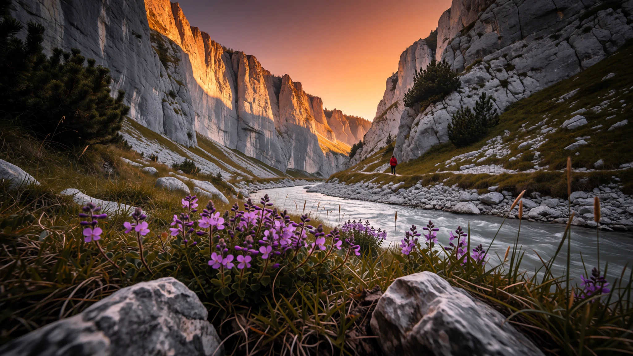
Gesäuse National Park is a steep Austrian limestone gorge for walkers and climbers who want real Alpine rock and a wild river without a resort crowd.
The place
Gesäuse National Park sits in Upper Styria, in the north of the Austrian state of Styria, where the Enns river leaves a broad valley and squeezes through a steep-sided gap between Admont and Hieflau. Around that gorge rise the pale limestone walls of the Ennstal Alps, with Hochtor the highest summit at 2,369 metres. The park was founded in 2002 and covers about 110 square kilometres, with a further 15 square kilometres planned. Its land touches the municipalities of Johnsbach, Weng, Landl and Sankt Gallen. The park's listed elevation is 641 metres, but that figure hides the real drama: the climb from valley floor to summit is long, and the scenery changes quickly from river meadows and mixed forest to dwarf pine, scree and bare rock. The feel is of a working Alpine landscape rather than a resort. Road and railway share the gorge with the river, and walkers set off from small settlements rather than from one gateway town. Crowds are modest by Alpine standards and thin out fast once a trail leaves the road, though summer weekends bring climbers, cyclists and day walkers to the same few car parks. Weather matters. Cloud can swallow the high ridges within an hour, and thunderstorms are common on warm afternoons. Anyone planning a summit should treat the park as proper mountain country, with an early start, a sound forecast and a firm turn-back time.
Its story
Gesäuse National Park was established on 26 October 2002, but the landscape it protects was shaped long before by water, ice and ordinary work. The Enns cut its narrow gap between Admont and Hieflau through hard limestone, and the name Gesäuse is often explained as an echo of the river's rushing sound. For generations the slopes around the gorge were forest, pasture and hay meadow, worked by farming families in settlements such as Johnsbach. The gorge was also a route, and the engineering is still visible. Photographs of the valley show a road tunnel built around a rock face and a railway bridge crossing the road, evidence of how awkward it was to push transport through such a tight space. Turning the area into a national park changed the emphasis. Parts of the land are now left to regrow and the river is treated as habitat, while walking, climbing and paddling continue under park rules. Local communities stayed central to the arrangement, since the park spans several municipalities and many residents farm, guide or run guesthouses. The result is a protected area where heritage and use overlap, and where traces of old routes and farms sit beside slopes left to run wild. It is a younger park than many in the Alps, and its management is still being worked out in the valley as much as on the maps.
What to see
- Hochtor and the high ridge — Central Ennstal Alps
Hochtor, at 2,369 metres, is the park's highest peak and the centrepiece of the Gesäuse skyline. Its grey limestone face is best admired from the valley or the Hesshütte side. Climbing routes up it are serious undertakings for experienced mountaineers; most visitors are happier looking up from a trail.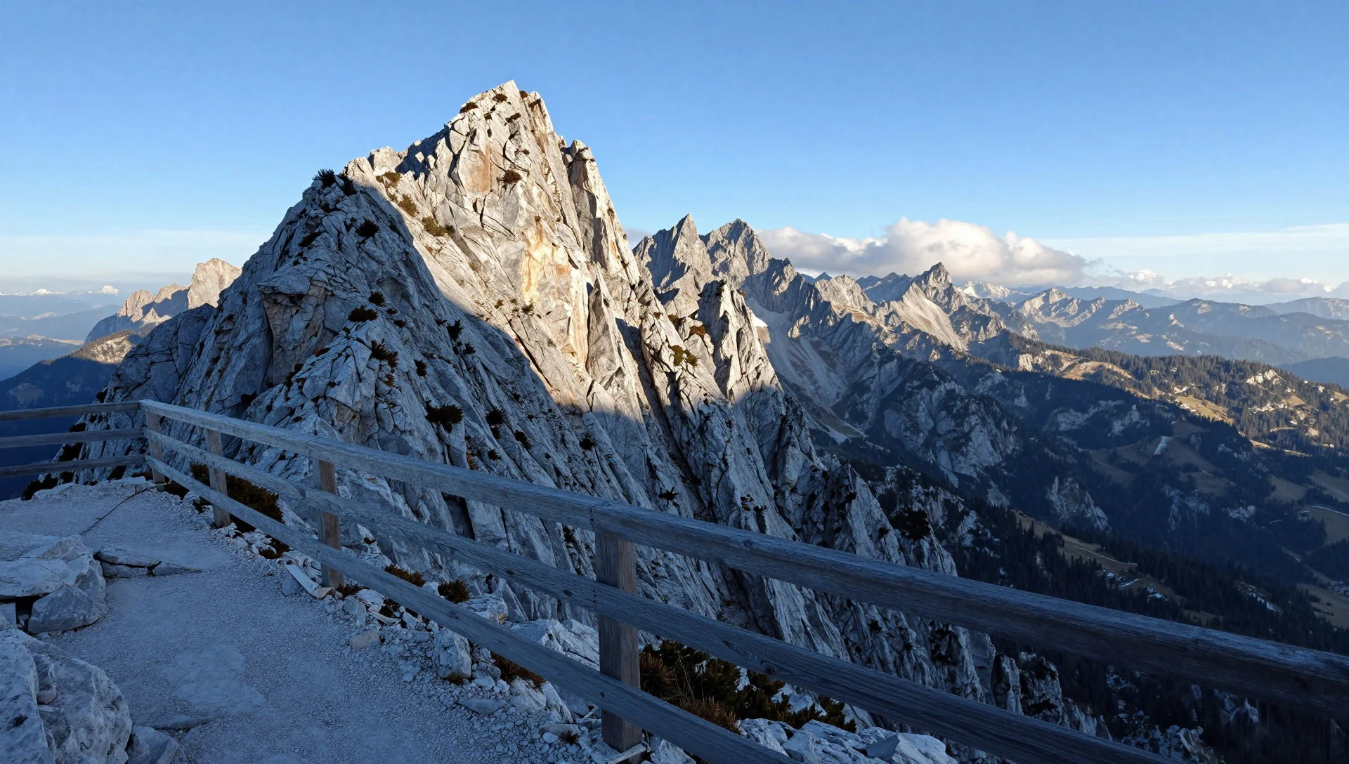
- Gesäuse entrance and the pond at Weng — Weng, western edge of the park
Near Weng the broad Enns valley narrows and the mountains close in, which makes this a good first stop for getting your bearings. A small pond in the meadows gives calm reflections of the peaks on still mornings. It suits a short, flat walk before committing to anything steeper.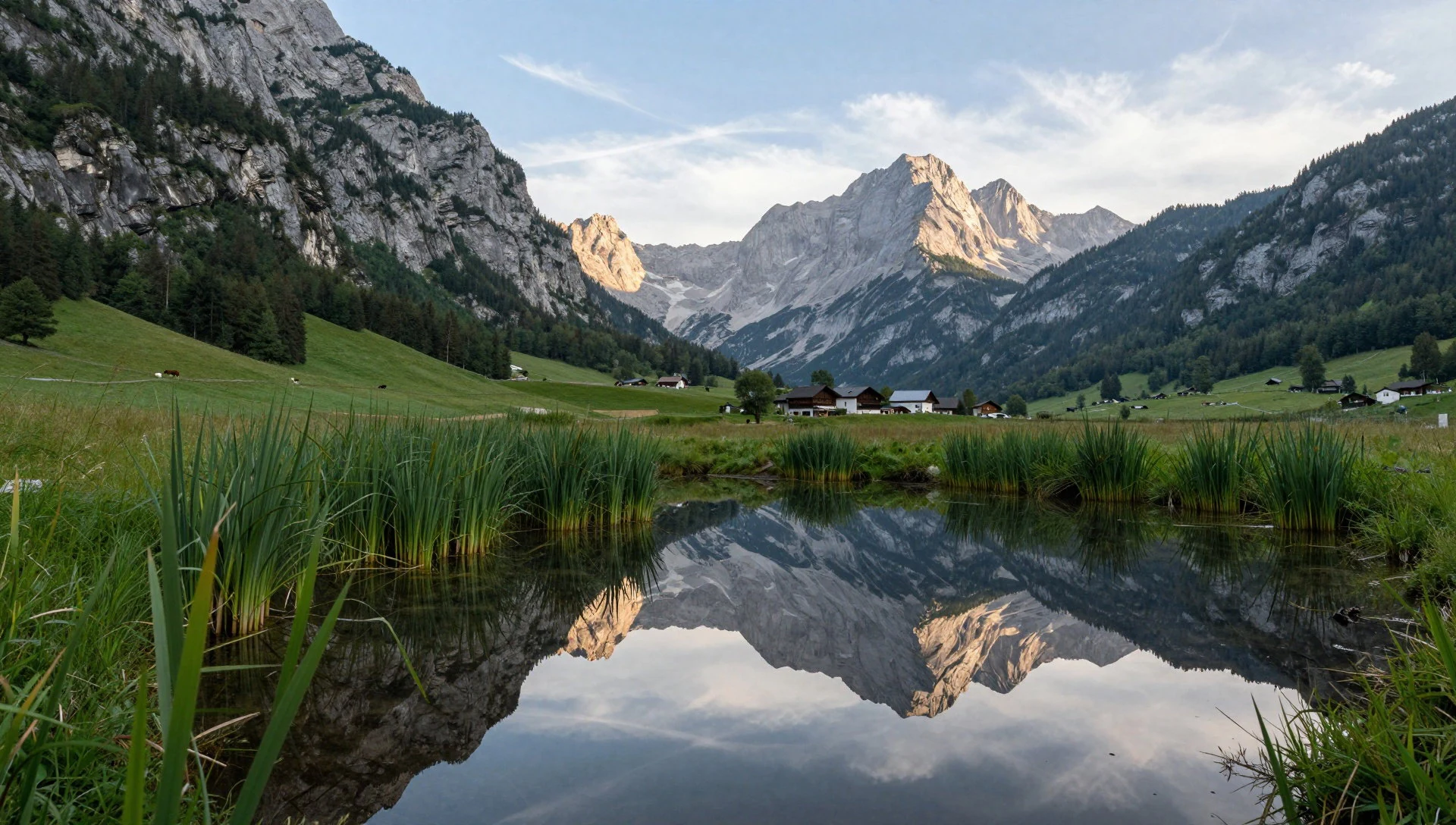
- Enns cataract near Admont — Between Admont and Weng
Between Admont and Weng the Enns runs fast over rock steps, and the stretch is a listed natural monument. Paths and bridges nearby, including the modern Lauferbauer bridge, let walkers watch the water without scrambling. It is a gentle, family-friendly outing, and the river is loudest after rain or snowmelt.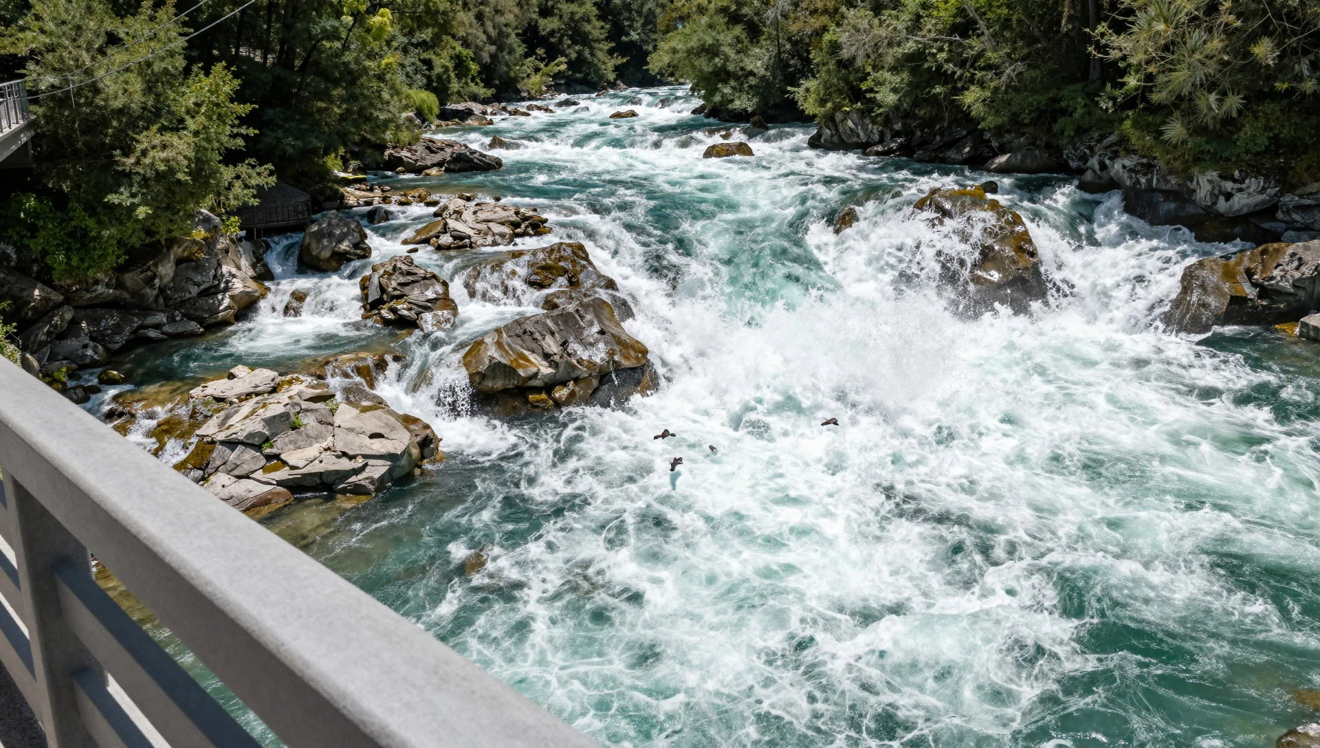
- The Gesäuse road, tunnel and rail bridge — Gesäuse gorge road
The valley road and the railway squeeze through the gorge together, with a tunnel wrapped around one rock face and a rail bridge crossing the road. It is a good place to appreciate how tight the gap is. Cyclists and drivers should watch for traffic, since the lanes are narrow and the views distracting.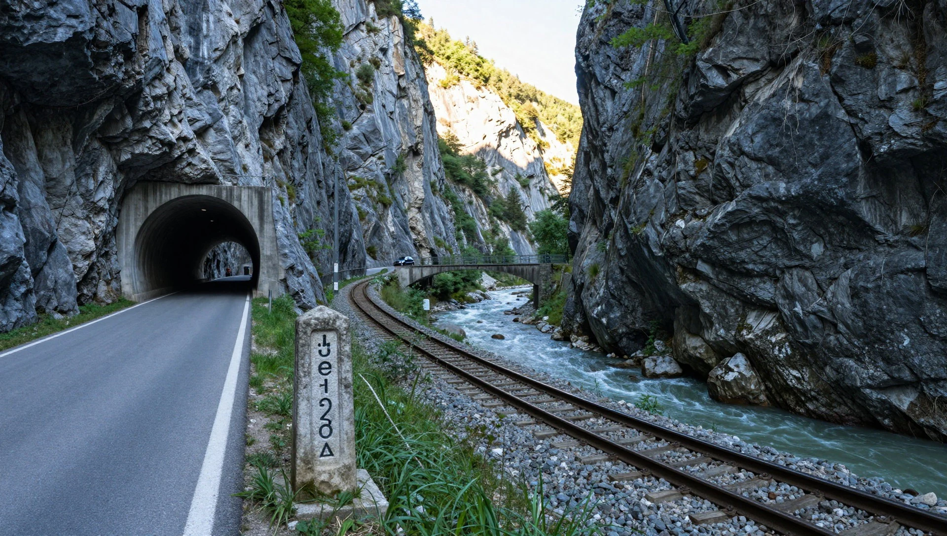
- Hesshütte trail — Above Johnsbach valley
The path to the Hesshütte mountain hut climbs through forest into open rock country beneath the big walls, and the views widen with every bend. It is a full day on foot with real height gain, so boots, water and an early start matter. Check hut opening dates with the park before setting out.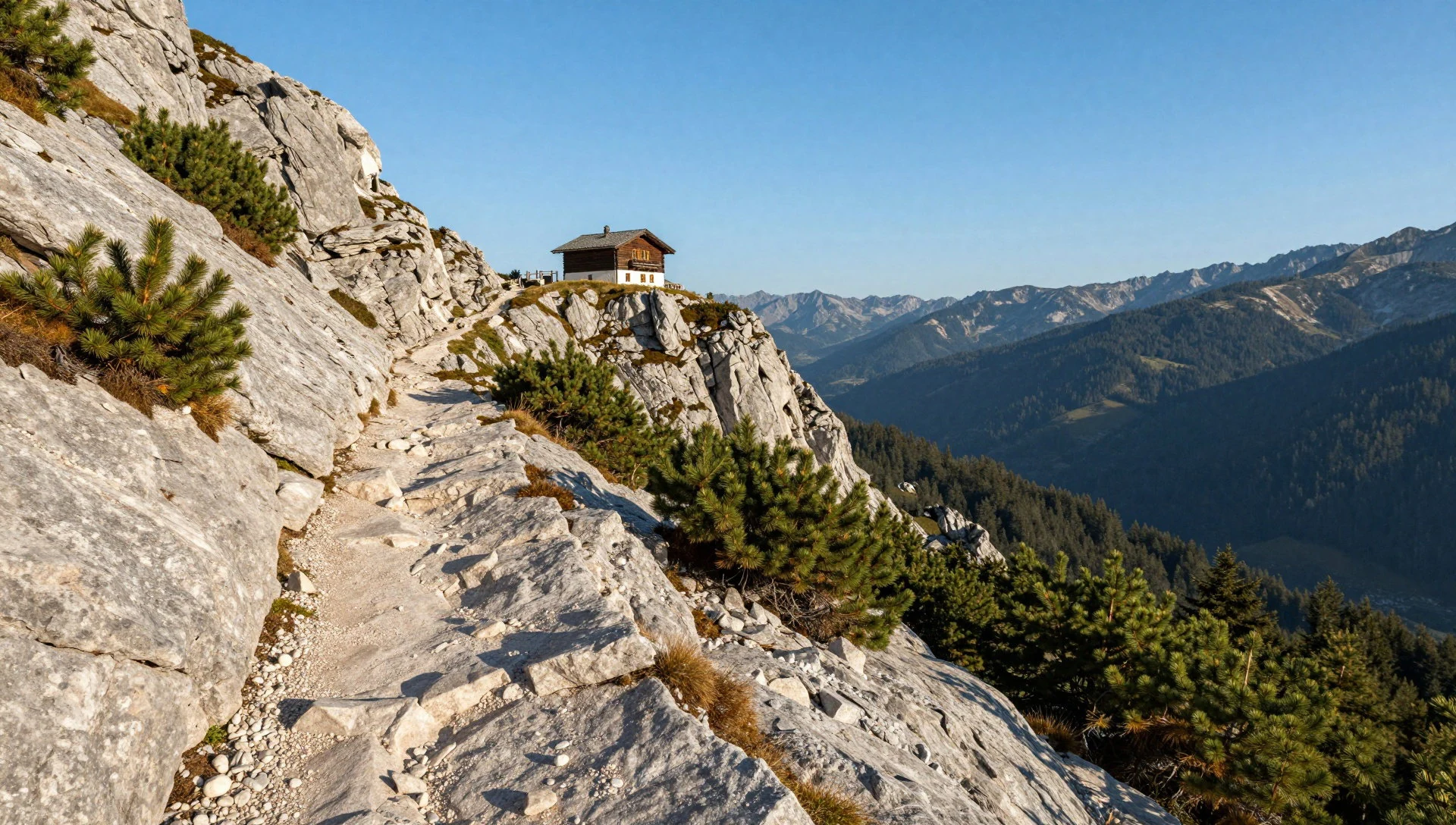
Culture
Gesäuse National Park lies in Upper Styria, a region with a strong farming, forestry and mountaineering culture. Daily life in villages such as Johnsbach and Weng still turns on the seasons: hay in summer, wood and livestock chores, and a steady trickle of walkers and climbers who have used these valleys for generations. Mountain huts are the social centre of the hills. They are staffed by people who know the paths and the weather, and they work on mutual courtesy: walkers greet each other on the trail, and hut guests share tables and keep to quiet hours in the evening. Mountain rescue and weather awareness are part of the local outlook, so turning back is treated as sensible rather than weak. Styria is also known for its own food and wine traditions, its folk costume and its village festivals, which tend to centre on churches, fire brigades and brass bands. German is the everyday language, with a Styrian accent, and a friendly Grüß Gott or simple Servus goes down well. The park's management also shapes behaviour: certain zones are kept quiet for wildlife, and rules on camping, fires and drones are enforced. Greet people you pass on mountain paths, stay on marked trails, take all rubbish back down with you, and follow the park's posted rules on wildlife areas and closures.
What to wear
Gesäuse National Park sits in a part of Styria where traditional dress is still worn on festive days. The classic Styrian costume, the Steireranzug, is cut from loden, a dense, water-resistant wool, usually in grey or green with contrasting trim and buttons. Women wear the dirndl, a bodiced dress with apron, often in cotton, linen or wool depending on the season. Both appear at church festivals, weddings, brass-band gatherings and village events rather than every day. What people wear day to day is far more practical. Walkers, climbers and farmers favour fleece, softshell jackets, sturdy trousers and boots, and you will see plenty of wool socks and small rucksacks in the valley cafés. Mountain huts are informal, so nobody dresses up for dinner. For visitors the advice is about weather and terrain. Bring layers, because mornings are cold even in summer and the temperature drops quickly with height. Pack a waterproof shell, sun protection and a warm hat for higher routes. Footwear matters most: proper walking boots with a stiff sole and good grip are needed on scree and rocky paths, while trainers will do only for the flat riverside walks. Many huts ask guests to remove boots at the door and offer indoor slippers, so a pair of light shoes or thick socks is useful. Village churches are fine in neat, casual clothes.
What to eat
- Brettljause — Farm taverns and Buschenschank wine taverns across Styria, and village inns
A wooden board stacked with cold meats, cheese, bread and pickles, often with grated horseradish (Kren). It is a hearty Styrian snack that can serve as a meal, and it is not designed for vegetarians or light eaters.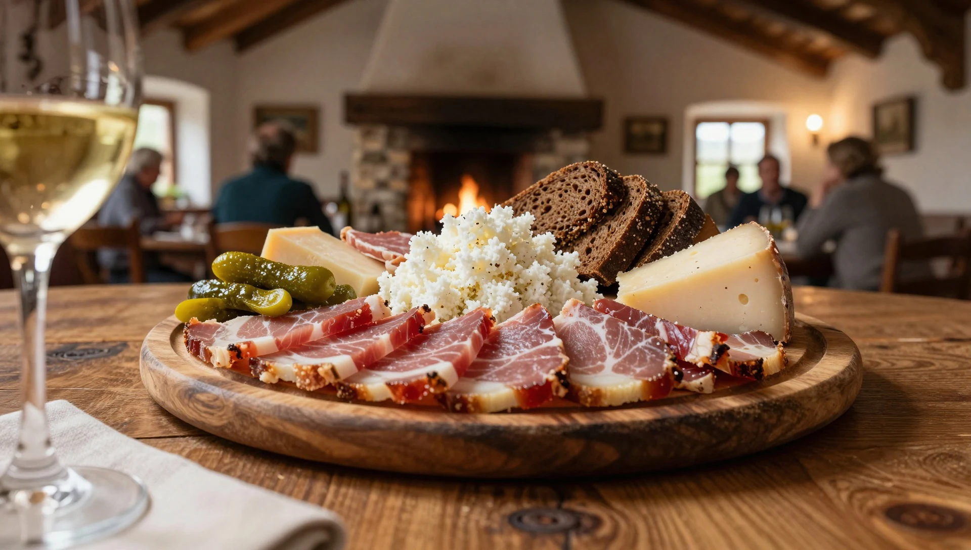
- Kürbiskernöl salad — Village inns and guesthouse dining rooms
Styria is known for dark green pumpkin-seed oil, which is drizzled over salads, potatoes and soups. It has a nutty, roasted flavour and a deep colour. Look for it on the menu of ordinary village inns.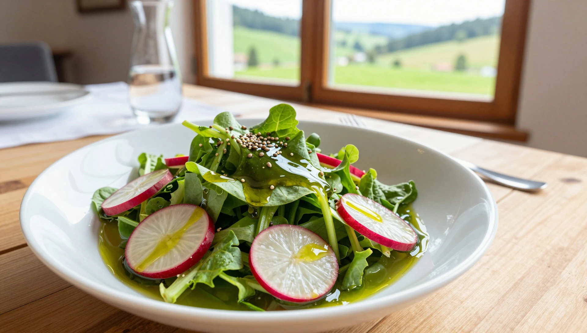
- Frittatensuppe — Mountain huts and village inns
A clear beef broth with ribbons of savoury pancake, a restorative bowl after a cold day on the hill. It is simple, salty and filling, and often cheap compared with the main dishes alongside it. - Kaiserschmarrn — Mountain huts and valley cafés
A fluffy shredded pancake dusted with sugar and served with fruit compote, usually shared. It is a favourite reward after a long walk and is made fresh, so expect a short wait on busy afternoons. - Styrian white wine — Village inns, and wine taverns elsewhere in Styria
Styria is known for crisp, dry white wines, which pair well with cold boards and cheese. The main wine country lies further south, near the Slovenian border, but bottles are widely poured in the valleys. Ask for a regional glass.
Plan it
Best time. June to July and September to October. Summer brings the longest days and open huts, but afternoon thunderstorms and busy weekends. Early autumn is usually calmer and clearer, with cooler air and colour on the slopes. High routes can hold snow into early summer, and winter needs proper mountain experience.
How long. 2–4
Getting there. Fly to Graz Thalerhof (GRZ), which has links from Frankfurt, Munich and Vienna, with several flights a week from London Stansted; Vienna's airport is the alternative. Trains run into Styria from all neighbouring provinces. For the last leg to Admont and Weng, check regional rail, bus and car options on the official timetable sites.
Budget. mid
Tips
- Start walks early: weather turns by afternoon and car parks fill on summer weekends
- Check hut opening dates and park closures on the official site before planning a route: https://nationalpark-gesaeuse.at/
- Carry water, a rain shell and a warm layer even for day walks, and save the forecast before leaving signal
- Book hut beds in advance for summer weekends and carry some cash for small huts and cafés
- Do not attempt climbing routes or high ridges without experience, proper kit and a local forecast
Etiquette
- Greet other walkers and stay on marked trails
- Take all rubbish back down and respect wildlife quiet zones
- Remove boots where huts ask and keep quiet in dormitories at night
Nearby
Sources
- Wikidata Q369655 (CC0)
- Wikipedia: Gesäuse National Park (rev 1362735600) (CC BY-SA 4.0)
- Wikivoyage: Styria (rev 5371307) (CC BY-SA 4.0)
- Aerial image of the Gesäuse National Park (view from the west), Carsten Steger (CC BY-SA 4.0)
- Blick auf den Gesäuseeingang; Weiher bei Weng, Berni Schmieder (CC BY-SA 4.0)
- Hochtor von Lugauer, Gerdsch (CC BY-SA 3.0 at)
- A trail by Hesshütte, Gesäuse National Park, Michal Klajban (CC BY-SA 4.0)
- Admont, Nationalpark Gesäuse, Eisenbahnbrücke über die Gesäusestraße, Haeferl (CC BY-SA 3.0 at)
- Admont, Nationalpark Gesäuse, um den Fels herum gebauter Tunnel, Haeferl (CC BY-SA 3.0 at)
- Admont Weng Lauferbauerbrücke, Isiwal (CC BY-SA 3.0 at)
- Admont-Weng, Naturdenkmal 958, Kataraktstrecke der Enns, Haeferl (CC BY-SA 3.0 at)


