Gaochang
Gaochang, People's Republic of China
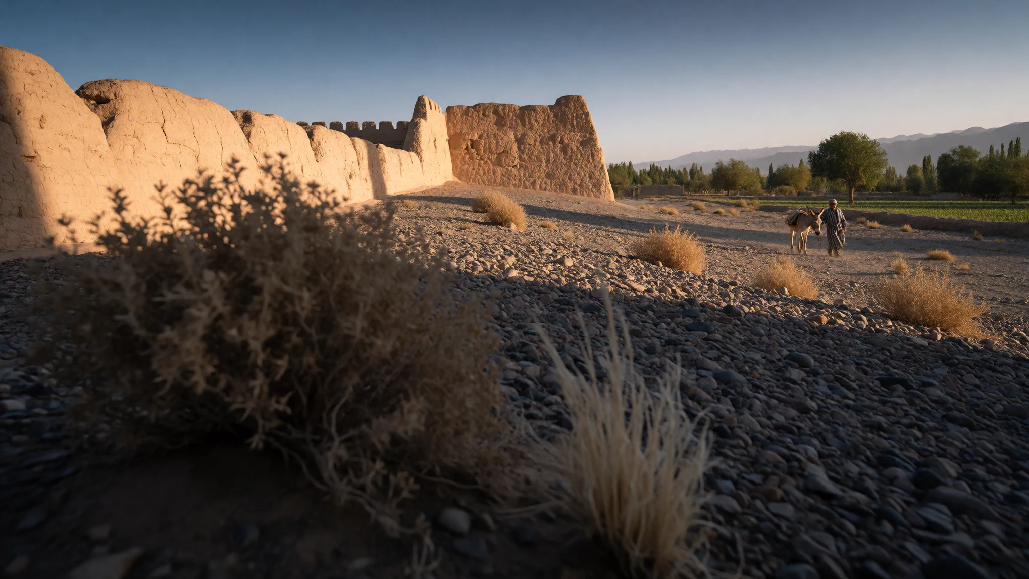
Gaochang is a ruined Silk Road oasis city in the Turpan basin, where wind-worn earthen walls tell a story of caravans, faiths and shifting rulers.
The place
Gaochang is a ruined oasis city on the northern edge of the Taklamakan Desert, in Sanbu Township, Xinjiang, western China. Its name turns up in many spellings: Gāochāng in pinyin, Qocho in Old Uyghur, and Khocho, Karakhoja or Chotscho in older European reports. Under the Yuan and Ming dynasties it was known as Qara-khoja and Huozhou. The setting explains the city. The Turpan basin is parched, and a town could only thrive here where irrigation water and caravan routes met. What survives is almost entirely earthen: broad mud-brick ramparts, the footings of a palace quarter, the stumps of towers and temples, all spread across open ground that bakes in the sun. There is no skyline and very little shade, only wind-cut walls and the dim line of mountains. The site is part of the Silk Roads: the Routes Network of Chang'an-Tianshan Corridor, inscribed on the UNESCO World Heritage List in 2014. Another archaeological site, the Astana tombs, lies close by. Gaochang works best as a half-day or full-day trip from Turpan, whose Uyghur old quarters, bazaars and vineyards give the ruins their living context. Expect heat, glare, dust and long walks between the surviving structures. Foreign visitors need no special permit for Xinjiang, though security checks are routine across the region.
Its story
Gaochang was founded in the 1st century BC, when the Turpan basin was already home to the Jushi, an oasis kingdom known from Chinese records. Earlier still, an Iron Age people called the Subeshi had left cemeteries here, some linked to the later Tarim mummies. Under the Han dynasty, control of the basin passed back and forth between the Han court and the Xiongnu, until the Jushi leaders eventually pledged loyalty to the Han. The Chinese set up a military colony and divided the land into districts, and settlers from the Hexi region and the central plains moved in to farm. When the Western Jin dynasty fell, northern China broke into rival states and the Central Asian oases were drawn into the contest. Gaochang passed through the hands of the Former Liang, the Former Qin and the Northern Liang. In 327 the Former Liang, under the ruler Zhang Jun, created the Gaochang Commandery, which gave the town formal standing. Its place as a trading hub carried it through many later regimes, and its name changed as rulers did. Wars in the 14th century finally destroyed the city. The palace ruins and the lines of the inner and outer cities are what remain. Its story is one of repeated handovers rather than a single golden age, and the layered walls reflect that.
What to see
- The city walls — Sanbu Township, east of Turpan
The ruined walls of Gaochang are the main sight: thick earthen ramparts, worn into ridges by wind, enclosing an outer city and a smaller inner one. Walking their lines helps make sense of the layout. Shade is scarce, so the walls are best seen early, with plenty of water and a hat.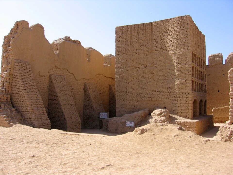
- The palace quarter — Inner city, Gaochang
Within the inner city stand the footings of the old palace area, along with broken towers and the stumps of mud-brick buildings. Little is roofed or restored, so the experience is one of reading shapes in the ground. Interpretation boards help, and a local guide can explain how the quarters were arranged.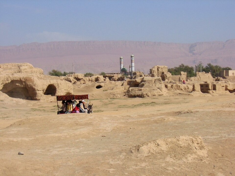
- Temple and monastery ruins — Across the Gaochang site
Scattered across the site are the bases of temples and religious buildings from the city's long life. Wall paintings recovered from Khocho by early expeditions now sit in Berlin, which explains why the ruins look so bare. Visitors have to picture colour and plaster where today there is only brown earth.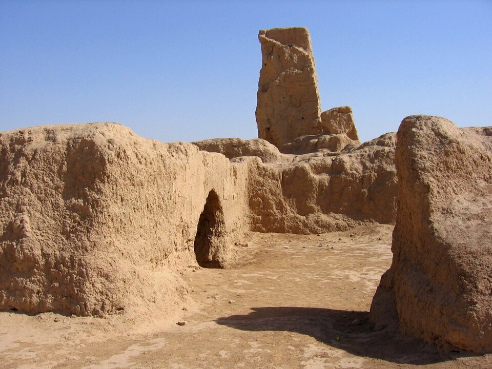
- Astana tombs — Near Gaochang, Turpan basin
The Astana tombs lie close to Gaochang and pair naturally with the city. They were a burial ground of the oasis people, and finds from tombs in the area, including painted figures of warriors from nearby Yanghai, show how the living imagined the afterlife. Check the official site for which tombs are open.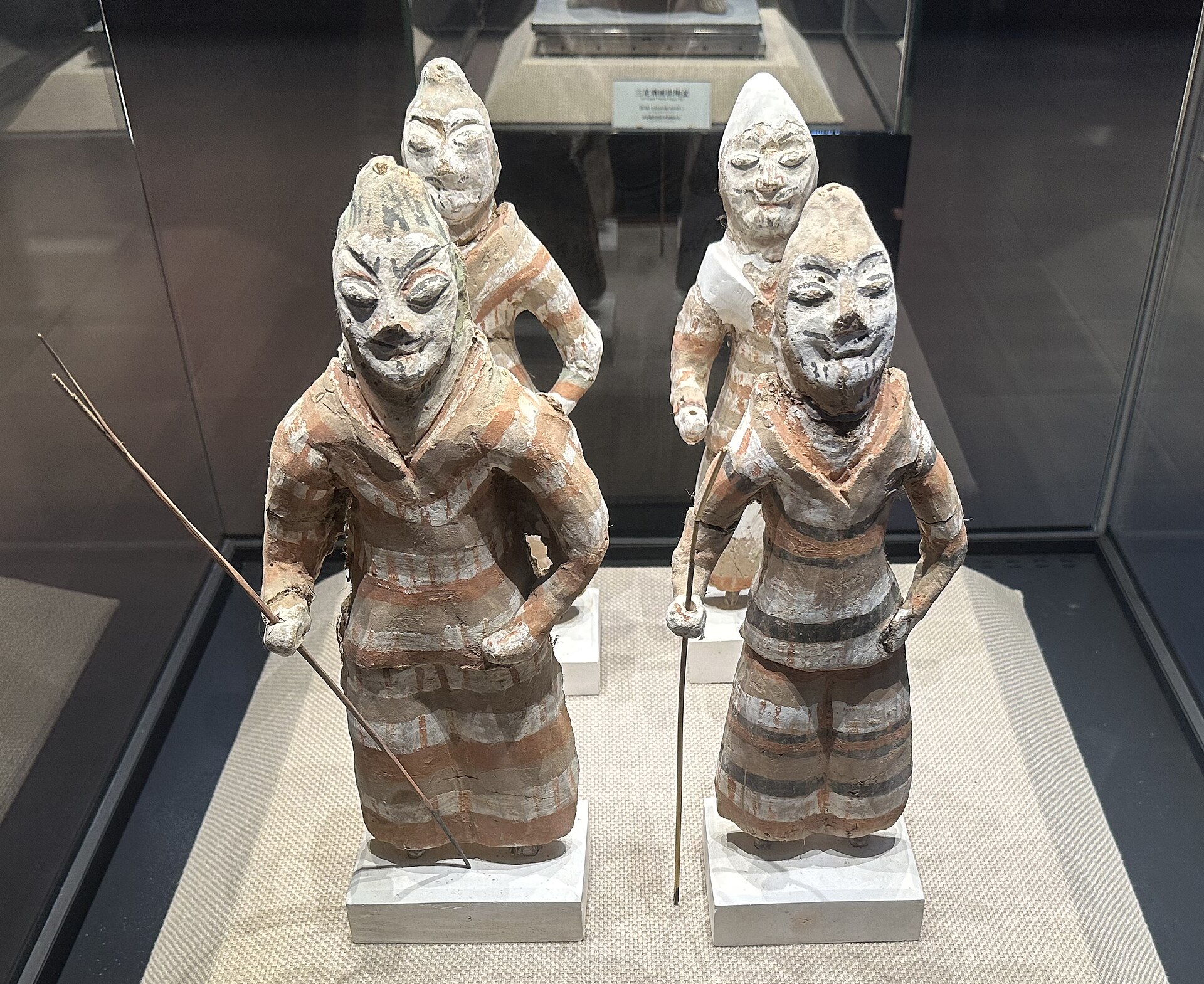
- Turpan bazaars and vineyards — Turpan town
Turpan, the nearby oasis town, is the base for any visit. Its covered bazaars, irrigated vineyards and old Uyghur quarters show the same water-driven life that once fed Gaochang. An evening wander here, after the heat of the ruins, rounds out the day.
Culture
Gaochang's culture is layered, and so is the region around it. The ruins record a succession of rulers and faiths: Han Chinese colonists, the Jushi, and later Turkic-speaking Uyghur rulers, with Buddhist and Nestorian Christian communities leaving temples and painted walls. Wall paintings taken from Khocho and nearby Bezeklik by early expeditions now hang in a museum in Berlin, among them images of Uyghur princesses and a scene thought to show Palm Sunday. Today Turpan is a mainly Uyghur oasis, and Muslim custom shapes daily life: hospitality is generous, tea is offered freely, and the rhythm of the day bends around prayer. Xinjiang as a whole is home to Uyghurs, Kazakhs, Kyrgyz and Han Chinese, and its politics are sensitive; identity and security checks are routine for everyone. Visitors do best by being curious, listening more than they talk, and leaving political topics alone with strangers. The site is protected as part of a World Heritage network, so walls that look like ordinary mud are irreplaceable. Stay on the marked paths, do not climb or lean on the earthen walls, and ask permission before photographing local people, especially women, children and anyone near a checkpoint.
What to wear
Traditional Uyghur dress around Turpan draws on the oasis textile trades. Women wear loose dresses cut from atlas, a bright silk with a blurred, ikat-style pattern, often over trousers, and headscarves or embroidered caps. Men wear the chapan, a long striped coat of silk or cotton, and the doppa, a square embroidered skullcap that is still worn on festive days and at weddings. Felted wool and embroidered waistcoats appear in colder months. In everyday life now, most people wear ordinary modern clothes: shirts, trousers, jeans, simple dresses, with a headscarf for many older women and a doppa for some men, especially on Fridays. Visitors should dress for sun and dust first. The basin is intensely hot in summer and cold in winter, and the ruins have almost no shade, so wear a wide-brimmed hat, sunglasses, light long sleeves and long trousers in breathable fabric. Closed, sturdy shoes matter on loose, uneven ground, and a scarf helps against wind-blown grit. Modest dress, with covered shoulders and knees, suits a mainly Muslim region and is essential if you step into a mosque, where women should also carry a scarf for the head. Pack a warm layer for spring and autumn evenings.
What to eat
- Lamb kebabs (chuànr) — Evening grill stalls and night markets in Turpan
Chuànr are skewers of lamb, usually cumin-dusted and grilled over charcoal until the fat crackles. Uyghur-style kebabs are known across China and count as a signature of Xinjiang cooking. Eat them hot, straight from the skewer, with a piece of naan alongside. - Samsa (kǎo bāozi) — Bakery stalls near Turpan's bazaar streets
Samsa, called kǎo bāozi in Mandarin, is a baked pastry filled with chopped lamb and onion. The crust turns crisp and flaky in the oven wall. Buy them hot from a bakery stall, and mind the juices on the first bite. - Naan (náng) — Street bakeries in any Turpan neighbourhood
Náng is the round flatbread sold on streets in every Xinjiang city, in plain versions or with onion or spring onion baked in. It is far better warm, so point at the oven and ask for a fresh one. - Stuffed naan (ròunáng) — Small eateries and bakeries around the bazaar
Ròunáng is naan with lamb stuffed inside, a hearty meal in one hand. The bread soaks up the meat juices as it bakes. Look for it in bakery doorways and small eateries around Turpan's bazaar streets, especially at midday. - Grapes and raisins — Fruit stalls in the Turpan bazaar and roadside vineyard stands
Turpan is a grape-growing oasis, and fresh grapes in season or dried raisins in many colours fill market stalls. They make a sweet, light snack in the dry heat and travel well as gifts.
Plan it
Best time. April–May and September–October, when days are warm rather than punishing. Summer in the Turpan basin is fiercely hot and the ruins have almost no shade; winter is cold and dry.
How long. 1–2
Getting there. Fly to Urumqi, the regional capital, which has many domestic connections and some international ones; trains also link Urumqi with Beijing, Shanghai and Guangzhou. From Urumqi, continue to Turpan by rail or road, then take a taxi or arranged tour for the last leg to the ruins.
Budget. low
Tips
- Arrive at opening time to walk the site before the heat builds
- Carry more water than seems necessary, plus a hat and sun cream
- Bring your passport, as identity and security checks are routine across Xinjiang
- Carry some cash for bazaar stalls and small eateries, as cards are not accepted everywhere
- Check the official site or ask your accommodation about opening arrangements before you set out
Etiquette
- Ask before photographing people, and avoid photographing checkpoints
- Do not climb on the earthen walls or remove anything from the site
- Dress modestly and cover your head if you enter a mosque
Nearby
Sources
- Wikidata Q877381 (CC0)
- Wikipedia: Gaochang (rev 1384711074) (CC BY-SA 4.0)
- Wikivoyage: Xinjiang (rev 5394920) (CC BY-SA 4.0)
- Photo 01: Turpan-gaochang-d10.jpg, Colegota (CC BY-SA 2.5 es)
- Photo 02: Seidenstrasse GMT.jpg, Captain Blood (CC BY 3.0)
- Photo 03: Painted warriors, Yanghai tomb, HaziiDozen (CC BY-SA 4.0)
- Photo 04: 麹氏高昌左卫大将军张雄, HaziiDozen (CC BY-SA 4.0)
- Photo 05: Palm Sunday (probably), Khocho, Daderot (CC0 1.0)
- Photo 06: Uighur princesses, Bezeklik, Daderot (CC0 1.0)
- Photo 07: Turpan-gaochang-d03.jpg, Colegota (CC BY-SA 2.5 es)
- Photo 08: Turpan-gaochang-d05.jpg, Colegota (CC BY-SA 2.5 es)


